- Joined
- Jul 23, 2013
- Messages
- 1,666
This past weekend, the local scout troop in my neighborhood had made plans to go on a little backpacking trip up nearby Slide Canyon. The campsite they had in mind was only a couple miles up trail. Of course, I looked over my schedule, saw that I had the evening and morning free, and invited myself to tag along with them. I had loaned out some gear for some others to use and felt like it'd be good to be there in case any issues with the gear arose. But really, this was an opportunity to get another bag night in.
Day 1
Friday - April 29, 2016
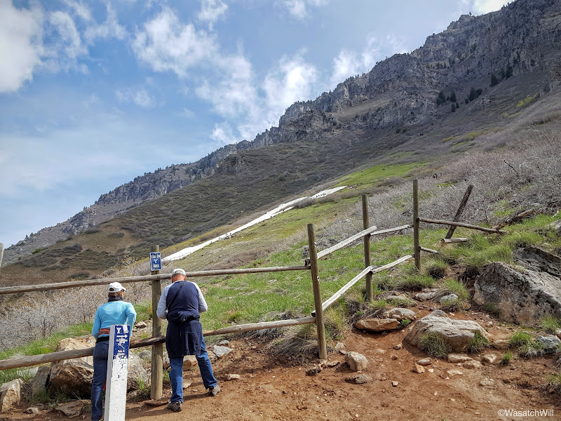
Most of the group had started up the trail at about 5:30 pm. I was hoping to meet them at the trailhead, but ended up leaving work a little later than I had desired and still had to drive home to change and get my pack. I took care of a few other household things, and didn't end up arriving at the trailhead until about 7 pm. I didn't think I'd catch them before camp with how short the trail was, but then again, there'd be about 2000 feet of elevation gain in those two miles, and these were scouts, some of them young and on their first backpacking trip ever.
The weather all week had been raining and even for that afternoon, the forecast had shown lingering clouds and a chance of scattered showers. I was a nervous for a moment starting out with how dark some of the clouds above were, but I hadn't seen any lightning or heard any thunder and with the direction the clouds were moving, my concerns quickly dissipated.
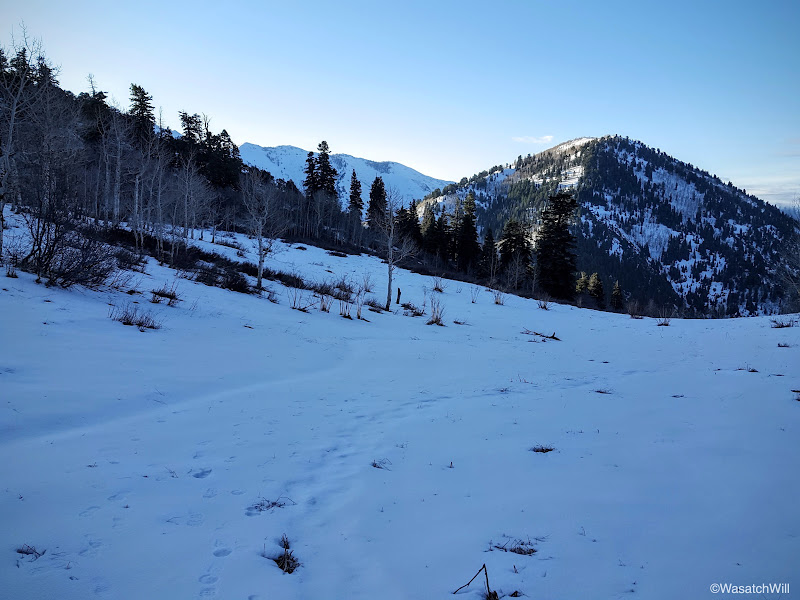
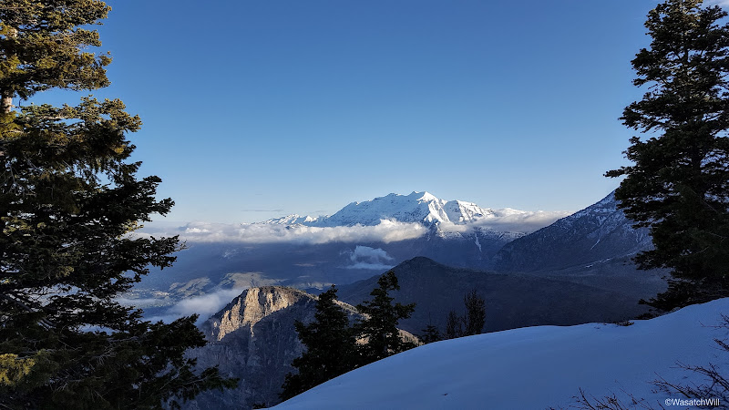
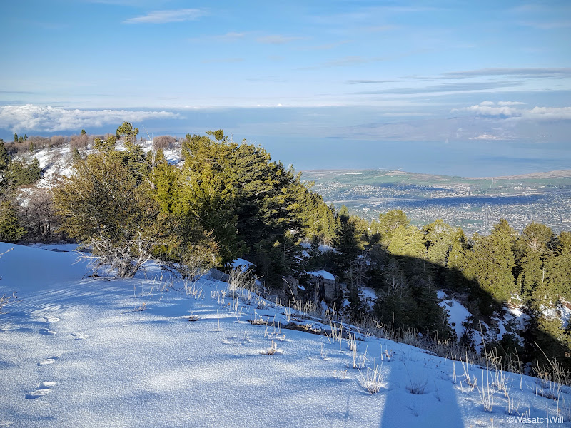
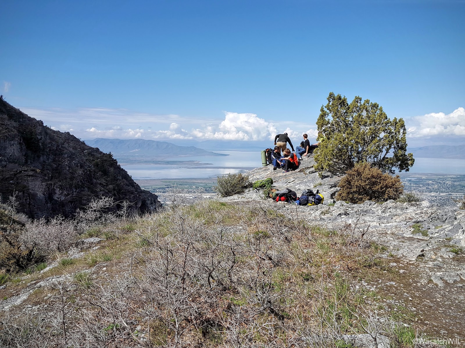
About a half hour from starting, I had arrived at the top of the Y and a few moments later, I was sitting at Eagle Pass where the trail turns a corner into Slide Canyon. This is always a great place to take a little breather break and take in some views of the valley below.


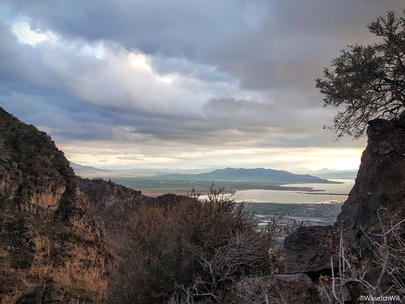
After a few moments of rest, I set course for the final mile. There were a few times I had to keep looking back to see if how the sunset was setting up. There weren't ever any spectacular colors, but the clouds still set up some interesting shots.
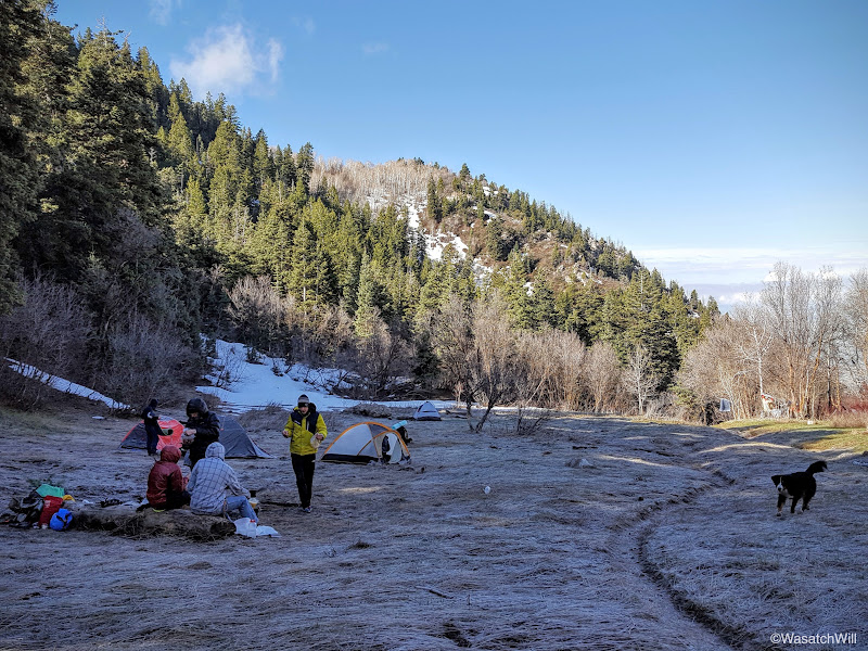
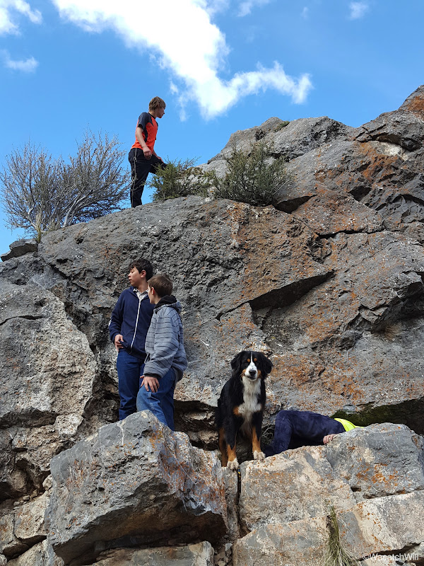
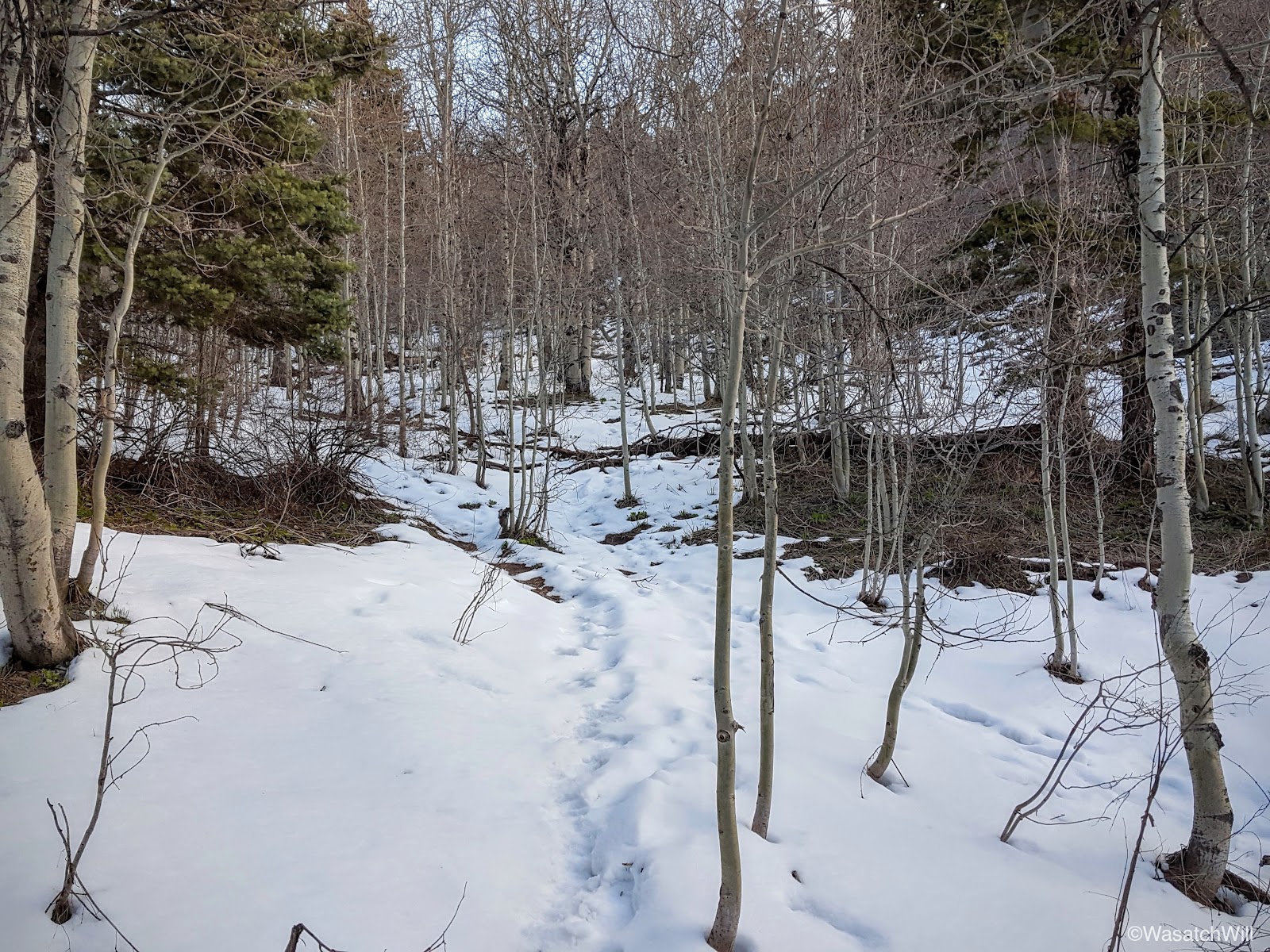
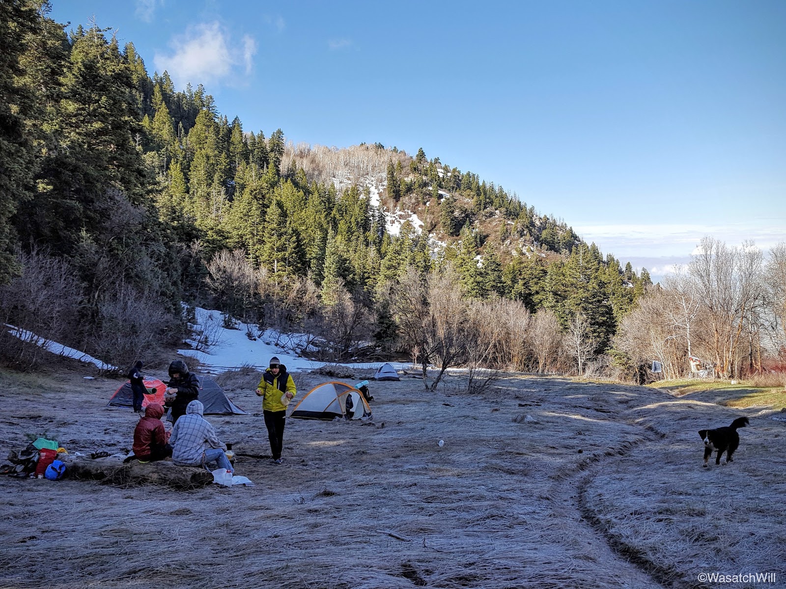
Within about a half mile, I ended up catching up to the tail end of the group: a couple adult leaders with all the beginners. The other two leaders with the more experienced boys had moved on, likely already setting up their camp. I stuck with them and soon thereafter, we were walking into camp, a little meadow off the trail known as Bear Flat.
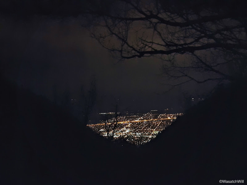
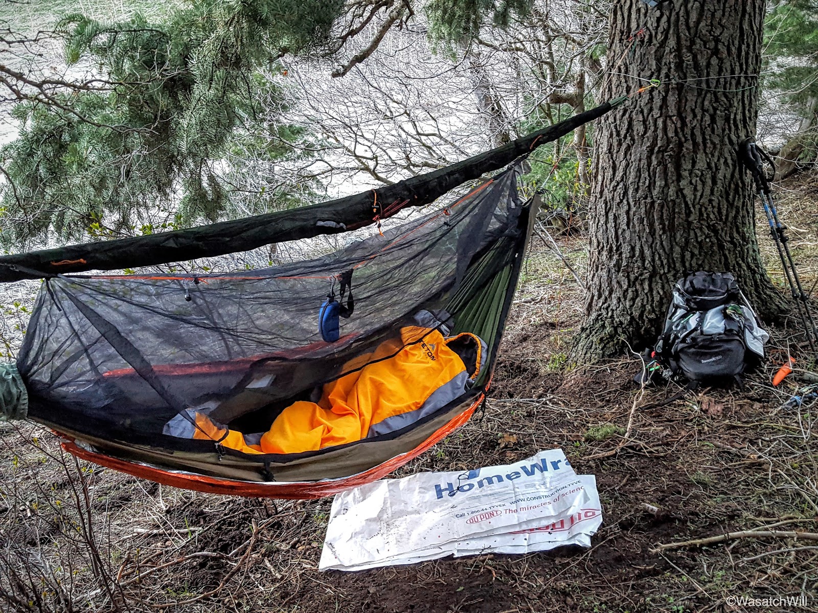
There was only a few minutes of decent daylight left and it was going fast with the cloud cover, so I hunted down a spot up in some pines just above the flat to hang my hammock. I also sought out a place to hang a bear bag. I managed a suitable spot, but the trees weren't ideal for hanging a bear bag, which is pretty typical of many areas in Utah's Mountains. By now it was dark and while dinner was rehydrating, I wandered down trail a few hundred feet to look down at the valley lights.
With dinner now done, the skies began to clear up and with that came a surge of coldness. While cleaning up, another group, including some very young children ages 4 and 5 rolled into the meadow. They were a family and with it being so late, dark, and cold, they went back down and began to establish their camp down by the bear hang. I went down and retrieved the bear bag, opting to just trust the odor-proofness of my bear bag liner and rested it near the campfire.
Most of the boys had grown quite tired from the hike up and went to bed. A few adults, including myself, huddled around the campfire for a while before calling it a night ourselves.
Day 2
Saturday - April 30, 2016
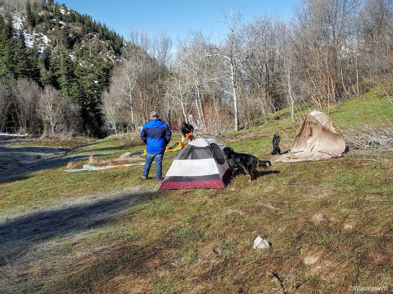
The night remained quite cold with clear skies. I never did deploy my tarp. I had started out my sleep with a few chills here and there, but then realized, after getting out to do some business, my emergency blanket under-quilt had been bunched up on one side instead of fully wrapped around the bottom of the hammock. After getting that adjusted and settling back in, there were no more shivers and I slept warm enough.

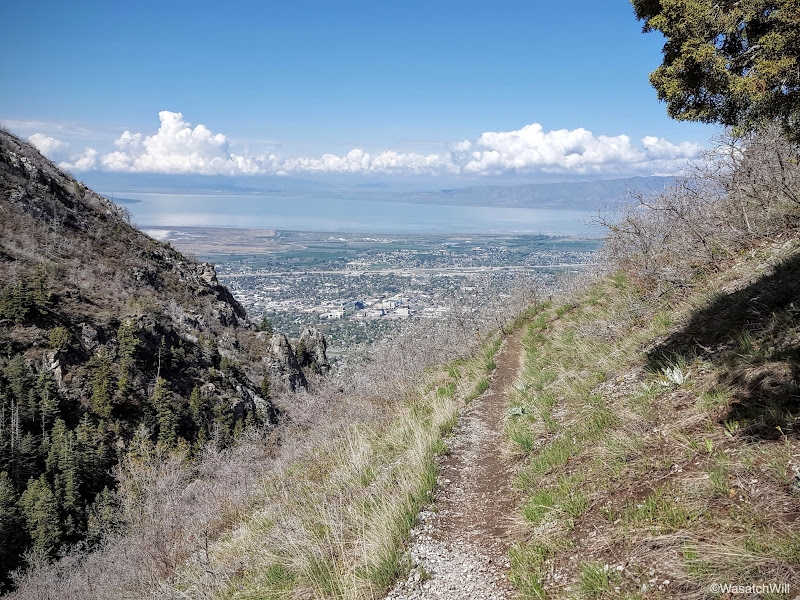
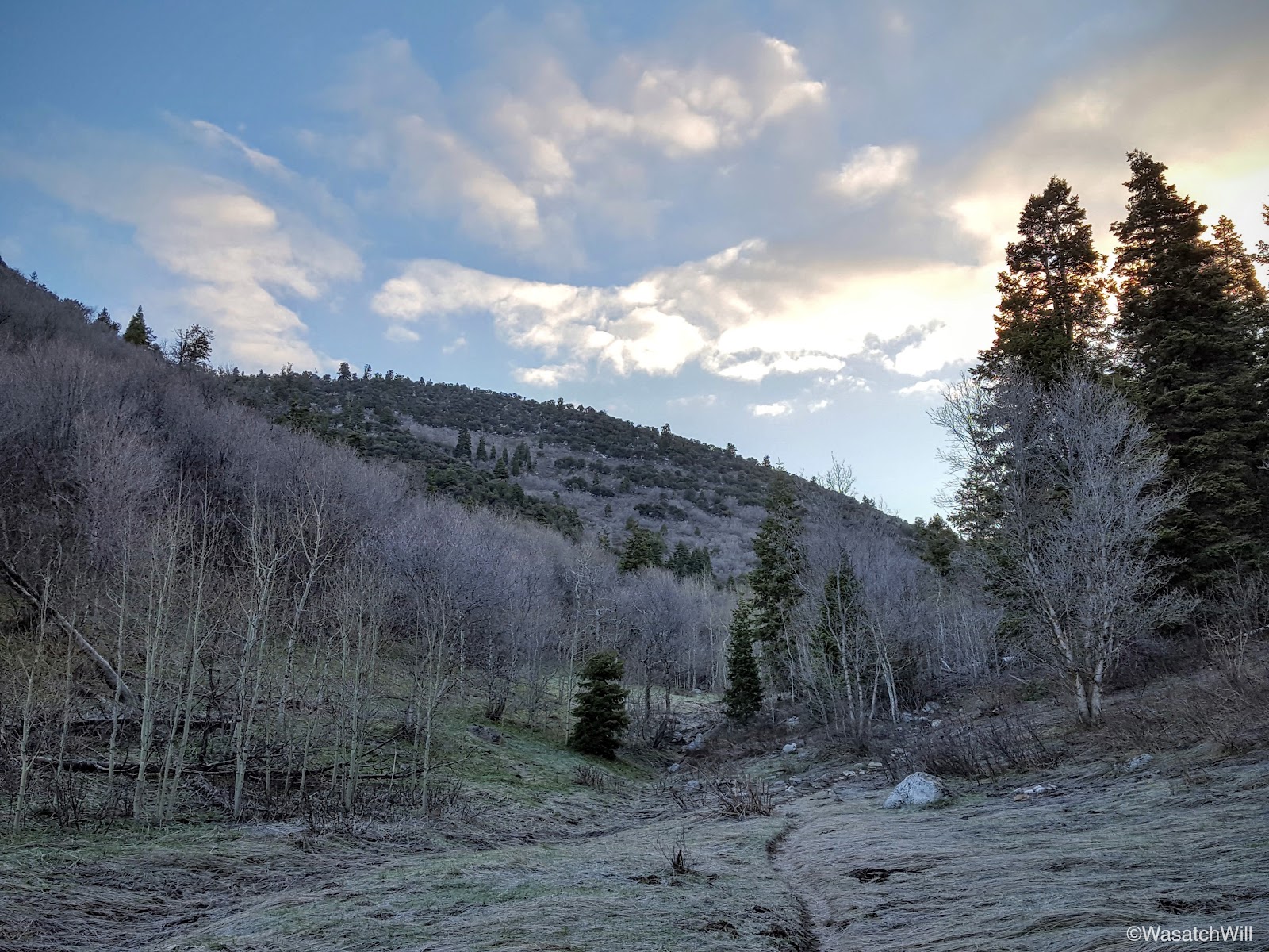
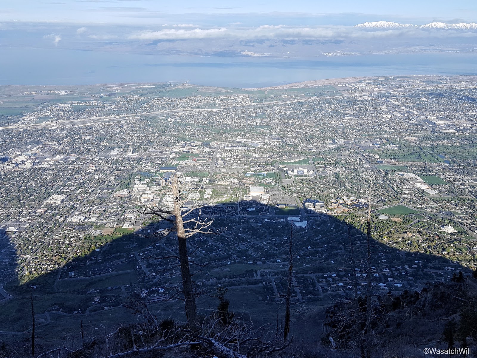
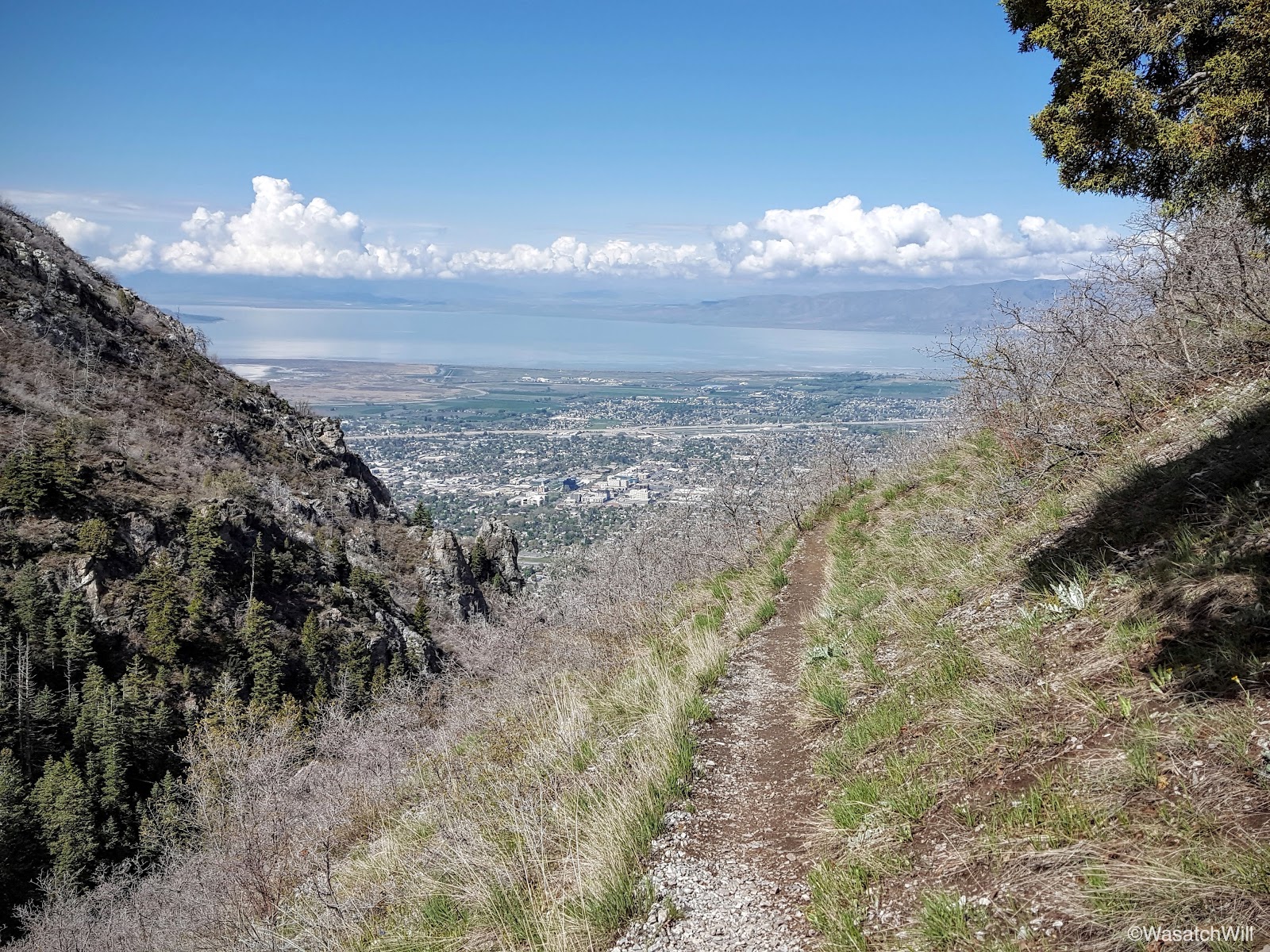
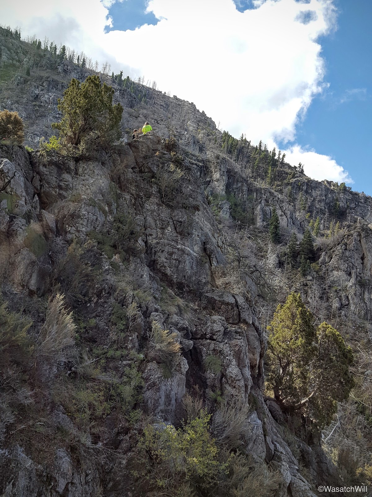
As the light of dawn filled in, I opted to wake up and get moving. I wanted to take a stroll up to the true summit of Y Mountain and check out the view from up there. I had hiked to the valley overlook at the top of Y Mountain, which is right near the true summit, once before, but never did make it over to the true summit which is several feet higher. This was a golden opportunity to go do that and also get into some direct sunshine long before it would ever reach our camp.
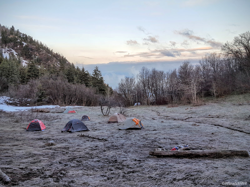
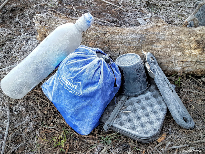
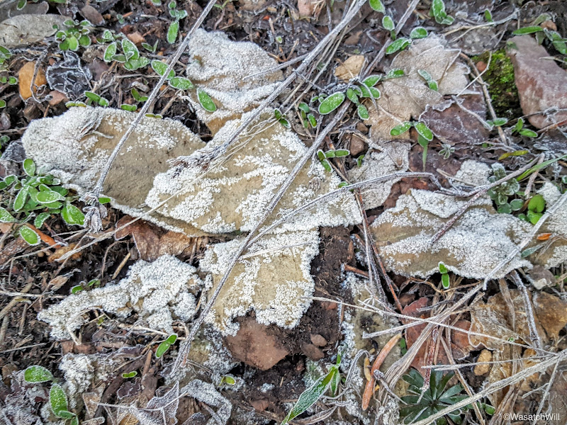
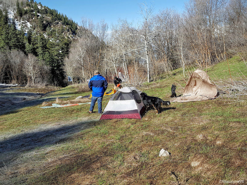
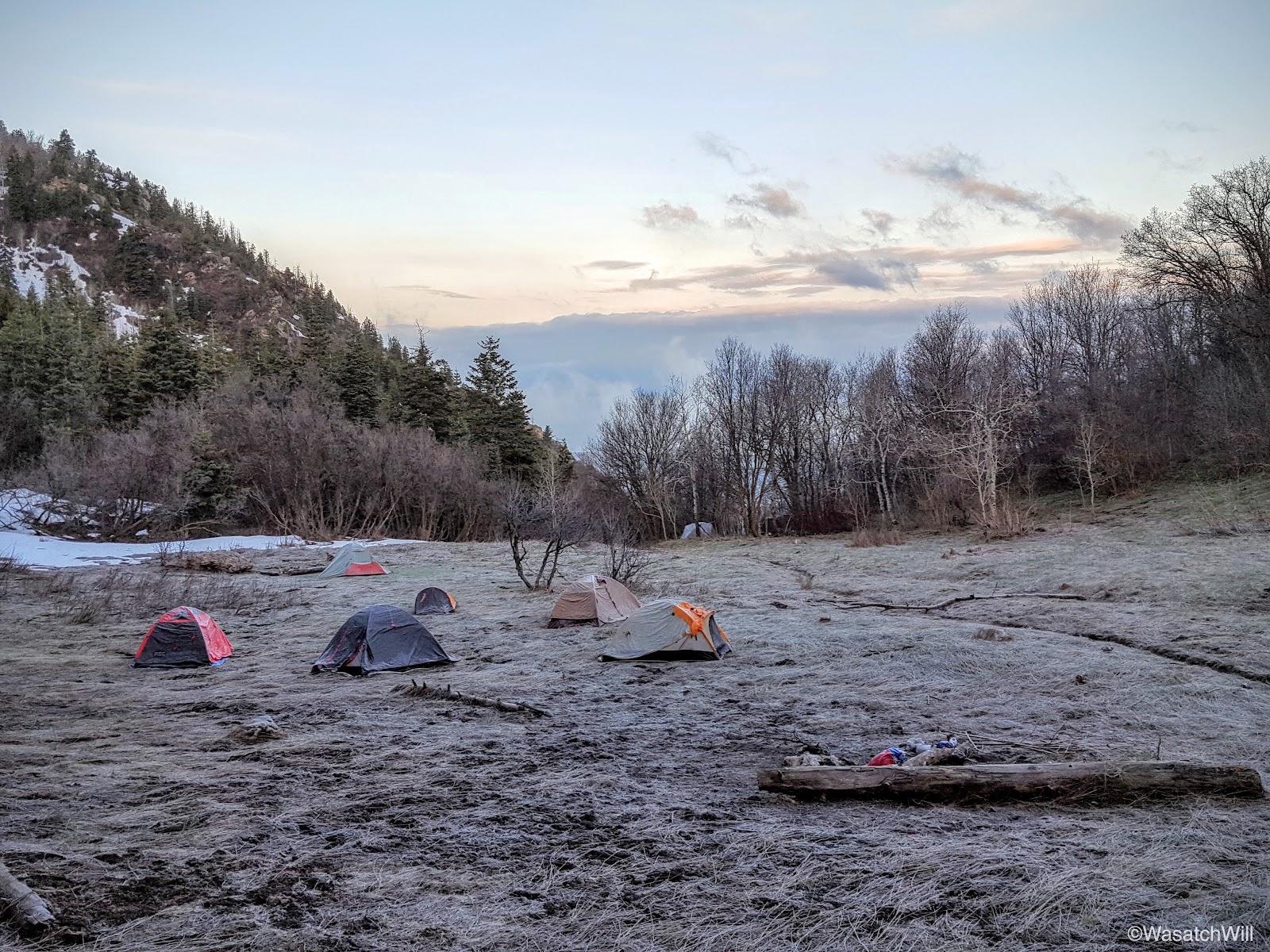
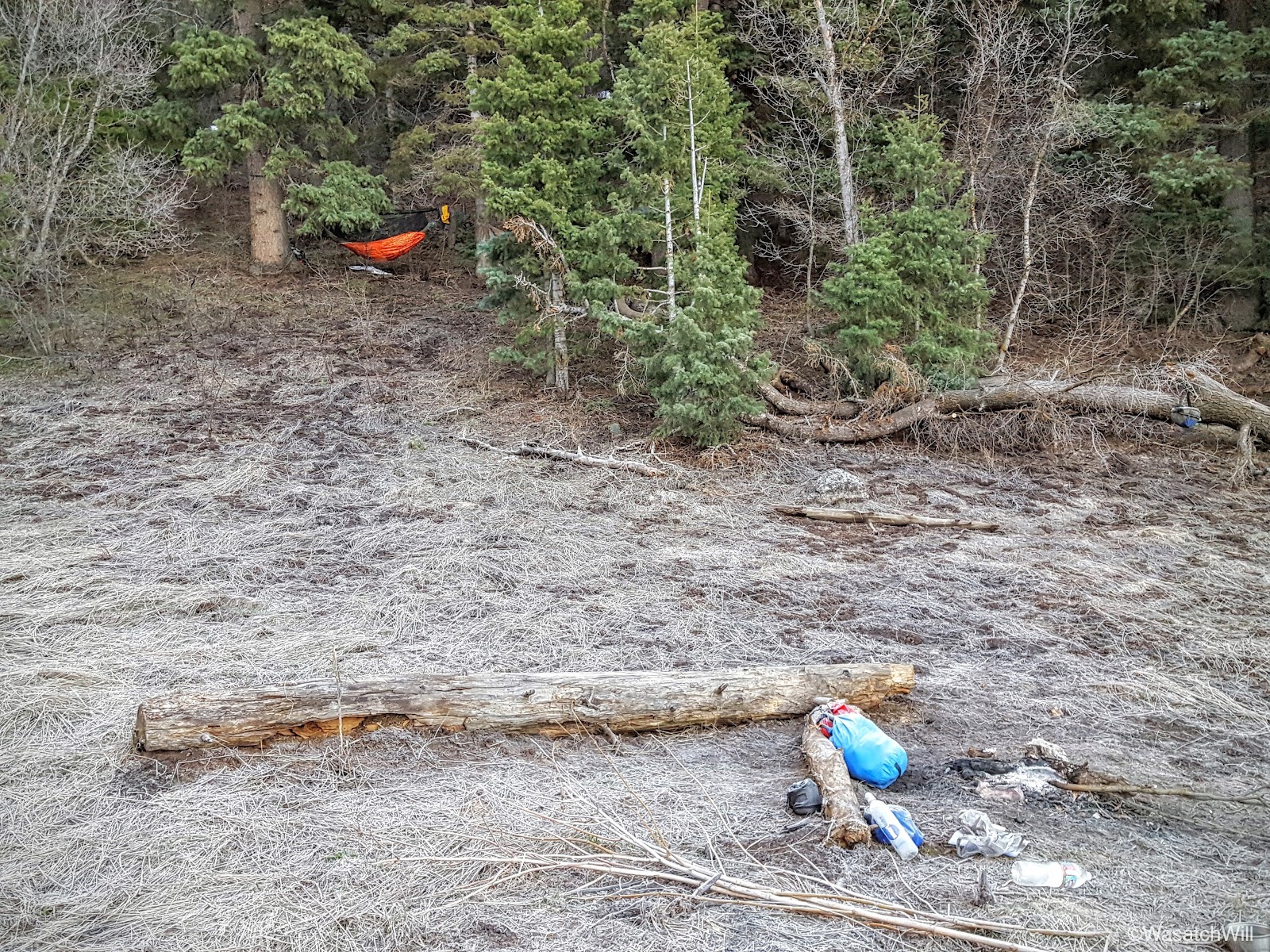
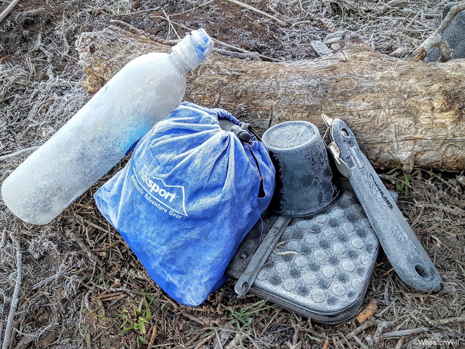
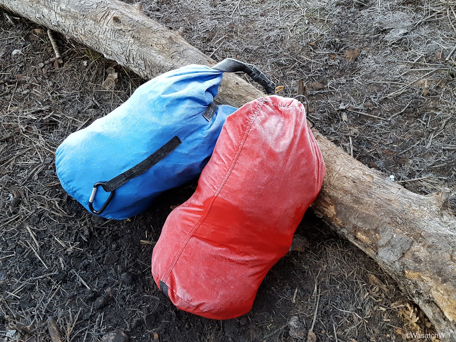
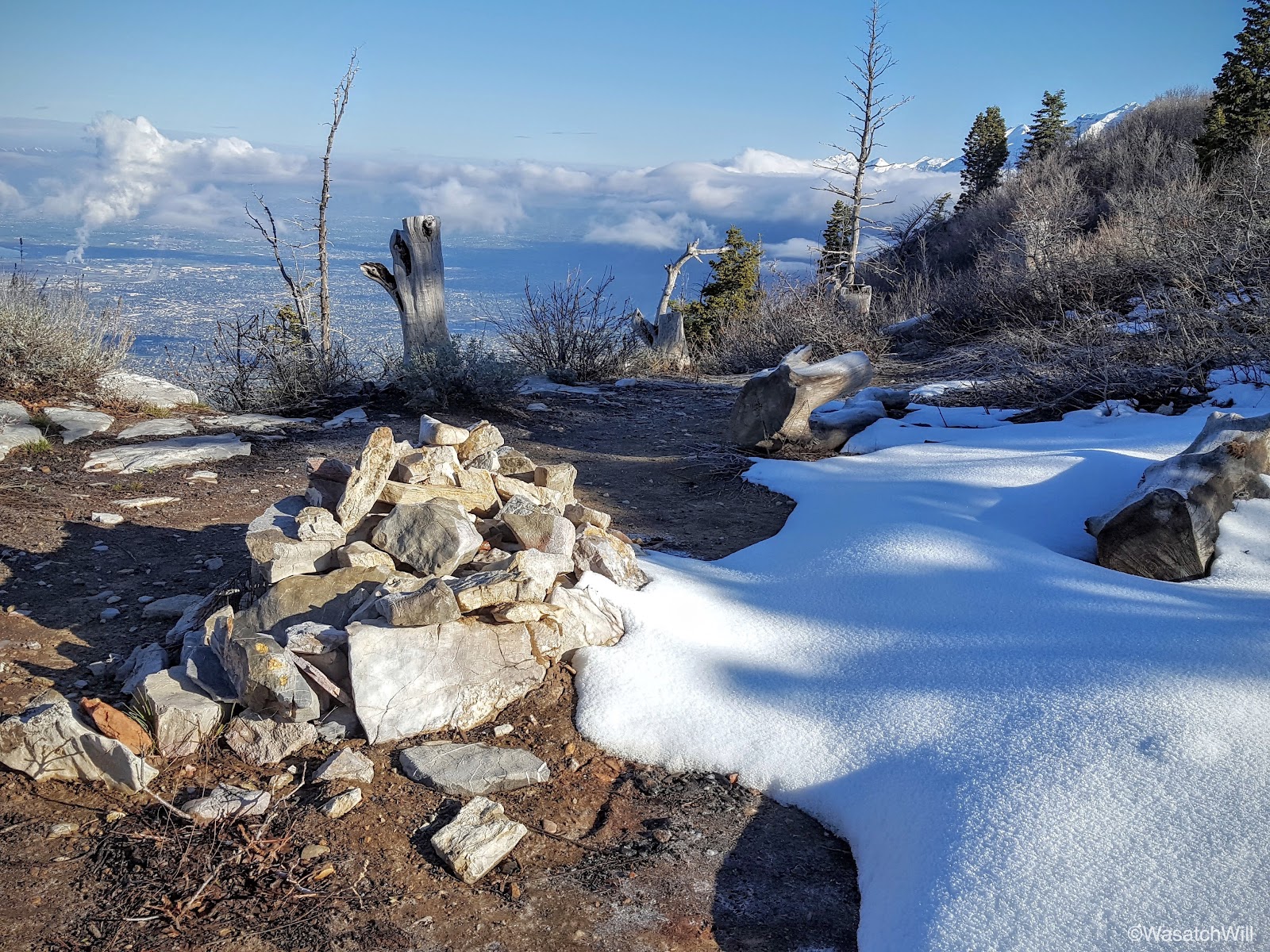
As I exited the shelter of the trees, I beheld a camp that had received a big visit from Jack Frost overnight.

I saw no signs of anyone else getting up. Apparently everyone else was going to stay snug in their bags where they could sleep in a bit. I ventured on up the trail and out of the flat.

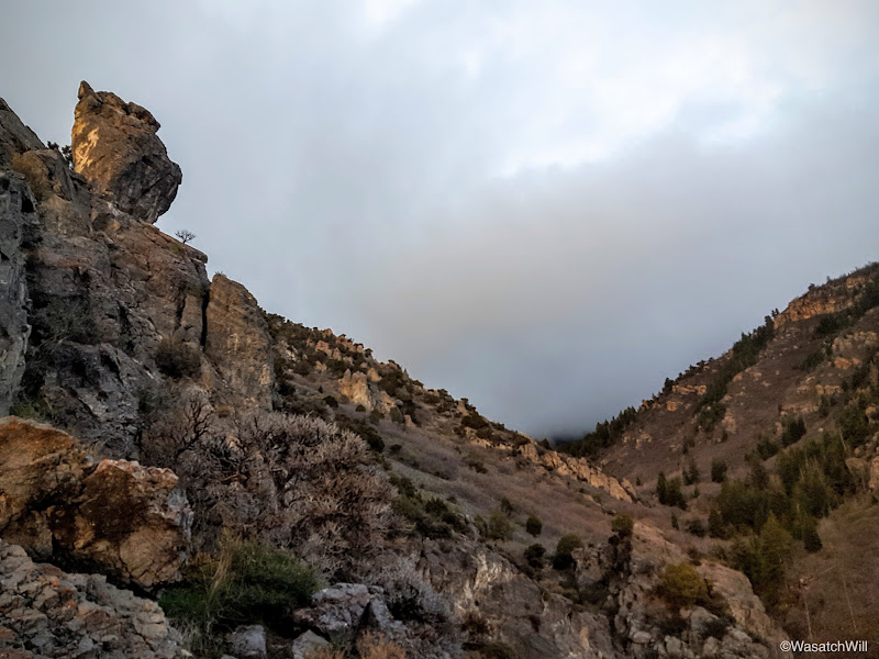
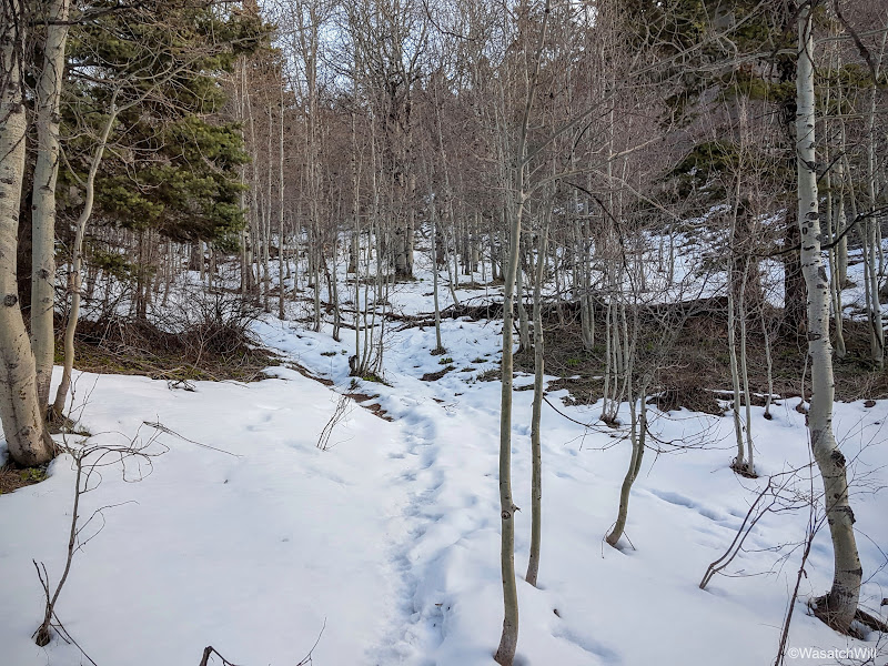
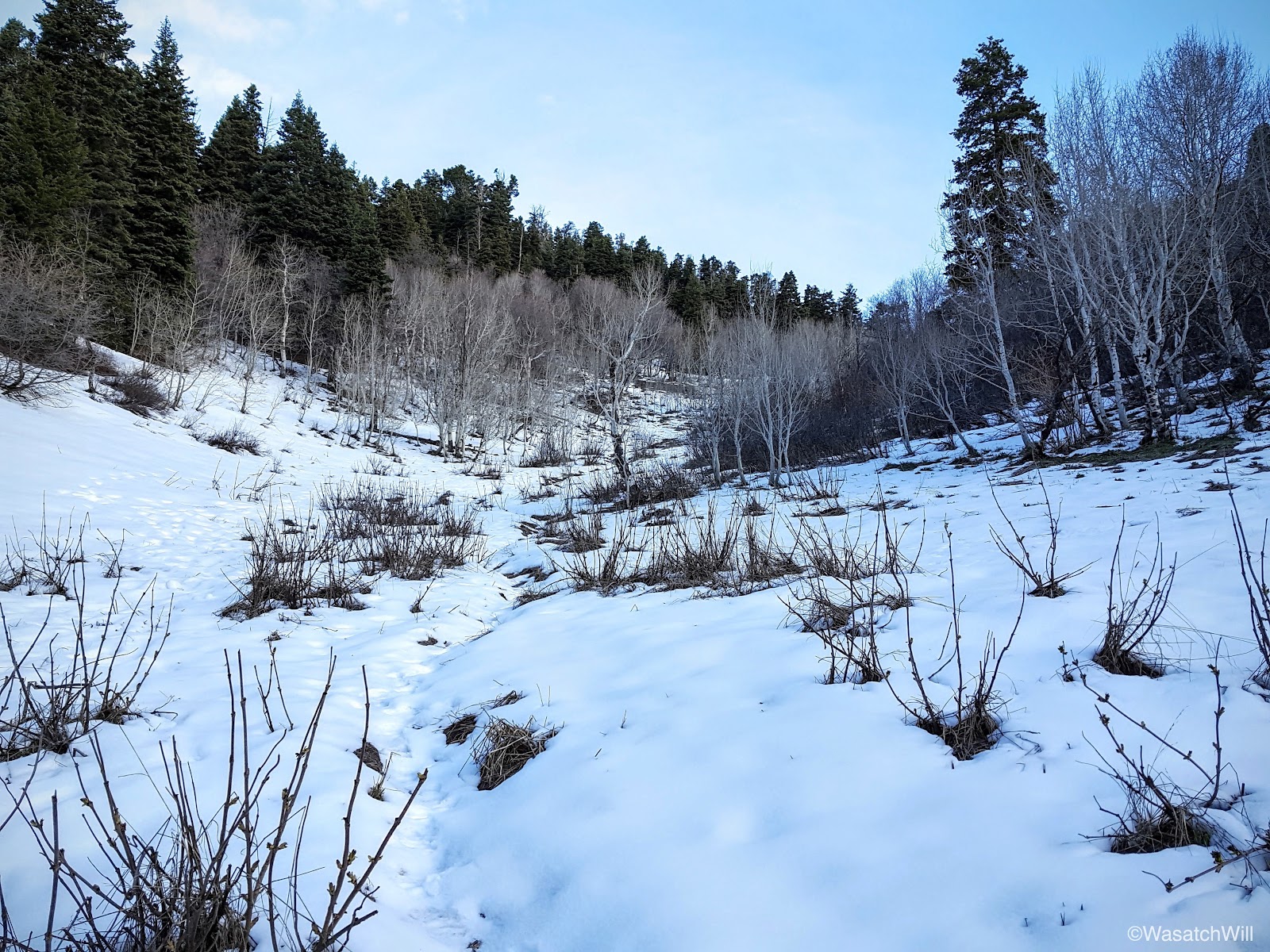
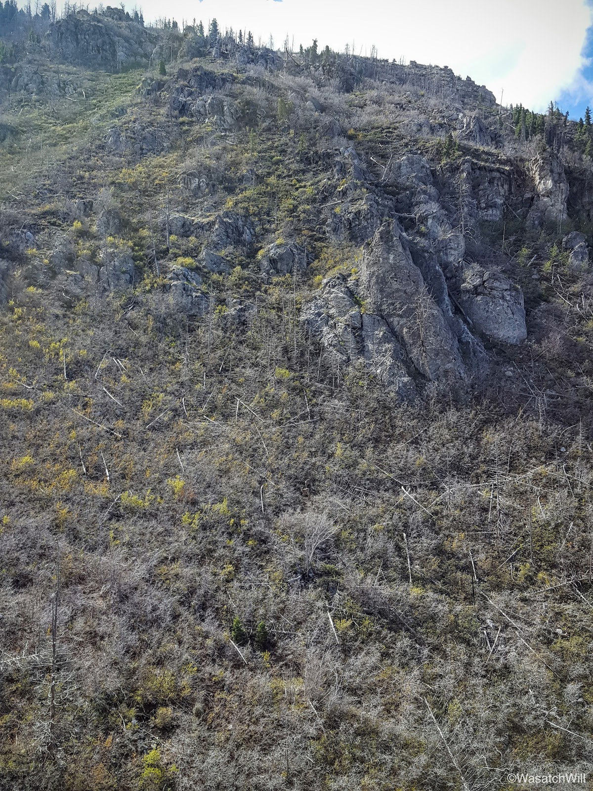
Moments later, I took the north fork trail and moments after that, I began to encounter some snow. I was surprised to find so much snow along a trail facing the south. I had not brought my spikes, but fortunately, I never needed them. The snow proved to be frozen stiff and the texture of it was closer to that of pavement than of ice. Easy treading.


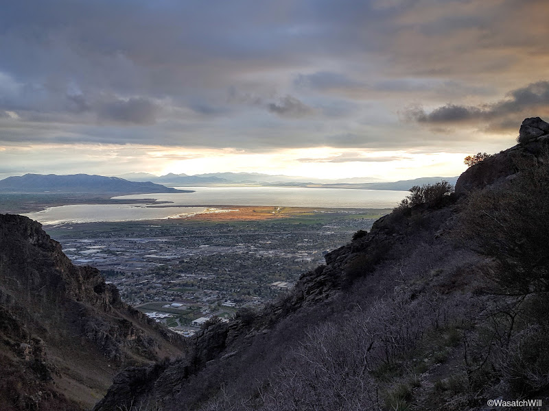
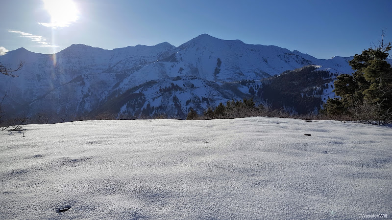
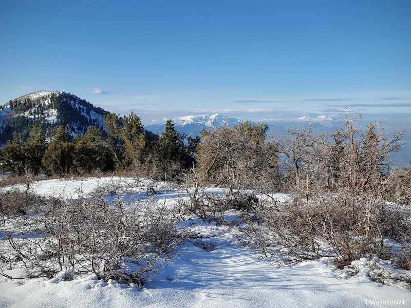
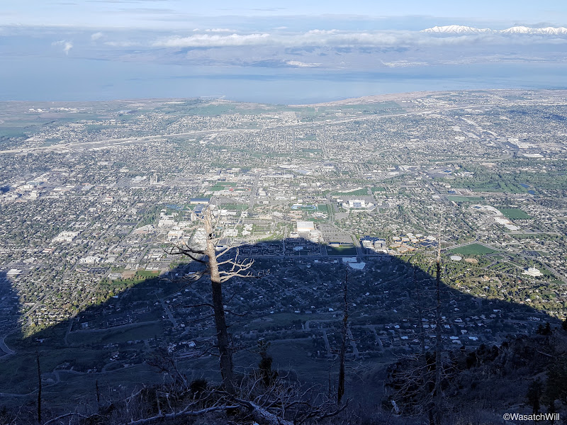
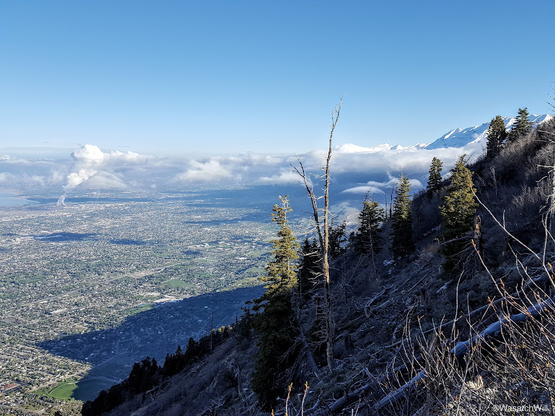
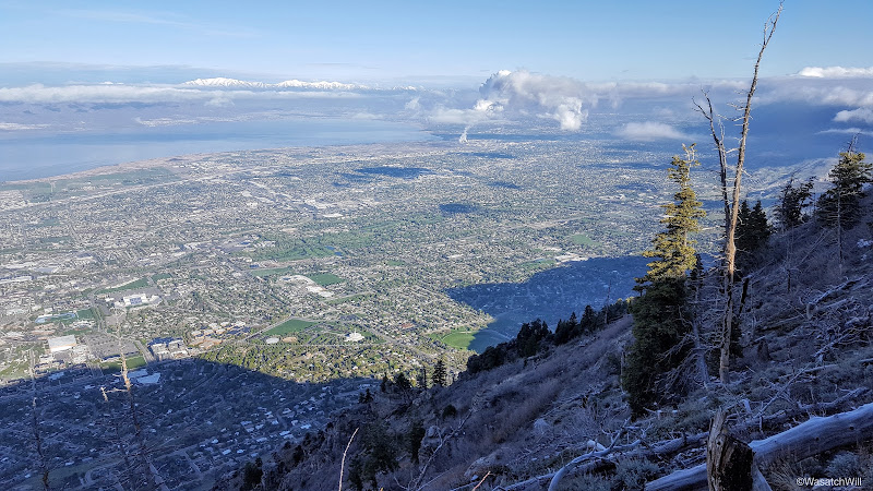
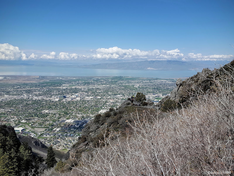
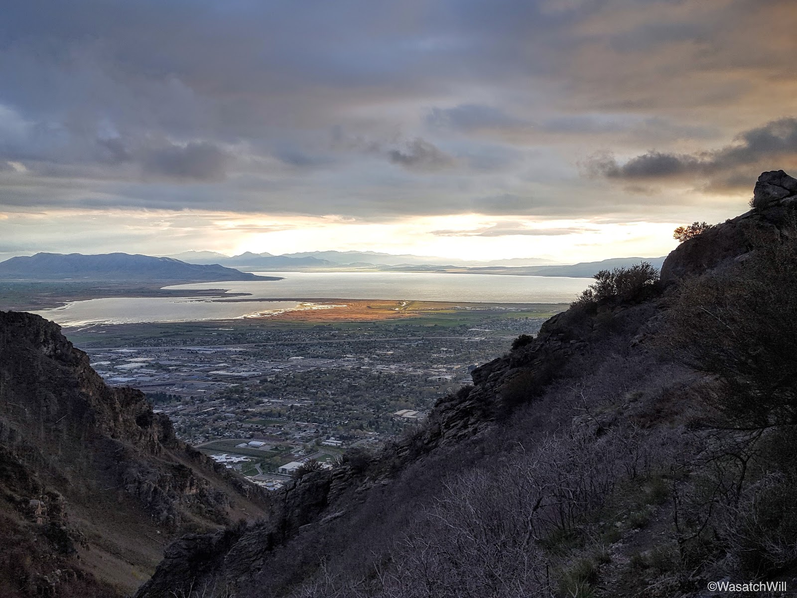
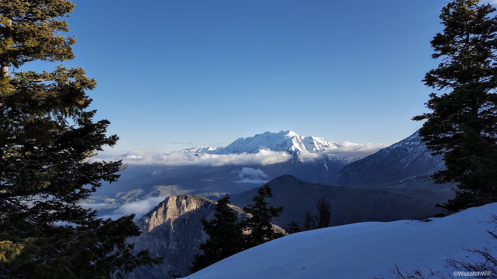
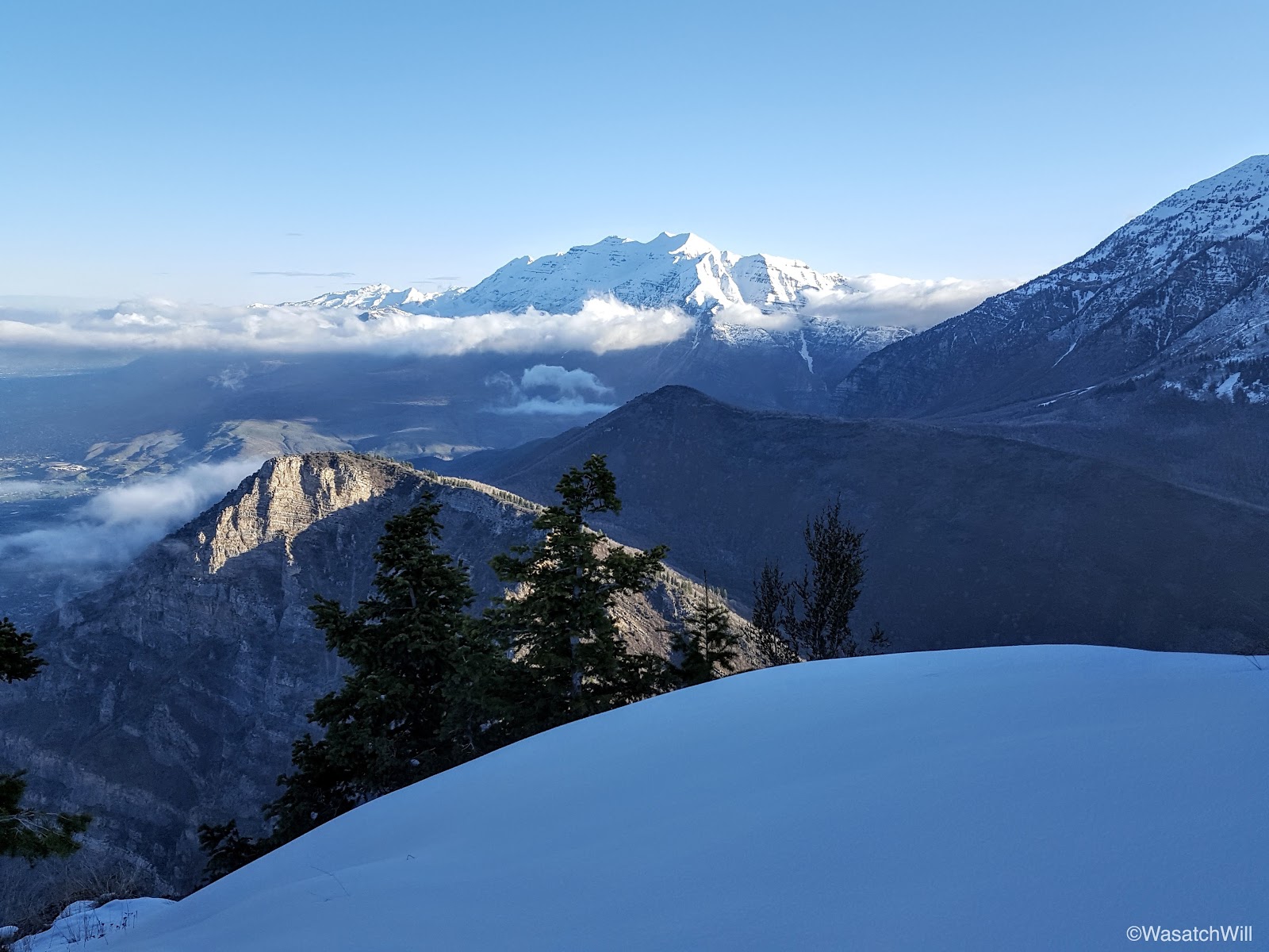
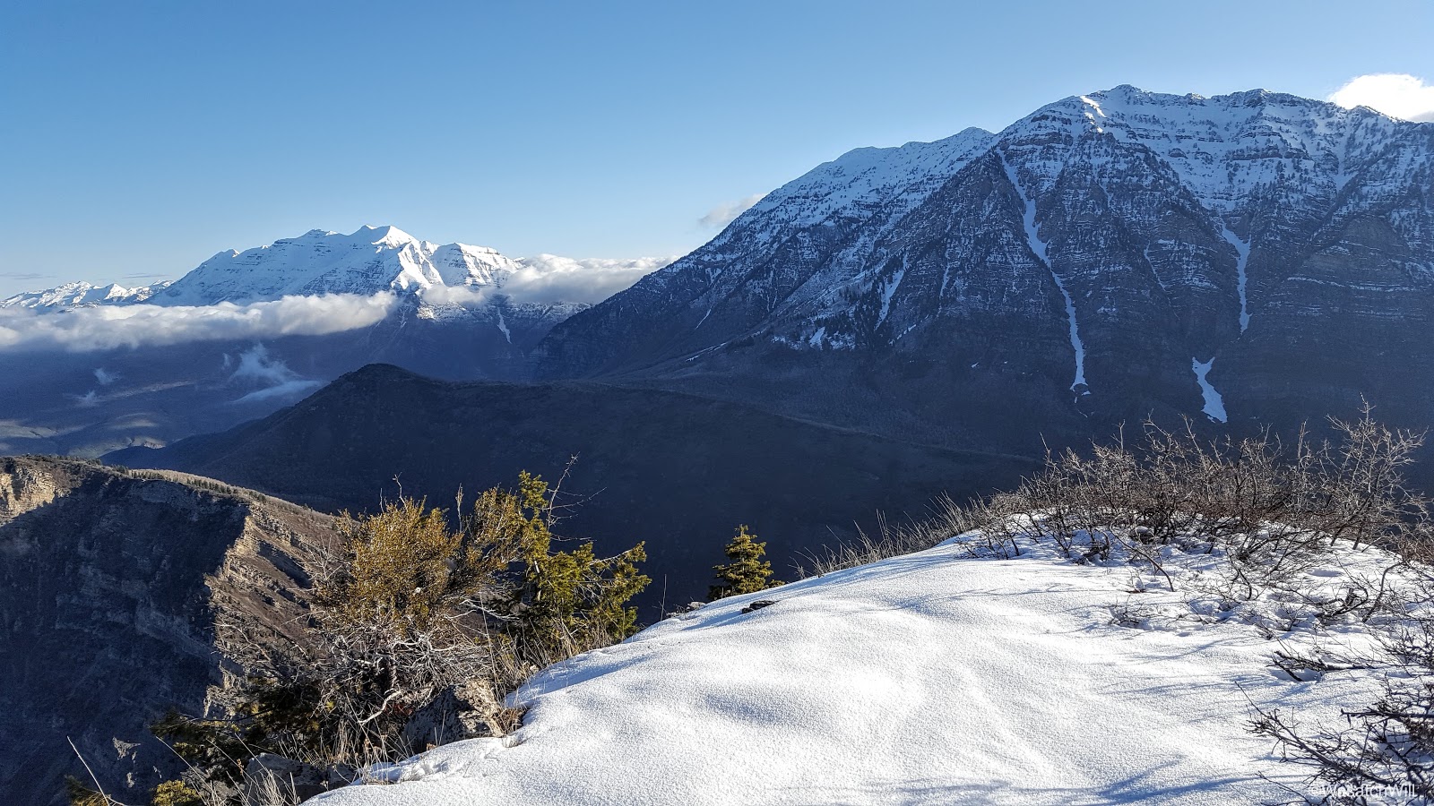
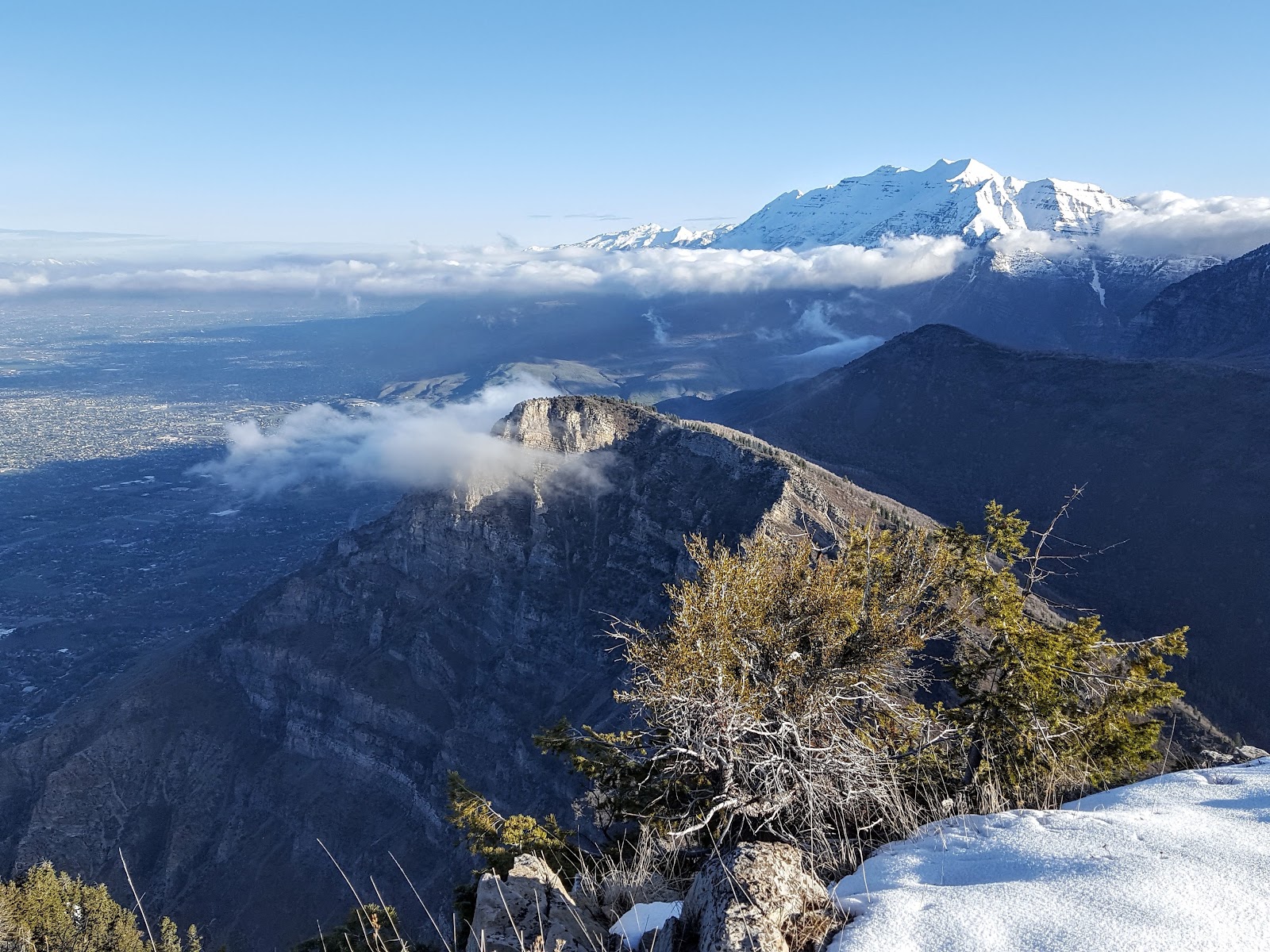
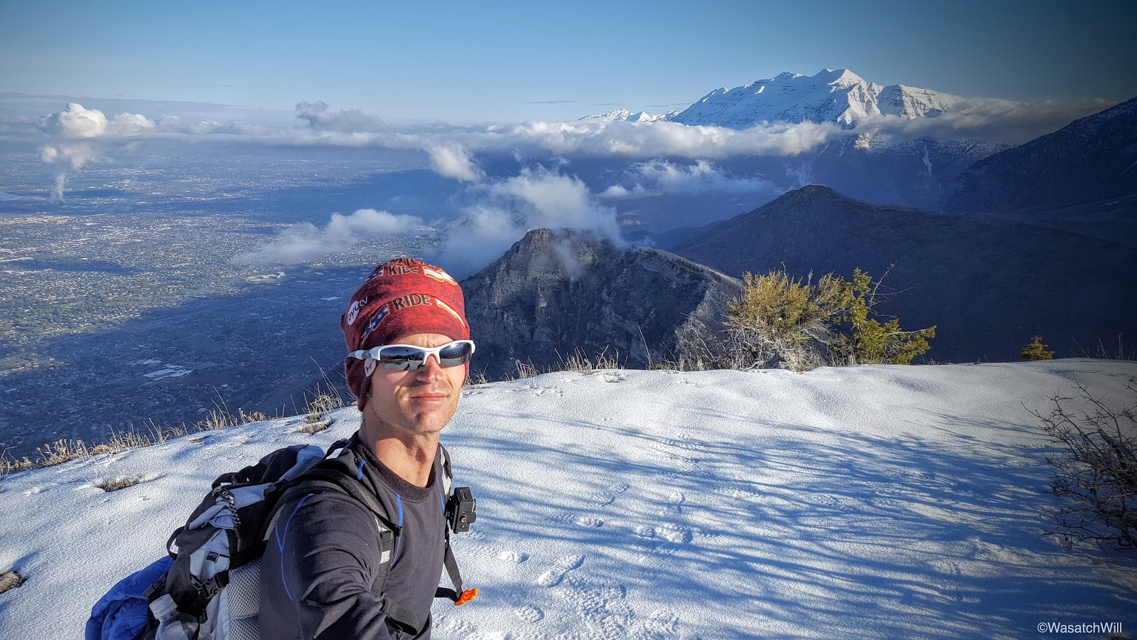
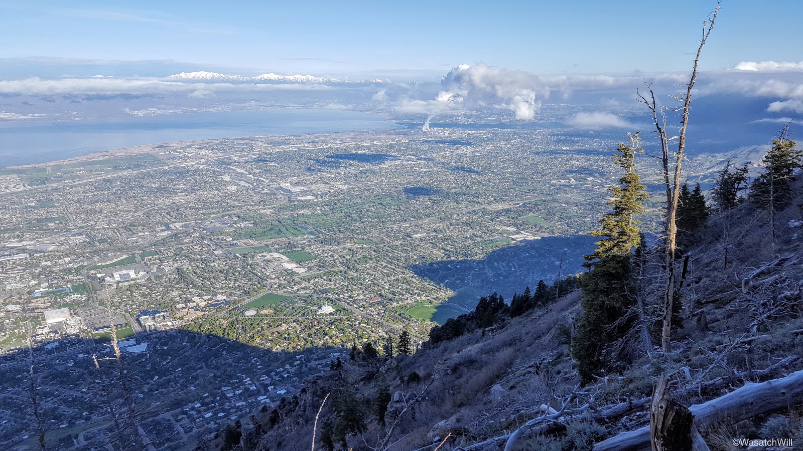
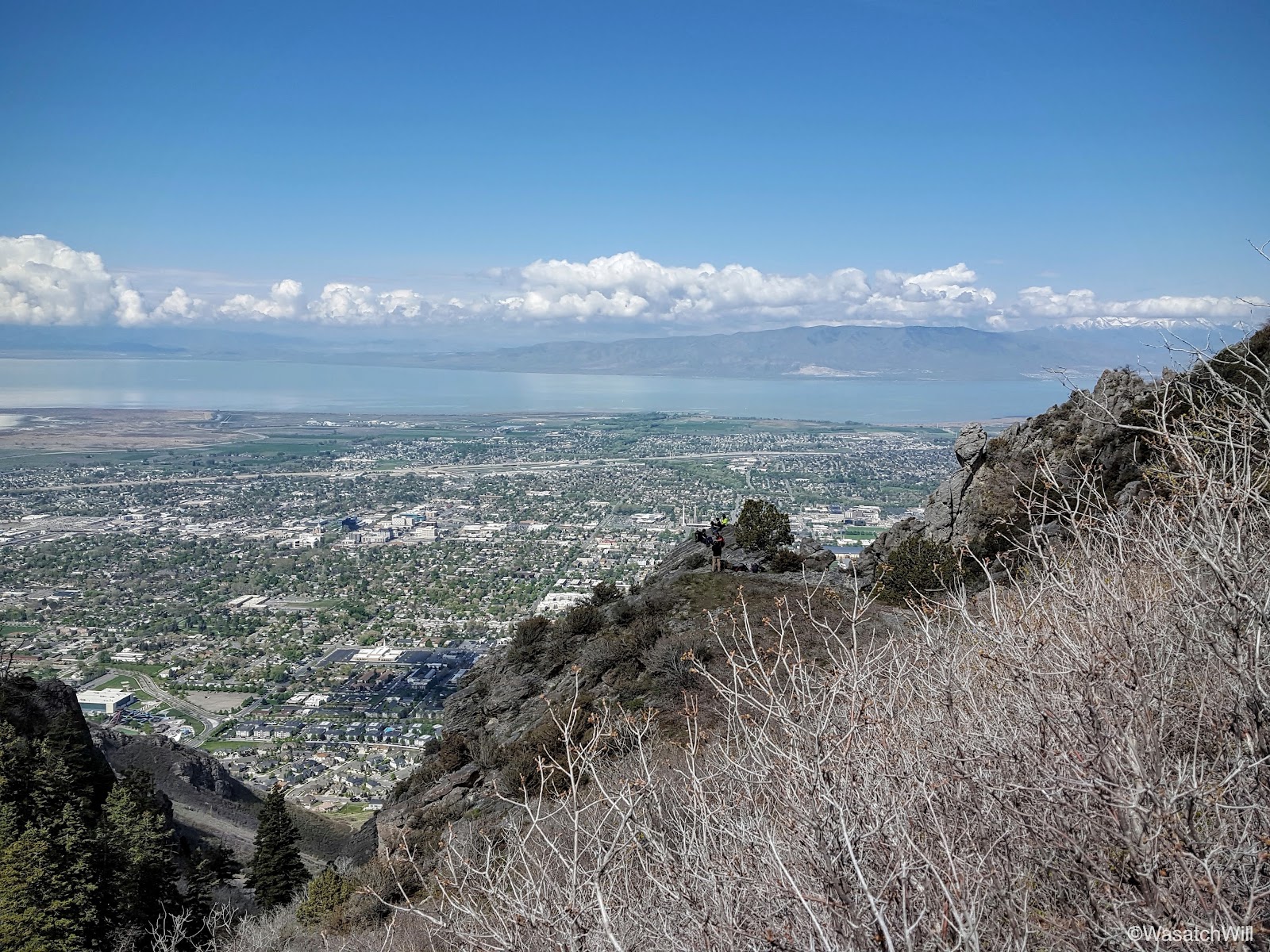
About a mile and another 1000 feet of elevation later, I was at the ridge leading up to the summit and the view north really opened up where I could gaze out at Mount Timpanogos all aglow in morning light as she rose above some stray clouds in all her majesty.

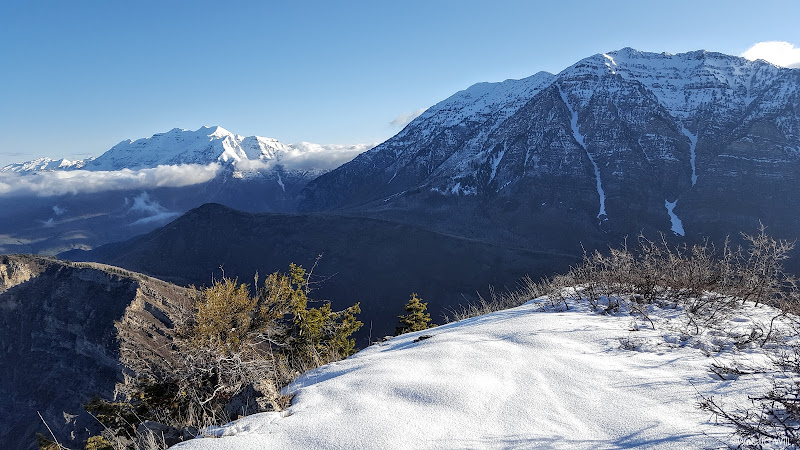
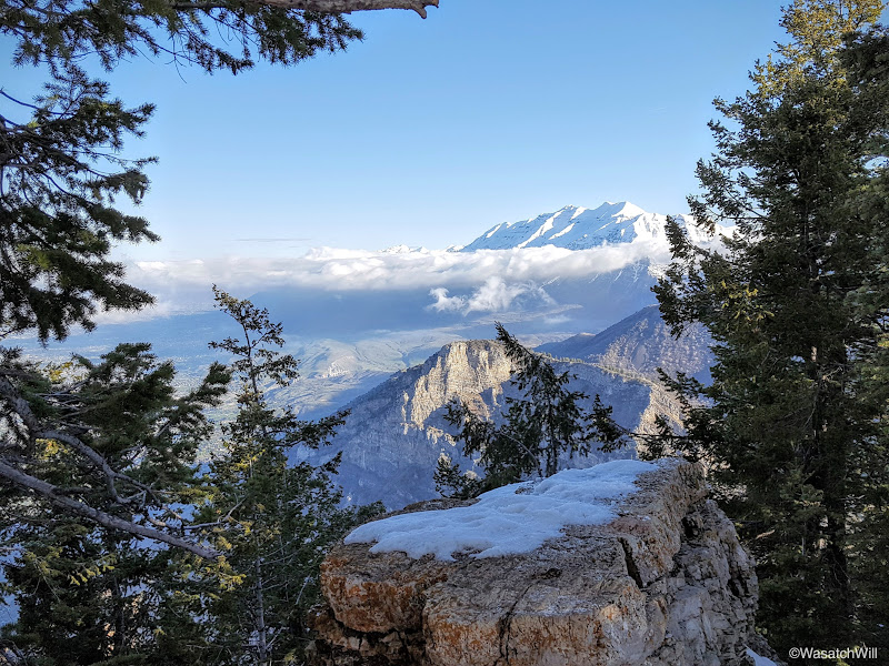
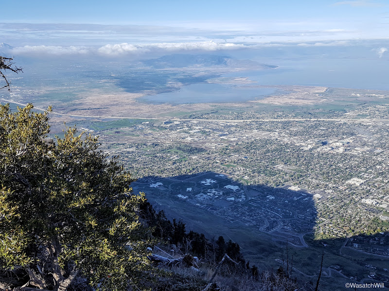
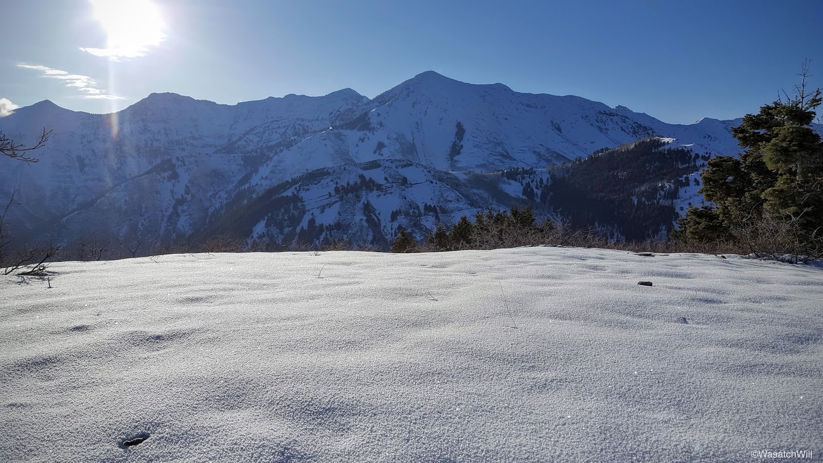
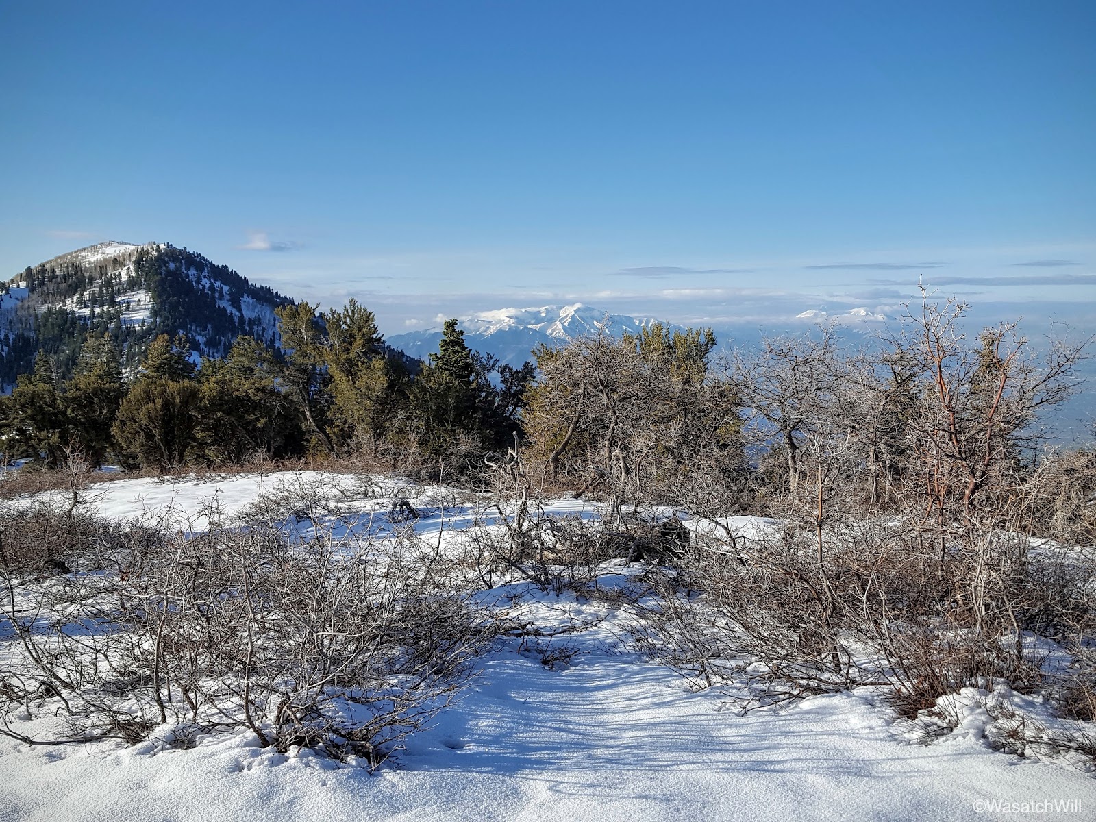
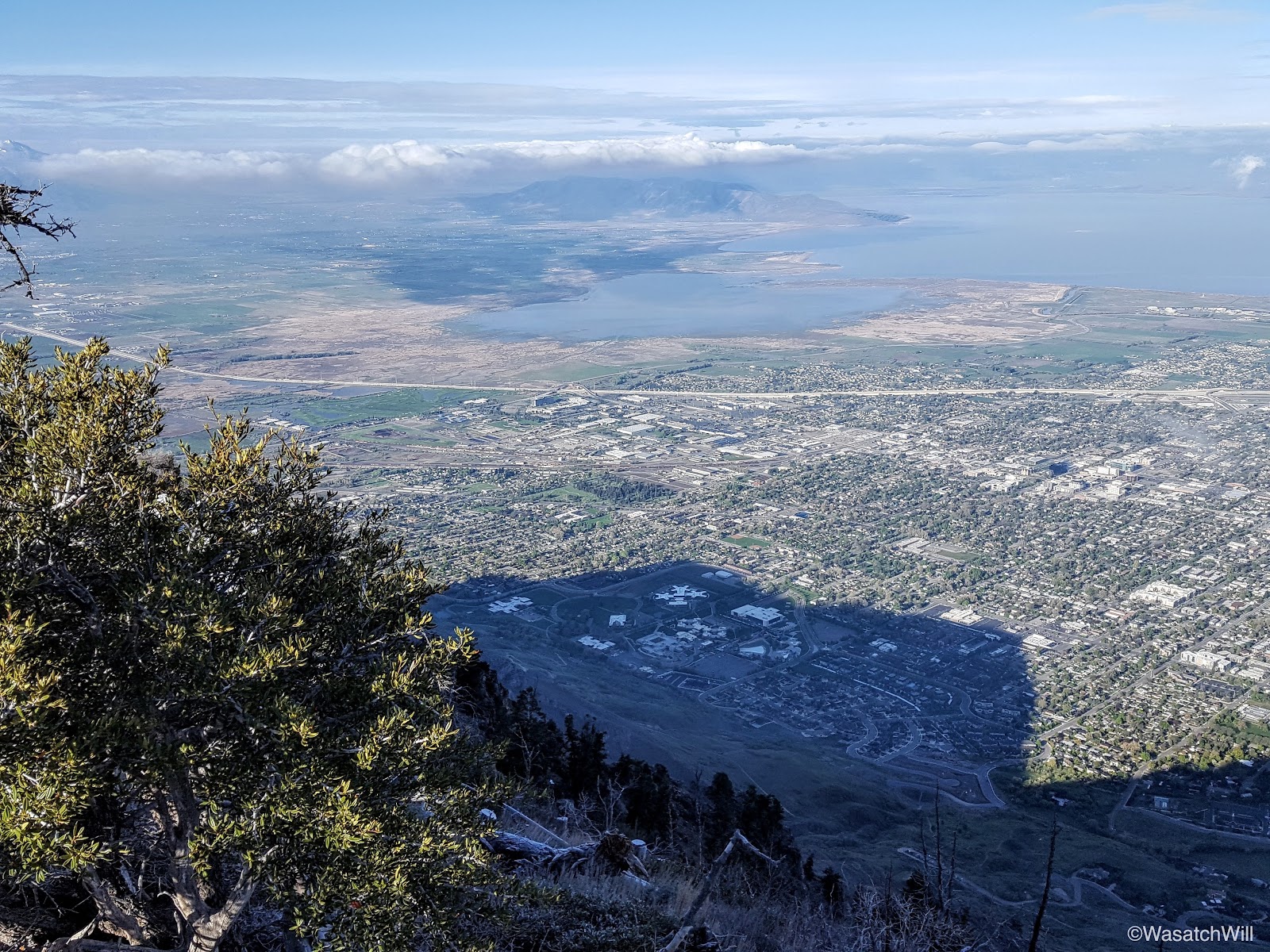
A couple hundred more feet traversing the ridge and I was at the summit proper at last. Provo Peak, Cascade Mountain, Timpanogos, Lone Peak, Mount Nebo, Santaquin Peak, and Maple Mountain were all prominent mountains and peaks that could be seen both near and far.
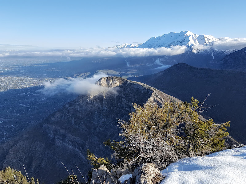

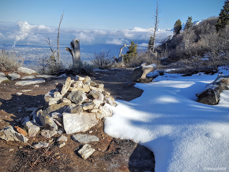
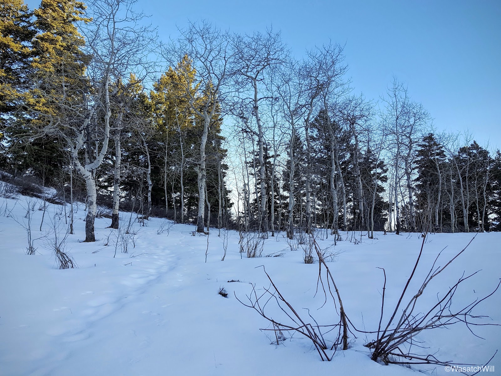
Once I had my fill of the beautiful views afforded to me, I descended the summit and strolled across to pay another visit out to Y Mountain overlook.
By now it was about 8:30 a.m. and a good time to get heading back down to break camp and have breakfast.
Some were wise to drag their tents over across the meadow into the sunlight where they could defrost and dry out before packing them away.
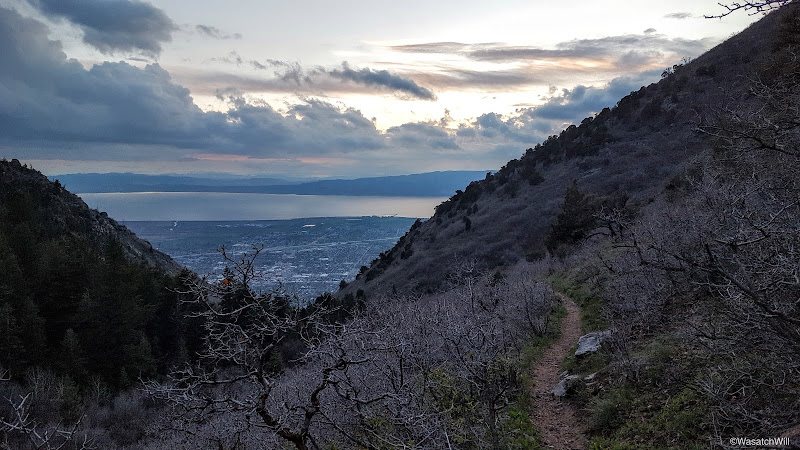
All packed up, we moved on down trail back into the civilization below.


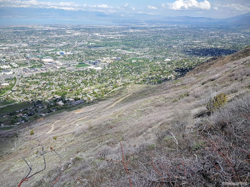
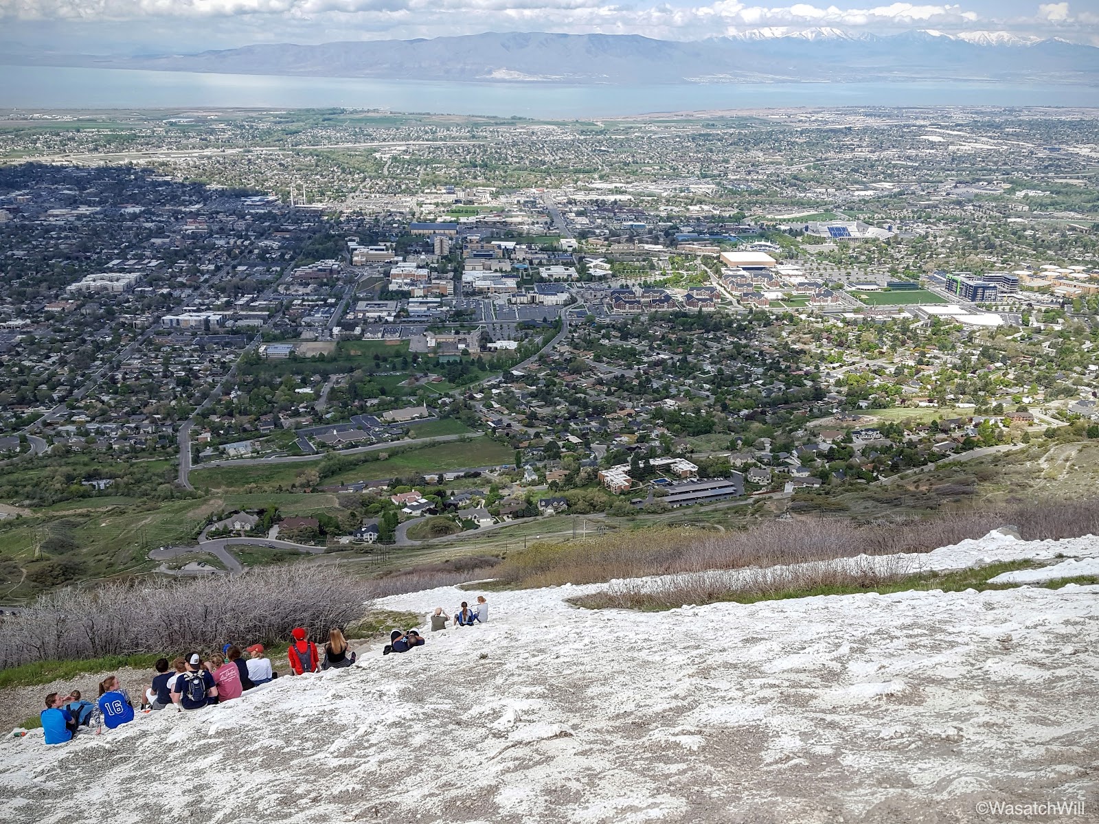
Being a Saturday morning with blissful weather, the crowds really picked up, as expected, from the popular "Y" all the way down. When you are so close to it, it is hard to capture and make out the full letter, but there is no missing it when looking up at the mountain on a clear day from most anywhere in the valley.
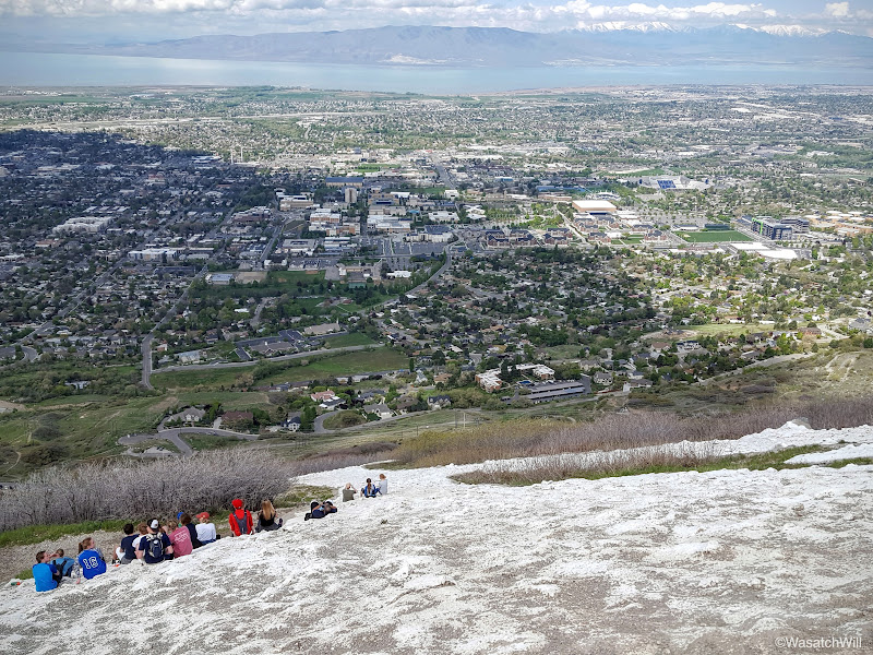
If I were to guess, I'd say that year to year, the "Y Trail" probably receives more foot traffic than any other trail in the county, the trails up Mount Timpanogos coming in at a distant second. With it's easy accessibility at the edge of the valley, and its close proximity to the nation's largest private university for which the large block letter on the mountain side represents, and the views of the valley, it's no wonder why it is such a popular trail to hike. You wouldn't know it by the last couple pictures I took though.
Nine switchbacks later and I was back at my car and rushing out to a nearby park to catch one of my daughter's soccer game. I arrived just in time to catch her score her first goal ever in a game. What a morning and what a nice little trip! It is such a blessing to be able to live and work at the feet of such beautiful mountains that make it possible for such quick little backpacking trips like this one was.
Day 1
Friday - April 29, 2016
Most of the group had started up the trail at about 5:30 pm. I was hoping to meet them at the trailhead, but ended up leaving work a little later than I had desired and still had to drive home to change and get my pack. I took care of a few other household things, and didn't end up arriving at the trailhead until about 7 pm. I didn't think I'd catch them before camp with how short the trail was, but then again, there'd be about 2000 feet of elevation gain in those two miles, and these were scouts, some of them young and on their first backpacking trip ever.
The weather all week had been raining and even for that afternoon, the forecast had shown lingering clouds and a chance of scattered showers. I was a nervous for a moment starting out with how dark some of the clouds above were, but I hadn't seen any lightning or heard any thunder and with the direction the clouds were moving, my concerns quickly dissipated.
About a half hour from starting, I had arrived at the top of the Y and a few moments later, I was sitting at Eagle Pass where the trail turns a corner into Slide Canyon. This is always a great place to take a little breather break and take in some views of the valley below.
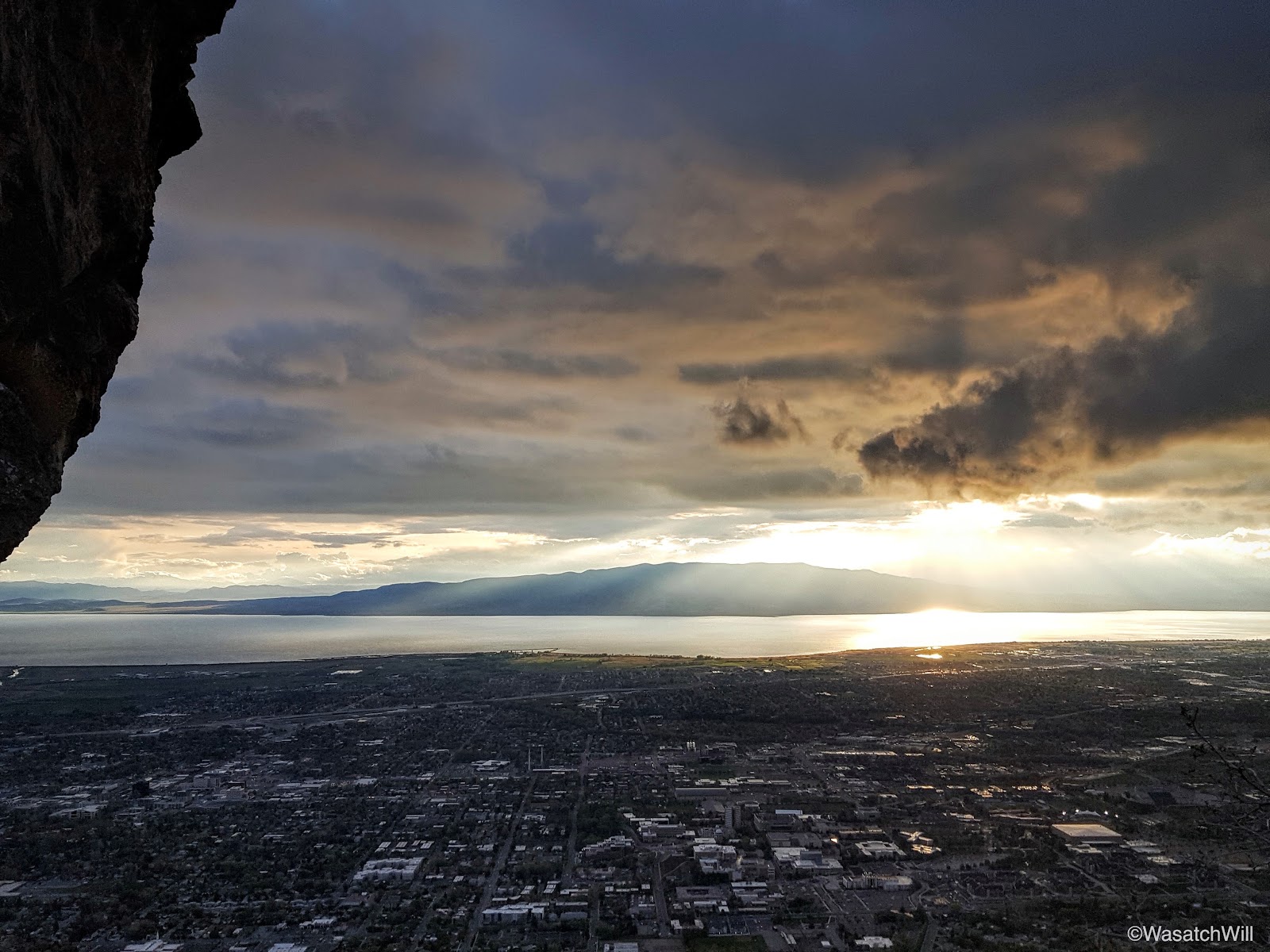
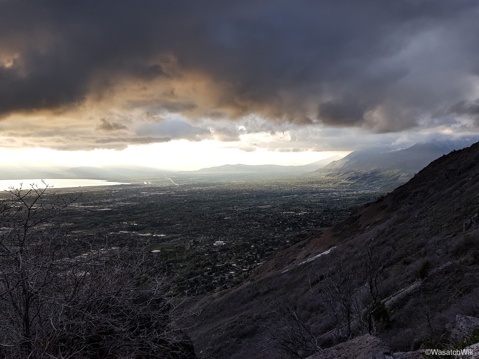
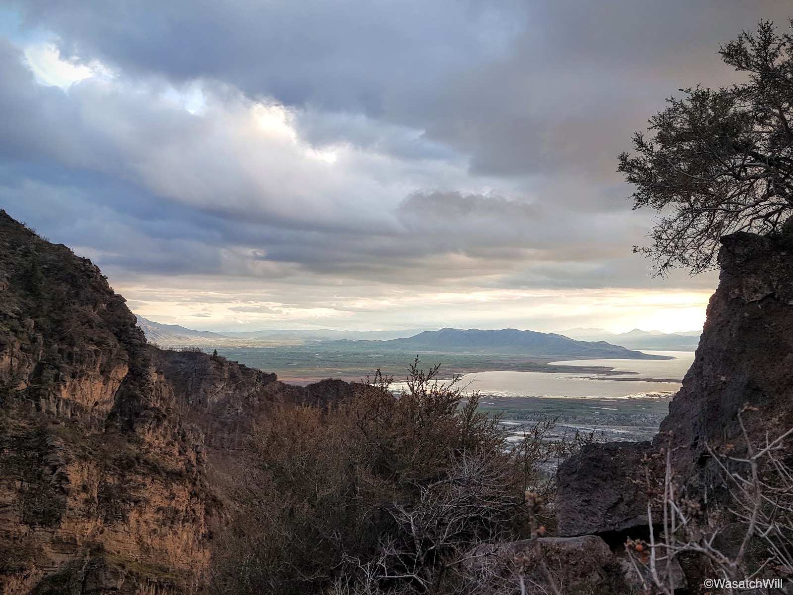
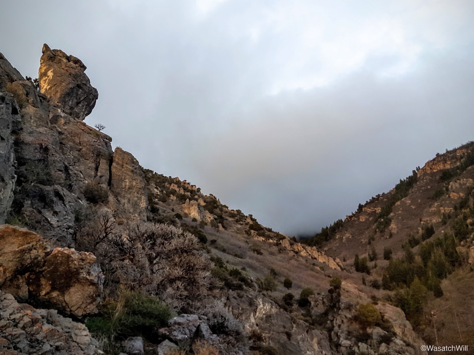
After a few moments of rest, I set course for the final mile. There were a few times I had to keep looking back to see if how the sunset was setting up. There weren't ever any spectacular colors, but the clouds still set up some interesting shots.

Within about a half mile, I ended up catching up to the tail end of the group: a couple adult leaders with all the beginners. The other two leaders with the more experienced boys had moved on, likely already setting up their camp. I stuck with them and soon thereafter, we were walking into camp, a little meadow off the trail known as Bear Flat.
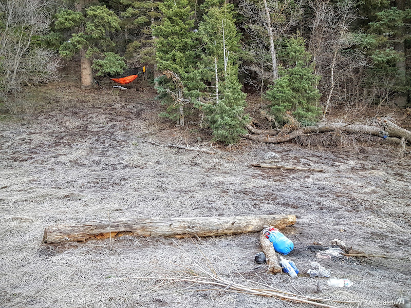
There was only a few minutes of decent daylight left and it was going fast with the cloud cover, so I hunted down a spot up in some pines just above the flat to hang my hammock. I also sought out a place to hang a bear bag. I managed a suitable spot, but the trees weren't ideal for hanging a bear bag, which is pretty typical of many areas in Utah's Mountains. By now it was dark and while dinner was rehydrating, I wandered down trail a few hundred feet to look down at the valley lights.

With dinner now done, the skies began to clear up and with that came a surge of coldness. While cleaning up, another group, including some very young children ages 4 and 5 rolled into the meadow. They were a family and with it being so late, dark, and cold, they went back down and began to establish their camp down by the bear hang. I went down and retrieved the bear bag, opting to just trust the odor-proofness of my bear bag liner and rested it near the campfire.
Most of the boys had grown quite tired from the hike up and went to bed. A few adults, including myself, huddled around the campfire for a while before calling it a night ourselves.
Day 2
Saturday - April 30, 2016
The night remained quite cold with clear skies. I never did deploy my tarp. I had started out my sleep with a few chills here and there, but then realized, after getting out to do some business, my emergency blanket under-quilt had been bunched up on one side instead of fully wrapped around the bottom of the hammock. After getting that adjusted and settling back in, there were no more shivers and I slept warm enough.
As the light of dawn filled in, I opted to wake up and get moving. I wanted to take a stroll up to the true summit of Y Mountain and check out the view from up there. I had hiked to the valley overlook at the top of Y Mountain, which is right near the true summit, once before, but never did make it over to the true summit which is several feet higher. This was a golden opportunity to go do that and also get into some direct sunshine long before it would ever reach our camp.
As I exited the shelter of the trees, I beheld a camp that had received a big visit from Jack Frost overnight.

I saw no signs of anyone else getting up. Apparently everyone else was going to stay snug in their bags where they could sleep in a bit. I ventured on up the trail and out of the flat.
Moments later, I took the north fork trail and moments after that, I began to encounter some snow. I was surprised to find so much snow along a trail facing the south. I had not brought my spikes, but fortunately, I never needed them. The snow proved to be frozen stiff and the texture of it was closer to that of pavement than of ice. Easy treading.
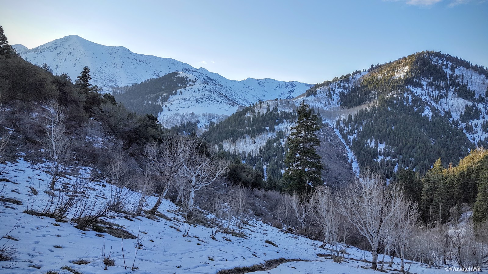

About a mile and another 1000 feet of elevation later, I was at the ridge leading up to the summit and the view north really opened up where I could gaze out at Mount Timpanogos all aglow in morning light as she rose above some stray clouds in all her majesty.
A couple hundred more feet traversing the ridge and I was at the summit proper at last. Provo Peak, Cascade Mountain, Timpanogos, Lone Peak, Mount Nebo, Santaquin Peak, and Maple Mountain were all prominent mountains and peaks that could be seen both near and far.
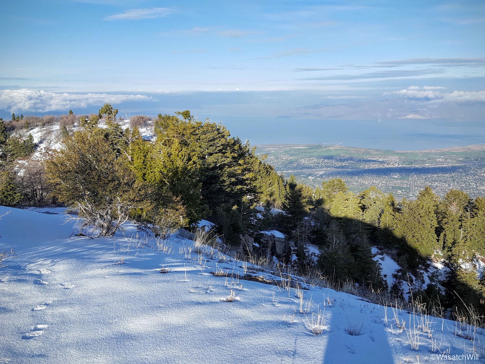
Once I had my fill of the beautiful views afforded to me, I descended the summit and strolled across to pay another visit out to Y Mountain overlook.


By now it was about 8:30 a.m. and a good time to get heading back down to break camp and have breakfast.
Some were wise to drag their tents over across the meadow into the sunlight where they could defrost and dry out before packing them away.
All packed up, we moved on down trail back into the civilization below.

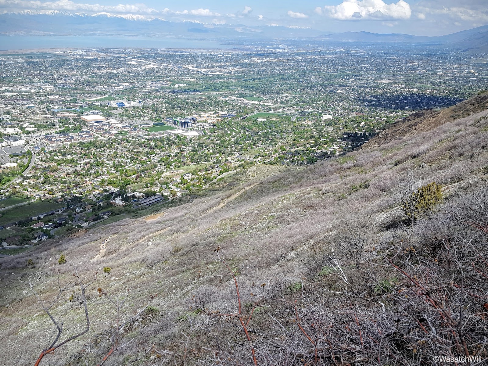

Being a Saturday morning with blissful weather, the crowds really picked up, as expected, from the popular "Y" all the way down. When you are so close to it, it is hard to capture and make out the full letter, but there is no missing it when looking up at the mountain on a clear day from most anywhere in the valley.
If I were to guess, I'd say that year to year, the "Y Trail" probably receives more foot traffic than any other trail in the county, the trails up Mount Timpanogos coming in at a distant second. With it's easy accessibility at the edge of the valley, and its close proximity to the nation's largest private university for which the large block letter on the mountain side represents, and the views of the valley, it's no wonder why it is such a popular trail to hike. You wouldn't know it by the last couple pictures I took though.

Nine switchbacks later and I was back at my car and rushing out to a nearby park to catch one of my daughter's soccer game. I arrived just in time to catch her score her first goal ever in a game. What a morning and what a nice little trip! It is such a blessing to be able to live and work at the feet of such beautiful mountains that make it possible for such quick little backpacking trips like this one was.
")