Udink
Still right here.
- Joined
- Jan 17, 2012
- Messages
- 1,734
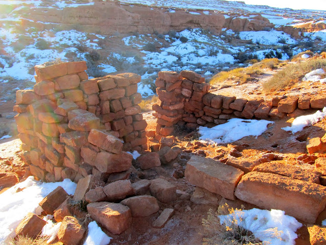
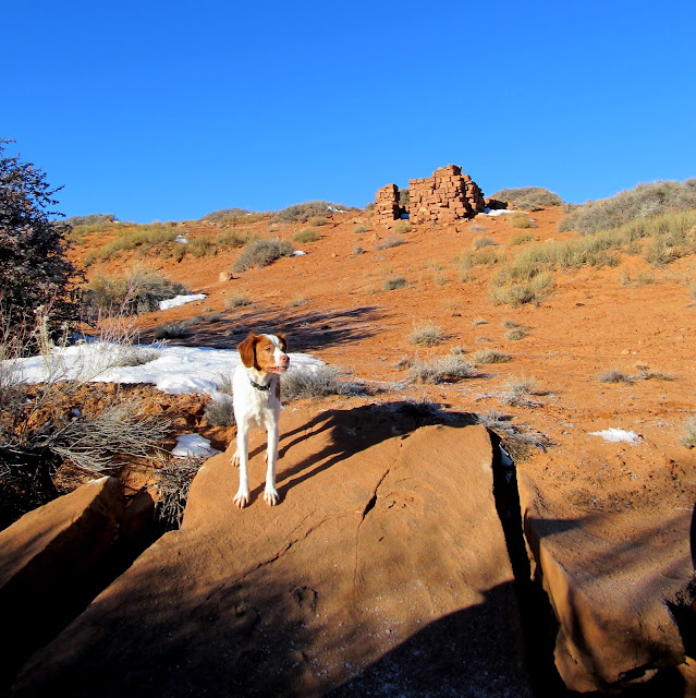
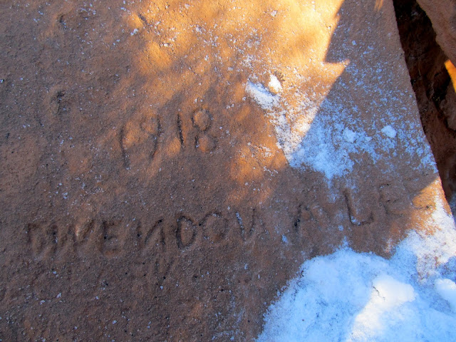
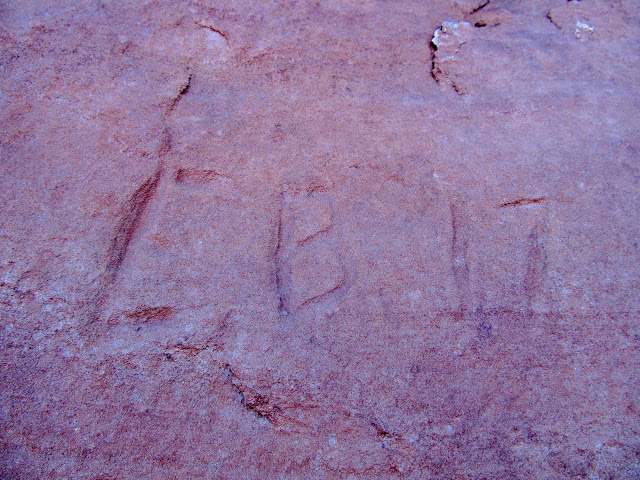
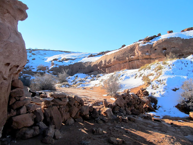
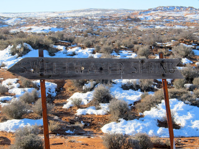
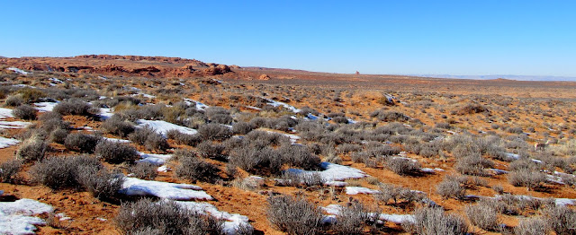
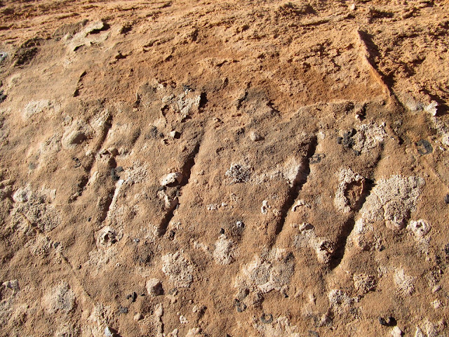
Alan proposed a trip he had been planning in the Sweetwater Reef area of the San Rafael Desert, which meant another 5:15AM wake-up call on Saturday morning. We'd apparently both been researching the area recently. I already had a few places I wanted to check out near there, and I'd been reading up about the springs in the area in my recently-purchased Utah's Canyon Country Place Names book by Steve Allen. Alan picked me up at 6AM and we met Wade at the usual spot on UT-24, and during the remainder of the drive we changed our plans a bit. We'd originally planned on visiting Sweetwater Spring first, then doing a loop hike through the two unnamed canyons north of Middle Canyon, but instead we decided our second priority after Sweetwater Spring would be the North Spring Wash area. We hiked around Sweetwater Spring for a bit but didn't find any surprises there. We saw a partial-dugout stone cabin near the spring and a rock wall in a box canyon that was used to corral livestock, plus a couple of names carved in a rock near the spring, most of which we'd already read about from Janie and Steve's blog.
Remains of a partial-dugout cabin at Sweetwater Spring
Torrey at Sweetwater Spring
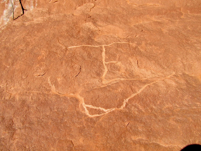
1918 Dwendon A. Lee
E.B. '17
Rock wall in a box canyon to hold livestock
Old sign for Sweetwater Spring
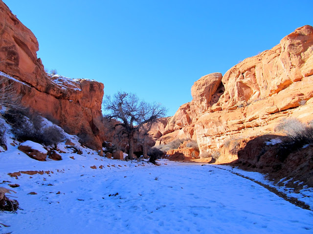
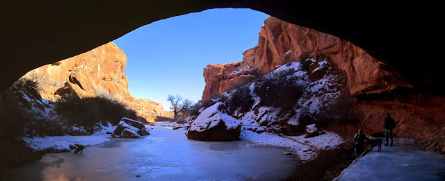
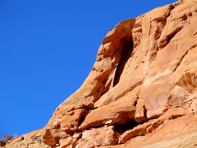
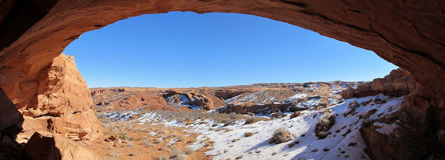
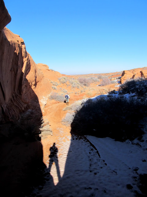
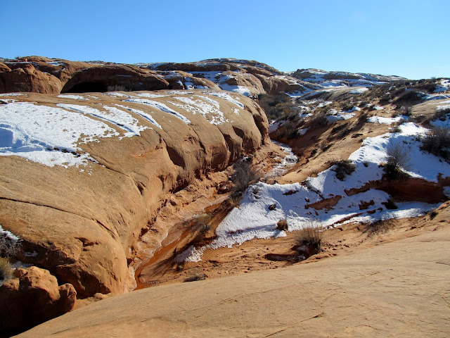
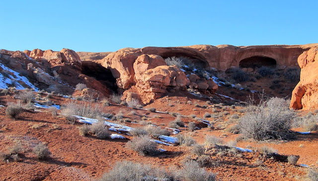
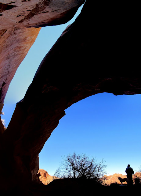
After a relatively short drive to the east, we were at the end of a road near North Spring and following a cattle trail into North Spring Wash. Once in the canyon I scrambled up to an arch-like formation, looking for inscriptions, but found that it really was an arch and I could see blue sky through it. We hiked up a small fenced-off side-canyon and only found a single brand scrawled into a cliff, then we moved on toward North Spring.
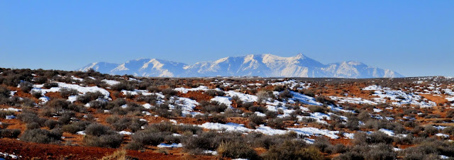
The Henrys viewed from our parking spot above North Spring Wash
Boulder on the canyon rim
Descending into North Spring Wash
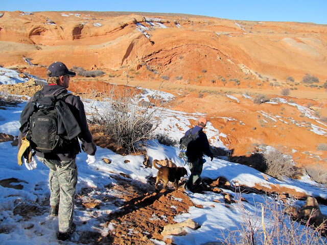
North Spring Wash
An arch?
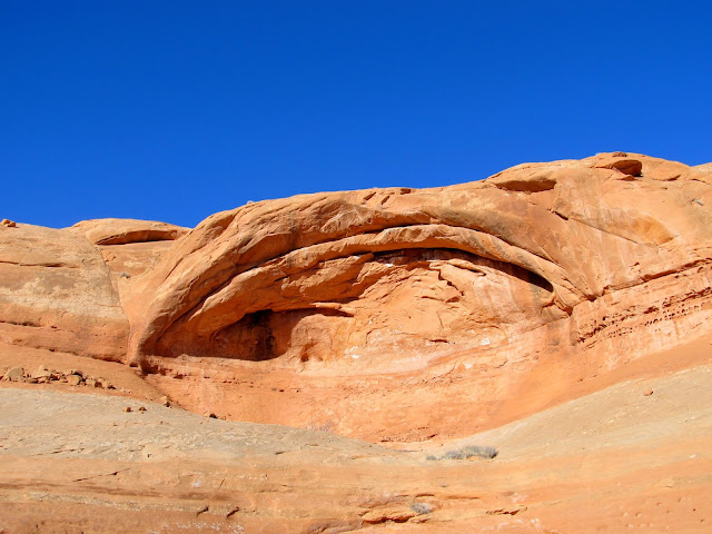
It *is* an arch!
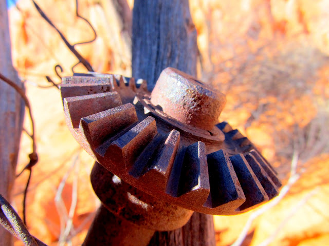
Axle shaft used in the construction of a fence
Rocking TE brand scratched into the canyon wall
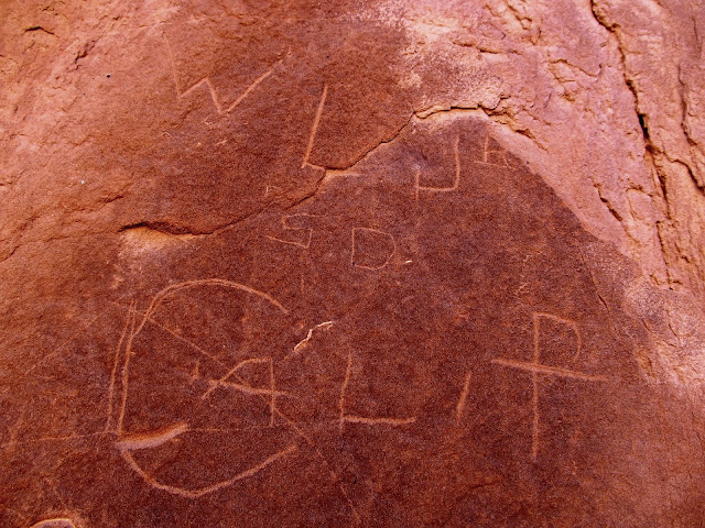
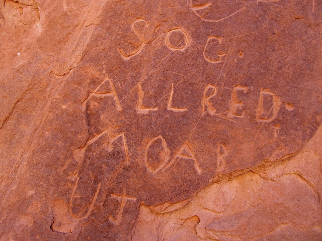
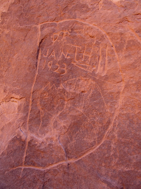
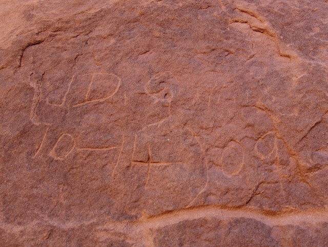
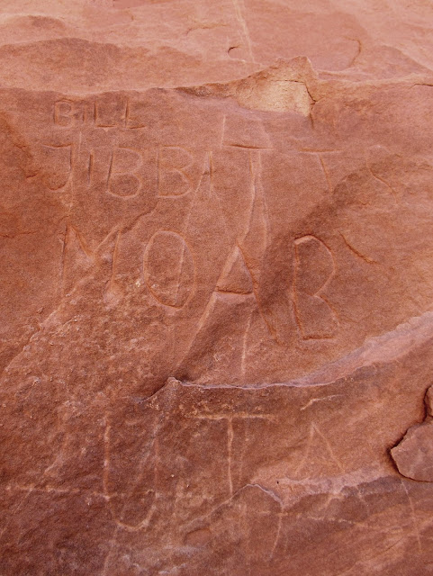
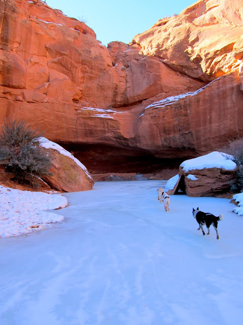
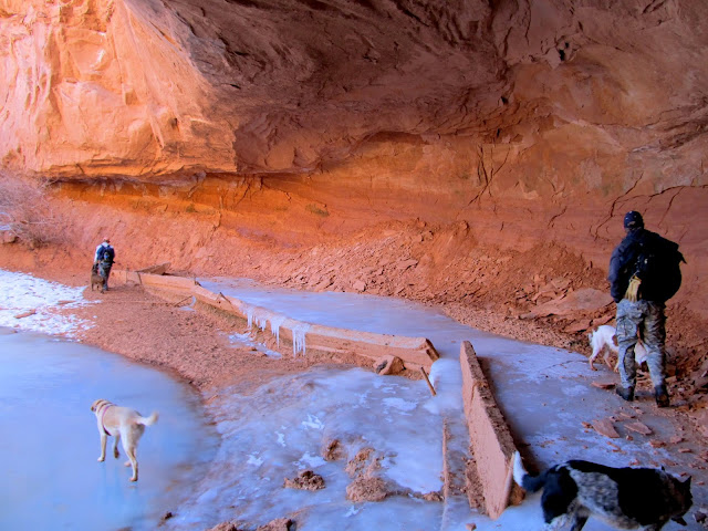
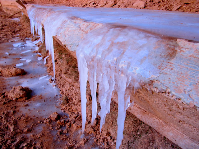
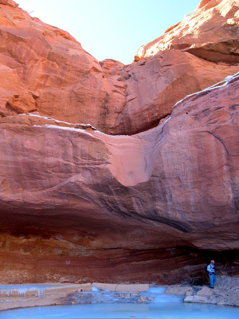
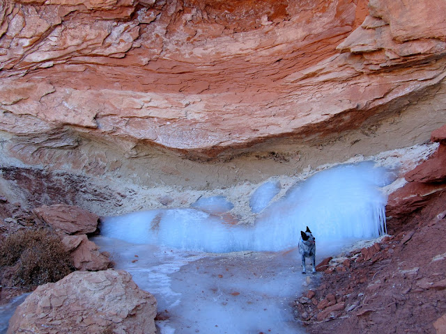
Near North Spring we found several inscriptions from the first quarter of the 1900s, including one from Bill Tibbetts, whose name Alan and I found miles away in an alcove almost exactly a year earlier. North Spring had formed a large sheet of ice in the shaded canyon. At the head of the spring, inside an alcove and below a dryfall, was an old concrete dam.
North Spring Canyon
W.L. Jr., S.D., Calif.
Sog Allred, Moab UT
D.T., Jan. th 11, 1923 (probably Daff Thompson)
J.D. Gillis, 10-14-1909
Bill Tibbetts, Moab, Utah
The dogs running toward North Spring
Concrete dam at North Spring
Inside the North Spring alcove
Icicles spilling over the dam
Dryfall above North Spring
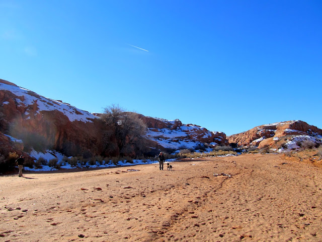
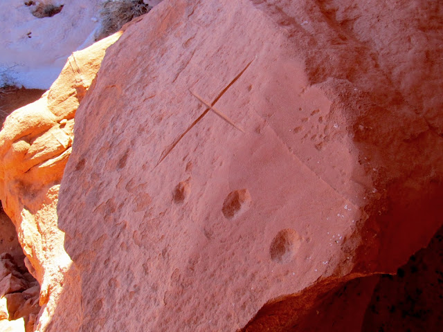
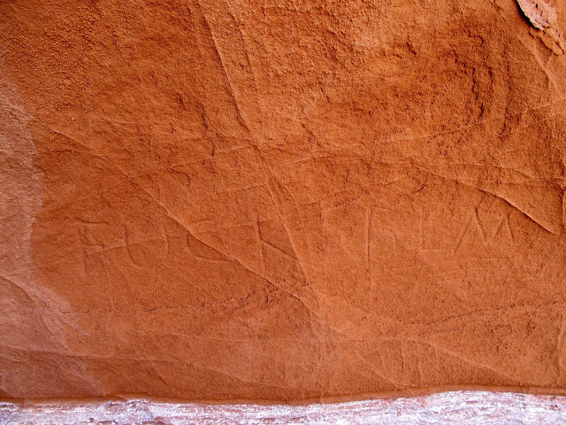
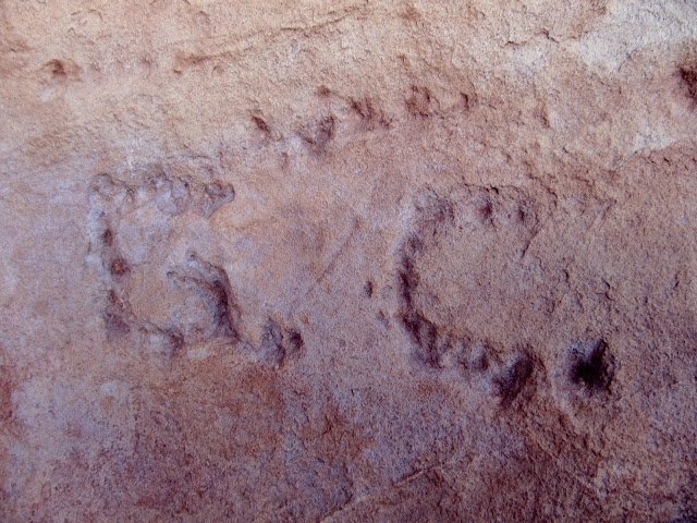
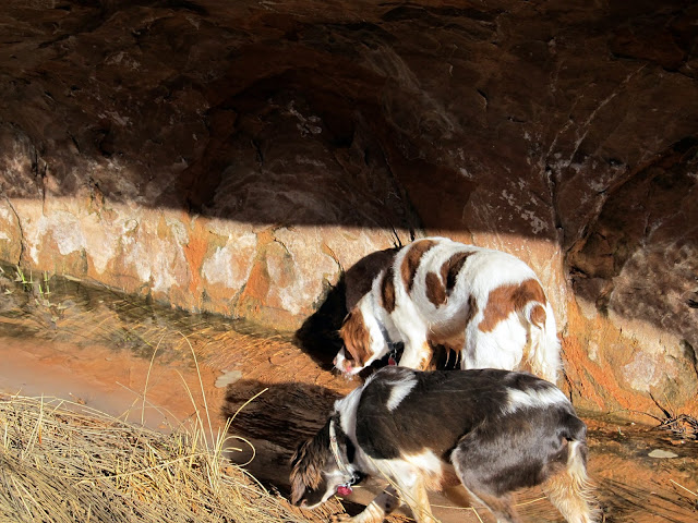
We next headed downstream in North Spring Wash with the intention of cutting across toward the Middle Canyon drainage. On the way, though, we got separated, with each of us going to investigate something different. I'd spotted an alcove that looked interesting and found that it was an Indian habitation site. There were a lot of grinding marks and a few sharpening grooves in the sandstone, plus a more recent humorous message left for the BLM. I hadn't seen Alan or Wade for a while so I hiked back toward North Spring Wash hoping to find them waiting for me. Eventually I found them hiking back up the wash looking for me--I wasn't worried about finding them as much as I was Torrey and Boulder, who had followed one of them. Luckily both of my dogs had stuck around with Alan and Wade. We checked out nearby Hooch Spring before continuing back down the canyon.
Arch in North Spring Wash
Grinding stones in an alcove
Chiseled circles and an incised cross
Looking out from the Indian alcove
A love letter to the BLM, probably left by a member of the Moore family
Water tank at Hooch Spring
G.C. inscription at Hooch Spring
Sophie at Hooch Spring
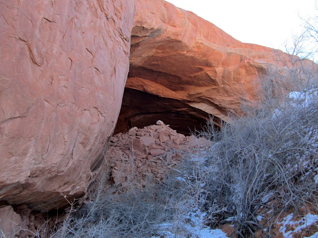
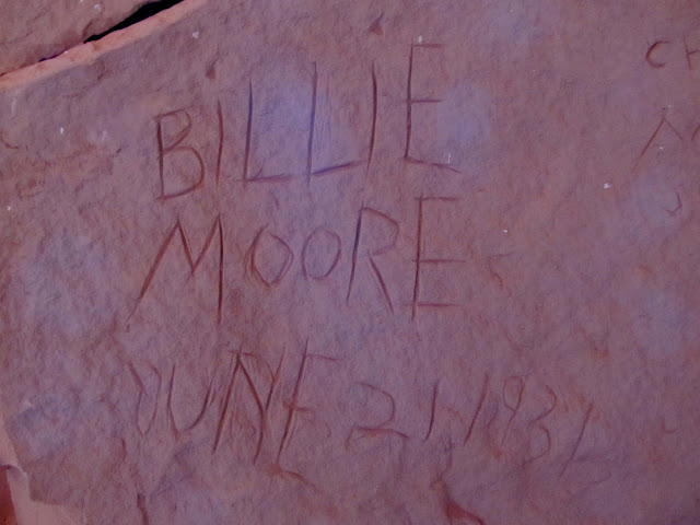
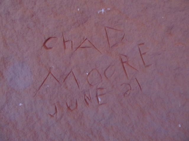
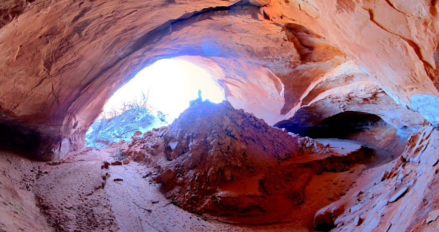
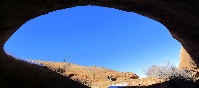
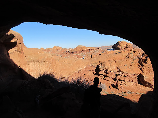
While hiking cross-country toward Middle Canyon we followed a very old road that hasn't seen tracks in decades. We approached a cave marked on the USGS topo map that I expected to just be a moderately-deep alcove, but what we found was a huge cavern, carved out by a drainage that flows through it. Inside, on one of the many boulders that have fallen from the ceiling, were the names of two Moore family members who once owned the nearby springs and commensurate grazing rights in the 1930s. The cave turned out to be the highlight of my day.
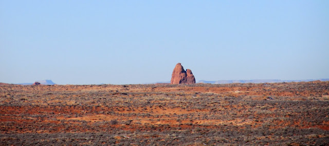
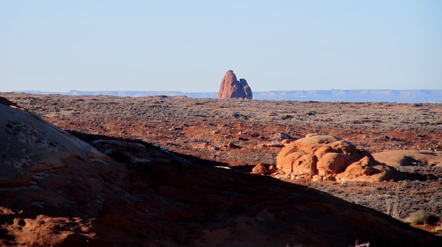
Heading across the flat desert toward the Middle Canyon drainage, Jack's Knob on the distant horizon
Jack's Knob
Cave near Village Home Spring
Billie Moore, June 21, 1936
Chad Moore, June 21
Inside the cave
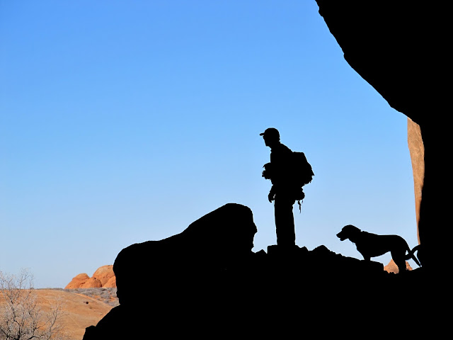
A boy and his dog, in a cave
In the next small drainage to the west, only a few hundred feet away, was Village Home Spring. There was a long sandstone ridge between us and the drainage, and we each ended up taking a different route to get there. My route consisted of as direct a route as possible, with a sketchy downclimb/jump that I had to force my dogs down before I went. We all met back up at Village Home Spring, which was the only flowing (non-frozen) spring we'd seen that day.
Alan looking for a way around the dryfall I was standing atop
Water running from Village Home Spring
Torrey and Boulder drinking from Village Home Spring
Alcove at Village Home Spring
Old inscription at Village Home Spring
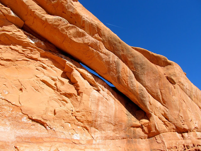
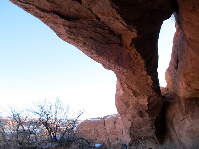
Daylight was growing short but we saw one last place that we wanted to explore. Just across Middle Canyon were three alcoves that looked promising. Two of them held nothing special but one of the alcoves was actually a good-sized natural arch.
Three alcoves in Middle Canyon
View from one of the Middle Canyon alcoves
Natural arch
A boy and his dog, under an arch
For me, the hike back to the truck was a long trudge. It had been a wonderfully sunny day and I'd hiked all of it in a t-shirt--hardly befitting a mid-January day. At the end of the day my total hiking distance was 8.5 miles. Wade headed home when we dropped him off at his car, but Alan and I continued to Green River where we met Butch and Jeanie, of Tavaputs Ranch, for dinner at Ray's Tavern.
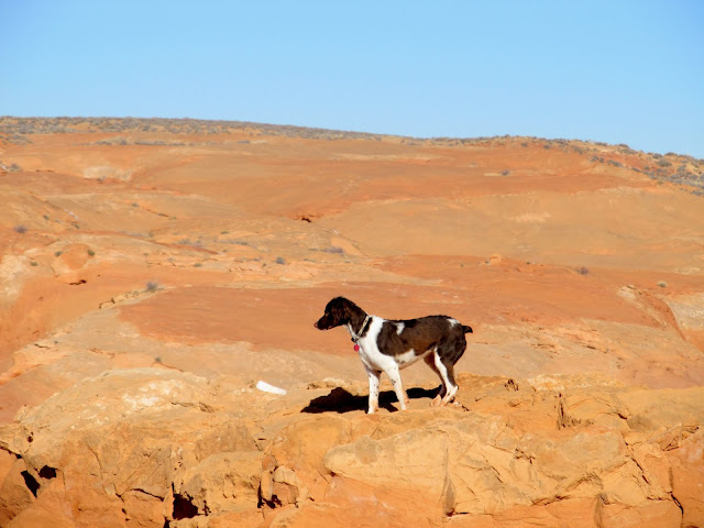
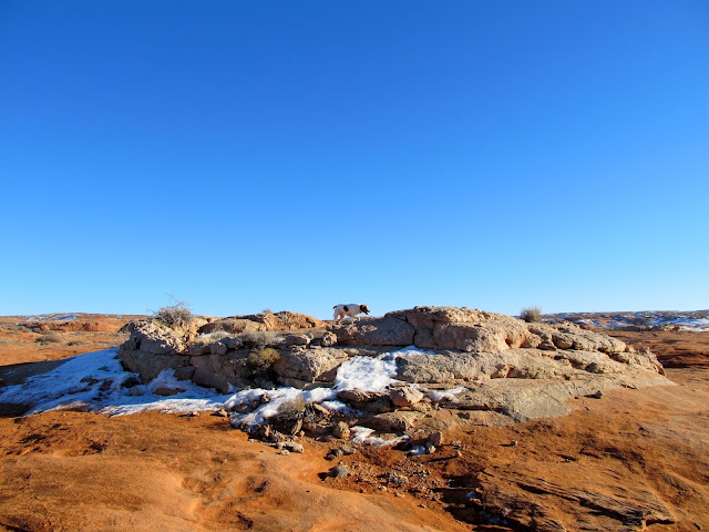
Torrey on one of the many circular 'sand pipe' formations in the area
Parting shot of Jack's Knob
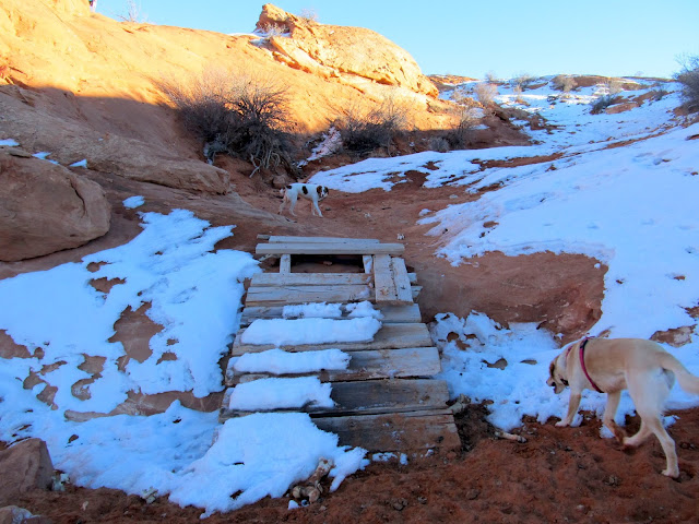
Cattle bridge on the old road into North Spring Wash
Eat at Y's
Full photo gallery:
https://picasaweb.google.com/Dennis.Udink/SweetwaterReefArea
[parsehtml]<iframe width="640" height="480" frameborder="0" scrolling="no" marginheight="0" marginwidth="0" src="https://maps.google.com/maps?q=http...pn=0.12897,0.219383&z=12&output=embed"></iframe><br /><small><a href="https://maps.google.com/maps?q=http...pn=0.12897,0.219383&z=12&source=embed" style="color:#0000FF;text-align:left">View Larger Map</a></small>[/parsehtml]http://udink.org/geo/SweetwaterReefArea.kmz
Featured image for home page:

Remains of a partial-dugout cabin at Sweetwater Spring
Torrey at Sweetwater Spring
1918 Dwendon A. Lee
E.B. '17
Rock wall in a box canyon to hold livestock
Old sign for Sweetwater Spring
After a relatively short drive to the east, we were at the end of a road near North Spring and following a cattle trail into North Spring Wash. Once in the canyon I scrambled up to an arch-like formation, looking for inscriptions, but found that it really was an arch and I could see blue sky through it. We hiked up a small fenced-off side-canyon and only found a single brand scrawled into a cliff, then we moved on toward North Spring.
The Henrys viewed from our parking spot above North Spring Wash
Boulder on the canyon rim
Descending into North Spring Wash
North Spring Wash
An arch?
It *is* an arch!
Axle shaft used in the construction of a fence
Rocking TE brand scratched into the canyon wall
Near North Spring we found several inscriptions from the first quarter of the 1900s, including one from Bill Tibbetts, whose name Alan and I found miles away in an alcove almost exactly a year earlier. North Spring had formed a large sheet of ice in the shaded canyon. At the head of the spring, inside an alcove and below a dryfall, was an old concrete dam.
North Spring Canyon
W.L. Jr., S.D., Calif.
Sog Allred, Moab UT
D.T., Jan. th 11, 1923 (probably Daff Thompson)
J.D. Gillis, 10-14-1909
Bill Tibbetts, Moab, Utah
The dogs running toward North Spring
Concrete dam at North Spring
Inside the North Spring alcove
Icicles spilling over the dam
Dryfall above North Spring
We next headed downstream in North Spring Wash with the intention of cutting across toward the Middle Canyon drainage. On the way, though, we got separated, with each of us going to investigate something different. I'd spotted an alcove that looked interesting and found that it was an Indian habitation site. There were a lot of grinding marks and a few sharpening grooves in the sandstone, plus a more recent humorous message left for the BLM. I hadn't seen Alan or Wade for a while so I hiked back toward North Spring Wash hoping to find them waiting for me. Eventually I found them hiking back up the wash looking for me--I wasn't worried about finding them as much as I was Torrey and Boulder, who had followed one of them. Luckily both of my dogs had stuck around with Alan and Wade. We checked out nearby Hooch Spring before continuing back down the canyon.
Arch in North Spring Wash
Grinding stones in an alcove
Chiseled circles and an incised cross
Looking out from the Indian alcove
A love letter to the BLM, probably left by a member of the Moore family
Water tank at Hooch Spring
G.C. inscription at Hooch Spring
Sophie at Hooch Spring
While hiking cross-country toward Middle Canyon we followed a very old road that hasn't seen tracks in decades. We approached a cave marked on the USGS topo map that I expected to just be a moderately-deep alcove, but what we found was a huge cavern, carved out by a drainage that flows through it. Inside, on one of the many boulders that have fallen from the ceiling, were the names of two Moore family members who once owned the nearby springs and commensurate grazing rights in the 1930s. The cave turned out to be the highlight of my day.
Heading across the flat desert toward the Middle Canyon drainage, Jack's Knob on the distant horizon
Jack's Knob
Cave near Village Home Spring
Billie Moore, June 21, 1936
Chad Moore, June 21
Inside the cave
A boy and his dog, in a cave
In the next small drainage to the west, only a few hundred feet away, was Village Home Spring. There was a long sandstone ridge between us and the drainage, and we each ended up taking a different route to get there. My route consisted of as direct a route as possible, with a sketchy downclimb/jump that I had to force my dogs down before I went. We all met back up at Village Home Spring, which was the only flowing (non-frozen) spring we'd seen that day.
Alan looking for a way around the dryfall I was standing atop
Water running from Village Home Spring
Torrey and Boulder drinking from Village Home Spring
Alcove at Village Home Spring
Old inscription at Village Home Spring
Daylight was growing short but we saw one last place that we wanted to explore. Just across Middle Canyon were three alcoves that looked promising. Two of them held nothing special but one of the alcoves was actually a good-sized natural arch.
Three alcoves in Middle Canyon
View from one of the Middle Canyon alcoves
Natural arch
A boy and his dog, under an arch
For me, the hike back to the truck was a long trudge. It had been a wonderfully sunny day and I'd hiked all of it in a t-shirt--hardly befitting a mid-January day. At the end of the day my total hiking distance was 8.5 miles. Wade headed home when we dropped him off at his car, but Alan and I continued to Green River where we met Butch and Jeanie, of Tavaputs Ranch, for dinner at Ray's Tavern.
Torrey on one of the many circular 'sand pipe' formations in the area
Parting shot of Jack's Knob
Cattle bridge on the old road into North Spring Wash
Eat at Y's
Full photo gallery:
https://picasaweb.google.com/Dennis.Udink/SweetwaterReefArea
[parsehtml]<iframe width="640" height="480" frameborder="0" scrolling="no" marginheight="0" marginwidth="0" src="https://maps.google.com/maps?q=http...pn=0.12897,0.219383&z=12&output=embed"></iframe><br /><small><a href="https://maps.google.com/maps?q=http...pn=0.12897,0.219383&z=12&source=embed" style="color:#0000FF;text-align:left">View Larger Map</a></small>[/parsehtml]http://udink.org/geo/SweetwaterReefArea.kmz
Featured image for home page:
Last edited by a moderator:
")