- Joined
- Jun 25, 2012
- Messages
- 4,429
Greetings summer wanderers. A quick trip report about this weekend's (July 10, 2015) walkabout in the Wind River range with Underscore and his doggie Maya. We went in to examine some climbing cliffs I had heard about above the Sweetwater Gap and to generally enjoy the range. We were lured, as usual, into going up something. That something in this case was Mt. Nystrom (12,356') above its east cirque above said climbing cliffs. The weather was generally great but threatened black clouds and violence occasionally. It followed through a couple of times with said violence but, after holing up under a boulder a little while, we were able to execute on an ascent of the peak as you will see the pics.
Stats: 19 mile weekend, 4000"+ of ascent and great fun was had by all. We saw *no* other people and mucho elk scat. Not bad for an easily accessible trailhead only 4.5 hours from home on a midsummer weekend. The bugs were moderate. The weather ranged from poor to fantastic.
Track from my radio collar:
http://caltopo.com/m/446J
Sweetwater Gap Trailhead - we encountered some of that weather violence as we got out of the car and started packing up. So we got back in the truck and waited it out. This is one of the more obscure trailheads in the range in the southwest corner and thus one of the least used. You access it on dirt roads from South Pass and only the last mile or two is blocked to all but high ground clearance vehicles and that only because of an overaggressive water bar builder and a grader. Some of the water bar ditches were a couple of feet deep!

Storm over - we are off.

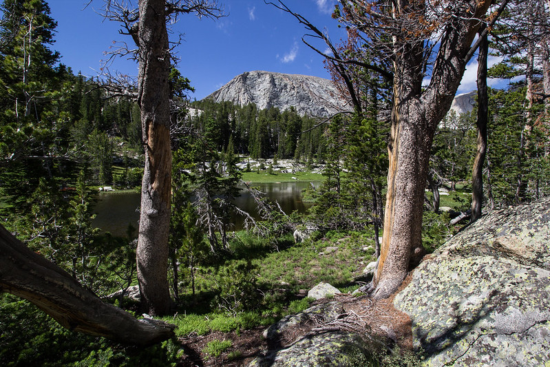
Our first camp was in the forest near the Gap since we had a late start. A lake on the next day as we climbed into the cirque.

Weather is teasing from blue sky to black so we keep ascending trying to keep up with the dog.

A fine view of one of the routes now added to the tic list. The left sky line is the Anvil Arete. Grade III, 5.8 as told to me by Joe Kelsey in his Climbing and Hiking in the Wind River Mountains. Recommended. The book that is... - even for non climbers. I talked to Joe about beta before the trip.

A popping pointer with Poppa. Pointer=Maya. Poppa= Underscore ( @slc_dan )

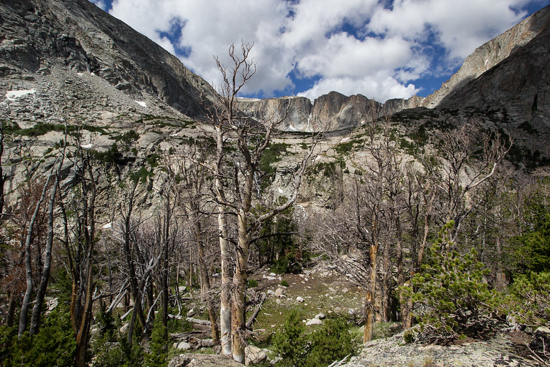
The head walls of the cirque. Mt. Nystrom is just out of the view behind the highest point.

The route past the head wall. The grassy slopes of the shoulder. Looks casual but turned out to be mostly boulder hopping as was the ridge and right hand turn to the peak. Quite grueling.

The wandering Poppa showing that the footing wasn't all grassy slope.

Beauty to compensate for the labor.

A strange, strange rock. I thought it was a stump at 12k' at first.

Underscore on the wrong summit.

Me on the correct summit (luckily I was in charge of navigation). Selfie focused north with view of the whole range to the north. This could conceivably be called the most southerly high point in the range and would make a good ending to a High Wind River traverse finishing at the Sweetwater Gap trailhead. Our @kullaberger, his family and new doggie were on East Temple Peak just left of center three days before.
Unobstructed view of the range looking north. Temple, East Temple and Wind River Peak above the skyline in the middle background L to R.

Artsy view of the Little Sandy Lake and its river drainage. Next on the recon list. Big granite towers in this drainage as well.

Hopping back through the boulders...

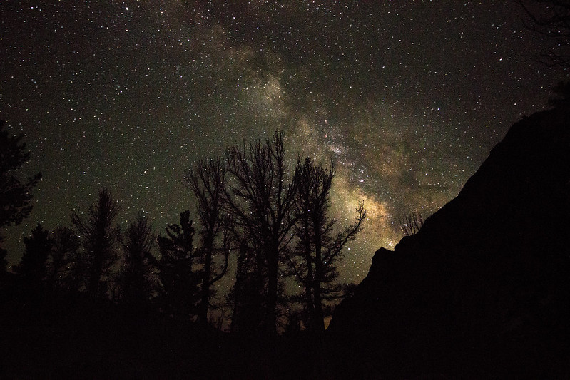
An idyllic setting in the forest on the Sweetwater Gap trail on the walk out. About half of our walk was trail-less.

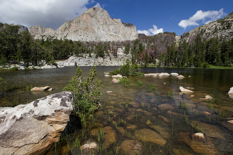
Another fantastic Wind Rivers high country location.
Enjoy.
Featured image for home page:

Stats: 19 mile weekend, 4000"+ of ascent and great fun was had by all. We saw *no* other people and mucho elk scat. Not bad for an easily accessible trailhead only 4.5 hours from home on a midsummer weekend. The bugs were moderate. The weather ranged from poor to fantastic.
Track from my radio collar:
http://caltopo.com/m/446J
Sweetwater Gap Trailhead - we encountered some of that weather violence as we got out of the car and started packing up. So we got back in the truck and waited it out. This is one of the more obscure trailheads in the range in the southwest corner and thus one of the least used. You access it on dirt roads from South Pass and only the last mile or two is blocked to all but high ground clearance vehicles and that only because of an overaggressive water bar builder and a grader. Some of the water bar ditches were a couple of feet deep!
Storm over - we are off.
Our first camp was in the forest near the Gap since we had a late start. A lake on the next day as we climbed into the cirque.
Weather is teasing from blue sky to black so we keep ascending trying to keep up with the dog.
A fine view of one of the routes now added to the tic list. The left sky line is the Anvil Arete. Grade III, 5.8 as told to me by Joe Kelsey in his Climbing and Hiking in the Wind River Mountains. Recommended. The book that is... - even for non climbers. I talked to Joe about beta before the trip.
A popping pointer with Poppa. Pointer=Maya. Poppa= Underscore ( @slc_dan )
The head walls of the cirque. Mt. Nystrom is just out of the view behind the highest point.
The route past the head wall. The grassy slopes of the shoulder. Looks casual but turned out to be mostly boulder hopping as was the ridge and right hand turn to the peak. Quite grueling.
The wandering Poppa showing that the footing wasn't all grassy slope.
Beauty to compensate for the labor.
A strange, strange rock. I thought it was a stump at 12k' at first.
Underscore on the wrong summit.
Me on the correct summit (luckily I was in charge of navigation). Selfie focused north with view of the whole range to the north. This could conceivably be called the most southerly high point in the range and would make a good ending to a High Wind River traverse finishing at the Sweetwater Gap trailhead. Our @kullaberger, his family and new doggie were on East Temple Peak just left of center three days before.
Unobstructed view of the range looking north. Temple, East Temple and Wind River Peak above the skyline in the middle background L to R.
Artsy view of the Little Sandy Lake and its river drainage. Next on the recon list. Big granite towers in this drainage as well.
Hopping back through the boulders...
An idyllic setting in the forest on the Sweetwater Gap trail on the walk out. About half of our walk was trail-less.
Another fantastic Wind Rivers high country location.
Enjoy.
Featured image for home page:
Last edited:
")