IntrepidXJ
ADVENTR
- Joined
- Jan 17, 2012
- Messages
- 3,493
Sunday, June 12, 2016
The ‘Antique Store’ that can be seen from the Million Dollar Highway at the end of this hike.
June is that time of year when the desert starts getting too hot for me and I start looking towards the mountains. After hiking Professor Creek on Saturday, I thought it would be nice to drive down to Ouray on Sunday for my first mountain hike of the season. Diane had school work to get done on Sunday so I would be on my own this time. I decided to start with an easier hike and chose the Sutton Mine Trail which is just outside of town and only about 4.5 miles round trip with about 1,500 feet of elevation gain. While this trail is called the Sutton Mine Trail, the main trail does not actually climb up to the Sutton Mine and instead ends at the Neosho Mine. If you’ve ever driven over Red Mountain Pass between Ouray and Silverton, you might have noticed a building with an ‘Antiques’ sign on it near the Bear Creek bridge. That is the final destination of this trail and is part of the Neosho Mine.
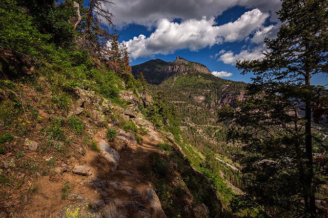
I left home Sunday morning around 7:30am and made it into Ouray around 9:00am. Before making it over to the trailhead, I stopped at Mouse’s Chocolates & Coffee for a Mocha Shake (it’s never too early for a shake, right?) which gave me plenty of energy for the hike. The trail started out climbing a couple hundred feet pretty quickly up to the top of the ridge where there is a nice overlook of Ouray. After that point the trail leveled out and offered great views over the Uncompahgre River Gorge and Million Dollar Highway on the way to the Neosho Mine. It was definitely a great first hike of the season, and I found out that I’m not in as bad of shape as I thought I’d be.
The start of the trail along the Camp Bird Road.
The trail quickly gained a few hundred feet of elevation as it switchbacked up to the top of the ridge. Twin Peaks is very visible from this section of the trail which is fitting since that was my first hike in the mountains about the same time last year.
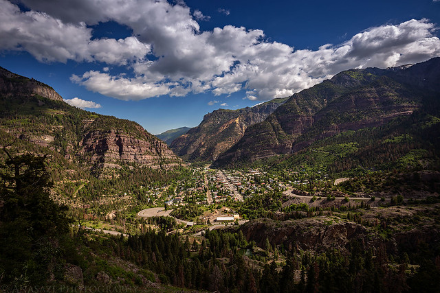
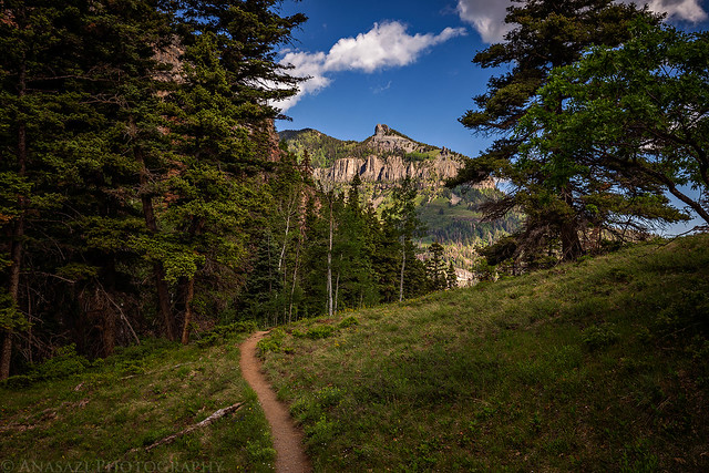
Once you reach the top of the ridge the trail flattens out more and you are treated to a nice view over Ouray.
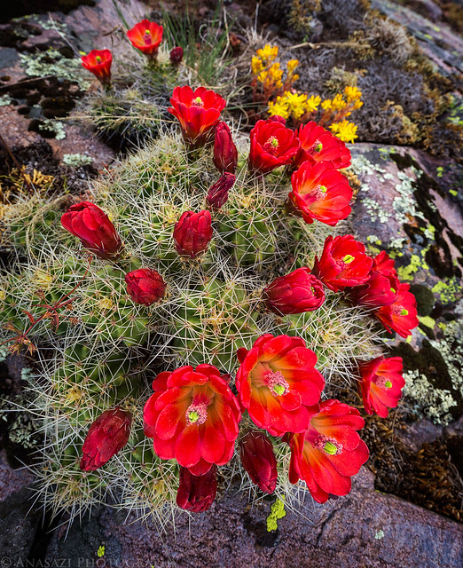
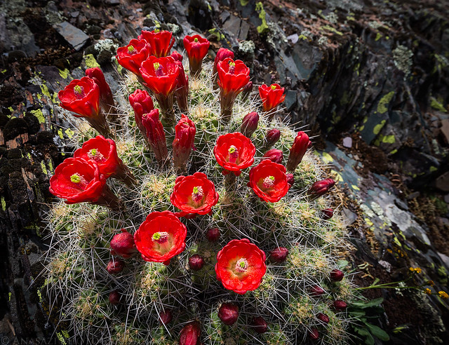
There were some nice clusters of Claret Cups along the trail, which is not something you come across in the mountains too often.
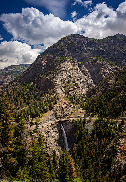
I’ve driven over that bridge and waterfall on the Million Dollar Highway many times and it was interesting to see it from this perspective.
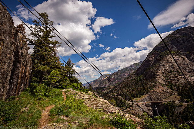
Shortly before reaching the Neosho Mine, the trail passed below this old tramway that came down from the Sutton Mine.
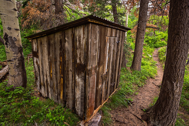
An old shack along the trail just before reaching the mine.
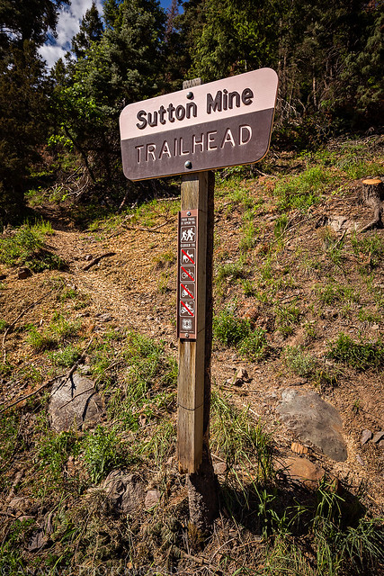
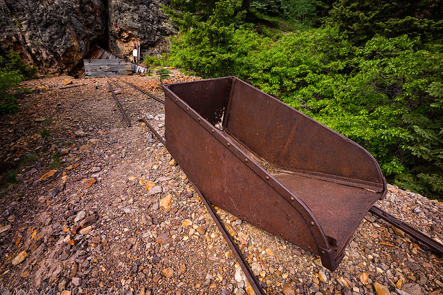
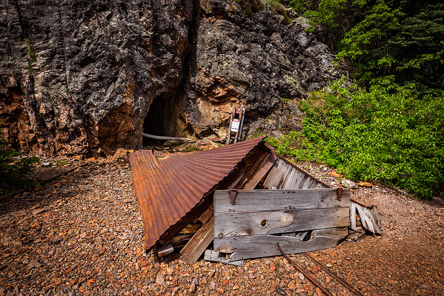
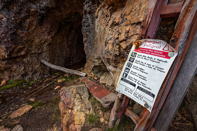
The main trail ends at the Neosho Mine.
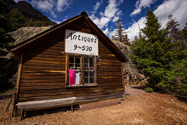
Finally, a closer look of the ‘Antique Store’ that I’ve seen from the highway for many years.
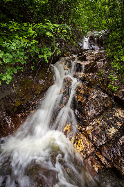
A small cascade near the crossing of Ralston Creek during my hike back to the trailhead.
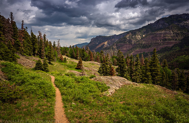
Hiking back as storm clouds roll into the area.
After returning to the trailhead earlier than I had anticipated and still feeling pretty good, I decided to walk down the road a few hundred yards to the Ice Park Trail. Since it was nearby and only a two-mile loop, I figured I’d hike it, too. As soon as I started hiking up the trail a brief storm moved through the area with lightning, thunder, bursts of wind and a little rain. I wasn’t too concerned about the weather since I wasn’t going to be above treeline on this hike, plus I could tell that it was going to blow over pretty quickly- and it did.
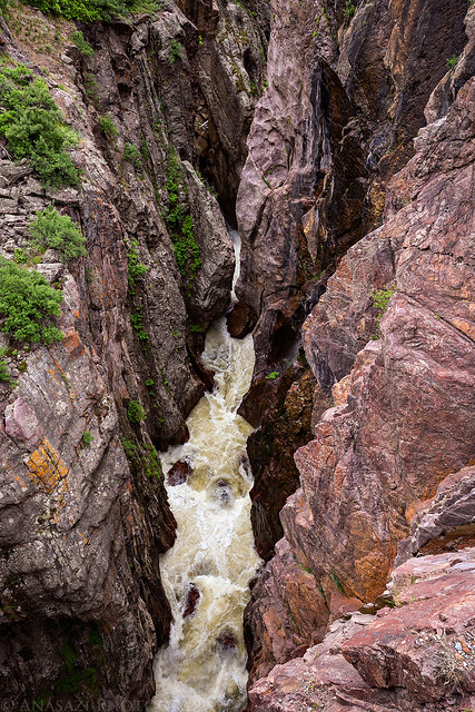
While walking over the bridge across the Uncompahgre River on my way to the trailhead I stopped for a quick photo looking down. It looks a little bit different down there now than during the annualIce Festival.
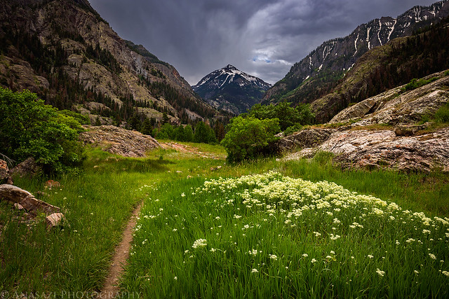
Abrams Mountain dominates the view from the beginning of the trail.
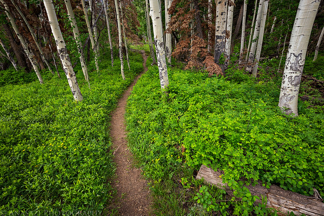
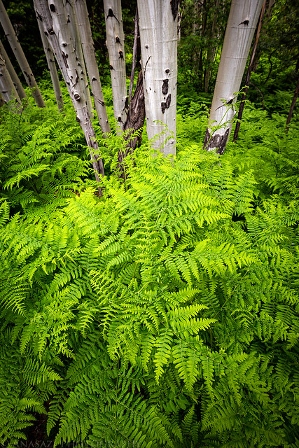
There was a section with some nice green ferns at the base of the aspen trees.
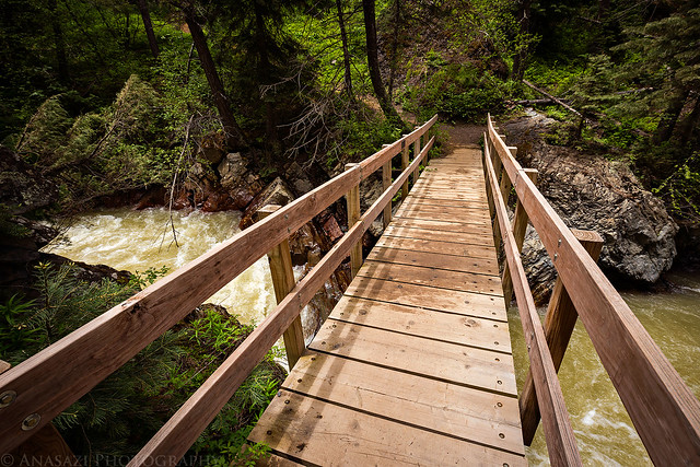
Maximum capacity for the bridge over the Uncompahgre River is 500lbs or two people.
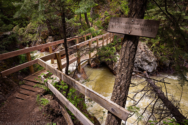
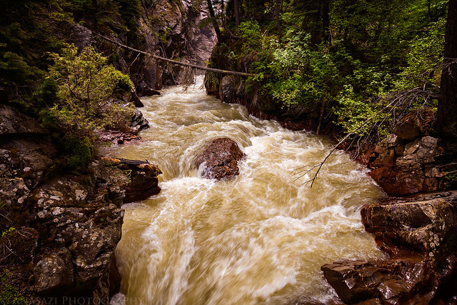
The water below was moving very fast.
Across the bridge and then back to my Jeep.
>> Sutton Mine Trail Photo Gallery
>> The Original Trip Report on ADVENTR.CO
The ‘Antique Store’ that can be seen from the Million Dollar Highway at the end of this hike.
June is that time of year when the desert starts getting too hot for me and I start looking towards the mountains. After hiking Professor Creek on Saturday, I thought it would be nice to drive down to Ouray on Sunday for my first mountain hike of the season. Diane had school work to get done on Sunday so I would be on my own this time. I decided to start with an easier hike and chose the Sutton Mine Trail which is just outside of town and only about 4.5 miles round trip with about 1,500 feet of elevation gain. While this trail is called the Sutton Mine Trail, the main trail does not actually climb up to the Sutton Mine and instead ends at the Neosho Mine. If you’ve ever driven over Red Mountain Pass between Ouray and Silverton, you might have noticed a building with an ‘Antiques’ sign on it near the Bear Creek bridge. That is the final destination of this trail and is part of the Neosho Mine.
I left home Sunday morning around 7:30am and made it into Ouray around 9:00am. Before making it over to the trailhead, I stopped at Mouse’s Chocolates & Coffee for a Mocha Shake (it’s never too early for a shake, right?) which gave me plenty of energy for the hike. The trail started out climbing a couple hundred feet pretty quickly up to the top of the ridge where there is a nice overlook of Ouray. After that point the trail leveled out and offered great views over the Uncompahgre River Gorge and Million Dollar Highway on the way to the Neosho Mine. It was definitely a great first hike of the season, and I found out that I’m not in as bad of shape as I thought I’d be.
The start of the trail along the Camp Bird Road.
The trail quickly gained a few hundred feet of elevation as it switchbacked up to the top of the ridge. Twin Peaks is very visible from this section of the trail which is fitting since that was my first hike in the mountains about the same time last year.
Once you reach the top of the ridge the trail flattens out more and you are treated to a nice view over Ouray.
There were some nice clusters of Claret Cups along the trail, which is not something you come across in the mountains too often.
I’ve driven over that bridge and waterfall on the Million Dollar Highway many times and it was interesting to see it from this perspective.
Shortly before reaching the Neosho Mine, the trail passed below this old tramway that came down from the Sutton Mine.
An old shack along the trail just before reaching the mine.
The main trail ends at the Neosho Mine.
Finally, a closer look of the ‘Antique Store’ that I’ve seen from the highway for many years.
A small cascade near the crossing of Ralston Creek during my hike back to the trailhead.
Hiking back as storm clouds roll into the area.
After returning to the trailhead earlier than I had anticipated and still feeling pretty good, I decided to walk down the road a few hundred yards to the Ice Park Trail. Since it was nearby and only a two-mile loop, I figured I’d hike it, too. As soon as I started hiking up the trail a brief storm moved through the area with lightning, thunder, bursts of wind and a little rain. I wasn’t too concerned about the weather since I wasn’t going to be above treeline on this hike, plus I could tell that it was going to blow over pretty quickly- and it did.
While walking over the bridge across the Uncompahgre River on my way to the trailhead I stopped for a quick photo looking down. It looks a little bit different down there now than during the annualIce Festival.
Abrams Mountain dominates the view from the beginning of the trail.
There was a section with some nice green ferns at the base of the aspen trees.
Maximum capacity for the bridge over the Uncompahgre River is 500lbs or two people.
The water below was moving very fast.
Across the bridge and then back to my Jeep.
>> Sutton Mine Trail Photo Gallery
>> The Original Trip Report on ADVENTR.CO