Udink
Still right here.
- Joined
- Jan 17, 2012
- Messages
- 1,734
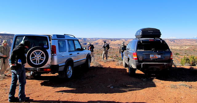
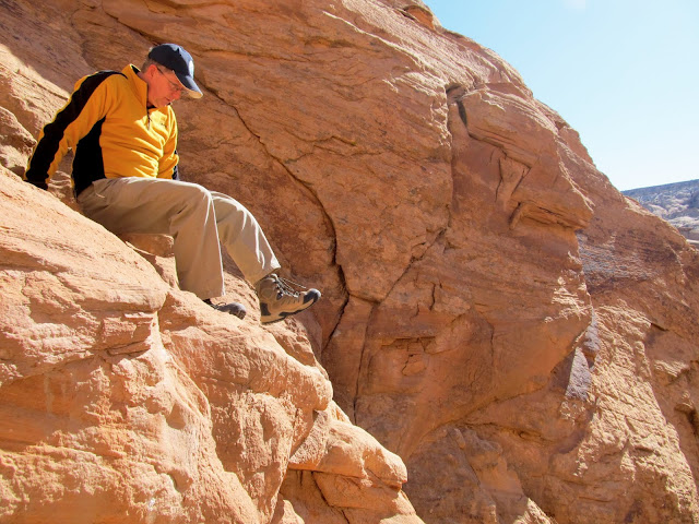
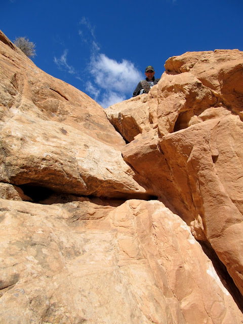
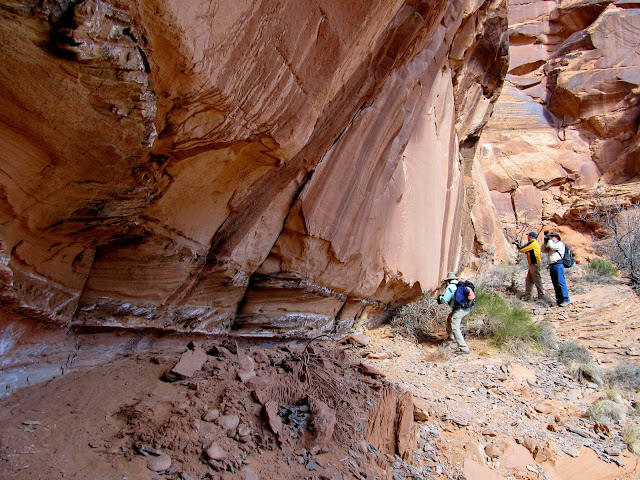
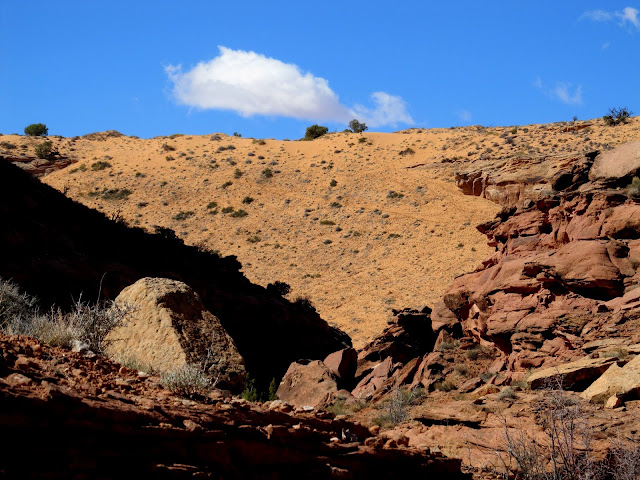
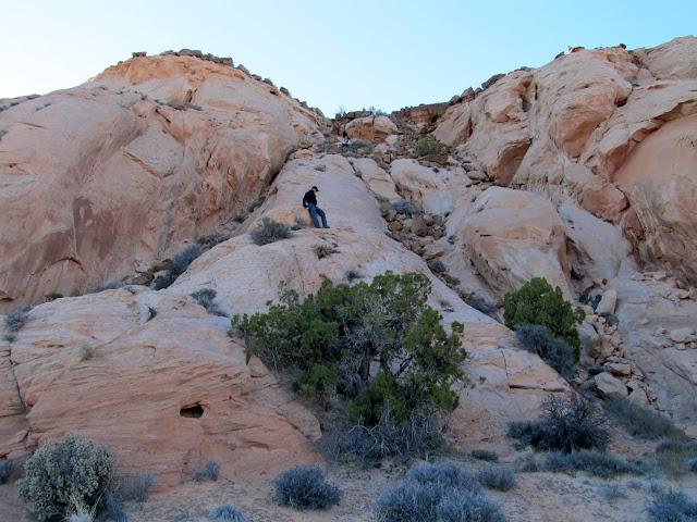
After two shorter warm-up hikes the previous day, we left camp on Saturday morning and drove north along the Spur to a drop-in point near Northeast Spur Fork. We were joined by Pat the previous evening at camp, bringing the total group size to seven. Our plan was to drop into Spur Fork (a tributary of Horseshoe Canyon) via a steep chute that is normally used to exit Northeast Spur Fork (aka the High Spur slot canyon, which I had completed with Chris a year and a half earlier). We'd only decided to take the Northeast Spur Fork route the previous evening. Another option was to do a shorter cross-country route directly from the Spur road, but there were some cliffs bands we weren't sure were passable so we settled on the longer but more certain route. After a short hike from the vehicles we reached the top of the chute leading down the cliffs into Northeast Spur Fork. It quickly became clear that I'd done a poor job of informing the group just how difficult the climb down would be. I hadn't really discussed it with Alan and Wade, with whom I'd originally planned the trip, because we all have similar climbing abilities, and hence the rest of the group didn't know what was in store. Even though I'd dropped the ball, the guys pushed on and we all helped each other down the most difficult part near the top of the chute.
Preparing to drop down from the Spur into Northeast Spur Fork
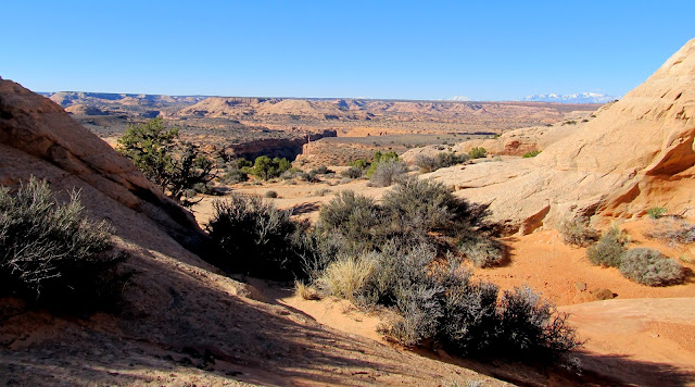
Getting closer to Northeast Spur Fork (the dark canyon near the center)
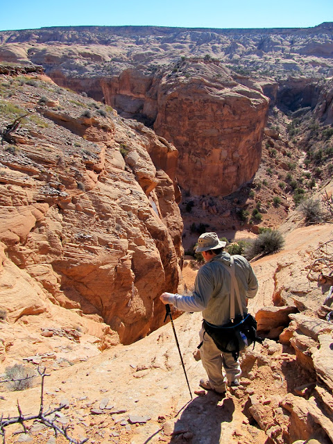
Above the crack into Northeast Spur Fork
The group above me after I descended the tough part of the crack
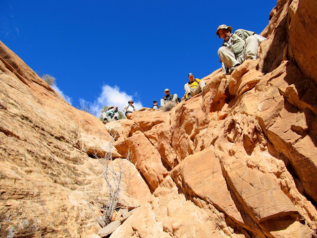
Mike descending the crack
Layne beginning his descent
Making our way into Northeast Spur Fork
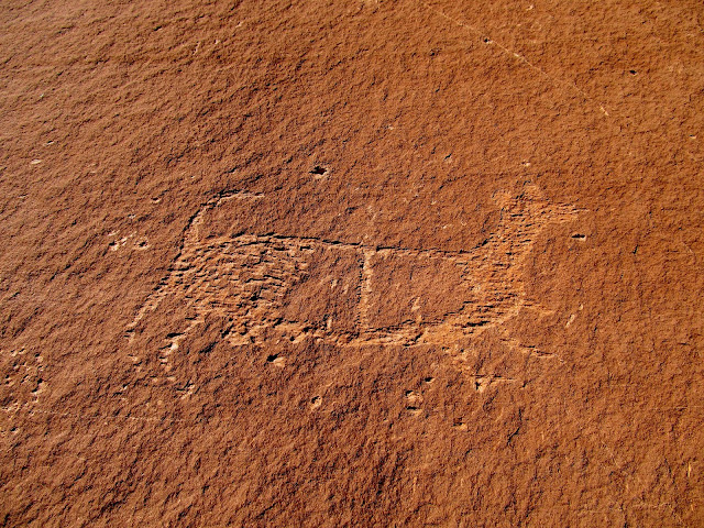
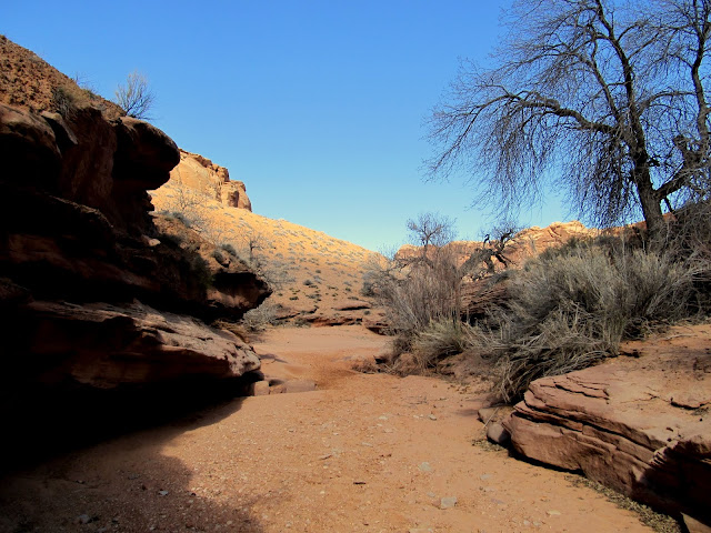
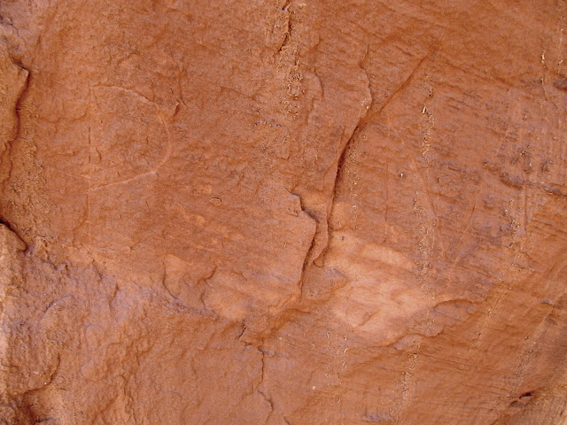
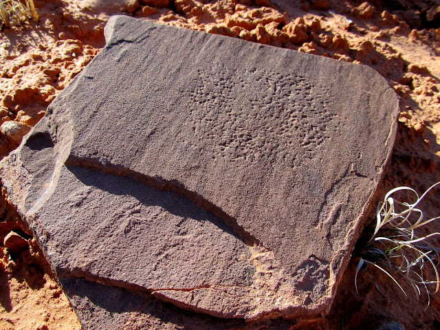
While descending the still-steep but easier part of the chute I noticed an overhang with some nice patinaed cliffs below it that I hadn't noticed when climbing up this part on my earlier trip--it's much easier to spot while descending. I scrambled over to check it out and was surprised to find some petroglyphs there! At first I thought they were modern fakes because one petroglyph was made with a flat tool, like a chisel, but others were pecked in the normal manner and looked legitimate. After photographing the rock art we finished the climb down, then descended Northeast Spur Fork to its confluence with Spur Fork.
Petroglyphs in the crack
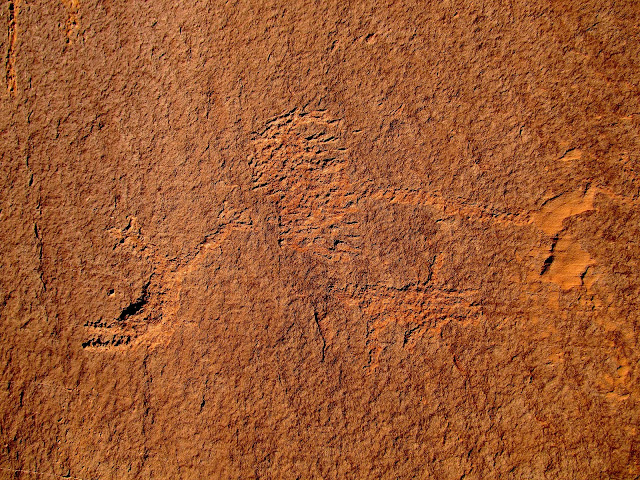
Petroglyphs in the crack
Checking out the rock art
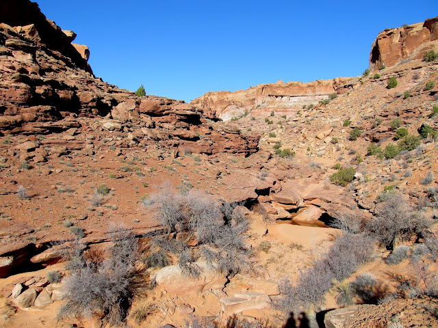
In Northeast Spur Fork below the crack
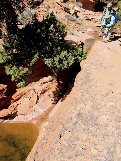
Pothole and dryfall in Northeast Spur Fork
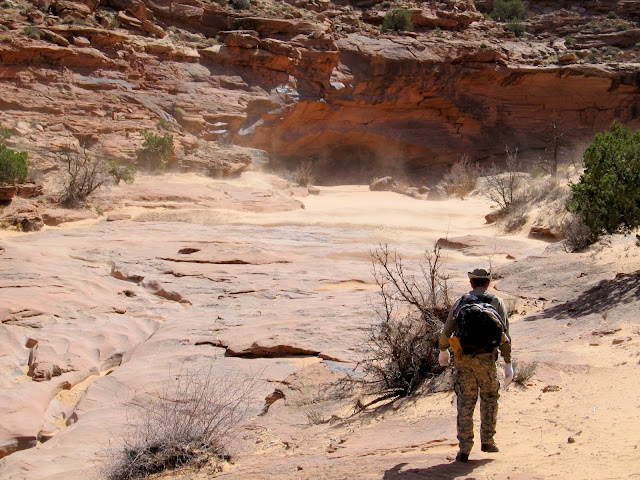
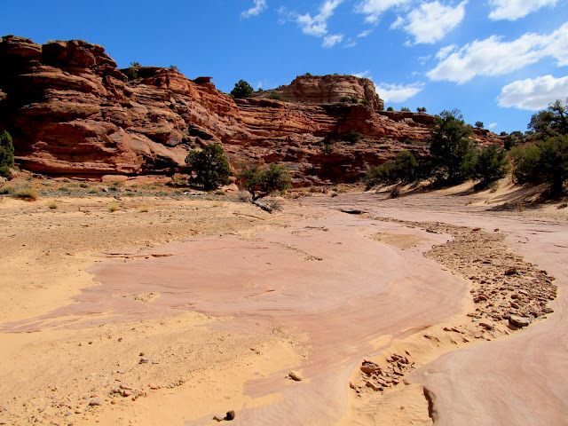
Sand slide across the confluence with Spur Fork
Northeast Spur Fork confluence with Spur Fork
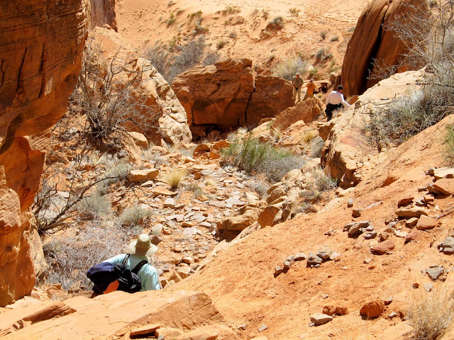
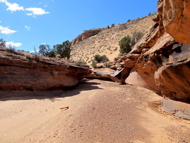
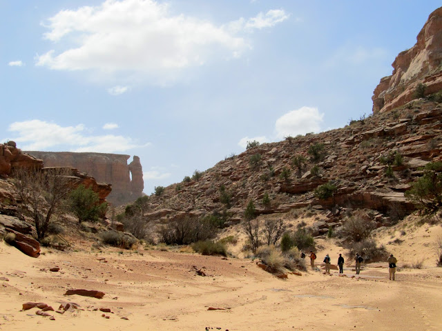
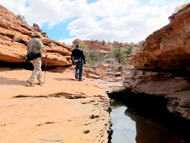
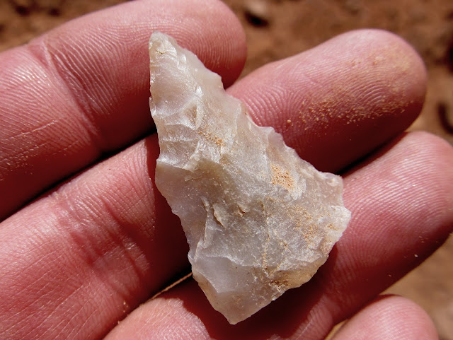
At the confluence we turned south and ascended Spur Fork, doing our usual search for rock art, cowboy inscriptions, any anything else the group members found interesting. I found a couple of arrowheads, and we stumbled upon some old sheepherder inscriptions, the oldest dating to 1905. We hiked up Spur Fork until we were just past the confluence with Moqui Fork, where we turned around at a small spring and started heading back the way we'd come.
Spur Fork
Mike in Spur Fork
Windy conditions in Spur Fork
Spur Fork
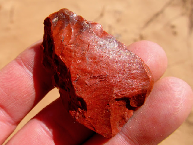
Ooh, a pretty rock!
Side canyon in Spur Fork
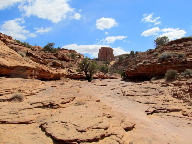
Spur Fork
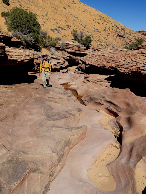
Bypassing a pothole in Spur Fork
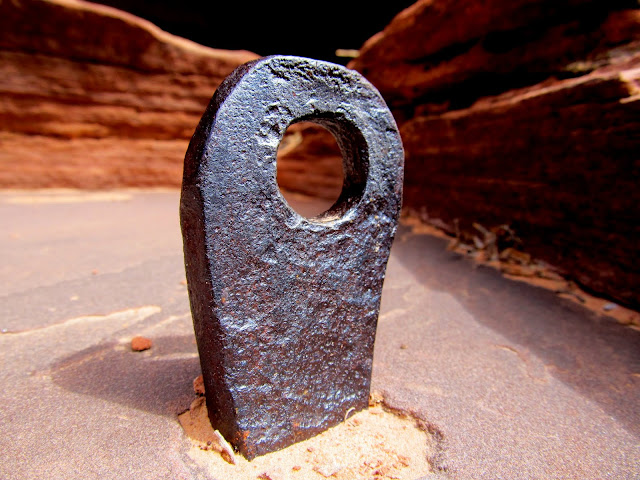
Metal stake driven into the sandstone
Ooh, a pretty rock!
HM brand belonging to Henry Moynier (with a 1939 date nearby)
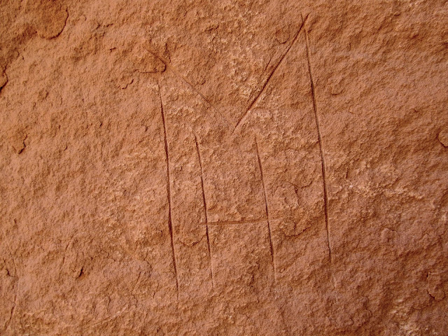
PM initials probably belonging to Pierre Moynier
1905 date near the PM initials
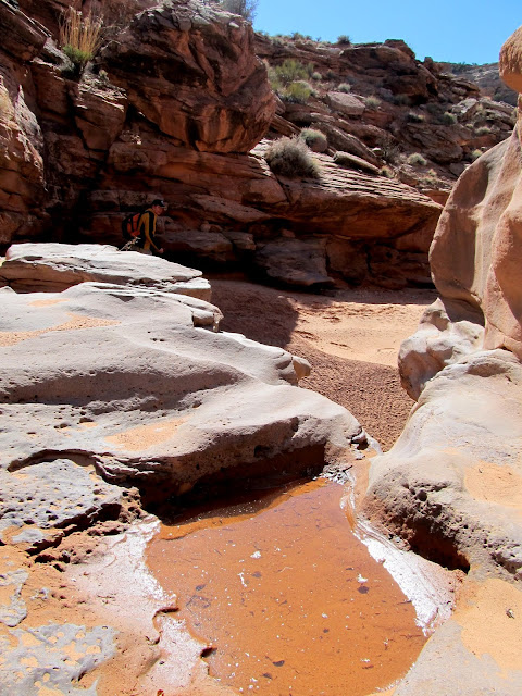
A spring trickling into a pool
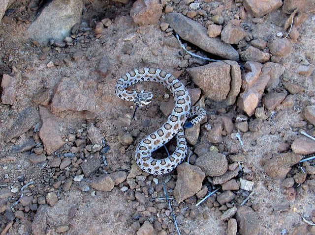
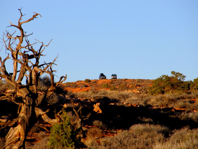
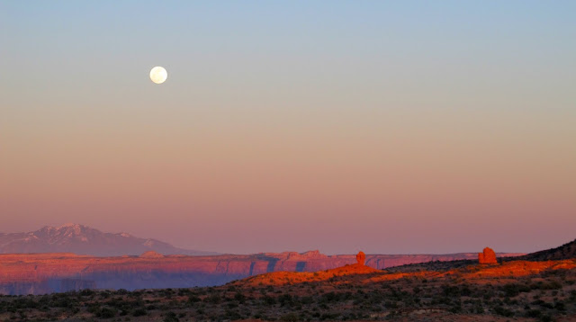
It was much faster going back down Spur Fork since we'd seen it all during the hike up. I think nearly everyone was apprehensive about the climb back up the chute. Everyone was quiet as we assisted each other up, this time using some webbing that Alan and Wade had in their packs, and nobody was taking photos. Once done with the climb, however, everyone was cheerier as we made the final ascent to the vehicles. The sun was near the horizon and shadows were growing long as I got to the top of the climb out, and I almost stepped on a tiny rattlesnake. It was so young that its rattle wasn't well-formed and it didn't give any warning. It was a relief to get back to the Jeep, where I downed some Powerade and opened a bag of salt and vinegar chips--perfect fare after a long hike! We'd covered 15 miles in about nine hours. The moon rose over the La Sals while the sun set behind the Henrys, providing a nice show during the drive back to camp.
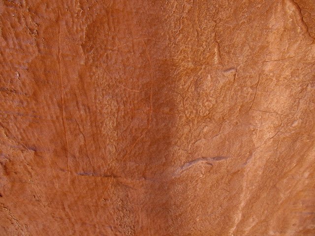
Peck marks on a rock near the Spur Fork/Northeast Spur Fork confluence
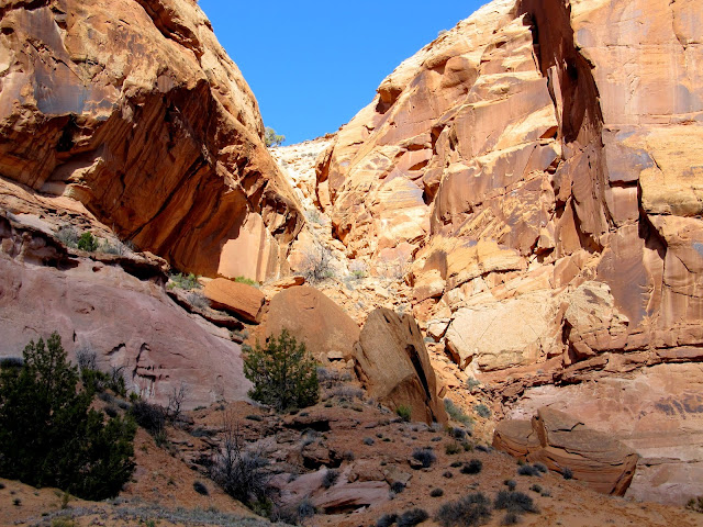
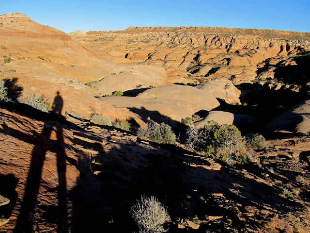
Northeast Spur Fork
Long shadows above Northeast Spur Fork
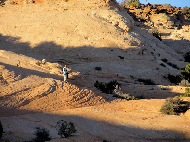
Alan climbing above Northeast Spur Fork
Layne making the last climb onto the Spur
Tiny rattlesnake at the top of the climb out of Northeast Spur Fork
Huge relief at seeing the vehicles!
Moonrise over the La Sals at sunset
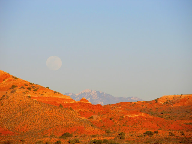
Full moon at sunset
Full photo gallery: https://picasaweb.google.com/Dennis.Udink/SpurFork
[parsehtml]<iframe width="640" height="480" frameborder="0" scrolling="no" marginheight="0" marginwidth="0" src="https://maps.google.com/maps?q=http:%2F%2Fudink.org%2Fgeo%2FSpurFork.kmz&hl=en&sspn=0.082137,0.169086&t=h&ie=UTF8&ll=38.384875,-110.19547&spn=0.061599,0.017839&output=embed"></iframe><br /><small><a href="https://maps.google.com/maps?q=http:%2F%2Fudink.org%2Fgeo%2FSpurFork.kmz&hl=en&sspn=0.082137,0.169086&t=h&ie=UTF8&ll=38.384875,-110.19547&spn=0.061599,0.017839&source=embed" style="color:#0000FF;text-align:left">View Larger Map</a></small>[/parsehtml]http://udink.org/geo/SpurFork.kmz
Featured image for home page:

Preparing to drop down from the Spur into Northeast Spur Fork
Getting closer to Northeast Spur Fork (the dark canyon near the center)
Above the crack into Northeast Spur Fork
The group above me after I descended the tough part of the crack
Mike descending the crack
Layne beginning his descent
Making our way into Northeast Spur Fork
While descending the still-steep but easier part of the chute I noticed an overhang with some nice patinaed cliffs below it that I hadn't noticed when climbing up this part on my earlier trip--it's much easier to spot while descending. I scrambled over to check it out and was surprised to find some petroglyphs there! At first I thought they were modern fakes because one petroglyph was made with a flat tool, like a chisel, but others were pecked in the normal manner and looked legitimate. After photographing the rock art we finished the climb down, then descended Northeast Spur Fork to its confluence with Spur Fork.
Petroglyphs in the crack
Petroglyphs in the crack
Checking out the rock art
In Northeast Spur Fork below the crack
Pothole and dryfall in Northeast Spur Fork
Sand slide across the confluence with Spur Fork
Northeast Spur Fork confluence with Spur Fork
At the confluence we turned south and ascended Spur Fork, doing our usual search for rock art, cowboy inscriptions, any anything else the group members found interesting. I found a couple of arrowheads, and we stumbled upon some old sheepherder inscriptions, the oldest dating to 1905. We hiked up Spur Fork until we were just past the confluence with Moqui Fork, where we turned around at a small spring and started heading back the way we'd come.
Spur Fork
Mike in Spur Fork
Windy conditions in Spur Fork
Spur Fork
Ooh, a pretty rock!
Side canyon in Spur Fork
Spur Fork
Bypassing a pothole in Spur Fork
Metal stake driven into the sandstone
Ooh, a pretty rock!
HM brand belonging to Henry Moynier (with a 1939 date nearby)
PM initials probably belonging to Pierre Moynier
1905 date near the PM initials
A spring trickling into a pool
It was much faster going back down Spur Fork since we'd seen it all during the hike up. I think nearly everyone was apprehensive about the climb back up the chute. Everyone was quiet as we assisted each other up, this time using some webbing that Alan and Wade had in their packs, and nobody was taking photos. Once done with the climb, however, everyone was cheerier as we made the final ascent to the vehicles. The sun was near the horizon and shadows were growing long as I got to the top of the climb out, and I almost stepped on a tiny rattlesnake. It was so young that its rattle wasn't well-formed and it didn't give any warning. It was a relief to get back to the Jeep, where I downed some Powerade and opened a bag of salt and vinegar chips--perfect fare after a long hike! We'd covered 15 miles in about nine hours. The moon rose over the La Sals while the sun set behind the Henrys, providing a nice show during the drive back to camp.
Peck marks on a rock near the Spur Fork/Northeast Spur Fork confluence
Northeast Spur Fork
Long shadows above Northeast Spur Fork
Alan climbing above Northeast Spur Fork
Layne making the last climb onto the Spur
Tiny rattlesnake at the top of the climb out of Northeast Spur Fork
Huge relief at seeing the vehicles!
Moonrise over the La Sals at sunset
Full moon at sunset
Full photo gallery: https://picasaweb.google.com/Dennis.Udink/SpurFork
[parsehtml]<iframe width="640" height="480" frameborder="0" scrolling="no" marginheight="0" marginwidth="0" src="https://maps.google.com/maps?q=http:%2F%2Fudink.org%2Fgeo%2FSpurFork.kmz&hl=en&sspn=0.082137,0.169086&t=h&ie=UTF8&ll=38.384875,-110.19547&spn=0.061599,0.017839&output=embed"></iframe><br /><small><a href="https://maps.google.com/maps?q=http:%2F%2Fudink.org%2Fgeo%2FSpurFork.kmz&hl=en&sspn=0.082137,0.169086&t=h&ie=UTF8&ll=38.384875,-110.19547&spn=0.061599,0.017839&source=embed" style="color:#0000FF;text-align:left">View Larger Map</a></small>[/parsehtml]http://udink.org/geo/SpurFork.kmz
Featured image for home page: