- Joined
- Aug 8, 2016
- Messages
- 2,077
I've been itching to get up into the Uintas for at least a day hike to try to get back in shape. I made plans to head up the Shingle Creek trail to see what things look like. I had been up that trail on snowshoes two winters ago but have not seen it otherwise.
I headed up Saturday morning and arrived at the trail head to find that the Forest Service had the trail closed for a prescribed burn somewhere in the area. The posted proclamation said to refer to the accompanying map for details but the map was nowhere to be found. Rather than take a chance of getting into something bad I went for plan B heading on up the highway where I thought I might try going up the North Fork Provo River Trail. I parked at the trail head just west of the river and headed up the trail.
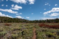
It turns out that the route I chose took me up the Boulder Creek drainage just to the West of North Fork of the Provo. New territory to see for me. The weather was mild but a bit windy. Pretty much perfect hiking weather.
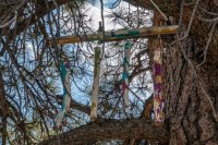
Shortly I came to a big nice Ponderosa pine with a curiosity hanging in its branches. Not sure if there is any significance to this apparatus or just a piece of trail art...
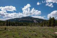
Heading further up I glanced back to find my point of reference to find my way back, a nice peak across the way...
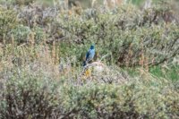
I didn't see any four-legged friends on this trip but the bird friends were keeping me company...
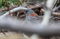
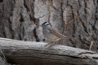
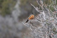
I approached a place to cross Boulder Creek but it was running a bit fast for my tastes for a crossing so I decided to continue up this drainage. I soon reached the first meadow with a pretty pond which I explored around. I actually got to see what i think was a salamander swimming across this shallow pond, a first for me.
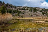
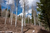
The trail continued on above the creek soon entering the quaking aspen which have yet to bud out...
The flowers however were already getting going...

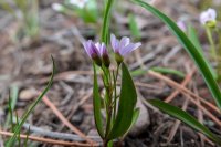
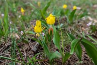
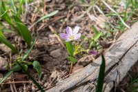
I finally had to break down and cross a small swift creek coming down the mountain side. Luckily, there were a couple downed trees that made it doable without getting wet...
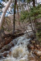
Soon the canyon began to narrow and the trail was becoming more of a social trail. I had very little snow to cross up to up to this point. Glancing back I could see just how much more snow was yet on the west-facing slopes...
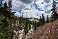
I continued up only to find the slopes above the creek below were getting uncomfortably steep and loose so I tried to gain the ridge above to the west. Unfortunately there was no trail and I began to encounter a lot of snow still 2-3 feet deep and slushy. I made my way a bit further when I decided to call it for the day.
When I arrived back at the truck my InReach told me I had gone exactly ten miles so I felt pretty good about that with my not having been out much since around Christmas time. Reviewing my track it looks like it was about 1,100 feet of elevation gain so all in all a nice little hike.
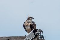
On the trip home I managed to see one more fun sight near the Wanship Dam. I managed to get a decent shot of a momma osprey...
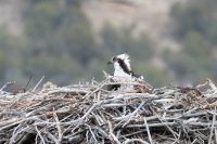
*and* a sneak peek of her baby with the cool haircut!
I headed up Saturday morning and arrived at the trail head to find that the Forest Service had the trail closed for a prescribed burn somewhere in the area. The posted proclamation said to refer to the accompanying map for details but the map was nowhere to be found. Rather than take a chance of getting into something bad I went for plan B heading on up the highway where I thought I might try going up the North Fork Provo River Trail. I parked at the trail head just west of the river and headed up the trail.

It turns out that the route I chose took me up the Boulder Creek drainage just to the West of North Fork of the Provo. New territory to see for me. The weather was mild but a bit windy. Pretty much perfect hiking weather.
Shortly I came to a big nice Ponderosa pine with a curiosity hanging in its branches. Not sure if there is any significance to this apparatus or just a piece of trail art...

Heading further up I glanced back to find my point of reference to find my way back, a nice peak across the way...

I didn't see any four-legged friends on this trip but the bird friends were keeping me company...


I approached a place to cross Boulder Creek but it was running a bit fast for my tastes for a crossing so I decided to continue up this drainage. I soon reached the first meadow with a pretty pond which I explored around. I actually got to see what i think was a salamander swimming across this shallow pond, a first for me.

The trail continued on above the creek soon entering the quaking aspen which have yet to bud out...

The flowers however were already getting going...


I finally had to break down and cross a small swift creek coming down the mountain side. Luckily, there were a couple downed trees that made it doable without getting wet...

Soon the canyon began to narrow and the trail was becoming more of a social trail. I had very little snow to cross up to up to this point. Glancing back I could see just how much more snow was yet on the west-facing slopes...

I continued up only to find the slopes above the creek below were getting uncomfortably steep and loose so I tried to gain the ridge above to the west. Unfortunately there was no trail and I began to encounter a lot of snow still 2-3 feet deep and slushy. I made my way a bit further when I decided to call it for the day.
When I arrived back at the truck my InReach told me I had gone exactly ten miles so I felt pretty good about that with my not having been out much since around Christmas time. Reviewing my track it looks like it was about 1,100 feet of elevation gain so all in all a nice little hike.
On the trip home I managed to see one more fun sight near the Wanship Dam. I managed to get a decent shot of a momma osprey...

*and* a sneak peek of her baby with the cool haircut!

Last edited:
