- Joined
- May 31, 2015
- Messages
- 3,354
August 10-12, 2017
This trip was originally going to be one night longer, at least 12 miles longer, and include a significant portion of the Buffalo Plateau, but we realized those plans were too ambitious. More on that later.
I had been planning this trip for the last year after reading trip reports by @scatman, @Joey, and @Georgia Yankee from various areas in the Teton Wilderness. As I've said on here before, I love the GYE, and this was a part of it that I had never seen. I managed to rope my friend, Dan, into going with me. He's my only friend that would agree to go to a place over 6 hours away on a trip that's supposed to cover 48+ miles in 4 days, with no extra days for travel time. A very good friend to have.
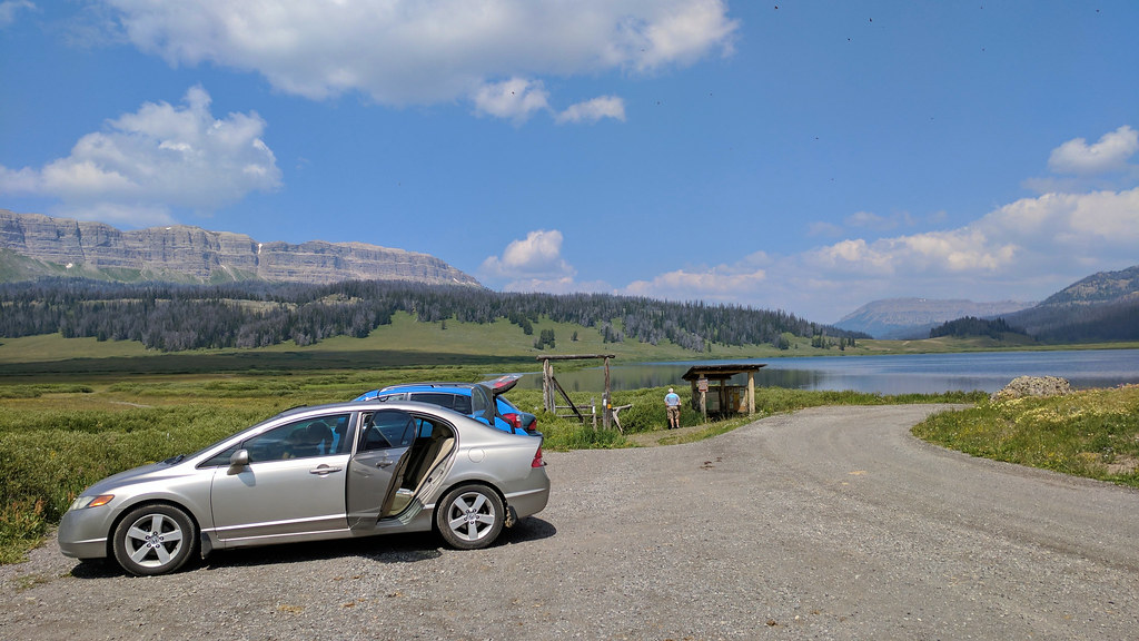
We made the drive up to the trailhead, and it was cloudy and rainy near Jackson and GTNP. It cleared off as we got closer, and it was beautiful out when we arrived.
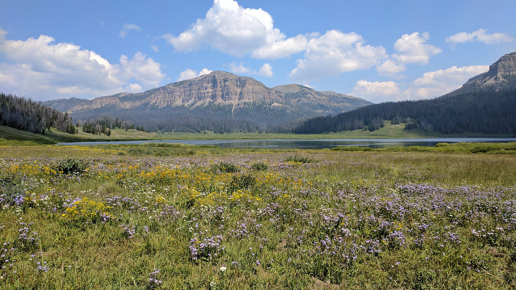
We had brought lunch, so we ate that quickly and got ready. The walk around Brooks Lake was great. The trail sees a LOT of horse traffic because of the Brooks Lake Lodge.
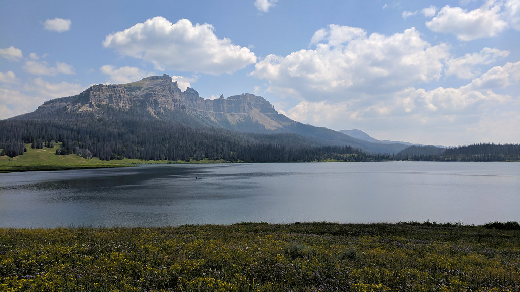
The plan was for us to do 11-12 miles that day. We had started at 1 p.m., so we were moving pretty quickly. We got to Upper Brooks Lake.
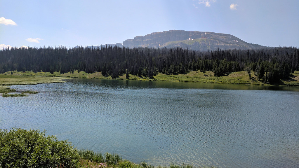
From there, we continued toward Bear Cub Pass.
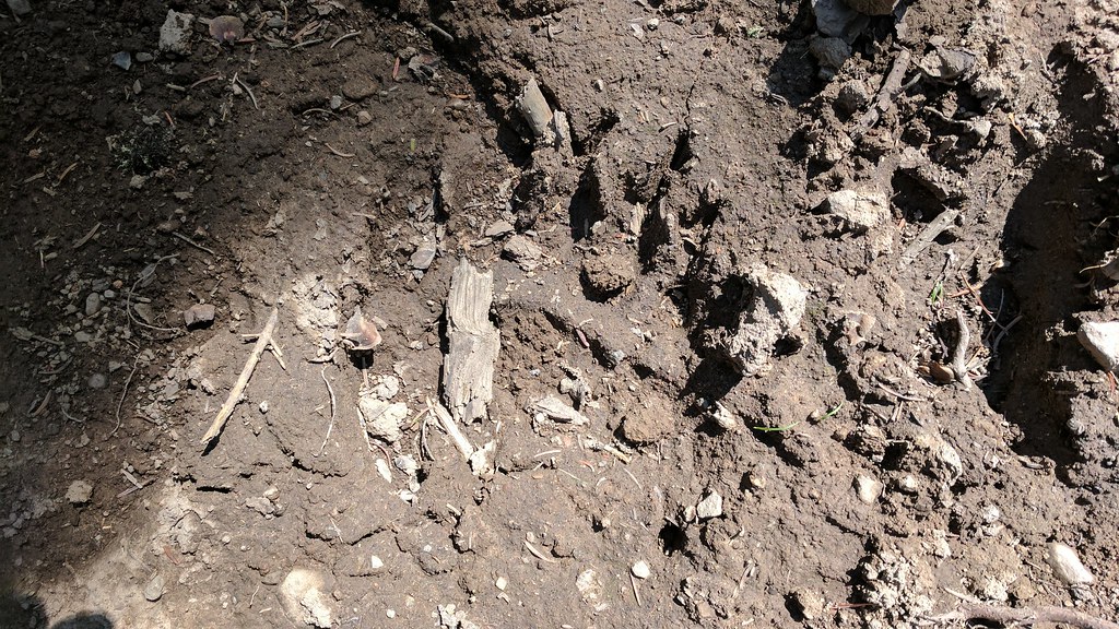
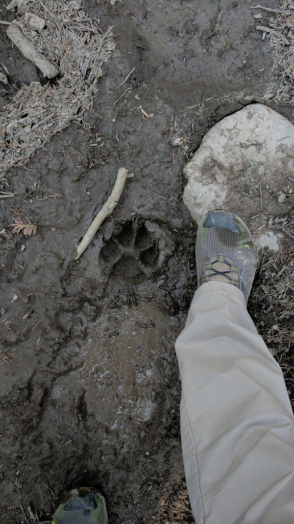
And we saw a grizzly track, I think.
We headed down toward the creek and came across a CDT thru-hiker. He said he had seen a grizzly bear a little bit down the trail, but we never saw it. I wonder if we misunderstood him. English was not his first language.
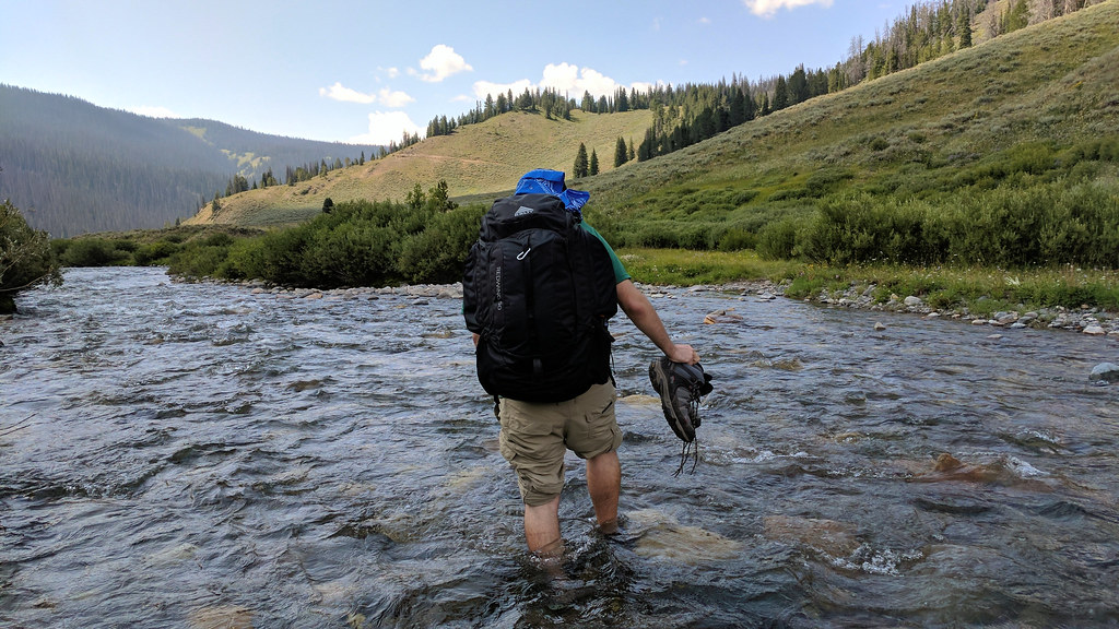
We got to the creek, changed into our water shoes, and headed across. I bought a pair of Crocs Swiftwater Waves in anticipation of this (yeah, I know, Crocs), and I was very pleased with my purchase. Also, John Cena modeled them in the same color for Crocs, so that means they're cool, right?
Did I mention it was a beautiful afternoon?
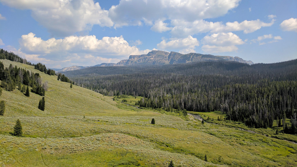
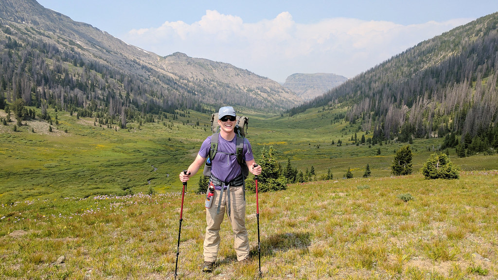
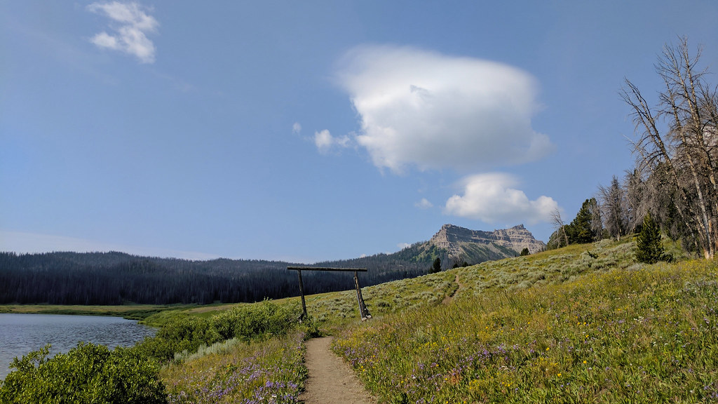
We headed up the mountain toward the South Buffalo Fork. This is looking back at Cub Creek.
For a few miles, we followed a wolf's prints on the trail. There were also elk tracks in the mud, so we imagined that the wolf chased the elk for miles. Probably not, though.
We came across 3 more CDT thru hikers before we broke off on the Angle Lakes trail. All were going north to south. I don't think I could thru hike the CDT.
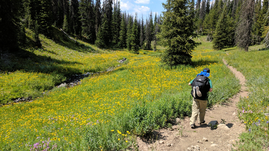
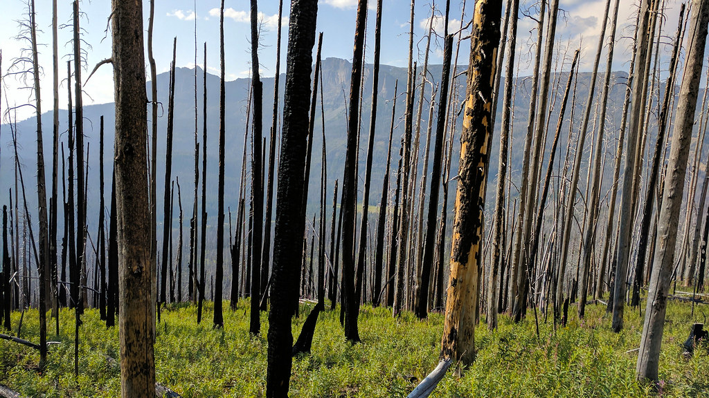
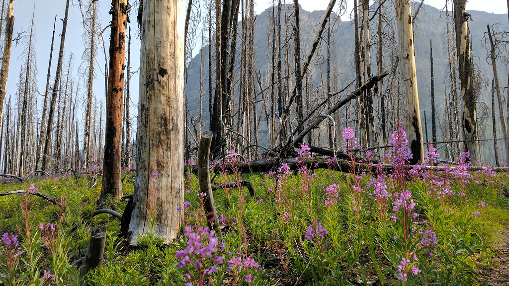
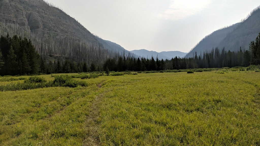
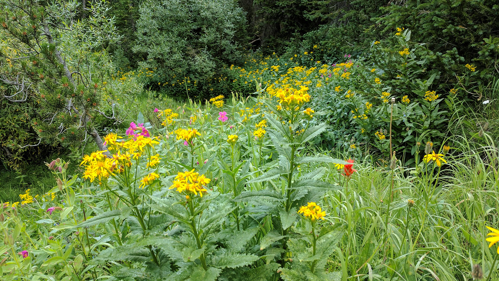
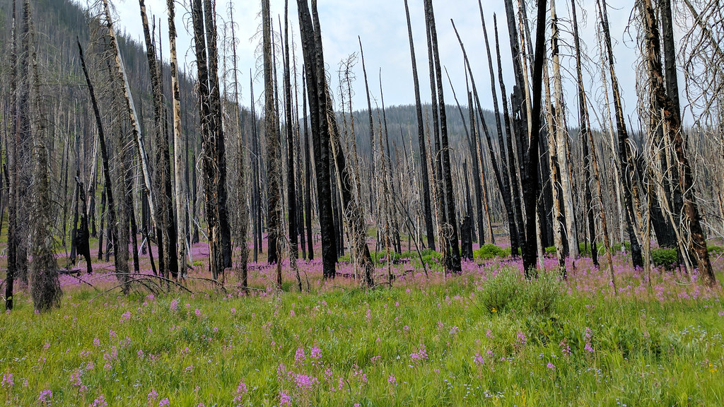
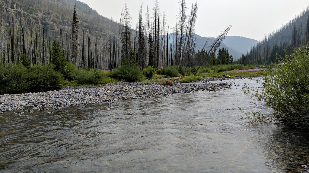
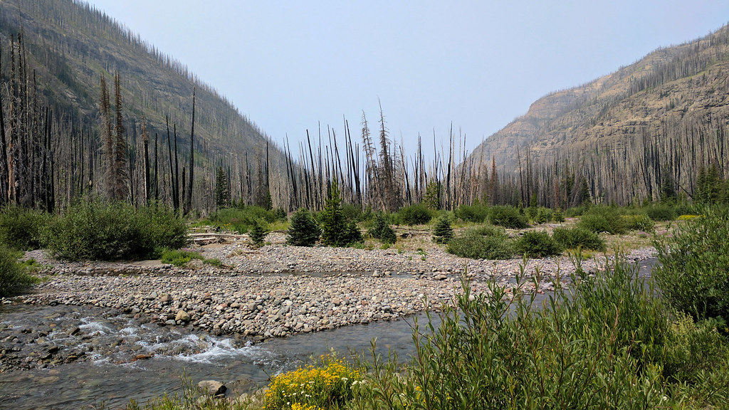
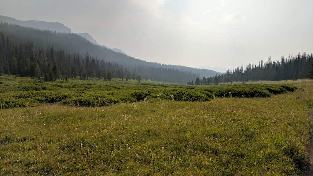
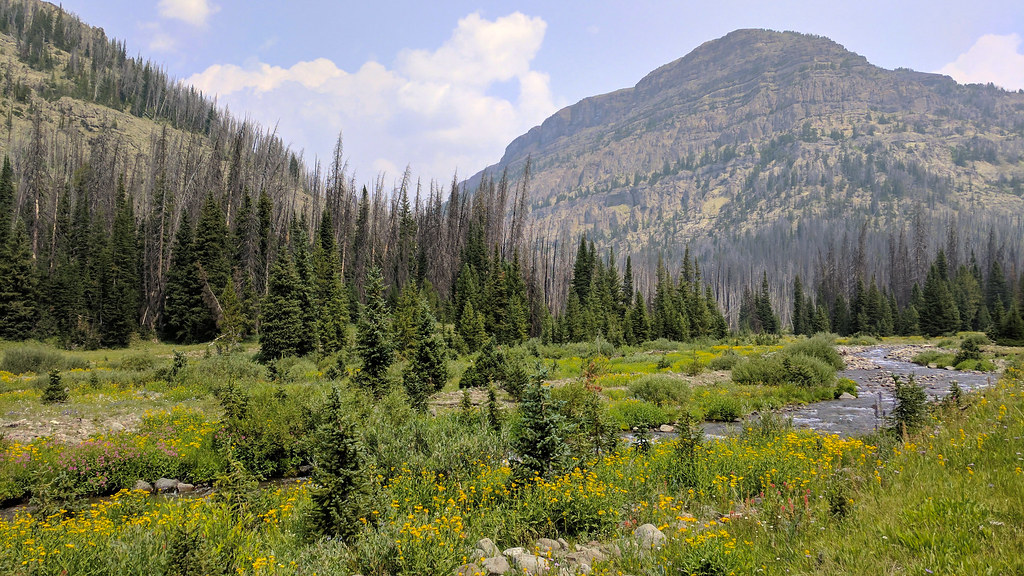
As we made our way around, we reached a big burn area. Huge. It ended up extending most of the way up the South Buffalo Fork. It must have been somewhat recent, as we didn't see much new tree growth. Lots of fireweed though, as you'll see in a bit.
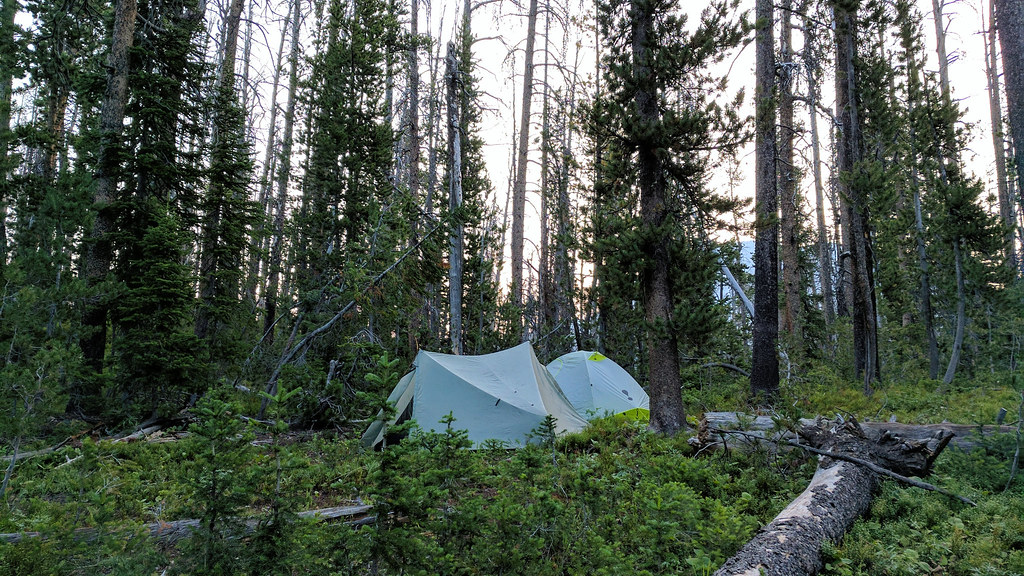
The trail twisted and turned through the burn area, and the twists and turns were not reflected at all in the map I brought along. I recalled seeing on Caltopo that the trail's location on the map was approximate. Take my word for it, it was very approximate. We kept going and going until we found a decent (not great) place to camp. We were a little close to the trail for my liking, but we figured (correctly) that no one would be coming through any time soon. The bugs were somewhat bad because we were within 400 feet of one of the smaller Angle Lakes.
At this point, we had become certain that our plans were too audacious for the time we had allotted. Near where we camped, I had planned on going off trail for a mile through the forest to cut off 4-5 miles of trail. There was no way that was going to happen, as the forest was thick with deadfall, weeds and marshy areas, and you couldn't easily tell where you were headed. We didn't want to tack on that extra trail mileage, as that would put us well over 50 miles for the entire trip, which was already proving to be more strenuous than we had anticipated. So we opted to go up the South Buffalo Fork rather than ascending Lake Creek to the Buffalo Plateau.
In the night, I heard a fair amount of animal activity. Something small was in our camp for a few hours. Later, I was jolted awake when I heard a loud chirp/whistle very close to my tent. It sounded a whole lot like a mountain lion chirp, so that was pretty cool. I guess you usually don't hear birds doing any chirping at 2 a.m.
We got going the next morning, and it was very nice out. More walking through the burned area. Lots of fireweed. I love that stuff. It's pretty seeing it in contrast with all the snags.
We reached a junction not marked on the map, but trail that wasn't marked looked good and headed in a better direction than the one on the map, so we took it. It took us directly to an outfitter camp. I later learned from Joey that the outfitters blazed the trail a while back. Not sure how that's allowed in a wilderness or national forest area, but we were not complaining that morning. It probably saved us a mile or so.
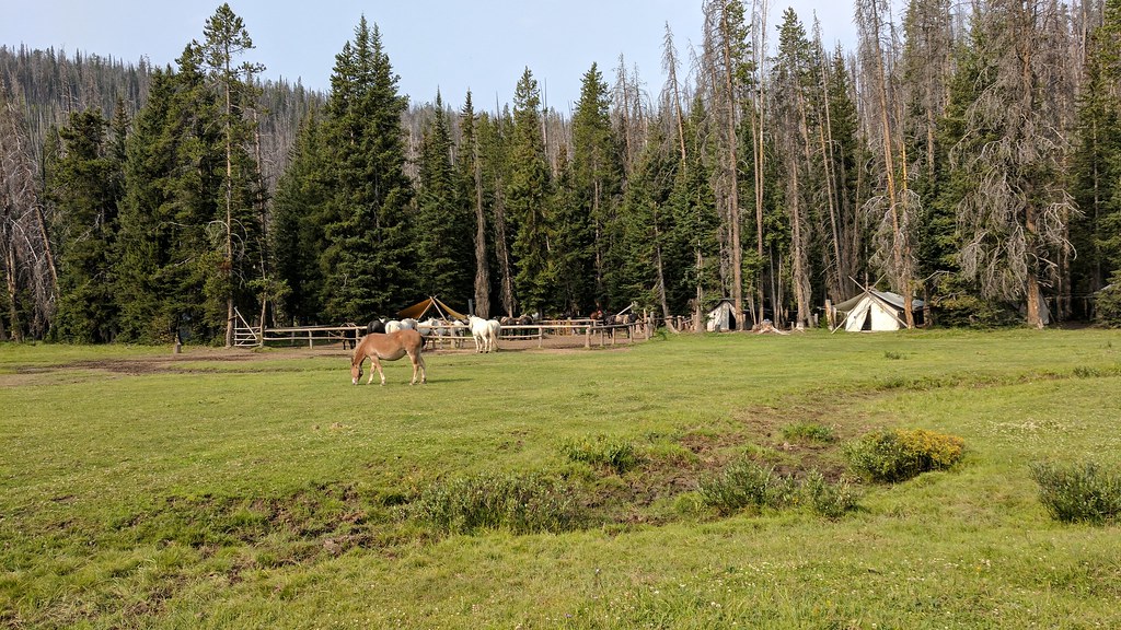
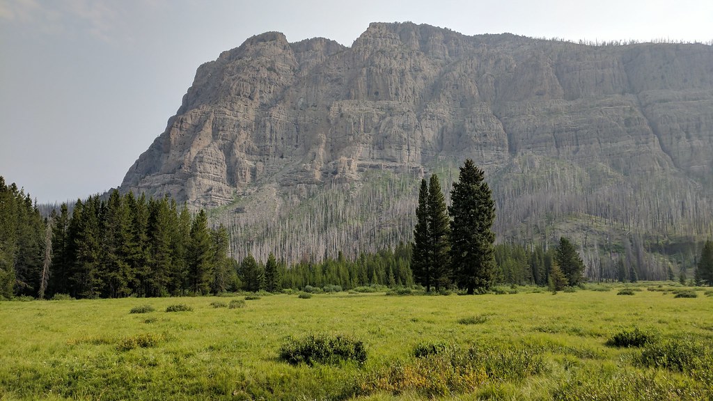
Their camp was set up in a beautiful meadow next to the creek. They had a great view of Pendergraft Peak.
The horses were out to pasture. We spoke briefly with a man standing by the corral. He seemed to know the area pretty well, so I'd imagine he worked for the outfitter.
We got going, and the horses that were out grazing kind of chased out of there. They didn't run at us, but they walked toward us when we got too close to them, and they followed us a ways before heading back. This is consistent with what Joey told us later. When he was there, they camped near the pasture, and the horses chased them out of their camp and shredded his food bag. He said they actually growled at him.
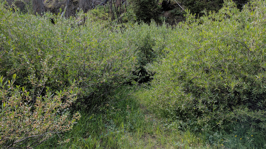
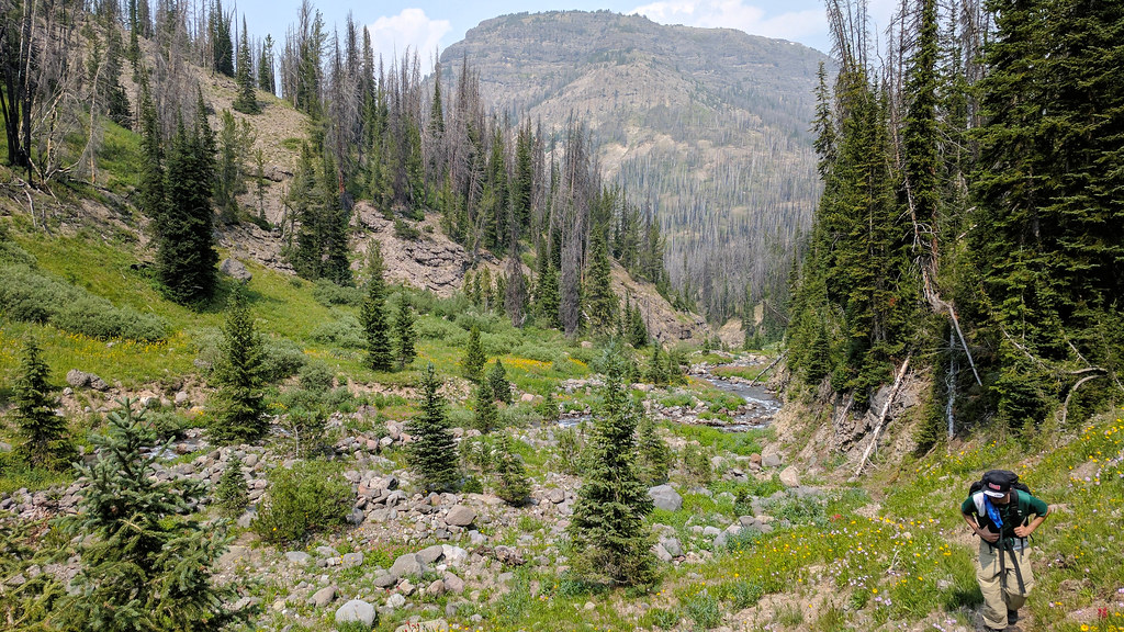
The vegetation was thick in places.
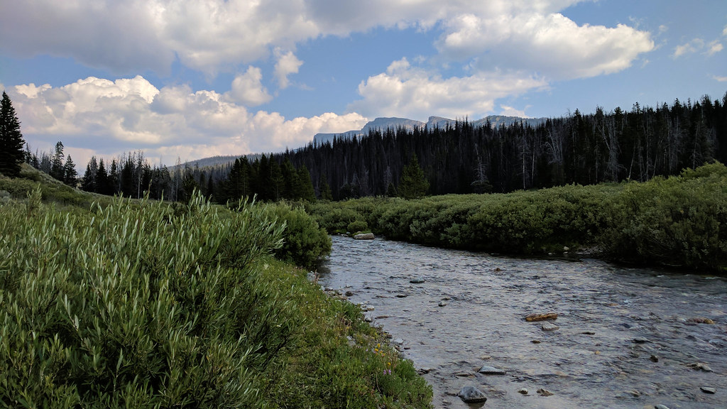
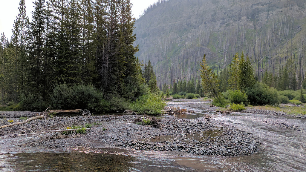
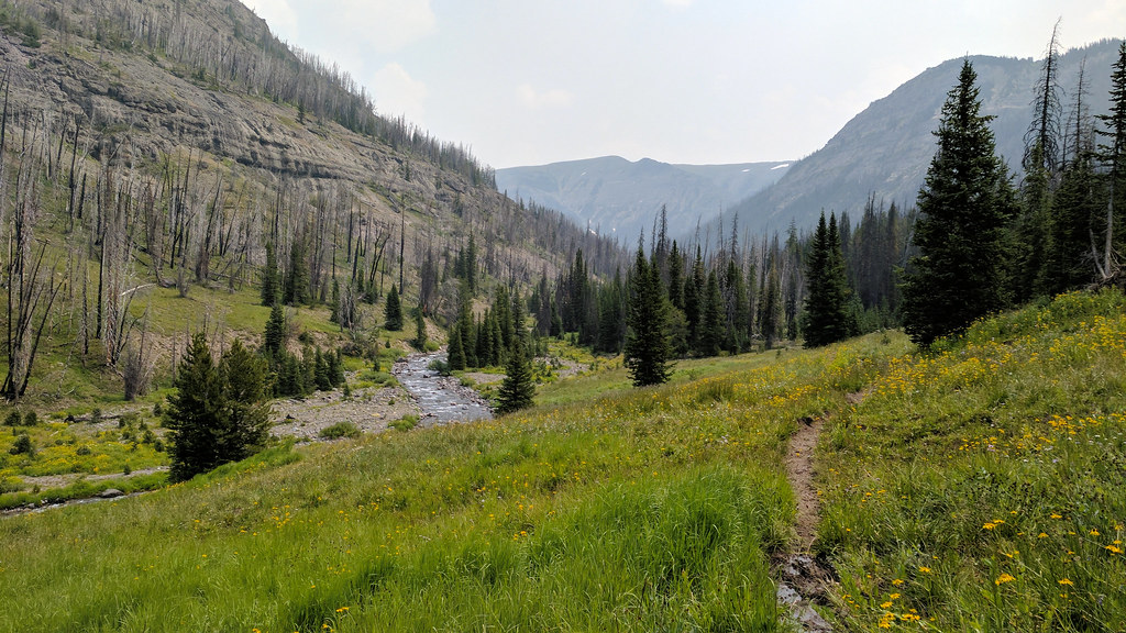
We eventually got a good view of the creek. It was very pretty.
The trail went through some more burned areas. That fireweed, man.
As we continued, I heard some squeaking. There were two otters playing in the water. When they saw us, they dove and swam away. I got this crappy picture of one of them moments before it dove.
We continued along the creek, sticking to the south side to avoid having to ford it too many times.
A result of this was that we had to thrash through numerous "willow tunnels", as we called them. They were usually very narrow with branches above our heads. We were sure that if we were going to surprise a grizzly somewhere, it would be in one of these.
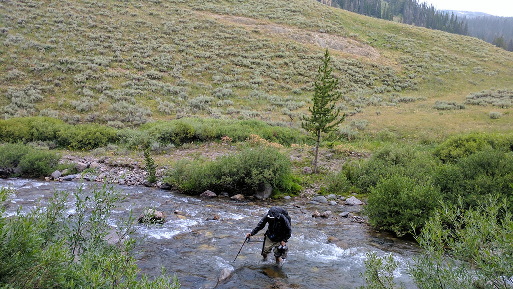
We got to a certain point, and we couldn't continue comfortably on the south side of the creek. We crossed it twice and ended up back on the south side. We had made very little progress in the last hour due to our determination to stay on the south and our reluctance to ford. We were trying to find our way, and we began to smell something very foul. A minute later, we came across a deer carcass in the middle of some smashed down grass. We then noticed a large, fresh pile of bear scat. We wheeled around and headed for the other side of the creek, very nervous about encountering a defensive bear nearby. Once across, we found a good trail, and we began to make progress again.

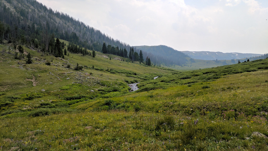
We neared where the trail turns south. It was still very pretty out.
The trail turned south and we headed uphill.
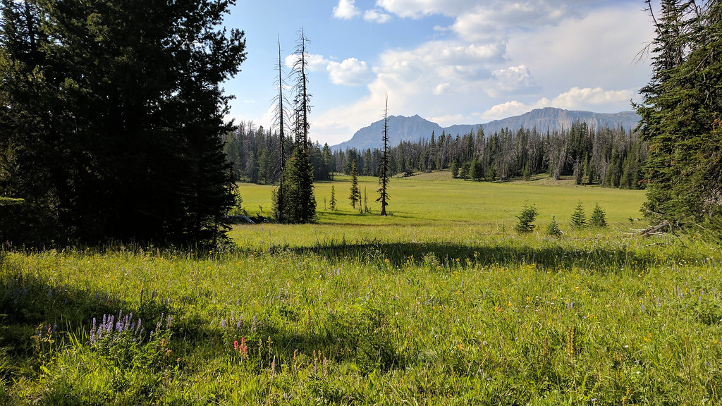
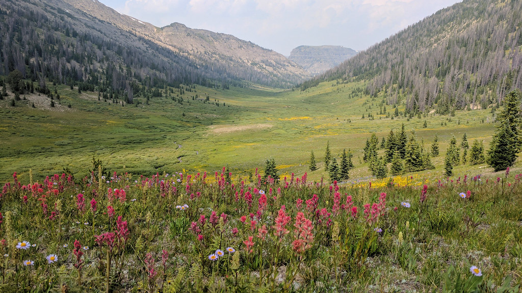
The pass came into view. It was nice up there.
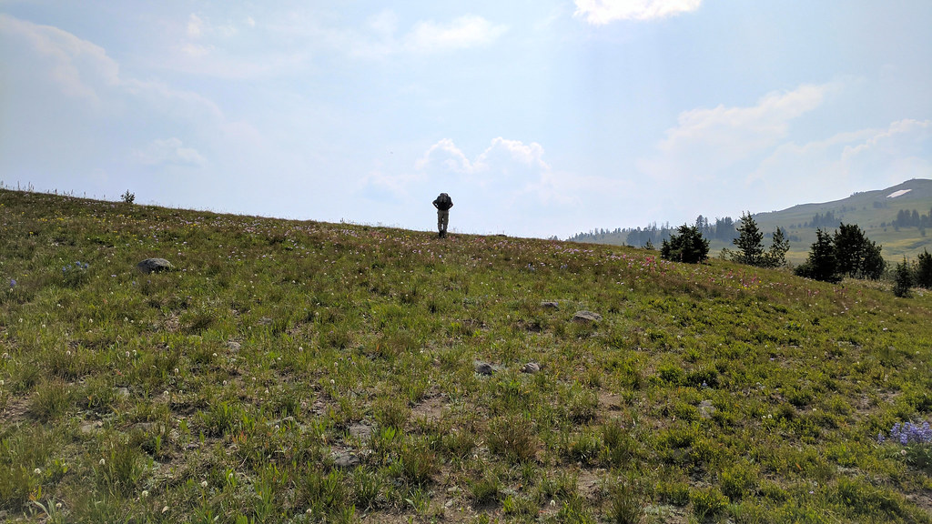
We made it to the pass. We relaxed for a bit and took it in.
We decided that we would hike as far as we could before dark, so we headed down to Cub Creek.
I realized once I was home that I took nearly no pictures of the several miles we covered along Cub Creek. It was absolutely beautiful, and I wish I had taken more photos. I guess we were just trying to knock down the miles. There were lots of long marshy stretches. By this point, I had given up on keeping my feet dry, and I just plowed through them.
It began to sprinkle, and it looked like it would rain more, so we donned our rain gear. We ended up not getting rained on until we had set up camp.
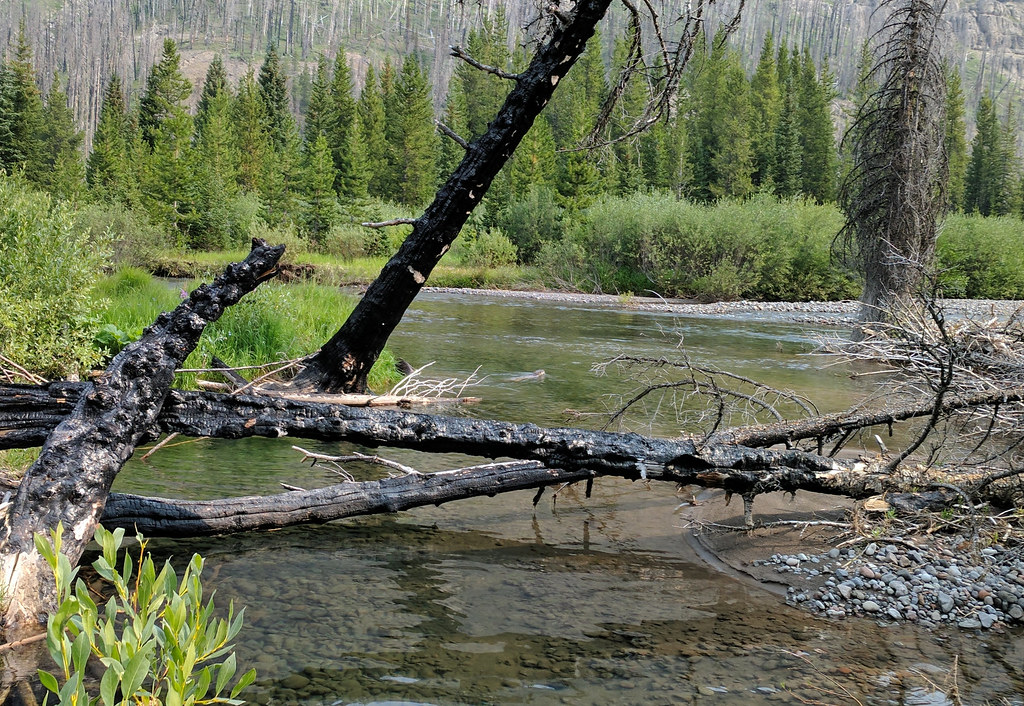
We made our final crossing of Cub Creek.
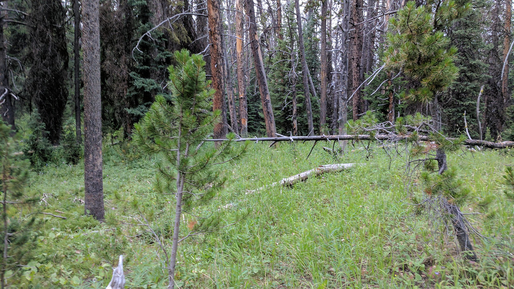
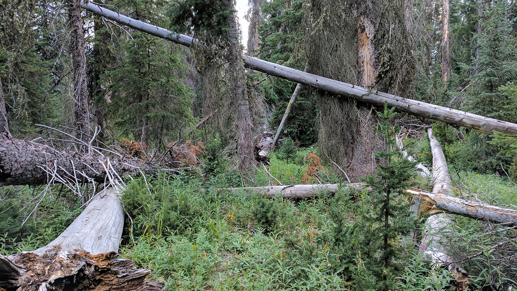
We ascended a steep slope once we had crossed, and for the next while, the trail was in bad shape. It was marked correctly on the map, but there were so many dead trees that had fallen into it, and parts of it were overgrown. We found our way through. The trail is in the next picture, but you can't really see it.
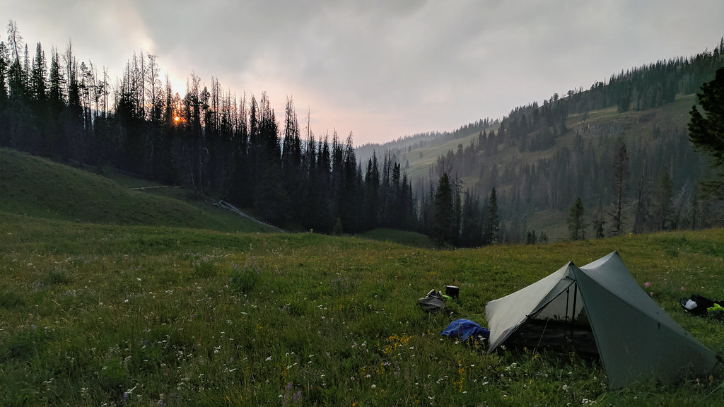
As the sun began to set, we reached a big open area (and the trail disappeared), and we decided to call it a day. We were 5-6 miles from the trailhead.
There were 2 big ponderosas nearby, which surprised me. They were perfect for hanging our food. I looked at some ponderosa distribution maps when I got home, and I realized that those trees are pretty uncommon for where we were.
It rained steadily on us for 10 minutes as we ate, but otherwise, it was a clear night. Much quieter than the previous night.
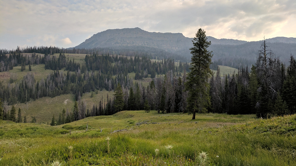
In the morning, we got going early. This shot is looking back to where we camped. I love that pine standing all by itself.
We struggled to find the trail. We crashed through a lot of forest for a while trying to find it without backtracking.
We did find it eventually. We cooked it back to Brooks Lake.
We ran into Joey at the trailhead. He and two friends were headed in for 6 nights.
By the time I got home, I was already looking forward to my next trip back to the Teton Wilderness. What a rugged, wild place.
This trip was originally going to be one night longer, at least 12 miles longer, and include a significant portion of the Buffalo Plateau, but we realized those plans were too ambitious. More on that later.
I had been planning this trip for the last year after reading trip reports by @scatman, @Joey, and @Georgia Yankee from various areas in the Teton Wilderness. As I've said on here before, I love the GYE, and this was a part of it that I had never seen. I managed to rope my friend, Dan, into going with me. He's my only friend that would agree to go to a place over 6 hours away on a trip that's supposed to cover 48+ miles in 4 days, with no extra days for travel time. A very good friend to have.
We made the drive up to the trailhead, and it was cloudy and rainy near Jackson and GTNP. It cleared off as we got closer, and it was beautiful out when we arrived.
We had brought lunch, so we ate that quickly and got ready. The walk around Brooks Lake was great. The trail sees a LOT of horse traffic because of the Brooks Lake Lodge.
The plan was for us to do 11-12 miles that day. We had started at 1 p.m., so we were moving pretty quickly. We got to Upper Brooks Lake.
From there, we continued toward Bear Cub Pass.
And we saw a grizzly track, I think.
We headed down toward the creek and came across a CDT thru-hiker. He said he had seen a grizzly bear a little bit down the trail, but we never saw it. I wonder if we misunderstood him. English was not his first language.
We got to the creek, changed into our water shoes, and headed across. I bought a pair of Crocs Swiftwater Waves in anticipation of this (yeah, I know, Crocs), and I was very pleased with my purchase. Also, John Cena modeled them in the same color for Crocs, so that means they're cool, right?
Did I mention it was a beautiful afternoon?
We headed up the mountain toward the South Buffalo Fork. This is looking back at Cub Creek.
For a few miles, we followed a wolf's prints on the trail. There were also elk tracks in the mud, so we imagined that the wolf chased the elk for miles. Probably not, though.
We came across 3 more CDT thru hikers before we broke off on the Angle Lakes trail. All were going north to south. I don't think I could thru hike the CDT.
As we made our way around, we reached a big burn area. Huge. It ended up extending most of the way up the South Buffalo Fork. It must have been somewhat recent, as we didn't see much new tree growth. Lots of fireweed though, as you'll see in a bit.
The trail twisted and turned through the burn area, and the twists and turns were not reflected at all in the map I brought along. I recalled seeing on Caltopo that the trail's location on the map was approximate. Take my word for it, it was very approximate. We kept going and going until we found a decent (not great) place to camp. We were a little close to the trail for my liking, but we figured (correctly) that no one would be coming through any time soon. The bugs were somewhat bad because we were within 400 feet of one of the smaller Angle Lakes.
At this point, we had become certain that our plans were too audacious for the time we had allotted. Near where we camped, I had planned on going off trail for a mile through the forest to cut off 4-5 miles of trail. There was no way that was going to happen, as the forest was thick with deadfall, weeds and marshy areas, and you couldn't easily tell where you were headed. We didn't want to tack on that extra trail mileage, as that would put us well over 50 miles for the entire trip, which was already proving to be more strenuous than we had anticipated. So we opted to go up the South Buffalo Fork rather than ascending Lake Creek to the Buffalo Plateau.
In the night, I heard a fair amount of animal activity. Something small was in our camp for a few hours. Later, I was jolted awake when I heard a loud chirp/whistle very close to my tent. It sounded a whole lot like a mountain lion chirp, so that was pretty cool. I guess you usually don't hear birds doing any chirping at 2 a.m.
We got going the next morning, and it was very nice out. More walking through the burned area. Lots of fireweed. I love that stuff. It's pretty seeing it in contrast with all the snags.
We reached a junction not marked on the map, but trail that wasn't marked looked good and headed in a better direction than the one on the map, so we took it. It took us directly to an outfitter camp. I later learned from Joey that the outfitters blazed the trail a while back. Not sure how that's allowed in a wilderness or national forest area, but we were not complaining that morning. It probably saved us a mile or so.
Their camp was set up in a beautiful meadow next to the creek. They had a great view of Pendergraft Peak.
The horses were out to pasture. We spoke briefly with a man standing by the corral. He seemed to know the area pretty well, so I'd imagine he worked for the outfitter.
We got going, and the horses that were out grazing kind of chased out of there. They didn't run at us, but they walked toward us when we got too close to them, and they followed us a ways before heading back. This is consistent with what Joey told us later. When he was there, they camped near the pasture, and the horses chased them out of their camp and shredded his food bag. He said they actually growled at him.
The vegetation was thick in places.
We eventually got a good view of the creek. It was very pretty.
The trail went through some more burned areas. That fireweed, man.
As we continued, I heard some squeaking. There were two otters playing in the water. When they saw us, they dove and swam away. I got this crappy picture of one of them moments before it dove.
We continued along the creek, sticking to the south side to avoid having to ford it too many times.
A result of this was that we had to thrash through numerous "willow tunnels", as we called them. They were usually very narrow with branches above our heads. We were sure that if we were going to surprise a grizzly somewhere, it would be in one of these.
We got to a certain point, and we couldn't continue comfortably on the south side of the creek. We crossed it twice and ended up back on the south side. We had made very little progress in the last hour due to our determination to stay on the south and our reluctance to ford. We were trying to find our way, and we began to smell something very foul. A minute later, we came across a deer carcass in the middle of some smashed down grass. We then noticed a large, fresh pile of bear scat. We wheeled around and headed for the other side of the creek, very nervous about encountering a defensive bear nearby. Once across, we found a good trail, and we began to make progress again.
We neared where the trail turns south. It was still very pretty out.
The trail turned south and we headed uphill.
The pass came into view. It was nice up there.
We made it to the pass. We relaxed for a bit and took it in.
We decided that we would hike as far as we could before dark, so we headed down to Cub Creek.
I realized once I was home that I took nearly no pictures of the several miles we covered along Cub Creek. It was absolutely beautiful, and I wish I had taken more photos. I guess we were just trying to knock down the miles. There were lots of long marshy stretches. By this point, I had given up on keeping my feet dry, and I just plowed through them.
It began to sprinkle, and it looked like it would rain more, so we donned our rain gear. We ended up not getting rained on until we had set up camp.
We made our final crossing of Cub Creek.
We ascended a steep slope once we had crossed, and for the next while, the trail was in bad shape. It was marked correctly on the map, but there were so many dead trees that had fallen into it, and parts of it were overgrown. We found our way through. The trail is in the next picture, but you can't really see it.
As the sun began to set, we reached a big open area (and the trail disappeared), and we decided to call it a day. We were 5-6 miles from the trailhead.
There were 2 big ponderosas nearby, which surprised me. They were perfect for hanging our food. I looked at some ponderosa distribution maps when I got home, and I realized that those trees are pretty uncommon for where we were.
It rained steadily on us for 10 minutes as we ate, but otherwise, it was a clear night. Much quieter than the previous night.
In the morning, we got going early. This shot is looking back to where we camped. I love that pine standing all by itself.
We struggled to find the trail. We crashed through a lot of forest for a while trying to find it without backtracking.
We did find it eventually. We cooked it back to Brooks Lake.
We ran into Joey at the trailhead. He and two friends were headed in for 6 nights.
By the time I got home, I was already looking forward to my next trip back to the Teton Wilderness. What a rugged, wild place.
Last edited:


