klank
one step at a time
- Joined
- Jul 29, 2013
- Messages
- 77
Last season I fell in love with the Eastern Sierras; starting with options out of Bishop, CA. Tom Harrison’s Bishop Pass map begs for one to complete North Lake to South Lake or South Lake to North Lake via Evolution Basin/Valley located in Kings Canyon National Park. On average, Evolution Basin will take 3 days to reach from either direction (East or West); most folks completing loop will travel North to South. I chose South to North.
The drive to Bishop from the Bay Area takes on average 6-7 hours. Best part of the journey is rolling through Yosemite. Challenging part is attempting to enter and pass through in a reasonable time on a Saturday. Enter by 10:30 am or prepare to wait. Small break at Tenya Lake and then off to Whoa Nellie Deli in Lee Vining. While exiting Tioga heading east the line to enter was nearly 2 miles long. Crazy chit. Enjoying mountain air @ Whoa Nellie Deli (around 1pm) I watched the Walker Fire build a large plume. The next morning I learned Tioga Pass had been closed a couple hours after passing through. A sign of good fortune to come.
The plan was to pick permit up at White Mountain Ranger Station, grab last minute supplies and head up Rte. 168 locating campsite to acclimate. Last year I came down with AMS hiking in this area; it was a concern heading into a long journey. The sooner I could locate a campsite the better. First, a smoothie from legendary Eastside Juice in Bishop. A must before entry and exit - day hike or multi day trip. Arriving at North Lake (exit point) all sites were taken, but later did I learn there are sites not seen from road. Heading back down to Sabrina Campground I grabbed #10 around 2:30 pm. One surprise driving up from Owens Valley was the air condition. The Rough Fire would be wreaking havoc the next few days. Once camp was set, hiked/climbed in the area to adjust body. Later that evening an Arabian Dance Party went off. Must say.. twas enjoyable.
Map: http://caltopo.com/m/0C44
(data is estimate)
Day 1 - South Lake to LeConte Ranger Station
10.5 miles
Early start as Gigi from Eastside Ride was set to pick up at 6 am (sharp!) Prompt she was. A little rushed I forgot mp3 player and moleskin. One item I could live without and one item desperately needed. Arriving at South Lake TH @ 6:30 am, watching Gigi head off I wondered “what have I done!?”. My main decision to start at South Lake was due to the gradual incline Bishop Pass offered compared to Piute Pass from North Lake. The downside, you lost all elevation gained later in day (or the following day) only to be faced with climbing LeConte Canyon. Finally getting started shortly after 6:30 am spirits were up while the sun began to shine.
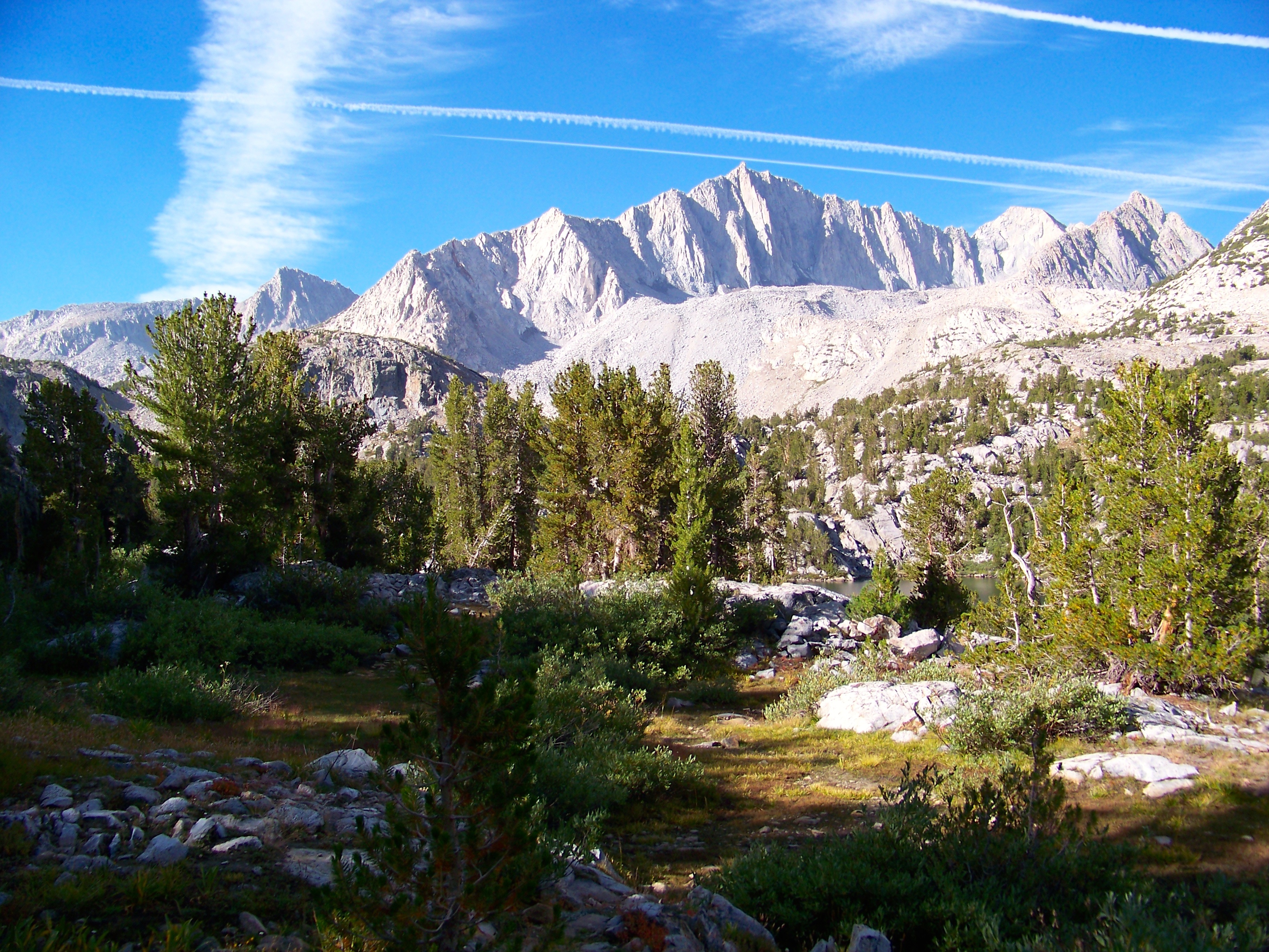 onwards & upwards to Bishop Pass by clifton dobbie, on Flickr
 climbing to Bishop Pass by clifton dobbie, on Flickr
As the morning gently passed into afternoon the skies began to haze up. Beautiful mornings followed by hazy afternoons were the norm all throughout trip. Before reaching Bishop Pass I was presented with first test: Camelbak leakage. I had not sealed bladder correctly. The good news - Camelbak Stoaway pushed leaking water to a central point, allowing water to drop out of pack at base of back; leaving bag & down jacket unscathed. Bishop Pass was reached @ 12:30 pm; flat plateau resembling a moonscape.
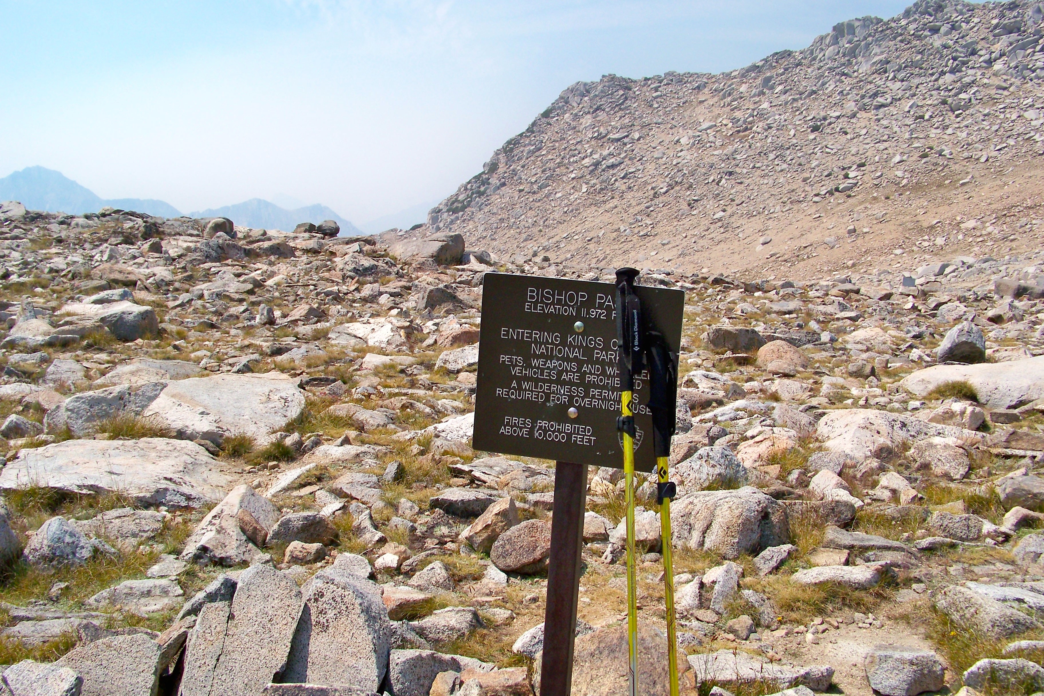 Bishop Pass by clifton dobbie, on Flickr
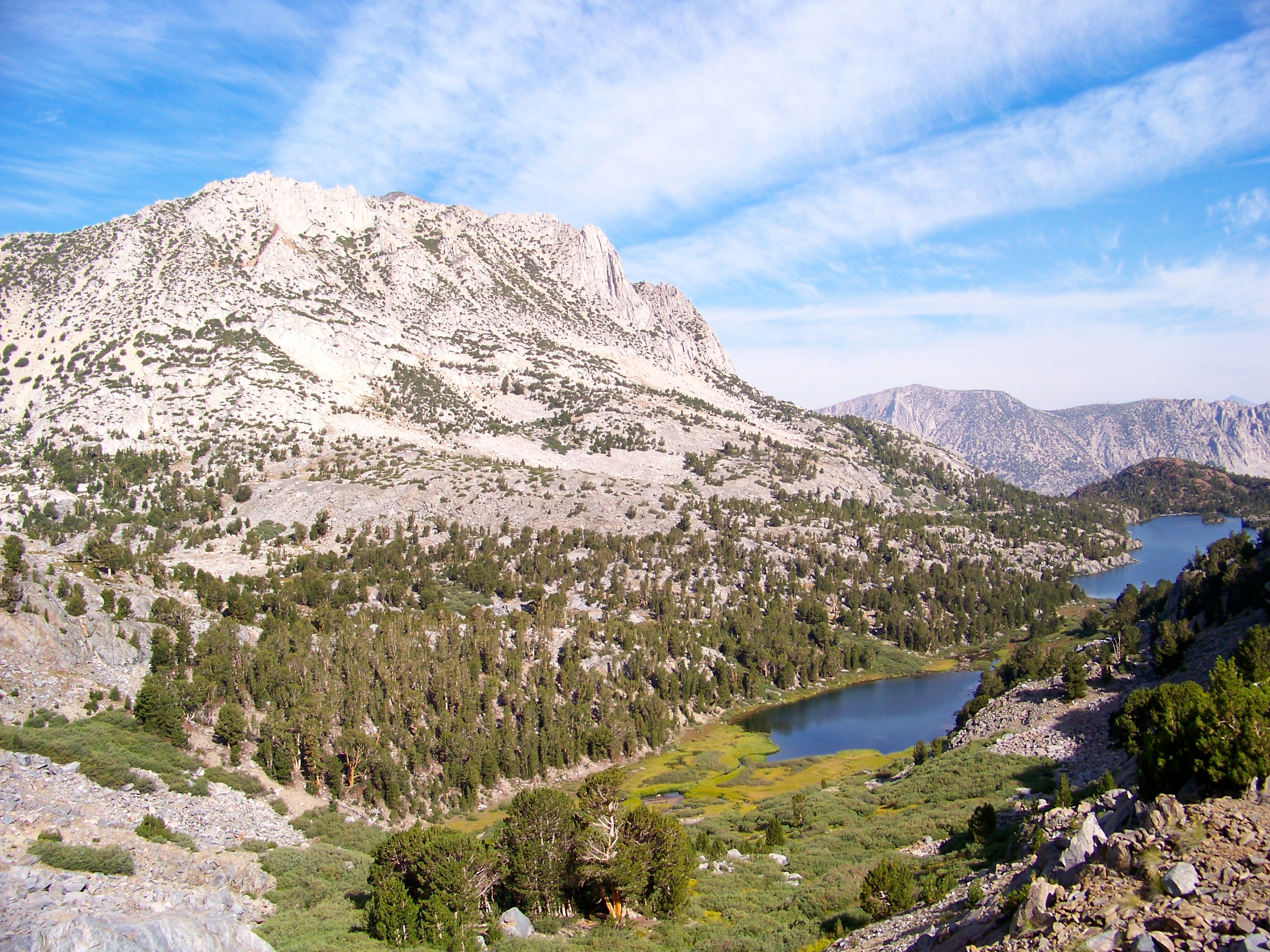
 Upper Dusy Basin Lakes by clifton dobbie, on Flickr
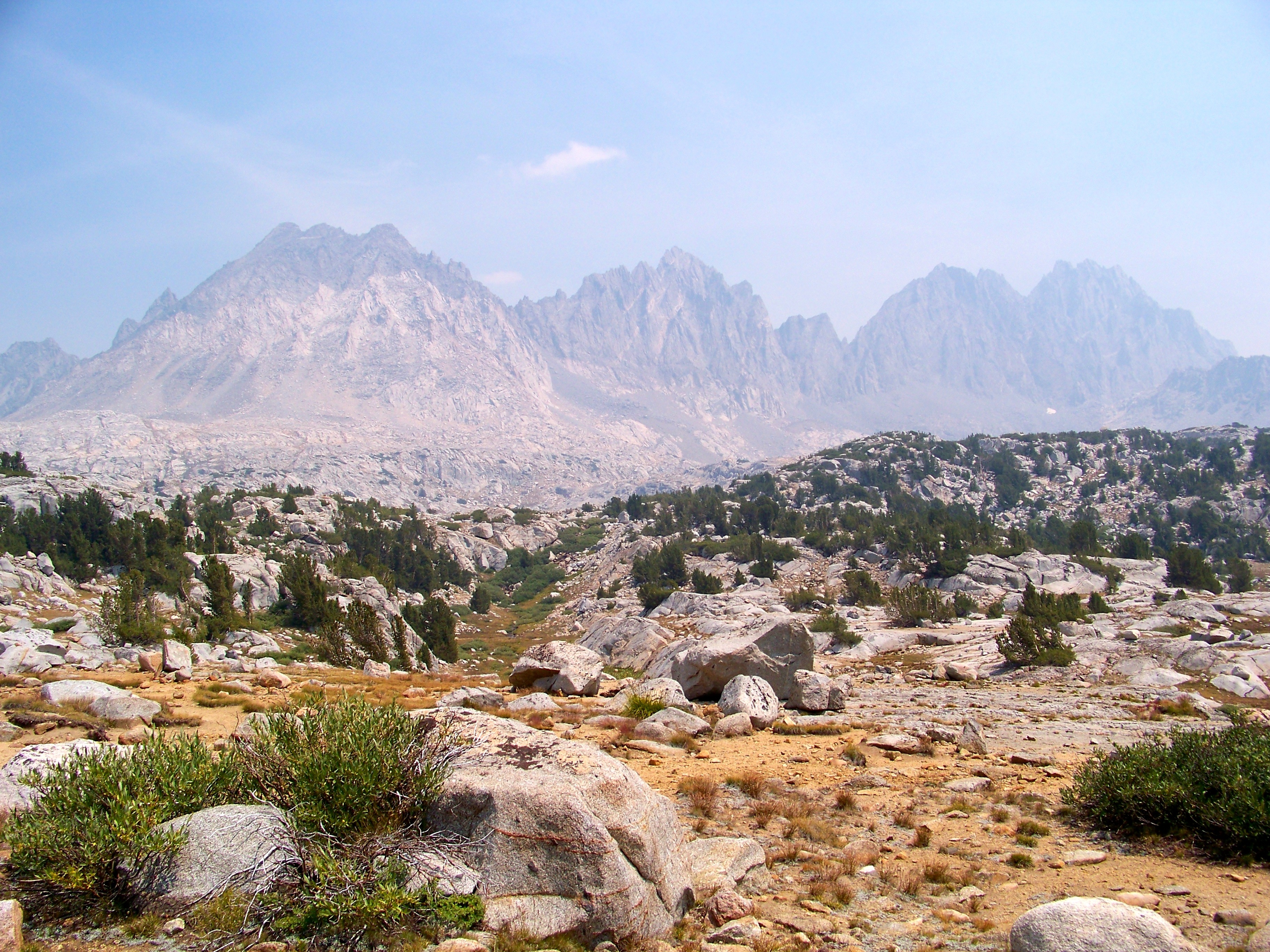 Palisades by clifton dobbie, on Flickr
Plan for the day was to tackle Bishop Pass and camp in Dusy Basin. Once into Dusy Basin the smoke became thick. Ran into a solo JMT through hiker bailing due to how congested it was down in LeConte Canyon. Not a good sign. Thankfully I do not have asthma or any other related health issues dealing with smoke. I kinda enjoyed the smell. Stopped to enjoy lunch overlooking Dusy Basin with another solo hiker heading to Cedar Grove. He was trekking directly into the direction of fire. Thankfully, I was heading north (away) once reached canyon floor. By 4:30 pm I had arrived at LeConte Ranger station; view = 3.371555%.
 LeConte Canyon glow by clifton dobbie, on Flickr
Camped at the confluence of Dusy Basin creek & creek flowing out of LeConte. No other soul camped in area. The solitude was comforting.
Day 2: LeConte Ranger Station to Wanda Lake
9.3 miles
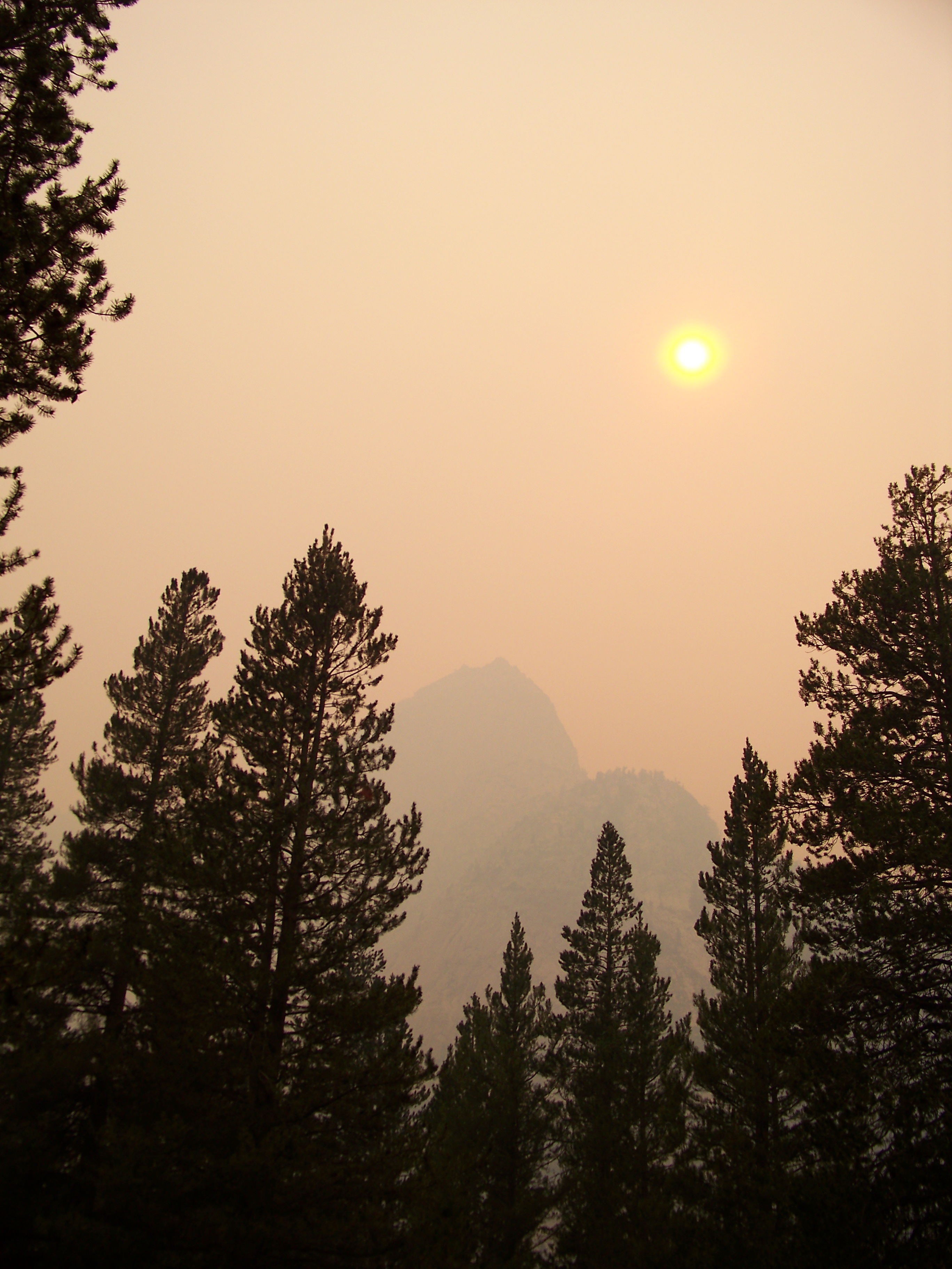
Ahead of schedule, today’s goal was to reach Helen Lake just below Muir Pass; 8 miles roughly 3k ft. Taking into account the prior day's feat I second guessed self many times all throughout the climb up (up! up! UP!) LeConte Canyon. Starting @ 8:30 am making good time through Big Pete Meadow (which offers many good camping options), smoke was thick offering no views whatsoever of the gargantuan mountains that lie ahead. Yes, it was a major bummer no views were available. Joked this must be what it's like to hike in China. Taking in the mountains silhouette views, knowing next trip different views will be had. I’ll be returning, dragging Mark, no doubt about it.
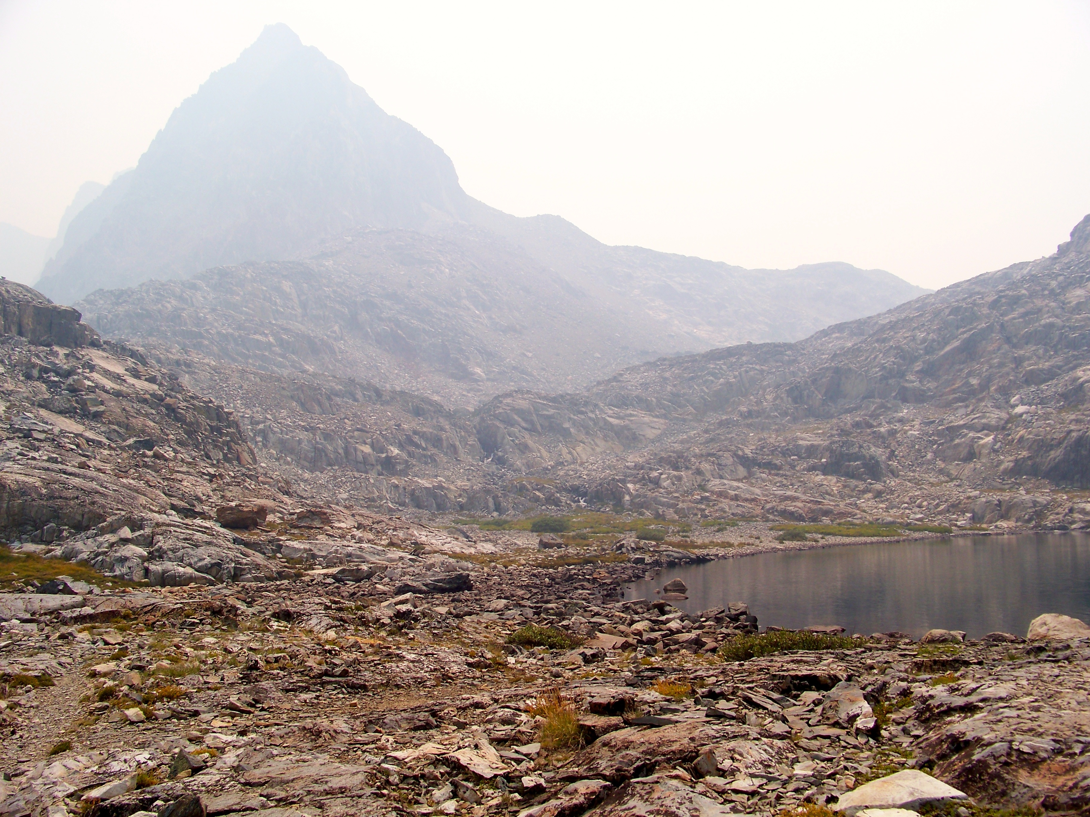 Helen Lake [Mt. Solomons in background] by clifton dobbie, on Flickr
Many of the trekkers were hiking the JMT North to South. As they passed, coming over Muir Pass they raised concern of smoke and urged me to hike over Muir Pass into Evolution Basin. Running on fumes at Helen Lake I took a short break, refilled the bladder and decided to tackle Muir Pass. False summit after false summit; least that’s how it felt. Finally, reaching pass @ 4:30 pm I ran into a father/son duo who were hiking North Lake to South Lake. We chatted for a bit of what lies ahead for each. Dad's joked if I would be completing loop in 4 days. We all shared a good chuckle. If memory serves, they were on Day 6.
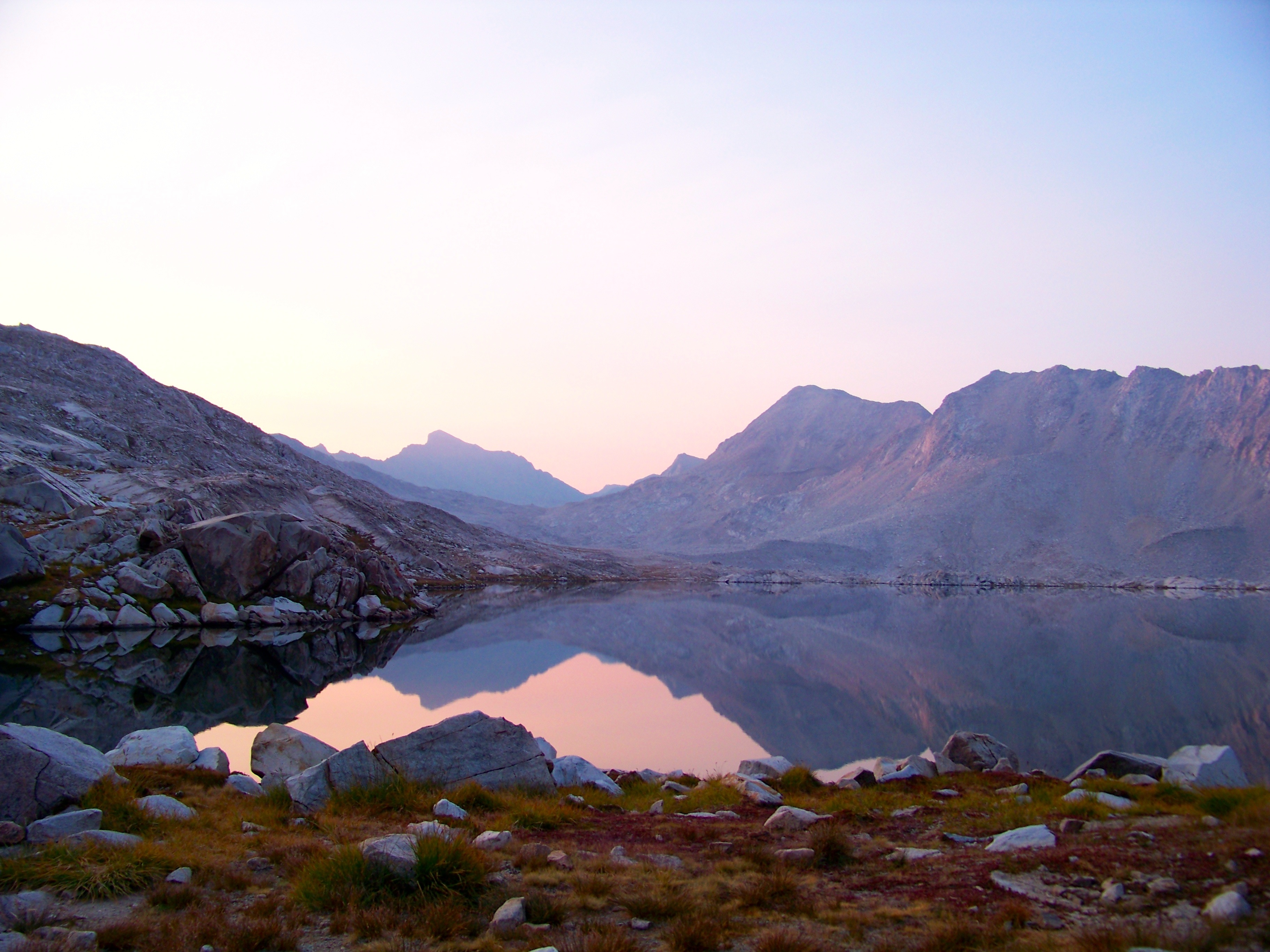
Exhausted, it was slow going heading down to Wanda Lake. Arriving at the the north end around 5:30 pm, mentally & physically wiped, I spotted a beautiful site facing Muir Pass. Campsite offered a kitchenette and recliner. As the evening progressed I was not 100%. Packit Gourmet Chicken & Dumplings hit the spot. I can not say enough good things about Packit. The only downside is the plethora of garbage. Slowly recharging, sunset began to set in offering prime alpenglow.
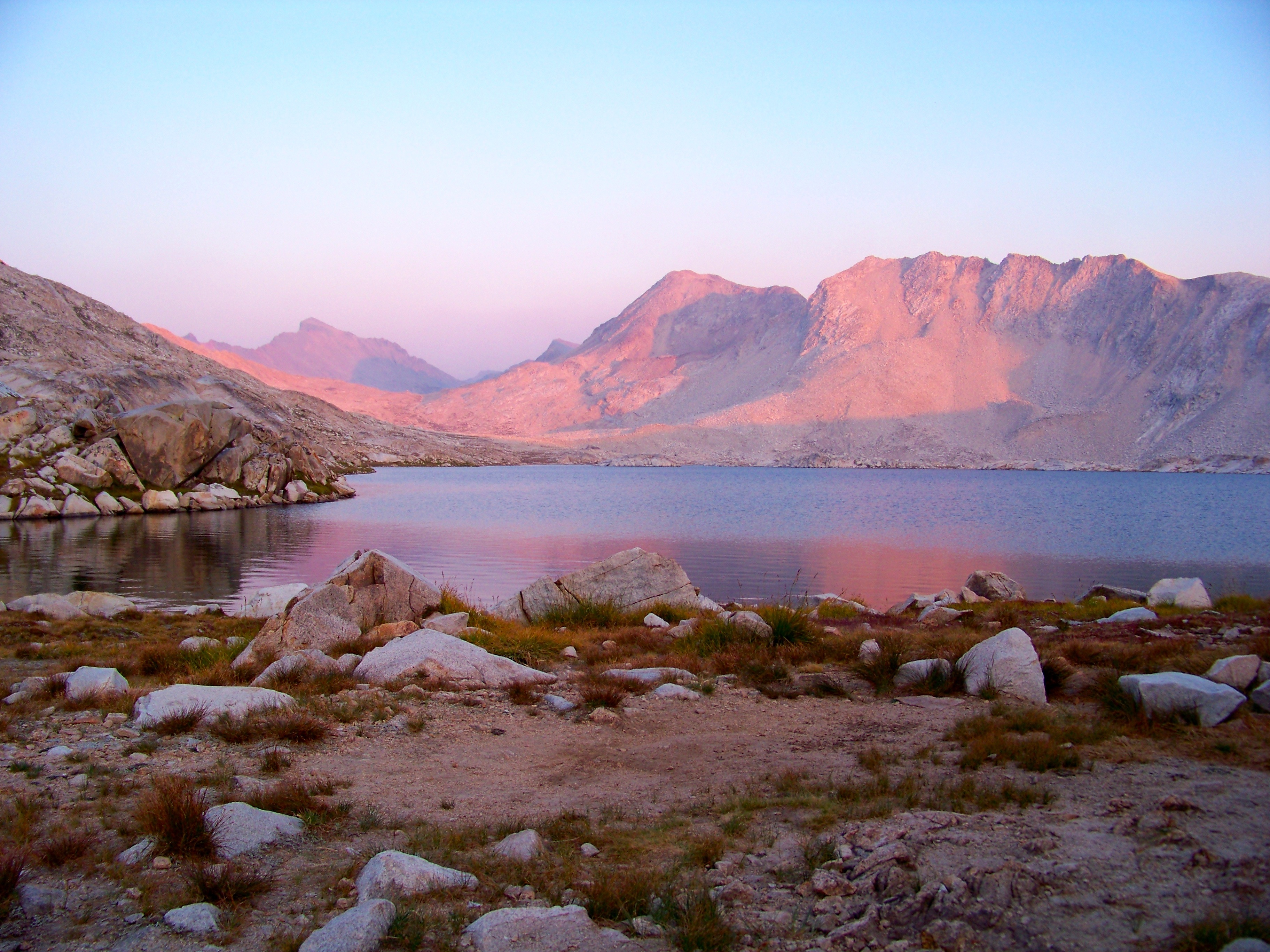 Alpenglow Along Muir Pass by clifton dobbie, on Flickr
Day 3: Wanda Lake to McClure Meadow
7.7 miles
Sunrise set the tone for the day. By the end of this glorious day, shutter fatigue had set in.
 Muir Pass sunrise by clifton dobbie, on Flickr
Ahead of schedule I decided to enjoy Wanda Lake to the fullest. Goddard Divide felt as if one could reach out and touch. A ledge up Scott from Oakland, CA had camped the night before. He too was out snapping away at Wanda's glory.
 Wanda Lake by clifton dobbie, on Flickr
 Mt. Goddard by clifton dobbie, on Flickr
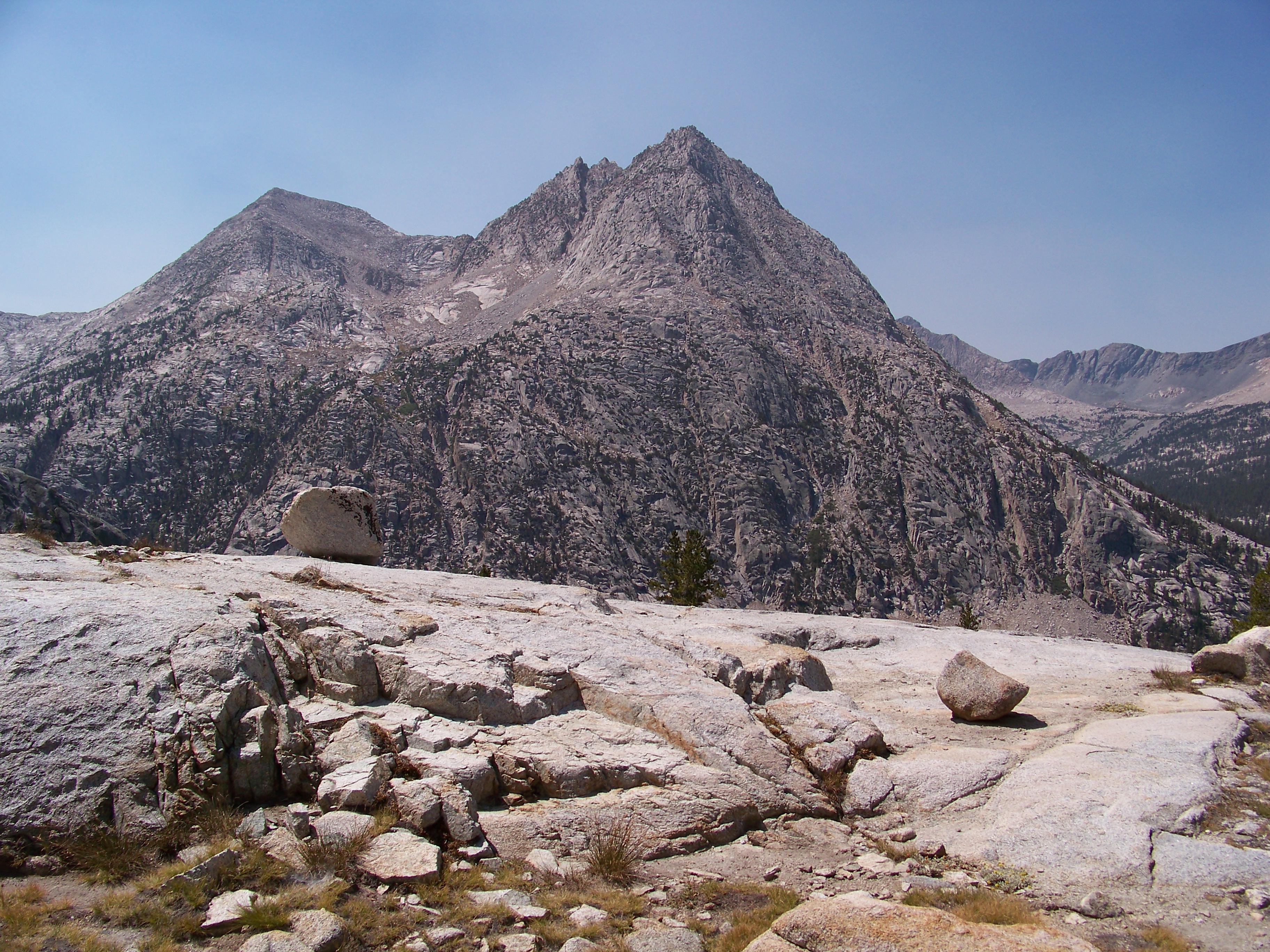
The original plan for Day 3 was to camp @ Evolution Lake. That option was out as wanted to tally more miles for the day. Evolution Basin lives up to the hype and then some. The auras felt were unreal. The Hermit, Mt. Mendel & Mt. Darwin, oh my! Sapphire Lake looks to be a primo spot to set up base camp. I regret not taking more pictures of the upper basin.
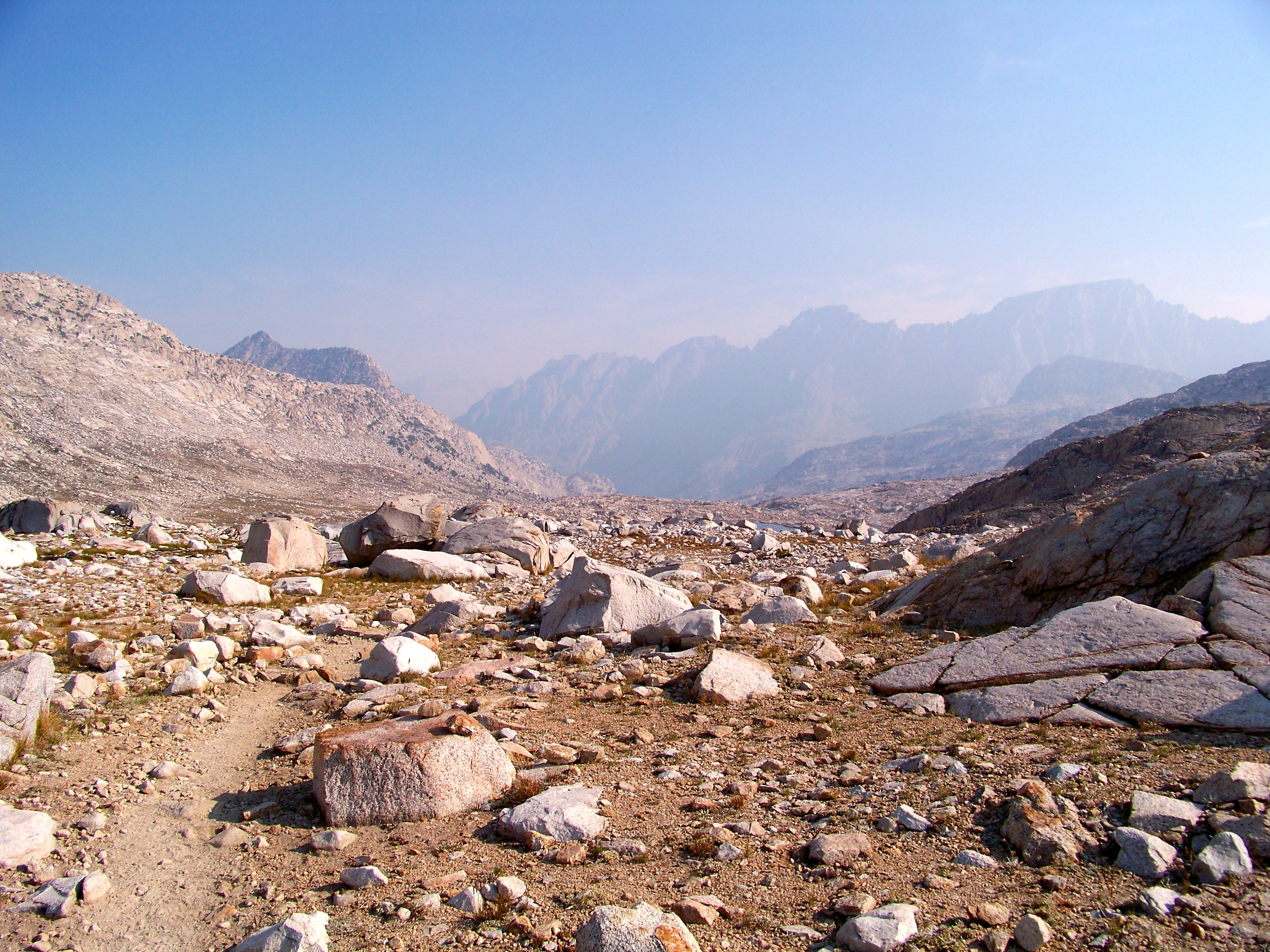 down to Evolution Valley by clifton dobbie, on Flickr
 down [some more] to Evolution Valley by clifton dobbie, on Flickr
 The Hermit by clifton dobbie, on Flickr
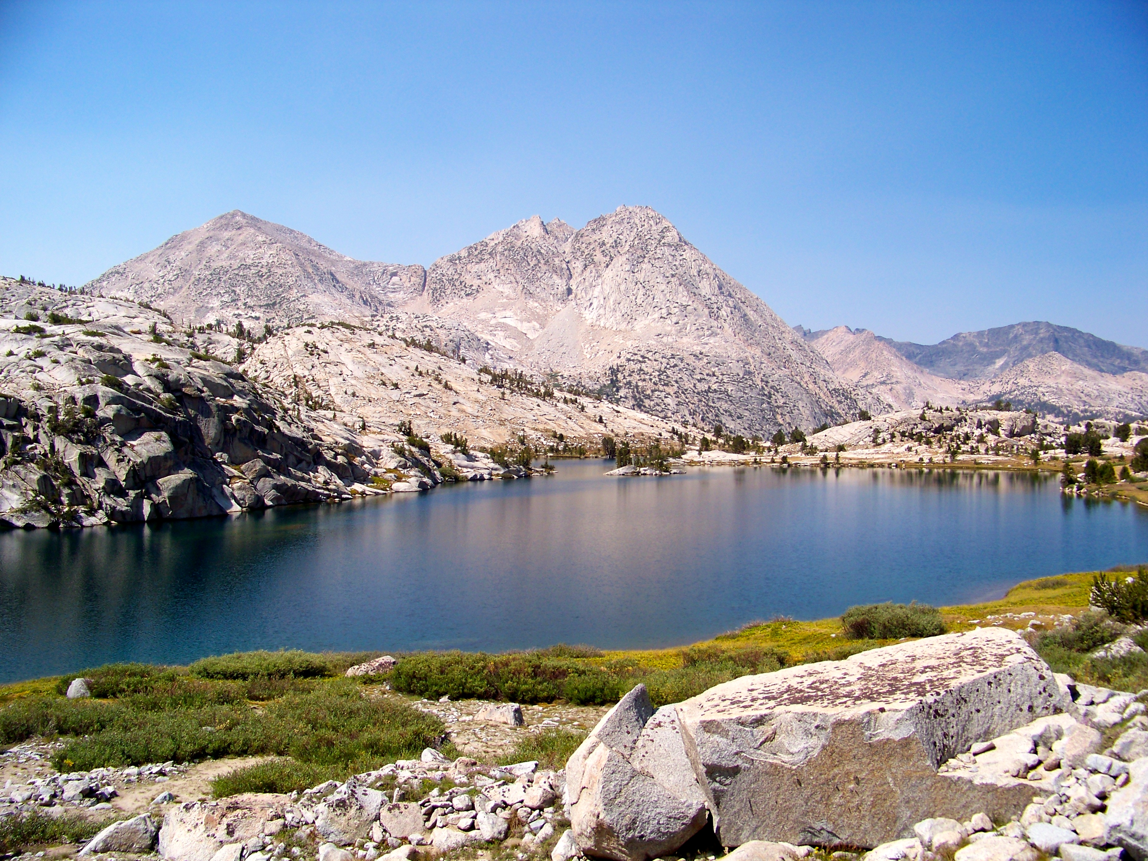 Evolution Lake by clifton dobbie, on Flickr
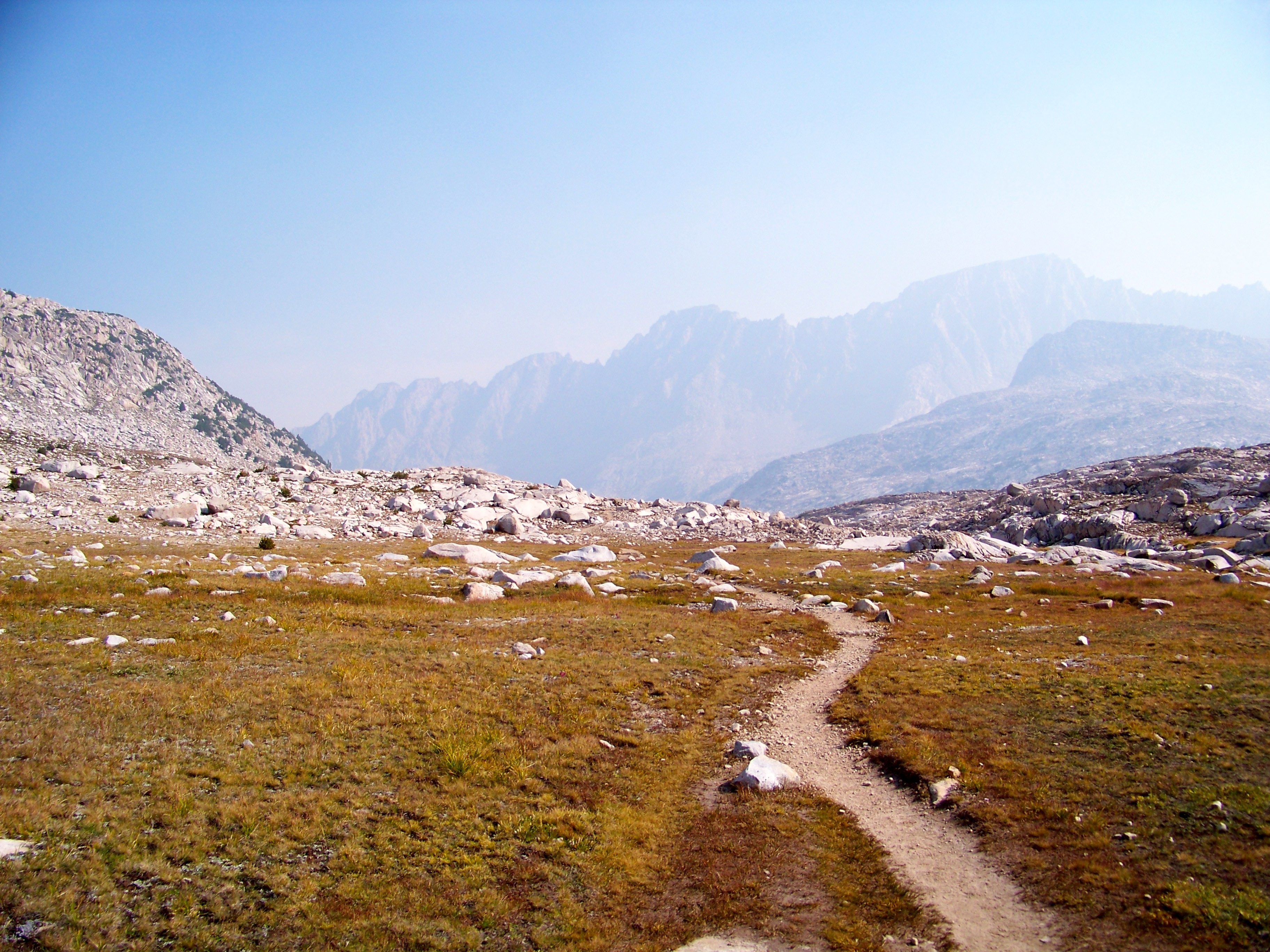
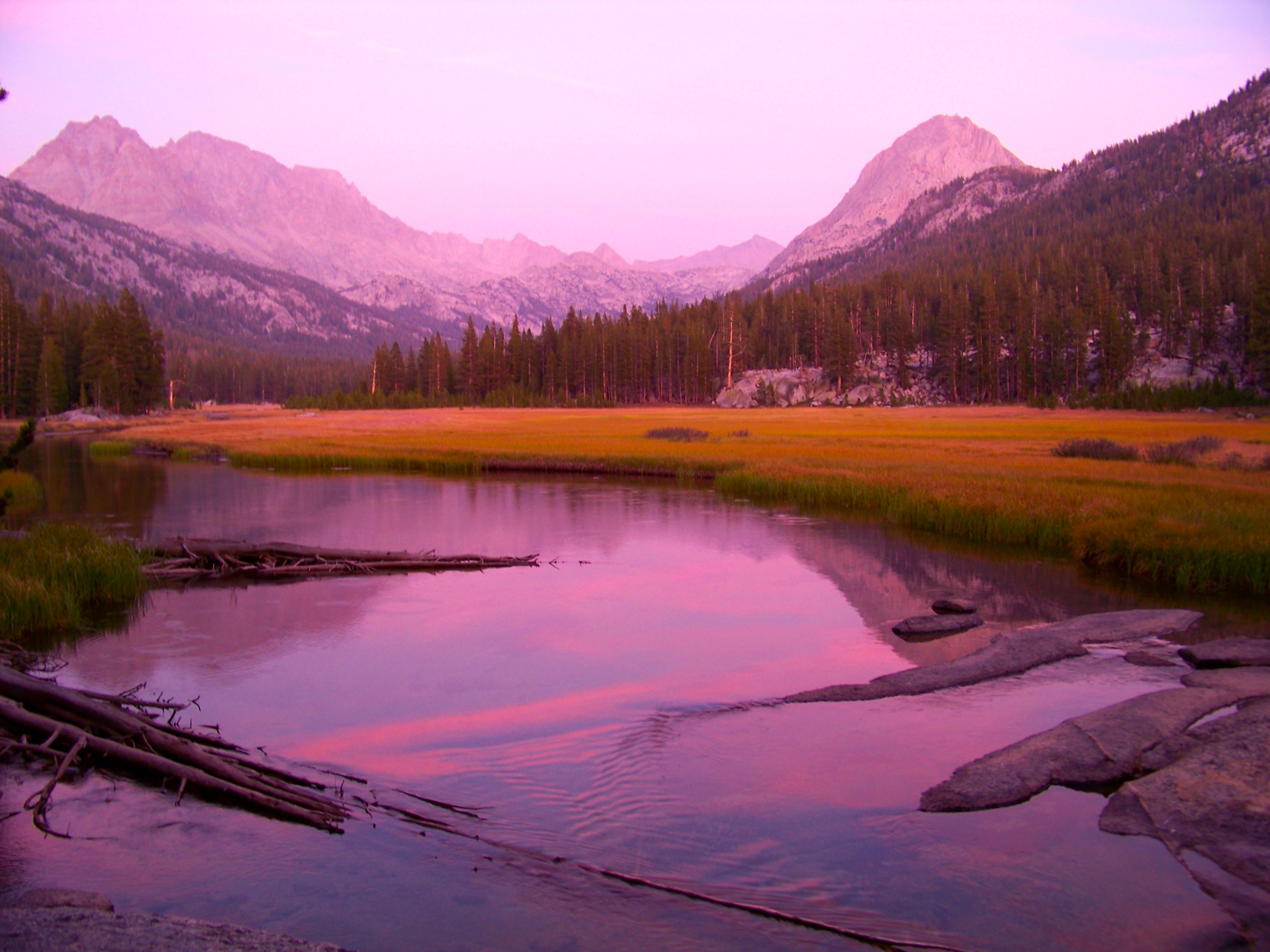
As one climbs down from Evolution Basin you first come to Colby Meadow & McClure Meadow, before reaching Evolution Valley. Colby Meadow offers a primo site along Evolution Creek with many pools to soak or fish. I stopped, pondered and made a wrong decision to head for McClure Meadow. While the sites @ McClure Meadowvare nice, none came close to the site @ Colby. Spent remainder of day doing chores, lounging & reading Jack Kerouac: Big Sur.
As the afternoon waned a pack train arrived. All throughout the evening 2 horses (in love w/ one another) roamed McClure Meadow; twice coming into camp.
 McClure Meadow Guardians by clifton dobbie, on Flickr
 Mt. Mendel & Mt. Darwin by clifton dobbie, on Flickr
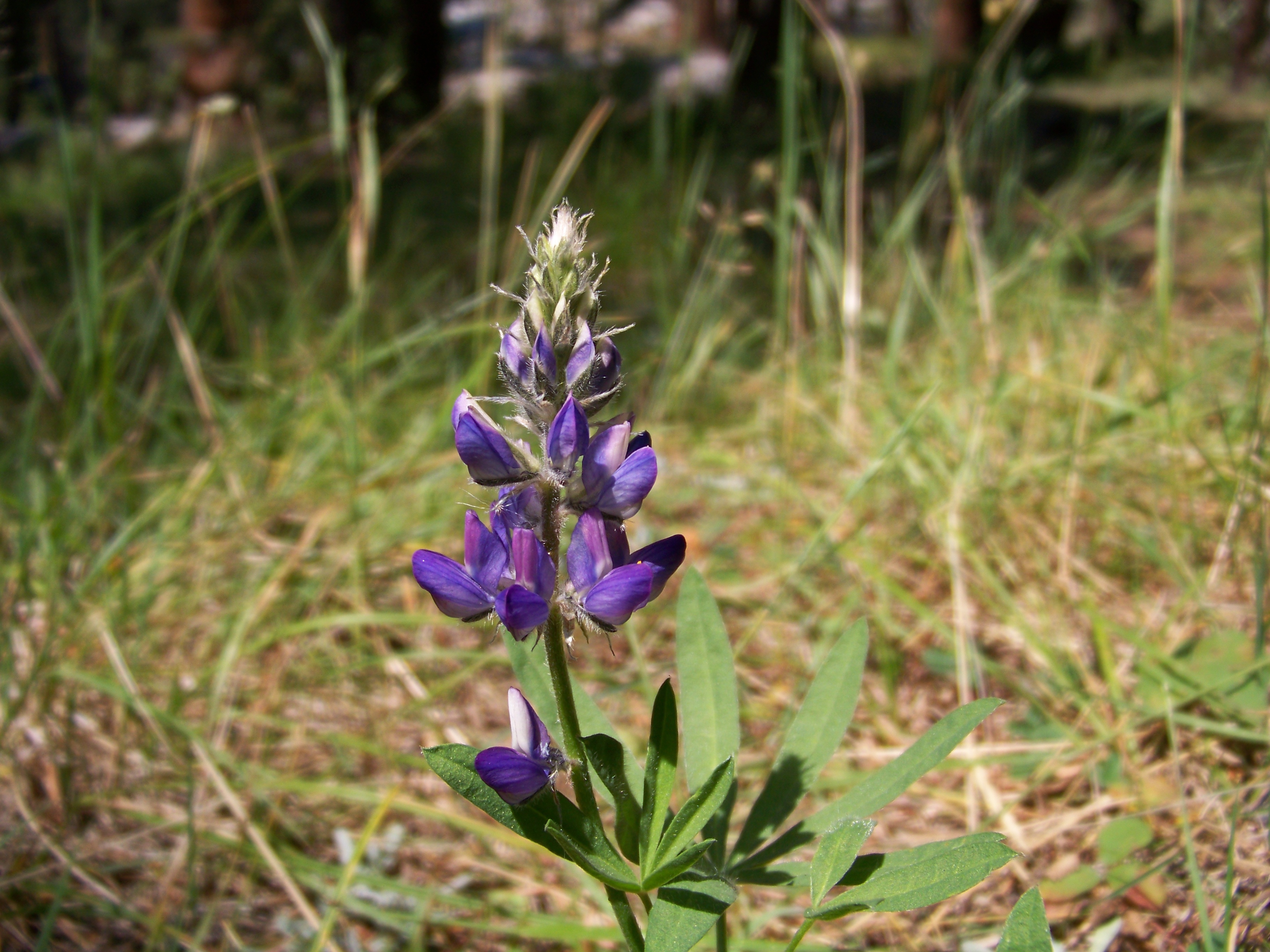 Lupine by clifton dobbie, on Flickr
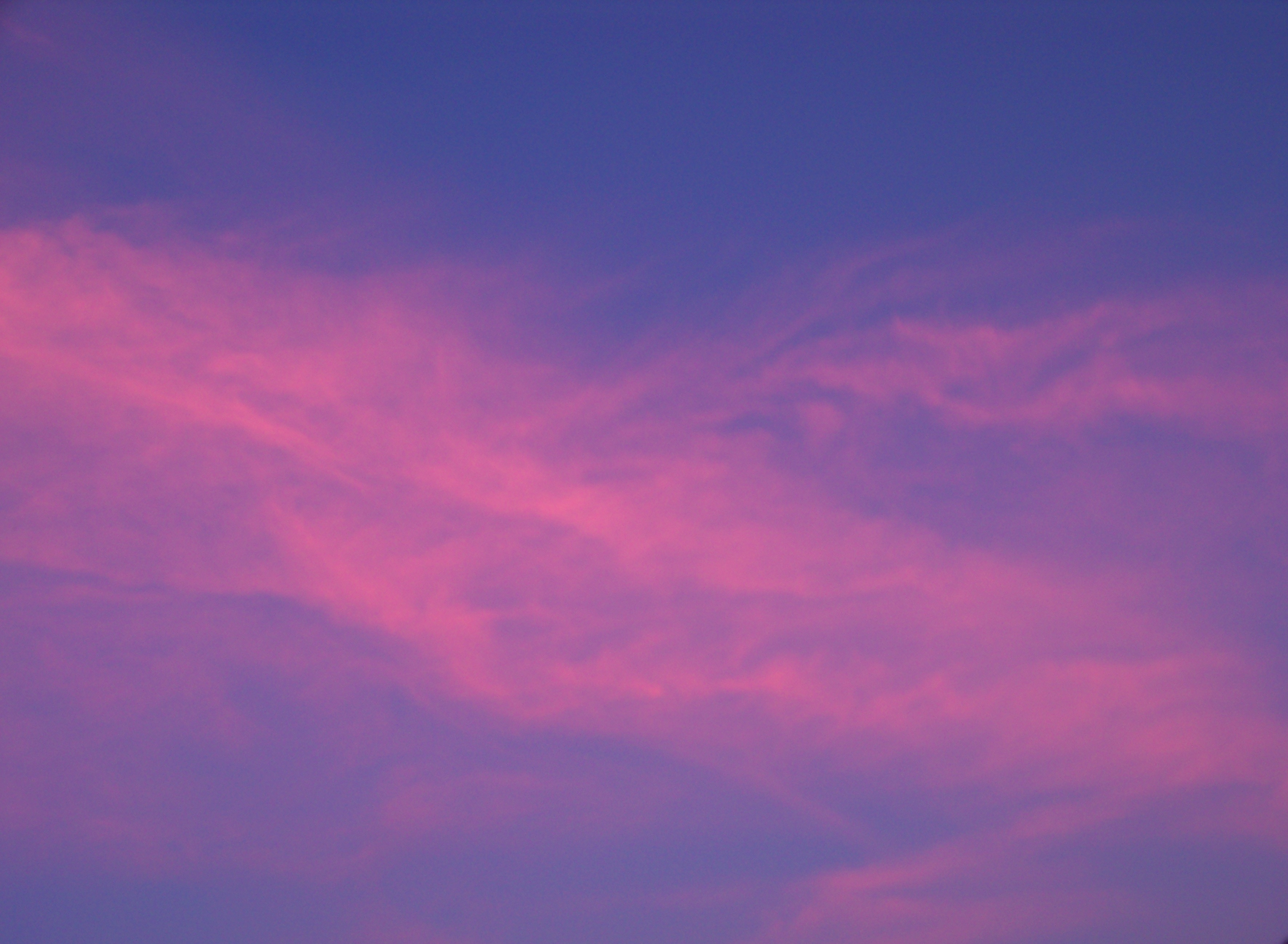
Fires do offer glorious sunsets.
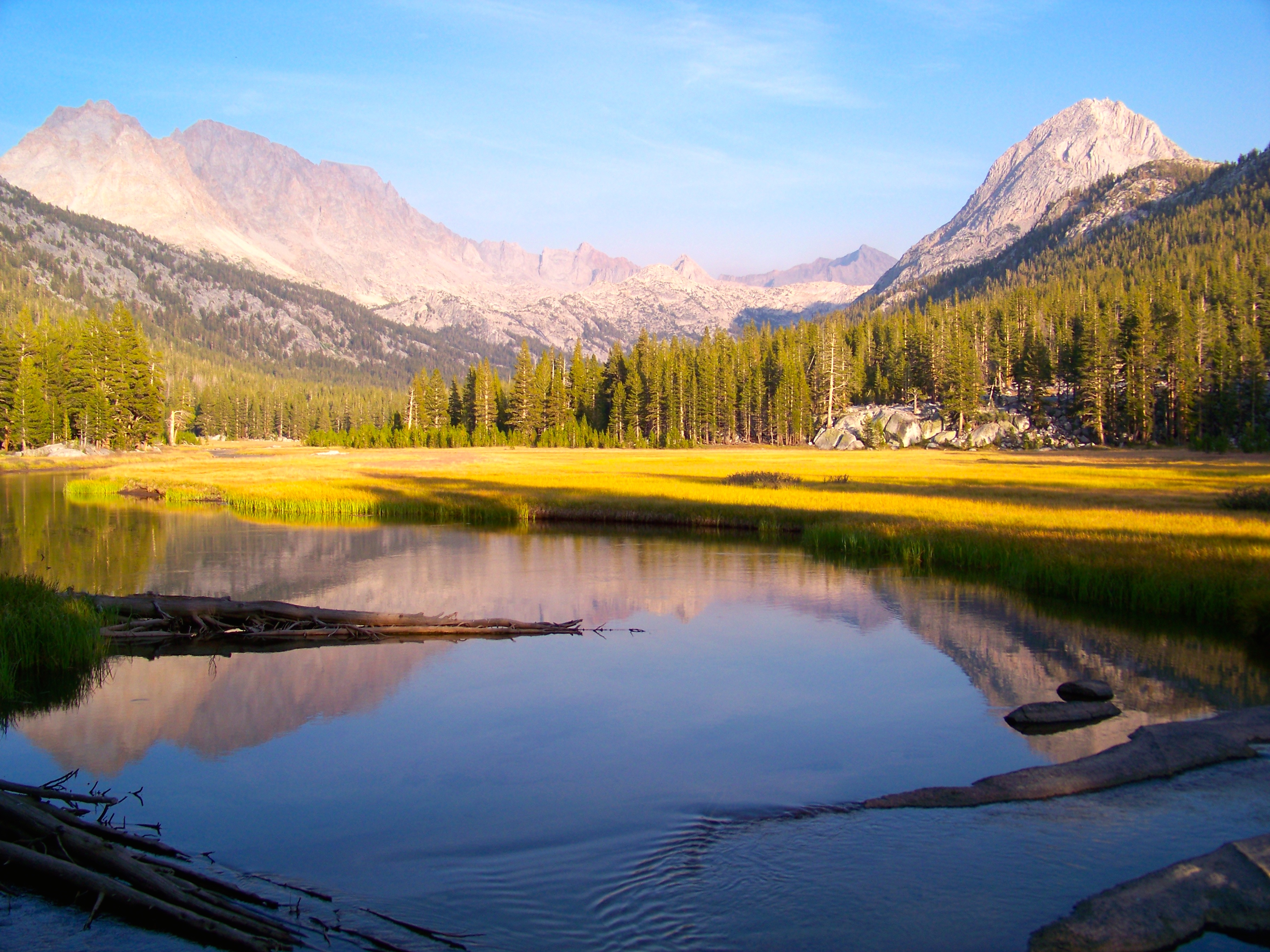 McClure Meadow by clifton dobbie, on Flickr
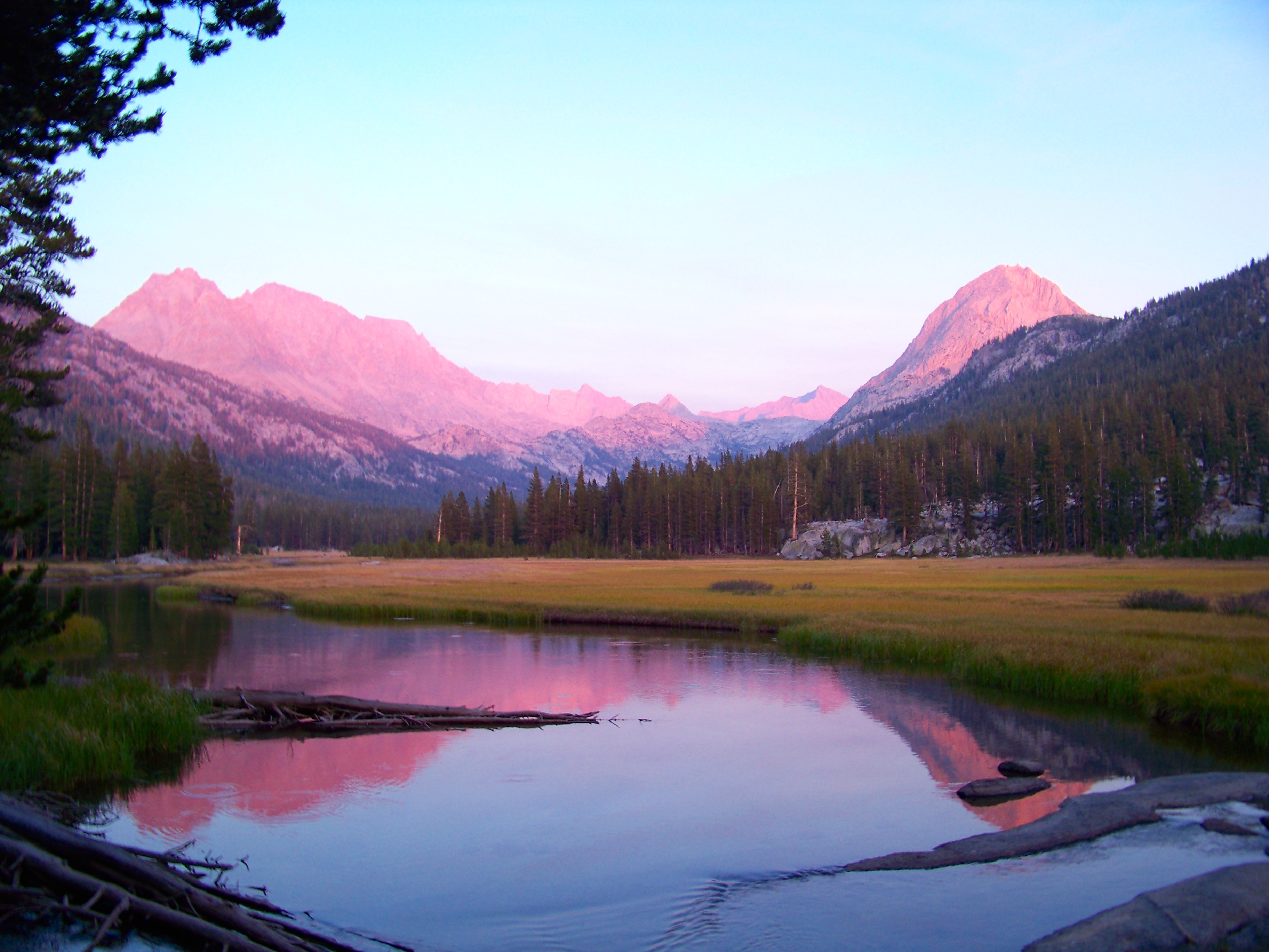 McClure Meadow sunset by clifton dobbie, on Flickr
 McClure Meadow sunset by clifton dobbie, on Flickr
 Clouds over McClure by clifton dobbie, on Flickr
Day 4: McClure Meadow to Piute Creek/JMT (John Muir Trail)
7 miles
One more easy day before heavy work. But first!, the famous crossing of Evolution Creek. Even in a (mega) drought year the creek was still flowing; by no means raging. Bringing no other footwear, crossing would need to take place boots on. Thank you, Keen Dry! Safely made across with minimal wettage. The first half of trip has mainly been in solitude; yes, I would interact with trekkers, but never connecting with any. At the Goddard/JMT trail intersection I met Pete from Santa Cruz. This dude was getting back into backpacking and chose Evolution Valley/Basin. He shared a story of his first trip into Kings Canyon with a mule, never letting go of the reigns, the whole trip. Pete inquired of my route, reacting in shock I would be heading up Piute Creek from the West (not the first time received") . He offered tips (stressed!) to start early. EARLY. I was aware the first mile = steep. Pete informed it was very exposed. He also bursted my bubble I would not be stopping at Muir Ranch. Muir Ranch offers rooms, hot mineral tubs & showers for the right price. It is also a main restock point for JMT & PCT trekkers. Packers can camp nearby enjoying hot mineral baths not associated with Muir Ranch. I was hoping to grab a new can of gas. I’ve been dealing with a leaker since Day 1. A small backup was in the pack so I was not overly concerned.
. He offered tips (stressed!) to start early. EARLY. I was aware the first mile = steep. Pete informed it was very exposed. He also bursted my bubble I would not be stopping at Muir Ranch. Muir Ranch offers rooms, hot mineral tubs & showers for the right price. It is also a main restock point for JMT & PCT trekkers. Packers can camp nearby enjoying hot mineral baths not associated with Muir Ranch. I was hoping to grab a new can of gas. I’ve been dealing with a leaker since Day 1. A small backup was in the pack so I was not overly concerned.
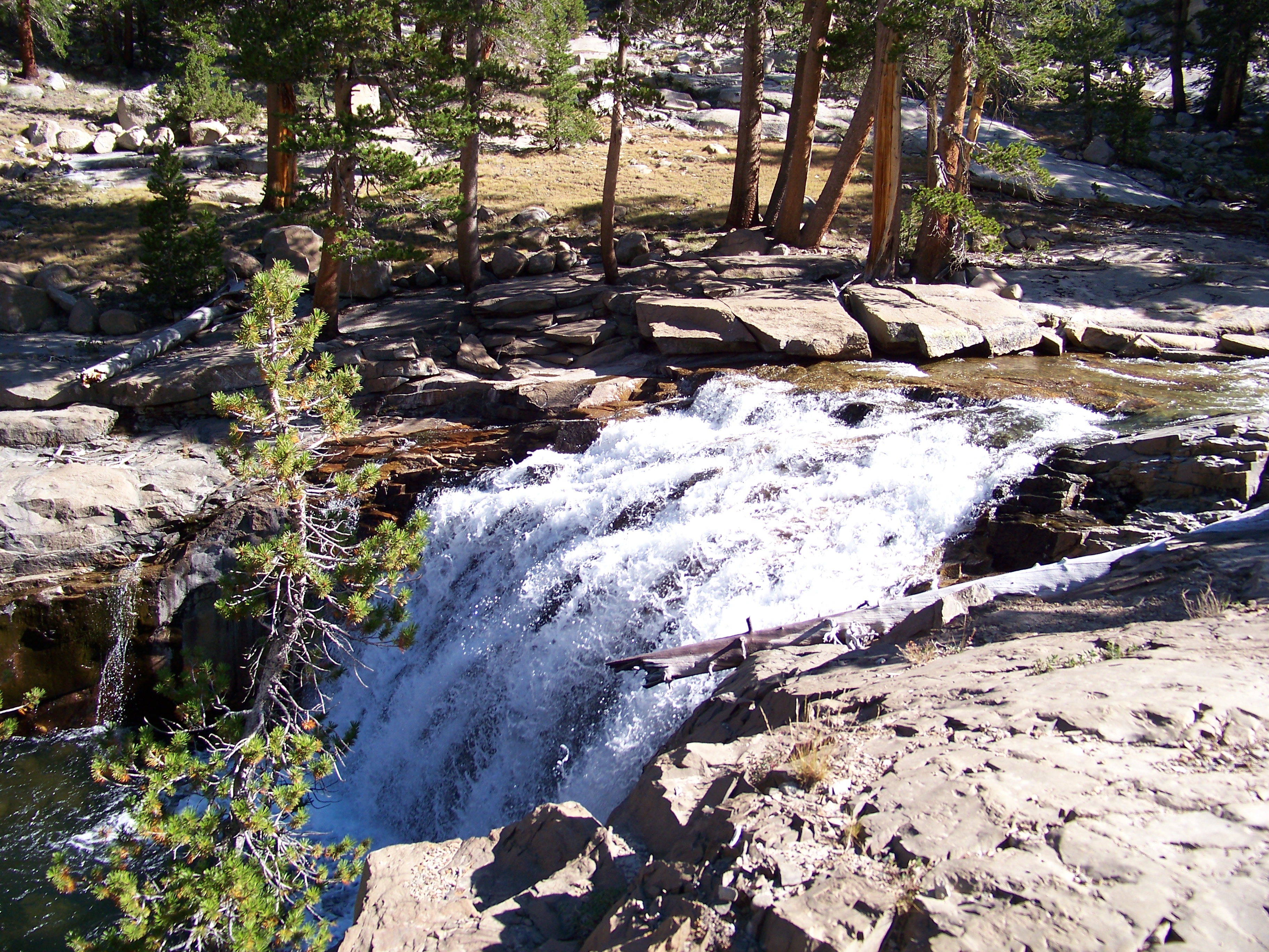 Evolution Creek by clifton dobbie, on Flickr
Granting Pete safe journey I headed down the final stretch of the JMT to Piute Creek. Campsite was empty @ 2pm. Set up camp then enjoyed the pools along Piute Creek. Rested, read more of Kerouac and rested some more. It was going to be an early start.
 The Road to Evolution by clifton dobbie, on Flickr
 Pavillion Dome by clifton dobbie, on Flickr
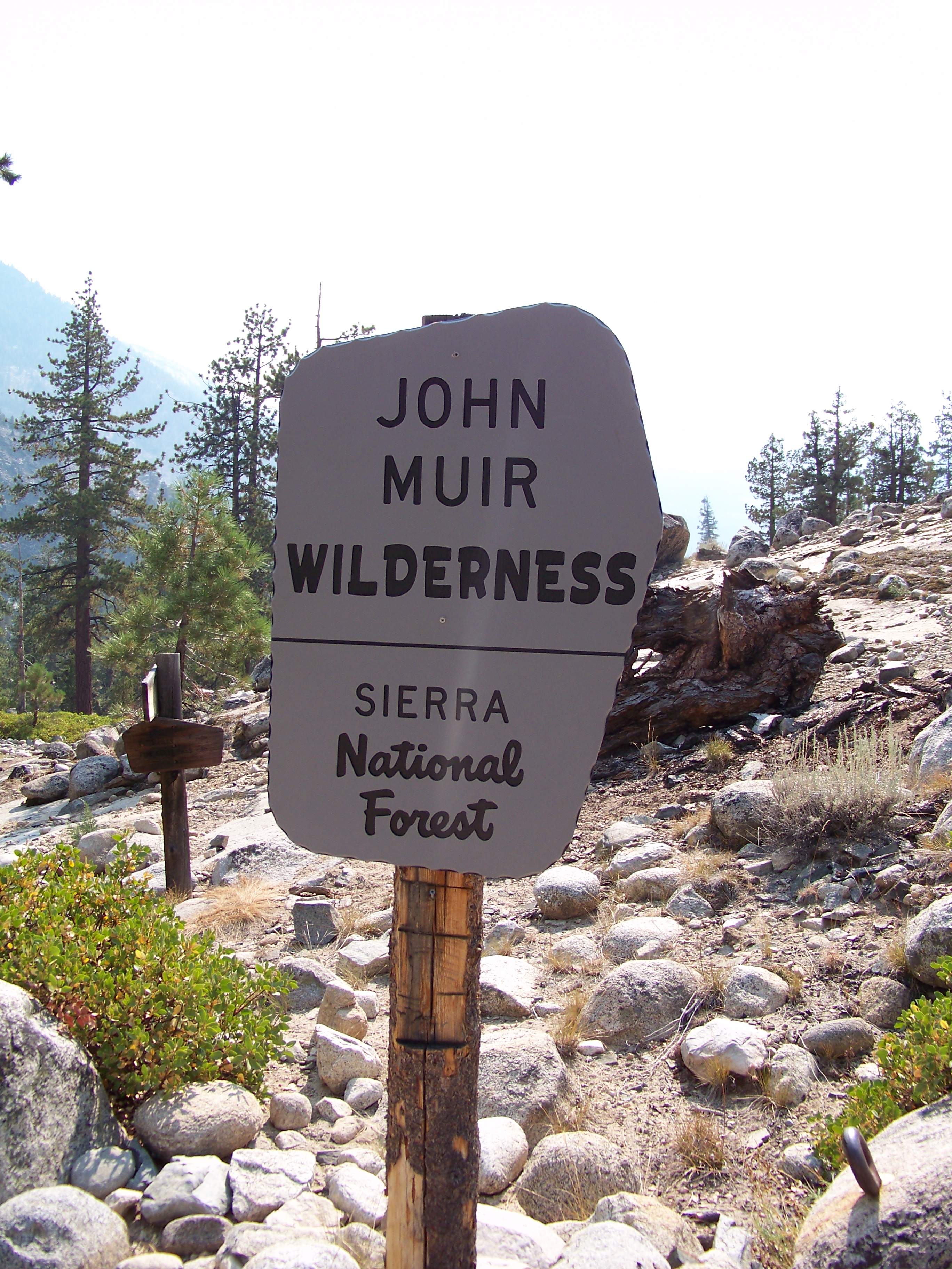 John Muir Wilderness - Piute Creek by clifton dobbie, on Flickr
Day 5: Piute Creek/JMT to Piute Lake
13.5 miles
Never in my wildest dream did I think Piute Pass would be made this day. Breaking camp early, out by 6am, I met a couple Aerospace Engineers from LA camping about .25 miles up Piute Creek. They were heading out to North Lake in need of a ride to South Lake. Obliging to assist, I trekked on knowing our paths would cross later in morning. The first mile is no joke. Short, steep, rocky switchbacks. My kinda switchbacks! Making good time, watering up in Hutchinson Meadow, thankfully doing so cause the next water source was nearly 6 miles away.
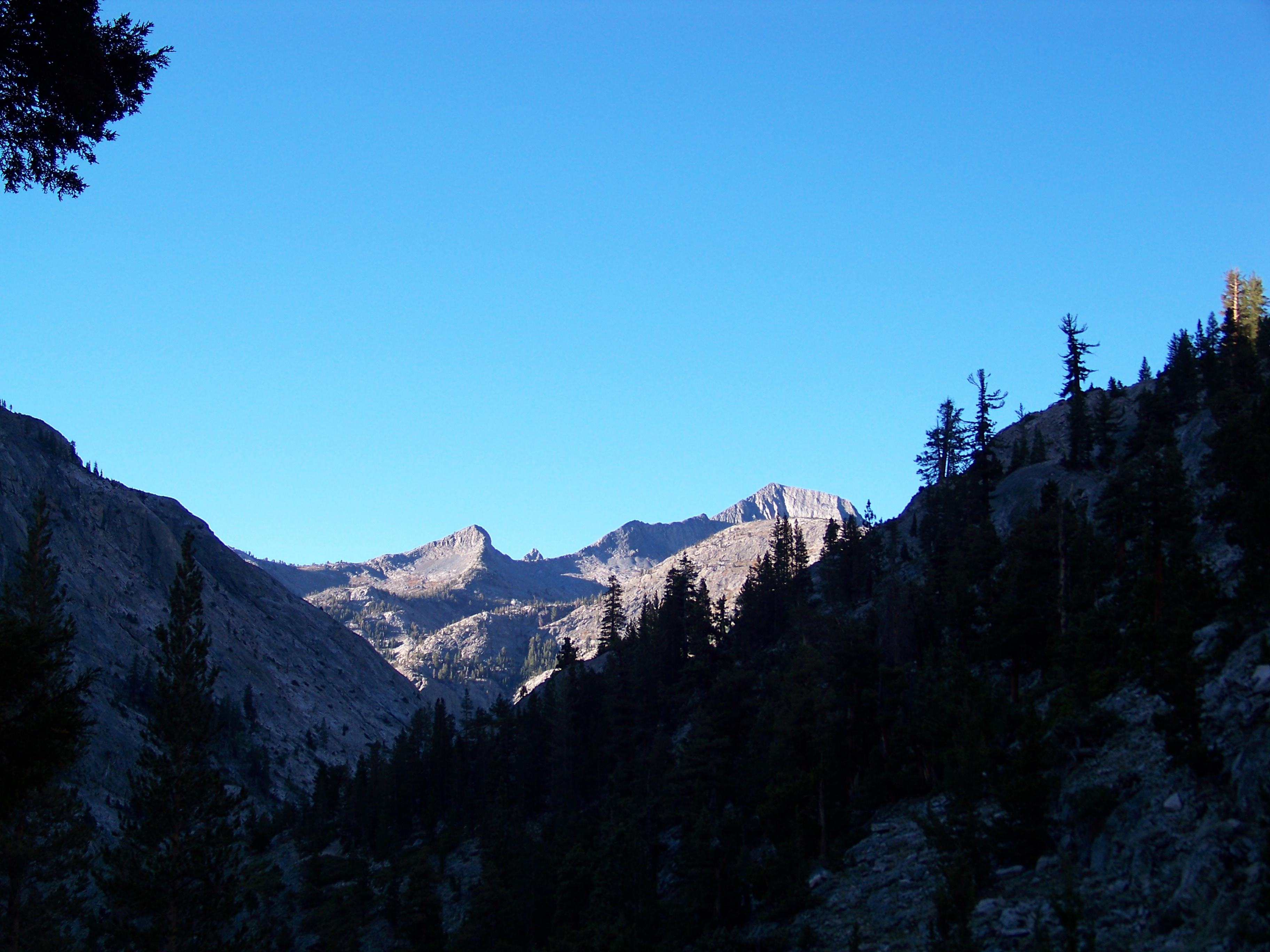 Piute Canyon by clifton dobbie, on Flickr
 Piute Canyon by clifton dobbie, on Flickr
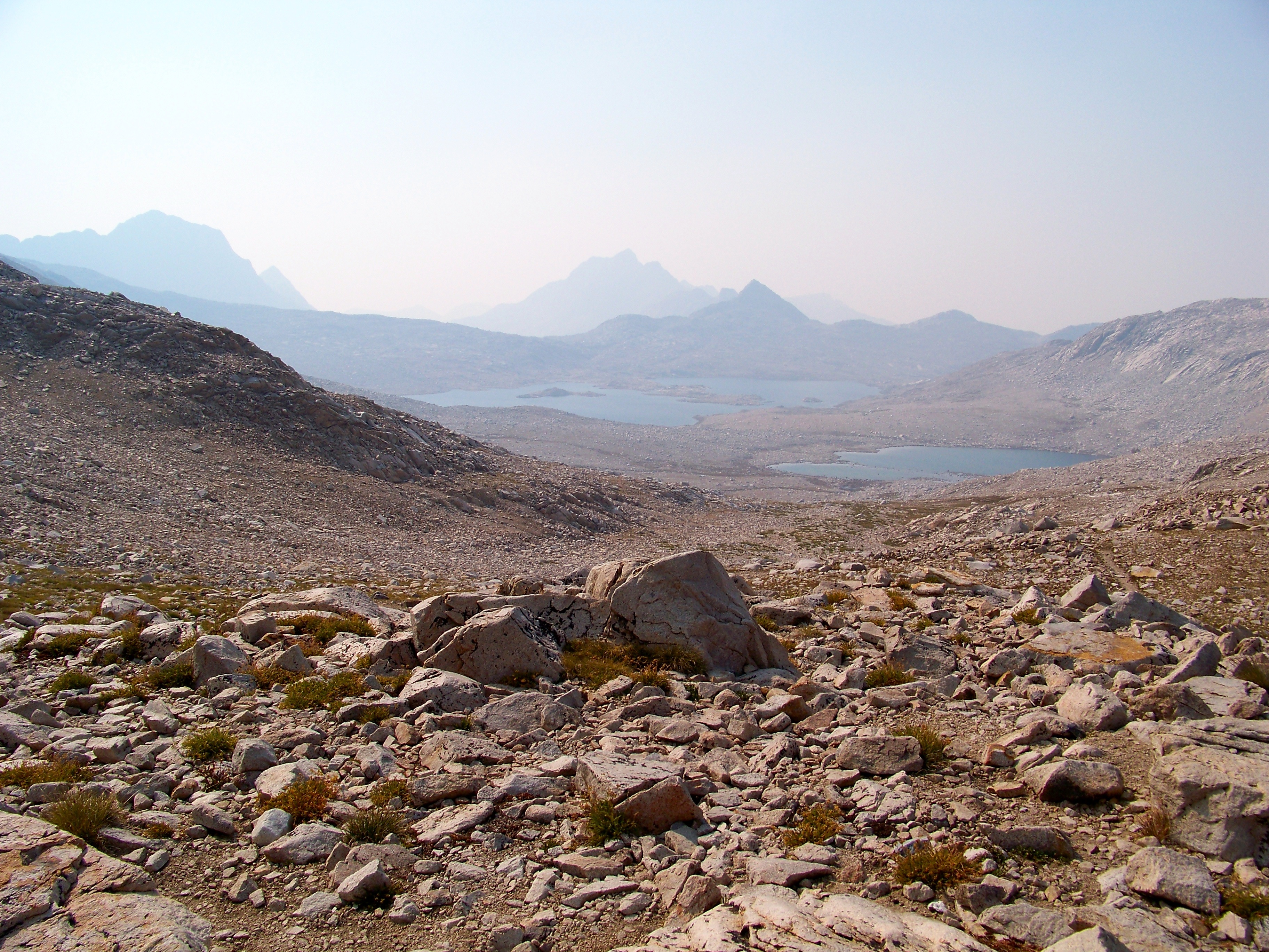
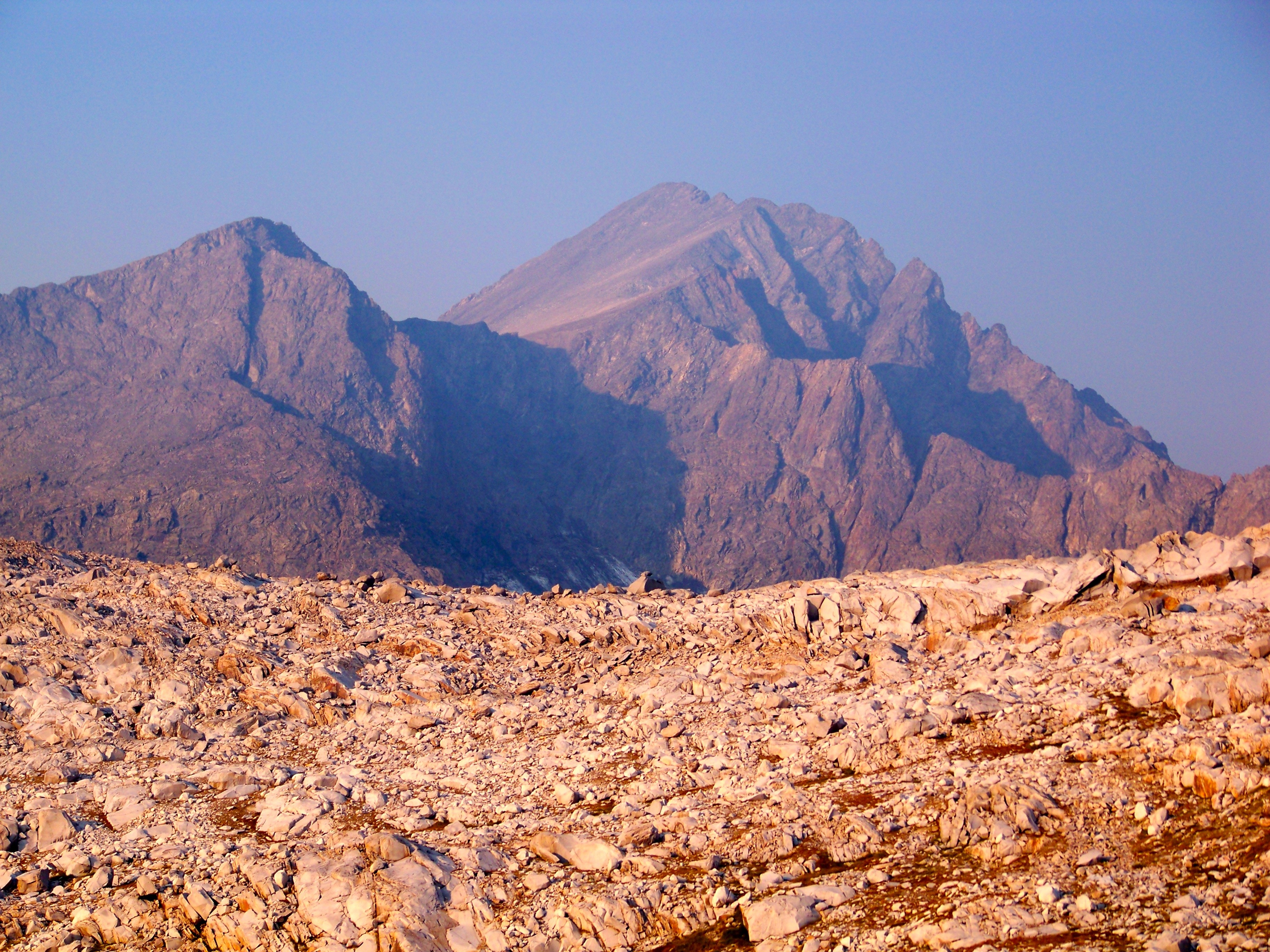
Shortly after leaving the meadow the LA fellas caught up. We pushed each other to go farther than each expected. In truth, there really is no good spot to camp (heading east) once past Pine Creek Pass trail junction. As the miles and afternoon went by we finally came upon a stream heading out of lower Desolation Lake. Refilling bladders and soaking feet we all made the decision to tackle Piute Pass. She was in sight. Humphrey’s Basin resembled a moonscape. Rolling hills, north to south.
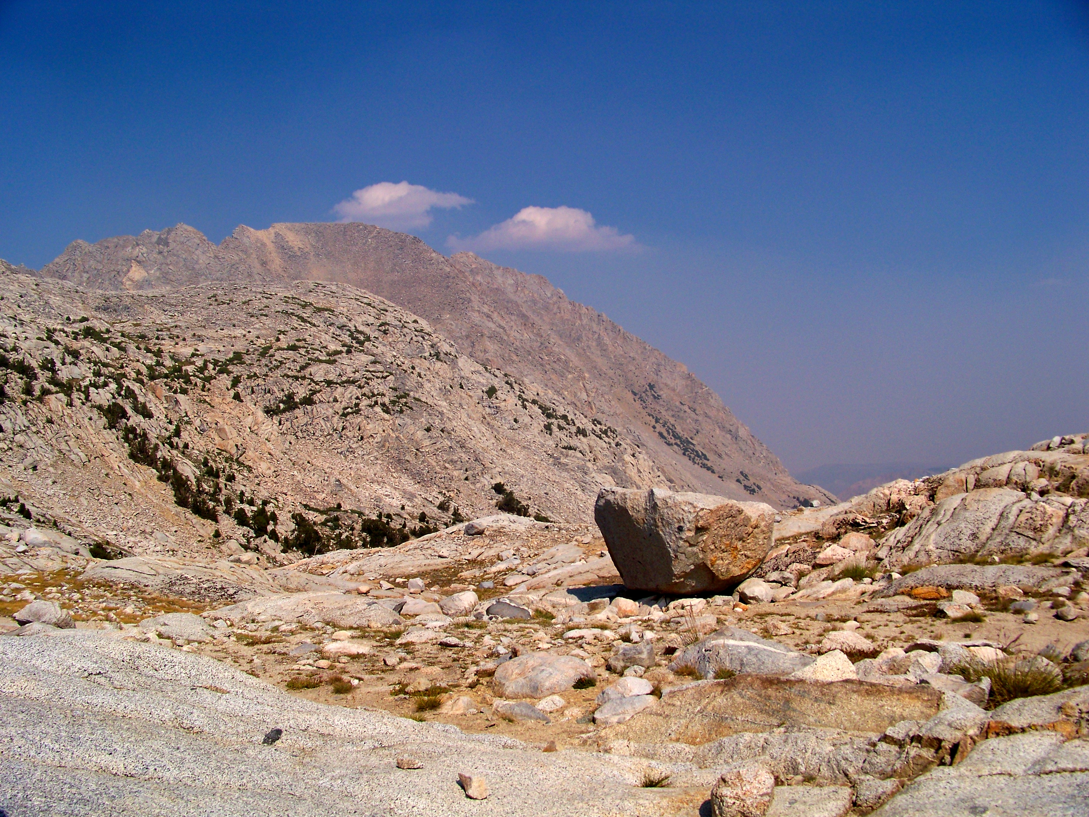
 remnants of Matthes Glacier by clifton dobbie, on Flickr
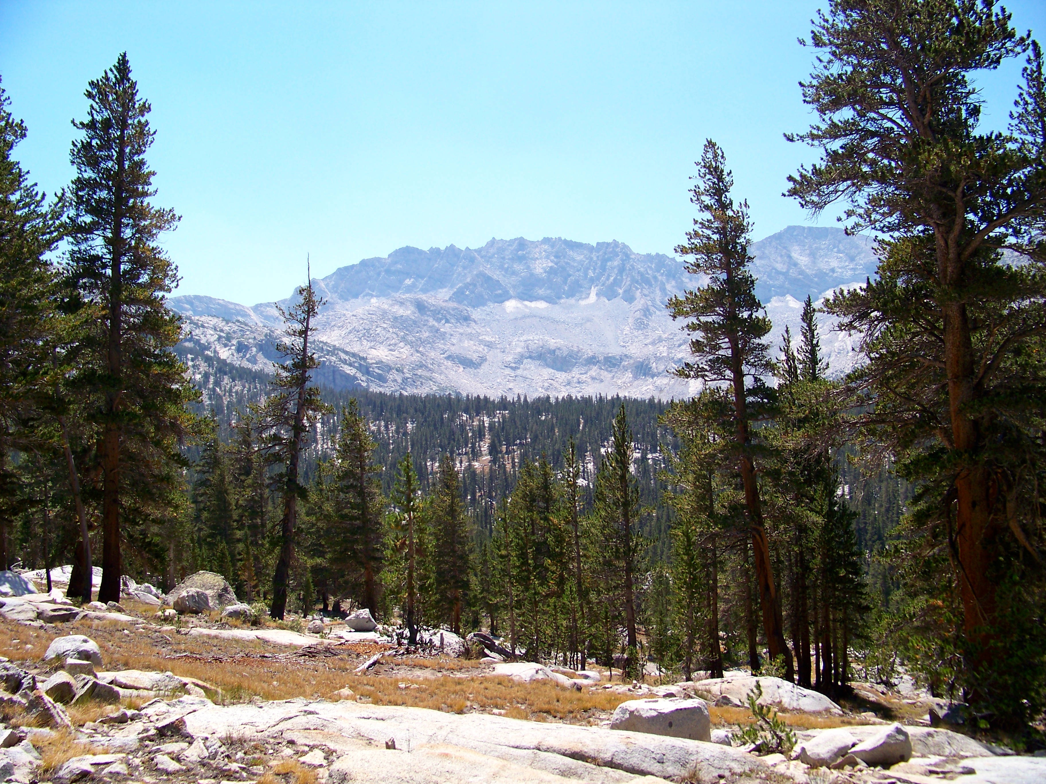
 Mt. Humphreys by clifton dobbie, on Flickr
Within a hour we had bagged Piute Pass.
 Mt. Emerson by clifton dobbie, on Flickr
 atop Piute Pass by clifton dobbie, on Flickr
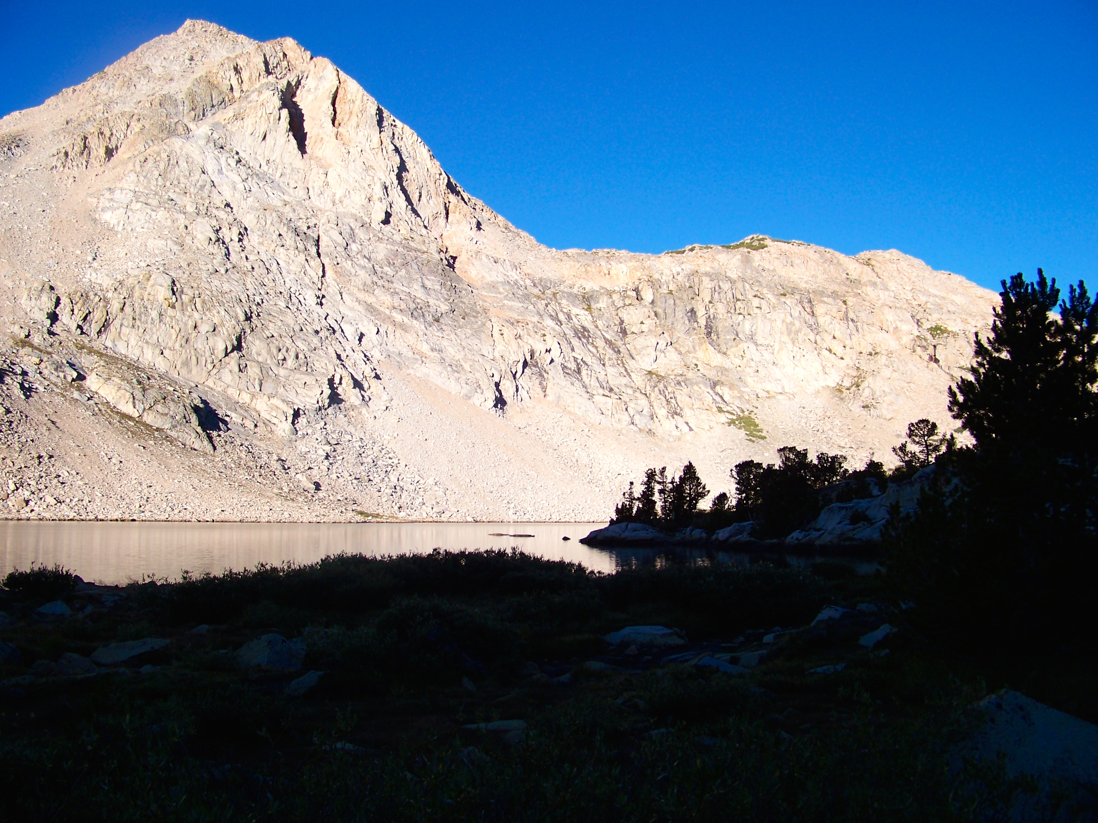
Next stop, Piute Lake. Roughly 2 miles & 1K ft down.
 Piute Lake by clifton dobbie, on Flickr
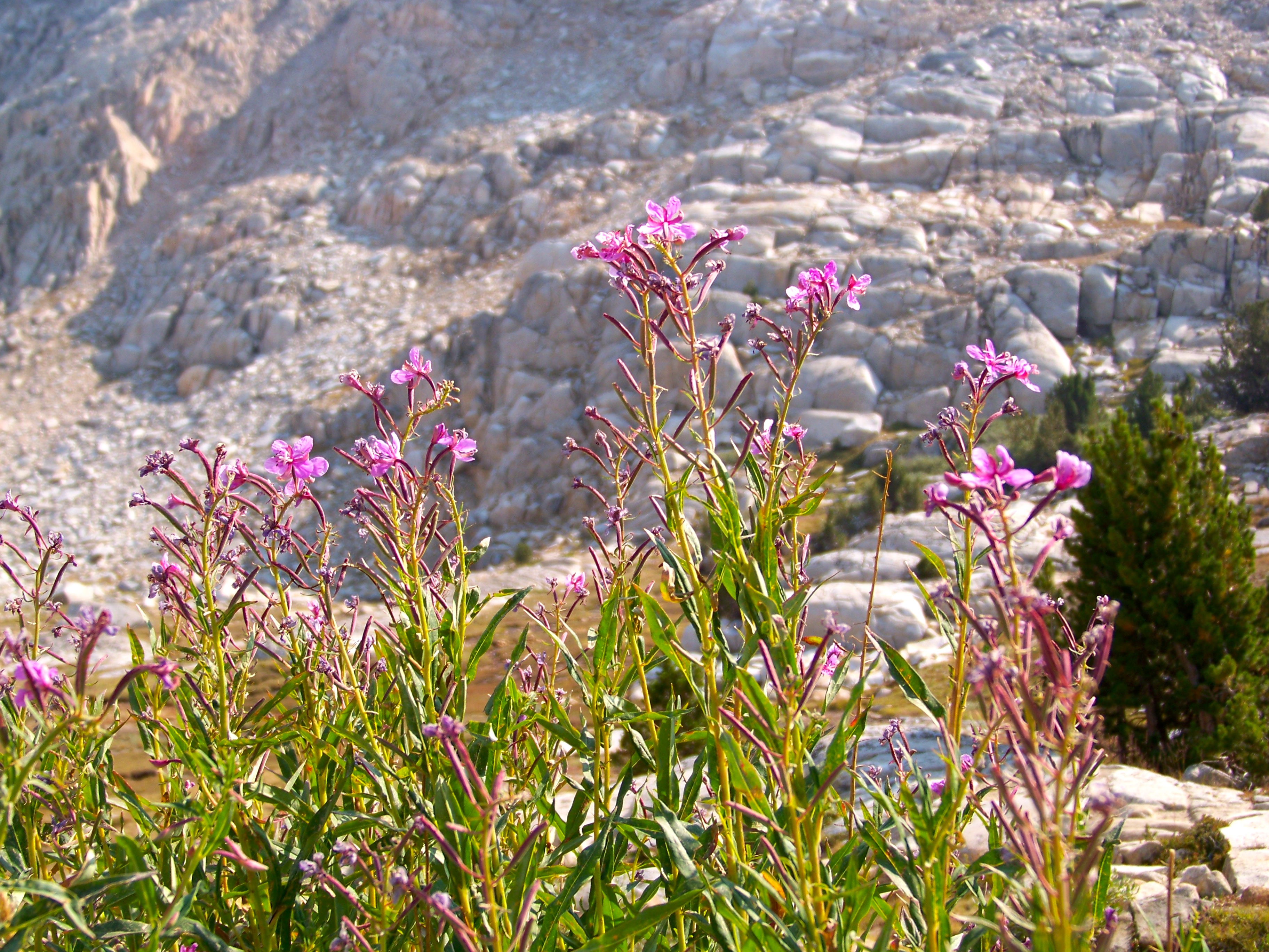 Fireweed by clifton dobbie, on Flickr
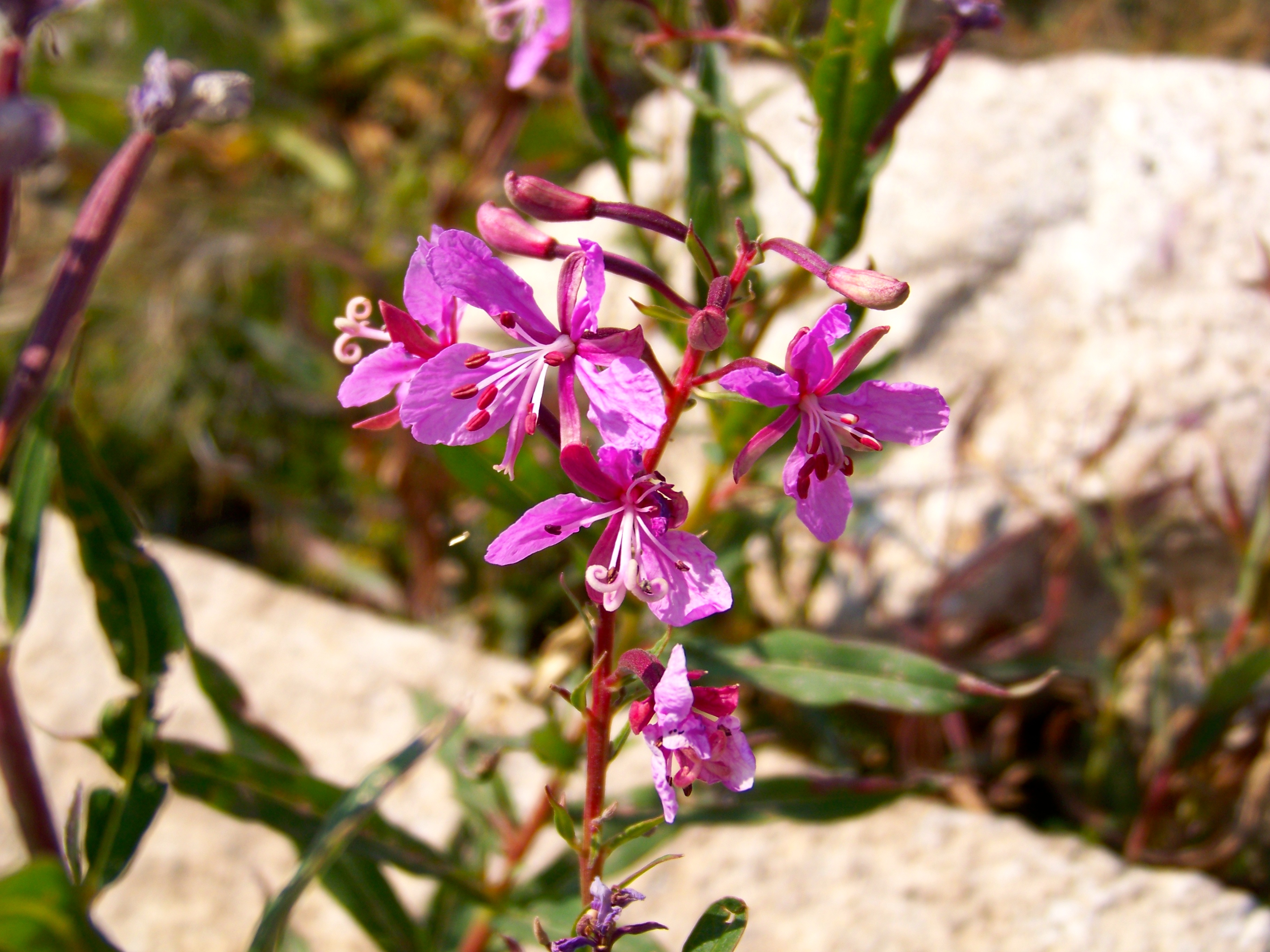 Fireweed by clifton dobbie, on Flickr
As the waxing moon set over the mountain along Piute Lake the coyotes began to sing.
Day 6: Piute Lake to North Lake
3.4 miles
Departing early combined with short mileage made for an easy hike out.
 Loch Leven Lake by clifton dobbie, on Flickr
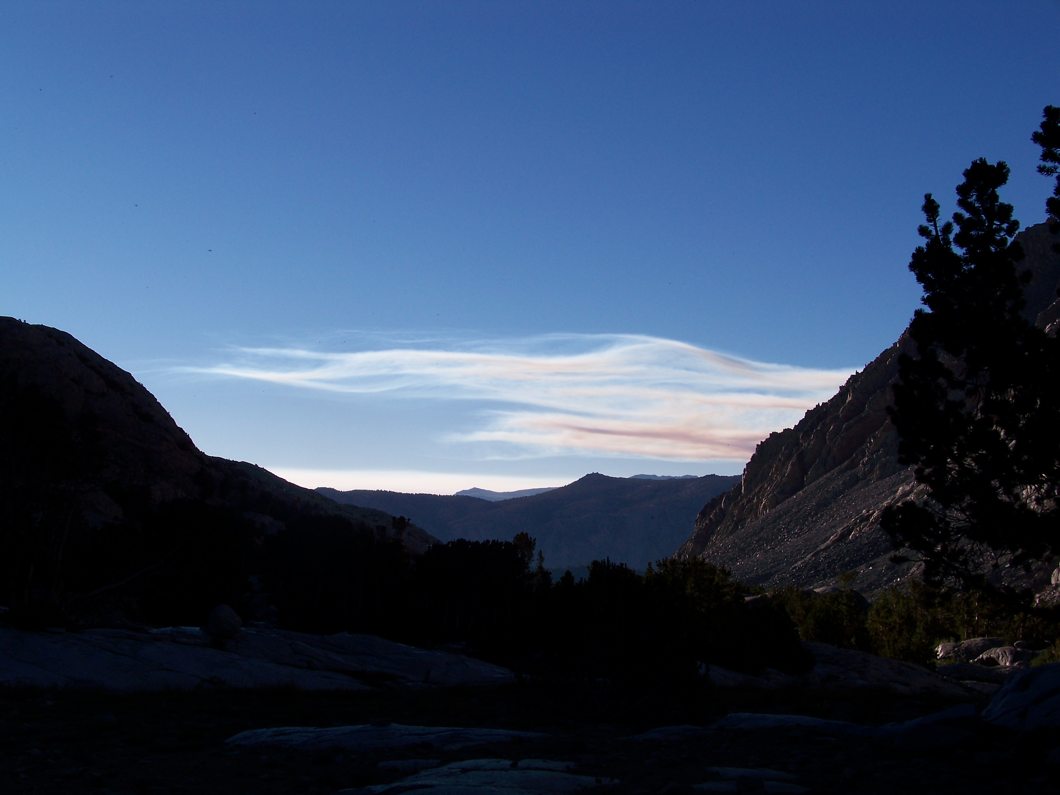 morning glow atop Owens Valley by clifton dobbie, on Flickr
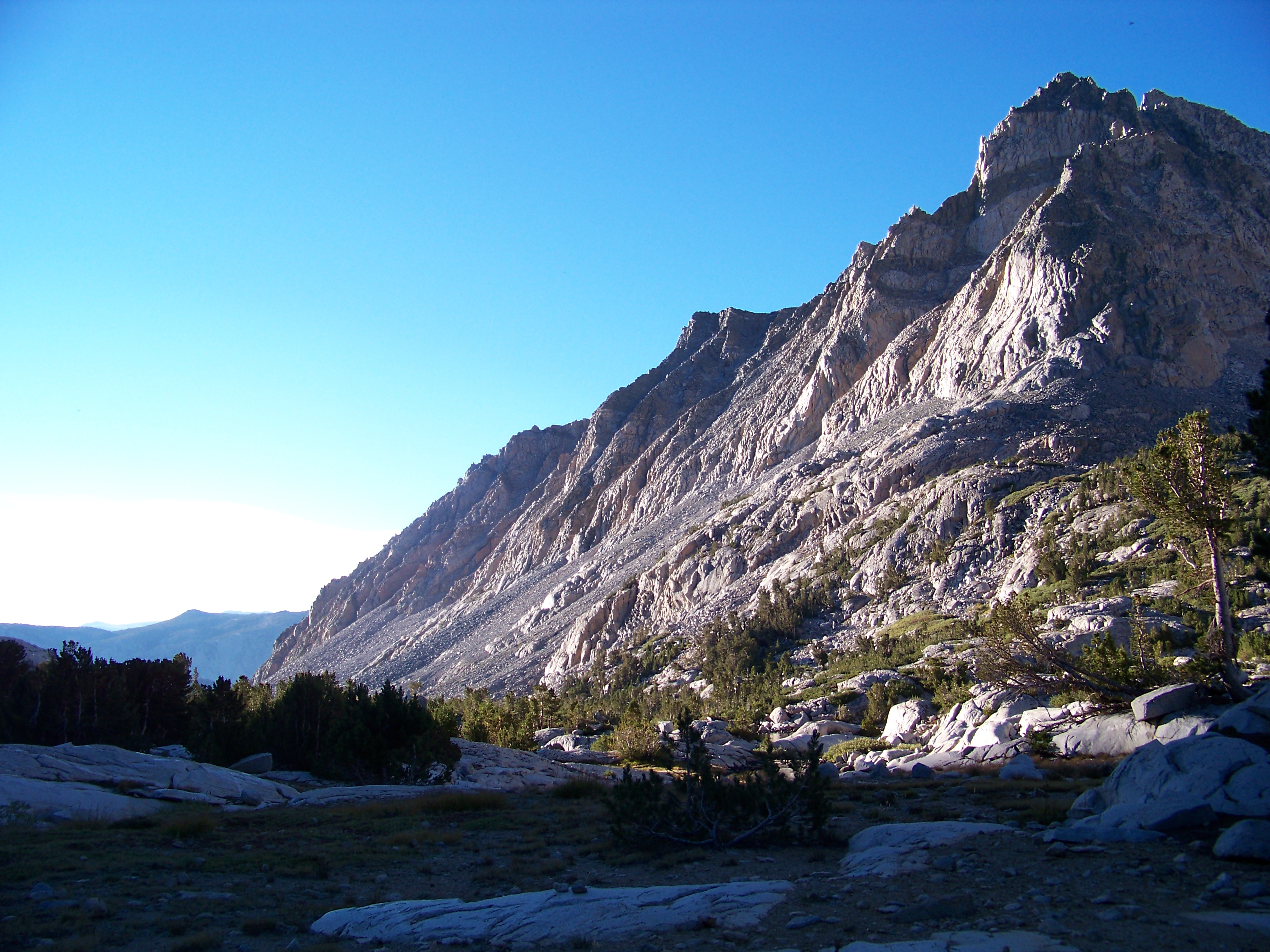 Piute Canyon by clifton dobbie, on Flickr
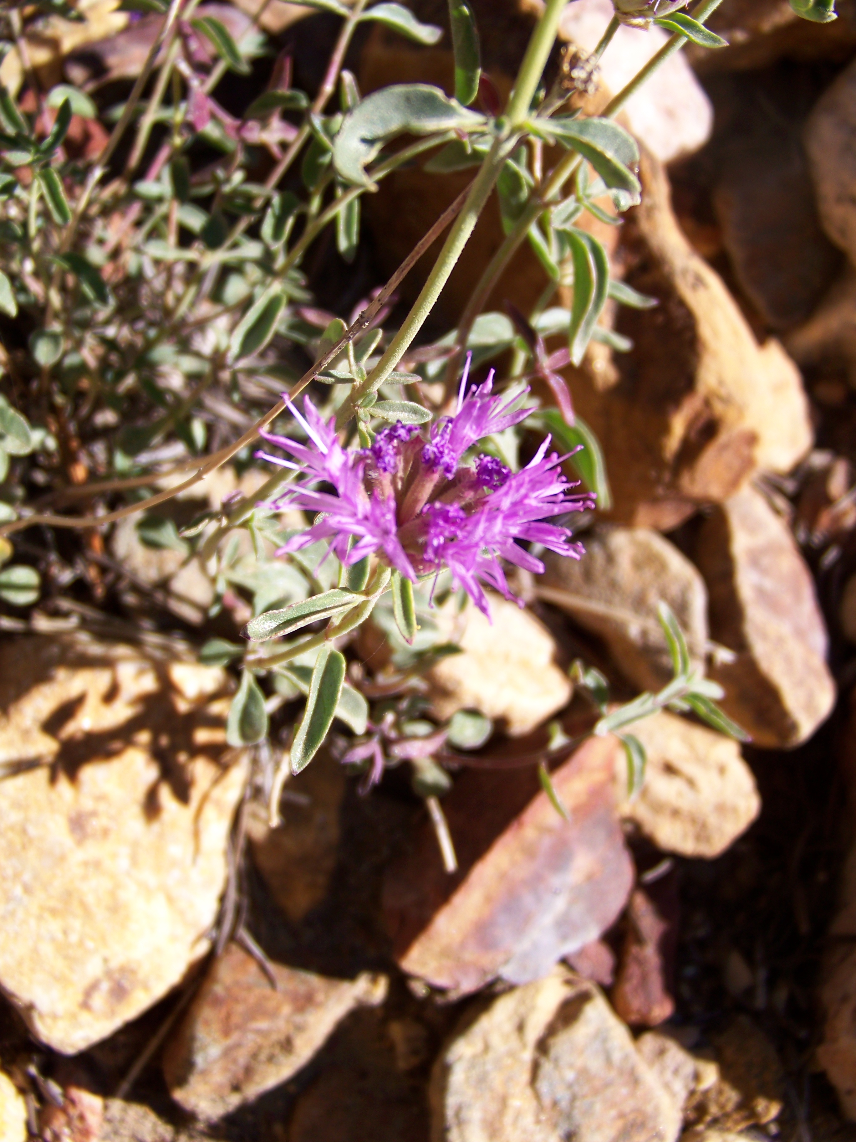 unknown Wildflower by clifton dobbie, on Flickr
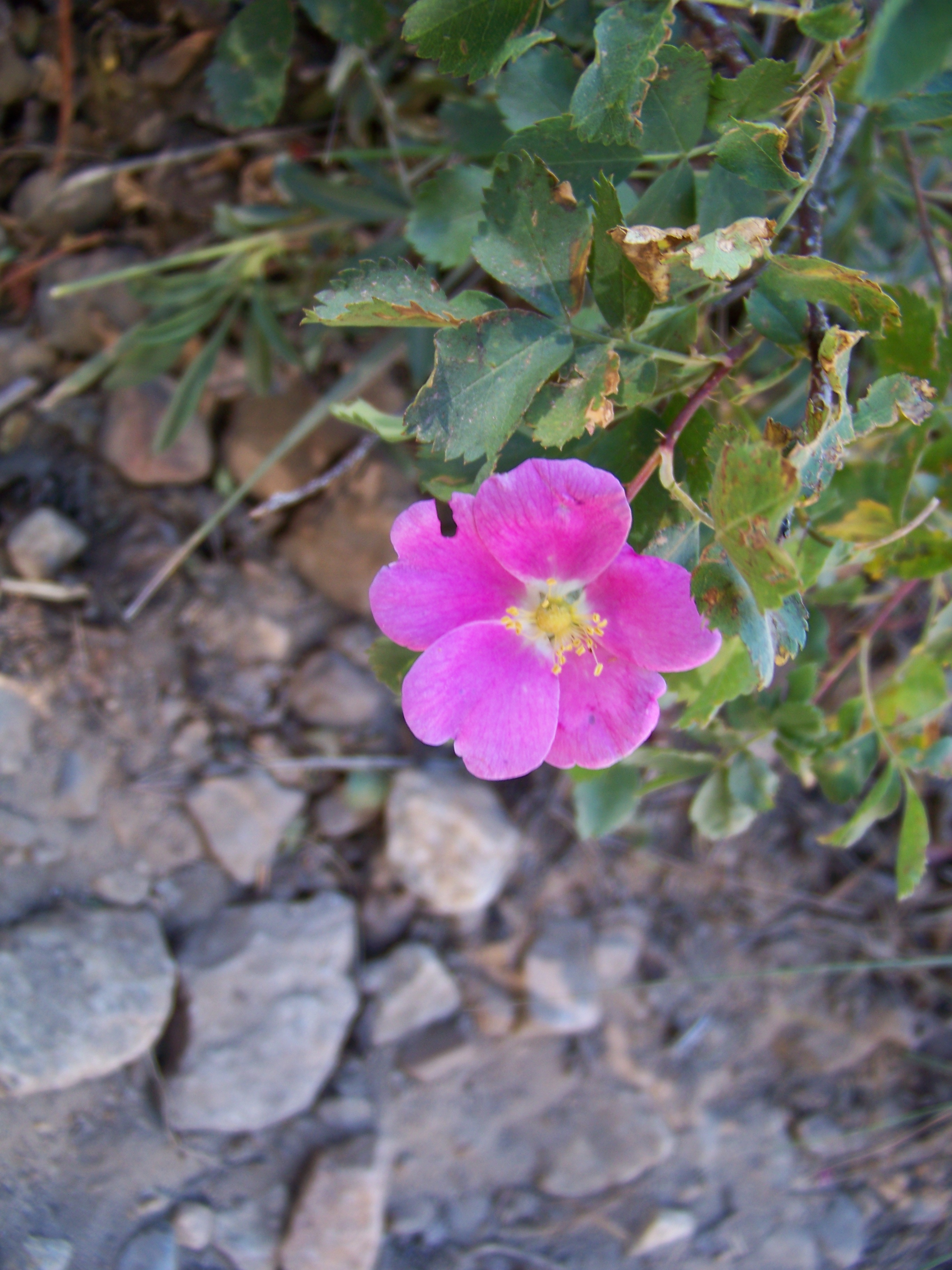 Ground Rose aka Rosa spithamea by clifton dobbie, on Flickr
 end of the line by clifton dobbie, on Flickr
We arrived at North Lake as the glampers were arising for their morning coffee. What an epic trip.
Distance: 51.4 miles
Featured image for home page:

The drive to Bishop from the Bay Area takes on average 6-7 hours. Best part of the journey is rolling through Yosemite. Challenging part is attempting to enter and pass through in a reasonable time on a Saturday. Enter by 10:30 am or prepare to wait. Small break at Tenya Lake and then off to Whoa Nellie Deli in Lee Vining. While exiting Tioga heading east the line to enter was nearly 2 miles long. Crazy chit. Enjoying mountain air @ Whoa Nellie Deli (around 1pm) I watched the Walker Fire build a large plume. The next morning I learned Tioga Pass had been closed a couple hours after passing through. A sign of good fortune to come.
The plan was to pick permit up at White Mountain Ranger Station, grab last minute supplies and head up Rte. 168 locating campsite to acclimate. Last year I came down with AMS hiking in this area; it was a concern heading into a long journey. The sooner I could locate a campsite the better. First, a smoothie from legendary Eastside Juice in Bishop. A must before entry and exit - day hike or multi day trip. Arriving at North Lake (exit point) all sites were taken, but later did I learn there are sites not seen from road. Heading back down to Sabrina Campground I grabbed #10 around 2:30 pm. One surprise driving up from Owens Valley was the air condition. The Rough Fire would be wreaking havoc the next few days. Once camp was set, hiked/climbed in the area to adjust body. Later that evening an Arabian Dance Party went off. Must say.. twas enjoyable.
Map: http://caltopo.com/m/0C44
(data is estimate)
Day 1 - South Lake to LeConte Ranger Station
10.5 miles
Early start as Gigi from Eastside Ride was set to pick up at 6 am (sharp!) Prompt she was. A little rushed I forgot mp3 player and moleskin. One item I could live without and one item desperately needed. Arriving at South Lake TH @ 6:30 am, watching Gigi head off I wondered “what have I done!?”. My main decision to start at South Lake was due to the gradual incline Bishop Pass offered compared to Piute Pass from North Lake. The downside, you lost all elevation gained later in day (or the following day) only to be faced with climbing LeConte Canyon. Finally getting started shortly after 6:30 am spirits were up while the sun began to shine.
onwards & upwards to Bishop Pass by clifton dobbie, on Flickrclimbing to Bishop Pass by clifton dobbie, on FlickrAs the morning gently passed into afternoon the skies began to haze up. Beautiful mornings followed by hazy afternoons were the norm all throughout trip. Before reaching Bishop Pass I was presented with first test: Camelbak leakage. I had not sealed bladder correctly. The good news - Camelbak Stoaway pushed leaking water to a central point, allowing water to drop out of pack at base of back; leaving bag & down jacket unscathed. Bishop Pass was reached @ 12:30 pm; flat plateau resembling a moonscape.
Bishop Pass by clifton dobbie, on FlickrUpper Dusy Basin Lakes by clifton dobbie, on FlickrPalisades by clifton dobbie, on FlickrPlan for the day was to tackle Bishop Pass and camp in Dusy Basin. Once into Dusy Basin the smoke became thick. Ran into a solo JMT through hiker bailing due to how congested it was down in LeConte Canyon. Not a good sign. Thankfully I do not have asthma or any other related health issues dealing with smoke. I kinda enjoyed the smell. Stopped to enjoy lunch overlooking Dusy Basin with another solo hiker heading to Cedar Grove. He was trekking directly into the direction of fire. Thankfully, I was heading north (away) once reached canyon floor. By 4:30 pm I had arrived at LeConte Ranger station; view = 3.371555%.
LeConte Canyon glow by clifton dobbie, on FlickrCamped at the confluence of Dusy Basin creek & creek flowing out of LeConte. No other soul camped in area. The solitude was comforting.
Day 2: LeConte Ranger Station to Wanda Lake
9.3 miles
Ahead of schedule, today’s goal was to reach Helen Lake just below Muir Pass; 8 miles roughly 3k ft. Taking into account the prior day's feat I second guessed self many times all throughout the climb up (up! up! UP!) LeConte Canyon. Starting @ 8:30 am making good time through Big Pete Meadow (which offers many good camping options), smoke was thick offering no views whatsoever of the gargantuan mountains that lie ahead. Yes, it was a major bummer no views were available. Joked this must be what it's like to hike in China. Taking in the mountains silhouette views, knowing next trip different views will be had. I’ll be returning, dragging Mark, no doubt about it.
Helen Lake [Mt. Solomons in background] by clifton dobbie, on FlickrMany of the trekkers were hiking the JMT North to South. As they passed, coming over Muir Pass they raised concern of smoke and urged me to hike over Muir Pass into Evolution Basin. Running on fumes at Helen Lake I took a short break, refilled the bladder and decided to tackle Muir Pass. False summit after false summit; least that’s how it felt. Finally, reaching pass @ 4:30 pm I ran into a father/son duo who were hiking North Lake to South Lake. We chatted for a bit of what lies ahead for each. Dad's joked if I would be completing loop in 4 days. We all shared a good chuckle. If memory serves, they were on Day 6.
Exhausted, it was slow going heading down to Wanda Lake. Arriving at the the north end around 5:30 pm, mentally & physically wiped, I spotted a beautiful site facing Muir Pass. Campsite offered a kitchenette and recliner. As the evening progressed I was not 100%. Packit Gourmet Chicken & Dumplings hit the spot. I can not say enough good things about Packit. The only downside is the plethora of garbage. Slowly recharging, sunset began to set in offering prime alpenglow.
Alpenglow Along Muir Pass by clifton dobbie, on FlickrDay 3: Wanda Lake to McClure Meadow
7.7 miles
Sunrise set the tone for the day. By the end of this glorious day, shutter fatigue had set in.
Muir Pass sunrise by clifton dobbie, on FlickrAhead of schedule I decided to enjoy Wanda Lake to the fullest. Goddard Divide felt as if one could reach out and touch. A ledge up Scott from Oakland, CA had camped the night before. He too was out snapping away at Wanda's glory.
Wanda Lake by clifton dobbie, on FlickrMt. Goddard by clifton dobbie, on FlickrThe original plan for Day 3 was to camp @ Evolution Lake. That option was out as wanted to tally more miles for the day. Evolution Basin lives up to the hype and then some. The auras felt were unreal. The Hermit, Mt. Mendel & Mt. Darwin, oh my! Sapphire Lake looks to be a primo spot to set up base camp. I regret not taking more pictures of the upper basin.
down to Evolution Valley by clifton dobbie, on Flickrdown [some more] to Evolution Valley by clifton dobbie, on FlickrThe Hermit by clifton dobbie, on FlickrEvolution Lake by clifton dobbie, on FlickrAs one climbs down from Evolution Basin you first come to Colby Meadow & McClure Meadow, before reaching Evolution Valley. Colby Meadow offers a primo site along Evolution Creek with many pools to soak or fish. I stopped, pondered and made a wrong decision to head for McClure Meadow. While the sites @ McClure Meadowvare nice, none came close to the site @ Colby. Spent remainder of day doing chores, lounging & reading Jack Kerouac: Big Sur.
As the afternoon waned a pack train arrived. All throughout the evening 2 horses (in love w/ one another) roamed McClure Meadow; twice coming into camp.
McClure Meadow Guardians by clifton dobbie, on FlickrMt. Mendel & Mt. Darwin by clifton dobbie, on FlickrLupine by clifton dobbie, on FlickrFires do offer glorious sunsets.
McClure Meadow by clifton dobbie, on FlickrMcClure Meadow sunset by clifton dobbie, on FlickrMcClure Meadow sunset by clifton dobbie, on FlickrClouds over McClure by clifton dobbie, on FlickrDay 4: McClure Meadow to Piute Creek/JMT (John Muir Trail)
7 miles
One more easy day before heavy work. But first!, the famous crossing of Evolution Creek. Even in a (mega) drought year the creek was still flowing; by no means raging. Bringing no other footwear, crossing would need to take place boots on. Thank you, Keen Dry! Safely made across with minimal wettage. The first half of trip has mainly been in solitude; yes, I would interact with trekkers, but never connecting with any. At the Goddard/JMT trail intersection I met Pete from Santa Cruz. This dude was getting back into backpacking and chose Evolution Valley/Basin. He shared a story of his first trip into Kings Canyon with a mule, never letting go of the reigns, the whole trip. Pete inquired of my route, reacting in shock I would be heading up Piute Creek from the West (not the first time received
. He offered tips (stressed!) to start early. EARLY. I was aware the first mile = steep. Pete informed it was very exposed. He also bursted my bubble I would not be stopping at Muir Ranch. Muir Ranch offers rooms, hot mineral tubs & showers for the right price. It is also a main restock point for JMT & PCT trekkers. Packers can camp nearby enjoying hot mineral baths not associated with Muir Ranch. I was hoping to grab a new can of gas. I’ve been dealing with a leaker since Day 1. A small backup was in the pack so I was not overly concerned.Evolution Creek by clifton dobbie, on FlickrGranting Pete safe journey I headed down the final stretch of the JMT to Piute Creek. Campsite was empty @ 2pm. Set up camp then enjoyed the pools along Piute Creek. Rested, read more of Kerouac and rested some more. It was going to be an early start.
The Road to Evolution by clifton dobbie, on FlickrPavillion Dome by clifton dobbie, on FlickrJohn Muir Wilderness - Piute Creek by clifton dobbie, on FlickrDay 5: Piute Creek/JMT to Piute Lake
13.5 miles
Never in my wildest dream did I think Piute Pass would be made this day. Breaking camp early, out by 6am, I met a couple Aerospace Engineers from LA camping about .25 miles up Piute Creek. They were heading out to North Lake in need of a ride to South Lake. Obliging to assist, I trekked on knowing our paths would cross later in morning. The first mile is no joke. Short, steep, rocky switchbacks. My kinda switchbacks! Making good time, watering up in Hutchinson Meadow, thankfully doing so cause the next water source was nearly 6 miles away.
Piute Canyon by clifton dobbie, on FlickrPiute Canyon by clifton dobbie, on FlickrShortly after leaving the meadow the LA fellas caught up. We pushed each other to go farther than each expected. In truth, there really is no good spot to camp (heading east) once past Pine Creek Pass trail junction. As the miles and afternoon went by we finally came upon a stream heading out of lower Desolation Lake. Refilling bladders and soaking feet we all made the decision to tackle Piute Pass. She was in sight. Humphrey’s Basin resembled a moonscape. Rolling hills, north to south.
remnants of Matthes Glacier by clifton dobbie, on FlickrMt. Humphreys by clifton dobbie, on FlickrWithin a hour we had bagged Piute Pass.
Mt. Emerson by clifton dobbie, on Flickratop Piute Pass by clifton dobbie, on FlickrNext stop, Piute Lake. Roughly 2 miles & 1K ft down.
Piute Lake by clifton dobbie, on FlickrFireweed by clifton dobbie, on FlickrFireweed by clifton dobbie, on FlickrAs the waxing moon set over the mountain along Piute Lake the coyotes began to sing.
Day 6: Piute Lake to North Lake
3.4 miles
Departing early combined with short mileage made for an easy hike out.
Loch Leven Lake by clifton dobbie, on Flickrmorning glow atop Owens Valley by clifton dobbie, on FlickrPiute Canyon by clifton dobbie, on Flickrunknown Wildflower by clifton dobbie, on FlickrGround Rose aka Rosa spithamea by clifton dobbie, on Flickrend of the line by clifton dobbie, on FlickrWe arrived at North Lake as the glampers were arising for their morning coffee. What an epic trip.
Distance: 51.4 miles
Featured image for home page: