- Joined
- May 31, 2015
- Messages
- 3,306
January 6, 2018
This may be my favorite day hike. It may also be the hardest one I've ever done.
I went with my friends Gavin, Michelle, and Tyson down to Zion last weekend. It was my first time seeing the park. I had avoided the area entirely, mostly because of how crowded I had heard that it usually was. I began to look more deeply into the matter and found that there are some awesome off-trail routes, away from the main attractions, that see little traffic.
We went down the night before, ate dinner in Hurricane, and slept at a heavily used (but nearly empty that night) BLM spot along the Left Fork of North Creek. We were up before dawn, since we knew we would need to get an early start so we could hopefully have enough daylight. Estimates for the length of the route we were doing ranged from 12 miles, which I had mapped, to 15 miles, according to someone's GPS track. Routefinding was supposed to be somewhat challenging, but the ruggedness of the terrain was what was going to be the real butt kicker. The route started from the Wildcat Trailhead, dropped down to the Left Fork of North Creek, ascended the other side, and then climbed out of a wash onto slickrock, then on to the summit.
We were the only ones at the trailhead, and we got going quickly. The first miles through the ponderosa forest were very pleasant. I love ponderosa pines so much. We saw 20-30 deer up there as well. Quite a few bucks.
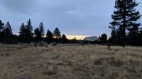
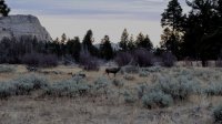
After 2 miles, we got to the end of the trail. We read the map briefly and headed down.
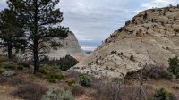
We walked through a bit more pine, and then we got to the rocks and the steeper part of the descent.
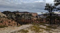
And we got our first good views of our objective for the day. And of how challenging the day would be. After climbing out of the Subway, our route would eventually lead us around the left side of the rock wall to the left of South Guardian in this picture.
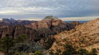
South Guardian Angel on the left, and the flanks of North Guardian Angel on the right.
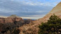
North Guardian Angel and Michelle.
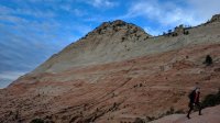
Gavin and Tyson making their way past some interesting chimney-like formations.
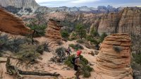
Tyson getting wild.
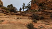
The famed Subway route is in the deep canyon below. I'm looking at a part of the the canyon that's a little upstream of the Subway itself.
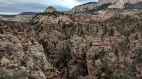
We ended up a bit too far to the west of the point we were supposed to descend. This was in part due to my phone being unable to acquire a GPS signal for some reason. We had a paper map with the route on it though, and that helped a lot. So we hunted around for the right way to get down, using up valuable time and getting ripped up by thorns and branches. I was starting to worry we'd end up having to turn back. We eventually did find a way that looked doable, and we found a few cairns on the way down that helped confirm our hunch. Whoever established this route was dedicated. After we had seen the whole thing, it looked like this was the only way to descend to the creek without falling off of a cliff or ending up a ways farther upstream with lots of swimming and wading. There were still lots of brambles to crash through on the way down though.
I didn't take any other pictures of the descent. It was very steep, rocky in places, and there was a good bit of class 3 scrambling. The last stretch was very sandy, and there were actually still some red leaves on some of the trees down there. We were thrilled we had made it down.
We took a nice break in the Subway.
Looking down the Left Fork of North Creek.
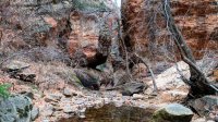
Looking upstream.
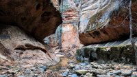
The climb out was a bit more technical, but it didn't take nearly as long. The first part of the ascent was 2 kind of sketchy scrambles. Probably class 4 with some exposure.
We got to the top, and we followed a wash around a big rock wall. Nice ponderosas again.
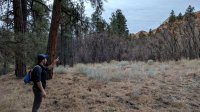
The wash ended at some slickrock, where the ascent of SGA began.
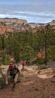
This is looking to the east. SGA is at my back.
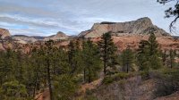
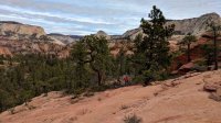
The orange rock here is what the wash we followed took us around.
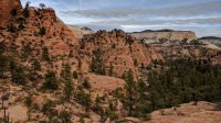
We took a quick break, and Michelle decided to stop and wait for the rest of us to go up and come back down. We had set a hard turn around time for 12:30, and it was 11:50. We weren't sure we could make it, but we decided we'd try anyway.
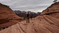
South Guardian Angel peeking out from behind some lower orange slickrock.
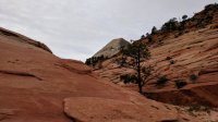
Here's a better look at South Guardian Angel, taken by Michelle. We largely just followed that ridge to the top.
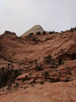
Looking back.
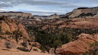
Tyson making his way up.
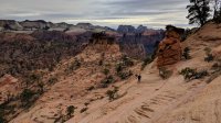
Getting a bit steeper.
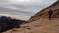
Gavin scrambling up.
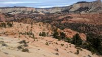
Views getting even better and rock getting lighter.
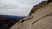
Gavin climbing up. I think that's the Left Fork down there.
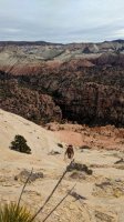
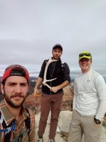
The last stretches were pretty steep, and we were feeling pretty beat. We made it to the top though, and the views were great. It was 12:23, so we had some time for a brief rest. We signed the summit register, which was just some paper in a Ziploc, tucked in a crack with an antler placed over it.
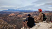
Looking west.
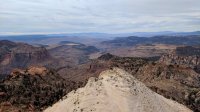
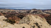
Looking northeast.
Gavin, Tyson, Jackson.
We made our way back down, and some of the sketchy spots felt even sketchier. My legs had started cramping too, but it was quickly cured by an apple that Gavin gave me. Not entirely sure why, but it worked great.
We met back up with Michelle and started down the wash.
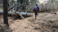
We overshot the drop-in point, but we backtracked and found it. A few rain drops started to fall, but fortunately, the rain held off.
The downclimbs on the class 4 spots were just as tricky as the ascents. You can see the others descending here. I'm standing at the base of the creek.
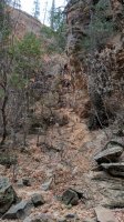
The climb back up the north side was brutal. Those class 3 scrambles were much more challenging on the way up than they were on the way down. Maybe I was just tired.
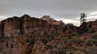
We kept moving at a pretty good pace, hoping to get back to the trailhead before the rain/snow hit. Heading through the forest at dusk was very pleasant.
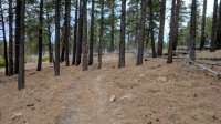
And we made it back before it got dark. Not too busy at the trailhead.
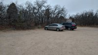
It started raining not too long after we got out of there. Everything ended up being timed perfectly. Awesome trip.
This may be my favorite day hike. It may also be the hardest one I've ever done.
I went with my friends Gavin, Michelle, and Tyson down to Zion last weekend. It was my first time seeing the park. I had avoided the area entirely, mostly because of how crowded I had heard that it usually was. I began to look more deeply into the matter and found that there are some awesome off-trail routes, away from the main attractions, that see little traffic.
We went down the night before, ate dinner in Hurricane, and slept at a heavily used (but nearly empty that night) BLM spot along the Left Fork of North Creek. We were up before dawn, since we knew we would need to get an early start so we could hopefully have enough daylight. Estimates for the length of the route we were doing ranged from 12 miles, which I had mapped, to 15 miles, according to someone's GPS track. Routefinding was supposed to be somewhat challenging, but the ruggedness of the terrain was what was going to be the real butt kicker. The route started from the Wildcat Trailhead, dropped down to the Left Fork of North Creek, ascended the other side, and then climbed out of a wash onto slickrock, then on to the summit.
We were the only ones at the trailhead, and we got going quickly. The first miles through the ponderosa forest were very pleasant. I love ponderosa pines so much. We saw 20-30 deer up there as well. Quite a few bucks.


After 2 miles, we got to the end of the trail. We read the map briefly and headed down.

We walked through a bit more pine, and then we got to the rocks and the steeper part of the descent.

And we got our first good views of our objective for the day. And of how challenging the day would be. After climbing out of the Subway, our route would eventually lead us around the left side of the rock wall to the left of South Guardian in this picture.

South Guardian Angel on the left, and the flanks of North Guardian Angel on the right.

North Guardian Angel and Michelle.

Gavin and Tyson making their way past some interesting chimney-like formations.

Tyson getting wild.

The famed Subway route is in the deep canyon below. I'm looking at a part of the the canyon that's a little upstream of the Subway itself.

We ended up a bit too far to the west of the point we were supposed to descend. This was in part due to my phone being unable to acquire a GPS signal for some reason. We had a paper map with the route on it though, and that helped a lot. So we hunted around for the right way to get down, using up valuable time and getting ripped up by thorns and branches. I was starting to worry we'd end up having to turn back. We eventually did find a way that looked doable, and we found a few cairns on the way down that helped confirm our hunch. Whoever established this route was dedicated. After we had seen the whole thing, it looked like this was the only way to descend to the creek without falling off of a cliff or ending up a ways farther upstream with lots of swimming and wading. There were still lots of brambles to crash through on the way down though.
I didn't take any other pictures of the descent. It was very steep, rocky in places, and there was a good bit of class 3 scrambling. The last stretch was very sandy, and there were actually still some red leaves on some of the trees down there. We were thrilled we had made it down.
We took a nice break in the Subway.
Looking down the Left Fork of North Creek.

Looking upstream.

The climb out was a bit more technical, but it didn't take nearly as long. The first part of the ascent was 2 kind of sketchy scrambles. Probably class 4 with some exposure.
We got to the top, and we followed a wash around a big rock wall. Nice ponderosas again.

The wash ended at some slickrock, where the ascent of SGA began.

This is looking to the east. SGA is at my back.


The orange rock here is what the wash we followed took us around.

We took a quick break, and Michelle decided to stop and wait for the rest of us to go up and come back down. We had set a hard turn around time for 12:30, and it was 11:50. We weren't sure we could make it, but we decided we'd try anyway.

South Guardian Angel peeking out from behind some lower orange slickrock.

Here's a better look at South Guardian Angel, taken by Michelle. We largely just followed that ridge to the top.

Looking back.

Tyson making his way up.

Getting a bit steeper.

Gavin scrambling up.

Views getting even better and rock getting lighter.

Gavin climbing up. I think that's the Left Fork down there.

The last stretches were pretty steep, and we were feeling pretty beat. We made it to the top though, and the views were great. It was 12:23, so we had some time for a brief rest. We signed the summit register, which was just some paper in a Ziploc, tucked in a crack with an antler placed over it.

Looking west.

Looking northeast.

Gavin, Tyson, Jackson.

We made our way back down, and some of the sketchy spots felt even sketchier. My legs had started cramping too, but it was quickly cured by an apple that Gavin gave me. Not entirely sure why, but it worked great.
We met back up with Michelle and started down the wash.

We overshot the drop-in point, but we backtracked and found it. A few rain drops started to fall, but fortunately, the rain held off.
The downclimbs on the class 4 spots were just as tricky as the ascents. You can see the others descending here. I'm standing at the base of the creek.

The climb back up the north side was brutal. Those class 3 scrambles were much more challenging on the way up than they were on the way down. Maybe I was just tired.

We kept moving at a pretty good pace, hoping to get back to the trailhead before the rain/snow hit. Heading through the forest at dusk was very pleasant.

And we made it back before it got dark. Not too busy at the trailhead.

It started raining not too long after we got out of there. Everything ended up being timed perfectly. Awesome trip.
