- Joined
- Oct 30, 2016
- Messages
- 991
I wanted to get out this weekend for a night or two, and had originally intended to head back to Missouri Gulch and tackle some 14ers down there that the weather chased me away from last summer. Then I remembered @Shirt357 talking about South Colony Lakes and as I looked at some recent pictures the Sangres were definitely looking a lot better than the Sawatch area as far as being lush, green and beautiful. So off I went.
As I neared the town of Westcliffe I was a little disappointed to see that smoke from the various wildfires in NM and CO was hazing out the views. Fortunately you're so up close and personal once in the basin, it didn't really impact the views at all.
The forecast called for 80 degree sunny days and it was absolutely an awesome morning for hiking. After a 30 minute two-mile drive up a hellacious road from the lower parking area to the 4x4 parking area at 9900 feet, I started hiking in. The first few miles are a now-closed jeep road which was, ironically, in much better shape than the road I drove up on.
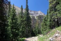
The views get good pretty quick...
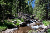
South Colony Creek was flowing decently given how parched this area of the state is. Trout larger than my forearm were circling lazily near the rocks.
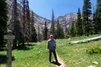
Half the hike threads itself between stretches of privately owned land, but then you hook over in to the basin proper and cross in to the Sangre de Cristo wilderness. It looks more like August than June already down there.
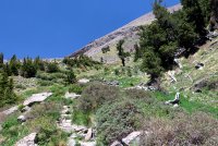
More hiking, more elevation. Eventually the trail turns rocky and then crosses a talus field under the slopes of Humboldt Peak as it nears the lakes area.
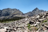
Broken Hand Peak from the south.
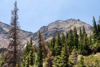
Crestone Needle looming behind the talus.
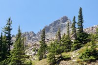
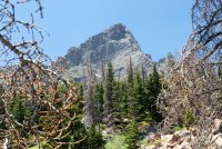
You can see how dry things are for early June. No snow, no mud. A little bit of trickling water here and there are maybe 20 feet of mud on the trail as it rounded the lower lake. I'm glad I made this trip given how things have been going in Colorado lately...
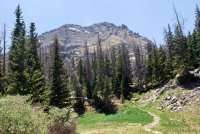
About 4 miles in and here's the lower lake with Broken Hand rising behind it.
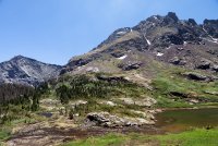
Crestone Needle behind the northern end of the lake. A bit further yet to go.
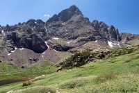
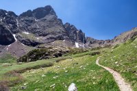
Vanity shot right before the upper lake.
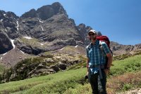
Winds had been picking up as the elevation increased. When I reached the upper lake they were roaring pretty good. I was surprised to see I had good cell signal in here, so I checked the forecast which promised the winds would dissipate at sunset and tomorrow would be another bluebird skies day perfect for some peak bagging.
I wandered around a bit to try and find a spot with some sort of a wind break and set up camp.
Looking back down the valley from camp.
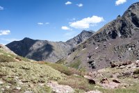
Every time I think about pulling the trigger on a 2-man tent, the 1-man reminds me how nice it is to be able to fit the thing in just about any nook or cranny that presents itself.
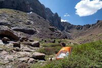
View from the front porch.
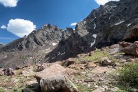
Windier and winder and clouds starting to blow in.
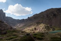
Not much of a sunset, but some nice golden light falling on the peaks.
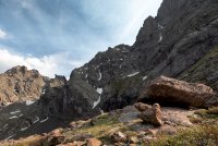
Contrary to the forecast the winds became much, much worse throughout the night. Sleeping was impossible and I had pretty much resigned myself to the fact that I'd be getting a new tent after all as I was certain the poles were going to snap.
What to do in the middle of the night? Thankfully most of the clouds had blown out... There are worse things in life than a windy night at 12000 feet under skies like this.
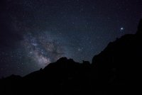
I "woke up" at 5am, realizing that climbing was out but hoping for a good sunrise. This area is supposed to offer one of the quintessential alpenglow photo ops in the state, but sadly it was gray skies all around. The basin offers climbing but little else as it is small and you are completely hemmed in by the surrounding peaks, so there was nothing for it but to pack up and head out.
Good to get out and dust off the gear, and I plan to make a return trip to tackle the 14ers another time.
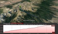
Trip vid:
As I neared the town of Westcliffe I was a little disappointed to see that smoke from the various wildfires in NM and CO was hazing out the views. Fortunately you're so up close and personal once in the basin, it didn't really impact the views at all.
The forecast called for 80 degree sunny days and it was absolutely an awesome morning for hiking. After a 30 minute two-mile drive up a hellacious road from the lower parking area to the 4x4 parking area at 9900 feet, I started hiking in. The first few miles are a now-closed jeep road which was, ironically, in much better shape than the road I drove up on.
The views get good pretty quick...

South Colony Creek was flowing decently given how parched this area of the state is. Trout larger than my forearm were circling lazily near the rocks.

Half the hike threads itself between stretches of privately owned land, but then you hook over in to the basin proper and cross in to the Sangre de Cristo wilderness. It looks more like August than June already down there.

More hiking, more elevation. Eventually the trail turns rocky and then crosses a talus field under the slopes of Humboldt Peak as it nears the lakes area.


Broken Hand Peak from the south.

Crestone Needle looming behind the talus.


You can see how dry things are for early June. No snow, no mud. A little bit of trickling water here and there are maybe 20 feet of mud on the trail as it rounded the lower lake. I'm glad I made this trip given how things have been going in Colorado lately...

About 4 miles in and here's the lower lake with Broken Hand rising behind it.

Crestone Needle behind the northern end of the lake. A bit further yet to go.


Vanity shot right before the upper lake.

Winds had been picking up as the elevation increased. When I reached the upper lake they were roaring pretty good. I was surprised to see I had good cell signal in here, so I checked the forecast which promised the winds would dissipate at sunset and tomorrow would be another bluebird skies day perfect for some peak bagging.
I wandered around a bit to try and find a spot with some sort of a wind break and set up camp.
Looking back down the valley from camp.

Every time I think about pulling the trigger on a 2-man tent, the 1-man reminds me how nice it is to be able to fit the thing in just about any nook or cranny that presents itself.

View from the front porch.

Windier and winder and clouds starting to blow in.

Not much of a sunset, but some nice golden light falling on the peaks.

Contrary to the forecast the winds became much, much worse throughout the night. Sleeping was impossible and I had pretty much resigned myself to the fact that I'd be getting a new tent after all as I was certain the poles were going to snap.
What to do in the middle of the night? Thankfully most of the clouds had blown out... There are worse things in life than a windy night at 12000 feet under skies like this.

I "woke up" at 5am, realizing that climbing was out but hoping for a good sunrise. This area is supposed to offer one of the quintessential alpenglow photo ops in the state, but sadly it was gray skies all around. The basin offers climbing but little else as it is small and you are completely hemmed in by the surrounding peaks, so there was nothing for it but to pack up and head out.
Good to get out and dust off the gear, and I plan to make a return trip to tackle the 14ers another time.

Trip vid:
Last edited:
