uinta_eagle
Free Ranger
- Joined
- Jan 28, 2012
- Messages
- 26
After lurking around this forum for several years, and thoroughly enjoying the vicarious pleasures of reading about your varied and exciting experiences, I've finally found the ambition to contribute a post of my own.
Labor Day weekend, 2013 found me deep in the High Uinta Wilderness on a solo backpacking excursion that GPS logged just shy of 40 miles - starting and ending at the East Fork of the Bear River trail head. I began the trip on Friday, August 30. All my best intentions aimed at getting an early start on the day came to naught. It was a little after noon when I signed the trail register. I camped the first evening in a small meadow just below Priord Lake.
Saturday, August 31, I crossed the crest of the Uintas to the south slope over Ostler Pass (as advertised, the trail is almost non-existent!) From there, I wandered through Upper Rock Creek. The second night was spent just south of Deadhorse Pass where the last of the tree line conifers are anchored on a bench overlooking the Highline Trail.
On Sunday, September 1, I crossed Deadhorse Pass, descended through Buck Pasture on the West Fork of Black’s Fork, then traversed back into the East Fork Drainage using the Bear River – Smiths Fork Trail. My truck rumbled off the mountain just as the last light was fading in the western sky – putting me home on Labor Day to enjoy activities with my family.
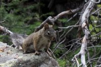
Being a holiday weekend and the last weekend of summer, I expected to share the trails with a lot of human company. Surprisingly, I saw fewer than a dozen people. Almost all were near the West Fork of Blacks Fork trail head engaged in day hikes to fish the river. I saw at least twice that many goats, the largest mule deer buck I've ever seen, and one very curious squirrel.
The weather was beautiful. Other than a few spitting sprinkles, I endured no rain. There were no mosquitoes. Temperatures were mild both day and night.
I have attached a few samples of the scenery.
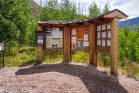
Trail Head at Noon
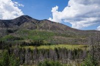
Lingering Effects of the Fire
Almost to Camp
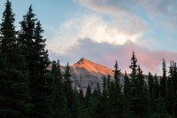
Alpenglow Near Priord
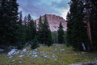
First Morning in Camp
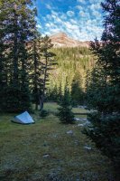
Up the Basin
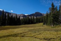
Priord Lake
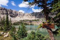
North Over Priord
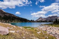
Halfway Up Ostler Pass
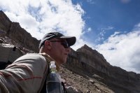
Not Much of a Trail
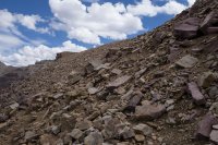
Priord Lake from Ostler Pass
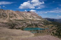
Down the Basin Towards Norice Lake
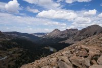
Upper Rock Creek from the Pass
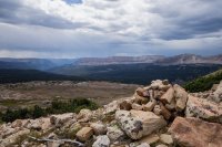
Upper Rock Creek Panorama

Cliffed Out - Spent an hour climbing down from here and spotted the largest buck I have ever seen!
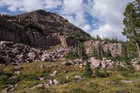
Second Camp - What a View!
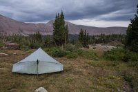
Packed for Home on the Last Morning
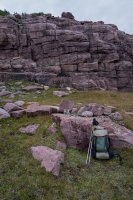
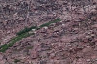
Goats Everywhere!
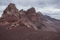
At the Top of Deadhorse Pass
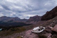
The "Dead" in Deadhorse Pass?
Deadhorse Lake
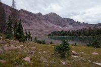
Where I Came From - Looking Up from Buck Pasture
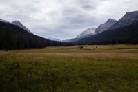
Curious George
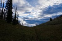
The Last Climb - It's Downhill from Here - Dead Man Pass
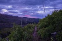
Nearing the Finish Line Just in Time
I would definitely do this trip again... although with a variation. Next time, I would cross over the ridge west of Deadhorse Lake to Allsop Lake and descend back down the East Fork of the Bear drainage to the trail head.
Going down West Fork of Blacks Fork became brutal with the final leg over the Bear River Smith's Fork trail. This trail passes through a lot of burned areas with many elevation gains and losses... Half the distance parallels a road with obviously heavy ATV traffic. I passed through late enough on Sunday evening that most of the traffic had gone back to their camps - I could only hear them in the distance through the trees - but it still wasn't the wilderness experience that I had during the earlier part of the trip.
Featured image for home page:
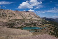
Labor Day weekend, 2013 found me deep in the High Uinta Wilderness on a solo backpacking excursion that GPS logged just shy of 40 miles - starting and ending at the East Fork of the Bear River trail head. I began the trip on Friday, August 30. All my best intentions aimed at getting an early start on the day came to naught. It was a little after noon when I signed the trail register. I camped the first evening in a small meadow just below Priord Lake.
Saturday, August 31, I crossed the crest of the Uintas to the south slope over Ostler Pass (as advertised, the trail is almost non-existent!) From there, I wandered through Upper Rock Creek. The second night was spent just south of Deadhorse Pass where the last of the tree line conifers are anchored on a bench overlooking the Highline Trail.
On Sunday, September 1, I crossed Deadhorse Pass, descended through Buck Pasture on the West Fork of Black’s Fork, then traversed back into the East Fork Drainage using the Bear River – Smiths Fork Trail. My truck rumbled off the mountain just as the last light was fading in the western sky – putting me home on Labor Day to enjoy activities with my family.
Being a holiday weekend and the last weekend of summer, I expected to share the trails with a lot of human company. Surprisingly, I saw fewer than a dozen people. Almost all were near the West Fork of Blacks Fork trail head engaged in day hikes to fish the river. I saw at least twice that many goats, the largest mule deer buck I've ever seen, and one very curious squirrel.
The weather was beautiful. Other than a few spitting sprinkles, I endured no rain. There were no mosquitoes. Temperatures were mild both day and night.
I have attached a few samples of the scenery.
Trail Head at Noon

Lingering Effects of the Fire

Almost to Camp

Alpenglow Near Priord

First Morning in Camp

Up the Basin

Priord Lake

North Over Priord

Halfway Up Ostler Pass

Not Much of a Trail

Priord Lake from Ostler Pass

Down the Basin Towards Norice Lake

Upper Rock Creek from the Pass

Upper Rock Creek Panorama
Cliffed Out - Spent an hour climbing down from here and spotted the largest buck I have ever seen!

Second Camp - What a View!

Packed for Home on the Last Morning

Goats Everywhere!

At the Top of Deadhorse Pass

The "Dead" in Deadhorse Pass?

Deadhorse Lake

Where I Came From - Looking Up from Buck Pasture

Curious George

The Last Climb - It's Downhill from Here - Dead Man Pass

Nearing the Finish Line Just in Time

I would definitely do this trip again... although with a variation. Next time, I would cross over the ridge west of Deadhorse Lake to Allsop Lake and descend back down the East Fork of the Bear drainage to the trail head.
Going down West Fork of Blacks Fork became brutal with the final leg over the Bear River Smith's Fork trail. This trail passes through a lot of burned areas with many elevation gains and losses... Half the distance parallels a road with obviously heavy ATV traffic. I passed through late enough on Sunday evening that most of the traffic had gone back to their camps - I could only hear them in the distance through the trees - but it still wasn't the wilderness experience that I had during the earlier part of the trip.
Featured image for home page:

