- Joined
- Aug 23, 2016
- Messages
- 146
This was to be a “creeks and meadows” trip with swimming holes at each campsite. We came up two days short swimming hole-wise due to poor weather or a late arrival at camp. We had a good time, went through the middle of absolute nowhere, saw some cool wildlife and had one scary encounter. Never underestimate the will of a wild animal to protect her young. Especially if that animal is a . . . wait for it . . . ruffed grouse. More on that later. The route was, of course, more challenging than anticipated and Stacy decided from here on out we are only hiking on trails built and maintained by the National Park Service (and, by the way, we are not hiking over Big Game Ridge again no matter who maintains the trail).
Day 1: YNP South Entrance to 8C6
We picked up our permit, watched the required video and were quickly on the trail. Because of where we parked the first trail we came to was a day use trail for Snake River fishing access and such. We headed along this trail for a few minutes before realizing it could not be right and soon found the proper Snake River Trail. I was reminded of a trip report a while back by @Outdoor_Fool where some backpackers bushwhacked all the way to 8C1 along the river—I’ll bet they started where we did, followed that trail along the river until it petered out, and just kept going.

First crossing of the Snake River

Interesting little hot spring

We took the Basin Creek Cutoff Trail up toward Heart Lake then up Basin Creek and back to the Snake

View from near our campsite, 8C6. The site was recently relocated across the river from its old location.

At the cooking area
Day 2: 8C6 to 8C4 via Basin Creek
We packed up, waded the Snake River and headed up into the trees on the other side. We were not yelling and clapping and carrying on but we were talking and our trekking poles were clattering on the rocks as we ascended onto the river terrace. It seemed to me that any bears in the area would hear us coming, but apparently not. I was in front and made it about five paces into the trees when I spotted the back of a bear apparently digging for something. It was mostly hidden by the four-foot tall vegetation and, luckily, it was facing away from us as it was only about 10 yards off the trail. We backed away quickly and silently and took a wide detour around the area and rejoined the trail further along.

Morning after the first night in our new Tarptent Stratospire II

8C6 is across the river at the far end of the photo. Just across the river from camp is where we saw the bear. We backed out of the woods, detoured via the gravel bar and finally stopped here at the top of the hill. Didn’t see or hear the bear after we left the woods.

We stopped for breakfast at a meadow on Red Creek.

More meadows. This was, after all, a creeks and meadows trip.

The divide above Basin Creek Lake looking southwest across, yes, meadows.

View from near 8B4. We would have hung around here for a little while but the mosquitoes were just awful.

More meadows on the way to 8C4

View downstream from 8C4

Upstream from 8C4. Our route crosses the river just about at the tree line and heads up to the saddle on the horizon.

Kitchen area at 8C4
Day 3: 8C4 to Big Game Ridge
A short day mileage-wise but it promised to be a pretty good climb. Also looked like camp could be suboptimal. So we hung around 8C4 until after noon. We hiked up past the Harebell Patrol Cabin and east along the South Boundary Trail until it zigzagged out of the park part way up Big Game Ridge. We found an ok place to camp and made it work.

On the trail upstream of 8C4 just about at the next ford of the Snake.

Regenerating forest on the way to Harebell Creek

Harebell patrol cabin

We started up Big Game Ridge in earnest after the cabin. I could barely keep up with Stacy.

We encountered a fire-scorched, sun-baked landscape on the way up Big Game Ridge. It made for some harsh walking conditions. Luckily the trail was in good shape. Virtually no shade--it was really hot.

We found an acceptable campsite up where the trail swings south out of YNP

Our cooking area
Day 4: Big Game Ridge to Fox Park
Today we went the rest of the way up Big Game Ridge and down the other side. On the way up we saw another backpacker camping like we did where the trail swings outside the park. As we broke out into the last meadow before reaching the Snake River again we spotted a grizzly down in the flats. It was working its way north along the river valley and would soon cross our path. So we sat back and waited for it to move on through. You know those willow tunnels where you always wonder if there is a bear coming in from the other side? Well that was this bear. It hopped on the trail and followed it about thirty yards right through the willows. We were able to see it come out the other side (it was not dragging any hikers) and continue north out of sight.

It got greener and there were more flowers the higher we got. It had started to get hazy so the views were not as crisp as we had hoped.

Near the crest of the ridge looking north toward Mt. Hancock

The east side of Big Game Ridge is primarily unburned forest and meadows

I always assumed these multitrunked pine trees were whitebark pine but I guess you need to look more closely to know for sure.

When we had almost reached the Snake River again (just north of Fox Park) we spotted a grizzly bear in the meadow below. This one was at a nice, comfortable distance. With my camera at full zoom (70mm equiv) you can just make out a somewhat bear-shaped blob slightly above and to the right of center in the photo.

It was interesting to watch it just ambling along with that super fluid bear-gait—smooth and apparently effortless—but with an astonishing rate of progress. I think we would have had to have been jogging to keep up. The bear made its way up to our trail then took the trail right through the willows. Up until now I had never been particularly worried about walking through those willow tunnels. Now every time we come to one I just see this bear in my mind’s eye!

We found a great campsite near the Snake River just north of Fox Park. This was our cooking area. I guess I forgot to take a picture of our tent site. We also had a good swimming hole.
Day 5: Fox Park to Wolverine Creek
Today we went out the south end of Fox park and over to the Wolverine Creek drainage. We lost the trail in meadows a couple of times but found it again without too much trouble. I had some promising campsites picked out on the satellite image on Wolverine Creek but we were so exhausted we just plunked down at the first acceptable spot we came to.

Today we hiked into Fox Park and out the southwest corner. You’ll have to take my word for it but there are two sandhill cranes in this photo.

If you hold the sign together you can read it

The divide between Fox Creek and Wolverine Creek

Heading down to Wolverine Creek

Our tent site near Wolverine Creek. The hike was, of course, further and more difficult than anticipated. We didn’t spend any time looking for the perfect site.

We had dinner down at the creek. And there was a nice little soaking pool near here.
Day 6: Wolverine Creek to Coulter Creek
We awoke to rain and got packed up under the rain fly. We found a dry spot under some big spruce trees for breakfast and hit the trail just as the rain stopped. We hiked through forest, meadows and burned forest and made it over to Coulter Creek. At one point in a forested section we flushed a bunch of baby ruffed grouse. The mother grouse did not fly away with the babies but instead ran off in the opposite direction and put on a very convincing sick bird act dragging herself along the ground and making pitiful sounds. We apologized for disturbing them and continued on our way. Well, the apology was not accepted. Mama grouse came after us at a full grouse-sprint with her neck and head feathers all puffed, her wings sort of jutting out, her head stretched out, beak wide open making really creepy horror movie type hissing sounds. We freaked out and RAN away down the trail. It was so strange it took a while for us to process what had just happened. I still have an image of that enraged mama grouse burned into my brain.
The map showed the trail heading basically right up Coulter Creek but we couldn’t find it. We found blazes, apparent sections of old trail but certainly not the real trail. Finally found it waaaaay over on the other side. The Forest Svc had relocated the trail but not updated their maps. By the time we were getting close to our intended camp the weather started deteriorating. We got the tent fly up just as the rain started. Luckily just an afternoon thunderstorm so we were able to have a pleasant dinner after the storms passed. But no swimming hole today. Oh--and did I mention the route was longer and more difficult than I had anticipated...

It was raining in the morning so we had breakfast in a dry spot under a big, dense spruce tree. Edit: That's a lodgepole pine (courtesy of @Outdoor_Fool)

One advantage of the Stratospire tent is that you can take down the tent from under the fly and have a large, dry area to pack up your gear

Large meadow on Wolverine Creek. It seemed like good moose habitat but we saw no signs of moose. By now my feet were soaked from all the wet vegetation. My boots were Gore-tex lined but evidently the Gore-tex had failed. But it hadn't entirely failed. It turned out it would hold the water IN but not keep it OUT. For the next couple of days I was constantly taking my boots off and wringing water out of my socks.

Heading back into the forest as we climb out of the Wolverine Creek drainage

Looking back along the new trail above Coulter Creek. The trail comes over from Wolverine Creek through the valley this side of the ridge on the horizon. Somewhere in that forest lives a badass mother grouse you don’t want to mess with.

Camp near Coulter Creek. Since it was unlikely anyone else would camp here any time soon (or ever, really) and we were on our way out, we cooked breakfast right at camp. What do you think—is this kosher? We never would have done this at an established campsite or even a non-established site in a more popular area but it seemed ok here.
Day 7: Coulter Creek to Pilgrim Creek
Another day, another thrashing by the Teton Wilderness. The route over to the Pilgrim Creek drainage was much harder than it looked on the map (you’d think we’d learn by now). There were lingering low clouds from the previous day’s weather so it was foggy near the top. We lost the trail in meadows just before starting down into Pilgrim Creek valley and could not find it again. We knew about where it had to be but the landscape had a lot of texture that did not register on a 40’ contour interval and there were loads of downed trees and marshy areas. We finally found a clear descent line that we were certain would intersect the trail and off we went. Ok—I said we were *certain* we’d intersect the trail. Maybe not so certain because it was a tremendous relief when we finally did cross it. Nice hiking until the main descent, which was steep and unrelenting. We were happy to be at the bottom of that. From there it was pleasant hiking through healthy forest and meadows to the main meadow area where we camped.

It’s hard to tell in the picture but the trail was really steep on the way up out of the Coulter Creek drainage and made mostly of loose rocks. We were happy we didn’t have to come down this way.

Mystery poop. Biggest blob was about 6” across. It looked to be nothing but small catkins (pine?). Do bears eat pine catkins?

Sign for Whetstone Creek and Pilgrim Creek trails. We found it on the ground in pieces. Someone had chopped it with an axe.

We lost the trail right after the sign. It’s somewhere down there… Or maybe we already dropped below it. Well, we could have gone a little to the west of the trail too, I suppose, so maybe it’s off to the left. There’s a choke point in the valley below us where the trail would be easy to find but we didn’t want to bushwhack blindly down the slope.

We climbed onto an open ridge where we could get our bearings and see the terrain better. From here it was clear where we needed to go and we could pick an easy route. This is the only time I really wished I had a GPS unit with me. It would have saved a good bit of time and effort.

Here’s the choke point. The trail was pretty much in the creek for a quarter mile or so.

The stream cobbles in this area have an interesting history. They formed as cobbles in a different stream system long ago, were incorporated into a sedimentary rock unit and finally were weathered out of that rock unit to become stream cobbles again.

The last obstacle before the main meadows of Pilgrim Creek. This was pure green slime but luckily there was a hard sandy bottom, not soft mud as we feared. And no leeches.

View from near our last campsite. Gorgeous meadow, great swimming hole and beautiful weather for our last night out.

There were lots of little butterflies on the meadow flowers

We put our tent at the edge of the trees.

We had miso soup from Walmart as a first course every night.
Day 8: Hike out, hitchhike back to South Entrance
Only about 4 miles today to reach the trailhead and another two on the gravel road to the hwy so we slept in and had a leisurely breakfast before leaving our lovely meadow. The map shows 14 stream crossings in this stretch but there are actually 18. Erosion has forced a few more crossing since the map was drawn. It’s maybe not as bad as it sounds because the crossings come in groups so you can put on water shoes and make four or more crossings at a time in some places. Even so it felt like we spent most of the day changing our shoes. We reached the trailhead shortly after noon and started the two miles out to the highway. Part way along a car passed us heading up to the trailhead. We did our best to look friendly in case they came back the other way and might want to pick us up. Sure enough, after a while they came back out and rolled up next to us and asked if we needed help. We explained our hitchhiking plans back to YNP and they offered us a ride to the hwy (they were heading back to Jackson). We immediately got to talking and they said they could take us a little way up the road where we could hitch a ride and/or get out of the rain (the weather did not look good at this point). Well, once we were underway headed north they said they might as well just drop us at the South Entrance. We did not protest. It turned out they had a summer home in Jackson but lived in Atlanta, just 50 miles from where we live.

Heading out on the last day

More of those recycled cobbles

Last of the Pilgrim Creek meadows

Changing shoes for the upteenth time

Hiking out toward the highway. My plan had been for Stacy to relax at the trailhead while I walked to the highway and hitchhiked back to the car. However, she said there was no way she was going to just sit there for who knows how long not knowing where I was or when I was coming back. So we both set out for the final leg. I have been super lucky overall with hitchhiking and this trip was no exception. A friendly couple about our age picked us up and ended up taking us right back to our car. I think they thought we were crazy--or at least had extremely poor judgement--and were truly worried about our safety. Whatever the reason, we closed the loop in no time.
The End! We survived bears, grouse and many miles of rough Teton Wilderness trails. One big surprise was the level of recent trail maintenance in the TW. Over all the miles we hiked I'll bet we only had to climb over or detour around deadfall half a dozen times. Whether it was the forest service or hunting outfitters, someone has been through here clearing the trails and we were thankful for that.
Day 1: YNP South Entrance to 8C6
We picked up our permit, watched the required video and were quickly on the trail. Because of where we parked the first trail we came to was a day use trail for Snake River fishing access and such. We headed along this trail for a few minutes before realizing it could not be right and soon found the proper Snake River Trail. I was reminded of a trip report a while back by @Outdoor_Fool where some backpackers bushwhacked all the way to 8C1 along the river—I’ll bet they started where we did, followed that trail along the river until it petered out, and just kept going.
First crossing of the Snake River
Interesting little hot spring
We took the Basin Creek Cutoff Trail up toward Heart Lake then up Basin Creek and back to the Snake
View from near our campsite, 8C6. The site was recently relocated across the river from its old location.
At the cooking area
Day 2: 8C6 to 8C4 via Basin Creek
We packed up, waded the Snake River and headed up into the trees on the other side. We were not yelling and clapping and carrying on but we were talking and our trekking poles were clattering on the rocks as we ascended onto the river terrace. It seemed to me that any bears in the area would hear us coming, but apparently not. I was in front and made it about five paces into the trees when I spotted the back of a bear apparently digging for something. It was mostly hidden by the four-foot tall vegetation and, luckily, it was facing away from us as it was only about 10 yards off the trail. We backed away quickly and silently and took a wide detour around the area and rejoined the trail further along.
Morning after the first night in our new Tarptent Stratospire II
8C6 is across the river at the far end of the photo. Just across the river from camp is where we saw the bear. We backed out of the woods, detoured via the gravel bar and finally stopped here at the top of the hill. Didn’t see or hear the bear after we left the woods.
We stopped for breakfast at a meadow on Red Creek.
More meadows. This was, after all, a creeks and meadows trip.
The divide above Basin Creek Lake looking southwest across, yes, meadows.
View from near 8B4. We would have hung around here for a little while but the mosquitoes were just awful.
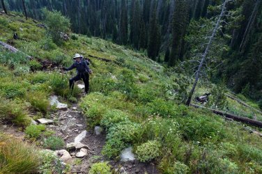
More meadows on the way to 8C4
View downstream from 8C4
Upstream from 8C4. Our route crosses the river just about at the tree line and heads up to the saddle on the horizon.
Kitchen area at 8C4
Day 3: 8C4 to Big Game Ridge
A short day mileage-wise but it promised to be a pretty good climb. Also looked like camp could be suboptimal. So we hung around 8C4 until after noon. We hiked up past the Harebell Patrol Cabin and east along the South Boundary Trail until it zigzagged out of the park part way up Big Game Ridge. We found an ok place to camp and made it work.
On the trail upstream of 8C4 just about at the next ford of the Snake.
Regenerating forest on the way to Harebell Creek
Harebell patrol cabin
We started up Big Game Ridge in earnest after the cabin. I could barely keep up with Stacy.
We encountered a fire-scorched, sun-baked landscape on the way up Big Game Ridge. It made for some harsh walking conditions. Luckily the trail was in good shape. Virtually no shade--it was really hot.
We found an acceptable campsite up where the trail swings south out of YNP
Our cooking area
Day 4: Big Game Ridge to Fox Park
Today we went the rest of the way up Big Game Ridge and down the other side. On the way up we saw another backpacker camping like we did where the trail swings outside the park. As we broke out into the last meadow before reaching the Snake River again we spotted a grizzly down in the flats. It was working its way north along the river valley and would soon cross our path. So we sat back and waited for it to move on through. You know those willow tunnels where you always wonder if there is a bear coming in from the other side? Well that was this bear. It hopped on the trail and followed it about thirty yards right through the willows. We were able to see it come out the other side (it was not dragging any hikers) and continue north out of sight.
It got greener and there were more flowers the higher we got. It had started to get hazy so the views were not as crisp as we had hoped.
Near the crest of the ridge looking north toward Mt. Hancock
The east side of Big Game Ridge is primarily unburned forest and meadows
I always assumed these multitrunked pine trees were whitebark pine but I guess you need to look more closely to know for sure.
When we had almost reached the Snake River again (just north of Fox Park) we spotted a grizzly bear in the meadow below. This one was at a nice, comfortable distance. With my camera at full zoom (70mm equiv) you can just make out a somewhat bear-shaped blob slightly above and to the right of center in the photo.
It was interesting to watch it just ambling along with that super fluid bear-gait—smooth and apparently effortless—but with an astonishing rate of progress. I think we would have had to have been jogging to keep up. The bear made its way up to our trail then took the trail right through the willows. Up until now I had never been particularly worried about walking through those willow tunnels. Now every time we come to one I just see this bear in my mind’s eye!
We found a great campsite near the Snake River just north of Fox Park. This was our cooking area. I guess I forgot to take a picture of our tent site. We also had a good swimming hole.
Day 5: Fox Park to Wolverine Creek
Today we went out the south end of Fox park and over to the Wolverine Creek drainage. We lost the trail in meadows a couple of times but found it again without too much trouble. I had some promising campsites picked out on the satellite image on Wolverine Creek but we were so exhausted we just plunked down at the first acceptable spot we came to.
Today we hiked into Fox Park and out the southwest corner. You’ll have to take my word for it but there are two sandhill cranes in this photo.
If you hold the sign together you can read it
The divide between Fox Creek and Wolverine Creek
Heading down to Wolverine Creek
Our tent site near Wolverine Creek. The hike was, of course, further and more difficult than anticipated. We didn’t spend any time looking for the perfect site.
We had dinner down at the creek. And there was a nice little soaking pool near here.
Day 6: Wolverine Creek to Coulter Creek
We awoke to rain and got packed up under the rain fly. We found a dry spot under some big spruce trees for breakfast and hit the trail just as the rain stopped. We hiked through forest, meadows and burned forest and made it over to Coulter Creek. At one point in a forested section we flushed a bunch of baby ruffed grouse. The mother grouse did not fly away with the babies but instead ran off in the opposite direction and put on a very convincing sick bird act dragging herself along the ground and making pitiful sounds. We apologized for disturbing them and continued on our way. Well, the apology was not accepted. Mama grouse came after us at a full grouse-sprint with her neck and head feathers all puffed, her wings sort of jutting out, her head stretched out, beak wide open making really creepy horror movie type hissing sounds. We freaked out and RAN away down the trail. It was so strange it took a while for us to process what had just happened. I still have an image of that enraged mama grouse burned into my brain.
The map showed the trail heading basically right up Coulter Creek but we couldn’t find it. We found blazes, apparent sections of old trail but certainly not the real trail. Finally found it waaaaay over on the other side. The Forest Svc had relocated the trail but not updated their maps. By the time we were getting close to our intended camp the weather started deteriorating. We got the tent fly up just as the rain started. Luckily just an afternoon thunderstorm so we were able to have a pleasant dinner after the storms passed. But no swimming hole today. Oh--and did I mention the route was longer and more difficult than I had anticipated...
It was raining in the morning so we had breakfast in a dry spot under a big, dense spruce tree. Edit: That's a lodgepole pine (courtesy of @Outdoor_Fool)
One advantage of the Stratospire tent is that you can take down the tent from under the fly and have a large, dry area to pack up your gear
Large meadow on Wolverine Creek. It seemed like good moose habitat but we saw no signs of moose. By now my feet were soaked from all the wet vegetation. My boots were Gore-tex lined but evidently the Gore-tex had failed. But it hadn't entirely failed. It turned out it would hold the water IN but not keep it OUT. For the next couple of days I was constantly taking my boots off and wringing water out of my socks.
Heading back into the forest as we climb out of the Wolverine Creek drainage
Looking back along the new trail above Coulter Creek. The trail comes over from Wolverine Creek through the valley this side of the ridge on the horizon. Somewhere in that forest lives a badass mother grouse you don’t want to mess with.
Camp near Coulter Creek. Since it was unlikely anyone else would camp here any time soon (or ever, really) and we were on our way out, we cooked breakfast right at camp. What do you think—is this kosher? We never would have done this at an established campsite or even a non-established site in a more popular area but it seemed ok here.
Day 7: Coulter Creek to Pilgrim Creek
Another day, another thrashing by the Teton Wilderness. The route over to the Pilgrim Creek drainage was much harder than it looked on the map (you’d think we’d learn by now). There were lingering low clouds from the previous day’s weather so it was foggy near the top. We lost the trail in meadows just before starting down into Pilgrim Creek valley and could not find it again. We knew about where it had to be but the landscape had a lot of texture that did not register on a 40’ contour interval and there were loads of downed trees and marshy areas. We finally found a clear descent line that we were certain would intersect the trail and off we went. Ok—I said we were *certain* we’d intersect the trail. Maybe not so certain because it was a tremendous relief when we finally did cross it. Nice hiking until the main descent, which was steep and unrelenting. We were happy to be at the bottom of that. From there it was pleasant hiking through healthy forest and meadows to the main meadow area where we camped.
It’s hard to tell in the picture but the trail was really steep on the way up out of the Coulter Creek drainage and made mostly of loose rocks. We were happy we didn’t have to come down this way.
Mystery poop. Biggest blob was about 6” across. It looked to be nothing but small catkins (pine?). Do bears eat pine catkins?
Sign for Whetstone Creek and Pilgrim Creek trails. We found it on the ground in pieces. Someone had chopped it with an axe.
We lost the trail right after the sign. It’s somewhere down there… Or maybe we already dropped below it. Well, we could have gone a little to the west of the trail too, I suppose, so maybe it’s off to the left. There’s a choke point in the valley below us where the trail would be easy to find but we didn’t want to bushwhack blindly down the slope.
We climbed onto an open ridge where we could get our bearings and see the terrain better. From here it was clear where we needed to go and we could pick an easy route. This is the only time I really wished I had a GPS unit with me. It would have saved a good bit of time and effort.
Here’s the choke point. The trail was pretty much in the creek for a quarter mile or so.
The stream cobbles in this area have an interesting history. They formed as cobbles in a different stream system long ago, were incorporated into a sedimentary rock unit and finally were weathered out of that rock unit to become stream cobbles again.
The last obstacle before the main meadows of Pilgrim Creek. This was pure green slime but luckily there was a hard sandy bottom, not soft mud as we feared. And no leeches.
View from near our last campsite. Gorgeous meadow, great swimming hole and beautiful weather for our last night out.
There were lots of little butterflies on the meadow flowers
We put our tent at the edge of the trees.
We had miso soup from Walmart as a first course every night.
Day 8: Hike out, hitchhike back to South Entrance
Only about 4 miles today to reach the trailhead and another two on the gravel road to the hwy so we slept in and had a leisurely breakfast before leaving our lovely meadow. The map shows 14 stream crossings in this stretch but there are actually 18. Erosion has forced a few more crossing since the map was drawn. It’s maybe not as bad as it sounds because the crossings come in groups so you can put on water shoes and make four or more crossings at a time in some places. Even so it felt like we spent most of the day changing our shoes. We reached the trailhead shortly after noon and started the two miles out to the highway. Part way along a car passed us heading up to the trailhead. We did our best to look friendly in case they came back the other way and might want to pick us up. Sure enough, after a while they came back out and rolled up next to us and asked if we needed help. We explained our hitchhiking plans back to YNP and they offered us a ride to the hwy (they were heading back to Jackson). We immediately got to talking and they said they could take us a little way up the road where we could hitch a ride and/or get out of the rain (the weather did not look good at this point). Well, once we were underway headed north they said they might as well just drop us at the South Entrance. We did not protest. It turned out they had a summer home in Jackson but lived in Atlanta, just 50 miles from where we live.
Heading out on the last day
More of those recycled cobbles
Last of the Pilgrim Creek meadows
Changing shoes for the upteenth time
Hiking out toward the highway. My plan had been for Stacy to relax at the trailhead while I walked to the highway and hitchhiked back to the car. However, she said there was no way she was going to just sit there for who knows how long not knowing where I was or when I was coming back. So we both set out for the final leg. I have been super lucky overall with hitchhiking and this trip was no exception. A friendly couple about our age picked us up and ended up taking us right back to our car. I think they thought we were crazy--or at least had extremely poor judgement--and were truly worried about our safety. Whatever the reason, we closed the loop in no time.
The End! We survived bears, grouse and many miles of rough Teton Wilderness trails. One big surprise was the level of recent trail maintenance in the TW. Over all the miles we hiked I'll bet we only had to climb over or detour around deadfall half a dozen times. Whether it was the forest service or hunting outfitters, someone has been through here clearing the trails and we were thankful for that.
Attachments
Last edited:
 I also find it annoying that the Forest Service doesn't go in and replace them, whether they just deteriorated on their own over time, or were vandalized. Sorry, a pet peeve of mine. We ran into the same issue on our recent trip to the Wilderness on our loop out of Brooks Lake.