Smoky Mountain National Park

Ok well our initial plan has been scraped. “Excessive bear activity” in campsite 37 and it’s currently closed!

Others have said they had other suggestions for different loop hikes. Recommendations?
 
Meh. One of those sites was under excessive bear activity when I went and I never saw a bear. Live on the edge!

All the park maps are available online, and they show elevation changes. The only challenge I had making loops was that I didn't want to stay in any of those wooden shelters. If you don't mind that, it's pretty easy to map out some routes.
 
I just looked again and it’s closed due to “aggressive bear activity” not excessive. Not sure if there’s much of a difference though.

So was it closed when you stayed there? I won’t mind taking the risk and staying there but I didn’t realize that was an option.

I too do not want to stay in a shelter and would prefer backcountry campsites. I’m having a hell of a time putting together a good 3 night loop or lollipop hike in this park when looking at the park map.
 
Ahhh, closed. No it wasn’t closed. I imagine thats the difference between excessive and aggressive. @wsp_scott can prob hook you up on some shelter-free loops.
 
I just looked again and it’s closed due to “aggressive bear activity” not excessive. Not sure if there’s much of a difference though.

So was it closed when you stayed there? I won’t mind taking the risk and staying there but I didn’t realize that was an option.

I too do not want to stay in a shelter and would prefer backcountry campsites. I’m having a hell of a time putting together a good 3 night loop or lollipop hike in this park when looking at the park map.

Sites 36 and 37 frequently get closed because of bears, usually means someone saw a bear nearby and freaked out and told a ranger :)

For 3 nights, there are a ton of possibilities.
Something similar to what you were planning, start at in Cataloochee (near the campground) and hike through the valley to Rough Fork Trail and then to site 41 (skip site 40). Next day hike up to Double Gap and across the ridge then down McKee Branch and Big Fork Ridge to the road, then up to site 39, this would be a long day with ~2500' up and down, but great views at Double Gap. From site 39 up to Mt Sterling and site 38 and views from the firetower. Last day back to the car in Catalochee.

Or you could hike into Site 41 and stay there for a couple nights. Leave your stuff and hike up to Double Gap and back to camp. Then head over to site 39 for your last night. I did a trip a couple years ago where we stayed at site 41 for 3 nights and hiked up to Double Gap one day and then the next did a loop around the Boogerman Trail the next day, then back to the car the last day. It was nice hiking without a pack :)
Here is a trip report for that trip http://backpackandbeer.blogspot.com/2016/11/cataloochee-valley.html

The Catalochee Valley is historic and pretty and there is a good chance you will see deer and elk and maybe a bear. You will definitely see people (dayhikers) if that is an issue.

let me know if you want other suggestions with more or less miles or people
 
Thanks man. That second route looks great, and I love the idea of having a basecamp for a few nights. But the idea of seeing hoards of people doesn't sounds all that good. Although I'm realizing that's a tough thing to avoid in this NP!

I was considering the deep creek trailhead and doing a loop hike. Night 1 in campsite 58, night 2 in campsite 52, and night 3 in campsite 51. I'm not sure how the scenery here is. And the campsites are getting mixed reviews online. It's so hard picking a route and i'm hella disappointed that 36 and 37 are closed due to bear activity. We were really looking forward to this hike!
 
First of all, once you get a mile from a trailhead, you loose most of the dayhikers, so don't worry about that. Cataloochee is very popular with dayhikers and car campers and horse riders, but it is for a reason, a very beautiful and historic area.

OK, from the Deep Creek area I haven't hiked that loop, but I have done a little in the area. Start at the end of Lakeview Drive (Road to Nowhere) and hike to 70 for your first day, then the Jonas Creek Trail (wet feet) up to the AT and across to Clingmans Dome (amazing views, but you will see tourists, it is worth it), then down to Andrews Bald followed by a slight backtrack to Forney Creek trail and site 68 for the second day. Then down Forney Creek and across Springhouse Branch to Noland Branch and site 64 for the third day, then down Noland Creek to the road and ~.5 mile road walk to the car.

This loop will get you some ridge hiking and great views, some classic creeks, and other than the Clingmans Dome and Andrews Bald stretch, you won't see a lot of people (only backpackers).

I haven't stayed at 68, but it is very close to some Cascades that look pretty cool. Every trip that I have tried to do this loop, something has gone wrong, but I'm usually in the park in the winter time. I also haven't hiked along Noland Creek, but it is a classic Smokies creek trail and that means nice hiking.
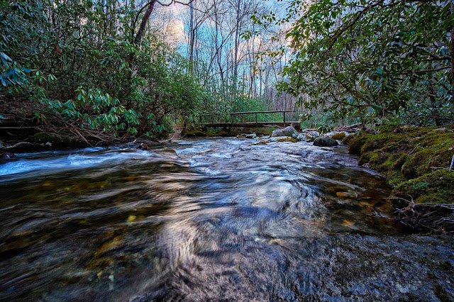
Next to Site 70
Mar%2B12%2B2018_31.jpg


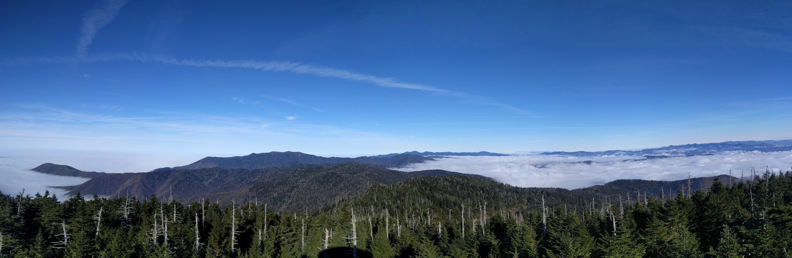
View from the tower at Clingmans Dome
2016-12-19%2B15.11.07_stitch.jpg


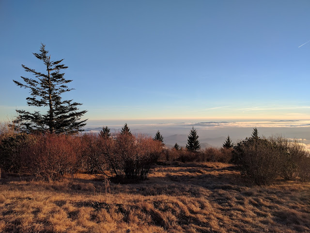
View from Andrews Bald
2016-12-19%2B17.05.04.jpg
 
Also, I just looked at my Nat Geo map for this loop and it shows 4 high water crossings on the Forney Creek Trail. If there has been a ton of recent rain, you might want to take the Forney Ridge trail to Springhouse Branch instead of the Creek Trail. It also shows one of the high water crossings is just before site 68. Like I said above, I have not hiked that part of the trail, so I'm not sure what the crossings look like, but you will definitely be getting wet, i.e. not a rock hop across a small trickle.
 
Alright so here's the plan.

We take lakeview drive which I think ends with the "road to nowhere"
We'll hike to site 70 the first night.
Then we'll hike along forney creek trail and stay at site 68 our second night
Then we'll hike up to Clingmans Dome and then down forney ridge trail and then cross over to site 64 for our third night.
Hike to car in the morning

What do you guys think?

Yes, Lakeview Drive is the "Road to Nowhere"

I think that sounds like a good plan except for the staying at 70 the first night and then 68 the second night. They are only about 5 miles apart, which makes for not much hiking that day (about 3 hours tops). But other than that, I think you will have a good time. Make sure to do the climb up to the tower on Clingmans Dome and Andrews Bald would be a great spot for lunch.

Post a trip report when you get back :)
 
Yes the 5 miles is not ideal but everything else looks pretty good. We’ll take it nice and slow that day and mess around with the water feature that I think we’ll be next to or crossing most of this day.
 
Similar threads
Thread starter Title Forum Replies Date
scatman The Anthony Creek, Russell Field Trails Loop - Great Smoky Mountain National Park, June 10, 2016 Hiking & Camping 13
scatman Gold Mine Loop Trail / Noland Trail - Great Smoky Mountain National Park, June 7, 2016 Hiking & Camping 3
C Our vacation to Smoky mountain USA Everything Else 0
Mountain Wanderer A smoky trip into the Bob Marshall Wilderness Backpacking 2
wsp_scott Clingman's Dome (Great Smoky Mountains NP) Backpacking 0
R Smoky Mtn Group Hike? March 28-30th? Trip Planning 4
BJett Lower Big Creek - Great Smoky Mountains National Park On The Water 2
Mikjik86 Hiking Colorado - 13er Bald Mountain 13,703' Hiking & Camping 2
B Hello mountain people! Noobs: Introduce yourself! 0
BeardoMcGrath Fiftymile Mountain rim and ruins tour: 13 May 2023 Hiking & Camping 12
Ugly Oh Mother! A Mountain Loop Backpacking 12
TheMountainRabbit Southern Absaroka & Thorofare Mountain (Teton/Washakie Wilderness) - July 2023 Backpacking 23
O Eagle Cap from China Cap to Meadow Mountain Backpacking 3
kwc Hadley Mountain hike Hiking & Camping 1
scatman Black Mountain Ridge - May 13, 2023 Hiking & Camping 49
kwc Spruce Mountain Fire Tower, Southern Adirondacks Hiking & Camping 0
regehr conditions at the Mexican Mountain road? Trip Planning 8
scatman Little Mountain - January 21, 2023 Hiking & Camping 28
TheMountainRabbit Black Lake (Rocky Mountain NP) - January 2023 Hiking & Camping 3
TheMountainRabbit Sky Pond (Rocky Mountain NP) - January 2023 Hiking & Camping 8
kwc Snowy Mountain, central Adirondacks Hiking & Camping 0
XID_AZ Kanab Creek Wilderness - Sowats Canyon - Mountain Sheep Spring Trip Planning 6
scatman Bald Mountain - August 20, 2022 Hiking & Camping 7
regehr mountain-forecast.com Trip Planning 22
Absarokanaut Welcome First Peoples Mountain General Discussion 0
scatman Mendon Peak - Wellsville Mountain Wilderness - June 4, 2022 Hiking & Camping 13
andyjaggy Wind River Range Roberts Mountain Trip Planning 4
LarryBoy SLC: Terrace Hills Drive to Big Mountain Peak Trip Planning 16
pstm13 Rocky Mountain National Park Mid June with Kids Trip Planning 7
pstm13 Rocky Mountain National Park Mid June with Kids Trip Planning 0
scatman Little Mountain - January 22, 2022 Hiking & Camping 1
scatman Jack's Mountain - December 24, 2021 Hiking & Camping 11
norwegianxplorer Highest Mountain in Norway, Galdhøpiggen, the start of a 9 day backpacking trip in Jotunheimen national park Backpacking 0
scatman Foothill Follies Part 2 - Black Mountain Ridge and City Creek Canyon Loop - November 11, 2021 Hiking & Camping 6
kwc Hadley Mountain Fire Tower hike, Southern Adirondacks Hiking & Camping 1
kwc Moxham Mountain, Adirondacks Hiking & Camping 3
J Death Valley National Park and Area Mountain Rambles Dec. 16-17, 2020 Hiking & Camping 0
scatman Black Mountain - May 22, 2021 Hiking & Camping 9
kwc Blue Mountain hike, Central Adirondacks Hiking & Camping 0
kwc Goodnow Mountain fire tower hike Hiking & Camping 2
LarryBoy Five Days on Boulder Mountain Backpacking 5
norwegianxplorer Greater Yellowstone part 2, from the Headwaters of Yellowstone River, through the Thorofare, Overlook Mountain, Rampart Creek Backpacking 9
kwc Chimney Mountain, South Central Adirondacks Hiking & Camping 3
regehr Sid's Mountain Loop Backpacking 5
fossana Bat Mountain traverse (Funeral Mountains) Hiking & Camping 5
Yvonne Sepulcher Mountain Hike, Yellowstone NP, September 2018 Hiking & Camping 2
UtahBrian Sids Mountain Wilderness November 2019 Backpacking 5
K Cycling The Divide Mountain Route Trip Planning 16
NorthwestWanderer Olympic National Park - Elk Mountain Hiking & Camping 7
Titans Prescribed burn South Monroe Mountain- photos from Capitol Reef area Photography 0

Similar threads

Back
Top