SLC: Terrace Hills Drive to Big Mountain Peak

LarryBoy

Hiker Trash
.
Joined
Jan 4, 2015
Messages
2,855
Hey gang, hoping to enlist the collective wisdom of the hive mind here. I'm hoping to hike one-way from the Terrace Hills Trailhead in the Upper Avenues to Big Mountain Summit and points beyond. This would be a weekend backpacking adventure. Fairly lightweight but not ultralight packs.

The question - what's, in your mind, the best way to get there? My thoughts below. Am nervous in particular about trail conditions in Upper City Creek. I've never been down that trail, but been on the GWT up there many times and never saw a trail junction, and there are a ton of stinging nettles in the area. This report doesn't exactly paint a rosy picture of the trail conditions. Anyone have an opinion/experience they'd be okay sharing?

Thanks!


Red Route:

Pros:

  • Not as strenuous, little elevation gain
  • Plenty of water most of the way
Cons:
  • Vague/non-existent trail conditions?
  • Nasty overgrowth/stinging nettles?
  • Trail near road once below the water treatment plant

Grandview Ridge Alt:

Pros:

  • Is doable, I've done it before
  • Great views along the ridge and from the peak
Cons:
  • No real trail up there, slow going along the ridge
  • Lots of vert/exertion

Black Mountain Alt:

Pros:

  • Avoids road in City Creek
Cons:
  • Lots of exertion
  • Things get a little scrambly up on the ridge if I recall correctly

Lookout Peak Alt:

Pros:

  • Avoids stinging nettles/City Creek potential bushwhack
Cons:
  • A ton of exertion and elevation
  • No water
  • Trail conditions unknown


Click here to view on CalTopo
 
Last edited:
What time of year are you planning this for? If you hit it just right you could have snow on the north side of the ridges in places for a water source, but I'm sure you already know this.

I've been up that non existent trail at the head of City Creek twice. Once, thirty two years ago I rode my mountain bike up City Creek and then on towards the head of the canyon up until the trail fizzled out. I then hauled myself and the bike to the Great Western Trail. That was in April and the scrub hadn't gotten its full complement of leaves yet, and there was still some traces of snow along the route. The second time that I did it was without the bike ( I wised up to a certain degree - Not!) and it was around the first week in June. So expect a good bushwhack if you go anytime after April. You're correct, there is no junction that I have ever seen when the supposed trail reaches he Great Western Trail, and I spent a good portion of time looking for a junction thinking that maybe I had just mistakenly gotten off of the old trail at some point. Finding no junction, I verified my previous thoughts that there is no trail anymore heading up the headwaters of City Creek.

The scrambling along the Black Mountain Ridge is very short, and nothing that would cause you any concern with your background. I think the trail that drops down into City Creek Canyon from the Black Mountain Ridge is a really pretty hike, and I've never seen another person along that stretch before.

I've also attempted to hike along the ridge to Lookout from the Black Mountain Ridge. I did this in July with my son maybe twelve years ago. After passing the trail that drops into City Creek It was bushwhacking along the ridge from that point on. We didn't quite make it to Lookout that day due to the slow going once we ran out of trail. I returned to that ridge with @regehr in May I believe. We did a U route around Red Butte Canyon, and the going was much easier because there was still snow along the ridge which allowed us to be on top of all the brush for the most part that my son and I just couldn't avoid in July.

I think all of your routes are worthy of consideration though. Not a bad one in the bunch in my opinion. I don't mind the road walking in City Creek. You can always take the trail that parallels the road up to just short of the water treatment plant if that would sway your decision.

All I can say is that if you do this, I'll be crushed if you don't stop by 766 9th Ave and say "Hello." Just look for the brown siding house with a maroon Subaru in the driveway, on the south side of 9th, between L & M Streets.
 
I've walked all of the marked routes except for the red parts east of hardscrabble pass, and I'll echo scat's request for when you want to do this
 
Thanks @regehr and @scatman! The thought was to do this in September/October timeframe... given your feedback, I might try the Grandview ridge route. Perhaps we'll use your house as a resupply stop :)
 
ok so I've been up there in Cottonwood Gulch in August in the neck-deep stinging nettles and I didn't love it but it really was not bad at all since I was wearing long pants and long sleeves. in June/July they're not nearly so bad. no idea about Sep/Oct. I've not seen bad nettles in City Creek Canyon proper but unfortunately in message above I lied a little -- I've been pretty high in CC but not up to Hardscrabble Pass. anyhow, indeed the trail in City Creek fades as you get a few miles above Upper Rotary park, but also it get gloriously wild, it's incredible to have this kind of backcountry this close to a major city -- it's a real treasure.
 
OK so you can figure out the elevation changes and miles yourself -- let me give a few subjective opinions about your options. I have a lot of opinions about this area since I spend a lot of time there, I've been on most of these trails at least a dozen times, please feel free to ask for more details.
  • the city creek road (and the trails closely paralleling it) are boring, I walk them many times per year and they started out boring the first time I walked them and they are still boring. I mean walk this road if you must but if you wait until after memorial day it's a helluva lot nicer to just catch a car ride to the North Fork trailhead or the Upper Rotary Park
  • the North Fork trail to Rudy's Flat and the rest of the route to Grandview and beyond (your purple route) are lovely! definitely walk these, just super nice, I don't get up there often enough cause it's just not close to anything. the North Fork trail, alas, is getting overgrown in places, not enough people walk it, but it's still mostly not hard to follow.
  • the trail to Little Black Mountain is pleasant and fun and pretty! as scat says the scrambling is no prob (though the exposure is real)
  • past Little Black Mtn, the Smuggler's Gap trail (down to CC just above upper Rotary) is very very nice, one of my tippy-top favorite trails in the Wasatch range. definitely worth walking. the first time I did it (around 2000 or so) it was hard to find the trail in places, but since then it has gotten far more established and in fact you'll likely run into trail runners now. maybe it was the Wasatch Steeplechase that was responsible for this I don't know.
  • your blue route (Little Black to Lookout and beyond) is largely off-trail and slow. it's a great route though and (like everywhere) getting more traffic these days, so eventually this will probably have an established route. but for now it's wild up there. no routefinding issues since you're just following a ridge but plenty of minor obstacles. fun!
 
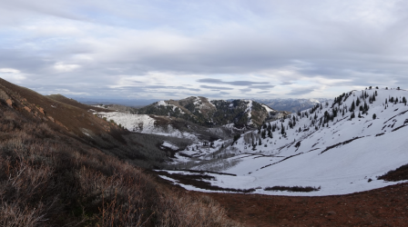
though I've done a lot of day hikes in this area, I've done only one backpacking trip. camping in City Creek itself is prohibited of course. anyway, during mid-May of the first covid spring my older son and I started at the City Creek parking lot, walked to the upper rotary, and then continued up the trail. at some point we took a steep off-trail route up through the City Creek Meadows and then hit the ridgeline and camped a bit over on the Sessions Mountains side. this is very close to, but a bit east of, Grandview Peak. so this ended up being like 4000 feet of vertical and a decent amount of miles, it was a nice day but we were pretty wiped out! also despite the poor snow year there was still a ton of snow on the Sessions side.

I don't remember what I had intended for day 2, perhaps exploring the Sessions. anyway next day I didn't feel very good, maybe simply due to over-exertion on the first day. so we just walked home
 
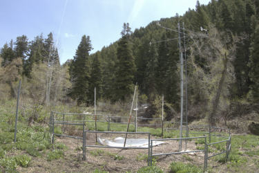
from that trip -- here's the Louis Meadows snotel facility if anyone is interested :)Screen Shot 2022-03-18 at 11.01.16 PM.png
 
All I can say is that if you do this, I'll be crushed if you don't stop by 766 9th Ave and say "Hello." Just look for the brown siding house with a maroon Subaru in the driveway, on the south side of 9th, between L & M Streets.
Is that an open invitation for all us BCP'ers to drop by and see what's cooking?
On our way through SLC for our desert trips, Jo always makes us detour to shop at the Title Nine store on Harvey Milk Blvd, not far away from you.
Just sayin' :p
 
though I've done a lot of day hikes in this area, I've done only one backpacking trip. camping in City Creek itself is prohibited of course. anyway, during mid-May of the first covid spring my older son and I started at the City Creek parking lot, walked to the upper rotary, and then continued up the trail. at some point we took a steep off-trail route up through the City Creek Meadows and then hit the ridgeline and camped a bit over on the Sessions Mountains side. this is very close to, but a bit east of, Grandview Peak. so this ended up being like 4000 feet of vertical and a decent amount of miles, it was a nice day but we were pretty wiped out! also despite the poor snow year there was still a ton of snow on the Sessions side.

I don't remember what I had intended for day 2, perhaps exploring the Sessions. anyway next day I didn't feel very good, maybe simply due to over-exertion on the first day. so we just walked home
Oh that's a good idea as well, especially if it avoids some of the nasty brush near Hardscrabble Pass. I once got really deep in the nettles trying to find the dang GWT (which is most certainly not in its mapped location there!). So much great information in your posts, thank you very much! Seems like the two leading candidates are either what you described above, or the purple grandview ridge route. What's your opinion, between the two?
 
our route above had too much road walking, I'll probably not do it again. would definitely go with the purple route.

but hey let me tell you what I think would be the perfect route up there.
  1. get dropped off at the N Fork trailhead (can't leave a car there overnight) and also drop off some bikes
  2. follow your purple route, camp somewhere near the end of it
  3. connect up to your blue route
  4. finally take the Smuggler's Gap trail down to city creek, find the bikes, then coast down the canyon
once the snow is gone you'd have to worry about water. there's probably some on the sessions side but you'd have to drop a ways down and then climb back up to the ridge. or, if doing this as a one-nighter, just carry your water.

you can only start this route (with car help) on an even-numbered day between Memorial Day and end of September, alas
 
Is that an open invitation for all us BCP'ers to drop by and see what's cooking?
On our way through SLC for our desert trips, Jo always makes us detour to shop at the Title Nine store on Harvey Milk Blvd, not far away from you.
Just sayin' :p

You're always welcome @SteveR, and anyone else for that matter. I've got a beer in the fridge, or maybe some orange juice, oat milk, or perhaps you would prefer some skim milk if you're thirsty. Of course, if you show up on a Saturday, then I can have a beer with you. :)
 
our route above had too much road walking, I'll probably not do it again. would definitely go with the purple route.

but hey let me tell you what I think would be the perfect route up there.
  1. get dropped off at the N Fork trailhead (can't leave a car there overnight) and also drop off some bikes
  2. follow your purple route, camp somewhere near the end of it
  3. connect up to your blue route
  4. finally take the Smuggler's Gap trail down to city creek, find the bikes, then coast down the canyon
once the snow is gone you'd have to worry about water. there's probably some on the sessions side but you'd have to drop a ways down and then climb back up to the ridge. or, if doing this as a one-nighter, just carry your water.

you can only start this route (with car help) on an even-numbered day between Memorial Day and end of September, alas
Purple route it is! That loop does look lovely, but I think this will probably be a one-way journey. Hoping to walk from SLC to PC in a weekend.
 
Back
Top