Yvonne
I lava it!!!
- Joined
- Jan 19, 2012
- Messages
- 4,177
This is by far my favorite trail in the park. I had this trail for years on my radar and finally made it happen. The views on top of Sky Rim are superb and the entire 20-miles hike with roughly 5,000 feet of elevation gain going along the high ridges of Sky Rim offered an experience I haven't had before in the park. Unfortunately, I had to skip Bighorn Peak as a storm was moving in fast and I wanted to be off the high ridge before it was hitting. It was a good call, the lightning was crazy. That means I need to go back and finish going up to Bighorn Peak next time.
Nonetheless, I had a lot of fun as I worked my way up and did not see a single person.
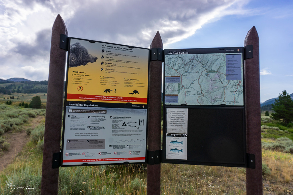
I started at Daly Creek trailhead later than expected because the road construction along 191 took longer than I thought it would. The primitive parking area already had several cars parked but I found enough parking for my car and got my gear ready. My backpack was heavier than normal because of all the water I carried today. There was no water along Sky Rim and I had to carry everything with me.
Around 9 am I was ready to start and left the trailhead.
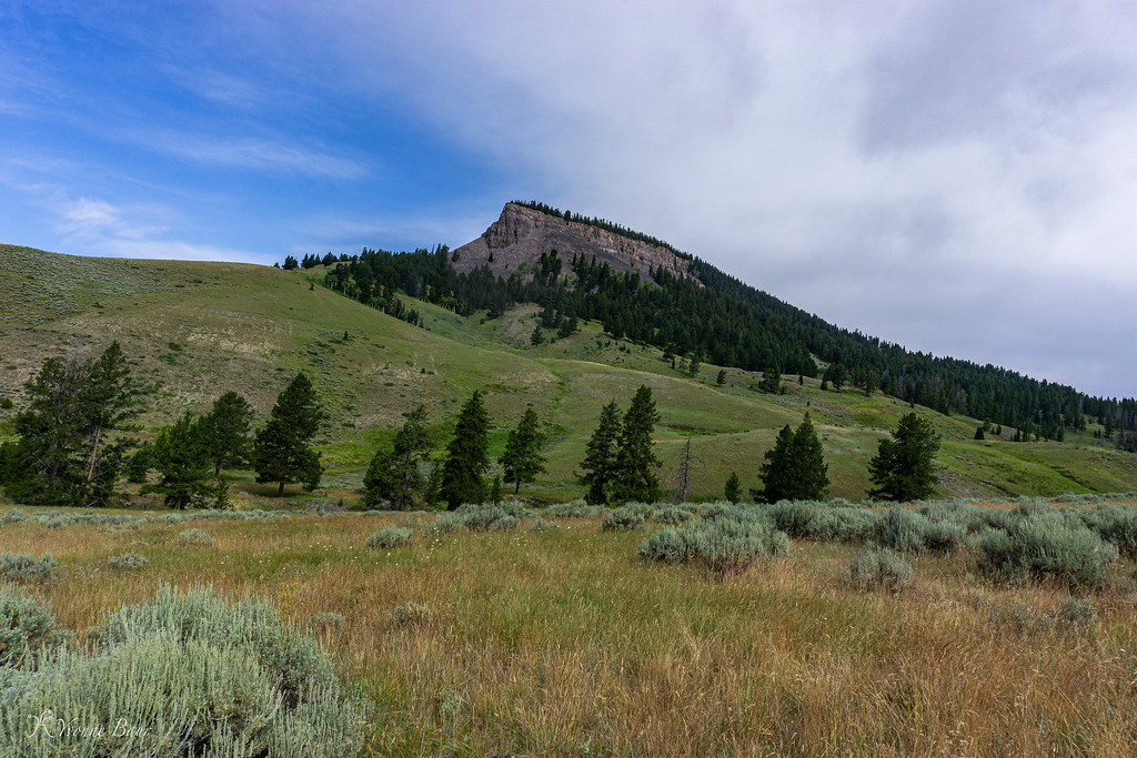
Crown Butte dominated the scene for the first 2 miles and the trail followed an area covered in sagebrush and grasses. Soon after the start I crossed Daly Creek and continued on.
It was pretty cloudy today but it helped to keep the temperatures low. I've also chosen a good day to hike and the chance of afternoon thunderstorms was only 15%.
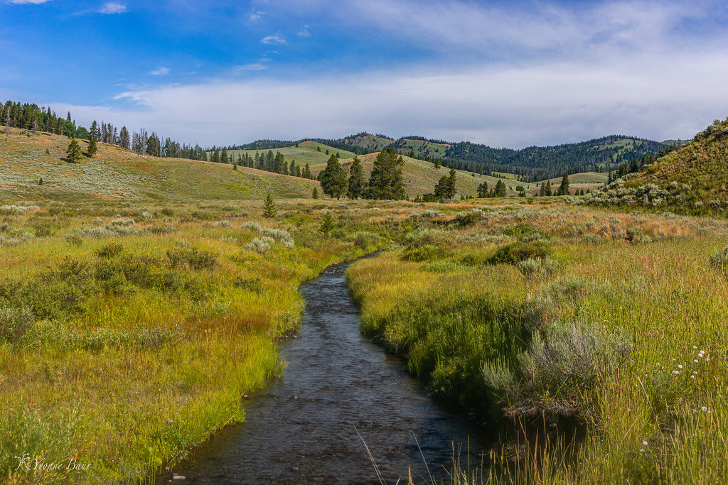
Daly Creek
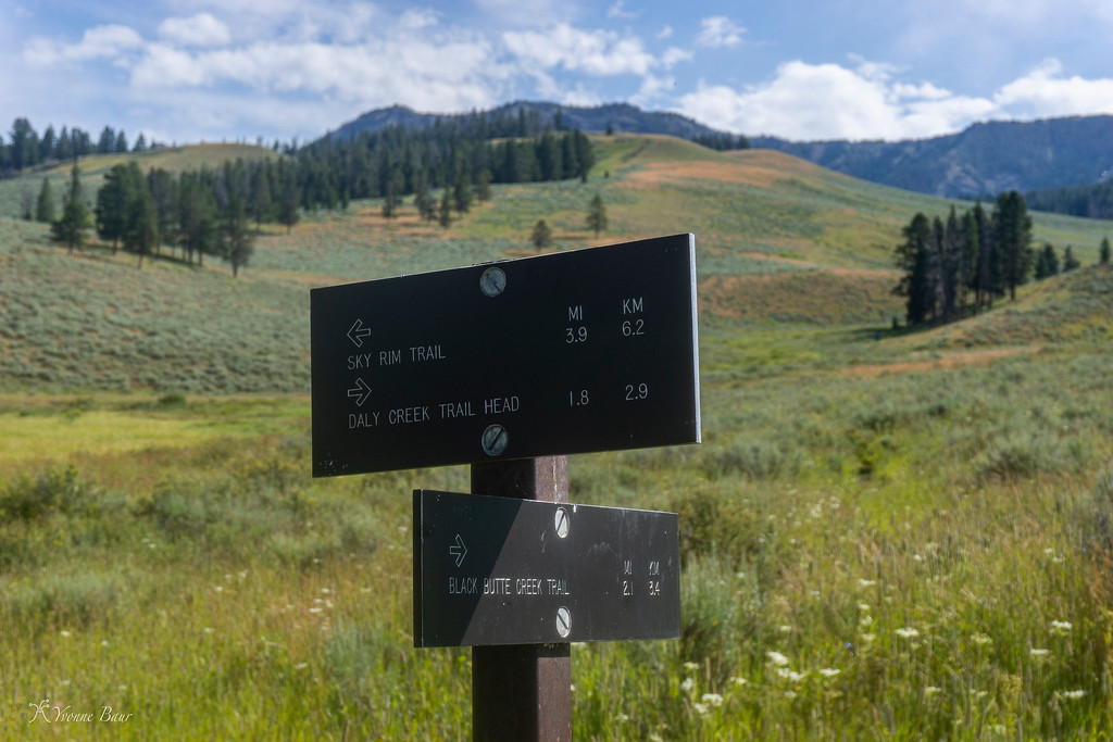
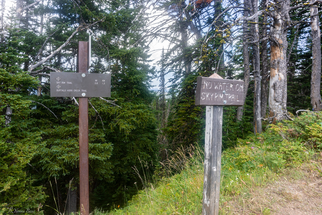
the first trail junction after 1.8 miles
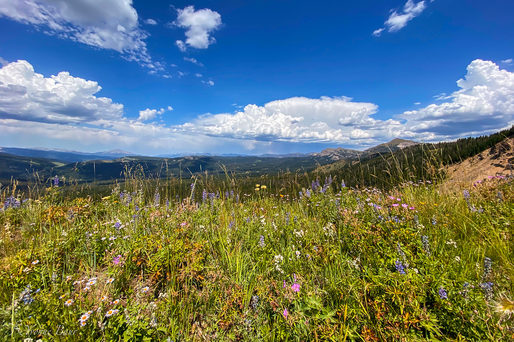
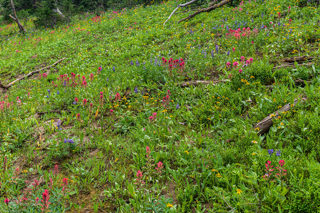
After leaving Daly Creek and the last spot to filter water, the trail started to climb up to the Sky Rim. Open meadows and patches of forests alternated several times and I worked my way up, huffing and puffing, and enjoying the wildflower display. So far it was not bad and the elevation gain was gradual.
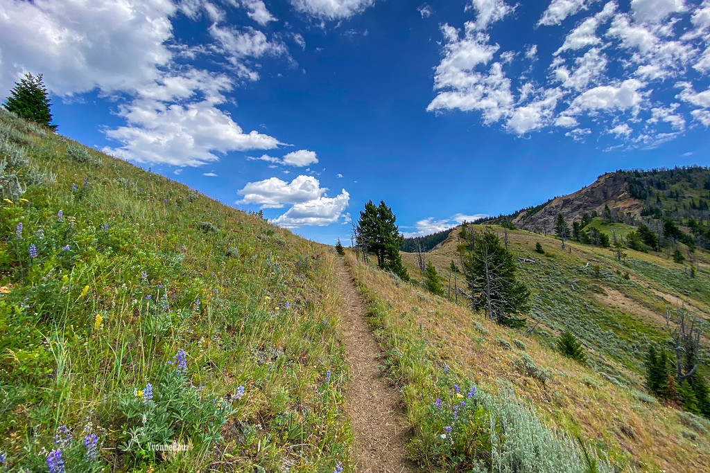
Eventually, I reached the Sky Rim and stopped for a short break. The trail up was a bit of a leg burner, but totally doable with great scenery along the way.
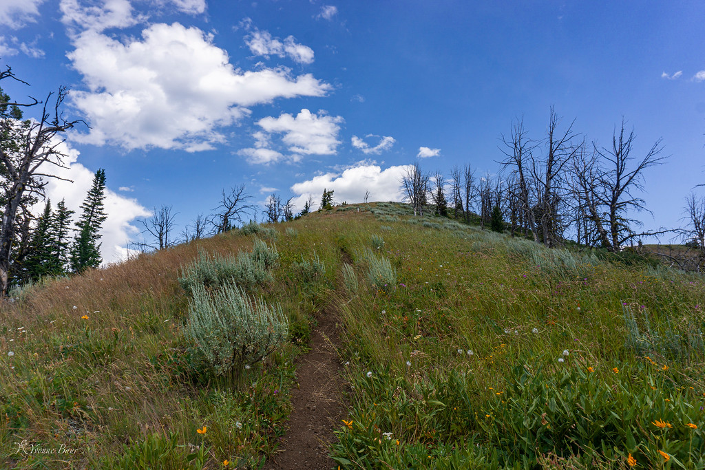
the trail follows some flower meadows along the rim
traveling along an arete I follow Sky Rim on a more mellow section
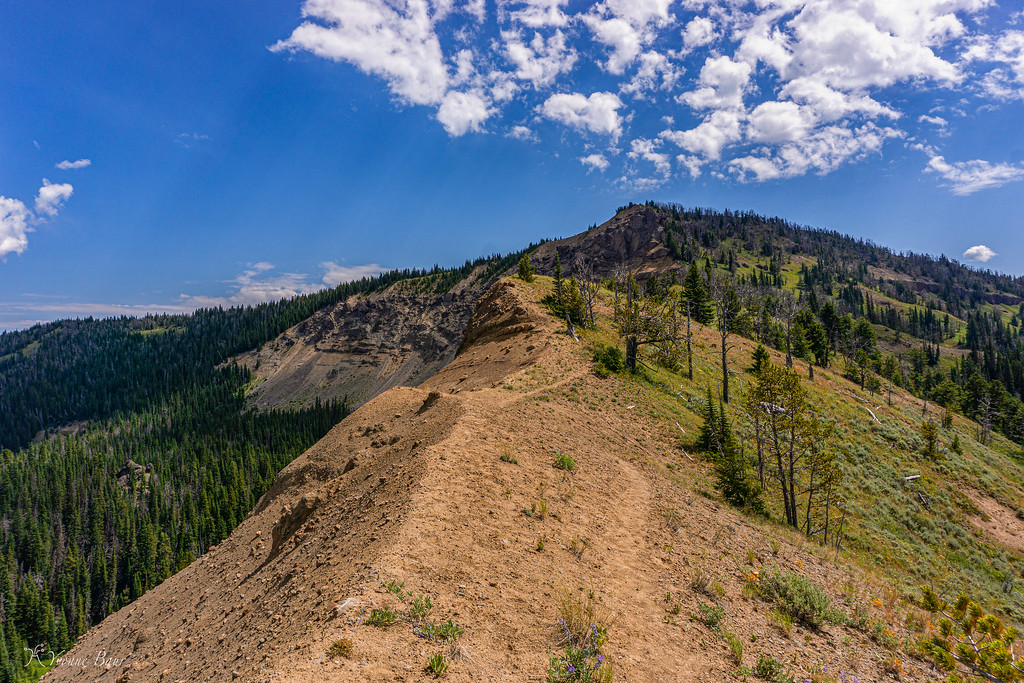
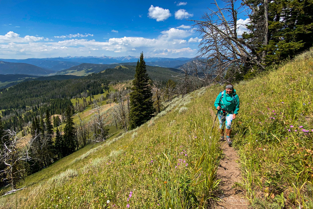
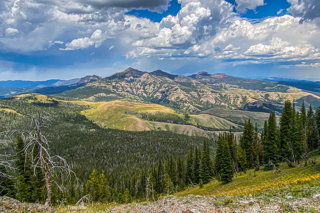
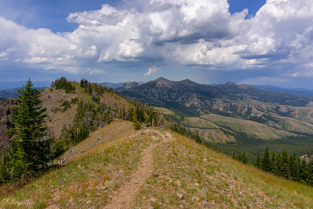
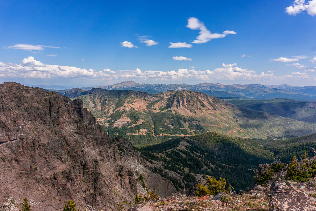
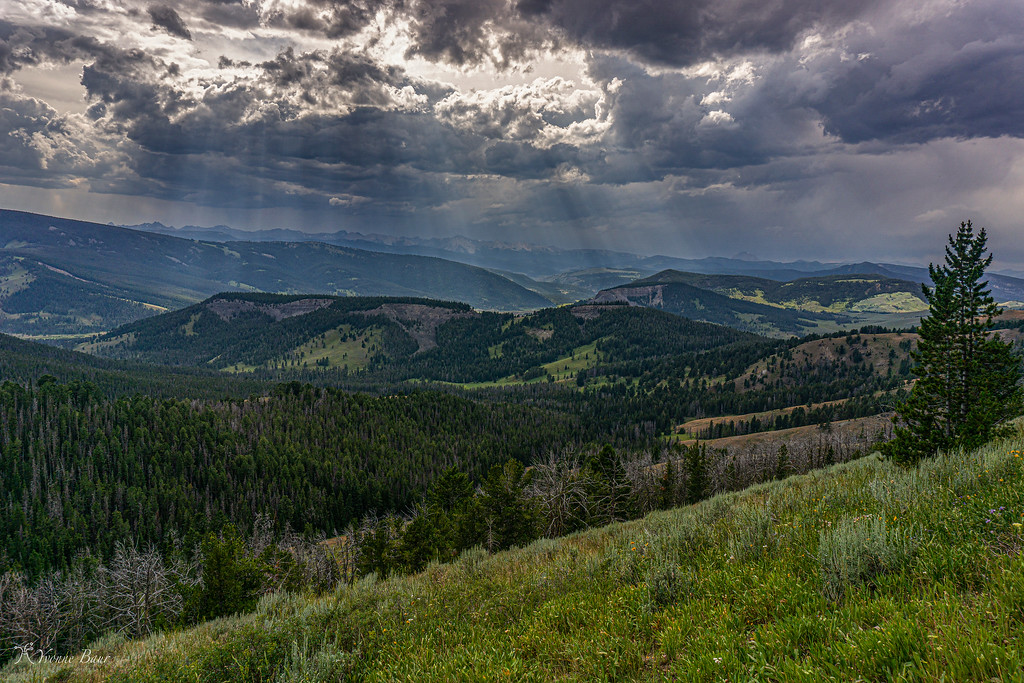
The trail section along the rim was really nice, there were up and downs all the time and the trail followed an arete carved by glaciers. The views to both sides were superb and I needed to stop all the time. I'm not sure what it is but I'm a huge fan of expansive mountain scenes. I often feel so small when I'm immersed in it and pictures just can't do justice.
working my way up
still going up
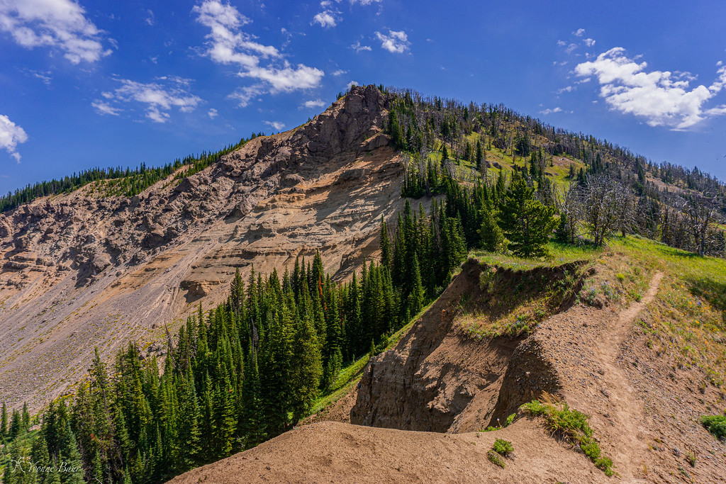
Between layers of lava tuff, I found many specimens of Petrified Wood. I knew there was a Petrified Forest on the other side of the ridge in Yankee Jim Canyon but did not know it was up here as well. Definitely a pretty cool surprise.
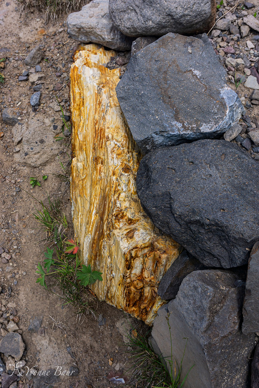
Petrified Wood
I encountered more Park boundary signs and the trail marker to some trails in the National Forest. Well, I guess one of these days I'll hike up here from the National Forest. There are tons of options all over the place and I made some mental notes for future references and trips.
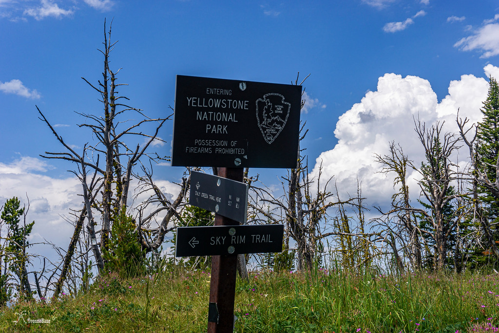
Park Boundary
The wildflower galore up here was just amazing. I thought I was way too late but got a pleasant surprise up here in the higher elevations.
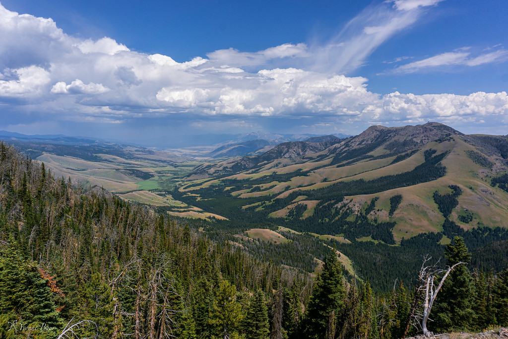
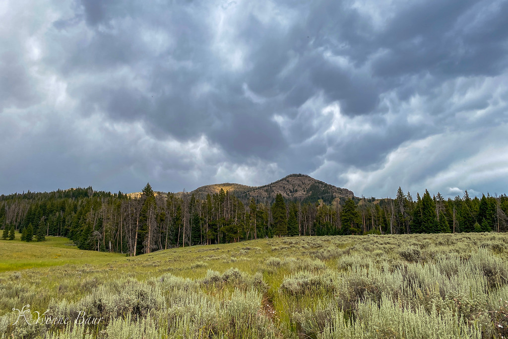
And then the first real views of the surrounding area - just wow!! Even the storm that was brewing in the distance couldn't take away all the wow moments I experienced right now.
It can't get any better
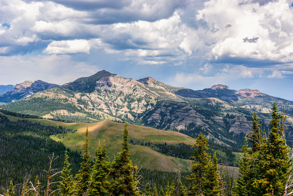
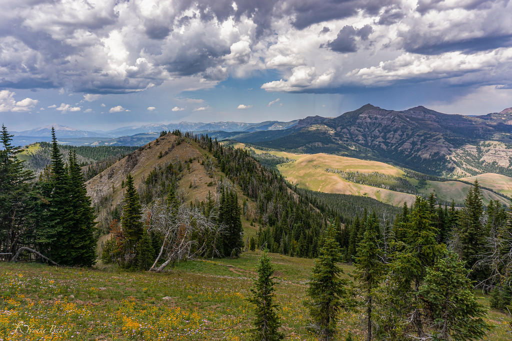
the view looking toward Ramshorn Peak, Twin Peaks, Steamboat Mountain
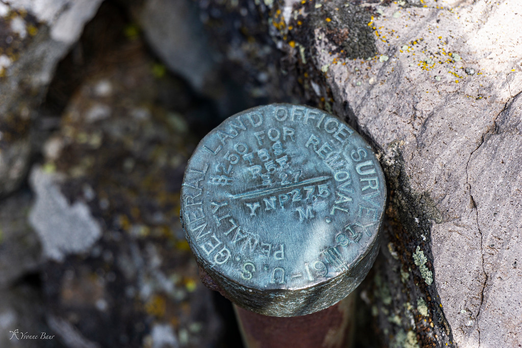
there were a lot of these markers along the Rim
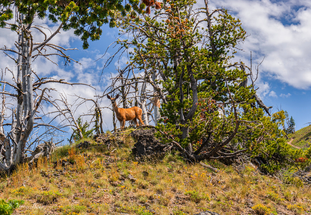
someone was watching me, I'm glad it wasn't a bear
looking back into Yankee Jim Canyon and the backside of Paradise Valley
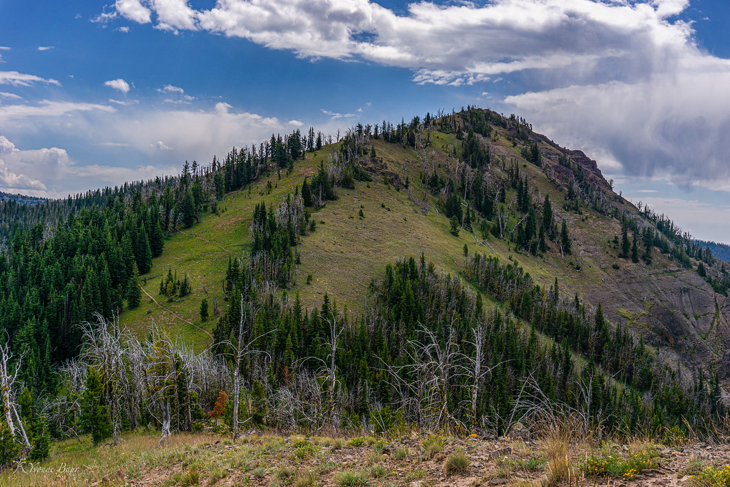
the trail is zigzagging up that ridge which means I have to zigzag my way up there soon
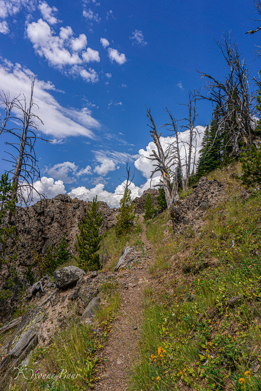
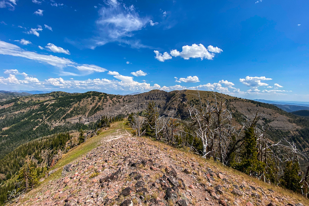
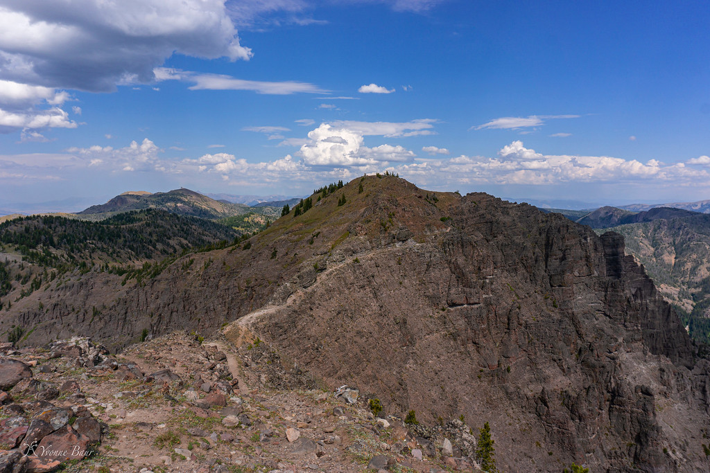
There were lots of ups and downs and the trail kept zigzagging up and down some ridges. It definitely was a leg burner and I could feel it, but the views excused all the work I had to do.
a storm developed in the distance
I made it up the ridge and enjoyed the views back
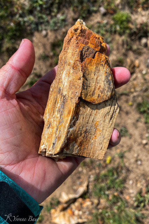
I found more Petrified Wood
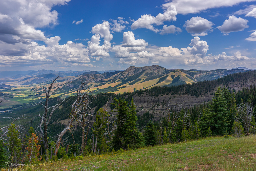
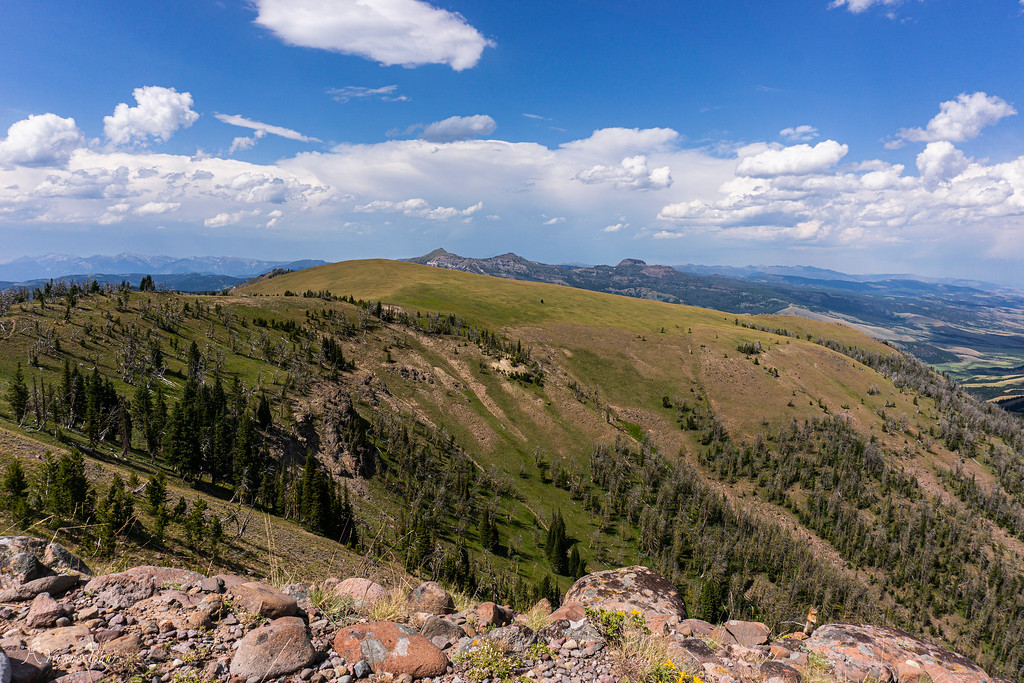
Mountain Galore wherever you look
short break
I just crossed that big meadow a bit earlier
Eventually, the trail became a bit faint when I had to climb up a steep meadow and it was hard to follow. There were some wooden stakes but many of them were damaged from recent winter snow. It took a little bit to find the proper trail but finally, I was up on the ridge again and could see Bighorn Peak ahead of me.
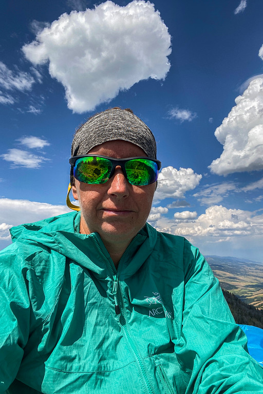
Unfortunately, a massive storm was moving in pretty fast and I was drawn back and forth. I really wanted to climb Bighorn Peak to the top but that would mean an additional 20-25 minute climb and be fully exposed high on the ridge.
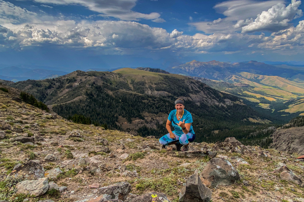
Selfie on the ridge with the storm moving in fast
I did not want to get caught up in this storm. I already felt the electricity building up and smelled ozone. This was not a place to be during a lightning storm. So I made the decision to skip Bighorn Peak. I was so close!!
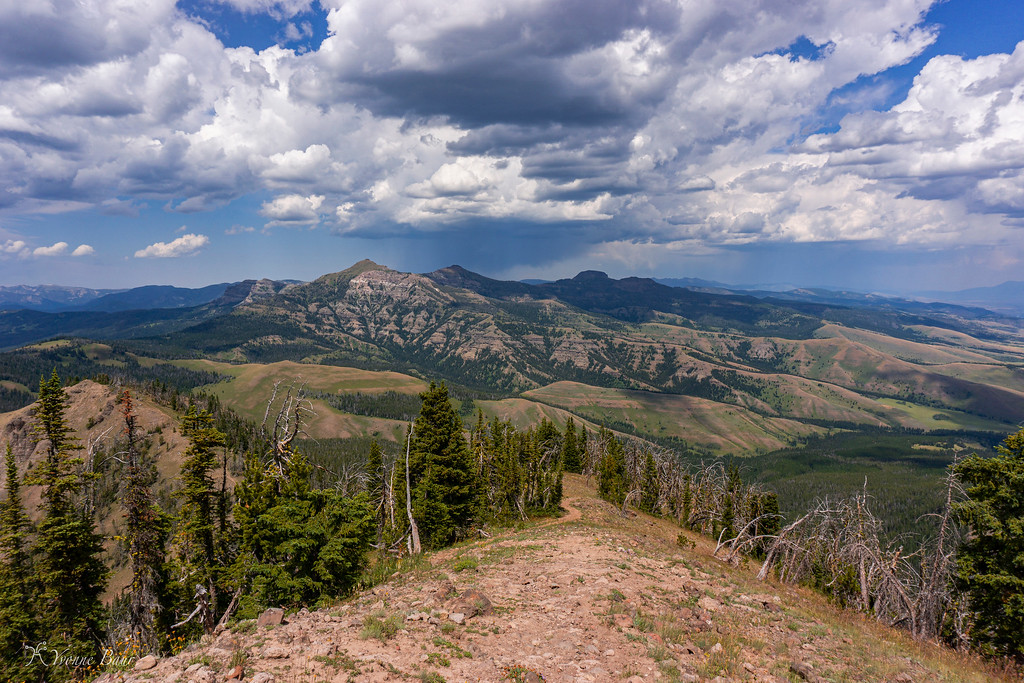
Bighorn Peak right in the foreground
Bighorn Peak
well, there is always another time. I rushed down the mountain and was glad to be back in the timberline when the storm started to hit.
It hailed and rained, thunder clapped and lightning came down all at the same time. I was glad when I reached the Daly Creek Patrol Cabin and sat out the storm on its front porch. In the end, I was glad I decided against Bighorn Peak because the storm would have hit me on top in full force.
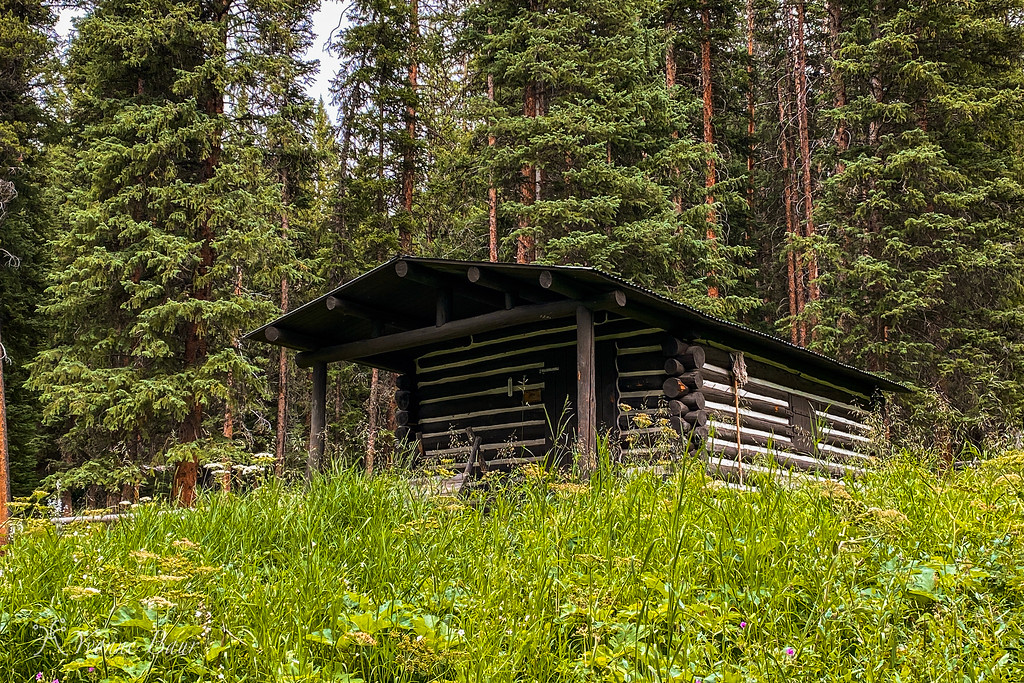
Daly Creek Patrol Cabin
I was still happy I did the hike. It took me about 9 hours and 20 miles to finish. What a great adventure. I did not see a single bear even though this area is known to have a good population f them. I guess I'm just too loud, lol.
Hopefully, next time I'll be able to climb Bighorn Peak as well.
Nonetheless, I had a lot of fun as I worked my way up and did not see a single person.
I started at Daly Creek trailhead later than expected because the road construction along 191 took longer than I thought it would. The primitive parking area already had several cars parked but I found enough parking for my car and got my gear ready. My backpack was heavier than normal because of all the water I carried today. There was no water along Sky Rim and I had to carry everything with me.
Around 9 am I was ready to start and left the trailhead.
Crown Butte dominated the scene for the first 2 miles and the trail followed an area covered in sagebrush and grasses. Soon after the start I crossed Daly Creek and continued on.
It was pretty cloudy today but it helped to keep the temperatures low. I've also chosen a good day to hike and the chance of afternoon thunderstorms was only 15%.
Daly Creek
the first trail junction after 1.8 miles
After leaving Daly Creek and the last spot to filter water, the trail started to climb up to the Sky Rim. Open meadows and patches of forests alternated several times and I worked my way up, huffing and puffing, and enjoying the wildflower display. So far it was not bad and the elevation gain was gradual.
Eventually, I reached the Sky Rim and stopped for a short break. The trail up was a bit of a leg burner, but totally doable with great scenery along the way.
the trail follows some flower meadows along the rim
traveling along an arete I follow Sky Rim on a more mellow section
The trail section along the rim was really nice, there were up and downs all the time and the trail followed an arete carved by glaciers. The views to both sides were superb and I needed to stop all the time. I'm not sure what it is but I'm a huge fan of expansive mountain scenes. I often feel so small when I'm immersed in it and pictures just can't do justice.
working my way up
still going up
Between layers of lava tuff, I found many specimens of Petrified Wood. I knew there was a Petrified Forest on the other side of the ridge in Yankee Jim Canyon but did not know it was up here as well. Definitely a pretty cool surprise.
Petrified Wood
I encountered more Park boundary signs and the trail marker to some trails in the National Forest. Well, I guess one of these days I'll hike up here from the National Forest. There are tons of options all over the place and I made some mental notes for future references and trips.
Park Boundary
The wildflower galore up here was just amazing. I thought I was way too late but got a pleasant surprise up here in the higher elevations.
And then the first real views of the surrounding area - just wow!! Even the storm that was brewing in the distance couldn't take away all the wow moments I experienced right now.
It can't get any better
the view looking toward Ramshorn Peak, Twin Peaks, Steamboat Mountain
there were a lot of these markers along the Rim
someone was watching me, I'm glad it wasn't a bear
looking back into Yankee Jim Canyon and the backside of Paradise Valley
the trail is zigzagging up that ridge which means I have to zigzag my way up there soon
There were lots of ups and downs and the trail kept zigzagging up and down some ridges. It definitely was a leg burner and I could feel it, but the views excused all the work I had to do.
a storm developed in the distance
I made it up the ridge and enjoyed the views back
I found more Petrified Wood
Mountain Galore wherever you look
short break
I just crossed that big meadow a bit earlier
Eventually, the trail became a bit faint when I had to climb up a steep meadow and it was hard to follow. There were some wooden stakes but many of them were damaged from recent winter snow. It took a little bit to find the proper trail but finally, I was up on the ridge again and could see Bighorn Peak ahead of me.
Unfortunately, a massive storm was moving in pretty fast and I was drawn back and forth. I really wanted to climb Bighorn Peak to the top but that would mean an additional 20-25 minute climb and be fully exposed high on the ridge.
Selfie on the ridge with the storm moving in fast
I did not want to get caught up in this storm. I already felt the electricity building up and smelled ozone. This was not a place to be during a lightning storm. So I made the decision to skip Bighorn Peak. I was so close!!
Bighorn Peak right in the foreground
Bighorn Peak
well, there is always another time. I rushed down the mountain and was glad to be back in the timberline when the storm started to hit.
It hailed and rained, thunder clapped and lightning came down all at the same time. I was glad when I reached the Daly Creek Patrol Cabin and sat out the storm on its front porch. In the end, I was glad I decided against Bighorn Peak because the storm would have hit me on top in full force.
Daly Creek Patrol Cabin
I was still happy I did the hike. It took me about 9 hours and 20 miles to finish. What a great adventure. I did not see a single bear even though this area is known to have a good population f them. I guess I'm just too loud, lol.
Hopefully, next time I'll be able to climb Bighorn Peak as well.

 Have a great trip.