Navigation
Install the app
How to install the app on iOS
Follow along with the video below to see how to install our site as a web app on your home screen.
Note: This feature may not be available in some browsers.
More options
Style variation
You are using an out of date browser. It may not display this or other websites correctly.
You should upgrade or use an alternative browser.
You should upgrade or use an alternative browser.
silver falls and choprock
- Thread starter regehr
- Start date
regehr
Member
- Joined
- Mar 28, 2012
- Messages
- 2,451
regehr
Member
- Joined
- Mar 28, 2012
- Messages
- 2,451
the GSENM road report was last updated in March. guess they got DOGEd. love to see the efficiency!

 www.blm.gov

GSENM-Road-Condition-Report | Bureau of Land Management
*****WEATHER RESOURCES***** Visit Monument Travel Advisories to help plan and prepare for your next adventure. Attention Monument Visitors, The Grand Staircase-Escalante National Monument Road Report is typically updated weekly, more frequently if road conditions warrant. However, we regret to...
- Joined
- Dec 5, 2017
- Messages
- 1,339
I saw that old report, too. This one (https://www.nps.gov/glca/learn/news/road-conditions.htm) is newer, but still too old to be helpful. I called today to find out about conditions and left a message. Given the fact that tomorrow is Oct. 1, I'm guessing I won't get through to anyone any time soon...the GSENM road report was last updated in March. guess they got DOGEd. love to see the efficiency!

GSENM-Road-Condition-Report | Bureau of Land Management
*****WEATHER RESOURCES***** Visit Monument Travel Advisories to help plan and prepare for your next adventure. Attention Monument Visitors, The Grand Staircase-Escalante National Monument Road Report is typically updated weekly, more frequently if road conditions warrant. However, we regret to...www.blm.gov
regehr
Member
- Joined
- Mar 28, 2012
- Messages
- 2,451
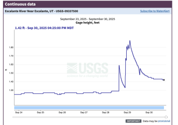
Silver Falls canyon seemed wet -- small pools started appearing about halfway down and persisted sporadically all the way to near the Escalante. We needed to make some time after a late start on Saturday and didn't checkout Emigrant Spring.Please report back on the water situation. We've at least been getting some rain in SW UT.
Choprock felt drier-- no water below the confluence with the technical (south) fork, but there's a large (perhaps perennial?) pool below the big dryfall a half mile up the technical fork. Then, just a few breakouts of surface water in the lower half of Choprock. Some of it very clayey and nasty.
Escalante itself was running turbid and warm, we spent a very pleasant hour soaking in a sunny spot near the mouth of Choprock on Sunday afternoon. Were not interrupted by packrafters. In fact, didn't see anyone at all between Saturday and today.
Quite a bit of traffic on the Burr Trail through Long Canyon, then very sparse on the eastern side. The "Little Bone" food truck on the premises of Hells Backbone Grill / Boulder Mtn Lodge served up an excellent lunch for us and seemed to be doing a solid amount of business.
Last edited:
- Joined
- Dec 5, 2017
- Messages
- 1,339
When you did the overland route, which side of the river were you on, east or west?randomly, we walked a chunk of the Overland route south of Choprock, this was super nice although we didn't push all the way to Neon Canyon
regehr
Member
- Joined
- Mar 28, 2012
- Messages
- 2,451
we climbed up to bench level near the mouth of Choprock Canyon, so on the east side of the Escalante. there's a super obviously constructed cattle trail leaving Choprock to the south, just a bit up-canyon from the Escalante. it requires one or two easy climbing moves since presumably there was a bit of wooden structure that has long since washed away. then, a bit higher up there's some obvious dynamite work. this trail is super easy to follow.When you did the overland route, which side of the river were you on, east or west?
James and Amy
Member
- Joined
- Jun 6, 2021
- Messages
- 69
Steve Allen's Overland Route stays almost entirely on the east rim above the river, but occasionally drops to the Escalante level itself when it crosses the many side canyons draining to the river.When you did the overland route, which side of the river were you on, east or west?
- Joined
- Dec 5, 2017
- Messages
- 1,339
Thanks for your responses, @regehr and @James and Amy. I'm collecting info for this trip because I hope to do it next fall when the cottonwoods will be yellow. I was just in Coyote Gulch too early for peak color but did a dayhike in the Upper Escalante on Oct. 9 and loved seeing some yellow cottonwoods there. Then while driving at higher elevation on Oct 10, I saw gorgeous stands of cottonwoods and was thinking about how to backpack amidst that golden color next year. I'm imagining a Silver Falls/Choprock/Neon/etc trip in mid-October, perhaps around the 20th. I realize there will be less daylight then and temps will be colder. I already stored away @John Morrow's info about going above the Escalante on the west side (going north to south - starting at a sand dune near where Harris & Silver Falls meet the Escalante and ending where Fence comes into the Escalante). At our hotel, Canyon Country Lodge, I just happened to chat with the owner, who was super nice and told me about that same sand dune at the north end (he referred to it as a sand slide) that he's confident I could do since he has ridden his horse down it!
Anyway, we like doing 5-6 nights on trail (when possible) and therefore want to find ways to extend the trip beyond just 3 nights. Wandering around on slickrock above the river is always thrilling to us, so figuring ways to get up there is very appealing.
Speaking of which, have any of you gone upstream in Harris from the Harris/Escalante confluence and gotten out of the wash onto the slickrock above? I found info somewhere about a possible exit on the north side, approx 2.8 mi up Harris, but I have a feeling it might be too challenging for us. If anyone knows about that (or other ways to get above the wash or river) I welcome your info!
Last edited:
- Joined
- Dec 5, 2017
- Messages
- 1,339
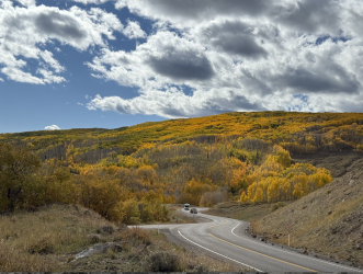
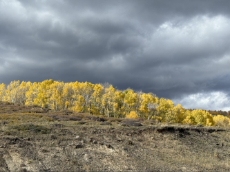
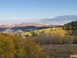
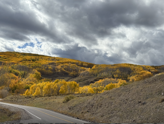
YES - Hwy 12 around Boulder Mtn was incredible! We were there Mon Oct. 6 and I had no idea the aspens would be at peak then. We stopped a lot to admire the view!I think around October 20th sounds great for changing cottonwoods.
our trip was Oct 4-7 and the cottonwoods in Silver Falls and Choprock were not even starting to change. but highway 12 over Boulder Mountain was sure pretty!
James and Amy
Member
- Joined
- Jun 6, 2021
- Messages
- 69
Janice,Thanks for your responses, @regehr and @James and Amy. I'm collecting info for this trip because I hope to do it next fall when the cottonwoods will be yellow. I was just in Coyote Gulch too early for peak color but did a dayhike in the Upper Escalante on Oct. 9 and loved seeing some yellow cottonwoods there. Then while driving at higher elevation on Oct 10, I saw gorgeous stands of cottonwoods and was thinking about how to backpack amidst that golden color next year. I'm imagining a Silver Falls/Choprock/Neon/etc trip in mid-October, perhaps around the 20th. I realize there will be less daylight then and temps will be colder. I already stored away @John Morrow's info about going above the Escalante on the west side (going north to south - starting at a sand dune near where Harris & Silver Falls meet the Escalante and ending where Fence comes into the Escalante). At our hotel, Canyon Country Lodge, I just happened to chat with the owner, who was super nice and told me about that same sand dune at the north end (he referred to it as a sand slide) that he's confident I could do since he has ridden his horse down it!
Anyway, we like doing 5-6 nights on trail (when possible) and therefore want to find ways to extend the trip beyond just 3 nights. Wandering around on slickrock above the river is always thrilling to us, so figuring ways to get up there is very appealing.
Speaking of which, have any of you gone upstream in Harris from the Harris/Escalante confluence and gotten out of the wash onto the slickrock above? I found info somewhere about a possible exit on the north side, perhaps 4.5 mi up Harris, but I have a feeling it might be too challenging for us. If anyone knows about that (or other ways to get above the wash or river) I welcome your info!
Please see https://doingmiles.com/2020-09-escalante/ for a trip report detailing an exit north from Harris Wash up Red Breaks. We did not do the segment between Red Breaks and the Escalante, but do not know of any significant obstacles along that route.
James (and Amy)
- Joined
- Dec 5, 2017
- Messages
- 1,339
Thanks, James. I made great use of your trip report when planning our 2022 LDH/Wolverine trip with extensions above the Escalante. On a Silver Falls/Choprock trip, if we go above Harris Wash, it would be closer to the Escalante than Red Breaks, perhaps around 37.65106, -111.26406. I'll be interested to see if this spot or some other spot will work...Janice,
Please see https://doingmiles.com/2020-09-escalante/ for a trip report detailing an exit north from Harris Wash up Red Breaks. We did not do the segment between Red Breaks and the Escalante, but do not know of any significant obstacles along that route.
James (and Amy)
Don't like ads? Become a BCP Supporting Member and kiss them all goodbye. Click here for more info.

