- Joined
- Dec 23, 2013
- Messages
- 4,295
I had the opportunity last week to spend two nights in the Yellowstone backcountry with my family at an area located within the Grand Canyon of the Yellowstone called Sevenmile Hole. In addition to spending the two nights at campsite 4C2, we did a day hike back out of the canyon to Washburn Hot Springs, plus a little off-trail jaunt to an unnamed pond located about halfway between the Grand Loop Road and the trail.
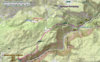
Trip Map
The trip begins at the Glacial Boulder trailhead where the trail parallels the Canyon for the first mile before turning north through the forest.
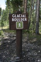
Glacial Boulder trailhead
At roughly 2.7 miles, we reached the trail intersection for Sevenmile Hole and began dropping down into the canyon itself where nice views began to present themselves to us.
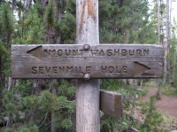
Trail Junction Sign
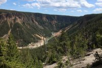
View to the south of the Grand Canyon of the Yelllowstone from the trail
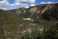
View to the northeast of the Grand Canyon of the Yelllowstone from the trail
We finally arrived at campsite 4C2 and went about setting up our camp after which we explored the immediate vicinity.
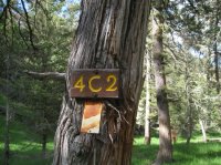
Campsite 4C2
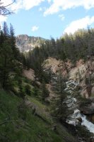
Sulphur Creek
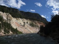
View from the bottom of the canyon - where we ate our meals
On day 2, we went on a day hike to Washburn Hot Springs. While on the way we took some time to investigate the thermal features that we had passed by the day before.
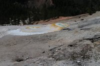
Thermal area along the trail that descends into the canyon
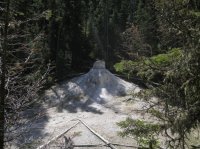
Another thermal feature
Once we made it back up the canyon, we quickly hiked to the trail junction where we took a right and headed towards the Washburn Hot Springs. The trail would skirt some beautiful meadows along the way and we saw wolf and bear tracks on the trail. Eventually we reached the hot springs
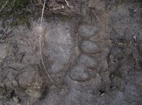
Bear track on the trail to Washburn Hot Springs
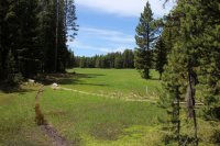
One of the meadows along the way
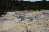
Washburn Hot Springs
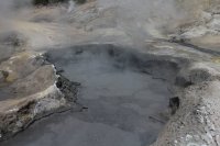
Hot pot at Washburn Hot Springs
After spending some time at the thermal area, we hike about a half a mile to the northeast to a large meadow, located south of Mount Washburn, to eat some lunch.
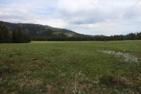
Meadow south of Mount Washburn
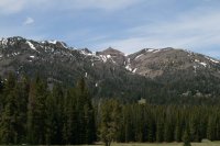
Mount Washburn
After lunch we retraced our footsteps back to an earlier meadow we passed and began our off-trail hike to an unnamed pond which was located at the far western end of a large marshy area about a mile east of the trail.
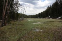
Marshy area we hiked through on the way to the pond
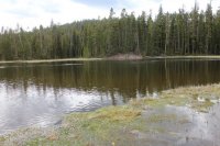
The pond
After finding our way back to the trail we returned to our campsite, ate dinner and called it a day. The next day we got up, packed up our camp and headed back to the trailhead.
Overall, it was a fun trip. I think a two night stay is probably the maximum number of nights I would recommend. Once at the bottom of the canyon the space to explore is limited. I suppose if you enjoy fishing the river, a third night stay might make sense. There were some thermal features above our campsite along Sulphur Creek that I wouldn't mind checking out if I ever return to this area. I didn't have the time to check out the other waterfalls in the area like I had intended to do. So I could also add that to the list if I go back.
Featured image for home page:
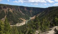

Trip Map
The trip begins at the Glacial Boulder trailhead where the trail parallels the Canyon for the first mile before turning north through the forest.

Glacial Boulder trailhead
At roughly 2.7 miles, we reached the trail intersection for Sevenmile Hole and began dropping down into the canyon itself where nice views began to present themselves to us.

Trail Junction Sign

View to the south of the Grand Canyon of the Yelllowstone from the trail

View to the northeast of the Grand Canyon of the Yelllowstone from the trail
We finally arrived at campsite 4C2 and went about setting up our camp after which we explored the immediate vicinity.

Campsite 4C2

Sulphur Creek

View from the bottom of the canyon - where we ate our meals
On day 2, we went on a day hike to Washburn Hot Springs. While on the way we took some time to investigate the thermal features that we had passed by the day before.

Thermal area along the trail that descends into the canyon

Another thermal feature
Once we made it back up the canyon, we quickly hiked to the trail junction where we took a right and headed towards the Washburn Hot Springs. The trail would skirt some beautiful meadows along the way and we saw wolf and bear tracks on the trail. Eventually we reached the hot springs

Bear track on the trail to Washburn Hot Springs

One of the meadows along the way

Washburn Hot Springs

Hot pot at Washburn Hot Springs
After spending some time at the thermal area, we hike about a half a mile to the northeast to a large meadow, located south of Mount Washburn, to eat some lunch.

Meadow south of Mount Washburn

Mount Washburn
After lunch we retraced our footsteps back to an earlier meadow we passed and began our off-trail hike to an unnamed pond which was located at the far western end of a large marshy area about a mile east of the trail.

Marshy area we hiked through on the way to the pond

The pond
After finding our way back to the trail we returned to our campsite, ate dinner and called it a day. The next day we got up, packed up our camp and headed back to the trailhead.
Overall, it was a fun trip. I think a two night stay is probably the maximum number of nights I would recommend. Once at the bottom of the canyon the space to explore is limited. I suppose if you enjoy fishing the river, a third night stay might make sense. There were some thermal features above our campsite along Sulphur Creek that I wouldn't mind checking out if I ever return to this area. I didn't have the time to check out the other waterfalls in the area like I had intended to do. So I could also add that to the list if I go back.
Featured image for home page:

Last edited:

