Keith
Member
- Joined
- Nov 2, 2014
- Messages
- 75
The weather looked good for the last weekend of the season so I decided to make the trip from Seattle to enjoy one last visit to the park in 2014. My plan was to visit sections of the Howard Eaton trail and to visit with Joey. With one exception, all the sections I planned to visit on this trip are no longer maintained. I took an interest in finding all the sections of the Howard Eaton after discovering it on old maps and then it really took off when I met Scatman and started hiking the unmaintained portions on his trips.
All the photos can be found at https://www.flickr.com/photos/83759699@N08/sets/72157649108338765/
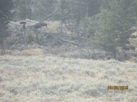
I arrived in the park around noon on Thursday. I quickly came across an Elk heard in Mammoth and this scene would illustrate the start of my hike:

My original plan was to park at Phantom Lake and hike up Oxbow creek. When I arrived the ravine looked deeper than I wanted to deal with so I went back to the Blacktail trailhead. On my way I passed an alligator! Not really of course but there was a group tracking wolves and two of them were in costume. I thought about taking a picture of them but that seemed too creepy, though I kind of regret not doing it now.
When I arrived at the Blacktail trailhead, I could see a bison heard in the meadow across the river where I thought the trail would be so that was disappointing but I figured I could walk around them. When I went to put my boots on I remembered one shoe lace broke back in Seattle and of course I forgot to replace it. I decided to go with tennis shoes which didn’t end up being horrible but was sub-optimal given how those meadows have so many ankle biters. About 100 yards into the hike I realized the bladder for my water backpack was leaking so I went back to the car to switch to bottles. When I reached the junction with the Howard Eaton, there was a bear warning posted. It was laying on the ground face down (I propped it up for this picture) and it wasn’t really clear which trail was closed. I figured I was going on an unmaintained trail and this kind of sign would only be for maintained trails so it surely wouldn’t impact me so I pressed ahead (flawless logic I’m sure!).

I first went up the hill to check out the fences. I then cut across the river to the East. At that point I was north of where I wanted to be but the bison were still in the way. I crossed the river and about a mile later I finally found the first trail marker:

I had hoped to find more markers such as this in the meadows but it was the only marker not in a tree that I could find:

The trail was pretty easy to follow the next mile but there were some game trails that distracted me at times and more bison kept getting in the way. I’m assuming Eaton used game trails so it wasn’t too surprising they would be intermixed. Unfortunately it does mean the animals leave obstacles in the trail and I stepped in one (yuck!).
I lost the trail close to Oxbow creek which was frustrating but I was running out of daylight and had to turn around. On the way back the bison were no longer in the meadow where I thought the trail should be but I couldn’t find any sign of it through the meadow. I did find this rebar in the ground up the hill from the river but I don’t really know what to make of it:

Overall it was fun adventure and I was surprised to get sunburn and hot in late October but it was a nice break from the dreary of Seattle. I’d really like to explore the portion from Oxbow to the east someday.
My plan was to camp at Mammoth so I headed back there. I was greeted with a rainbow! I bought new shoe laces and I enjoyed watching the Elk at Mammoth as well – the females appeared focused on getting ready for the winter and the males seemed more focused on the females.
On Friday I got up really early for the haul to Canyon – the construction had me concerned and I wanted to spend as much daylight as possible exploring the Howard Eaton that goes south from the Wapiti trailhead. This portion is maintained but it’s been closed a lot lately due to the wolves having a den with pups in the area. It’s open now so I figured I should explore it while I could. There were couple inches of snow on the ground and it was cold (26 degrees) but I was prepared for the weather and the sun was coming out! A few feet into the trail and I noticed bear tracks the entire visible length of the trail. That was a little scary but the good news is the tracks were in the opposite direction so I knew at least that grizzly had moved on (perhaps over optimistic of me?).


I had planned on doing the loop over to the Sour Creek trail but about a 1.5 miles into the hike I was tired of stomping through the snow so I turned back. I’ve been on some of the other edges of this meadow so it was fun getting the different perspective but this particular stretch is too close to the road to feel like the backcountry but I wanted to tick it off my Howard Eaton list!
I then headed down to Indian pond along the East Entrance road. There is a decommissioned picnic area on the other side of the road from the Storm Point trailhead. I took some photos of the garbage that was left behind, an asphalt pile, a couple sections of the old road and some trash. The view from the picnic area of Pelican Valley is pretty but I guess they decommissioned it when they decommissioned the campground close to Fishing Bridge.


I had lunch on the shore next to Lake Hotel. The view from the Hotel is a lot more fun now that I’ve visited Avalanche Peak (years ago) and the Thorofare (my first Thorofare trip was in August). Mount Sheridan is still taunting me!

Then I headed to a thermal area just north of West Thumb. I approached from the woods to the north along another section of old road (evidence of the old road still exists).


I was running out of daylight so it was time to head to Lewis Lake to set up camp and visit with Joey who came up from Jackson and was kind enough to bring food and firewood – I hadn’t planned this trip too carefully J. We had a great campfire and heard coyotes in the night. In the morning I went down to the lake and saw a couple of them in the distance. Joey wanted to spend one more night in the backcountry and I had planned on staying in the park Saturday night but they scared me with the weather forecast so I decided to tinker around the west part of the park and then head back to Seattle a day early.
We caravanned up to Canyon and saw Elk, Bison and a Grizzly along the way. The Elk and Bison were on and near the road. This would normally cause a 60 minute back up but not this time of year! The grizzly was close to the trail I hiked the day before so it’s possible it was his tracks I walked in:

We headed our separate ways at Canyon.
I decided to explore the unmaintained Howard Eaton trail around the west end of the Mary Mountain / Nez Perce trail. As I approached I saw two coyotes close to the road:


I decided to make a lunch stop at Old Faithful first. I was also curious to see the area when everything was quiet and closed. I was also hoping I might get lucky on timing with Grand or Castle but I wasn’t so lucky. I did see a pick-up truck with two crows fighting over the groceries in the back so that was fun. I always imagine the shock of people coming back to their truck wondering why it wasn’t safe to keep food out in Yellowstone.
The weather was beautiful (56 and sunny!) so I headed back to the Mary Mountain West / Nez Perce trailhead. I toyed with trying to figure out where the Howard Eaton crossed the river to the North but was quickly dissuaded by the bogginess. I did see a coyote on the trail and I wondered if it was one of the two I had seen before lunch. I went up into the woods to the South and soon found this guy close to where I thought the trail would be:

After taking that picture I looked up and saw a trail marker in the distance! There had to be some poetic justice to this dead bison helping me find the trail when all live bison thwarted me up at Blacktail.

I followed the trail for a while (finding 3 more markers) but then lost it when I hit a thermal area that caught me by surprise. I spent way too much time exploring the thermal area and never could find the trail south of it. Weather conditions were declining, I could hear thunder and see lightening so I decided it was time to pack it up and head back to Seattle.
The rain hit just as I was leaving the woods so I jogged back to my car (always fun with hiking boots!). I got a little cold and wet. I made every excuse I could think of to linger in the park but ultimately decided I should get on the road and face all the snow predicted for Western Montana along I90. There was no snow but lots of rain.
All the photos can be found at https://www.flickr.com/photos/83759699@N08/sets/72157649108338765/
I arrived in the park around noon on Thursday. I quickly came across an Elk heard in Mammoth and this scene would illustrate the start of my hike:
My original plan was to park at Phantom Lake and hike up Oxbow creek. When I arrived the ravine looked deeper than I wanted to deal with so I went back to the Blacktail trailhead. On my way I passed an alligator! Not really of course but there was a group tracking wolves and two of them were in costume. I thought about taking a picture of them but that seemed too creepy, though I kind of regret not doing it now.
When I arrived at the Blacktail trailhead, I could see a bison heard in the meadow across the river where I thought the trail would be so that was disappointing but I figured I could walk around them. When I went to put my boots on I remembered one shoe lace broke back in Seattle and of course I forgot to replace it. I decided to go with tennis shoes which didn’t end up being horrible but was sub-optimal given how those meadows have so many ankle biters. About 100 yards into the hike I realized the bladder for my water backpack was leaking so I went back to the car to switch to bottles. When I reached the junction with the Howard Eaton, there was a bear warning posted. It was laying on the ground face down (I propped it up for this picture) and it wasn’t really clear which trail was closed. I figured I was going on an unmaintained trail and this kind of sign would only be for maintained trails so it surely wouldn’t impact me so I pressed ahead (flawless logic I’m sure!).
I first went up the hill to check out the fences. I then cut across the river to the East. At that point I was north of where I wanted to be but the bison were still in the way. I crossed the river and about a mile later I finally found the first trail marker:
I had hoped to find more markers such as this in the meadows but it was the only marker not in a tree that I could find:
The trail was pretty easy to follow the next mile but there were some game trails that distracted me at times and more bison kept getting in the way. I’m assuming Eaton used game trails so it wasn’t too surprising they would be intermixed. Unfortunately it does mean the animals leave obstacles in the trail and I stepped in one (yuck!).
I lost the trail close to Oxbow creek which was frustrating but I was running out of daylight and had to turn around. On the way back the bison were no longer in the meadow where I thought the trail should be but I couldn’t find any sign of it through the meadow. I did find this rebar in the ground up the hill from the river but I don’t really know what to make of it:
Overall it was fun adventure and I was surprised to get sunburn and hot in late October but it was a nice break from the dreary of Seattle. I’d really like to explore the portion from Oxbow to the east someday.
My plan was to camp at Mammoth so I headed back there. I was greeted with a rainbow! I bought new shoe laces and I enjoyed watching the Elk at Mammoth as well – the females appeared focused on getting ready for the winter and the males seemed more focused on the females.
On Friday I got up really early for the haul to Canyon – the construction had me concerned and I wanted to spend as much daylight as possible exploring the Howard Eaton that goes south from the Wapiti trailhead. This portion is maintained but it’s been closed a lot lately due to the wolves having a den with pups in the area. It’s open now so I figured I should explore it while I could. There were couple inches of snow on the ground and it was cold (26 degrees) but I was prepared for the weather and the sun was coming out! A few feet into the trail and I noticed bear tracks the entire visible length of the trail. That was a little scary but the good news is the tracks were in the opposite direction so I knew at least that grizzly had moved on (perhaps over optimistic of me?).
I had planned on doing the loop over to the Sour Creek trail but about a 1.5 miles into the hike I was tired of stomping through the snow so I turned back. I’ve been on some of the other edges of this meadow so it was fun getting the different perspective but this particular stretch is too close to the road to feel like the backcountry but I wanted to tick it off my Howard Eaton list!
I then headed down to Indian pond along the East Entrance road. There is a decommissioned picnic area on the other side of the road from the Storm Point trailhead. I took some photos of the garbage that was left behind, an asphalt pile, a couple sections of the old road and some trash. The view from the picnic area of Pelican Valley is pretty but I guess they decommissioned it when they decommissioned the campground close to Fishing Bridge.
I had lunch on the shore next to Lake Hotel. The view from the Hotel is a lot more fun now that I’ve visited Avalanche Peak (years ago) and the Thorofare (my first Thorofare trip was in August). Mount Sheridan is still taunting me!
Then I headed to a thermal area just north of West Thumb. I approached from the woods to the north along another section of old road (evidence of the old road still exists).
I was running out of daylight so it was time to head to Lewis Lake to set up camp and visit with Joey who came up from Jackson and was kind enough to bring food and firewood – I hadn’t planned this trip too carefully J. We had a great campfire and heard coyotes in the night. In the morning I went down to the lake and saw a couple of them in the distance. Joey wanted to spend one more night in the backcountry and I had planned on staying in the park Saturday night but they scared me with the weather forecast so I decided to tinker around the west part of the park and then head back to Seattle a day early.
We caravanned up to Canyon and saw Elk, Bison and a Grizzly along the way. The Elk and Bison were on and near the road. This would normally cause a 60 minute back up but not this time of year! The grizzly was close to the trail I hiked the day before so it’s possible it was his tracks I walked in:
We headed our separate ways at Canyon.
I decided to explore the unmaintained Howard Eaton trail around the west end of the Mary Mountain / Nez Perce trail. As I approached I saw two coyotes close to the road:
I decided to make a lunch stop at Old Faithful first. I was also curious to see the area when everything was quiet and closed. I was also hoping I might get lucky on timing with Grand or Castle but I wasn’t so lucky. I did see a pick-up truck with two crows fighting over the groceries in the back so that was fun. I always imagine the shock of people coming back to their truck wondering why it wasn’t safe to keep food out in Yellowstone.
The weather was beautiful (56 and sunny!) so I headed back to the Mary Mountain West / Nez Perce trailhead. I toyed with trying to figure out where the Howard Eaton crossed the river to the North but was quickly dissuaded by the bogginess. I did see a coyote on the trail and I wondered if it was one of the two I had seen before lunch. I went up into the woods to the South and soon found this guy close to where I thought the trail would be:
After taking that picture I looked up and saw a trail marker in the distance! There had to be some poetic justice to this dead bison helping me find the trail when all live bison thwarted me up at Blacktail.
I followed the trail for a while (finding 3 more markers) but then lost it when I hit a thermal area that caught me by surprise. I spent way too much time exploring the thermal area and never could find the trail south of it. Weather conditions were declining, I could hear thunder and see lightening so I decided it was time to pack it up and head back to Seattle.
The rain hit just as I was leaving the woods so I jogged back to my car (always fun with hiking boots!). I got a little cold and wet. I made every excuse I could think of to linger in the park but ultimately decided I should get on the road and face all the snow predicted for Western Montana along I90. There was no snow but lots of rain.
")
 If I think that I can pull that off from a physical standpoint, I'll attempt it. By the way, you'll be getting an invite to join group/me when that time arrives!

