- Joined
- Jul 23, 2013
- Messages
- 1,666
This past Spring, I took yet another opportunity to do some more exploration of Capitol Reef National Park. No surprise there. This time, my wife Jessica would join along. In fact, this trip would be more unique from past trips, both in this park and elsewhere. We would be exploring an area in the northern regions of the park I had no familiarity with. There was no beta, no trail guides, no nothing to be found online other than maps and satellite imagery to aid us in the course we would take on this trip. This would be as remote as anywhere you could stumble into within the park's boundaries. It was to be all new and all raw. Well, most of it. Just good old fashioned backcountry route-finding and navigating off-trail through an area that I can confidently say very, very few others have ventured into since the Fremont culture inhabited this region over 700 years ago. As much fun of an adventure this would be all by itself, there was another purpose for this trip: Family History.
That's right, family history. As mentioned in previous posts, Jess is a great-great-granddaughter of Ephraim Pectol, a man credited with being the father of Capitol Reef National Park. Prior to successfully campaigning for federal protection of the landscape the comprises much of what lies within the borders of Capitol Reef today, or as he often called it, "Wayne Wonderland", after Wayne County for which the land occupied, Ephraim had spent much free time in the early 1900's wandering, roaming and exploring the landscapes surrounding his residence in Torrey, Utah. He was enchanted with the natural beauty and wonder of the Waterpocket Fold and all that surrounded it. In those explorations, he stumbled into a little known valley that is now found within the northern region of the park and there on a rock wall, in a time devoid of the Internet, social media, and modern day Leave No Trace ethics, he left an inscription of his name. Finding this inscription was our mission.
There is a relatively "easy" way to access this valley via a few miles of trail which has no mention in park literature or other guides, online or otherwise. However, to reach the trail requires driving up a very long, rough, and narrow 4WD road. In fact, we did attempt it a previous time, but the road to access the trail was so much rougher than anticipated that it took up all the time we had allotted to the endeavor just to drive the road, leaving us no time for any of the actual hiking and searching around once in the valley. Rather than mess with that road again, I wanted to be even more adventurous and see if the aforementioned valley could be accessed on foot from another direction, from another trailhead also lacking in popularity but was much easier to drive to, albeit much longer in distance. From there we could go down into a larger, lower valley and then attempt to navigate a maze of canyons that drain away from the high plateau that holds the little valley we were targeting. So plans were made to spend a weekend to explore this great unknown and see whether a route I had charted would be viable or not.
DAY ONE
Friday - April 23, 2021
Peak visitation season was just now beginning in the park, yet, the trailhead we made use of was completely vacant. There was not another vehicle or soul to be found here. In fact, we encountered very few others on the several miles long dirt road up to the trailhead since leaving the highway. In an effort to help preserve the quiet solitude that we were able to enjoy, to preserve its raw and wild character, and to keep this area a place of newness and discovery for any others that may stumble into this remote section of the park, I'm going to remain vague and not identify any landmarks.
However, a clue or two will be disclosed further down in this post that could help aid the reader in doing a little bit of detective work to locate the vicinity of the area we had the privilege of exploring for ourselves should they wish. Keep in mind, this area is very remote. That means it's far from emergency aid and has no available cell signal. As we did, you could find yourself all alone. While we never saw anyone else drive up to the trailhead we used, it does receive occasional traffic from time to time, mostly from folks there to check off part of a much larger sight-seeing agenda whereby they will spend just a few minutes to hike a very short distance to the rim of a scenic overlook. So aside from any clue, this will simply have to be a case of "If you know, you know."
Beyond a couple of named landmarks nearer to the trailhead, what trail there is through patches of the low valley quickly vanishes for good and the landscape thereby becomes a "no man's land". Oh, and water sources are very scarce out in this region. In fact, aside from what you can bring in yourself, there is none to be found for several miles from the trailhead. And even that was a gamble for us. Our ability to find water in a spot I had spied on satellite, not too far from a spot I aimed to camp, would dictate the agenda for the remainder of the trip. We'd each pack in between 5 and 6 liters of of water to ensure we had enough to get back out to the car the following day if efforts to find water near camp came up empty handed. In such a barren and drought stricken land, even that could have been risky.
All that water also helped to max out the weight capacity of our respective packs, ULA Circuits, and thus gave us a chance to test out their stated limit. At nearly 35 lbs each to start out, our packs did perform as specified and did not burden our bodies with too much discomfort. Rougher terrain with more strenuous elevation gain might have had different and less desirable results however.
Now, enough with the introductory remarks and tangents. Let's get into the action...
After obtaining our backcountry permit from the Visitor Center, we arrived at the trailhead in mid-afternoon, commenced our pre-hike routine and check-down, and put on our heavy, water-laden packs. Skies were mostly sunny while the air was breezy but generally comfortable. It would be over eight miles to arrive at our target for the night, a spot where we'd aim to make a basecamp for which we'd stay a second night were we to successfully find water in the vicinity. Due to the late start, we were now racing nightfall to get all those miles in.
Hoodoos greeted us at the rim where we began the descent.
Descending down into the large, lower valley.
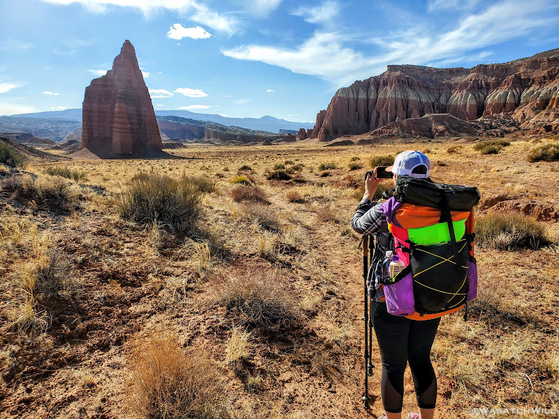
Jess escapes past a prominent butte behind her.
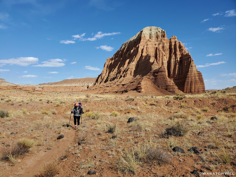
Jess pauses to snap a shot of the next prominent landmark ahead.
Looking back at whence we came before descending into a wash.
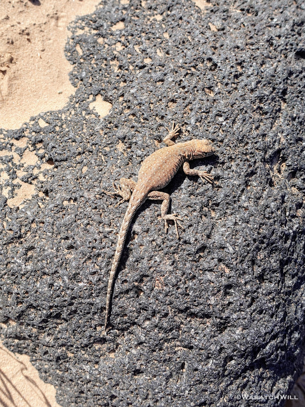
A friendly lizard.
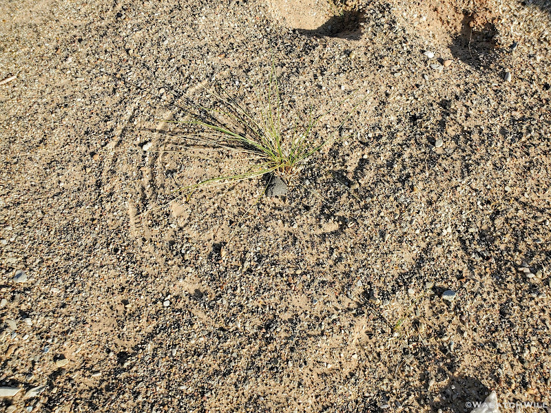
A 'scratch-circle' along the canyon bottom. This phenomenon occurs when wind bends over a grassy stalk causing it to sweep and pivot around, scratching a perfect circle, like a compass, into the sandy surface beneath.
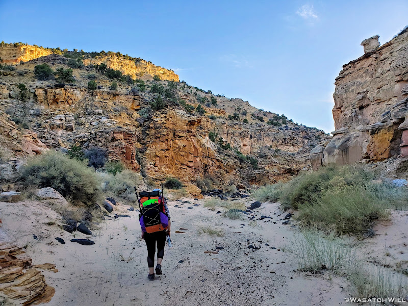
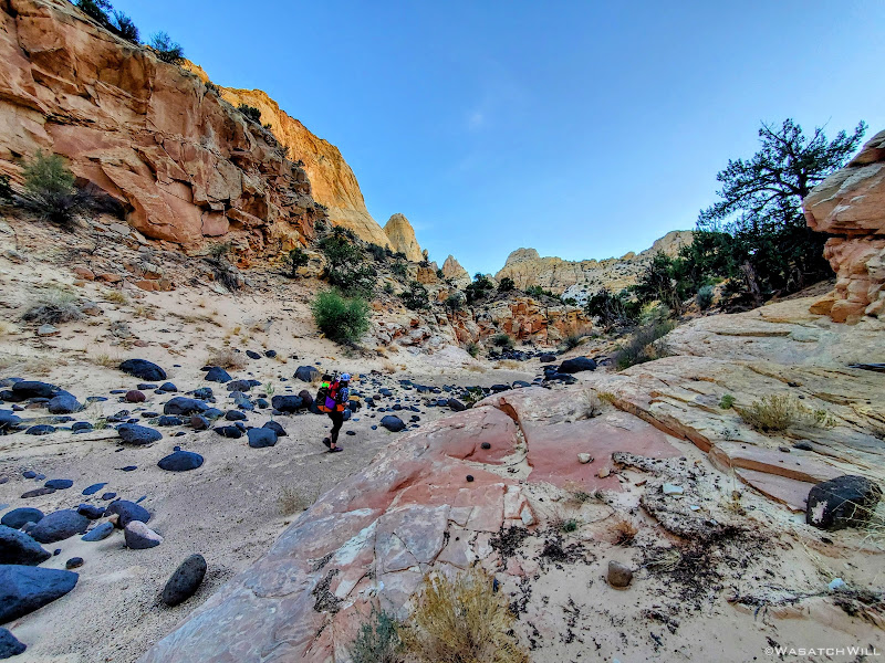
Jess forges ahead in a canyon.
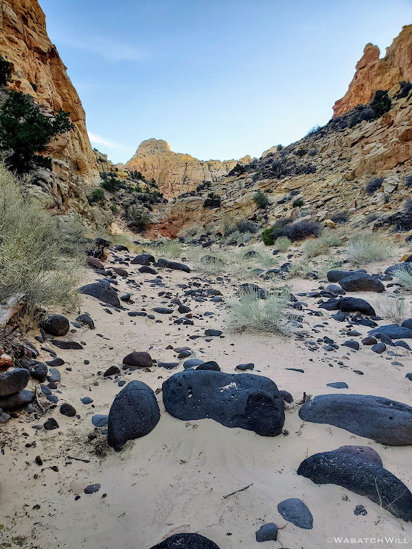
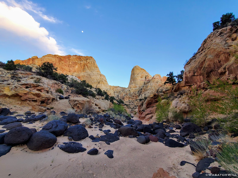
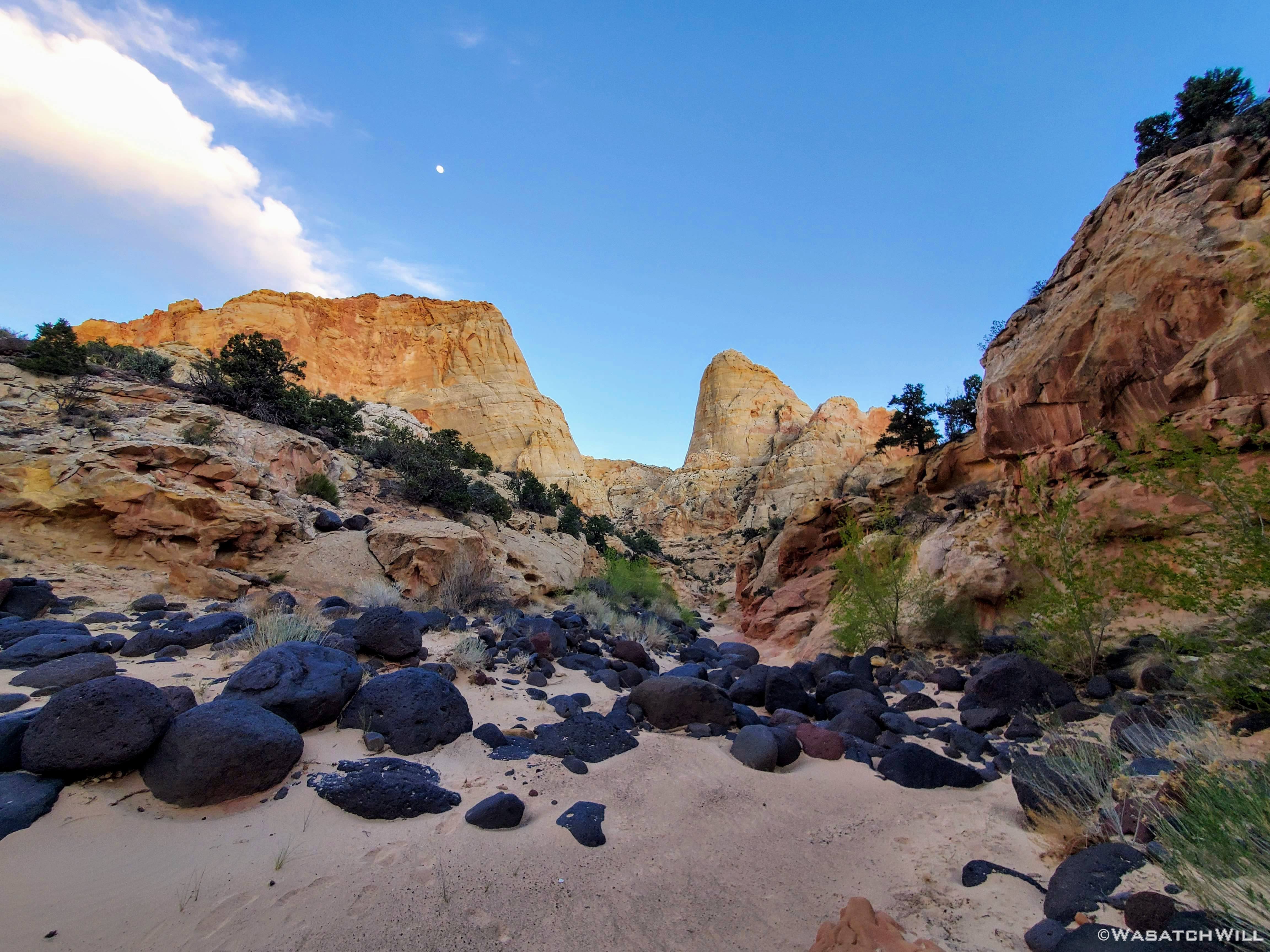
Large, dark igneous rocks and boulders littered the canyon bottom.
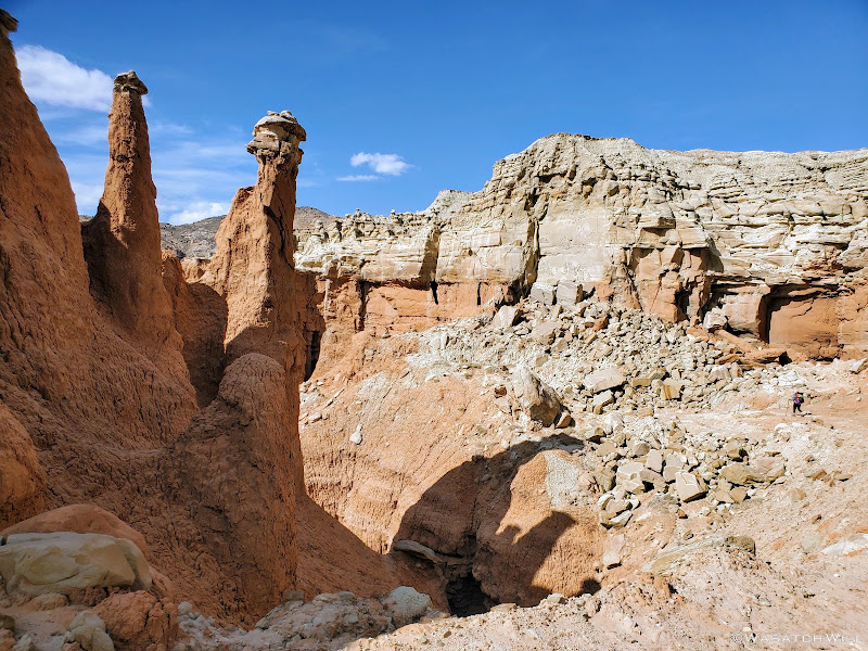
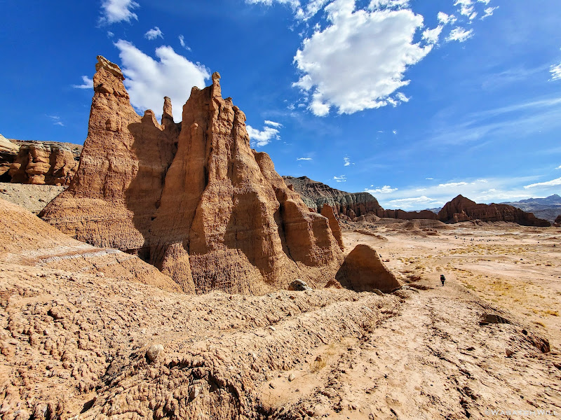
Jess approaches some pinnacles along the canyon wall up ahead.
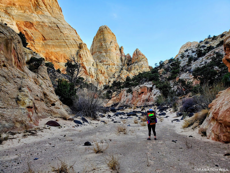
Closer up to the big pinnacles.
A deep saddle appears along the canyon wall.
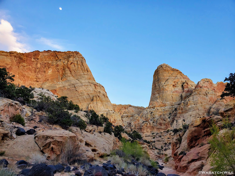
Last light on the canyon wall above.
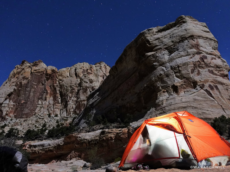
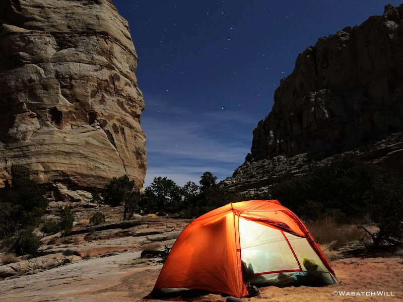
Ultimately, we failed to beat nightfall to our camp. Our last mile was in the dark with headlamps drawn out and activated. When we arrived at our desired site, we quickly set up camp, and had dinner before retiring to our tent for the night. We were excited to put our brand new Big Agnes Copper Spur HV UL2 tent to use. What does the HV and UL stand for, you ask? High Volume and Ultra Light. It was tough deciding between this one, a Nemo Dragonfly 2, and the newly released Sea to Summit Telos and Alto 2 tents. The latter appear to be rather innovative with lots of bells and whistles on it. In the end though, we scored the biggest discount on the Big Agnes. It too offered a lot of features and proved to be a great upgrade from our nearly 15 year old REI Half Dome tent we would typically take on a trip like this. It's nearly half the weight, comparatively roomy, has easy to access storage pockets, large gear loft, and the fly doors have the ability to be set up in a porch mode with trekking poles. I think we're going to love this tent for a long time to come!
Also, due to the darkness, the search for water nearby would have to wait until morning.
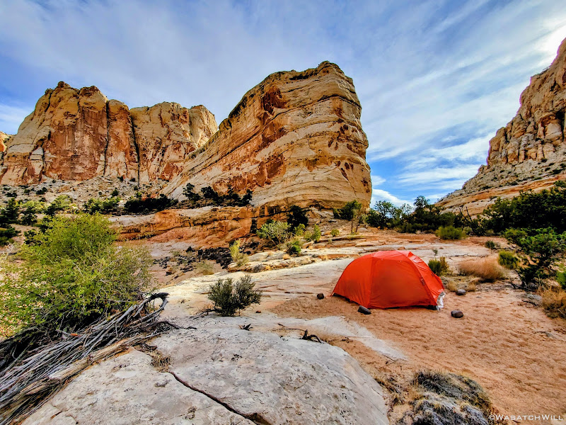
Camping on a bench above the canyon floor.
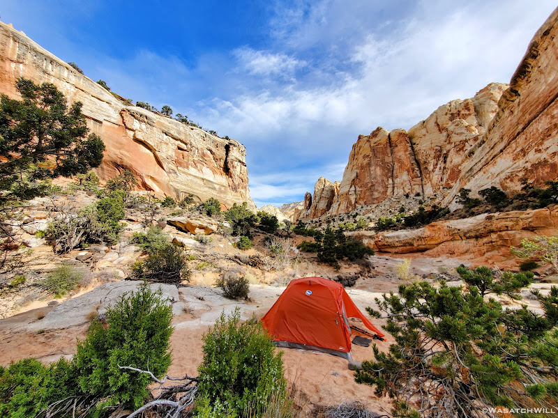
Looking down canyon from camp.
DAY TWO
Saturday - April 24, 2021
With the dawn of morning, I emerged from the tent and set out on a hunt for water while leaving Jess be to sleep in a bit. Again, finding water was as much of a mission as the inscription of Jessica's ancestor we were after. There was no guarantee of any reliable sources in the area, but I had marked a spot that looked promising on satellite up in a side canyon near our camp. A couple other potential spots I had marked out further down the canyon we had come up the evening before had turned out to be empty and dry.
Unfortunately I did not think to take any photos while on the water hunt. But I did take some video of the hunt. That can be viewed from minutes 8:30 to 15:00 in the video embedded at the end of the post. Suffice it to say...WATER WAS FOUND!!! On the way back down to camp, I stumbled into skeletal remains of a bighorn sheep. Poor sheep. Just a little further and it could have found the water too. Of course, I'm not sure what it may have succumbed to, but hopefully it was natural causes, like falling prey to a cougar, perhaps.
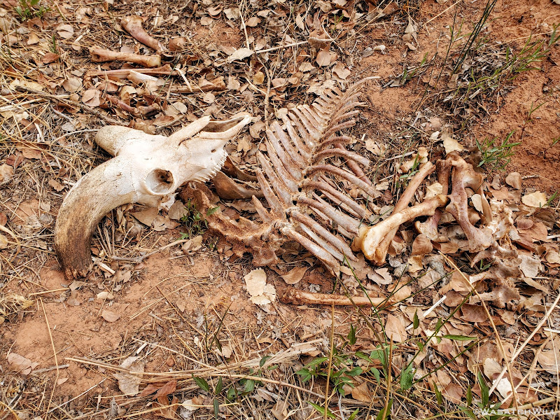
Bighorn Grave.
With water in tow, I returned back to camp where we were now enabled to gear up to continue our original plan. After a quick breakfast, we set course to go further up canyon with our packs loaded with just some essentials for the day. The only question that remained unanswered now was: Would we be able to reach the elusive Pectol inscription?
It was now time to find out.
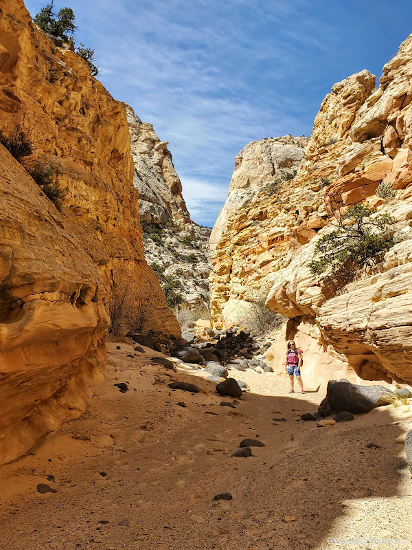
Jess stands for a photo in the canyon.
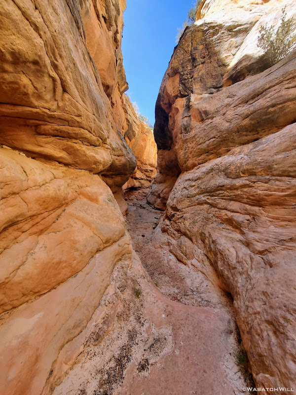
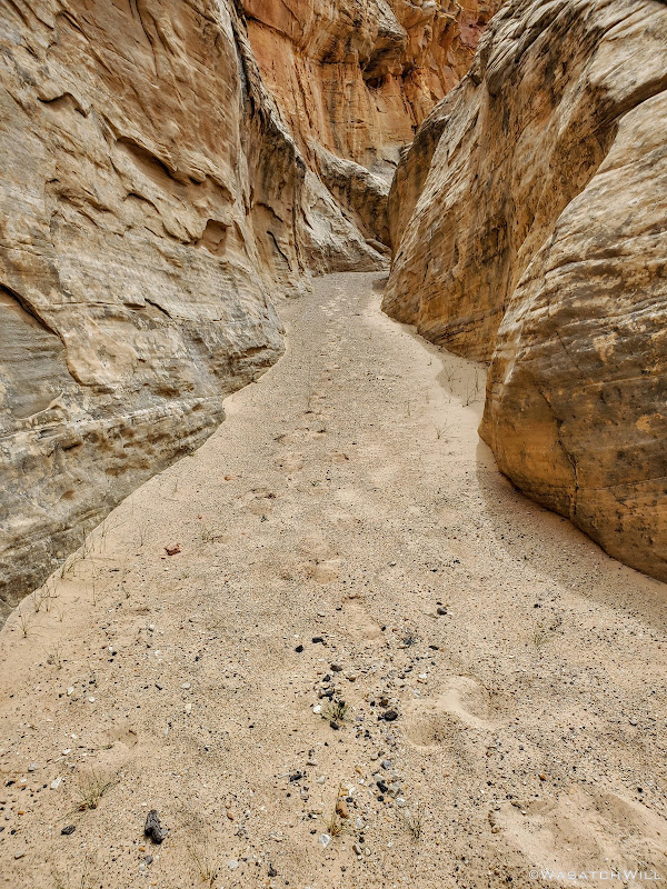
Into an unexpected but enjoyable slot section.
More of the slot.
While I shot plenty of video this stretch up the canyon, I again missed out on taking more photos than I would have liked to. I was so anxious and so excited at the prospects of achieving our goal that I was putting all my creative energy into the video. So, yet again...to see more of what we got to explore en route of trying to find the inscription, you'll have to view the video at the end.
Upon viewing the video, one will also see the unanticipated obstacles that inevitably turned us away from continuing our progress. Yep. We ended up stalling out and turning around. It was a real bummer to have our efforts thwarted in the way that they were. But, such is the gamble one takes when venturing out into unknown territory like we did where no beta can be found online through the power of Google. Not every slot and pour-off shows up well enough to be obvious on satellite either. Canyon country throw all sorts of hidden surprises like that at you. And yet, at least sometimes, I wouldn't have it any other way. That's what adds more to the adventure and makes everything feel so new, with all sorts of surprises, some very pleasant, and some not so much. So long as one as one is willing to assess new risks as they surface and be prepared to turn back to prevent a good day from becoming a bad day. And that we did.
From an unexpected pour-off to a high bench to bypass it that became riddled with sensitive cryptobiotic soil we had to play hopscotch with followed by a roller coaster of little side drainages to traverse over and over that became really tedious after only a few of them, our progress had slowed down immensely. We ultimately decided that even if we could make it, it would be a very strenuous and time consuming process to reach our target. That would likely result in hiking back down canyon in the dark for the last couple of miles back to camp. It just wasn't worth it knowing we could reach it from another direction with much less effort so long as more time was allotted for traveling the rough road.
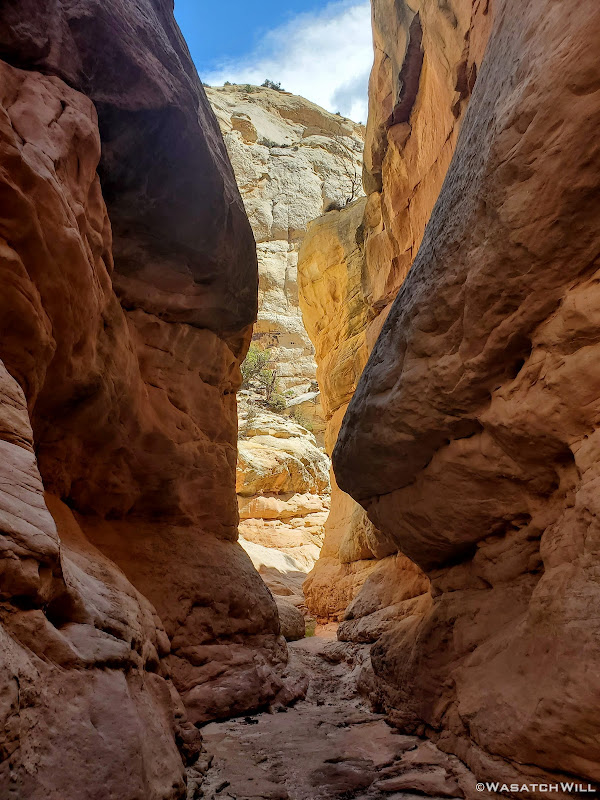
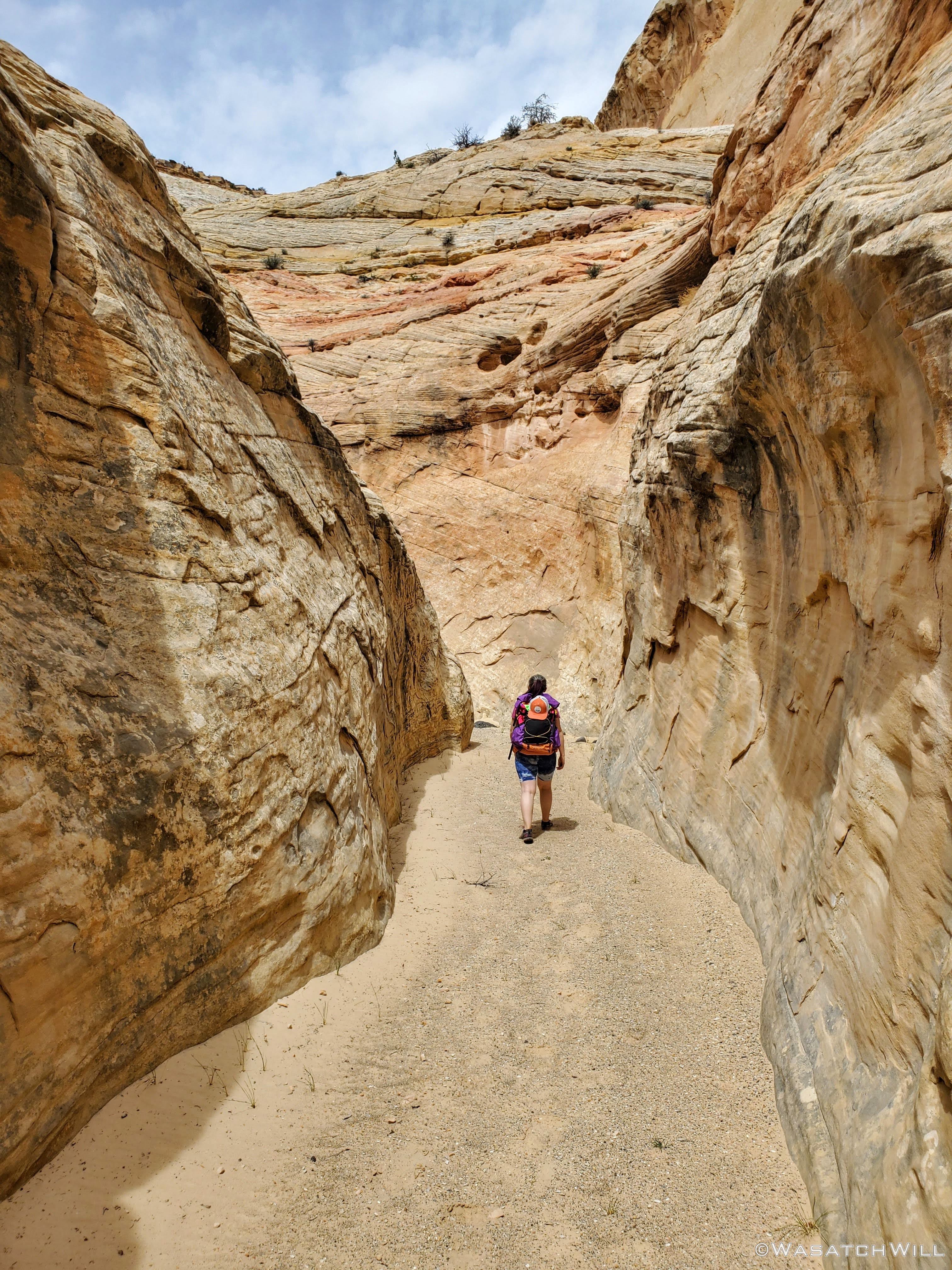
So instead, we made our way back down to another fork in the canyon we had passed by on our way up and wandered up that for a bit. It had a very smooth and sandy bottom and made for a very enjoyable walk. Here the walls would narrow up in spots and flirt with becoming a true slot at times before backing off again.

Up into another canyon fork.
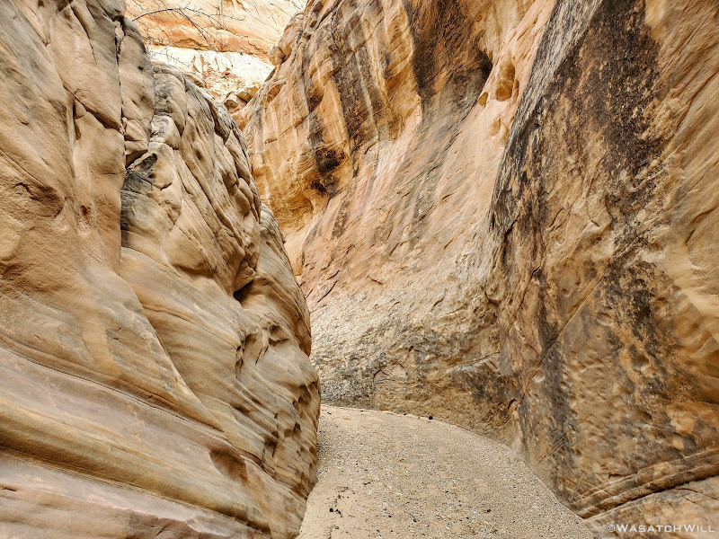
Almost a slot.
More narrows.
Eventually, we made it back down to camp where we made another big decision: lay down in the tent for a late afternoon siesta or wander back up the side canyon where the water was flowing a short distance and soak our feet for a bit there.
We opted for the nap and it proved to be the right decision almost right away. Right as we settled into our tent, some clouds moved in and some rather strong winds began to gust up. While we were never really threatened with any rain, the gusts of wind persisted for a few hours blowing all sorts of dust under our fly and up into our tent. The tent itself stood up to the moderately strong gusts just fine. I think I did guy out one side at one point to give it a bit of extra stability. The poles would flex a bit and bow in a little, but nothing that ever made me ever worry they were going to snap. As a side note, my friend Devin had taken his whole family out for a camping trip that same weekend in a place not so very far away. He and his family had large name-brand tent that did not fare so well in the high winds that swept across this region of the state. Unfortunately that tent was damaged beyond repair and he and his family had to cut their trip short.
In hindsight, the decision to give up on the inscription and save it for another day turned out to be an even better decision. It likely would have been miserable with the gusty wind and sand blowing all over had we been able to make it up into the more exposed valley we were aiming for.
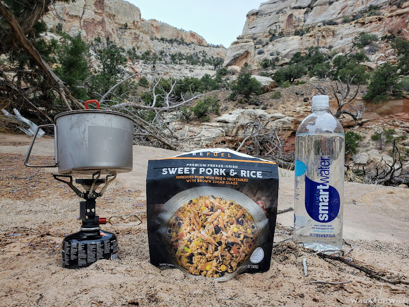
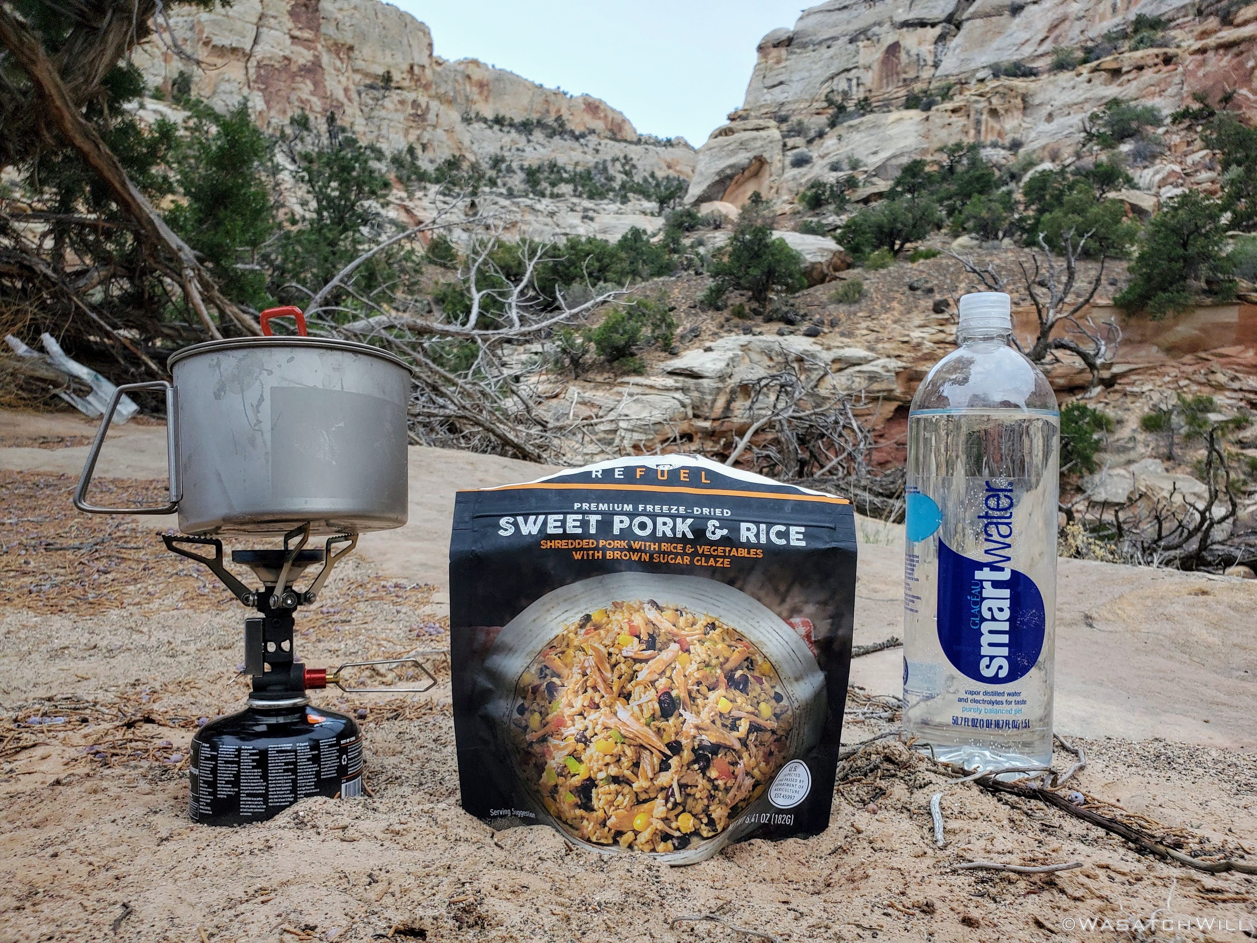
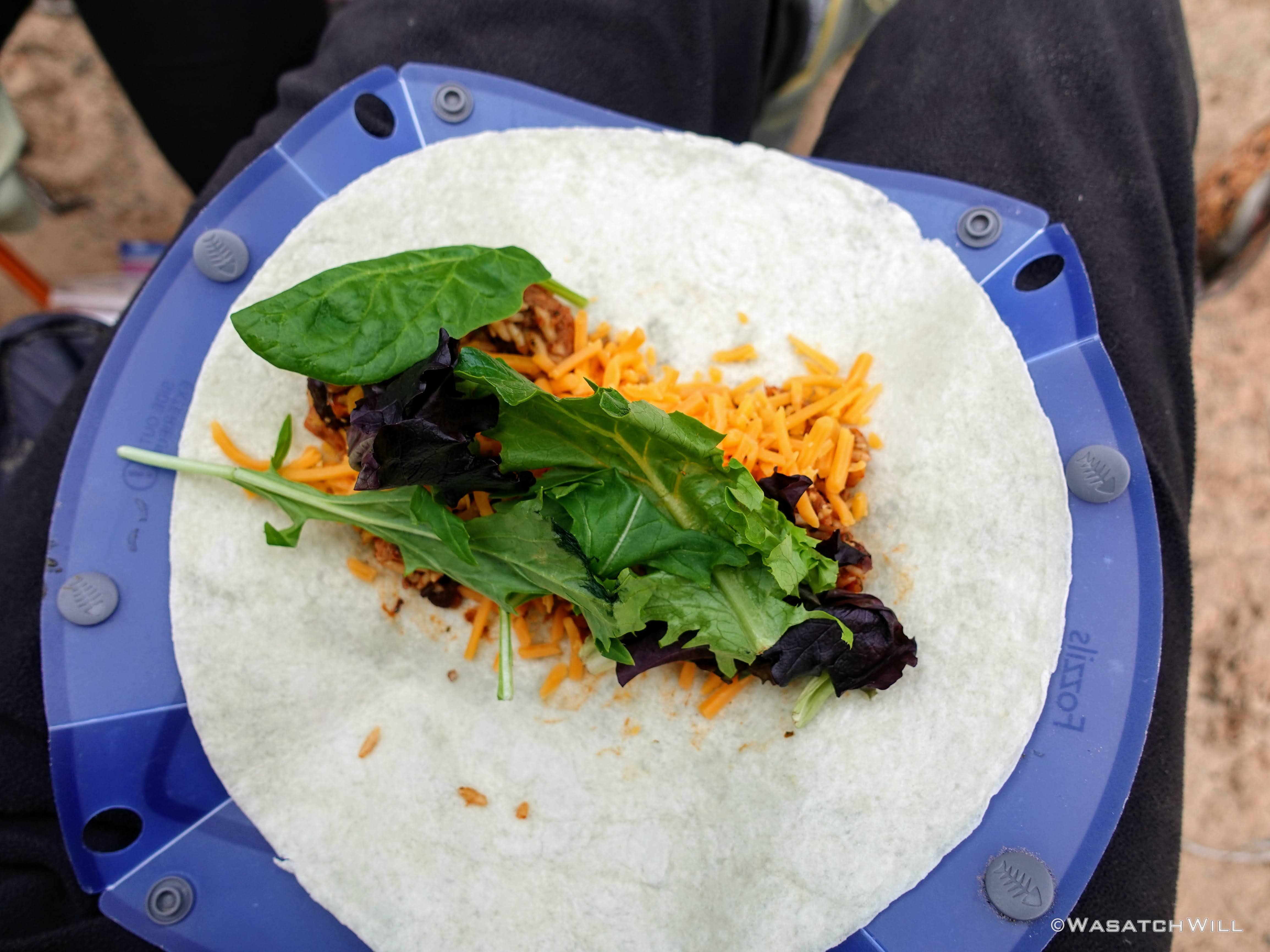
Some time in the evening, the winds began to settle down a bit and we took the opportunity to come out and make dinner. Tortilla wraps with pork and rice, salad greens, and shredded cheddar cheese was on the menu tonight. For this trip, we also employed a new kitchen setup with an MSR Titan Kettle and MSR PocketRocket Deluxe Stove.
Cooking dinner.

Dinner is served.
With full tummies we cleaned up and got settled into our tent for one more night.
DAY THREE
Sunday - April 25, 2021
Like the day before, the weather was calm and cool with partly cloudy skies. We enjoyed a relaxing morning, packed up, and made our way back to the car. As the day progressed, so did the strength of the wind. Light morning breezes grew into strong gusty winds in the afternoon for the last couple of miles back.
Last morning at camp.
Looking up canyon from camp.
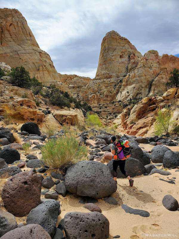
Jess weaves through a section of large igneous rocks.
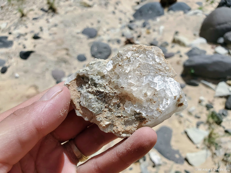
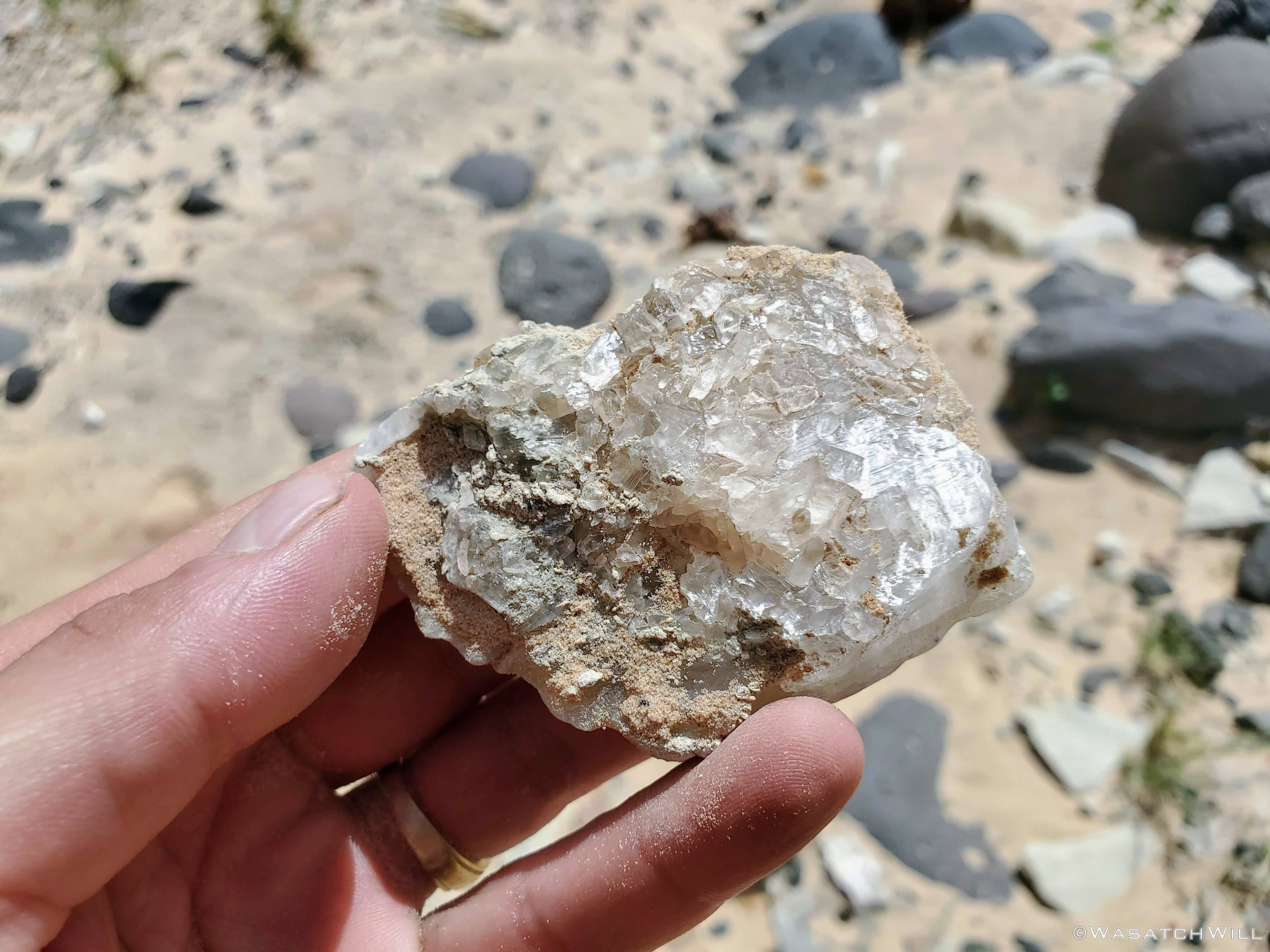
A chunk of gypsum. This stuff exists in high concentrations in a few parts around the park.
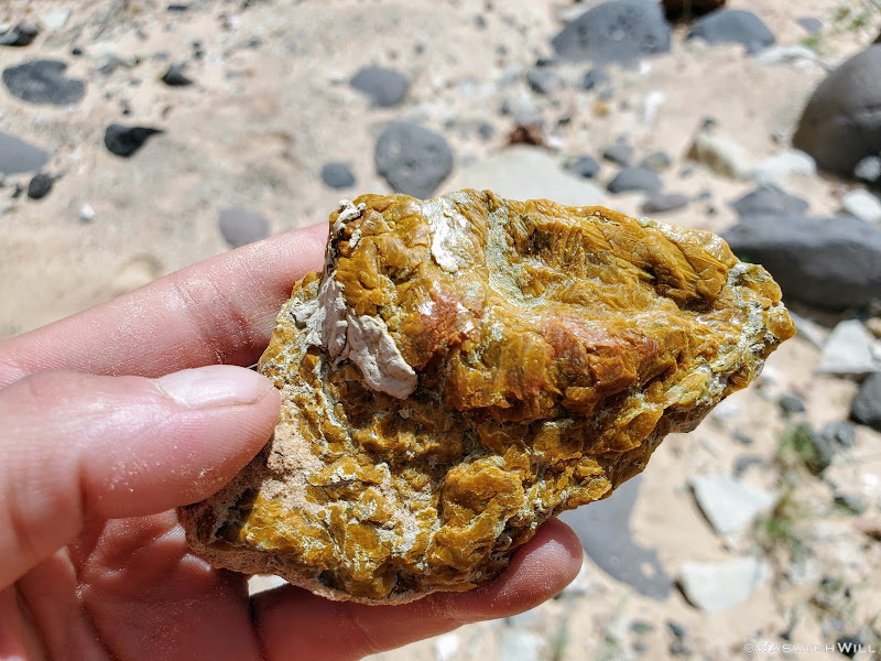
A chunk of flint or other calcified rock.

Jess approaches what I call "The Wedding Cake" for its white and frosted layers.
Out of the canyon and along the wash.

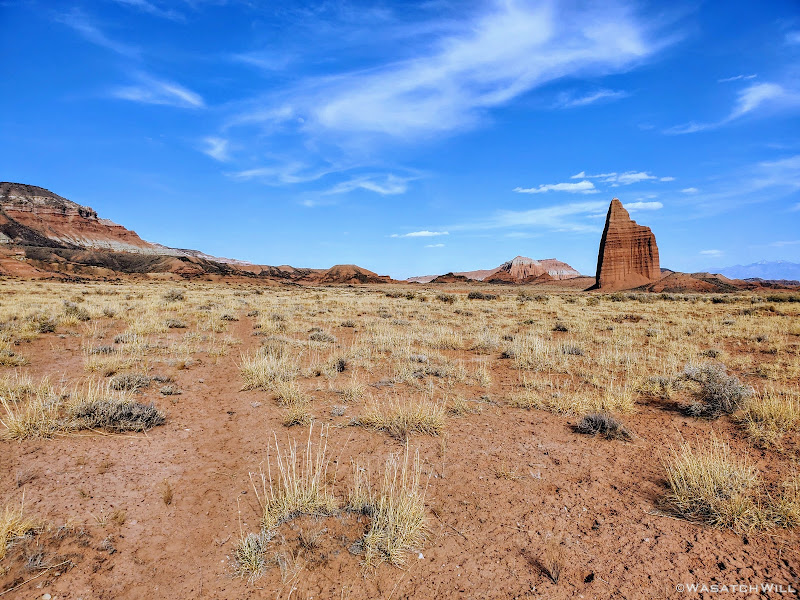
Rising up like a cathedral or temple spire.
Back on trail for the final stretch.
Locked away behind bars at the local jailhouse.
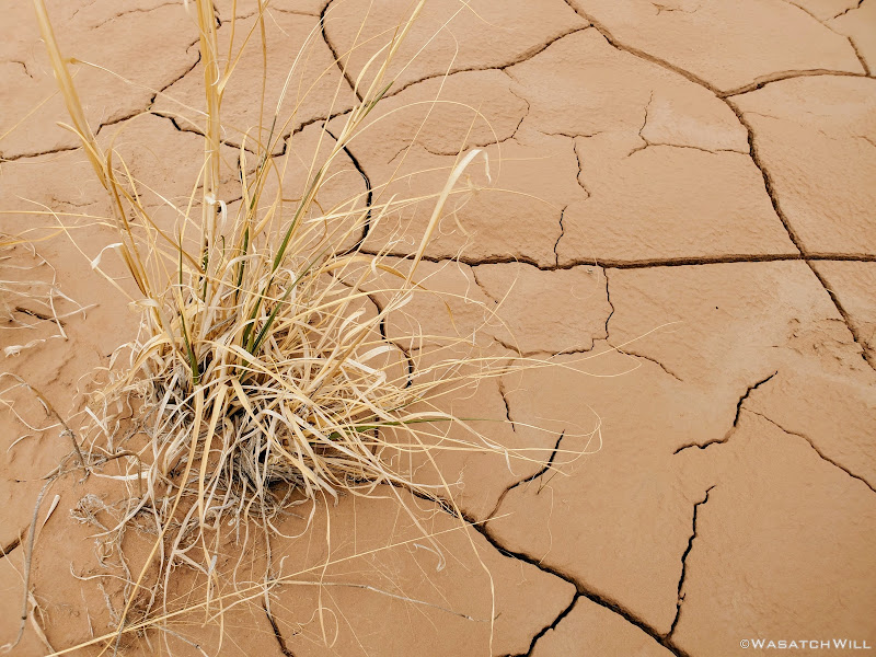
A parched desert floor.
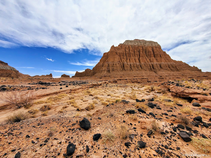
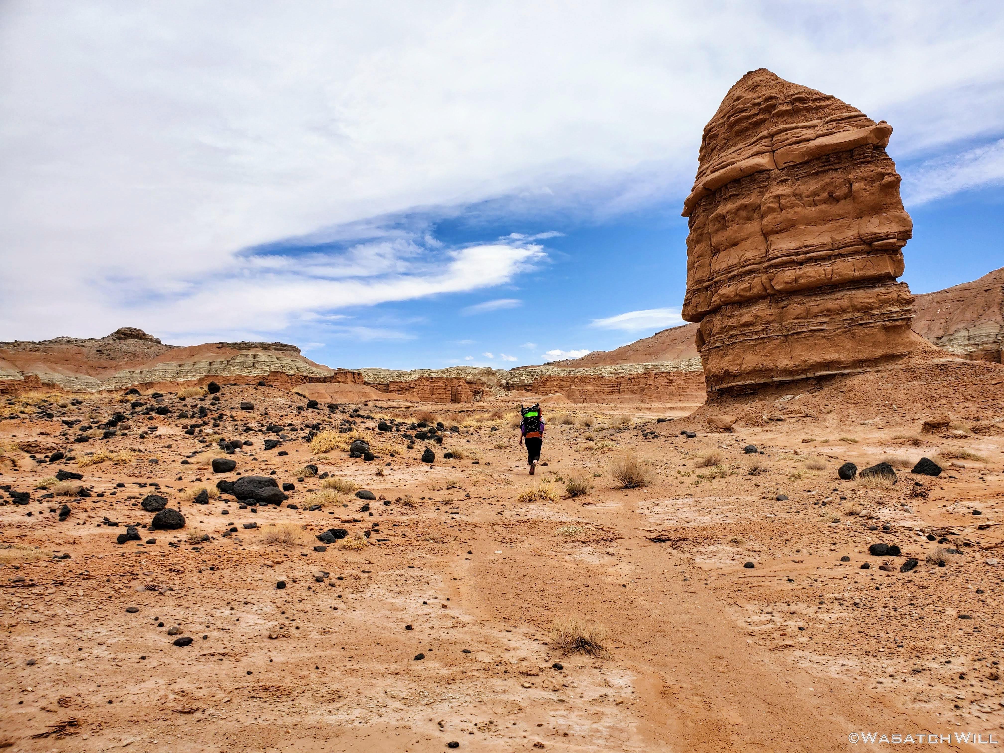
Rounding around a sizeable butte.
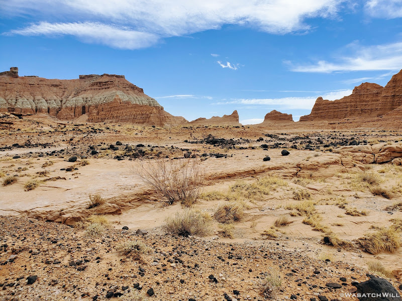
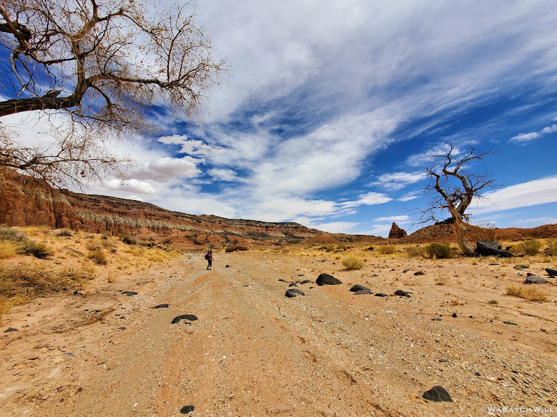
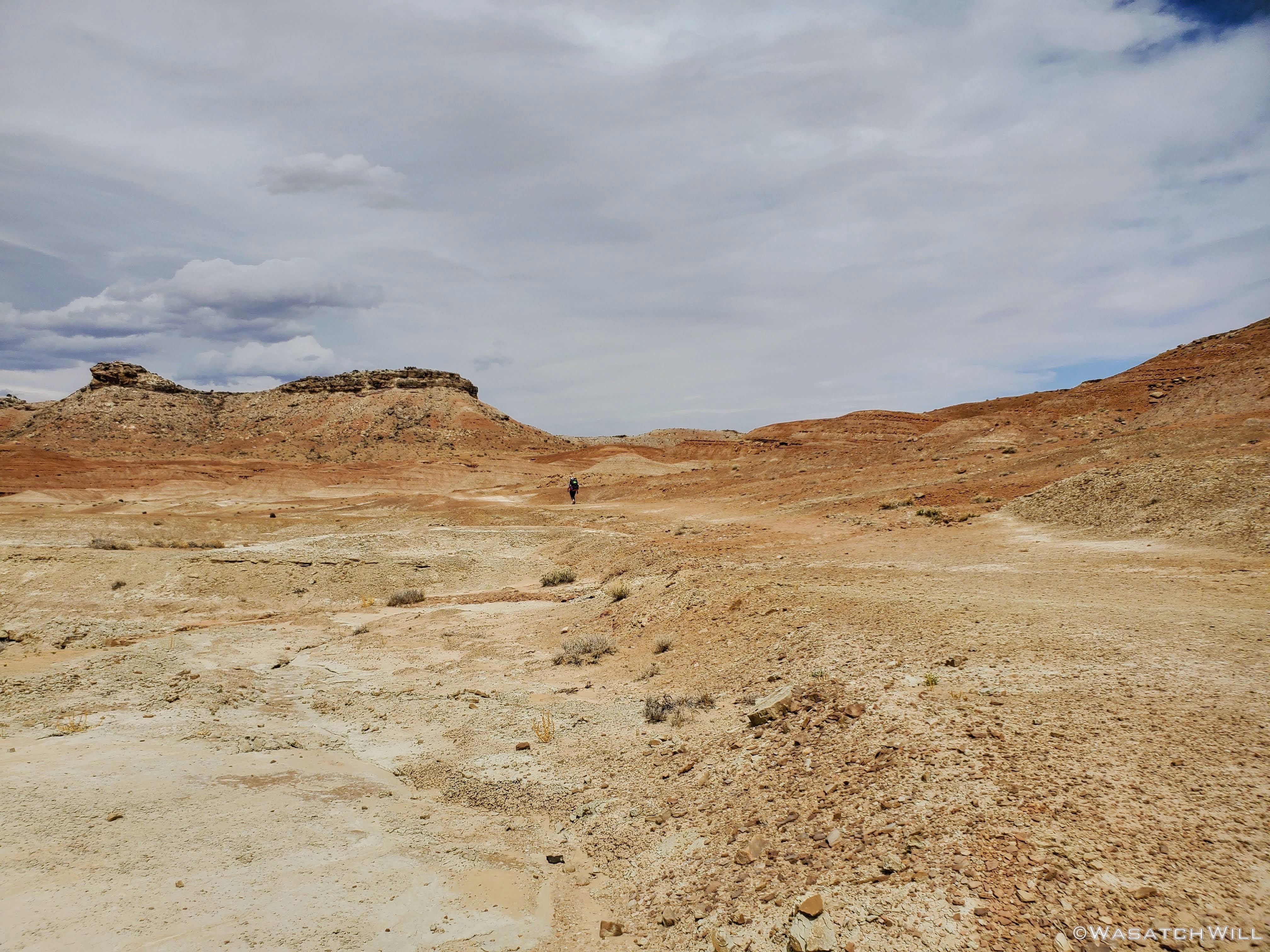
Desert Valley.

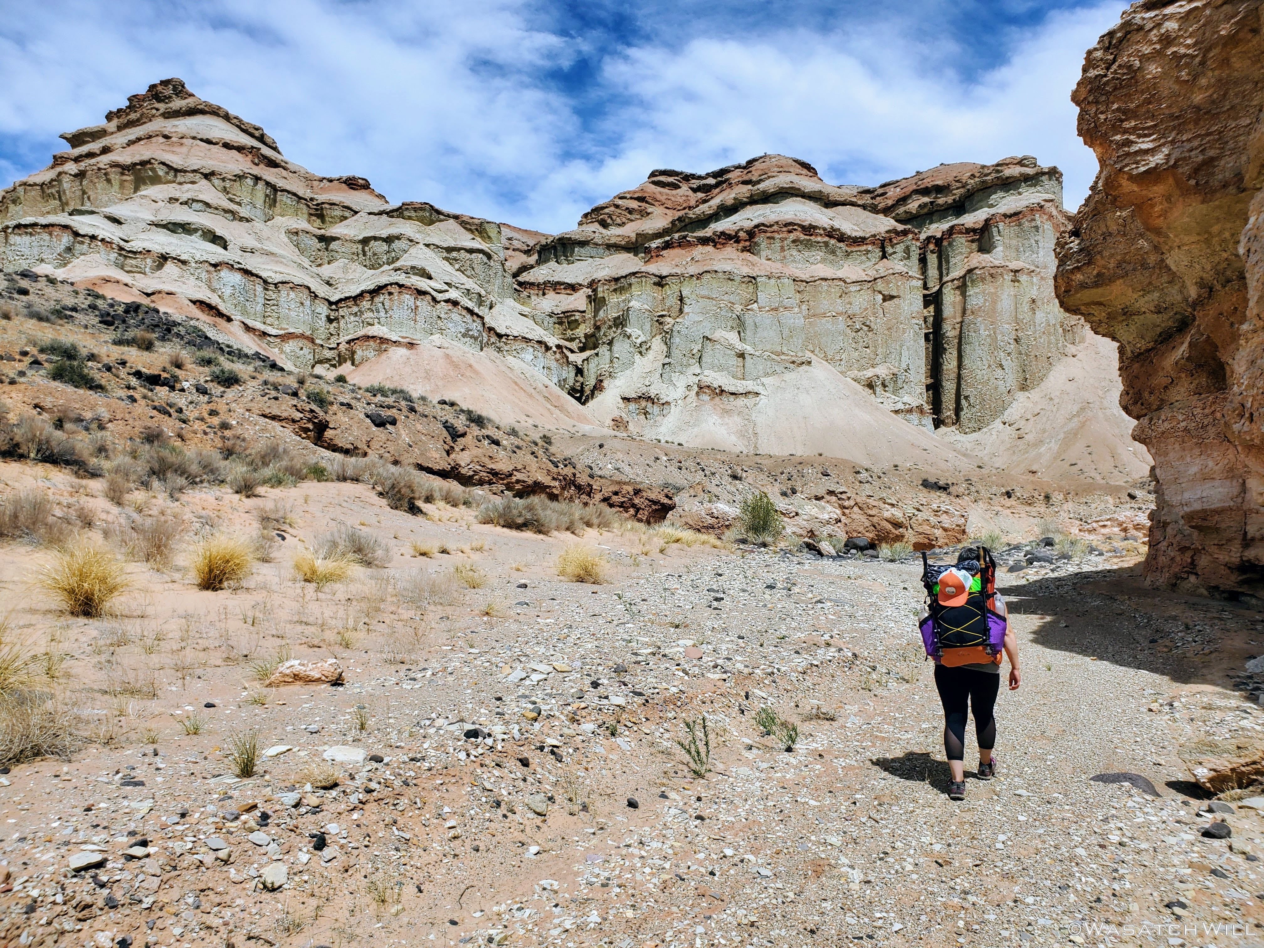
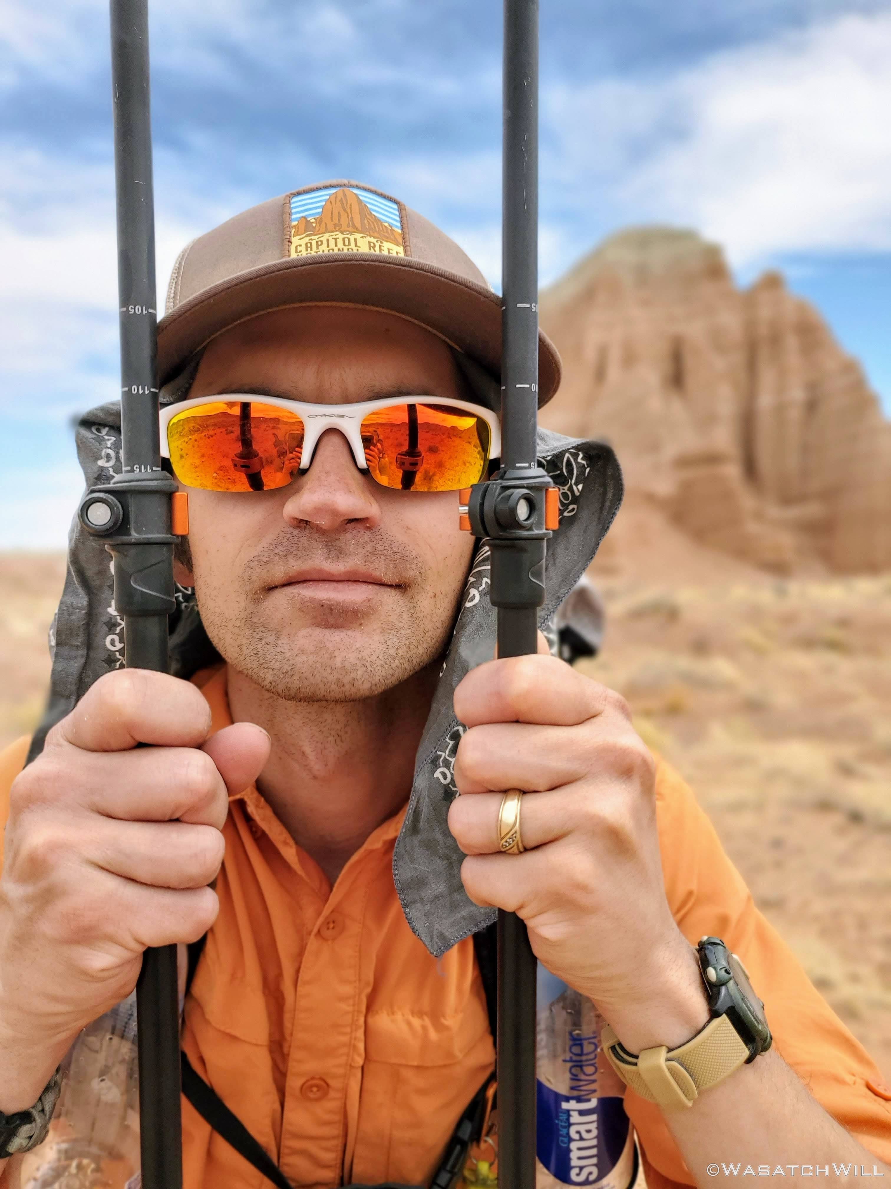
Jess making progress up the trail.
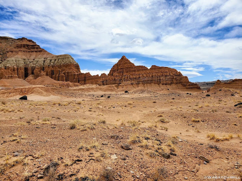
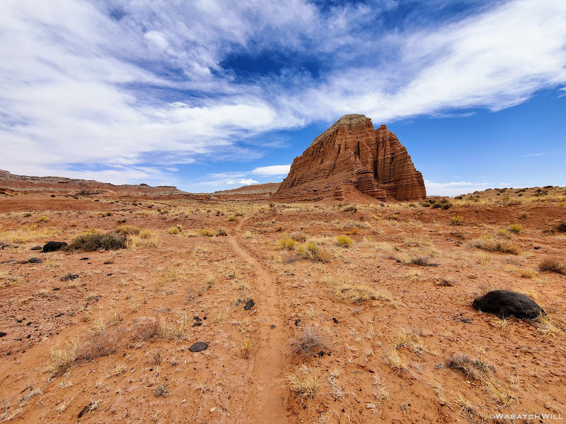
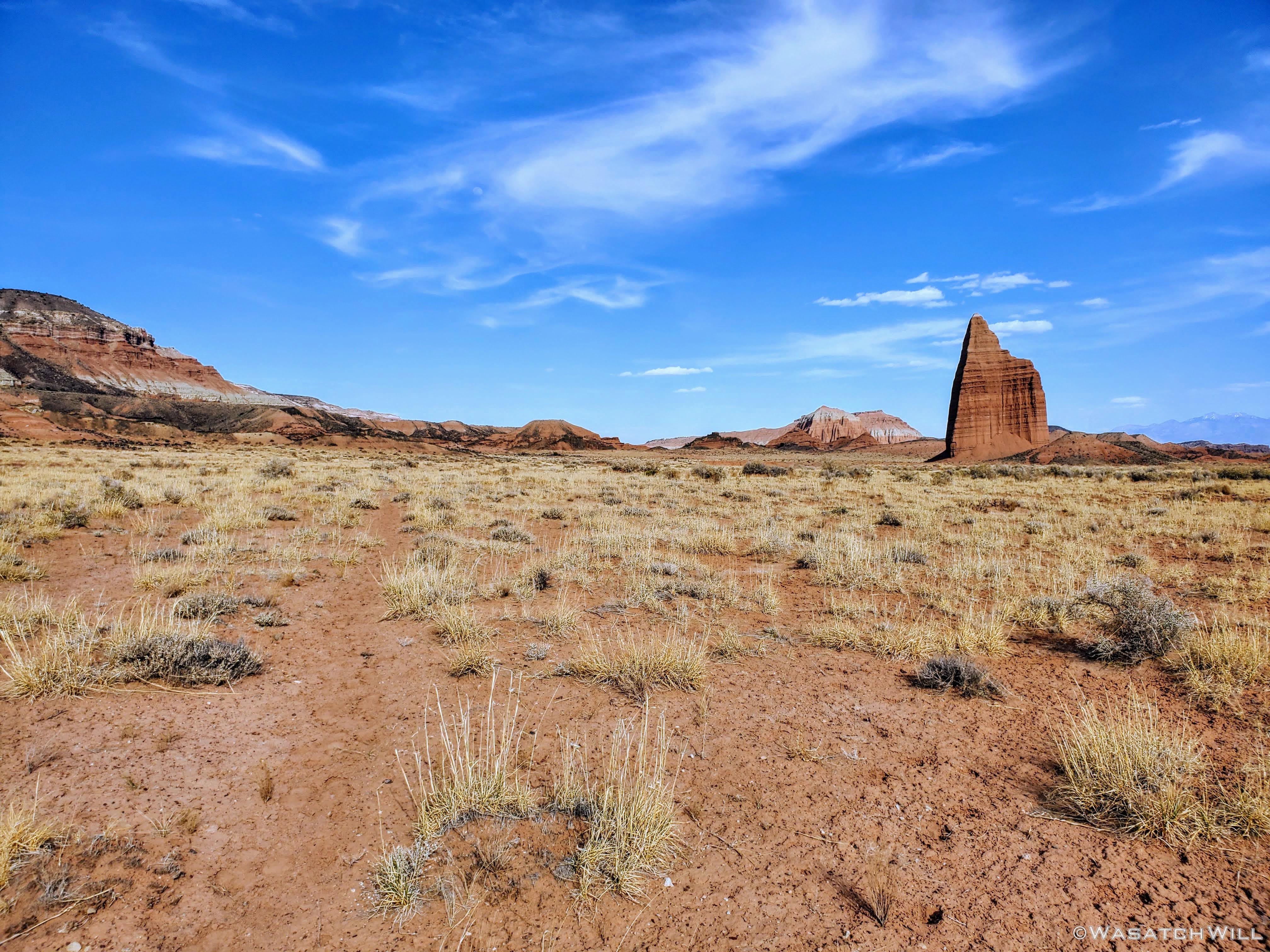
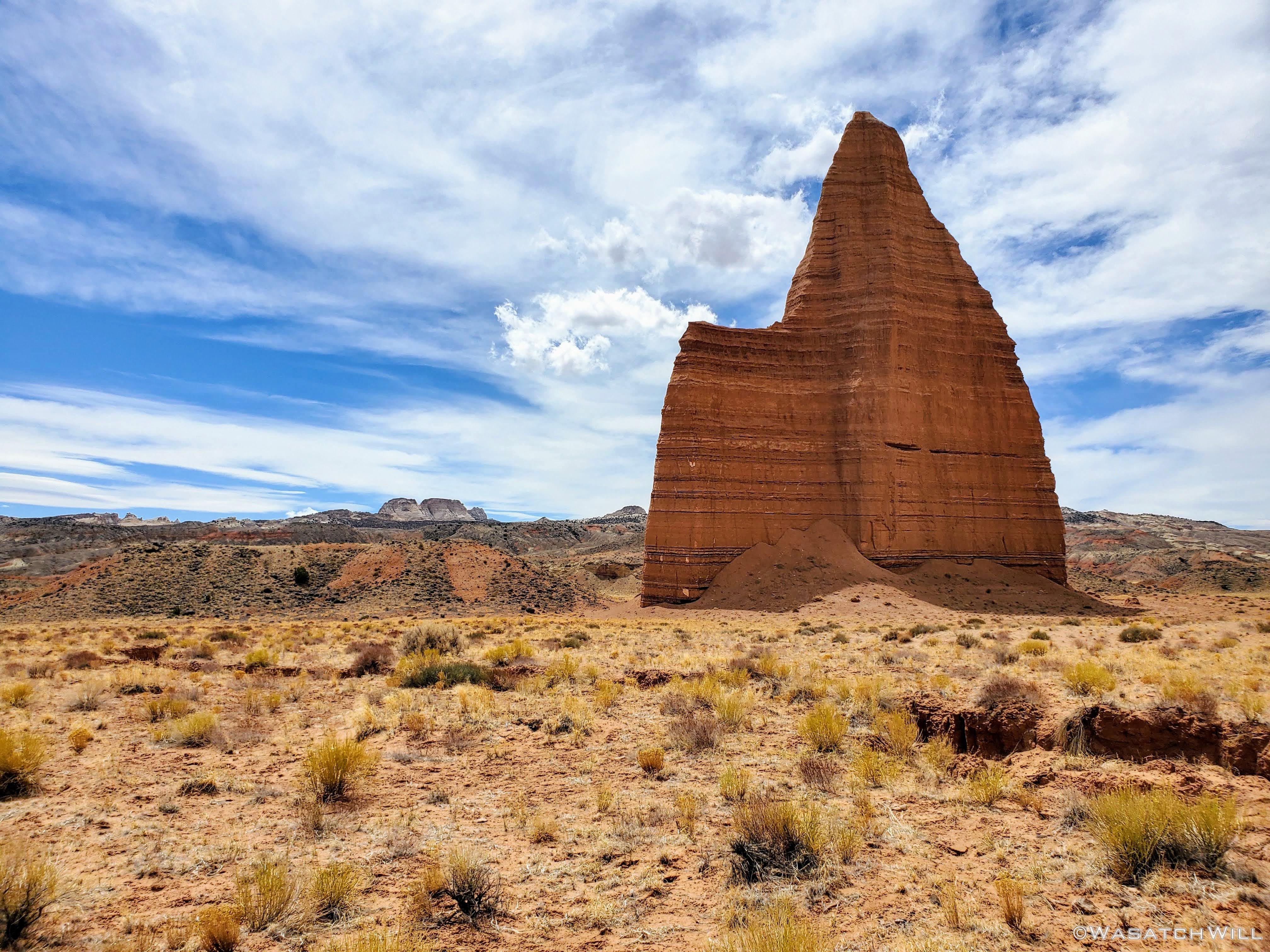
A pyramid rises in the distance.
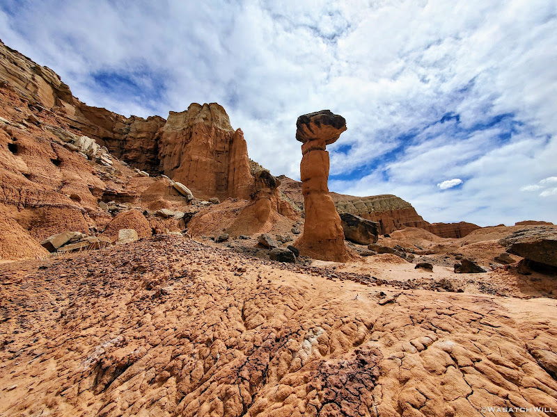
A lonely hoodoo.
Other side of the hoodoo.
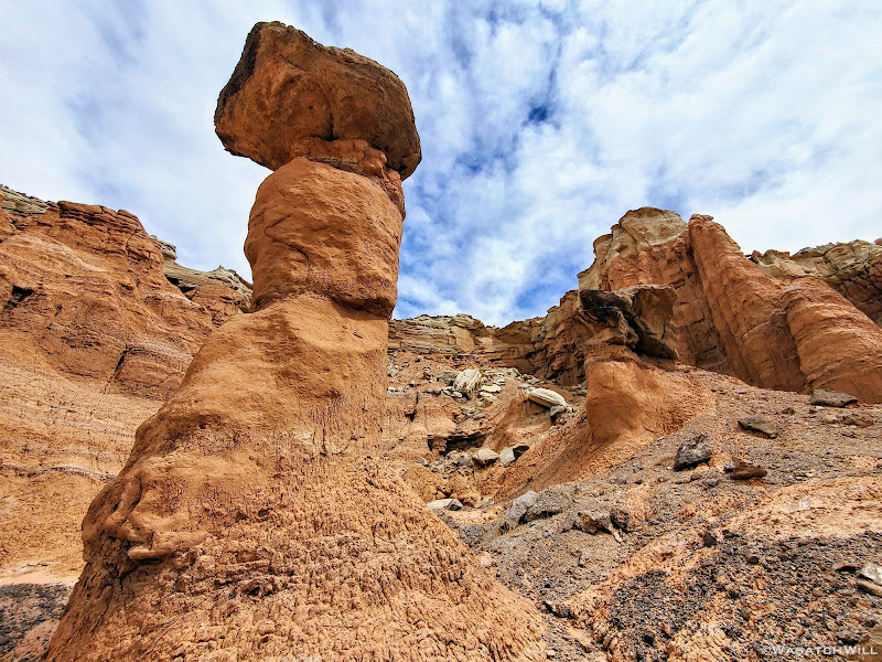
I call this "Chimney Rock, Jr" with a small community of goblins.
Back on the ascent as nearby hoodoos stand guard.

Jess way out on the home stretch.
Once back up on the rim of the high plateau, we arrived at our car. It's always a nervous moment when returning to your car and you go to start it up in an area as remote as this and there is nobody else around, no matter how reliable it usually is elsewhere. Fortunately it remained reliable and started up just fine. It was now time to go home and return to our kids. This was an adventure to be continued, when we make yet another attempt at getting to the inscription. Perhaps the third time will be the charm.
That's right, family history. As mentioned in previous posts, Jess is a great-great-granddaughter of Ephraim Pectol, a man credited with being the father of Capitol Reef National Park. Prior to successfully campaigning for federal protection of the landscape the comprises much of what lies within the borders of Capitol Reef today, or as he often called it, "Wayne Wonderland", after Wayne County for which the land occupied, Ephraim had spent much free time in the early 1900's wandering, roaming and exploring the landscapes surrounding his residence in Torrey, Utah. He was enchanted with the natural beauty and wonder of the Waterpocket Fold and all that surrounded it. In those explorations, he stumbled into a little known valley that is now found within the northern region of the park and there on a rock wall, in a time devoid of the Internet, social media, and modern day Leave No Trace ethics, he left an inscription of his name. Finding this inscription was our mission.
There is a relatively "easy" way to access this valley via a few miles of trail which has no mention in park literature or other guides, online or otherwise. However, to reach the trail requires driving up a very long, rough, and narrow 4WD road. In fact, we did attempt it a previous time, but the road to access the trail was so much rougher than anticipated that it took up all the time we had allotted to the endeavor just to drive the road, leaving us no time for any of the actual hiking and searching around once in the valley. Rather than mess with that road again, I wanted to be even more adventurous and see if the aforementioned valley could be accessed on foot from another direction, from another trailhead also lacking in popularity but was much easier to drive to, albeit much longer in distance. From there we could go down into a larger, lower valley and then attempt to navigate a maze of canyons that drain away from the high plateau that holds the little valley we were targeting. So plans were made to spend a weekend to explore this great unknown and see whether a route I had charted would be viable or not.
DAY ONE
Friday - April 23, 2021
Peak visitation season was just now beginning in the park, yet, the trailhead we made use of was completely vacant. There was not another vehicle or soul to be found here. In fact, we encountered very few others on the several miles long dirt road up to the trailhead since leaving the highway. In an effort to help preserve the quiet solitude that we were able to enjoy, to preserve its raw and wild character, and to keep this area a place of newness and discovery for any others that may stumble into this remote section of the park, I'm going to remain vague and not identify any landmarks.
However, a clue or two will be disclosed further down in this post that could help aid the reader in doing a little bit of detective work to locate the vicinity of the area we had the privilege of exploring for ourselves should they wish. Keep in mind, this area is very remote. That means it's far from emergency aid and has no available cell signal. As we did, you could find yourself all alone. While we never saw anyone else drive up to the trailhead we used, it does receive occasional traffic from time to time, mostly from folks there to check off part of a much larger sight-seeing agenda whereby they will spend just a few minutes to hike a very short distance to the rim of a scenic overlook. So aside from any clue, this will simply have to be a case of "If you know, you know."
Beyond a couple of named landmarks nearer to the trailhead, what trail there is through patches of the low valley quickly vanishes for good and the landscape thereby becomes a "no man's land". Oh, and water sources are very scarce out in this region. In fact, aside from what you can bring in yourself, there is none to be found for several miles from the trailhead. And even that was a gamble for us. Our ability to find water in a spot I had spied on satellite, not too far from a spot I aimed to camp, would dictate the agenda for the remainder of the trip. We'd each pack in between 5 and 6 liters of of water to ensure we had enough to get back out to the car the following day if efforts to find water near camp came up empty handed. In such a barren and drought stricken land, even that could have been risky.
All that water also helped to max out the weight capacity of our respective packs, ULA Circuits, and thus gave us a chance to test out their stated limit. At nearly 35 lbs each to start out, our packs did perform as specified and did not burden our bodies with too much discomfort. Rougher terrain with more strenuous elevation gain might have had different and less desirable results however.
Now, enough with the introductory remarks and tangents. Let's get into the action...
After obtaining our backcountry permit from the Visitor Center, we arrived at the trailhead in mid-afternoon, commenced our pre-hike routine and check-down, and put on our heavy, water-laden packs. Skies were mostly sunny while the air was breezy but generally comfortable. It would be over eight miles to arrive at our target for the night, a spot where we'd aim to make a basecamp for which we'd stay a second night were we to successfully find water in the vicinity. Due to the late start, we were now racing nightfall to get all those miles in.

Hoodoos greeted us at the rim where we began the descent.

Descending down into the large, lower valley.

Jess escapes past a prominent butte behind her.

Jess pauses to snap a shot of the next prominent landmark ahead.
Looking back at whence we came before descending into a wash.

A friendly lizard.
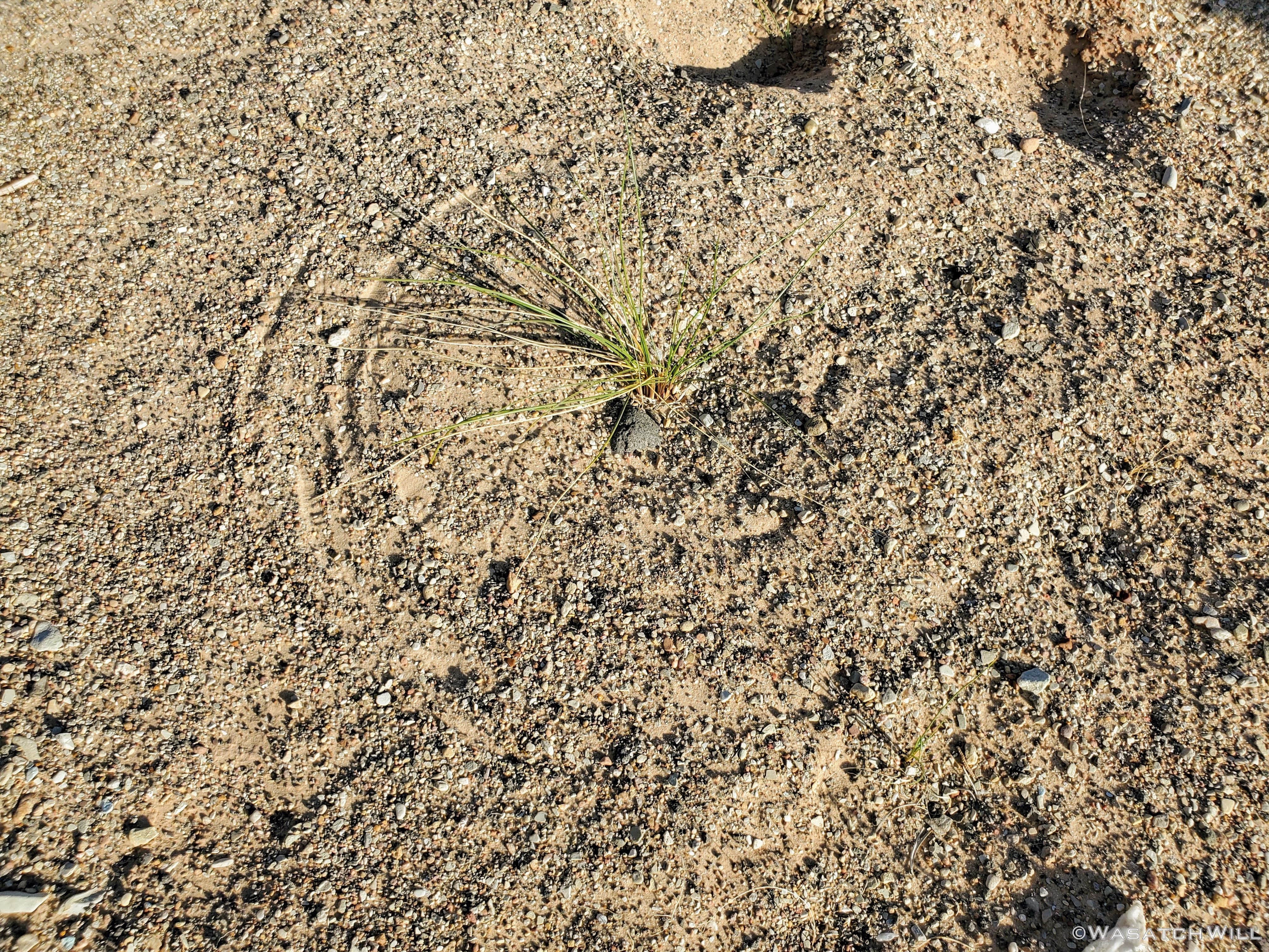
A 'scratch-circle' along the canyon bottom. This phenomenon occurs when wind bends over a grassy stalk causing it to sweep and pivot around, scratching a perfect circle, like a compass, into the sandy surface beneath.

Jess forges ahead in a canyon.

Large, dark igneous rocks and boulders littered the canyon bottom.

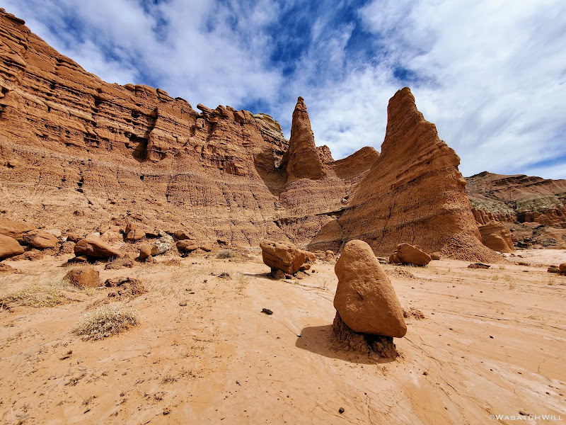
Jess approaches some pinnacles along the canyon wall up ahead.

Closer up to the big pinnacles.

A deep saddle appears along the canyon wall.
Last light on the canyon wall above.
Ultimately, we failed to beat nightfall to our camp. Our last mile was in the dark with headlamps drawn out and activated. When we arrived at our desired site, we quickly set up camp, and had dinner before retiring to our tent for the night. We were excited to put our brand new Big Agnes Copper Spur HV UL2 tent to use. What does the HV and UL stand for, you ask? High Volume and Ultra Light. It was tough deciding between this one, a Nemo Dragonfly 2, and the newly released Sea to Summit Telos and Alto 2 tents. The latter appear to be rather innovative with lots of bells and whistles on it. In the end though, we scored the biggest discount on the Big Agnes. It too offered a lot of features and proved to be a great upgrade from our nearly 15 year old REI Half Dome tent we would typically take on a trip like this. It's nearly half the weight, comparatively roomy, has easy to access storage pockets, large gear loft, and the fly doors have the ability to be set up in a porch mode with trekking poles. I think we're going to love this tent for a long time to come!
Also, due to the darkness, the search for water nearby would have to wait until morning.

Camping on a bench above the canyon floor.

Looking down canyon from camp.
DAY TWO
Saturday - April 24, 2021
With the dawn of morning, I emerged from the tent and set out on a hunt for water while leaving Jess be to sleep in a bit. Again, finding water was as much of a mission as the inscription of Jessica's ancestor we were after. There was no guarantee of any reliable sources in the area, but I had marked a spot that looked promising on satellite up in a side canyon near our camp. A couple other potential spots I had marked out further down the canyon we had come up the evening before had turned out to be empty and dry.
Unfortunately I did not think to take any photos while on the water hunt. But I did take some video of the hunt. That can be viewed from minutes 8:30 to 15:00 in the video embedded at the end of the post. Suffice it to say...WATER WAS FOUND!!! On the way back down to camp, I stumbled into skeletal remains of a bighorn sheep. Poor sheep. Just a little further and it could have found the water too. Of course, I'm not sure what it may have succumbed to, but hopefully it was natural causes, like falling prey to a cougar, perhaps.
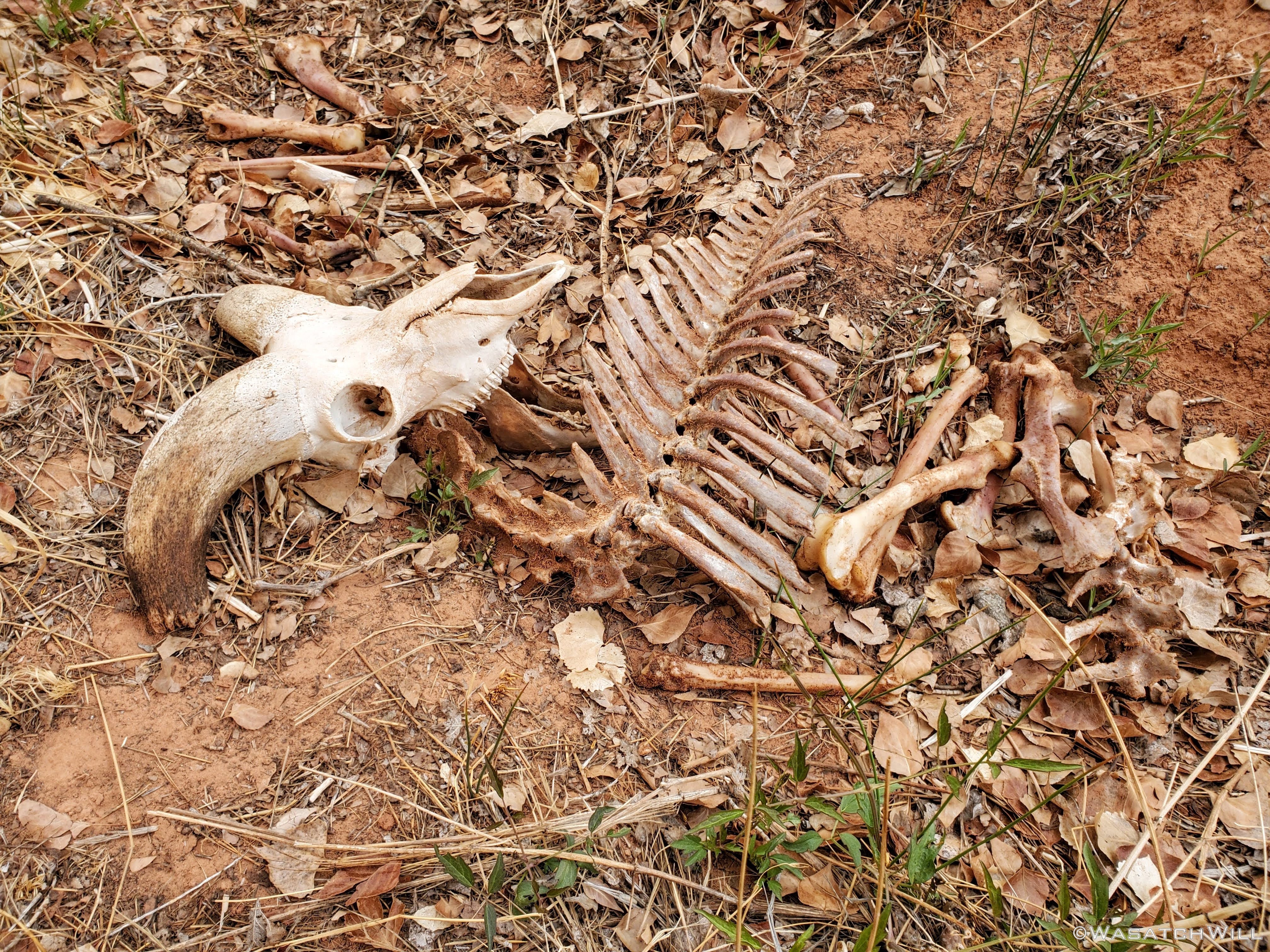
Bighorn Grave.
With water in tow, I returned back to camp where we were now enabled to gear up to continue our original plan. After a quick breakfast, we set course to go further up canyon with our packs loaded with just some essentials for the day. The only question that remained unanswered now was: Would we be able to reach the elusive Pectol inscription?
It was now time to find out.

Jess stands for a photo in the canyon.
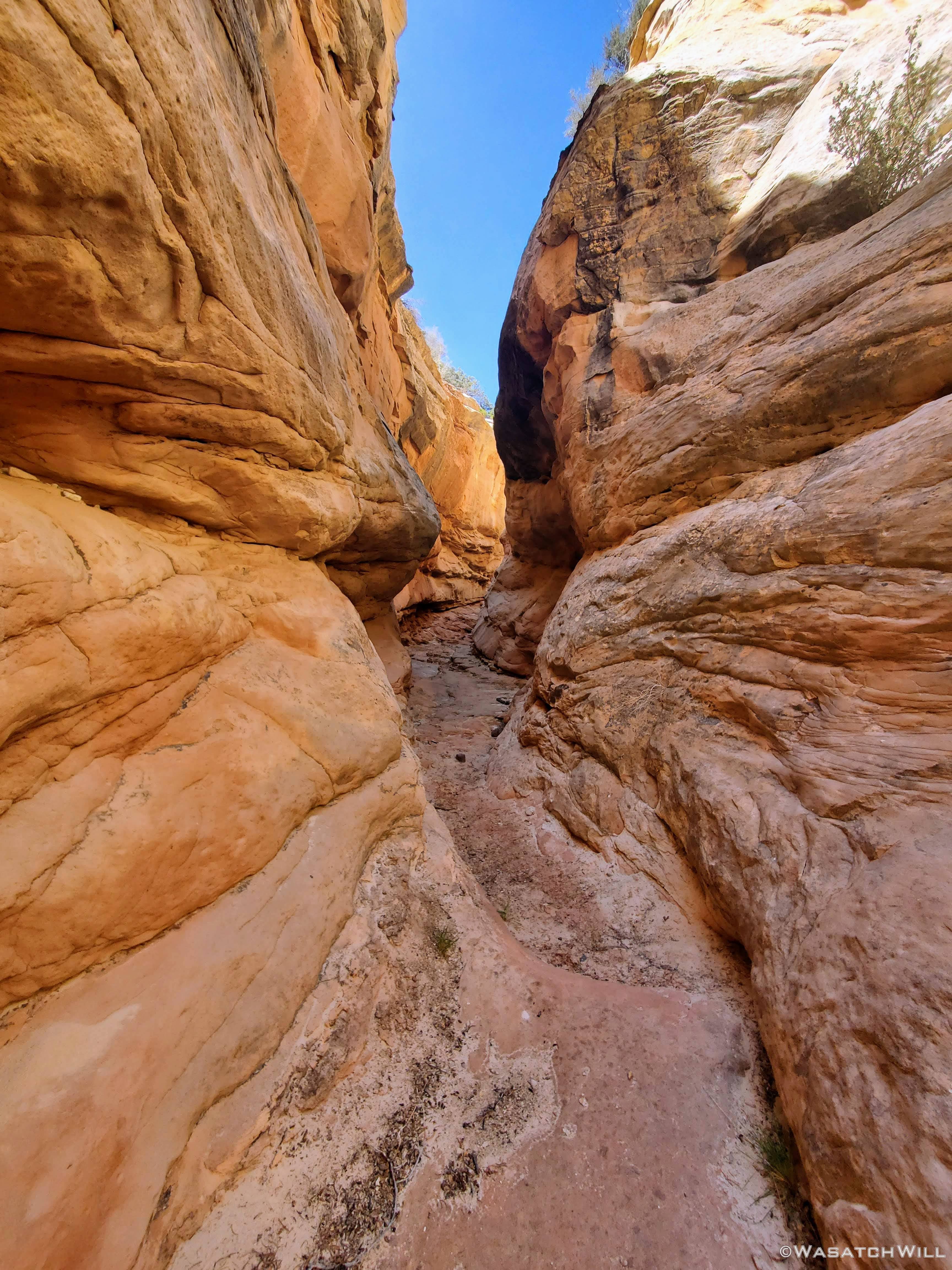
Into an unexpected but enjoyable slot section.

More of the slot.
While I shot plenty of video this stretch up the canyon, I again missed out on taking more photos than I would have liked to. I was so anxious and so excited at the prospects of achieving our goal that I was putting all my creative energy into the video. So, yet again...to see more of what we got to explore en route of trying to find the inscription, you'll have to view the video at the end.
Upon viewing the video, one will also see the unanticipated obstacles that inevitably turned us away from continuing our progress. Yep. We ended up stalling out and turning around. It was a real bummer to have our efforts thwarted in the way that they were. But, such is the gamble one takes when venturing out into unknown territory like we did where no beta can be found online through the power of Google. Not every slot and pour-off shows up well enough to be obvious on satellite either. Canyon country throw all sorts of hidden surprises like that at you. And yet, at least sometimes, I wouldn't have it any other way. That's what adds more to the adventure and makes everything feel so new, with all sorts of surprises, some very pleasant, and some not so much. So long as one as one is willing to assess new risks as they surface and be prepared to turn back to prevent a good day from becoming a bad day. And that we did.
From an unexpected pour-off to a high bench to bypass it that became riddled with sensitive cryptobiotic soil we had to play hopscotch with followed by a roller coaster of little side drainages to traverse over and over that became really tedious after only a few of them, our progress had slowed down immensely. We ultimately decided that even if we could make it, it would be a very strenuous and time consuming process to reach our target. That would likely result in hiking back down canyon in the dark for the last couple of miles back to camp. It just wasn't worth it knowing we could reach it from another direction with much less effort so long as more time was allotted for traveling the rough road.
So instead, we made our way back down to another fork in the canyon we had passed by on our way up and wandered up that for a bit. It had a very smooth and sandy bottom and made for a very enjoyable walk. Here the walls would narrow up in spots and flirt with becoming a true slot at times before backing off again.
Up into another canyon fork.

Almost a slot.

More narrows.
Eventually, we made it back down to camp where we made another big decision: lay down in the tent for a late afternoon siesta or wander back up the side canyon where the water was flowing a short distance and soak our feet for a bit there.
We opted for the nap and it proved to be the right decision almost right away. Right as we settled into our tent, some clouds moved in and some rather strong winds began to gust up. While we were never really threatened with any rain, the gusts of wind persisted for a few hours blowing all sorts of dust under our fly and up into our tent. The tent itself stood up to the moderately strong gusts just fine. I think I did guy out one side at one point to give it a bit of extra stability. The poles would flex a bit and bow in a little, but nothing that ever made me ever worry they were going to snap. As a side note, my friend Devin had taken his whole family out for a camping trip that same weekend in a place not so very far away. He and his family had large name-brand tent that did not fare so well in the high winds that swept across this region of the state. Unfortunately that tent was damaged beyond repair and he and his family had to cut their trip short.
In hindsight, the decision to give up on the inscription and save it for another day turned out to be an even better decision. It likely would have been miserable with the gusty wind and sand blowing all over had we been able to make it up into the more exposed valley we were aiming for.
Some time in the evening, the winds began to settle down a bit and we took the opportunity to come out and make dinner. Tortilla wraps with pork and rice, salad greens, and shredded cheddar cheese was on the menu tonight. For this trip, we also employed a new kitchen setup with an MSR Titan Kettle and MSR PocketRocket Deluxe Stove.
Cooking dinner.
Dinner is served.
With full tummies we cleaned up and got settled into our tent for one more night.
DAY THREE
Sunday - April 25, 2021
Like the day before, the weather was calm and cool with partly cloudy skies. We enjoyed a relaxing morning, packed up, and made our way back to the car. As the day progressed, so did the strength of the wind. Light morning breezes grew into strong gusty winds in the afternoon for the last couple of miles back.

Last morning at camp.

Looking up canyon from camp.

Jess weaves through a section of large igneous rocks.
A chunk of gypsum. This stuff exists in high concentrations in a few parts around the park.

A chunk of flint or other calcified rock.
Jess approaches what I call "The Wedding Cake" for its white and frosted layers.

Out of the canyon and along the wash.
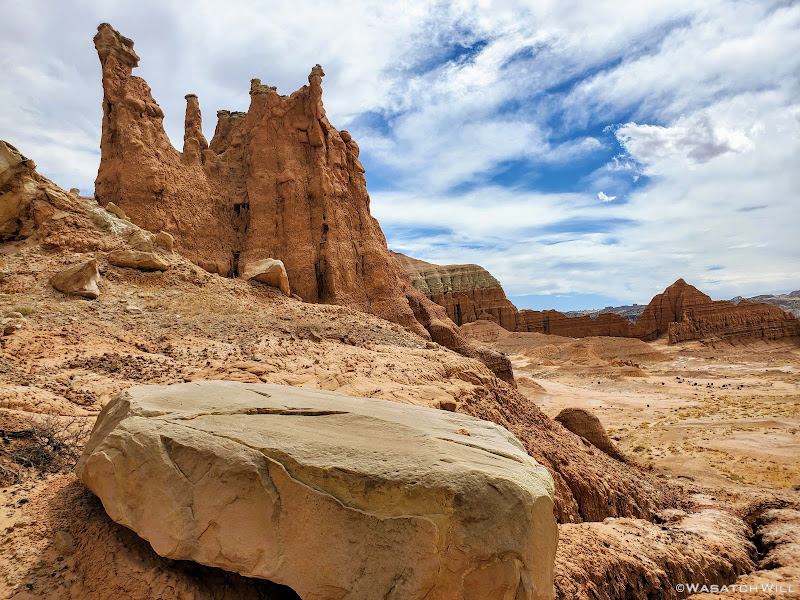
Rising up like a cathedral or temple spire.

Back on trail for the final stretch.
Locked away behind bars at the local jailhouse.

A parched desert floor.

Rounding around a sizeable butte.

Desert Valley.
Jess making progress up the trail.

A pyramid rises in the distance.
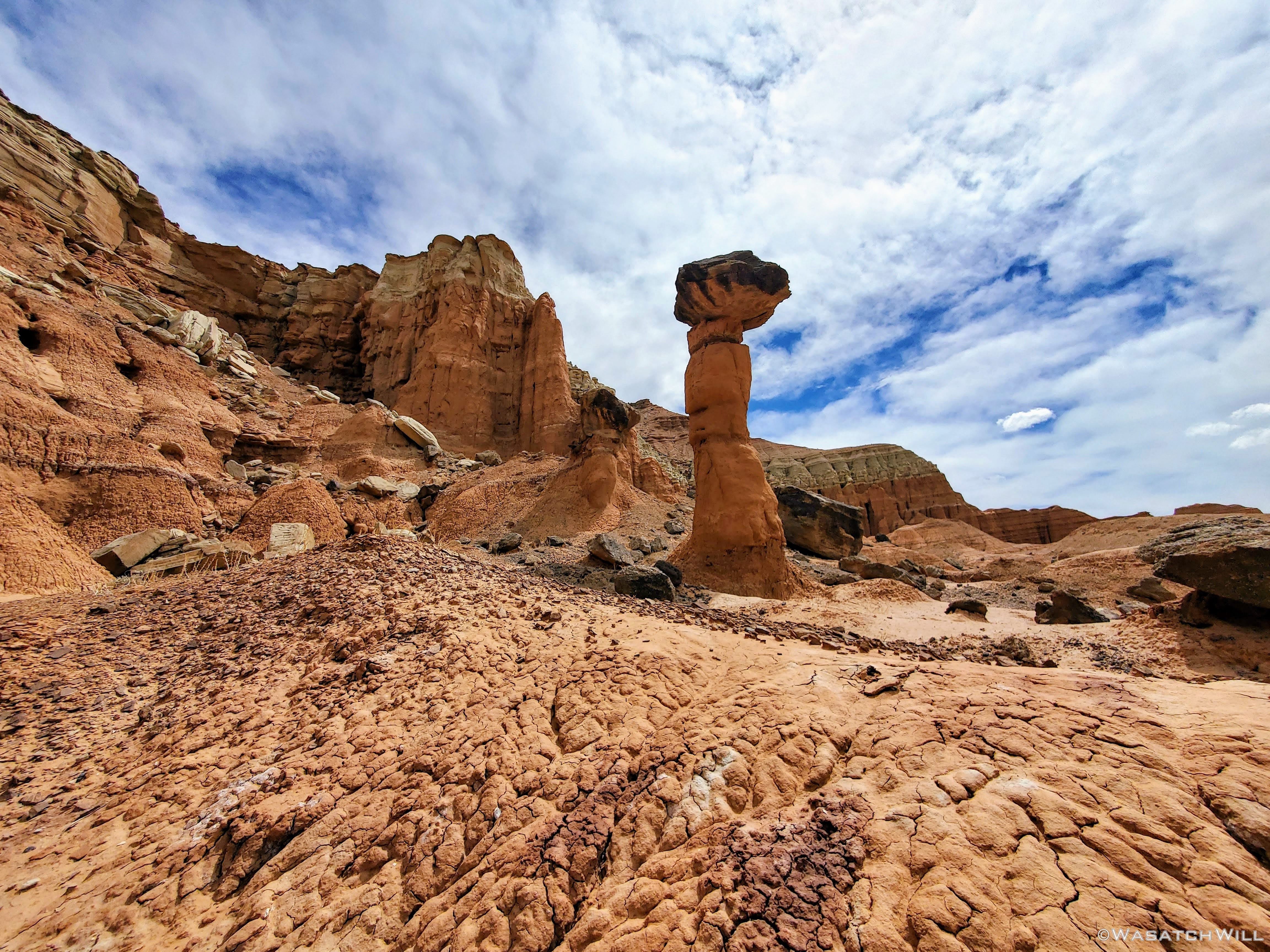
A lonely hoodoo.

Other side of the hoodoo.

I call this "Chimney Rock, Jr" with a small community of goblins.

Back on the ascent as nearby hoodoos stand guard.
Jess way out on the home stretch.
Once back up on the rim of the high plateau, we arrived at our car. It's always a nervous moment when returning to your car and you go to start it up in an area as remote as this and there is nobody else around, no matter how reliable it usually is elsewhere. Fortunately it remained reliable and started up just fine. It was now time to go home and return to our kids. This was an adventure to be continued, when we make yet another attempt at getting to the inscription. Perhaps the third time will be the charm.
") Love the photos, great TR! So much inspiration in this report. I was quite surprised to see the quality of the water you found, nice job identifying that location ahead of time. And one day you will make it to the inscription.
Love the photos, great TR! So much inspiration in this report. I was quite surprised to see the quality of the water you found, nice job identifying that location ahead of time. And one day you will make it to the inscription.
