- Joined
- May 5, 2012
- Messages
- 1,732
Melvin Heaps went for a hike off the Crystal Lake Trailhead on July 31, 2017. He didn't come home that night and his family reported him missing.
A full-scale search effort launched late that night. Over the course of the next week, deputies, search dogs, volunteers and helicopter crews scoured the area around Trial/Washington/Wall Lakes without success.
This area seems to be the Bermuda Triangle of Utah's mountains. People vanish in the general vicinity of the Mirror Lake Highway with some frequency.
I was away on a family vacation when Melvin went for his walk in the woods. I only learned of it while coming back into cell service at the opposite end of the range, near Manila, on Tuesday afternoon. I wanted to help in the search, but my car had broken down along I-80 in Echo Canyon and I had some family obligations that required attention.
Still, I made some effort to try and contribute, even after the official search was scaled back at the end of that week.
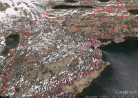
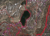
The Summit County Sheriff's Office tweeted a screen shot showing their GPS tracks. I contacted their PIO, who graciously provided the data file to me.
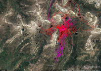
Red tracks are hikers/horses while the purple are dogs. Here's a closer look at the trailhead.
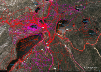
There are a couple of take-aways for me when looking at the search tracks. First, is Melvin is not on a trail. Protocol for this type of search would be to send teams out along all of the trails ASAP. They clearly did so.
Second, the likelihood of Melvin being near the trailhead are low. The area was covered extensively and in a short amount of time after his initial disappearance.
My approach then, in planning reconnaissance hikes, was to look for gaps in the search grid. Where possible, I would avoid the established trails. Any time spent on the trail was wasted, I reasoned, as we know with certainty Melvin is not on one.
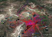
This trip report is three in one, covering three outings in search of Melvin Heaps (green are my tracks).
August 12, 2017
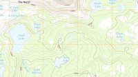
My first outing focused on the area at the center of this image. The half-circle of small ponds along the 10,200 contour line, north of Star Lake.
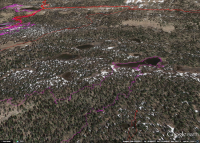
It is heavily wooded, tucked between two very active legs of the Notch Mountain Trail but not directly accessed by any trail of its own.
To reach it, I passed by Teapot, Diamond and Star Lakes.
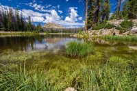
The slopes around the half-moon bench were choked with deadfall. The ponds though were surrounded by meadow.
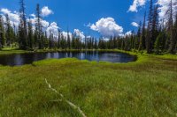
From there, I worked my way up to the slopes of Notch Mountain for a birds-eye view.
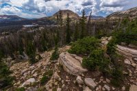
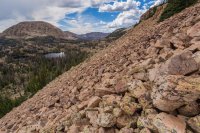
It never ceases to amaze me how well sound travels in the clear mountain air. I could almost make out the conversations of these noisy hikers down at Wall Lake.
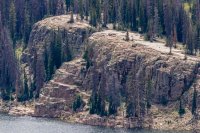
Traversing westward along the slope of Notch Mountain, I kept an eye out for anything that looked out of place below. Mount Watson is near center, Wall Lake at the left and the Notch at far right. It's a good bet Melvin is somewhere visible in this image.
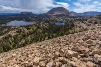
Looking west across the Notch.
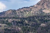
I arrived at the Notch via an improvised scramble route to find a shirtless guy and a gal in a sports bra loudly discussing religion and politics. Couldn't get away from them quickly enough.
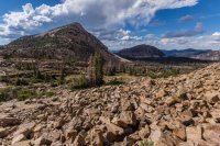
The Notch is a prominent destination for hikers and enough of a climb that a 74-year-old like Melvin may very well have sought but struggled to reach it. This area was not searched very thoroughly.
Rather than heading straight down the trail to Ibantik Lake, I made a slight detour to the north to go past a series of ponds near Lake Lovenia.
A lot of people camp at Ibantik and I reasoned it wouldn't make much sense to stick close to the lake for that reason. I cut across the head and pushed up into the hills east of it.
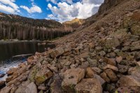
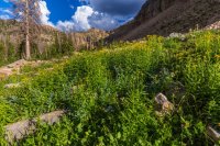
From above Ibantik, I could clearly see Meadow Lake and off down the Main Fork Weber River drainage.
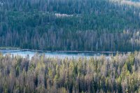
And looking across the Weber River basin offered views into Cuberant Basin. I've stood atop these cliffs and peered back the opposite direction on other hikes.
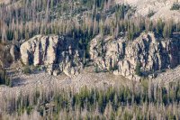
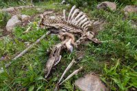
The sight of bones at a distance gave me pause, but it turned out to be a deer. The carcass had obviously been well predated but the amount of fur and intact nature of the skeleton made me think the death must have been relatively recent.
I rounded the northern tip of Notch Mountain and dropped down to the trail.
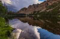
Daylight was running short and I was feeling a bit tired. Not only that, but weather was gathering on the horizon.
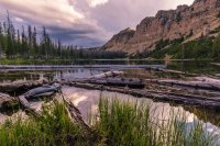
The winter of 16-17 was such a boon to the Uintas. Normally by so late in the summer, the lakes are drawn down and creeks are just trickling. Not so during the summer of 2017. Notch Lake was still high and dumping a good amount of water.
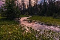
It became obvious I was not going to make the car by nightfall so I increased the pace. Then the fading daylight hit Reid and Bald Mountains. I had to stop at Dean Lake and capture it.
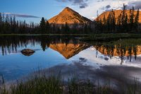
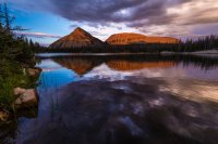
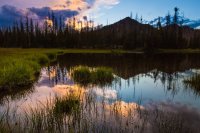
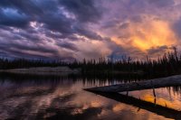
The photographic diversion cost me. I should have stayed with the trail but instead made the dumb decision to continue the search in the dark, off trail.
As such, I didn't make it back to the highway until quite late. I had told my parents I was only going out for the day and feared they would call out SAR if I didn't report in before midnight. I raced down to Kamas and checked in, then puked on the way home from a bit of exhaustion and altitude sickness.
October 7, 2017
Any search for a missing person in the area of the Crystal Lake TH is hampered if the searchers don't have a clear indication as to which trail the target of the search used.
The Clyde Lake Loop and the Notch are obvious targets for hikers, but so are Long Lake or Island Lake. It is impossible to effectively search both of those areas in a reasonable amount of time.
For my second hike, I started from the assumption someone might accidentally veer off the Clyde Lake trail and end up somewhere below Mount Watson's south face. From there, I cut across the head of the Middle Fork Weber River drainage in order to scan Ramona, Island, Fire and Duck Lakes.
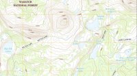
As you can see, the official search completely omitted Ramona and Fire Lakes.
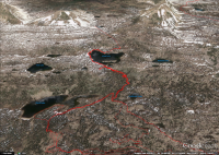
The hike started with an easy trail jaunt up to Watson Lake, passing by well-searched areas like Cliff Lake.
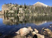
At the head of Lake Watson I left the trail and started working up along a rocky slope to the foot of Mount Watson.
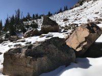
Notch, Reid and Bald Mountains from the lower slopes of Mount Watson.
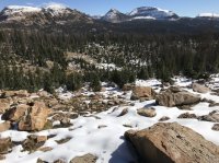
The Notch, as visible from near the same vantage point.
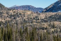
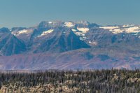
Rounding the mountain, Timpanogos came into view down south.
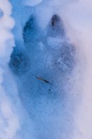
Wildlife signs were abundant. These coyote tracks were frozen in the snow. Cat scat was around as well but alas, no sighting of a cougar or bobcat.
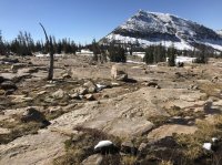
Rounding Watson, east Long Mountain came into view.
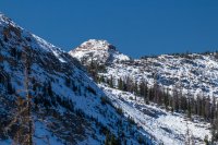
A pass sits between east Long and Long Mountain proper. I'd thought I might cross it, but the northern approach looked a bit too snowy.
Instead, I tried to stay to the 10,400 contour line while heading toward Ramona.
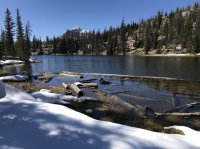
The snow made it tough to know if I might be hiking past something important.
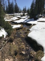
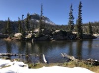
Island Lake and its smaller satellites sit on a high bench. Looking off the edge gave a great view of the whole North Fork Provo River headwaters. That's Duck Lake down below.
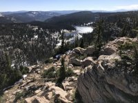
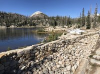
The dam at Fire Lake impressed me. So much effort went into constructing it and the structure has weathered well.
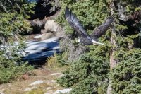
From Fire, I picked a path down the cliff bands and to Duck Lake. A bald eagle swooped low over the water, angry at me for scaring away the rising fish.
I was developing a raging headache at this point and decided to cut the search short. Rejoining the trail, I headed straight back to the trailhead and arrived just before sundown.
November 4, 2017
The forecast called for snow. A significant amount of it, probably enough to blanket the mountains with enough powder to bury any sign of Melvin until spring. It was the final shot of the season for me.
The Bald Mountain Pass weather station told a discouraging story: ambient temperatures below freezing with winds gusting to 30 mph. It was not going to be a typical summer lark.
Ambitious mileage would have to wait until warmer months. I aimed to check two spaces nearer to the trailhead. One, above Cliff Lake and the other between Wall and Clyde Lakes.
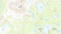
There were only a few cars at the Crystal Lake Trailhead, a far cry from August when I was unable to park anywhere close to it. So while the weather wasn't the best of hiking I must say the mountains were quiet and lovely.
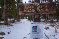
I started out on the trail toward Wall Lake but soon left it, climbing the hill to obtain the region between Wall and Cliff Lakes.
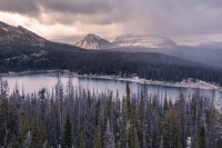
Clouds were racing by overhead. The sun never broke through in full, but occasionally the overcast would thin enough to allow some light.
I headed over to Wall Lake's inlet, which comes down from Clyde Lake.
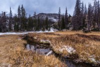
Between the two lakes are a series of cliff bands which sit one atop another. From this angle, it is obvious what a challenge the terrain presents for any kind of search. Each of those steps has to be scanned individually.
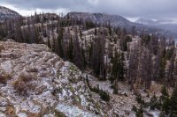
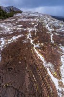
The clouds kept obscuring landmarks.
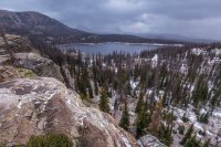
After ascending to near Clyde Lake, I headed west along the 10,400 contour line. Snow pelted me and the clouds made Mount Watson vanish.
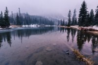
I pushed west from this point, following a line of cliffs before finding a break that allowed me down to the meadow above Cliff Lake.
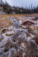
Wind was howling. My ears started to feel the sting and I worried about frostbite. Conceding defeat, I headed back to the car.
Until 2018, then.
A full-scale search effort launched late that night. Over the course of the next week, deputies, search dogs, volunteers and helicopter crews scoured the area around Trial/Washington/Wall Lakes without success.
This area seems to be the Bermuda Triangle of Utah's mountains. People vanish in the general vicinity of the Mirror Lake Highway with some frequency.
I was away on a family vacation when Melvin went for his walk in the woods. I only learned of it while coming back into cell service at the opposite end of the range, near Manila, on Tuesday afternoon. I wanted to help in the search, but my car had broken down along I-80 in Echo Canyon and I had some family obligations that required attention.
Still, I made some effort to try and contribute, even after the official search was scaled back at the end of that week.
The Summit County Sheriff's Office tweeted a screen shot showing their GPS tracks. I contacted their PIO, who graciously provided the data file to me.

Red tracks are hikers/horses while the purple are dogs. Here's a closer look at the trailhead.

There are a couple of take-aways for me when looking at the search tracks. First, is Melvin is not on a trail. Protocol for this type of search would be to send teams out along all of the trails ASAP. They clearly did so.
Second, the likelihood of Melvin being near the trailhead are low. The area was covered extensively and in a short amount of time after his initial disappearance.
My approach then, in planning reconnaissance hikes, was to look for gaps in the search grid. Where possible, I would avoid the established trails. Any time spent on the trail was wasted, I reasoned, as we know with certainty Melvin is not on one.
This trip report is three in one, covering three outings in search of Melvin Heaps (green are my tracks).

August 12, 2017

My first outing focused on the area at the center of this image. The half-circle of small ponds along the 10,200 contour line, north of Star Lake.

It is heavily wooded, tucked between two very active legs of the Notch Mountain Trail but not directly accessed by any trail of its own.
To reach it, I passed by Teapot, Diamond and Star Lakes.

The slopes around the half-moon bench were choked with deadfall. The ponds though were surrounded by meadow.

From there, I worked my way up to the slopes of Notch Mountain for a birds-eye view.


It never ceases to amaze me how well sound travels in the clear mountain air. I could almost make out the conversations of these noisy hikers down at Wall Lake.

Traversing westward along the slope of Notch Mountain, I kept an eye out for anything that looked out of place below. Mount Watson is near center, Wall Lake at the left and the Notch at far right. It's a good bet Melvin is somewhere visible in this image.

Looking west across the Notch.

I arrived at the Notch via an improvised scramble route to find a shirtless guy and a gal in a sports bra loudly discussing religion and politics. Couldn't get away from them quickly enough.

The Notch is a prominent destination for hikers and enough of a climb that a 74-year-old like Melvin may very well have sought but struggled to reach it. This area was not searched very thoroughly.
Rather than heading straight down the trail to Ibantik Lake, I made a slight detour to the north to go past a series of ponds near Lake Lovenia.
A lot of people camp at Ibantik and I reasoned it wouldn't make much sense to stick close to the lake for that reason. I cut across the head and pushed up into the hills east of it.


From above Ibantik, I could clearly see Meadow Lake and off down the Main Fork Weber River drainage.

And looking across the Weber River basin offered views into Cuberant Basin. I've stood atop these cliffs and peered back the opposite direction on other hikes.

The sight of bones at a distance gave me pause, but it turned out to be a deer. The carcass had obviously been well predated but the amount of fur and intact nature of the skeleton made me think the death must have been relatively recent.

I rounded the northern tip of Notch Mountain and dropped down to the trail.

Daylight was running short and I was feeling a bit tired. Not only that, but weather was gathering on the horizon.


The winter of 16-17 was such a boon to the Uintas. Normally by so late in the summer, the lakes are drawn down and creeks are just trickling. Not so during the summer of 2017. Notch Lake was still high and dumping a good amount of water.

It became obvious I was not going to make the car by nightfall so I increased the pace. Then the fading daylight hit Reid and Bald Mountains. I had to stop at Dean Lake and capture it.


The photographic diversion cost me. I should have stayed with the trail but instead made the dumb decision to continue the search in the dark, off trail.
As such, I didn't make it back to the highway until quite late. I had told my parents I was only going out for the day and feared they would call out SAR if I didn't report in before midnight. I raced down to Kamas and checked in, then puked on the way home from a bit of exhaustion and altitude sickness.
October 7, 2017
Any search for a missing person in the area of the Crystal Lake TH is hampered if the searchers don't have a clear indication as to which trail the target of the search used.
The Clyde Lake Loop and the Notch are obvious targets for hikers, but so are Long Lake or Island Lake. It is impossible to effectively search both of those areas in a reasonable amount of time.
For my second hike, I started from the assumption someone might accidentally veer off the Clyde Lake trail and end up somewhere below Mount Watson's south face. From there, I cut across the head of the Middle Fork Weber River drainage in order to scan Ramona, Island, Fire and Duck Lakes.

As you can see, the official search completely omitted Ramona and Fire Lakes.

The hike started with an easy trail jaunt up to Watson Lake, passing by well-searched areas like Cliff Lake.

At the head of Lake Watson I left the trail and started working up along a rocky slope to the foot of Mount Watson.

Notch, Reid and Bald Mountains from the lower slopes of Mount Watson.

The Notch, as visible from near the same vantage point.

Rounding the mountain, Timpanogos came into view down south.

Wildlife signs were abundant. These coyote tracks were frozen in the snow. Cat scat was around as well but alas, no sighting of a cougar or bobcat.

Rounding Watson, east Long Mountain came into view.

A pass sits between east Long and Long Mountain proper. I'd thought I might cross it, but the northern approach looked a bit too snowy.

Instead, I tried to stay to the 10,400 contour line while heading toward Ramona.

The snow made it tough to know if I might be hiking past something important.


Island Lake and its smaller satellites sit on a high bench. Looking off the edge gave a great view of the whole North Fork Provo River headwaters. That's Duck Lake down below.

The dam at Fire Lake impressed me. So much effort went into constructing it and the structure has weathered well.

From Fire, I picked a path down the cliff bands and to Duck Lake. A bald eagle swooped low over the water, angry at me for scaring away the rising fish.

I was developing a raging headache at this point and decided to cut the search short. Rejoining the trail, I headed straight back to the trailhead and arrived just before sundown.
November 4, 2017
The forecast called for snow. A significant amount of it, probably enough to blanket the mountains with enough powder to bury any sign of Melvin until spring. It was the final shot of the season for me.
The Bald Mountain Pass weather station told a discouraging story: ambient temperatures below freezing with winds gusting to 30 mph. It was not going to be a typical summer lark.
Ambitious mileage would have to wait until warmer months. I aimed to check two spaces nearer to the trailhead. One, above Cliff Lake and the other between Wall and Clyde Lakes.


There were only a few cars at the Crystal Lake Trailhead, a far cry from August when I was unable to park anywhere close to it. So while the weather wasn't the best of hiking I must say the mountains were quiet and lovely.

I started out on the trail toward Wall Lake but soon left it, climbing the hill to obtain the region between Wall and Cliff Lakes.

Clouds were racing by overhead. The sun never broke through in full, but occasionally the overcast would thin enough to allow some light.
I headed over to Wall Lake's inlet, which comes down from Clyde Lake.

Between the two lakes are a series of cliff bands which sit one atop another. From this angle, it is obvious what a challenge the terrain presents for any kind of search. Each of those steps has to be scanned individually.


The clouds kept obscuring landmarks.

After ascending to near Clyde Lake, I headed west along the 10,400 contour line. Snow pelted me and the clouds made Mount Watson vanish.

I pushed west from this point, following a line of cliffs before finding a break that allowed me down to the meadow above Cliff Lake.

Wind was howling. My ears started to feel the sting and I worried about frostbite. Conceding defeat, I headed back to the car.
Until 2018, then.
