Ben
Member
- Joined
- Sep 12, 2014
- Messages
- 1,873
The first week end of october here was unseasonably nice, so i was excited to get to the mountains. Temperatures at elevation were supposed to get up above sixty degrees, sun shine all week end long, and it had snowed up high just a week before, so it seemed it would look nice up there.
I decided to hike from Yellow Belly Lake, some where that i hadn't been before. My plan was to get over to Hidden Lake to try to explore the pass above it, but that didn't end up working out. Here's what i did do.
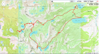
the link
I left later than i wanted to , like usual, and being fall, i got up to the trail head after dark. I'd never been here before, and i drove from Pettit Lake to Yellow Belly, an additional five miles. I could have done the hike that i did from Pettit in stead, but i wasn't sure exactly what i was going to end up doing, and Yellow Belly was closer to the pass over to the South Fork Payette drainage. The road to Pettit is a perfect dirt road, but the road between it and Yellow Belly was fun. It's rocky, like a natural cobble stone. Continual tiny bumps. My subaru made it fine. But not particularly quickly.
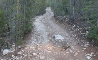
When i got to the trail head it was dark out. But i was awake, so i tried to hike in a little ways in the dark. I came along Yellow Belly Lake, but eventually couldn't tell which way the proper trail went, so i called it a night. I didn't bring a tent on this trip, just a tarp. It was cold the first night, but not insufferable. I also brought my dog Isaac with me. My four season sleeping bag is my three season sleeping bag with a dog in it. Mostly for his sake, he's a short hair. He spent the time i was trying to get to sleep barking at nothing in the darkness, trying to make sure i was at least a little bit uneasy. Then he woke up early the next morning to go run through the woods and run back while i slept an other hour.
The next morning the sun brought fog over Yellow Belly Lake.

It was pretty cool seeing the mist through the trees approaching the lake too.
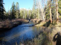
The trail that i'd been following in the night petered out pretty quickly. Just a social trail along the edge of the lake probably. I didn't know it yet, but i'd actually missed the real trail's turn off very early from the parking area. I'd never been here before, so i wasn't sure if the trail that was on the map had over grown since it had been surveyed. I followed the map cross country to where i felt that the trail should be, and picked it up near McDonald Lake. I took the time to make breakfast there. Here's the creek that runs into Yellow Belly along the way.
The trail starts to ascend gradually going toward Farley Lake. Here's a little bit of the fall color along the way.
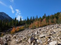
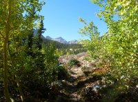
And here's a view back down on Farley Lake about half way up the drainage. I stopped there and ate again also. Isaac tried to pull large sticks that were closer to logs out of the edge of the lake. It was a very pretty lake in the crisp fall morning, but i didn't get a closer picture of it that i really liked. I kept going.
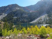
Here's looking up the valley above Farley Lake.

And a little bit of color along the way beyond Farley.


Farley is some thing more than four miles in. Around a mile and a half beyond it the trail forks, and i went right to Edith Lake and the pass above it. The other fork goes on to Toxaway Lake. The trail gains elevation more quickly here. Here's a picture looking back down the valley as i get closer to Edith. You can just make out the blues of Farley and Yellow Belly Lakes, and see the White Clouds across the Salmon River.
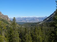
And then here's Edith Lake. I'll continue to the pass to the left of the peak above it.

Edith Lake.

Tiny pond above Edith Lake right along the trail. It was full of color. The pass is the low point left of center. It's a good pass, 360 views up there.

Continuing up to it. This was the only time that i walked past any real snow. Funny, when i had come here in august, there was still the last of the previous year's accumulation at the crest of the pass, but all of that was gone now in october, in stead just the first dusting of the coming season. Isaac manages his way into both these pictures. Always in front of me.
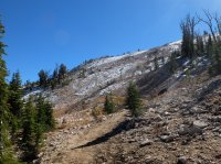
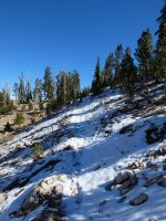
Looking over, and just slightly back near the top of the pass. You can see Yellow Belly, Edith, and the White Clouds on the right, and dead center is the pass over to Imogene Lake that also comes down to Edith.

And looking directly back where i'd come, Edith, Farley, and Yellow Belly Lakes.
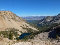
Isaac practically at the top. Waiting.
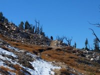
I enjoyed topping out at the pass here. On the left you have the pass back to Imogene, then the valley i'd come up with the White Clouds beyond, Parks Peak left of center, Snowyside Peak right of center in the distance, and the beginnings of the South Fork Payette River on the right

Looking a little more to the West, Snowyside Peak on the right, an unnamed lake on the right. I can just see Edna Lake near center, and a hint of Virginia Lake to the right of it.

An other view back down the valley to Yellow Belly.

Isaac and Snowyside Peak. You can see the trail that i came up on the left, and one that is no longer used on the right.
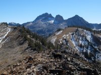
After running around on the top taking pictures i made my way down the other side. After coming down from every thing, there's a nice little stream to cross on the way to Edna Lake.
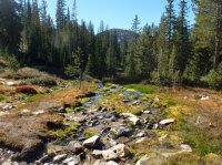
Near Edna Lake there is a junction. One trail continues down below Edna Lake, an other turns and goes up above it, to Vernon and beyond. The trail the goes down from Edna can eventually be taken up to Hidden Lake where i'd originally wanted to go. But at the time that i got there it didn't look like i would have the time to do what i wanted to there. Explore above it. And that would have only taken me farther away from the car any way, so that i would have had less time to see any thing on my way back the next day. I thought i'd rather have more time to go and see Toxaway and Twin and Alice Lakes on my way out, which i had never been to before. So i went on toward Vernon Lake, which i also had never seen before. I think i like Vernon better than Edna or Virginia. Here's a picture of Isaac in Vernon.
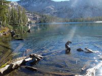
And a picture of Vernon without Isaac, at what would be it's outlet if it had enough water in it.
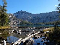
And a wider picture of Vernon.

I continued beyond Vernon because the whole reason i go is to see what else is there. Beyond Vernon the trail goes up a little ways to a saddle between it and Ardeth Lake. There is a very nice tiny unnamed lake up there sitting on top of the saddle.
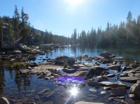
I thought it was gorgeous.

I continued on to where i could see Ardeth Lake from the saddle there.

And i decided to turn back and camp near Edna for the night.
Here's Isaac looking incredulously at me for some reason as we pass by Vernon Lake again. May be i was taking too long. Or may be i was telling him to hold still while i took a picture.

Vernon Lake again.

I went and set up, cooked dinner, and wrote in my journal. Fed the dog. Went to sleep. Not a lot to do alone in mountains in the evening in the fall. Nice night though. It was a lot warmer higher up, and away from the lake, than it had been the night before.
The next morning. Here's what seems to be the only good picture of Edna Lake that i took. Leaving it to go back.

Christmas colors. Near Edna.
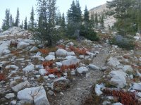
On the way back, looking out over the South Fork Payette drainage again. To the left of here, up just a little, there is a junction where you can either go to Edith Lake, the way i came, or to Toxaway Lake, to the right, to the South. I went toward Toxaway, to make a loop back to the car. This was one of the best decisions of my life.

As the trail curves around, Toxaway lake comes into view. Parks Peak on left, Snowyside on right.

Snowyside Peak, above Toxaway.
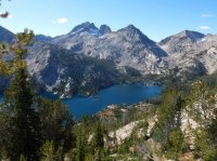
Trail on the way down to the lake.

Snowyside Peak.
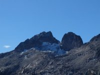
Toxaway Lake.


From the shore.

After arriving at the lake the trail goes around it and then up a draw to a pass to Twin Lakes. Here's looking back over a couple tarns above Toxaway.
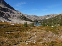
The trail nearing the shoulder of Snowyside Peak.
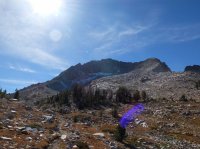
The notch where the trail passes over to Twin Lakes.
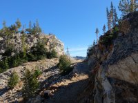
Aaaaaand Twin Lakes.

Probably the most scenic alpine place i've ever been.

The trail from the pass.
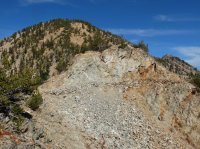
Isaac over looking the scene.
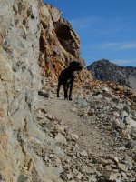
El Capitan. Alice Lake is in the valley in between.
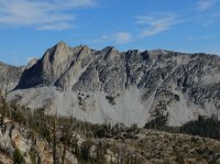
I had a hard time getting this report together. It was difficult to pick which pictures to use with so many good ones from such a gorgeous area.
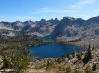
Twin Lakes, Snowyside Peak on right.

Those towers across the lake.
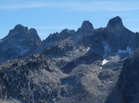
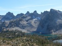
Past Twin Lakes the trail shortly arrives at Alice Lake. Here's El Capitan across Alice, and the towers over Twin on the right.


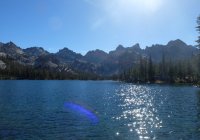
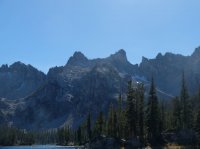
El Capitan and an out let pond below Alice Lake.
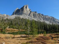
Isaac and the pond.
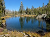
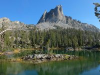
Looking out the valley below Alice Lake. White Clouds beyond. Of course.
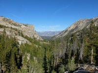
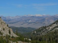
The creek below Alice Lake on the way down to Pettit Lake.
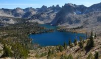
Pettit Lake, Looking back the way i'd come down.

From Pettit Lake i went over a small ridge back over to Yellow Belly Lake and my car on the other side. And i passed by McDonald Lake on the way there.


Only saw i think six people that week end. More than i expected, but it was a really gorgeous week end.
Featured image for home page:
I decided to hike from Yellow Belly Lake, some where that i hadn't been before. My plan was to get over to Hidden Lake to try to explore the pass above it, but that didn't end up working out. Here's what i did do.

the link
I left later than i wanted to , like usual, and being fall, i got up to the trail head after dark. I'd never been here before, and i drove from Pettit Lake to Yellow Belly, an additional five miles. I could have done the hike that i did from Pettit in stead, but i wasn't sure exactly what i was going to end up doing, and Yellow Belly was closer to the pass over to the South Fork Payette drainage. The road to Pettit is a perfect dirt road, but the road between it and Yellow Belly was fun. It's rocky, like a natural cobble stone. Continual tiny bumps. My subaru made it fine. But not particularly quickly.

When i got to the trail head it was dark out. But i was awake, so i tried to hike in a little ways in the dark. I came along Yellow Belly Lake, but eventually couldn't tell which way the proper trail went, so i called it a night. I didn't bring a tent on this trip, just a tarp. It was cold the first night, but not insufferable. I also brought my dog Isaac with me. My four season sleeping bag is my three season sleeping bag with a dog in it. Mostly for his sake, he's a short hair. He spent the time i was trying to get to sleep barking at nothing in the darkness, trying to make sure i was at least a little bit uneasy. Then he woke up early the next morning to go run through the woods and run back while i slept an other hour.
The next morning the sun brought fog over Yellow Belly Lake.

It was pretty cool seeing the mist through the trees approaching the lake too.
The trail that i'd been following in the night petered out pretty quickly. Just a social trail along the edge of the lake probably. I didn't know it yet, but i'd actually missed the real trail's turn off very early from the parking area. I'd never been here before, so i wasn't sure if the trail that was on the map had over grown since it had been surveyed. I followed the map cross country to where i felt that the trail should be, and picked it up near McDonald Lake. I took the time to make breakfast there. Here's the creek that runs into Yellow Belly along the way.

The trail starts to ascend gradually going toward Farley Lake. Here's a little bit of the fall color along the way.


And here's a view back down on Farley Lake about half way up the drainage. I stopped there and ate again also. Isaac tried to pull large sticks that were closer to logs out of the edge of the lake. It was a very pretty lake in the crisp fall morning, but i didn't get a closer picture of it that i really liked. I kept going.

Here's looking up the valley above Farley Lake.

And a little bit of color along the way beyond Farley.


Farley is some thing more than four miles in. Around a mile and a half beyond it the trail forks, and i went right to Edith Lake and the pass above it. The other fork goes on to Toxaway Lake. The trail gains elevation more quickly here. Here's a picture looking back down the valley as i get closer to Edith. You can just make out the blues of Farley and Yellow Belly Lakes, and see the White Clouds across the Salmon River.

And then here's Edith Lake. I'll continue to the pass to the left of the peak above it.

Edith Lake.

Tiny pond above Edith Lake right along the trail. It was full of color. The pass is the low point left of center. It's a good pass, 360 views up there.

Continuing up to it. This was the only time that i walked past any real snow. Funny, when i had come here in august, there was still the last of the previous year's accumulation at the crest of the pass, but all of that was gone now in october, in stead just the first dusting of the coming season. Isaac manages his way into both these pictures. Always in front of me.


Looking over, and just slightly back near the top of the pass. You can see Yellow Belly, Edith, and the White Clouds on the right, and dead center is the pass over to Imogene Lake that also comes down to Edith.

And looking directly back where i'd come, Edith, Farley, and Yellow Belly Lakes.

Isaac practically at the top. Waiting.

I enjoyed topping out at the pass here. On the left you have the pass back to Imogene, then the valley i'd come up with the White Clouds beyond, Parks Peak left of center, Snowyside Peak right of center in the distance, and the beginnings of the South Fork Payette River on the right
Looking a little more to the West, Snowyside Peak on the right, an unnamed lake on the right. I can just see Edna Lake near center, and a hint of Virginia Lake to the right of it.

An other view back down the valley to Yellow Belly.

Isaac and Snowyside Peak. You can see the trail that i came up on the left, and one that is no longer used on the right.

After running around on the top taking pictures i made my way down the other side. After coming down from every thing, there's a nice little stream to cross on the way to Edna Lake.

Near Edna Lake there is a junction. One trail continues down below Edna Lake, an other turns and goes up above it, to Vernon and beyond. The trail the goes down from Edna can eventually be taken up to Hidden Lake where i'd originally wanted to go. But at the time that i got there it didn't look like i would have the time to do what i wanted to there. Explore above it. And that would have only taken me farther away from the car any way, so that i would have had less time to see any thing on my way back the next day. I thought i'd rather have more time to go and see Toxaway and Twin and Alice Lakes on my way out, which i had never been to before. So i went on toward Vernon Lake, which i also had never seen before. I think i like Vernon better than Edna or Virginia. Here's a picture of Isaac in Vernon.

And a picture of Vernon without Isaac, at what would be it's outlet if it had enough water in it.

And a wider picture of Vernon.

I continued beyond Vernon because the whole reason i go is to see what else is there. Beyond Vernon the trail goes up a little ways to a saddle between it and Ardeth Lake. There is a very nice tiny unnamed lake up there sitting on top of the saddle.

I thought it was gorgeous.

I continued on to where i could see Ardeth Lake from the saddle there.

And i decided to turn back and camp near Edna for the night.
Here's Isaac looking incredulously at me for some reason as we pass by Vernon Lake again. May be i was taking too long. Or may be i was telling him to hold still while i took a picture.

Vernon Lake again.

I went and set up, cooked dinner, and wrote in my journal. Fed the dog. Went to sleep. Not a lot to do alone in mountains in the evening in the fall. Nice night though. It was a lot warmer higher up, and away from the lake, than it had been the night before.

The next morning. Here's what seems to be the only good picture of Edna Lake that i took. Leaving it to go back.

Christmas colors. Near Edna.

On the way back, looking out over the South Fork Payette drainage again. To the left of here, up just a little, there is a junction where you can either go to Edith Lake, the way i came, or to Toxaway Lake, to the right, to the South. I went toward Toxaway, to make a loop back to the car. This was one of the best decisions of my life.

As the trail curves around, Toxaway lake comes into view. Parks Peak on left, Snowyside on right.

Snowyside Peak, above Toxaway.

Trail on the way down to the lake.

Snowyside Peak.

Toxaway Lake.


From the shore.

After arriving at the lake the trail goes around it and then up a draw to a pass to Twin Lakes. Here's looking back over a couple tarns above Toxaway.

The trail nearing the shoulder of Snowyside Peak.

The notch where the trail passes over to Twin Lakes.

Aaaaaand Twin Lakes.

Probably the most scenic alpine place i've ever been.

The trail from the pass.

Isaac over looking the scene.

El Capitan. Alice Lake is in the valley in between.

I had a hard time getting this report together. It was difficult to pick which pictures to use with so many good ones from such a gorgeous area.

Twin Lakes, Snowyside Peak on right.

Those towers across the lake.


Past Twin Lakes the trail shortly arrives at Alice Lake. Here's El Capitan across Alice, and the towers over Twin on the right.


El Capitan and an out let pond below Alice Lake.

Isaac and the pond.


Looking out the valley below Alice Lake. White Clouds beyond. Of course.


The creek below Alice Lake on the way down to Pettit Lake.

Pettit Lake, Looking back the way i'd come down.

From Pettit Lake i went over a small ridge back over to Yellow Belly Lake and my car on the other side. And i passed by McDonald Lake on the way there.


Only saw i think six people that week end. More than i expected, but it was a really gorgeous week end.
Featured image for home page:

Last edited:


