Bob
Trailmaster
- Joined
- Mar 3, 2013
- Messages
- 4,897
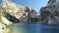
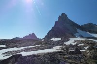
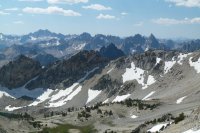
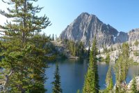
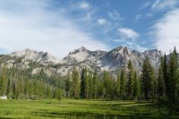
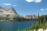
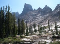
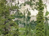
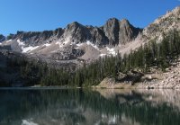
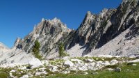
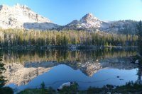
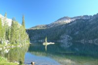
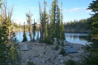
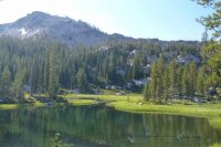
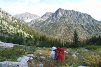
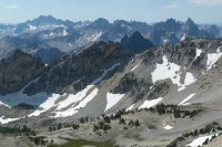
Day 1 – Started in from Iron Creek TH. Excellent weather for the start. We passed a few people coming out from Goat Lake area. It is certainly more popular than it used to be. Defined trail all the way to the lake now. Need to do some scrambling on a use trail, just below the cliffs heading up a steep section to the falls. At Goat Lake the trail ends, went on around the lake at about water level on a use trail. We saw fish in most all the lakes we passed to our first camp. We climbed about 2300 ft up in about 5 miles. The first camp was at the higher end of Lake 8865 in a small patch of pines. Due to the heavy snow year there were snowfields all around and it was very chilly.
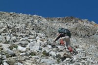
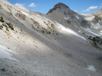
Day 2 – Headed out early as we had to complete Thompson Pass (10,400 ft) and Stephens Lakes pass (10,000 ft) today, the highest we would be on the trip. With Thompson Pass in view we knew it was going to be tough. Unusual snow had the entire saddle snowed in it was steep with loose shale. We had to work our way up the side on loose rock slopes exceeding 60 degrees; quite exhilarating….with full packs! The reward was worth it, the view from Thompson Pass is second to none. We saw three people day hiking to Thompson Peak…their route looked worse than ours! Then back down across a large, very rocky basin and back up Stephens Pass then back down to one of the Stephens Lakes for a total of 1300 ft up and 1100 ft down in about 3 ¼ miles……took about 8 hrs! This is by far the toughest hike section we have done, anywhere. We were rewarded by an excellent campsite and great fishing at Stephens Lake, cuts averaging 14”.
Day 3 – Headed out for what we hoped would be a night at Warbonnet Lake but after Day 2 we figured it would be a little out of reach because we were about 1 ½ mile behind. We decided hiking off trail in the Sawtooths needs to be measured by hours, not miles….extremes of up and downs, loose shale, large rocks and cliffs. We dropped out of the upper cirque into a ‘flat’ forest hike for a while then over Braxon Pass. After a total of about 3¼ miles we hit the main trail after 500 ft down, then 500 ft up, then 900 ft down. On trail at Baron Lakes we revised our route to go over to the Alice Lake side to access Warbonnet Pass instead of up the rocky Baron Lakes cirque. Looked like not many places to camp on the way and a very steep headwall, so we had another unexpected 1100 ft up and 400 ft down to our camp….a small, shallow lake with no fish, but great scenery.
Day 4 – This would be another tough off trail day. First thing we headed up to Warbonnet Pass, 1,000 ft up in a mile. A very interesting 8” wide (sheep trail) section across the steep, loose rock, at the top of Baron Lake cirque. We had great views from the Pass. Then there was a very steep 1,400 ft descent, the top part was very sketchy footing to the Warbonnet Lake basin. After passing the Feather Lakes we chose to go down the steep outlet creek instead of over to Bead Lakes and down. Was a good scramble but eventually got onto a good game trail ending at Bluerock Lake. Caught decent 12 “ cuts there. We had to make up some time so didn’t fish long. Had some info to head up the steep ridge by Bluerock to get to McWillards Lake but we decided to contour around. We ended up climbing some elevation but managed to pick our way around easily. A short stop at McWillards Lake brought some big fish, cuts about 14”. With no decent camping and a lot of mosquitoes, we pushed on to Oreamnos Lake. Really nice campsite, great fishing….if you like to catch a 6” cut on every cast. After Bluerock Lake the rock looks like the Sierras, very glaciated. We were back on schedule, late in the day… Another 3 ½ miles in 8 hours, because fishing, soaking in the scenery. This is the heart of the Sawtooths…and no sign of people.
Day 5 – What looked to be another long off trail day to get over Packrat Pass, a 1700 ft climb. A beautiful hike along a stream in scattered timber to Packrat Lake. This was the destination fishing spot so we allowed a two hour stop....three of us and 80 cuts later, most all 14” to 18” we had to leave. The last part up Packrat Pass is very steep with loose scree! Great view from the top and we could see Thompson Pass in the distance where we came over the second day. It was one of those ‘no way can you get there from here’ views. From the Pass it was 1,000 ft down to Upper Redfish Lake, past Lake Kathryn (probably the prettiest lake we went by). We saw big trout cruising in the crystal clear water but with no time we couldn’t stop. We made camp between the two Upper Redfish Lakes a while later. After a time we managed to catch enough large bows for dinner from the north lake. The south lake had small brookies. We did a little better than 3 miles in 6 hours.
Day 6 – After 1,000 ft down to Redfish Creek, busting brush (stay to the down canyon side of the outlet creek) we started a 2,000 ft climb up to get over Cramer Lake Pass. We started seeing people at Cramer Lakes. Then 900 ft down to camp at Hidden Lake. At least it was all on trail! We caught a lot of small brookies at Hidden Lake.
Day 7 – A full day on trail! Our feet would thank us! We went past many beautiful lakes, Virginia, Edna, Vernon, Ardeth, and Spangle Lakes. After a day with 1,700 ft up and 1,100 ft down we camped on the peninsula at Ingeborg Lake. Caught the biggest fish here….Four bows at 20”!! .... a half dozen at 16” that evening. Quite a few people on this stretch but after all this is on the trail.
Day 8 – This is another mostly on trail day (5 ¼ miles out of 7 ¾ miles). We headed for the 3 Island Lake Pass to drop over to Timpa Lake and the North Fork Boise River trail. 3 Island Lake is very scenic and has big bows (14”), caught four in less than an hour. This was supposed to be night 7 but we were still behind (sigh). A very nice pass, easy walking, dropping past Confusion and Surprise Lake. Confusion Lake looked to have some small fish and Surprise proved to be a surprise….pulled some 20” bows out in about 30 minutes…..but had to go, we needed to push some miles today and it was all downhill to the Middle Fork of the Boise River. We only climbed 300 ft and would drop 2700 ft. Very good, nicely forested, hardly used trail from Timpa Lake down Rock Creek to our nights camp at the MF Boise River.
Day 9 – Another all trail day. We managed to get started a little earlier as we wanted to get more miles in, so the last day wasn’t so long. The River trail was very good and dropped another 500 ft before turning up Mattingly Creek to climb up 2,300 ft to where we finally stopped. Mattingly Creek canyon was very beautiful, lots of changing colors. Both trails pretty much are next to water the entire way. This camp was also the coldest….woke up with ice on the tent.
Day 10 – The last day of a hard trip. After a short seemingly easy 500 ft up, it was 1700 ft down to the Alturas Lake TH and the truck. After an initial steep descent the canyon widens. The trail turns into multi use with ORV and horse tracks. A pretty uneventful, seemingly fast end to a great trip!
A very good trip! A total of 60 miles ….. and I don’t even want to know how much elevation gain and loss. Thompson Pass and Warbonnet Pass are not for the faint of heart. Great scenery, great fishing. We missed most of the typical thick smoky Idaho summer that occurs around Stanley.
Additional slideshow here:
Featured Image for Home Page:
