IntrepidXJ
ADVENTR
- Joined
- Jan 17, 2012
- Messages
- 3,487
Friday - Sunday, January 31 - February 2, 2014
The Original Trip Report on ADVENTR.CO
I had another permit to Coyote Buttes North this Saturday, so I decided to spend the weekend down around the Paria. The weather looked like it was going to be pretty nice so I was looking forward to getting in my first camping trip of the year. I only worked a half-day on Friday and then started driving through a snowstorm as I headed south through Utah. I finally got out of the snow shortly after passing through Monticello. I stopped for a quick dinner in Page and then hurried to make it up to the Paria Canyon Overlook in time for sunset. Unfortunately, I didn't leave myself enough time and made it to the overlook just after the sun had set. I was a little disappointed at first, but soon realized that the canyon looked pretty good in the early twilight. I had originally planned on camping up at the overlook for the night, but it was much windier and colder up here than I had anticipated, so I decided to drive back down to the Stateline Campground for the night. That way I would also be much closer to the Wire Pass trailhead for an early start in the morning.
As I was nearing Kayenta, I liked the clouds above Church Rock and pulled over for a quick photo.
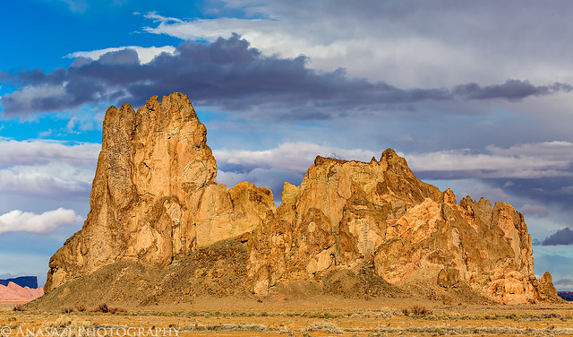
Church Rock by IntrepidXJ, on Flickr
I made it to the Paria Canyon Overlook just after the sun had set. There was a tiny bit of color in the clouds.
Jagged Edge by IntrepidXJ, on Flickr
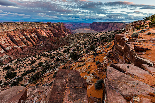
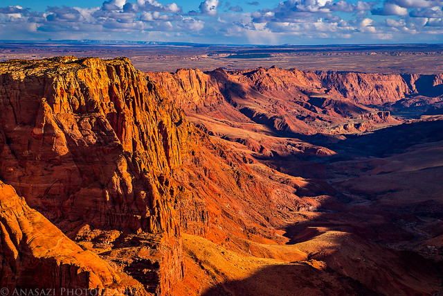
A beautiful view down Paria Canyon towards Lee's Ferry in the early twilight.
Paria Overlook by IntrepidXJ, on Flickr
It was a nice 32 degrees out when I woke up around 5:30am on Saturday morning, and there was a light dusting of snow on my tent and Jeep. I had a quick breakfast and then took the short drive over to the Wire Pass trailhead. I started my hike in the dark and headed over to The Boneyard and Sand Cove in time to catch the sunrise. There were some low clouds on the eastern horizon that blocked the warm early morning light but the clouds above were nice and the sun did eventually strike the Coyote Buttes above.
My first stop this time was to The Boneyard just as the sun was coming up for the day.
Boneyard Morning by IntrepidXJ, on Flickr
Great clouds in the sky this morning. I really couldn't have asked for a much better sunrise!
Clouds Over Sandstone by IntrepidXJ, on Flickr
I got a much better photo of this little hoodoo that I found on my last trip.
Sunrise Hoodoo by IntrepidXJ, on Flickr
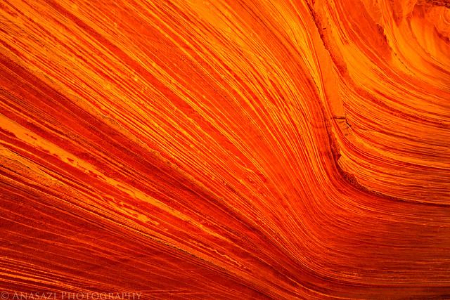
This was a happy accident. As I was searching for a new composition I accidentally pressed the shutter button on my camera as it was moving. I almost deleted the photo, but something about it made me stop myself. When I got home and looked at it more closely I am glad that I didn't delete it since it's a nice abstract image.
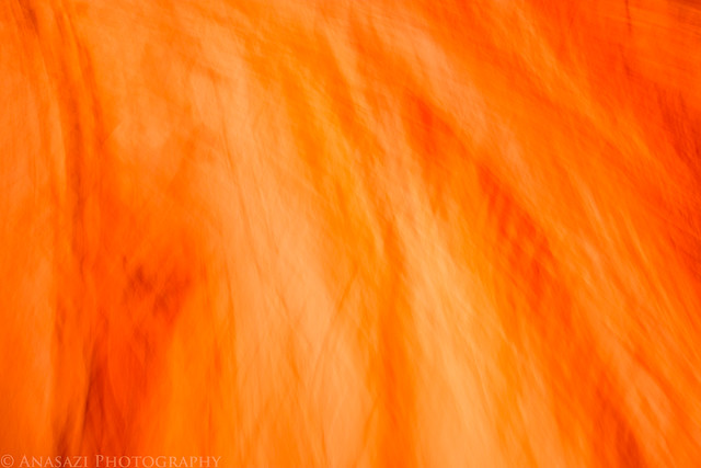
Sandstone Abstract by IntrepidXJ, on Flickr
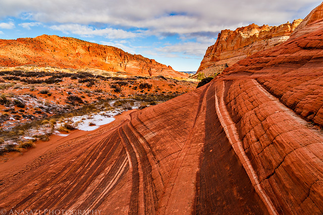
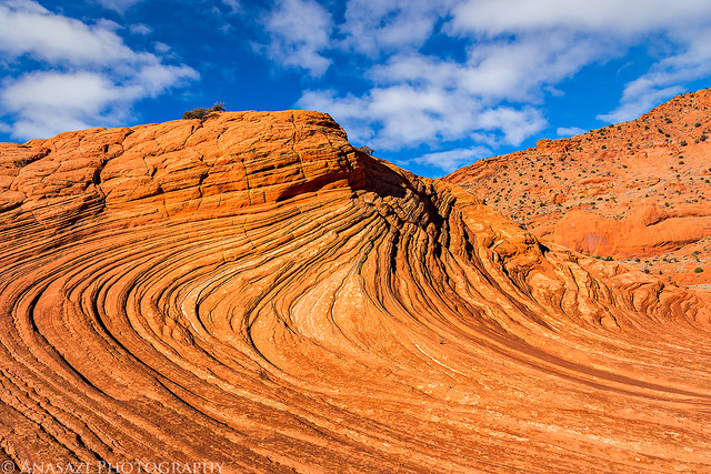
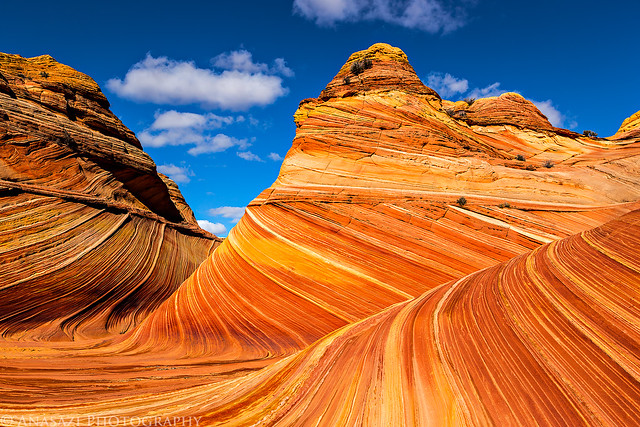
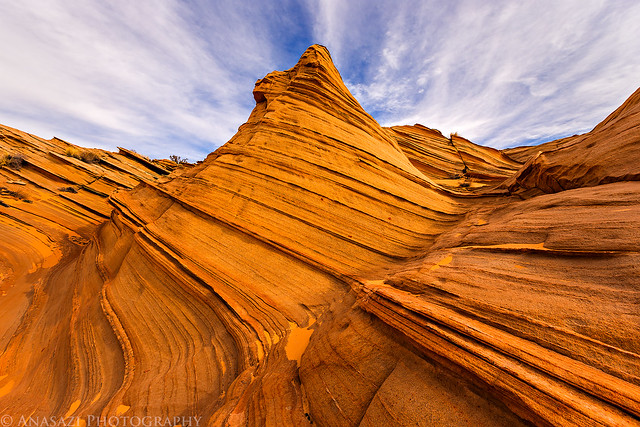
I always thought The Racetrack looked good in direct sunlight like The Wave, but now I think I prefer it in the shadows of the early morning...
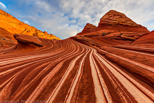
Racetrack Sunrise by IntrepidXJ, on Flickr
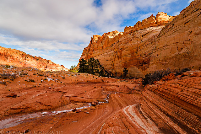
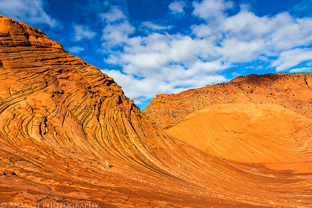
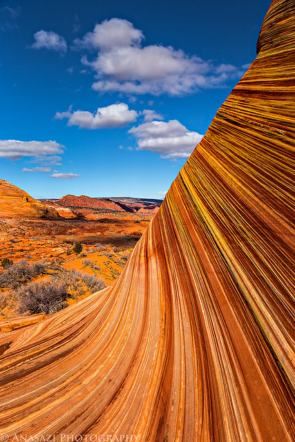
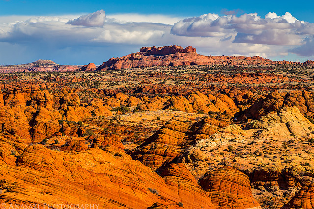
The view back towards the snow-covered Coyote Buttes was amazing!
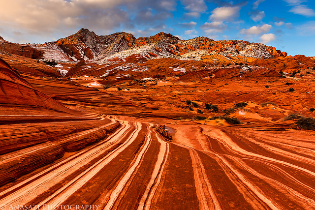
Coyote Buttes by IntrepidXJ, on Flickr
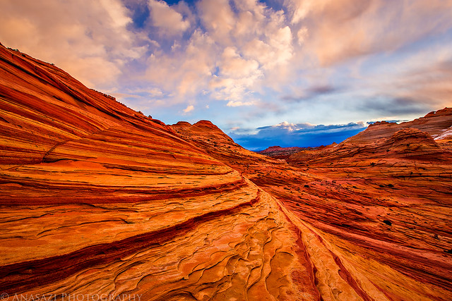
Great lines, clouds and light!
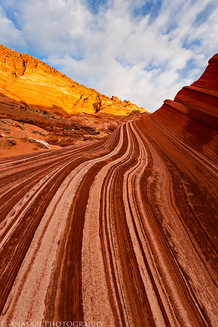
Morning Twist by IntrepidXJ, on Flickr
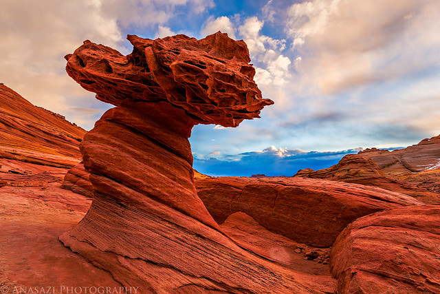
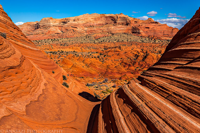
After photographing The Racetrack, I climbed up towards The Wave and wandered around the sandstone under the Black Crack for a little bit.
Under the Black Crack by IntrepidXJ, on Flickr
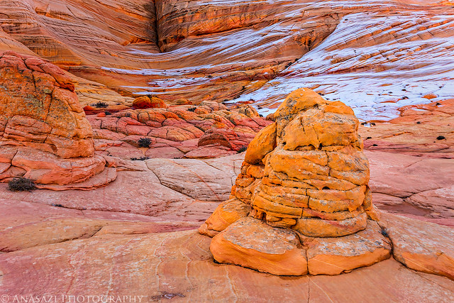
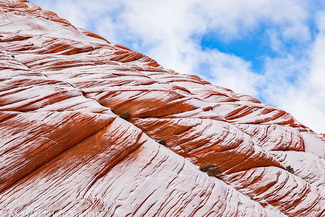
A light dusting of snow on the 'brainrock' below the Black Crack.
Dusting by IntrepidXJ, on Flickr
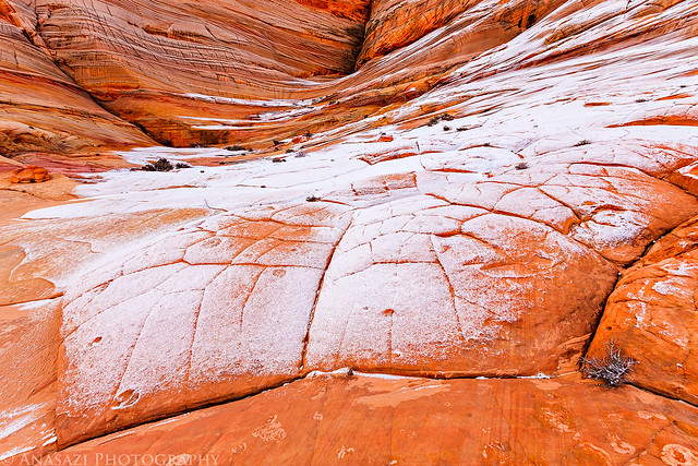
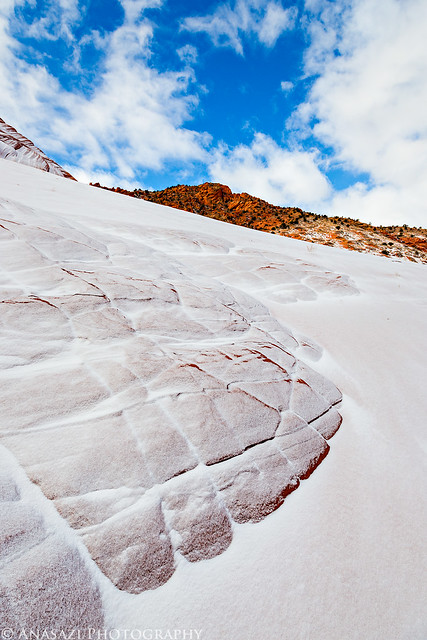
Snow caught on thin ridges near the Second Wave.
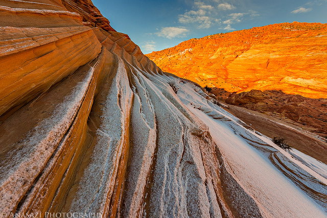
Light Snow by IntrepidXJ, on Flickr
Beautiful soft reflected light on the Second Wave. It always amazing me how differently these features can look in different light.
Soft Light by IntrepidXJ, on Flickr
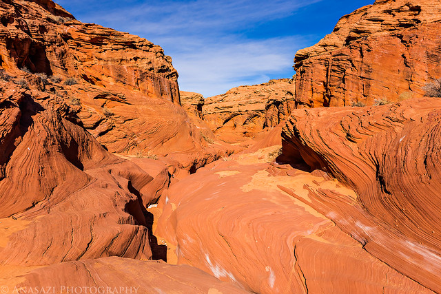
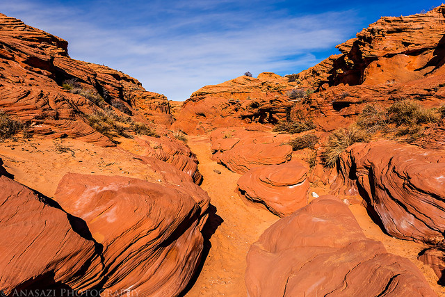
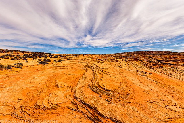
This trip I decided to spend much of my time exploring the Sand Cove area more closely since I have spent plenty of time around The Wave and on Top Rock before. It was a very interesting area and I didn't see anyone or even any footprints while I was down there.
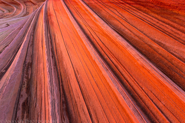
So many lines...
Stripes by IntrepidXJ, on Flickr
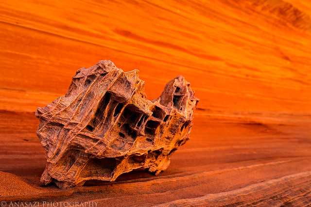
Here's a cool rock I stumbled upon as I explored a large alcove back in Sand Cove. I prefer this image in black and white over the color version.
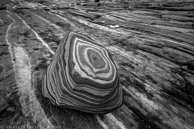
Ringed Rock by IntrepidXJ, on Flickr
I liked the way the ridges on this boulder were catching the reflected light. The light in the large alcove behind it isn't too bad either!
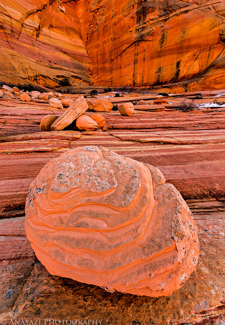
Rock by IntrepidXJ, on Flickr
I was paying attention to the small hidden details on this trip.
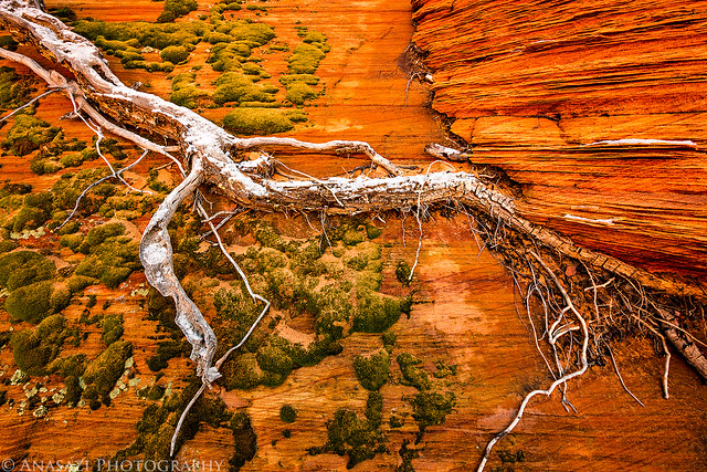
Root by IntrepidXJ, on Flickr
My shadow on a snow-covered sand dune as I hiked further up into Sand Cove.
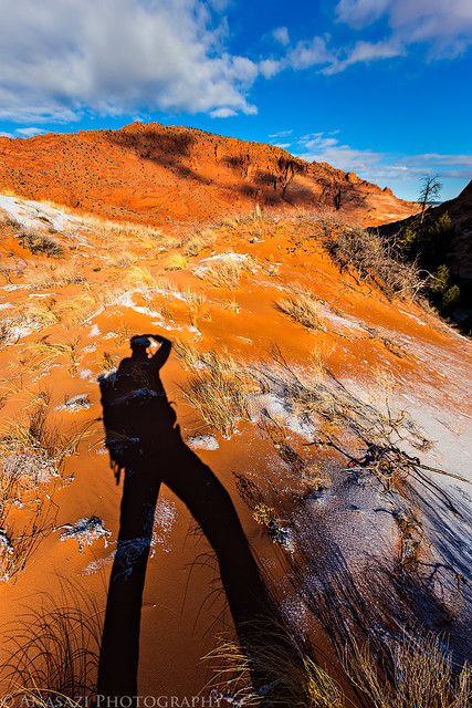
Sand Cove Shadow by IntrepidXJ, on Flickr
An interesting lone tree I found as I hiked along the base of Top Rock.
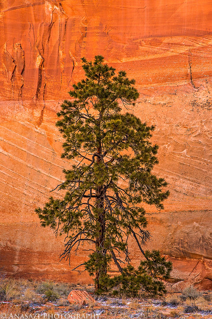
Lone Tree by IntrepidXJ, on Flickr
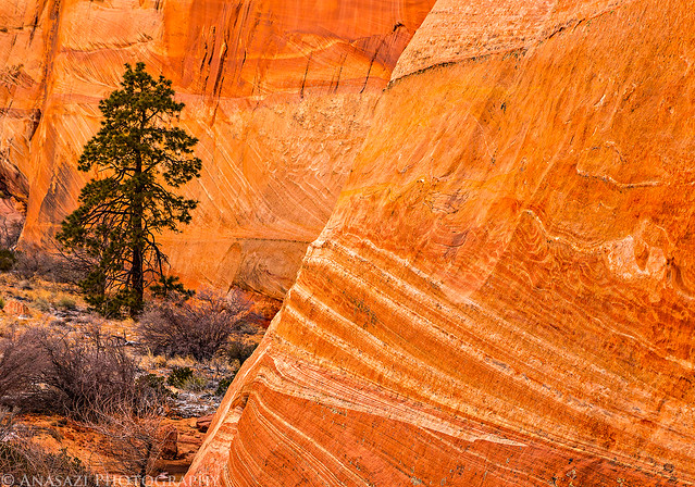
Stone & Tree by IntrepidXJ, on Flickr
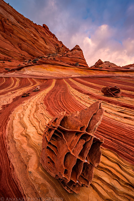
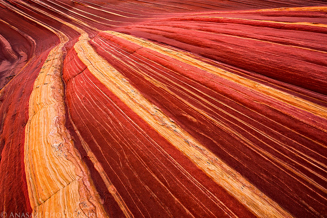
The colors you can find in the sandstone around here are beautiful.
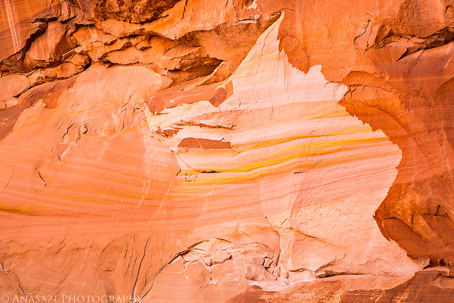
Sandstone Rainbow by IntrepidXJ, on Flickr
Crack by IntrepidXJ, on Flickr
Twist by IntrepidXJ, on Flickr
Looking back down Sand Cove as I hiked further to the top.
Upper Sand Cove by IntrepidXJ, on Flickr
Lines Everywhere by IntrepidXJ, on Flickr
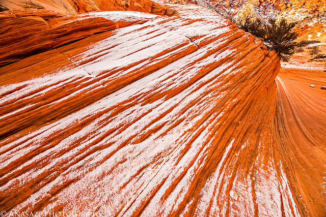
There was a nice layer of snow on the sandstone in the upper reaches of Sand Cove.
Snow Stone Clouds by IntrepidXJ, on Flickr
Snowstone by IntrepidXJ, on Flickr
A lot of sandstone hiking on my way back down...
Sandstone Hiking by IntrepidXJ, on Flickr
Swirl by IntrepidXJ, on Flickr
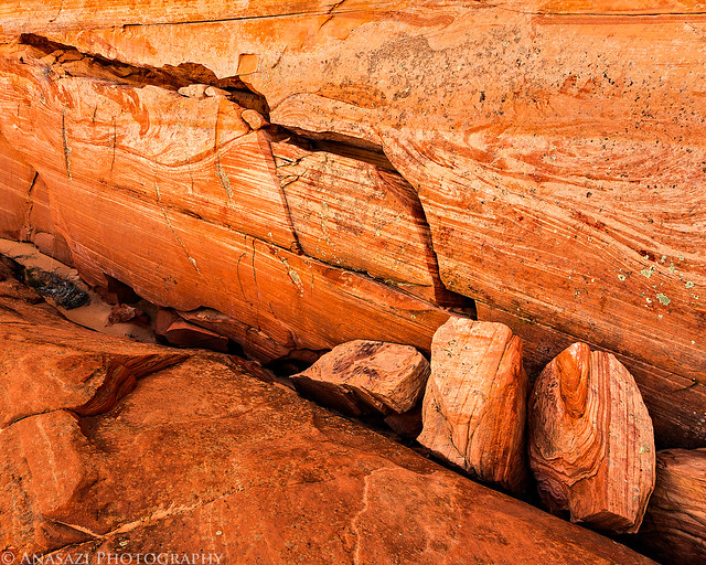
These cool boxwork rocks can be found all over the place.
Unique by IntrepidXJ, on Flickr
When I was here with Jared back in September 2012, we had searched for the dinosaur tracks but were unable to find them. I had better luck this time.
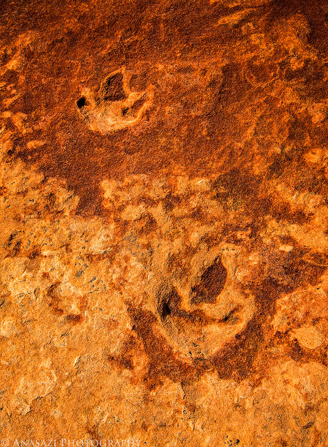
Dinosaur Tracks by IntrepidXJ, on Flickr
My hand for a little scale...
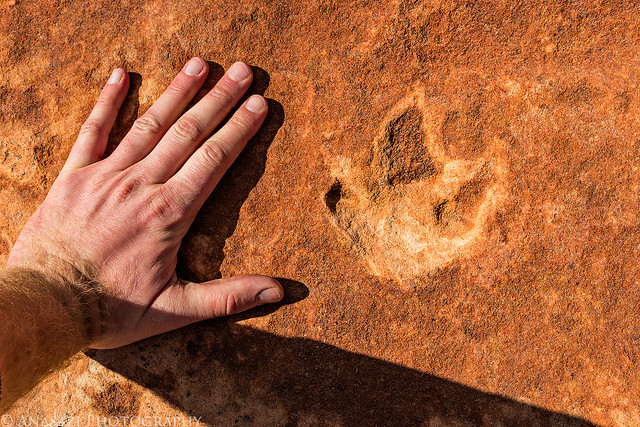
Dino Scale by IntrepidXJ, on Flickr
I did end up making a quick stop at The Wave before heading back to my Jeep. It was the only time I saw any people all day and most of them had just visited The Wave and were leaving...
As I entered the passageway to The Wave I noticed one small section of sandstone that was receiving this intense reflected light.
Entrance Light by IntrepidXJ, on Flickr
I almost didn't even stop by The Wave on this trip, but in the end I decided to swing by before leaving the area. I've been here a number of times over the years, but I still think my best photos of The Wave are from my very first trip.
The Wave by IntrepidXJ, on Flickr
Wave by IntrepidXJ, on Flickr
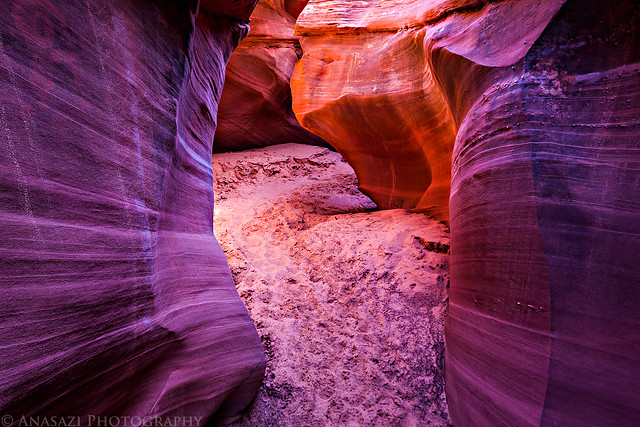
On my way back to the trailhead I took a detour to visit the Waterhole. Lucky for me it wasn't dry! It was a bit breezy out so the water wasn't completely still, but I still managed to get a nice reflection.
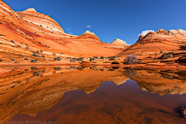
Waterhole by IntrepidXJ, on Flickr
View across to The Dive as I left the Waterhole.
The Dive by IntrepidXJ, on Flickr
Goblin Valley by IntrepidXJ, on Flickr
After I made it back to my Jeep I still had time to get back up to the Paria Canyon Overlook again in time for the sunset. I ended up crossing the state line a few times today...
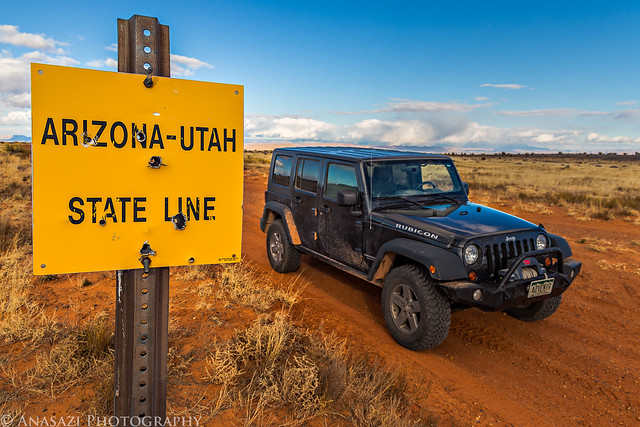
Arizona - Utah by IntrepidXJ, on Flickr
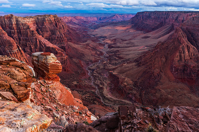
The sunset view down Paria Canyon. I think I prefer my twilight image from the night before a little more, but the warm light on the cliffs is nice.
Paria Shadows by IntrepidXJ, on Flickr
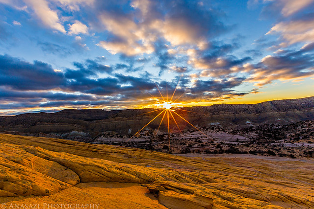
On Sunday morning I was up very early again. This time it was a much colder 20 degrees when I got out of my sleeping bag. I quickly packed up camp and headed up Cottonwood Wash Road along the Paria River and Cockscomb. I parked at the Lower Hackberry Canyon trailhead and started hiking up the steep trail to Yellow Rock in the dark. I have wanted to visit Yellow Rock for many years and it has almost always been on my itinerary every time I head down this direction, but for some reason it usually ends up getting bumped off for something else. I had actually planned to stop here when I was down this way back in November but I decided to go to Willis Creek instead because of the clear skies. Today was finally my day to visit Yellow Rock. I just made it to Yellow Rock as the sun was coming up for the day...
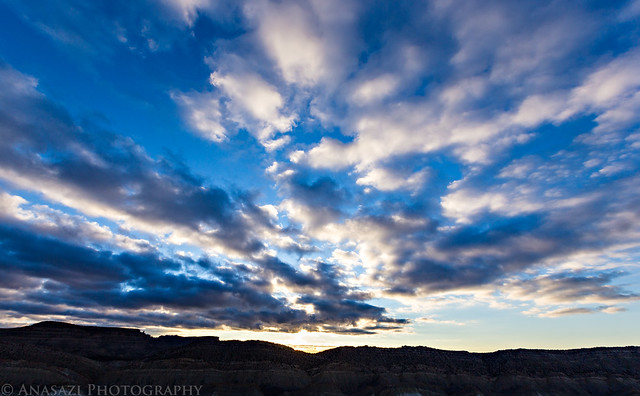
Magenta clouds above The Cockscomb.
Sunrise by IntrepidXJ, on Flickr
The sun did briefly light up the very top of Yellow Rock before hiding behind some clouds again.
Light First by IntrepidXJ, on Flickr
The sun would play hide and seek with the clouds all morning. It's always fun for me to photograph in these conditions.
Over the Cockscomb by IntrepidXJ, on Flickr
Found my shadow...
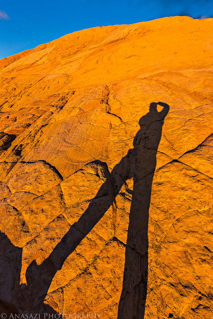
Yellow Rock Shadow by IntrepidXJ, on Flickr
Goblin by IntrepidXJ, on Flickr
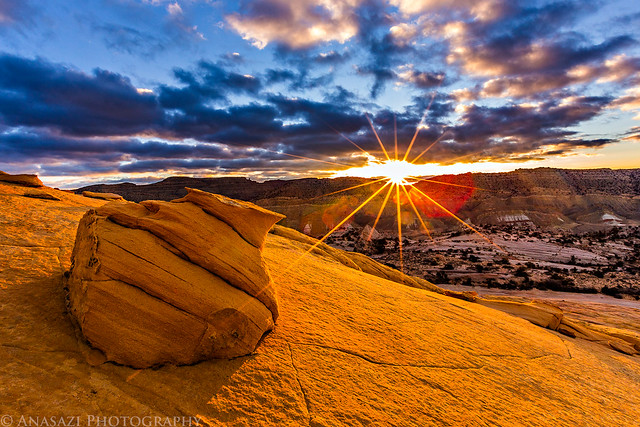
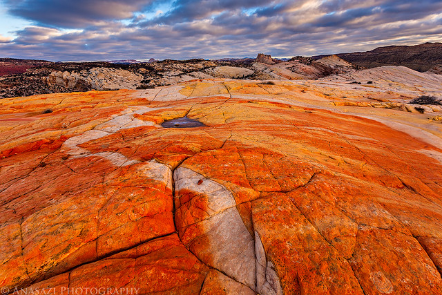
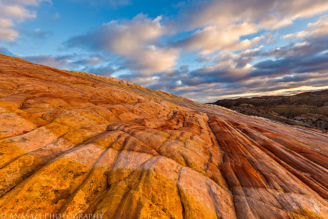
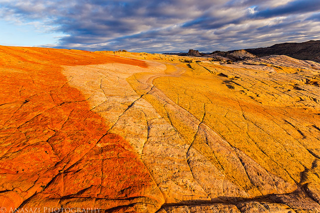
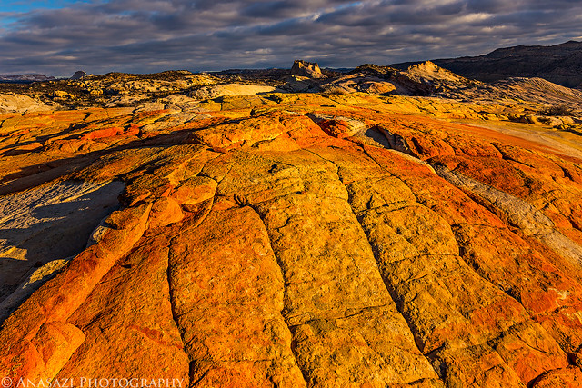
Beautiful clouds above warmly lit sandstone...my favorite combination!
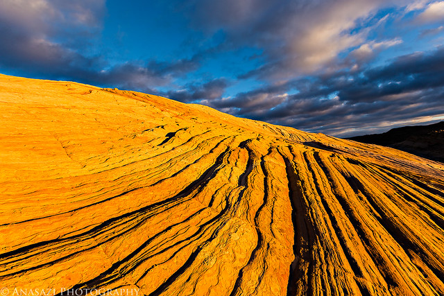
Yellow Lines by IntrepidXJ, on Flickr
Downhill by IntrepidXJ, on Flickr
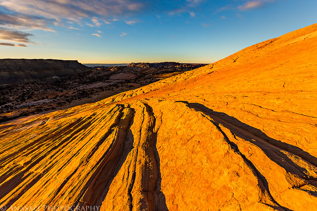
View from the top.
Red & Yellow by IntrepidXJ, on Flickr
Colorful Sunrise by IntrepidXJ, on Flickr
Clouds by IntrepidXJ, on Flickr
Colors by IntrepidXJ, on Flickr
Yellow Rock Top by IntrepidXJ, on Flickr
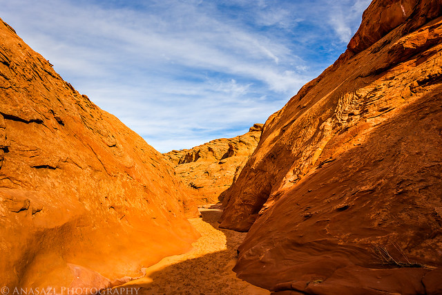
After an amazing morning photographing sunrise from Yellow Rock I made my way back to Page for a late breakfast and then made a quick stop at Water Holes Canyon before my long drive home.
Shallow sections of the canyon.
Water Holes Canyon by IntrepidXJ, on Flickr
Water Holes Canyon by IntrepidXJ, on Flickr
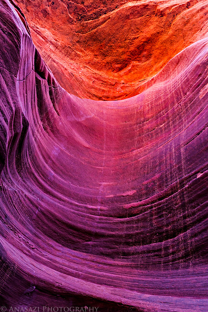
I must not have been here at a good time because I didn't find much reflected light while I was here. But there were a couple of small areas that had some...
Waterholes Passage by IntrepidXJ, on Flickr
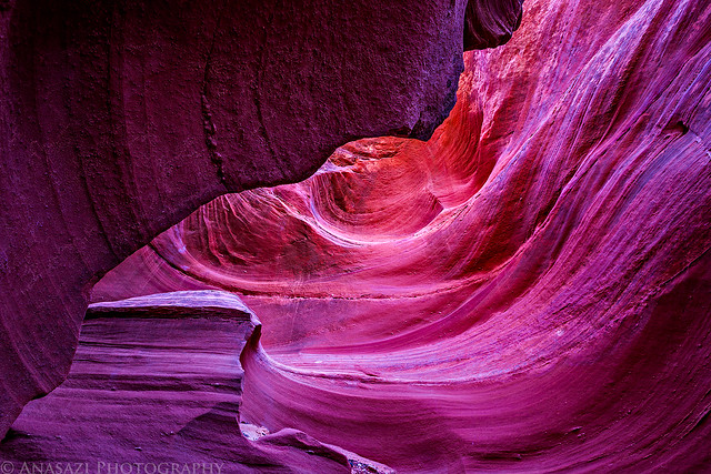
Waterholes Light by IntrepidXJ, on Flickr
Drain by IntrepidXJ, on Flickr
Hiking back out.
Water Holes Canyon by IntrepidXJ, on Flickr
I climbed out of the canyon to visit The Great Wall before hiking back along the rim.
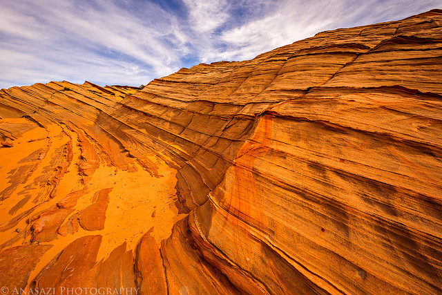
The Great Wall by IntrepidXJ, on Flickr
Part Wall by IntrepidXJ, on Flickr
I like the way the lines in the sandstone kind of mirror the clouds above...
Mirror by IntrepidXJ, on Flickr
>> Sand Cove & Yellow Rock Photo Gallery
Featured image for home page:

The Original Trip Report on ADVENTR.CO
I had another permit to Coyote Buttes North this Saturday, so I decided to spend the weekend down around the Paria. The weather looked like it was going to be pretty nice so I was looking forward to getting in my first camping trip of the year. I only worked a half-day on Friday and then started driving through a snowstorm as I headed south through Utah. I finally got out of the snow shortly after passing through Monticello. I stopped for a quick dinner in Page and then hurried to make it up to the Paria Canyon Overlook in time for sunset. Unfortunately, I didn't leave myself enough time and made it to the overlook just after the sun had set. I was a little disappointed at first, but soon realized that the canyon looked pretty good in the early twilight. I had originally planned on camping up at the overlook for the night, but it was much windier and colder up here than I had anticipated, so I decided to drive back down to the Stateline Campground for the night. That way I would also be much closer to the Wire Pass trailhead for an early start in the morning.
As I was nearing Kayenta, I liked the clouds above Church Rock and pulled over for a quick photo.
Church Rock by IntrepidXJ, on Flickr
I made it to the Paria Canyon Overlook just after the sun had set. There was a tiny bit of color in the clouds.
Jagged Edge by IntrepidXJ, on Flickr
A beautiful view down Paria Canyon towards Lee's Ferry in the early twilight.
Paria Overlook by IntrepidXJ, on Flickr
It was a nice 32 degrees out when I woke up around 5:30am on Saturday morning, and there was a light dusting of snow on my tent and Jeep. I had a quick breakfast and then took the short drive over to the Wire Pass trailhead. I started my hike in the dark and headed over to The Boneyard and Sand Cove in time to catch the sunrise. There were some low clouds on the eastern horizon that blocked the warm early morning light but the clouds above were nice and the sun did eventually strike the Coyote Buttes above.
My first stop this time was to The Boneyard just as the sun was coming up for the day.
Boneyard Morning by IntrepidXJ, on Flickr
Great clouds in the sky this morning. I really couldn't have asked for a much better sunrise!
Clouds Over Sandstone by IntrepidXJ, on Flickr
I got a much better photo of this little hoodoo that I found on my last trip.
Sunrise Hoodoo by IntrepidXJ, on Flickr
This was a happy accident. As I was searching for a new composition I accidentally pressed the shutter button on my camera as it was moving. I almost deleted the photo, but something about it made me stop myself. When I got home and looked at it more closely I am glad that I didn't delete it since it's a nice abstract image.
Sandstone Abstract by IntrepidXJ, on Flickr
I always thought The Racetrack looked good in direct sunlight like The Wave, but now I think I prefer it in the shadows of the early morning...
Racetrack Sunrise by IntrepidXJ, on Flickr
The view back towards the snow-covered Coyote Buttes was amazing!
Coyote Buttes by IntrepidXJ, on Flickr
Great lines, clouds and light!
Morning Twist by IntrepidXJ, on Flickr
After photographing The Racetrack, I climbed up towards The Wave and wandered around the sandstone under the Black Crack for a little bit.
Under the Black Crack by IntrepidXJ, on Flickr
A light dusting of snow on the 'brainrock' below the Black Crack.
Dusting by IntrepidXJ, on Flickr
Snow caught on thin ridges near the Second Wave.
Light Snow by IntrepidXJ, on Flickr
Beautiful soft reflected light on the Second Wave. It always amazing me how differently these features can look in different light.
Soft Light by IntrepidXJ, on Flickr
This trip I decided to spend much of my time exploring the Sand Cove area more closely since I have spent plenty of time around The Wave and on Top Rock before. It was a very interesting area and I didn't see anyone or even any footprints while I was down there.
So many lines...
Stripes by IntrepidXJ, on Flickr
Here's a cool rock I stumbled upon as I explored a large alcove back in Sand Cove. I prefer this image in black and white over the color version.
Ringed Rock by IntrepidXJ, on Flickr
I liked the way the ridges on this boulder were catching the reflected light. The light in the large alcove behind it isn't too bad either!
Rock by IntrepidXJ, on Flickr
I was paying attention to the small hidden details on this trip.
Root by IntrepidXJ, on Flickr
My shadow on a snow-covered sand dune as I hiked further up into Sand Cove.
Sand Cove Shadow by IntrepidXJ, on Flickr
An interesting lone tree I found as I hiked along the base of Top Rock.
Lone Tree by IntrepidXJ, on Flickr
Stone & Tree by IntrepidXJ, on Flickr
The colors you can find in the sandstone around here are beautiful.
Sandstone Rainbow by IntrepidXJ, on Flickr
Crack by IntrepidXJ, on Flickr
Twist by IntrepidXJ, on Flickr
Looking back down Sand Cove as I hiked further to the top.
Upper Sand Cove by IntrepidXJ, on Flickr
Lines Everywhere by IntrepidXJ, on Flickr
There was a nice layer of snow on the sandstone in the upper reaches of Sand Cove.
Snow Stone Clouds by IntrepidXJ, on Flickr
Snowstone by IntrepidXJ, on Flickr
A lot of sandstone hiking on my way back down...
Sandstone Hiking by IntrepidXJ, on Flickr
Swirl by IntrepidXJ, on Flickr
These cool boxwork rocks can be found all over the place.
Unique by IntrepidXJ, on Flickr
When I was here with Jared back in September 2012, we had searched for the dinosaur tracks but were unable to find them. I had better luck this time.
Dinosaur Tracks by IntrepidXJ, on Flickr
My hand for a little scale...
Dino Scale by IntrepidXJ, on Flickr
I did end up making a quick stop at The Wave before heading back to my Jeep. It was the only time I saw any people all day and most of them had just visited The Wave and were leaving...
As I entered the passageway to The Wave I noticed one small section of sandstone that was receiving this intense reflected light.
Entrance Light by IntrepidXJ, on Flickr
I almost didn't even stop by The Wave on this trip, but in the end I decided to swing by before leaving the area. I've been here a number of times over the years, but I still think my best photos of The Wave are from my very first trip.
The Wave by IntrepidXJ, on Flickr
Wave by IntrepidXJ, on Flickr
On my way back to the trailhead I took a detour to visit the Waterhole. Lucky for me it wasn't dry! It was a bit breezy out so the water wasn't completely still, but I still managed to get a nice reflection.
Waterhole by IntrepidXJ, on Flickr
View across to The Dive as I left the Waterhole.
The Dive by IntrepidXJ, on Flickr
Goblin Valley by IntrepidXJ, on Flickr
After I made it back to my Jeep I still had time to get back up to the Paria Canyon Overlook again in time for the sunset. I ended up crossing the state line a few times today...
Arizona - Utah by IntrepidXJ, on Flickr
The sunset view down Paria Canyon. I think I prefer my twilight image from the night before a little more, but the warm light on the cliffs is nice.
Paria Shadows by IntrepidXJ, on Flickr
On Sunday morning I was up very early again. This time it was a much colder 20 degrees when I got out of my sleeping bag. I quickly packed up camp and headed up Cottonwood Wash Road along the Paria River and Cockscomb. I parked at the Lower Hackberry Canyon trailhead and started hiking up the steep trail to Yellow Rock in the dark. I have wanted to visit Yellow Rock for many years and it has almost always been on my itinerary every time I head down this direction, but for some reason it usually ends up getting bumped off for something else. I had actually planned to stop here when I was down this way back in November but I decided to go to Willis Creek instead because of the clear skies. Today was finally my day to visit Yellow Rock. I just made it to Yellow Rock as the sun was coming up for the day...
Magenta clouds above The Cockscomb.
Sunrise by IntrepidXJ, on Flickr
The sun did briefly light up the very top of Yellow Rock before hiding behind some clouds again.
Light First by IntrepidXJ, on Flickr
The sun would play hide and seek with the clouds all morning. It's always fun for me to photograph in these conditions.
Over the Cockscomb by IntrepidXJ, on Flickr
Found my shadow...
Yellow Rock Shadow by IntrepidXJ, on Flickr
Goblin by IntrepidXJ, on Flickr
Beautiful clouds above warmly lit sandstone...my favorite combination!
Yellow Lines by IntrepidXJ, on Flickr
Downhill by IntrepidXJ, on Flickr
View from the top.
Red & Yellow by IntrepidXJ, on Flickr
Colorful Sunrise by IntrepidXJ, on Flickr
Clouds by IntrepidXJ, on Flickr
Colors by IntrepidXJ, on Flickr
Yellow Rock Top by IntrepidXJ, on Flickr
After an amazing morning photographing sunrise from Yellow Rock I made my way back to Page for a late breakfast and then made a quick stop at Water Holes Canyon before my long drive home.
Shallow sections of the canyon.
Water Holes Canyon by IntrepidXJ, on Flickr
Water Holes Canyon by IntrepidXJ, on Flickr
I must not have been here at a good time because I didn't find much reflected light while I was here. But there were a couple of small areas that had some...
Waterholes Passage by IntrepidXJ, on Flickr
Waterholes Light by IntrepidXJ, on Flickr
Drain by IntrepidXJ, on Flickr
Hiking back out.
Water Holes Canyon by IntrepidXJ, on Flickr
I climbed out of the canyon to visit The Great Wall before hiking back along the rim.
The Great Wall by IntrepidXJ, on Flickr
Part Wall by IntrepidXJ, on Flickr
I like the way the lines in the sandstone kind of mirror the clouds above...
Mirror by IntrepidXJ, on Flickr
>> Sand Cove & Yellow Rock Photo Gallery
Featured image for home page:
Last edited by a moderator: