steve
Member
- Joined
- Dec 11, 2013
- Messages
- 2,140
It's 2 PM on a Friday. I haven't been camping in 3 weeks, and I'm getting antsy. Work was starting to take its toll on me and I needed an escape. A few texts to some good friends Friday got some last minute plans rolling. We wanted something close by and relatively warm. The textversation went something like this:
Moab?
St. George?
Capitol Reef?
The Swell?
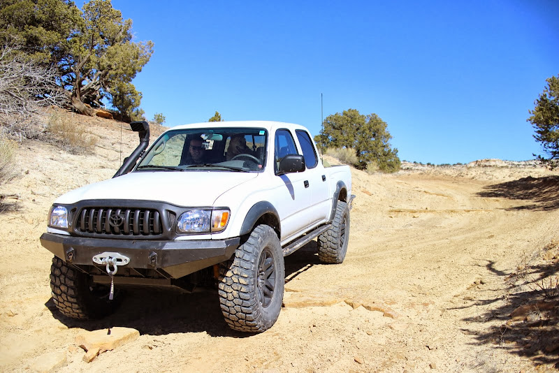
With plans in place, we decided to save gas and the 3 of us and two dogs piled into my truck headed for the wedge overlook.
Approaching the mouth of Spanish Fork Canyon I glance down at the gas gauge to find it just under 1/4 tank. The sensible man would have topped off at the chevron at the mouth, but we aren't sensible, we're out for an adventure. I can remember saying "it's ok, we still have 3 gallons left when the gas light comes on." [I read it on the internet, so it's gotta be true!]
The gas gauge faded until the light came on, and we weren't even to the summit yet. The stretch between Scofield and the descent into Helper seems a LOT longer and a lot flatter when your fuel light has been on for 20 minutes...
Before long we were descending into Helper. We tried to figure if we could coast all the way down the hill near the ice waterfall to helper without gas, just in case. Then we tried to remember where the first gas station was after the power plant.
We got to Helper, but we decided to push it a bit more to see if we could make it to the Chevron in Price. Sure enough, we made it, and it took 17.39 gal to fill her up to the top. I think I have an 18 gal tank. So we were fine, we had another 0.61 gal left. We could have probably made it to Wellington!
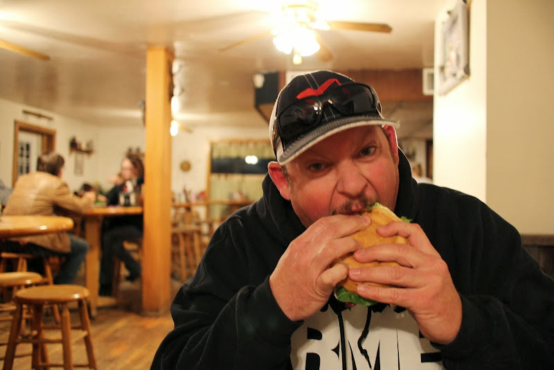
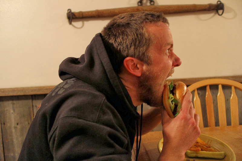
With our fuel tank full, it was time to head to Groggs to fill our stomachs.
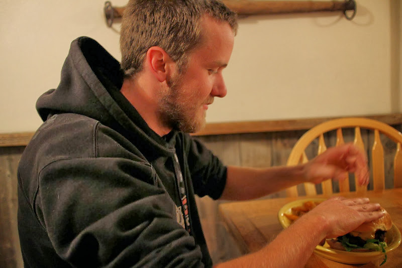
One thing I learned on this trip... never get between a hungry man and a good burger.
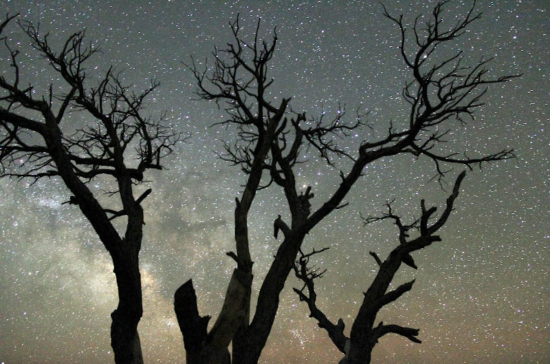
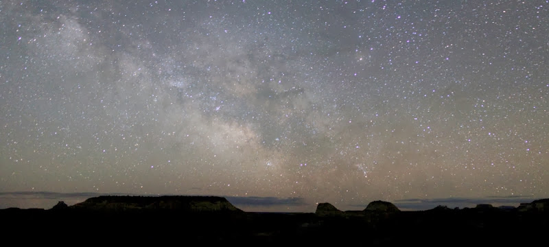
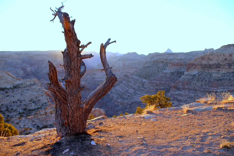
We pulled in to the Wedge Overlook around 10 PM. There was a 1/2 waxing moon, and the breeze we felt in Price was gone. It was probably around 40 degrees. We set up our tents, and I set out to test my new camera. Any flaws in the images are due to my poor photography skills, not necessarily the camera. Disclaimer: I focus more on video than photography, and I haven't learned LR or PS well enough to make my pictures look any better. That'll take some time. For now, here are the Jpegs with a few tweaks in Picasa. Lame, I know. I'm open to constructive criticism on how to improve my shots. I shot in full manual mode, and I kept the ISO below 1600, since I don't know how to remove the noise in PS or LR.
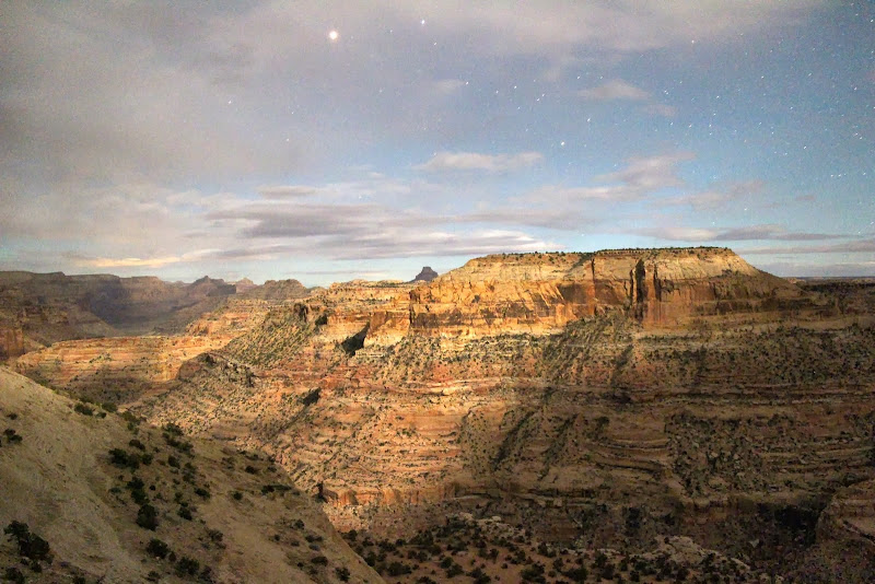
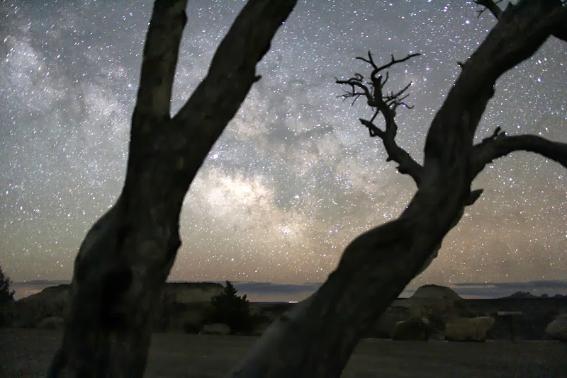
I awoke around 2 AM to find that the moon had set and we had a fantastic view of the stars. I could see the Milky Way quite clear so I tried my hand at capturing it on the camera. I then tried my hand at some time-lapse footage. I only got ~40 shots in before my battery died. Battery life is not one of the Canon EOS M's strengths. Oh well, I'll get better with practice.
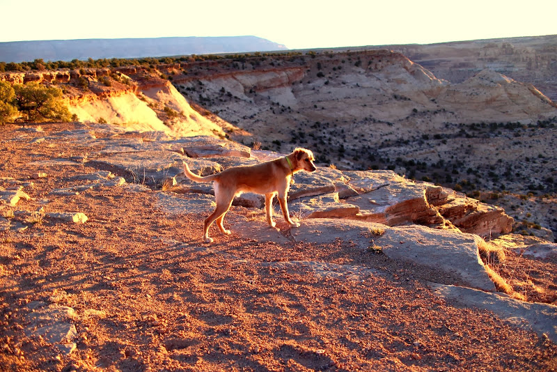
The temps in the night dipped below freezing, leaving the water in the dog bowls looking like a transparent hockey puck, but we were warm all night. My little Army Bivvy kept me warm all night. Fender was a little chilly with his little synthetic bag, but hey, he's covered in fur. I threw my down vest over him and he slept warmer. Every time I'd get up to adjust the camera or go pee, I'd come back to find him sleeping in my sleeping bag.")
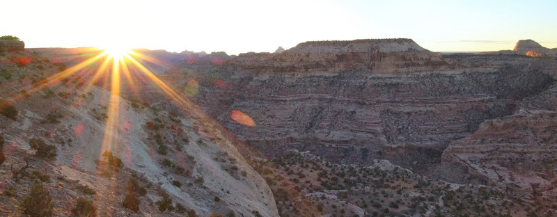
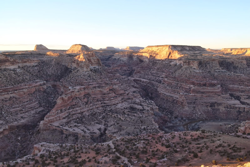
We awoke just in time to catch the sun coming up over the little grand canyon.
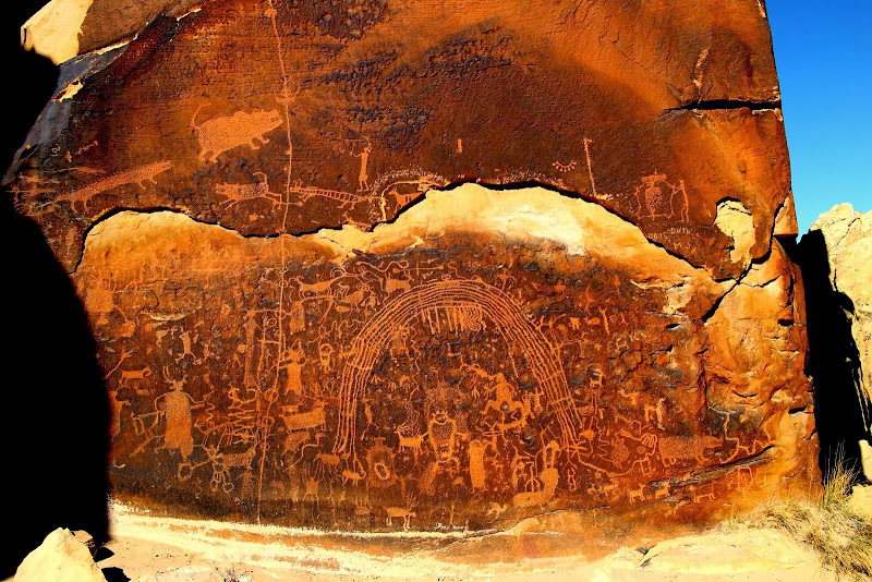
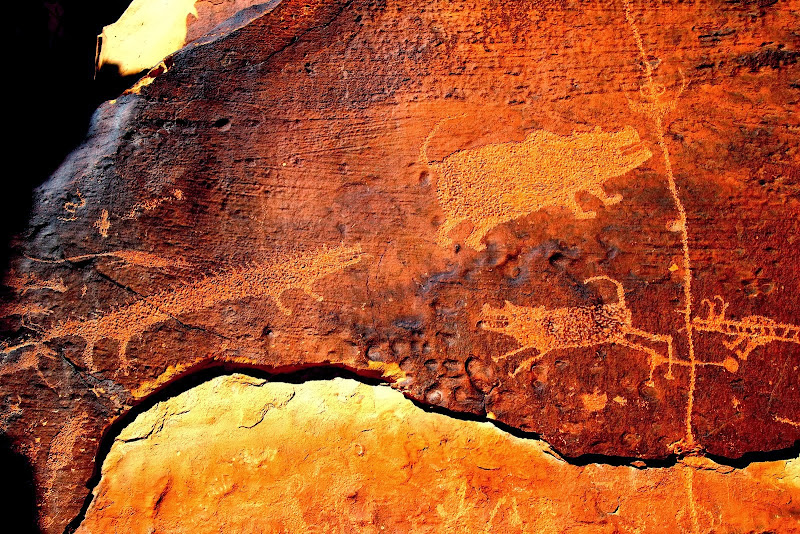
None of us had ever been to the Rochester Rock Art panel before, so we headed down to check it out. I had seen some pics from prior trip reports from other people, and it looked cool. On the way, we passed through fuller bottom, a river crossing that the atlas warned us may not be passable. I thought it'd be because of the water level, not the exit out of the riverbank. Good thing I had my snorkel, the water was over 2" deep and almost got my wheels wet.
We continued on the dusty roads toward the Rochester Art Panel. When we got there, I was pretty disappointed. The panel definitely has a ton of drawings on it, but a lot had been "added" to it in more recent years. I have a hard time believing more than 10% of the drawings are older than 100 years. Regardless, it had a lot of different things to look at. It was like a Where's Waldo version of rock art, searching for the original drawings mixed in with the modern additions.
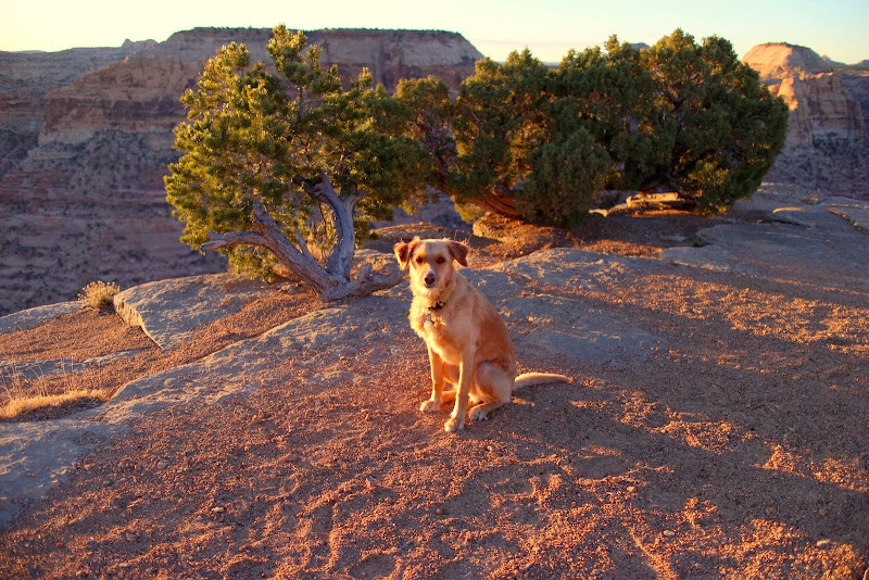
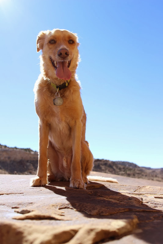
Fender wasn't disappointed, he was loving the hike.
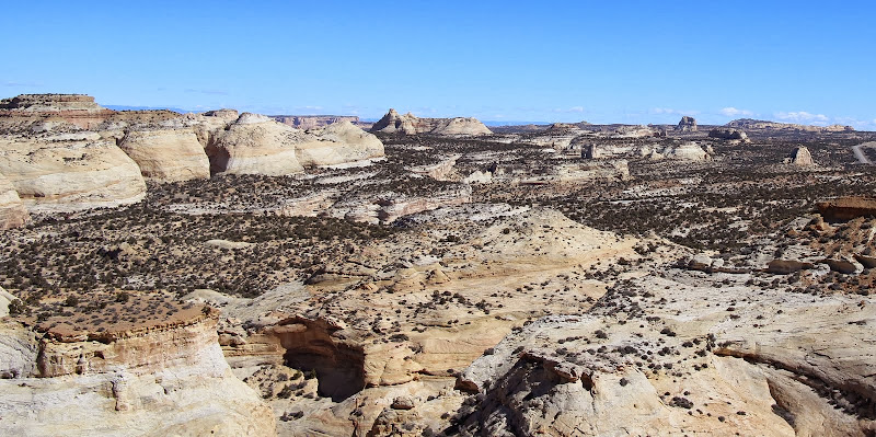
Leaving that panel, we headed over to cross I-70 and check out the Copper Globe Mine area. The view point there is breathtaking. We all made a mental note to explore these canyons in a not so distant trip in the future.
We crossed the highway and made our way down the bumpy road to Copper Globe Mine. We were the first non-atv to drive the road in a while.
At this point, my camera battery died and I had forgotten my charger at home. The rest of the trip is documented on the GoPro. We kept on our bumpy way towards Copper Globe mine, bottoming out the shock on every large rock on the passenger side. I still hadn't installed my rear bump stops because I've never maxed out the shocks before. Note to self: install rear bump stops before next week's trip.
At the mine, we poked around and explored. We saw what looked like a monument on the rock mountain above the mine, and decided to see if we could find a way up there. Sure enough, we scrambled to the top to find a huge cairn marking nothing, but very cool nonetheless. The view at the top was spectacular. 360* panoramas of the entire swell. This was the highlight of the trip for me.
On the way back down, I ended up taking a fall. While climbing a steep embankment, I lost my footing and did a backwards-somersault down the hill. It happened so fast that I didn't know what was happening, but I covered my head with my arms. My elbows got banged up, but they protected my head. I was was milimters from striking a rock with my head. That would have been bad. I did a quick check of my body, and all I had was a few cuts on my elbows, a pain in one of my insignificant toes, and a huge adrenaline rush. Cody, who was right behind me, had no idea how it happened either. I'm glad I didn't hit my head, that would have been a bad thing. When I got home later that night, my middle toe was black and blue, and I found out it was broken. Better a broken toe than a concussion.
We got back to the truck, topped off on water and some delicious jerky, and made our way back home. On the route home we stopped at KFC in Price to grab a bite, and we were lucky enough to meet a fellow explorer who came over to say hi. It's funny how many people we bump into in our travels.
All in all, it was a great trip with lots of new memories with friends. I can't wait for the next one!
Featured image for home page:

Moab?
No, we'll be there next week.
St. George?
Too far for a quick overnighter.
Capitol Reef?
I do want revenge on upper muley twists without snow on it, but it's too far for a quick overnighter.
The Swell?
Perfect. See you at 6.
With plans in place, we decided to save gas and the 3 of us and two dogs piled into my truck headed for the wedge overlook.
Approaching the mouth of Spanish Fork Canyon I glance down at the gas gauge to find it just under 1/4 tank. The sensible man would have topped off at the chevron at the mouth, but we aren't sensible, we're out for an adventure. I can remember saying "it's ok, we still have 3 gallons left when the gas light comes on." [I read it on the internet, so it's gotta be true!]
The gas gauge faded until the light came on, and we weren't even to the summit yet. The stretch between Scofield and the descent into Helper seems a LOT longer and a lot flatter when your fuel light has been on for 20 minutes...
Before long we were descending into Helper. We tried to figure if we could coast all the way down the hill near the ice waterfall to helper without gas, just in case. Then we tried to remember where the first gas station was after the power plant.
We got to Helper, but we decided to push it a bit more to see if we could make it to the Chevron in Price. Sure enough, we made it, and it took 17.39 gal to fill her up to the top. I think I have an 18 gal tank. So we were fine, we had another 0.61 gal left. We could have probably made it to Wellington!
With our fuel tank full, it was time to head to Groggs to fill our stomachs.
One thing I learned on this trip... never get between a hungry man and a good burger.
We pulled in to the Wedge Overlook around 10 PM. There was a 1/2 waxing moon, and the breeze we felt in Price was gone. It was probably around 40 degrees. We set up our tents, and I set out to test my new camera. Any flaws in the images are due to my poor photography skills, not necessarily the camera. Disclaimer: I focus more on video than photography, and I haven't learned LR or PS well enough to make my pictures look any better. That'll take some time. For now, here are the Jpegs with a few tweaks in Picasa. Lame, I know. I'm open to constructive criticism on how to improve my shots. I shot in full manual mode, and I kept the ISO below 1600, since I don't know how to remove the noise in PS or LR.
I awoke around 2 AM to find that the moon had set and we had a fantastic view of the stars. I could see the Milky Way quite clear so I tried my hand at capturing it on the camera. I then tried my hand at some time-lapse footage. I only got ~40 shots in before my battery died. Battery life is not one of the Canon EOS M's strengths. Oh well, I'll get better with practice.
The temps in the night dipped below freezing, leaving the water in the dog bowls looking like a transparent hockey puck, but we were warm all night. My little Army Bivvy kept me warm all night. Fender was a little chilly with his little synthetic bag, but hey, he's covered in fur. I threw my down vest over him and he slept warmer. Every time I'd get up to adjust the camera or go pee, I'd come back to find him sleeping in my sleeping bag.
We awoke just in time to catch the sun coming up over the little grand canyon.
None of us had ever been to the Rochester Rock Art panel before, so we headed down to check it out. I had seen some pics from prior trip reports from other people, and it looked cool. On the way, we passed through fuller bottom, a river crossing that the atlas warned us may not be passable. I thought it'd be because of the water level, not the exit out of the riverbank. Good thing I had my snorkel, the water was over 2" deep and almost got my wheels wet.
We continued on the dusty roads toward the Rochester Art Panel. When we got there, I was pretty disappointed. The panel definitely has a ton of drawings on it, but a lot had been "added" to it in more recent years. I have a hard time believing more than 10% of the drawings are older than 100 years. Regardless, it had a lot of different things to look at. It was like a Where's Waldo version of rock art, searching for the original drawings mixed in with the modern additions.
Fender wasn't disappointed, he was loving the hike.
Leaving that panel, we headed over to cross I-70 and check out the Copper Globe Mine area. The view point there is breathtaking. We all made a mental note to explore these canyons in a not so distant trip in the future.
We crossed the highway and made our way down the bumpy road to Copper Globe Mine. We were the first non-atv to drive the road in a while.
At this point, my camera battery died and I had forgotten my charger at home. The rest of the trip is documented on the GoPro. We kept on our bumpy way towards Copper Globe mine, bottoming out the shock on every large rock on the passenger side. I still hadn't installed my rear bump stops because I've never maxed out the shocks before. Note to self: install rear bump stops before next week's trip.
At the mine, we poked around and explored. We saw what looked like a monument on the rock mountain above the mine, and decided to see if we could find a way up there. Sure enough, we scrambled to the top to find a huge cairn marking nothing, but very cool nonetheless. The view at the top was spectacular. 360* panoramas of the entire swell. This was the highlight of the trip for me.
On the way back down, I ended up taking a fall. While climbing a steep embankment, I lost my footing and did a backwards-somersault down the hill. It happened so fast that I didn't know what was happening, but I covered my head with my arms. My elbows got banged up, but they protected my head. I was was milimters from striking a rock with my head. That would have been bad. I did a quick check of my body, and all I had was a few cuts on my elbows, a pain in one of my insignificant toes, and a huge adrenaline rush. Cody, who was right behind me, had no idea how it happened either. I'm glad I didn't hit my head, that would have been a bad thing. When I got home later that night, my middle toe was black and blue, and I found out it was broken. Better a broken toe than a concussion.
We got back to the truck, topped off on water and some delicious jerky, and made our way back home. On the route home we stopped at KFC in Price to grab a bite, and we were lucky enough to meet a fellow explorer who came over to say hi. It's funny how many people we bump into in our travels.
All in all, it was a great trip with lots of new memories with friends. I can't wait for the next one!
Featured image for home page:
Last edited: