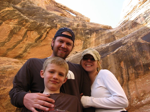
Tyler
^^^^^^^^^^^^^^^^^^^^^^^^^^^^^^^^^^^^
- Joined
- Jan 18, 2012
- Messages
- 464
March 2008
We had a GREAT time down at the Swell this past weekend. We planned on taking advantage of the time Caiden had off from school and head down Friday morning. We brought along one of Alene's co-workers, James, who likes the outdoors thing too and is a cool guy. The plan was to head down there early, find a camping spot, doing a hike, then meeting up with Russ & Randa at the I-70/24 junction to lead them to where we were at. We figured this would be the best spot because you get cell phone coverage there.
Day 1
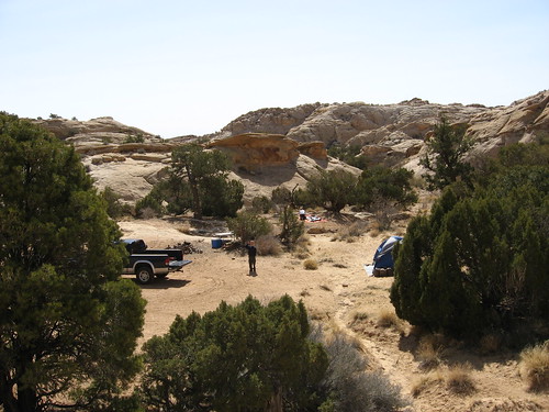
We left about 8am and arrived at the swell close to noon. There was one campsite we wanted badly that we camped in last fall (thanks to Bill). Being that it was Easter weekend, we had no hope it would be available (or many sites around the reef for that matter). However, when we pulled into the wash that takes us to the site we wanted, a large convoy of cars in front of us pulled over to let us by. We made our way up the wash and found the site empty and all to ourselves. We totally lucked out. Just as we were setting up our stuff, the convoy drove up, found us there, then turned around (likely they wanted that site too). If we had been 5 minutes later, we would not have gotten it. We could then tell it was going to be a great trip.
We quickly got our stuff up and drove south to check out the Ding/Dang canyon area. Being that I had never been there and it had been a while for Alene, it was like a new adventure (this trip was full of them). As we drove south, we passed Little Wild Horse canyon, which was PACKED with cars and all kinds of people, who were even camped in the parking lot. We discussed its popularity because of the fact that it has a sign pointing people where to go and that was it. We moved on and found the parking area for the Ding/Dang/Cistern canyon trail head (no sign, so only a couple of vehicles).
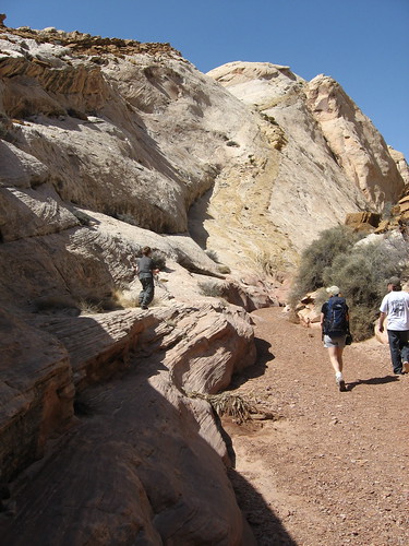
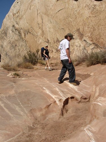
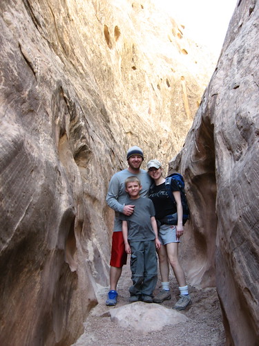
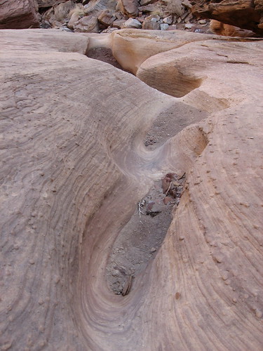
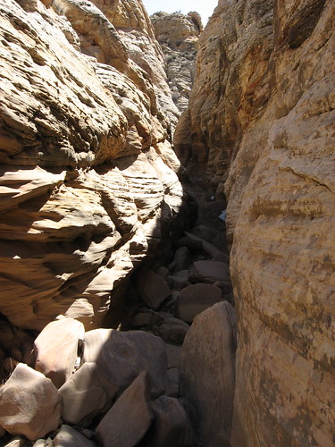
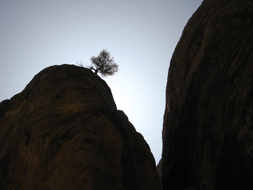
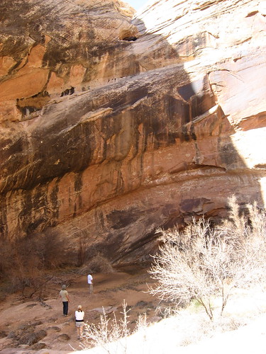
We worked our way up a wash for a while and found the opening to what I was hoping was Ding (hoping we hadn't passed it already). Right from the beginning of entering the canyon, I could see why Bill said this is one of his favorite canyons to hike in the swell. It's awesome. We hiked and climbed all the way to the back of the canyon where it reaches the behind the reef road, which I always wanted to see. However, being that I wasn't 100% sure of which canyon we were up, and the fact that I left my kelsey guide in the truck, we decided to just go back down canyon instead of looping around to find Dang canyon. On our way back, we ran into a family from SLC who were doing the whole loop. They were very friendly and said we were in fact in Ding canyon. They had brought along a 10' tow rope for a section in Dang that was supposed to drop about 10'. Good thing we didn't go that way I guess. Anyway, the canyon was beautiful and I can't wait to go back and actually attempt the whole loop. Here are some pictures from that hike:
On a side note, I hope one day to be able to get a 4 wheeler and drive along the back of the reef road on it. I think it would be fun to see all these canyons from the back side, all in one day.
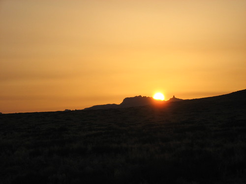
Anyway, we left Ding in time to head back to I-70 to meet Russ & Randa. When we got to the junction, I called them and they were still in Price because Russ thought that Hwy 6 went down through Mt. Pleasant (we used to do our family reunion down there every summer, so I think he was just used to heading down that way). We decided to head into town to Green River and get a bite to eat. We almost felt like we were cheating ourselves of the camping experience, but we forgot about that after getting our pizza and shakes at a small diner there. On our way back, the sun was setting and we caught this picture of it setting over the reef:
We met Russ & Randa about an hour later and headed back to the campsite. We found it unusually windy in the canyon that night, it was a little annoying, but we dealt with it. Before heading to bed, we took a quick jaunt up the reef behind us to look around. It was a full moon and we could see all the other campsites around us. It's an awesome view and I could stay up there much longer, but it was getting cold.
Day 2
The next morning Caiden was the first person up and out of the tent making noise. I couldn't sleep anymore, so I got up and took him for a drive to explore more of North Temple Wash and to hopefully allow ALene and the others to sleep a little longer without having to hear an 8 year old banging on things with a hatchet or talking about Ancient times, and the Middle Ages from his computer game "civilization" that he plays.
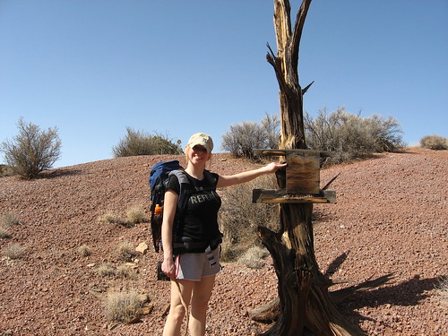
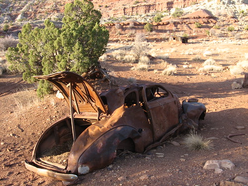
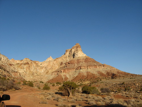
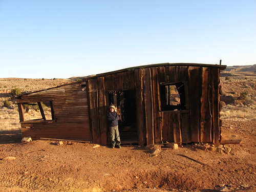
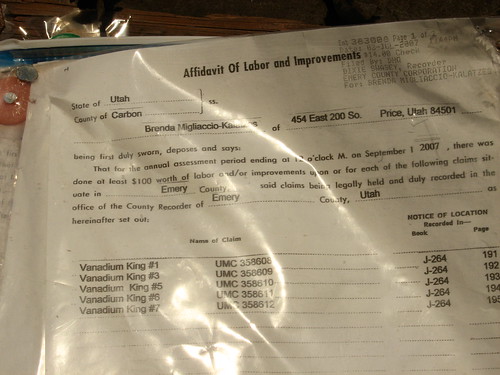
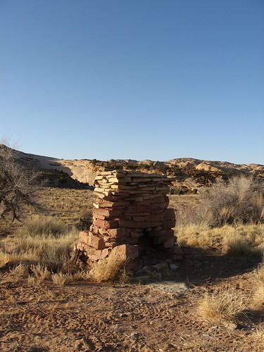
The drive up North Temple wash was nice. I got to explore around a bit, finding other campsites (for future reference) and getting closer to Temple Mountain. Along the way we also ran into a miners cabin, a well, and an old rusted out car. It was cool to see the miners cabin with the mining claim updated and pinned to it still. Here are some pictures from the drive:
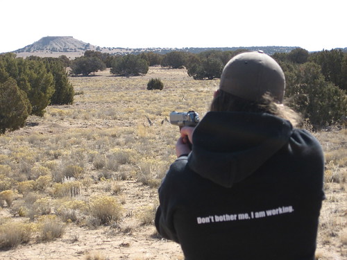
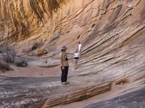
We headed back to camp and by this time everyone was up. We ate breakfast, packed up stuff and headed to upper Eardley Canyon, which was a good 1 hour drive from our campsite. Again, this was a canyon I had never been to and only had a few glances at google earth with Bill showing me where to go. Finding the place to park was easy and, like Bill said, it was an awesome view of the area (called Cliff Dweller Flat). We parked there, hiked down off the flat and took the opportunity to shoot a few rounds of James' .40cal Ruger (yes, even Alene took a couple of shots; video to come soon).
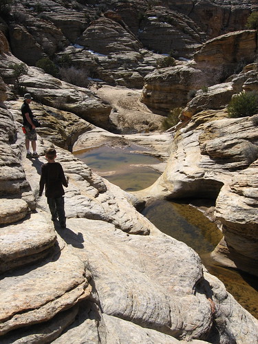
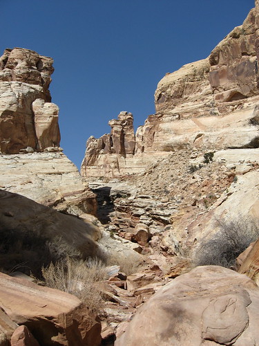
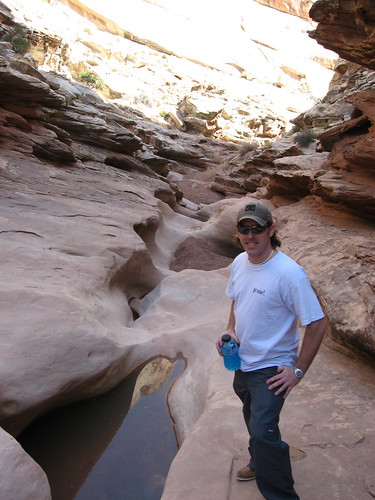
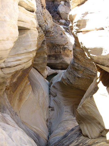
After that fun, we headed down to where I thought we were supposed to go. I had the Kelsey guide, but the map was somewhat vague and it was hard to follow all the Cairns down into the canyon, so we eventually found a wash and followed it down, thinking it would gradually take us into Eardley Canyon. This canyon had a beautiful section of full pools. We ended up coming to halt because there was a HUGE 100+' dry fall that ended in some beautiful pools below (they were frozen).
From here, I started to worry a bit, thinking I'd lead us somewhere else. I knew I wasn't lost because I could see Cliff Dweller flat behind us as I climbed up a little peak. I then figured we had gone a little too far east and were in Hyde Draw (we were). We rim-walked back to the canyon we were supposed to be in originally, which was a little de-moralizing because it was a lot of up and down, scrambling over little sandstone peaks just to get into the canyon we needed to route find in.
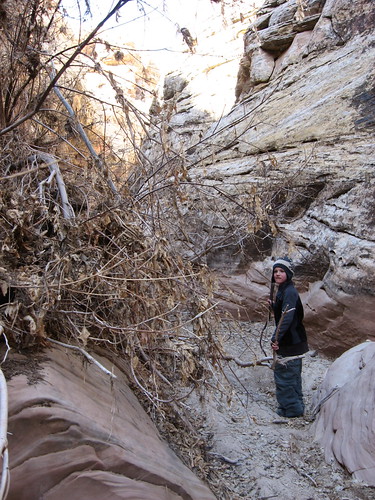
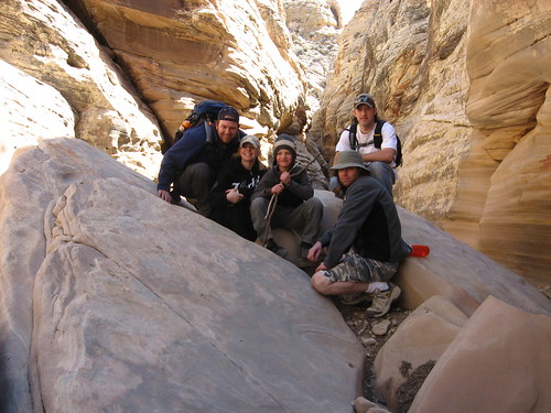
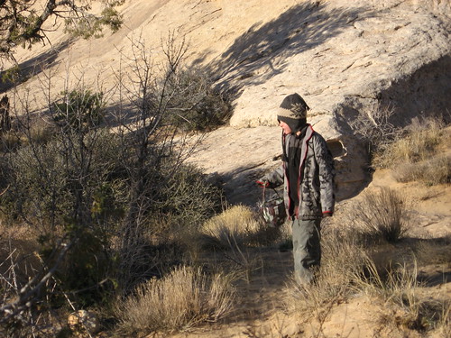
By the time we got down to the canyon floor, we were a little tired (at least I was). Either way, we were still able to make some good strides down Eardley canyon and see a lot of it. It was nice because we were the only ones there that day. I had seen footprints from someone else here and there, but they were older and it was great to have this GIANT canyon to ourselves. After getting a little past where Hyde draw enters into Eardley, we hiked back to where we entered the canyon and decided to go a little further up because there was a difficult section as we came down (about a 6' drop off). About 200 yards up the canyon we found a cairn and a dangerous, but difficult climb/scramble up and out of the canyon. I was so proud of Caiden for being able to do it (he doesn't care for hiking, but he LOVES scrambling over rocks). He was one of the first up and out of the canyon.
We spotted our cliff where the truck was parked and made our way back. We had turkey/swiss croissantwiches there waiting for us, which was a great relief. We stuffed our faces and headed back to camp. Here are some pictures from Eardley:
Pooped from the hiking, we took a little nap. However, Caiden was still wide awake and was making noise (even when he tried not to make noise, he made noise). I slept about half an hour and could not fall back asleep. I decided to do some more exploring, so I took Caiden for another drive along the front side of the reef heading north to check out the entry points for places like Farnsworth Canyon and Old woman wash. Along the way I heard stories of Caiden's game civilization and saw some cool markings in the kelsey guide, namely the Swaisey chimney and the Garvin chimney. I headed back out East from this dirt road and hooked up with 24 again, heading back south again to the Temple junction and to our campsite.
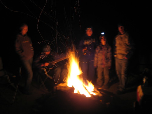
That night we had some foiled potatoes, chilli, cheese, and toppings for dinner. It stuffed us. Russ broke out his guitar and we sat around the fire (it was windy/cold again). We had planned on going to Goblin Valley that night to see it under the moonlight. We arrived at Goblin about 5 minutes to 10pm and found the park closed in 5 minutes, so we asked if we could just drive in quickly and look at it from the parking lot. The ranger was cool with it. Not much to write home about since the moon was still a bit in the East, but you could see the light cast on it.
Day 3
We slept in a bit, then woke up for Caiden to find his Easter basket (he walked right by it as he walked away to play in the sand and we had to point it out to him). He searched for easter eggs we had hidden the night before. I think he found them, if not, someone else will have a nice plastic egg full of candy. We had some good breakfast in egg/sausage/salsa/cheese burritos, broke down camp and headed out toward Black Dragon Canyon so Russ & Randa would get a chance to see some easy-to-find ancient pictographs (didn't take any pictures because we had been there a few times before)
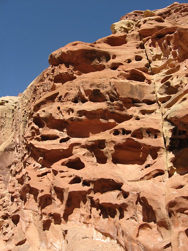
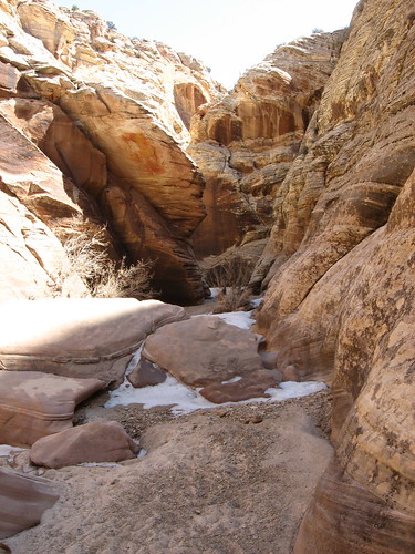
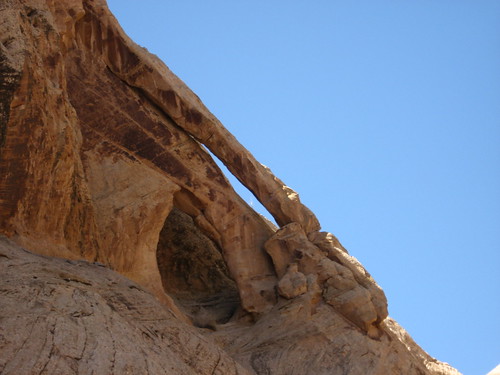
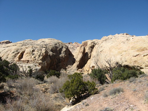
We then decided to go south from Black Dragon canyon and try to find Arch Canyon, which features a dry water fall with 3 arches above it. It was a surprisingly beautiful up there. Here are some pictures from Arch Canyon:
It was a great trip and I had a blast. I was telling Alene this morning that every time I go there, I feel more drawn to the place. I have to remain humble about it and remember that if it weren't for Alene, April, and Bill, that I would have never likely have gone down there. I used to HATE the desert and thought it all could be used for nuclear testing and garbage dumping for all I cared. Now I love the place and I want to support preserving it, keeping it beautiful, and respecting it. I look forward to many more trips in the future, exploring it going places that 99.9% of the world has never seen. In fact, we're heading back down to the desert this weekend for Bill's birthday trip. He's taking us over to the Robbers Roost area for some camping and hiking. It should be a blast. So, Alene, April, Bill, THANK YOU!!
Here are some various video clips from the trip:
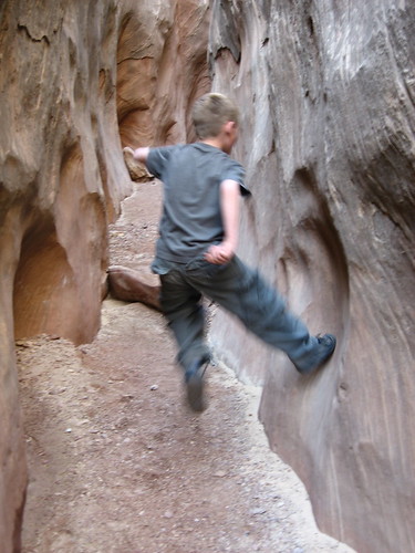
Caiden jumping off the walls of Ding Canyon
Ding Canyon pools
Fat Tyler jumping
Alene shooting a .40cal Ruger
Campfire
Alene & Caiden on the reef
Arch Canyon
Car fire on our way home
We had a GREAT time down at the Swell this past weekend. We planned on taking advantage of the time Caiden had off from school and head down Friday morning. We brought along one of Alene's co-workers, James, who likes the outdoors thing too and is a cool guy. The plan was to head down there early, find a camping spot, doing a hike, then meeting up with Russ & Randa at the I-70/24 junction to lead them to where we were at. We figured this would be the best spot because you get cell phone coverage there.
Day 1
We left about 8am and arrived at the swell close to noon. There was one campsite we wanted badly that we camped in last fall (thanks to Bill). Being that it was Easter weekend, we had no hope it would be available (or many sites around the reef for that matter). However, when we pulled into the wash that takes us to the site we wanted, a large convoy of cars in front of us pulled over to let us by. We made our way up the wash and found the site empty and all to ourselves. We totally lucked out. Just as we were setting up our stuff, the convoy drove up, found us there, then turned around (likely they wanted that site too). If we had been 5 minutes later, we would not have gotten it. We could then tell it was going to be a great trip.
We quickly got our stuff up and drove south to check out the Ding/Dang canyon area. Being that I had never been there and it had been a while for Alene, it was like a new adventure (this trip was full of them). As we drove south, we passed Little Wild Horse canyon, which was PACKED with cars and all kinds of people, who were even camped in the parking lot. We discussed its popularity because of the fact that it has a sign pointing people where to go and that was it. We moved on and found the parking area for the Ding/Dang/Cistern canyon trail head (no sign, so only a couple of vehicles).
We worked our way up a wash for a while and found the opening to what I was hoping was Ding (hoping we hadn't passed it already). Right from the beginning of entering the canyon, I could see why Bill said this is one of his favorite canyons to hike in the swell. It's awesome. We hiked and climbed all the way to the back of the canyon where it reaches the behind the reef road, which I always wanted to see. However, being that I wasn't 100% sure of which canyon we were up, and the fact that I left my kelsey guide in the truck, we decided to just go back down canyon instead of looping around to find Dang canyon. On our way back, we ran into a family from SLC who were doing the whole loop. They were very friendly and said we were in fact in Ding canyon. They had brought along a 10' tow rope for a section in Dang that was supposed to drop about 10'. Good thing we didn't go that way I guess. Anyway, the canyon was beautiful and I can't wait to go back and actually attempt the whole loop. Here are some pictures from that hike:
On a side note, I hope one day to be able to get a 4 wheeler and drive along the back of the reef road on it. I think it would be fun to see all these canyons from the back side, all in one day.
Anyway, we left Ding in time to head back to I-70 to meet Russ & Randa. When we got to the junction, I called them and they were still in Price because Russ thought that Hwy 6 went down through Mt. Pleasant (we used to do our family reunion down there every summer, so I think he was just used to heading down that way). We decided to head into town to Green River and get a bite to eat. We almost felt like we were cheating ourselves of the camping experience, but we forgot about that after getting our pizza and shakes at a small diner there. On our way back, the sun was setting and we caught this picture of it setting over the reef:
We met Russ & Randa about an hour later and headed back to the campsite. We found it unusually windy in the canyon that night, it was a little annoying, but we dealt with it. Before heading to bed, we took a quick jaunt up the reef behind us to look around. It was a full moon and we could see all the other campsites around us. It's an awesome view and I could stay up there much longer, but it was getting cold.
Day 2
The next morning Caiden was the first person up and out of the tent making noise. I couldn't sleep anymore, so I got up and took him for a drive to explore more of North Temple Wash and to hopefully allow ALene and the others to sleep a little longer without having to hear an 8 year old banging on things with a hatchet or talking about Ancient times, and the Middle Ages from his computer game "civilization" that he plays.
The drive up North Temple wash was nice. I got to explore around a bit, finding other campsites (for future reference) and getting closer to Temple Mountain. Along the way we also ran into a miners cabin, a well, and an old rusted out car. It was cool to see the miners cabin with the mining claim updated and pinned to it still. Here are some pictures from the drive:
We headed back to camp and by this time everyone was up. We ate breakfast, packed up stuff and headed to upper Eardley Canyon, which was a good 1 hour drive from our campsite. Again, this was a canyon I had never been to and only had a few glances at google earth with Bill showing me where to go. Finding the place to park was easy and, like Bill said, it was an awesome view of the area (called Cliff Dweller Flat). We parked there, hiked down off the flat and took the opportunity to shoot a few rounds of James' .40cal Ruger (yes, even Alene took a couple of shots; video to come soon).
After that fun, we headed down to where I thought we were supposed to go. I had the Kelsey guide, but the map was somewhat vague and it was hard to follow all the Cairns down into the canyon, so we eventually found a wash and followed it down, thinking it would gradually take us into Eardley Canyon. This canyon had a beautiful section of full pools. We ended up coming to halt because there was a HUGE 100+' dry fall that ended in some beautiful pools below (they were frozen).
From here, I started to worry a bit, thinking I'd lead us somewhere else. I knew I wasn't lost because I could see Cliff Dweller flat behind us as I climbed up a little peak. I then figured we had gone a little too far east and were in Hyde Draw (we were). We rim-walked back to the canyon we were supposed to be in originally, which was a little de-moralizing because it was a lot of up and down, scrambling over little sandstone peaks just to get into the canyon we needed to route find in.
By the time we got down to the canyon floor, we were a little tired (at least I was). Either way, we were still able to make some good strides down Eardley canyon and see a lot of it. It was nice because we were the only ones there that day. I had seen footprints from someone else here and there, but they were older and it was great to have this GIANT canyon to ourselves. After getting a little past where Hyde draw enters into Eardley, we hiked back to where we entered the canyon and decided to go a little further up because there was a difficult section as we came down (about a 6' drop off). About 200 yards up the canyon we found a cairn and a dangerous, but difficult climb/scramble up and out of the canyon. I was so proud of Caiden for being able to do it (he doesn't care for hiking, but he LOVES scrambling over rocks). He was one of the first up and out of the canyon.
We spotted our cliff where the truck was parked and made our way back. We had turkey/swiss croissantwiches there waiting for us, which was a great relief. We stuffed our faces and headed back to camp. Here are some pictures from Eardley:
Pooped from the hiking, we took a little nap. However, Caiden was still wide awake and was making noise (even when he tried not to make noise, he made noise). I slept about half an hour and could not fall back asleep. I decided to do some more exploring, so I took Caiden for another drive along the front side of the reef heading north to check out the entry points for places like Farnsworth Canyon and Old woman wash. Along the way I heard stories of Caiden's game civilization and saw some cool markings in the kelsey guide, namely the Swaisey chimney and the Garvin chimney. I headed back out East from this dirt road and hooked up with 24 again, heading back south again to the Temple junction and to our campsite.
That night we had some foiled potatoes, chilli, cheese, and toppings for dinner. It stuffed us. Russ broke out his guitar and we sat around the fire (it was windy/cold again). We had planned on going to Goblin Valley that night to see it under the moonlight. We arrived at Goblin about 5 minutes to 10pm and found the park closed in 5 minutes, so we asked if we could just drive in quickly and look at it from the parking lot. The ranger was cool with it. Not much to write home about since the moon was still a bit in the East, but you could see the light cast on it.
Day 3
We slept in a bit, then woke up for Caiden to find his Easter basket (he walked right by it as he walked away to play in the sand and we had to point it out to him). He searched for easter eggs we had hidden the night before. I think he found them, if not, someone else will have a nice plastic egg full of candy. We had some good breakfast in egg/sausage/salsa/cheese burritos, broke down camp and headed out toward Black Dragon Canyon so Russ & Randa would get a chance to see some easy-to-find ancient pictographs (didn't take any pictures because we had been there a few times before)
We then decided to go south from Black Dragon canyon and try to find Arch Canyon, which features a dry water fall with 3 arches above it. It was a surprisingly beautiful up there. Here are some pictures from Arch Canyon:
It was a great trip and I had a blast. I was telling Alene this morning that every time I go there, I feel more drawn to the place. I have to remain humble about it and remember that if it weren't for Alene, April, and Bill, that I would have never likely have gone down there. I used to HATE the desert and thought it all could be used for nuclear testing and garbage dumping for all I cared. Now I love the place and I want to support preserving it, keeping it beautiful, and respecting it. I look forward to many more trips in the future, exploring it going places that 99.9% of the world has never seen. In fact, we're heading back down to the desert this weekend for Bill's birthday trip. He's taking us over to the Robbers Roost area for some camping and hiking. It should be a blast. So, Alene, April, Bill, THANK YOU!!
Here are some various video clips from the trip:
Caiden jumping off the walls of Ding Canyon
Ding Canyon pools
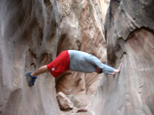
Fat Tyler jumping
Alene shooting a .40cal Ruger
Campfire
Alene & Caiden on the reef
Arch Canyon
Car fire on our way home