HomerJ
Member
- Joined
- Jan 19, 2012
- Messages
- 1,199
This was suppose to be about the Buckskin, but unfortunately a buddy had to drop out and with just two of us going we figured we'd go somewhere closer and save gas $$$.
Day1:
We left Cache Valley Wednesday morning and headed south. Made it to Price for lunch and picked up groceries for the week. After that it was onto the Swell! Because of our last minute changes I hadn't had anytime to research campsites, but Tyler came through with a list of possible places. :twothumbs: His first recommendation was available and we took it! It ended up being a very good site!!! Not too much traffic around it and the closet anyone could camp was about 100 yards away!
After setting up camp we ran down to Little Wild Horse Canyon and hiked it. We had seen in before last fall when we make the full loop up it and down Bell Canyon. We hiked up through the interesting spots and then turned around and came back down. There was about 3 other groups in the canyon besides us.
I believe this was posted in the "Guess the spot" section, but I can't find it to give the person credit (think it was Udink). Anyway, we were watching the road for it and found it and stopped to take a few pics of it.
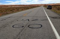
LWHC
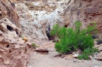
LWHC
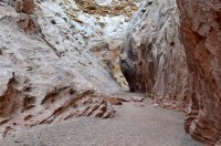
LWHC
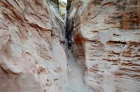
LWHC
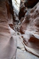
LWHC
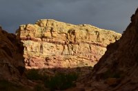
Day2:
The next day we decided to drive down and hike Leprechaun Canyon. It is South of Hanksville on the Hwy to Hite. Leprechaun is a technical canyon and normally hiked along the side to the top and down. Not being canyoneers, we hiked from the bottom up. We could only hike up about a mile before the canyon got too narrow and couldn't go any further. It was well worth it though! Leprechaun Canyon was the highlight of the trip!!!
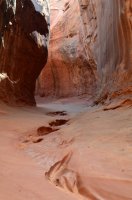
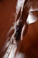
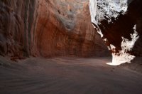
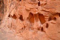
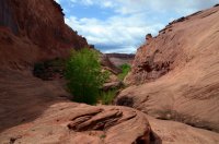
After Leprechaun we drove down the road a few miles to Hogs Spring. It
ended up being not that spectacular. We did run into some poison ivy
at the very top of the canyon which I noticed on our way back down.
Luckily we did touch any of it!
After Hogs Spring we drove onto Hite, more so to check out Lake Powell
and the bridges. The road winds down through the red rock and then
crosses the Dirty Devil river and then the Colorado river. For some
reason we didn't stop and take any photos.
We then drove back to Goblin Valley and found we could use the showers
at the campground if we paid the campground fee (later we found we
were "misinformed"). We also asked about Ding and Dang Canyons, Crack
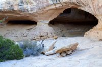
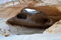
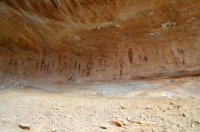
and Chute Canyons, and the Wild Horse Window. We decided to hike to
the Wild Horse Window that evening as it wouldn't take long. It was
neat...
Day3:
Today we had decided to hike Ding and Dang Canyons. They were said to be "a bit more challenging than Little Wild Horse Canyon". We found them A LOT more challenging. Unless you are an expert rock climber, you cannot get up Dang so you have to hike up Ding and then Down Dang.
Ding had a lot more scrambling and climbing than LWHC. It also wasn't as cool as LWHC, but still unique. Ding eventually opens up and you loop over to Dang.
Ding Canyon
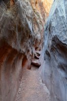
Ding Canyon
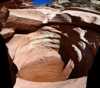
Between Ding and Dang
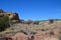
Heading down Dang
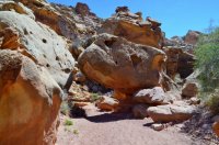
Dang
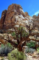
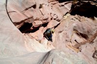
Dang starts to slot up and we were soon at the first drop off, but we managed it just fine. A little later on we came to a high, steep, drop (about 40feet). It was more exposed than I was exspecting! After this obsticle we ran into a bunch of choke stone with 10' to 15' drops after them! I had to help my friend down them and then he helped me down. It would be nearly
impossible to do solo (for the average hiker). I didn't take any pics of them as I had put my camera in my backpack and didn't bother to get it out.... We decided that we wouldn't hike Dang again.... LOL!
Dang
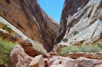
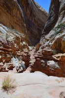
This was a lot scarier than it looks!!!!
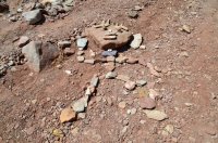
Found this cool Rock Guy in the wash of Ding and Dang!!!
After Ding and Dang we drove over to Goblin Valley to go have a shower and to explore more of Goblin Valley than we did last fall. On the way you pass the trail head for LWHC. There was 30 cars parked there when we went by!!! I'm sure glad we hiked it earlier in the week!
At Goblin Valley we pulled up and told the Ranger we would like to pay the camping fee for a shower. He said the campground was full (was full yesterday when we asked about showering) and we couldn't. We told the Ranger that we were told yesterday we could just pay the camping fee and use the showers. He then got an attitude and told us "your misinformed" and that we can't. So we told him, well the Ranger yesterday told us we could and he said, well I'm the guy with the badge (pulling his badge forward on his shirt) and I say you can't....
So instead of showering and exploring Goblin Valley we drove over to Crack Canyon to hike it. You can do a loop and hike Crack and Chute, but it's 13 miles long and a lot of it's hiking in the open desert from one to the other. Chute is more open so we decided to hike Crack. Crack canyon has some very unique rock formation along the sides of the canyon that made it neat! We hiked down for a while and then the canyon narrows up to about 5' wide and then there was a choke stone with a drop off. Well, after our experience in Dang that morning we were wore out and didn't want to have to scramble back up it. There were also other drop offs we could see just ahead of this one and if we couldn't get back up we'd have to make the 13 mile loop to get back to the truck.
Crack Canyon
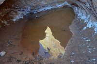
Crack Canyon
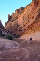
Crack Canyon - cool section
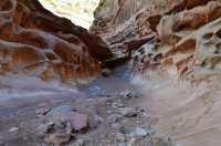
Crack Canyon
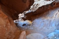
Crack Canyon
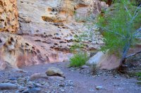
Crack Canyon
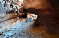
Crack Canyon
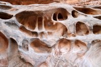
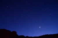
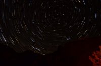
After hiking Crack Canyon we had decided to head out a day early. There was SO many people coming to camp/four wheel/motor bike/hike the swell. Since it was the last night we were going to be there and the sky was nice and clear of clouds I decided to do some night shots!
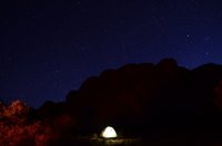
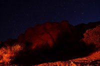
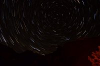
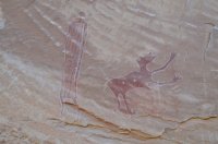
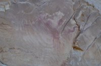
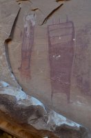
The next moring we, after packing up camp, we stopped at the Black Dragon canyon/pictograph that is just off of I-70 right were it goes through the Swell. After that we drove on to Happy Valley (Utah County) to eat and the traffic was so horrible we decided to get out of there and eat in Sandy even though it was already 2pm.
Featured image for slideshow:
Day1:
We left Cache Valley Wednesday morning and headed south. Made it to Price for lunch and picked up groceries for the week. After that it was onto the Swell! Because of our last minute changes I hadn't had anytime to research campsites, but Tyler came through with a list of possible places. :twothumbs: His first recommendation was available and we took it! It ended up being a very good site!!! Not too much traffic around it and the closet anyone could camp was about 100 yards away!
After setting up camp we ran down to Little Wild Horse Canyon and hiked it. We had seen in before last fall when we make the full loop up it and down Bell Canyon. We hiked up through the interesting spots and then turned around and came back down. There was about 3 other groups in the canyon besides us.
I believe this was posted in the "Guess the spot" section, but I can't find it to give the person credit (think it was Udink). Anyway, we were watching the road for it and found it and stopped to take a few pics of it.

LWHC

LWHC

LWHC

LWHC

LWHC

Day2:
The next day we decided to drive down and hike Leprechaun Canyon. It is South of Hanksville on the Hwy to Hite. Leprechaun is a technical canyon and normally hiked along the side to the top and down. Not being canyoneers, we hiked from the bottom up. We could only hike up about a mile before the canyon got too narrow and couldn't go any further. It was well worth it though! Leprechaun Canyon was the highlight of the trip!!!


After Leprechaun we drove down the road a few miles to Hogs Spring. It
ended up being not that spectacular. We did run into some poison ivy
at the very top of the canyon which I noticed on our way back down.
Luckily we did touch any of it!
After Hogs Spring we drove onto Hite, more so to check out Lake Powell
and the bridges. The road winds down through the red rock and then
crosses the Dirty Devil river and then the Colorado river. For some
reason we didn't stop and take any photos.
We then drove back to Goblin Valley and found we could use the showers
at the campground if we paid the campground fee (later we found we
were "misinformed"). We also asked about Ding and Dang Canyons, Crack
and Chute Canyons, and the Wild Horse Window. We decided to hike to
the Wild Horse Window that evening as it wouldn't take long. It was
neat...


Day3:
Today we had decided to hike Ding and Dang Canyons. They were said to be "a bit more challenging than Little Wild Horse Canyon". We found them A LOT more challenging. Unless you are an expert rock climber, you cannot get up Dang so you have to hike up Ding and then Down Dang.
Ding had a lot more scrambling and climbing than LWHC. It also wasn't as cool as LWHC, but still unique. Ding eventually opens up and you loop over to Dang.
Ding Canyon

Ding Canyon

Between Ding and Dang

Heading down Dang

Dang

Dang starts to slot up and we were soon at the first drop off, but we managed it just fine. A little later on we came to a high, steep, drop (about 40feet). It was more exposed than I was exspecting! After this obsticle we ran into a bunch of choke stone with 10' to 15' drops after them! I had to help my friend down them and then he helped me down. It would be nearly
impossible to do solo (for the average hiker). I didn't take any pics of them as I had put my camera in my backpack and didn't bother to get it out.... We decided that we wouldn't hike Dang again.... LOL!
Dang


This was a lot scarier than it looks!!!!

Found this cool Rock Guy in the wash of Ding and Dang!!!

After Ding and Dang we drove over to Goblin Valley to go have a shower and to explore more of Goblin Valley than we did last fall. On the way you pass the trail head for LWHC. There was 30 cars parked there when we went by!!!
At Goblin Valley we pulled up and told the Ranger we would like to pay the camping fee for a shower. He said the campground was full (was full yesterday when we asked about showering) and we couldn't. We told the Ranger that we were told yesterday we could just pay the camping fee and use the showers. He then got an attitude and told us "your misinformed" and that we can't. So we told him, well the Ranger yesterday told us we could and he said, well I'm the guy with the badge (pulling his badge forward on his shirt) and I say you can't....
So instead of showering and exploring Goblin Valley we drove over to Crack Canyon to hike it. You can do a loop and hike Crack and Chute, but it's 13 miles long and a lot of it's hiking in the open desert from one to the other. Chute is more open so we decided to hike Crack. Crack canyon has some very unique rock formation along the sides of the canyon that made it neat! We hiked down for a while and then the canyon narrows up to about 5' wide and then there was a choke stone with a drop off. Well, after our experience in Dang that morning we were wore out and didn't want to have to scramble back up it. There were also other drop offs we could see just ahead of this one and if we couldn't get back up we'd have to make the 13 mile loop to get back to the truck.
Crack Canyon

Crack Canyon

Crack Canyon - cool section

Crack Canyon

Crack Canyon

Crack Canyon

Crack Canyon

After hiking Crack Canyon we had decided to head out a day early. There was SO many people coming to camp/four wheel/motor bike/hike the swell. Since it was the last night we were going to be there and the sky was nice and clear of clouds I decided to do some night shots!


The next moring we, after packing up camp, we stopped at the Black Dragon canyon/pictograph that is just off of I-70 right were it goes through the Swell. After that we drove on to Happy Valley (Utah County) to eat and the traffic was so horrible we decided to get out of there and eat in Sandy even though it was already 2pm.


Featured image for slideshow:


