Udink
Still right here.
- Joined
- Jan 17, 2012
- Messages
- 1,734
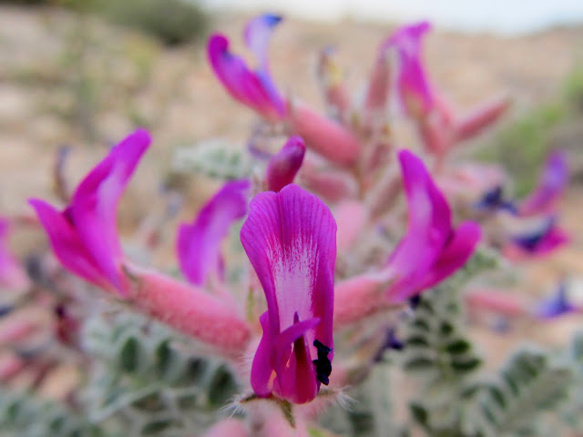
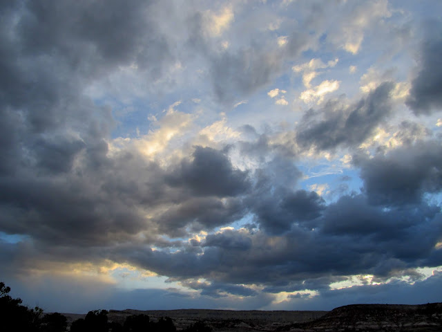
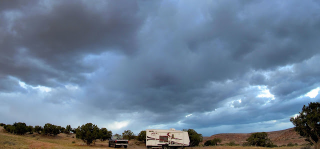
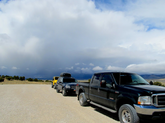
The semi-annual San Rafael geocaching event this spring was pretty low-key this year, but provided me some relaxing time to myself early in the week and some fun with friends on the weekend. For the past couple of years Dave has accompanied me early in the week before the events. This season he had some other commitments, so I drove down solo--just me, Torrey, and Boulder, that is--on Tuesday evening. I set up camp just off the Moore Cutoff Road a short distance southeast of Lone Tree Reservoir, then poured a drink and threw some chicken on the grill. It was windy with dark clouds moving in, so I hunkered down in the trailer and read a book, Tales of Canyonlands Cowboys.
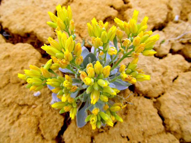
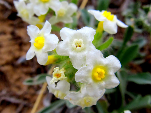
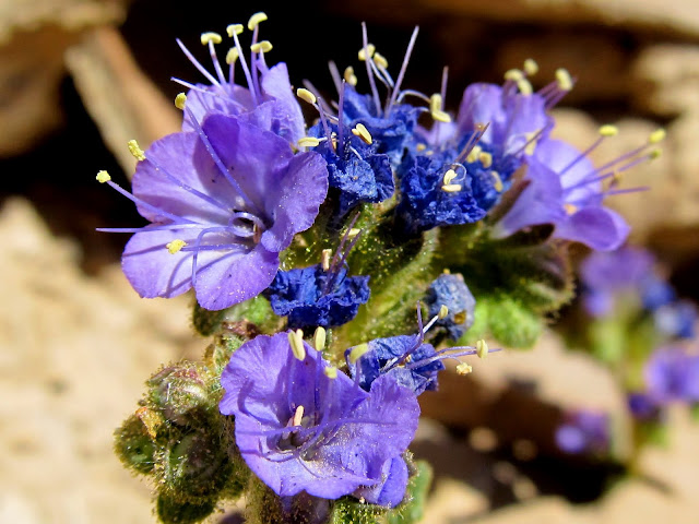
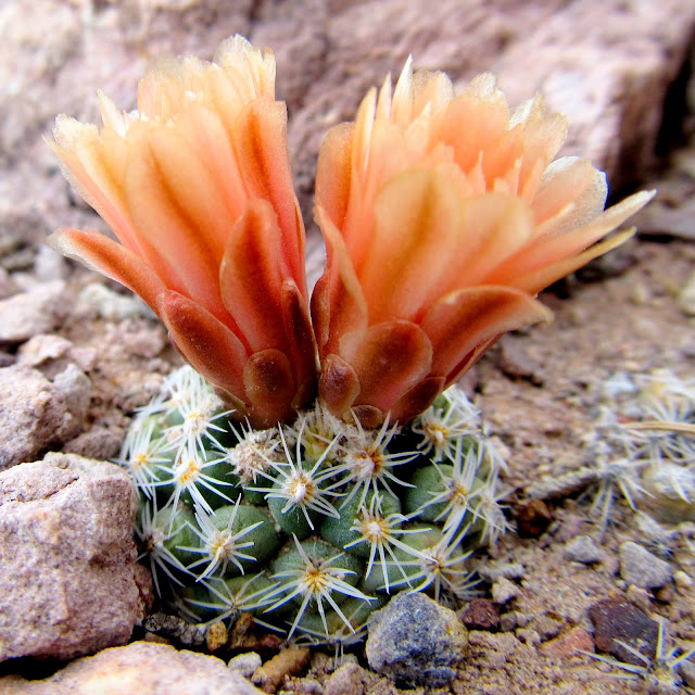
Astragalus mollissimus (Locoweed)
Dark clouds blowing in
Dark clouds over camp
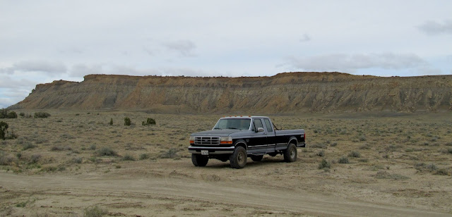
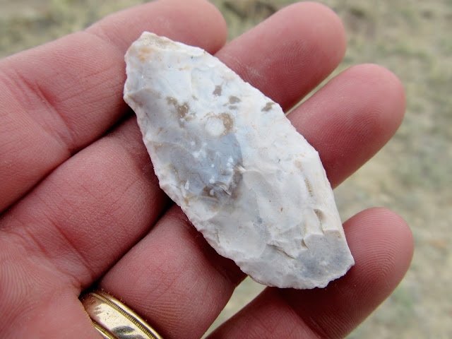
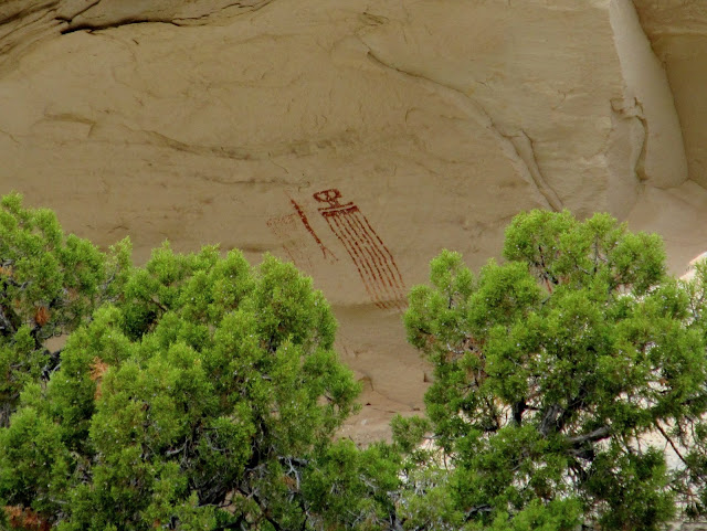
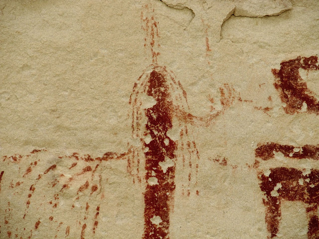
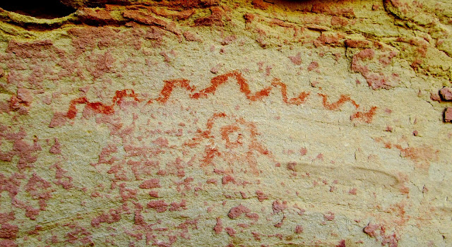
The dogs' restlessness woke me just before sunrise on Wednesday morning, so I let them outside for a bit then went back to sleep for another hour or so. After breakfast I hopped in the truck for a short drive along the eastern edge of Molen Reef and then began hiking to some pictographs that I've known of for years but had never visited. I've become so spoiled with my Jeep that driving the truck felt like driving a tank. Worse, actually. I found an arrowhead and saw a lot of wildflowers while hiking. It was overcast and cool--perfect weather for hiking and rock art hunting. I only knew roughly where the pictograph were, somewhere within a half-mile stretch of a small canyon. I found it easily and took a few photos before heading back toward the truck.
Wednesday's sunrise
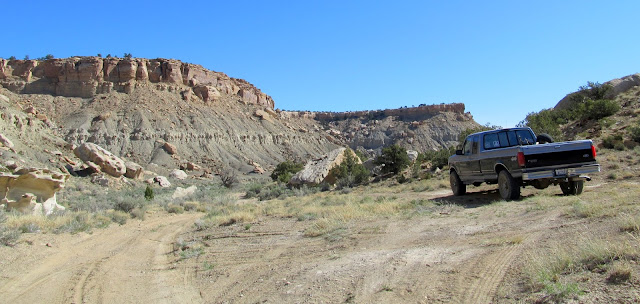
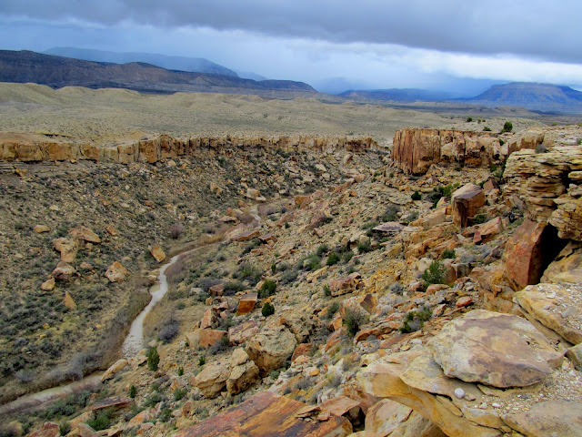
Truck parked with Molen Reef stretching across the background
Ooh, a pretty rock!
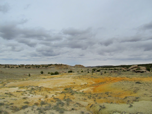
Outcropping of orange soil
Physaria rectipes (Bladderpod)
Oreocarya flavoculata (?)
The Observer
The Observer
The Observer
The Observer
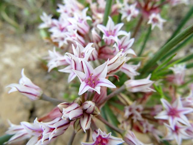
Allium textile (Onion)
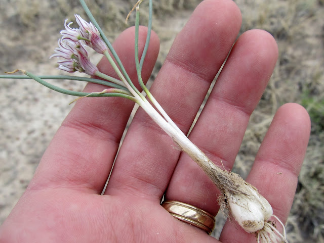
Allium textile (Onion), which I dug up and ate with dinner
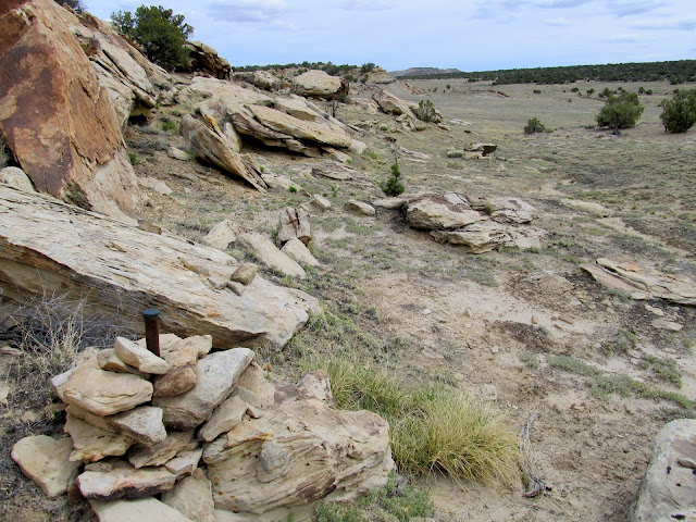
Section corner survey marker
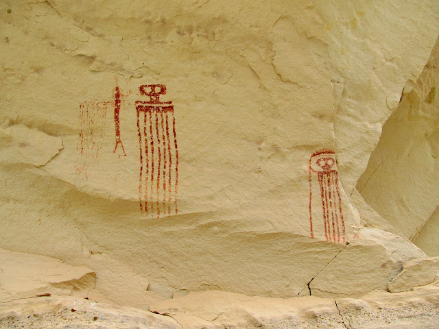
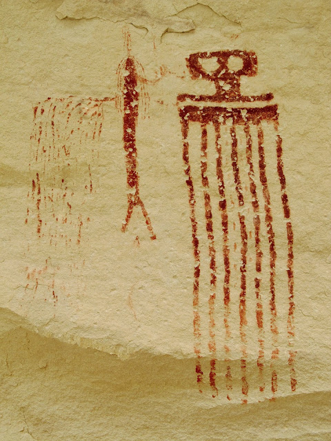
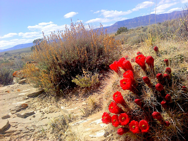
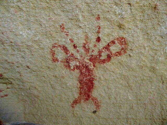
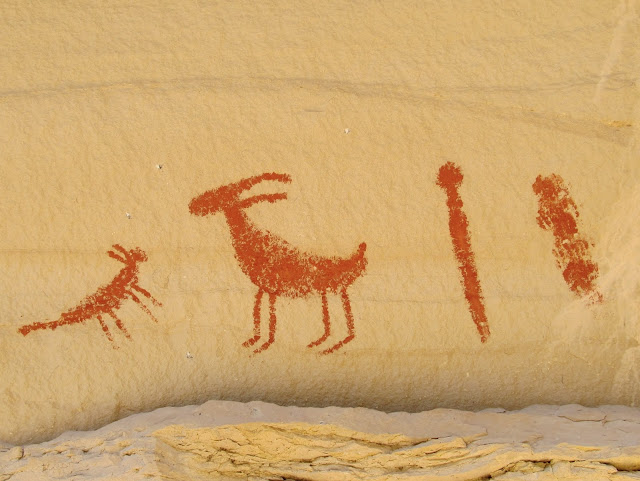
In the afternoon I made another short drive to find another pictograph that I learned of just a few months ago. During the drive I had to stop for a nice, bright Claret Cup that was in bloom a couple hundred feet from the road--the first I'd seen blooming this year. The "Fairy" pictograph was easy to find since Alan had been there several weeks earlier and narrowed the location down for me. The quality of the rock art wasn't great but the Fairy figure was unique.
Echinocereus triglochidiatus (Claret Cup Cactus)
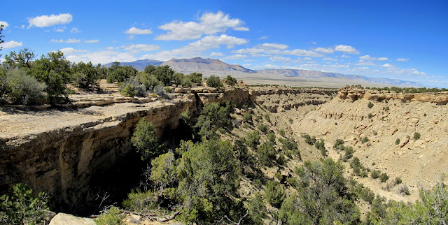
Canyon along Molen Reef
Fairy pictograph
Indiscernible pictographs near the Fairy
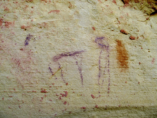
Pictograph near the Fairy
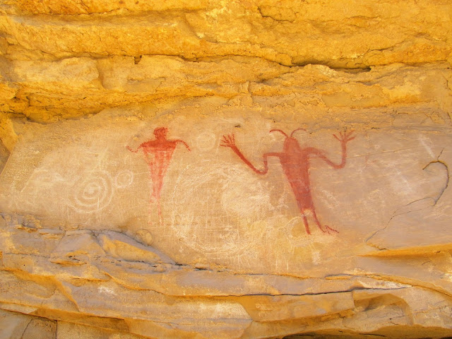
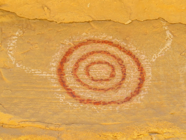
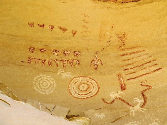
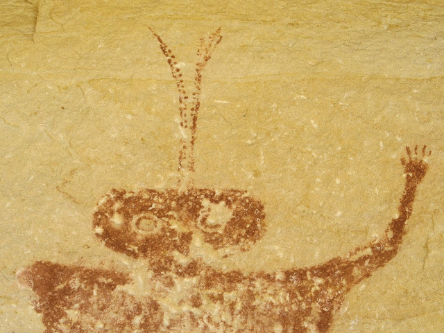
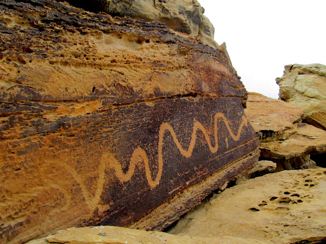
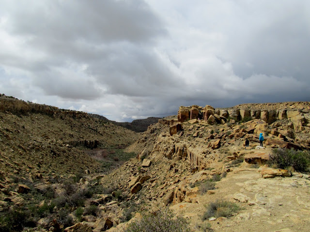
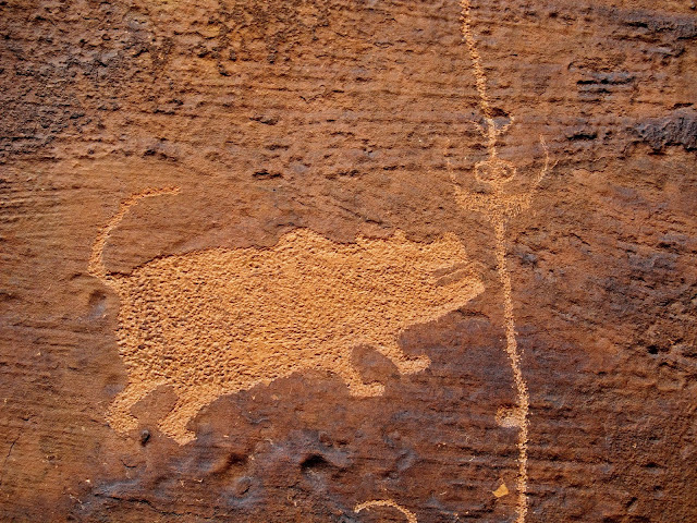
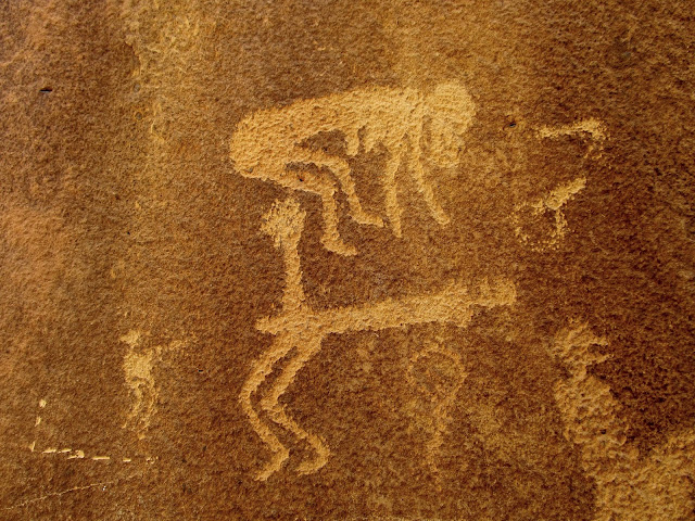
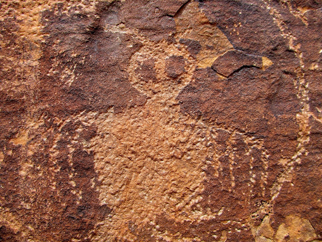
Thursday was probably my favorite day. I spent several hours exploring Short Canyon. I began hiking after I drove my truck into the canyon about as far as it could go. There's quite a bit of rock art in Short Canyon, and though I didn't know the location of any of it, I think I found it all. It was a clear, sunny day, so the dogs got hot quickly with all the running they do, but I kept a slower pace and was fairly comfortable. I had actually been in Short Canyon twice before, each time to find a geocache, but each time I'd hiked in from the main road because the BLM had posted closure signs at the Short Canyon turnoff--I simply wasn't interested enough in the rock art back then to continue the hike to look for it. This time there were no closure signs and I cheerily drove on the Short Canyon road. The rock art got better and better as I ascended the canyon on foot. The first pictograph panel isn't terribly well made and looks quite bright--I'll hesitate to call it recent, but it doesn't look very ancient, either. There was a smattering of pictographs and petroglyphs before reaching the very cool Wavy Arms Guy. Next was a large pictograph panel that had petroglyphs pecked over the top of it--certainly two different cultures, perhaps the more recent trying to diss the older. Finally, there was a great Barrier Canyon style figure with large eyes, antennae, and an upheld, perfect five-fingered hand.
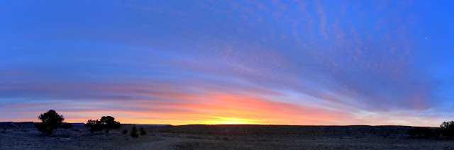
Thursday's sunrise
Truck parked in Short Canyon
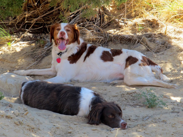
Torrey and Boulder cooling off in the shade of a tree
Phacelia crenulata (Notched-leaved Phacelia)
Short Canyon pictographs
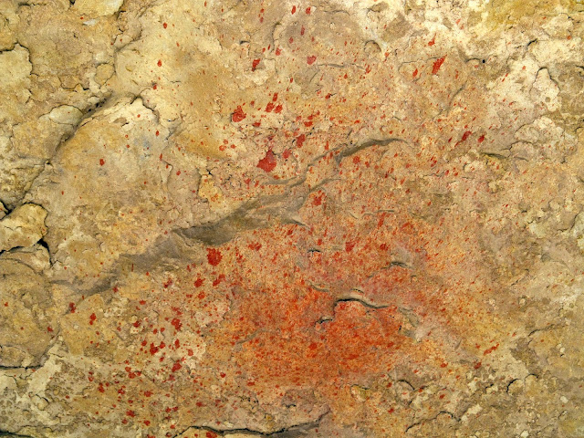
Paint splatter near some pictographs
Short Canyon petroglyphs
Wavy Arms Guy
Spiral pictograph with horns
Short Canyon pictographs with overlaid petroglyphs
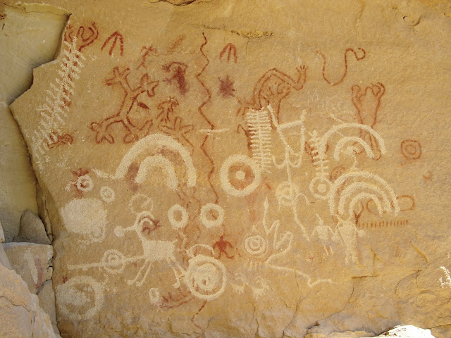
Short Canyon pictographs with overlaid petroglyphs
Short Canyon pictographs
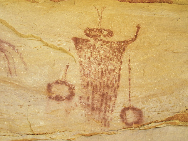
Head and antennae detail
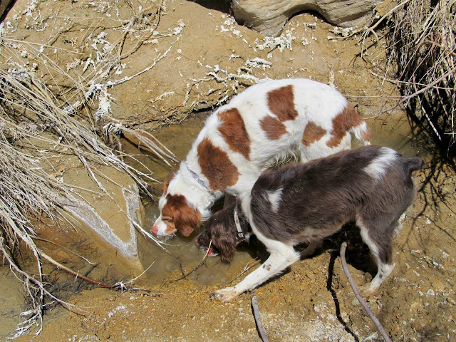
Torrey and Boulder drinking from Short Canyon Spring
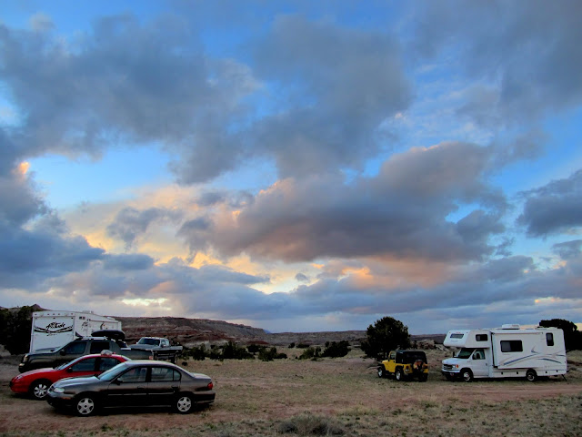
I got back to camp and found that Terry and Karen had arrived and set up their camp outfit. Traci and the kids showed up late in the evening after Bradley's soccer game, bringing my precious Jeep so I wouldn't have to drive the tank any more. Chris got there late at night and we stayed up until early in the morning around the campfire. No surprise--I spent Friday lying in bed until the afternoon.") Ken and Jan got to camp sometime while I was konked out. Chris, Bradley, and I went for a short drive on Friday evening along the Moore Cutoff Road and hiked around a bit, and a while after returning to camp I noticed a tire on the Jeep going flat. I didn't want to change it right then so I put the jack under the axle to keep the wheel from sitting on the tire and left it that way for the night.
Ken and Jan got to camp sometime while I was konked out. Chris, Bradley, and I went for a short drive on Friday evening along the Moore Cutoff Road and hiked around a bit, and a while after returning to camp I noticed a tire on the Jeep going flat. I didn't want to change it right then so I put the jack under the axle to keep the wheel from sitting on the tire and left it that way for the night.
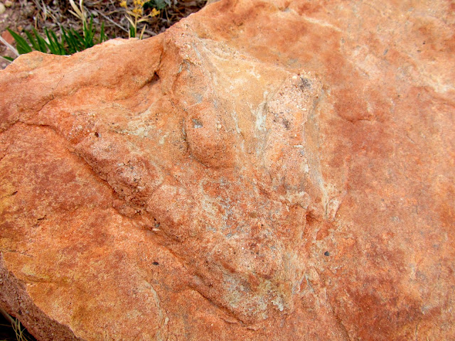
Dinosaur footprint near the Moore Cutoff Road
Pediocactus despainii (San Rafael Cactus), an endangered cactus, this being the first I've ever seen
Large snake petroglyph at Dry Wash
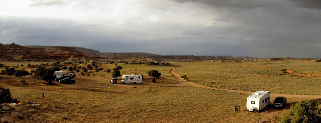
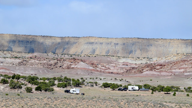
Camp on Friday evening
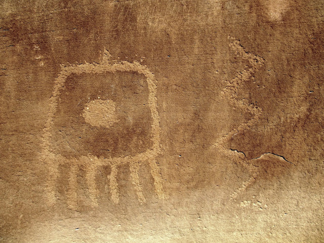
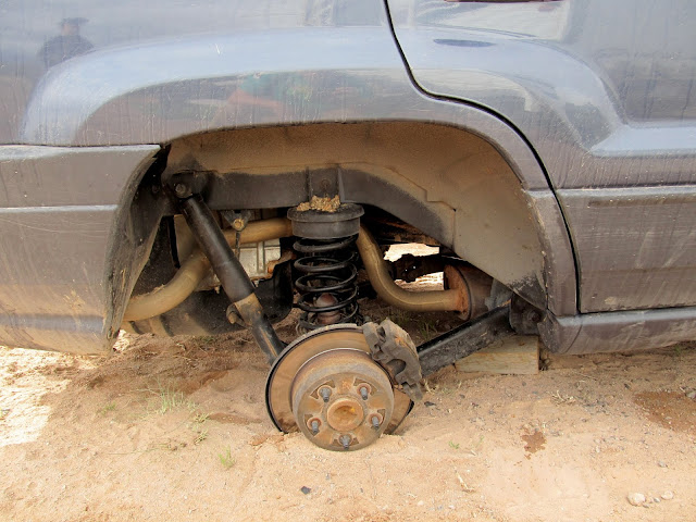
I changed the tire on Saturday morning and forgot to chock the wheels or use the parking brake and the Jeep rolled off the jack. There was still room to get the jack back under the axle and raise it again, but I had to hammer the brake heat shield back into shape. The tire had a damned sidewall puncture (my third this year after already having one on the truck and camp trailer), and later at home I ended up putting two new tires on it and using the other good used tire as my spare. Later in the morning the whole group headed to the Rochester Panel. It had been several years since my first visit, and I still chuckled at some of the pornographic petroglyphs.
Jeep brake rotor on the ground
Our group parked at the Rochester Panel trailhead
Hiking to the Rochester Panel
Rochester Panel
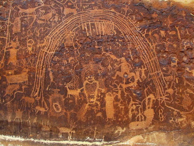
Rochester Panel
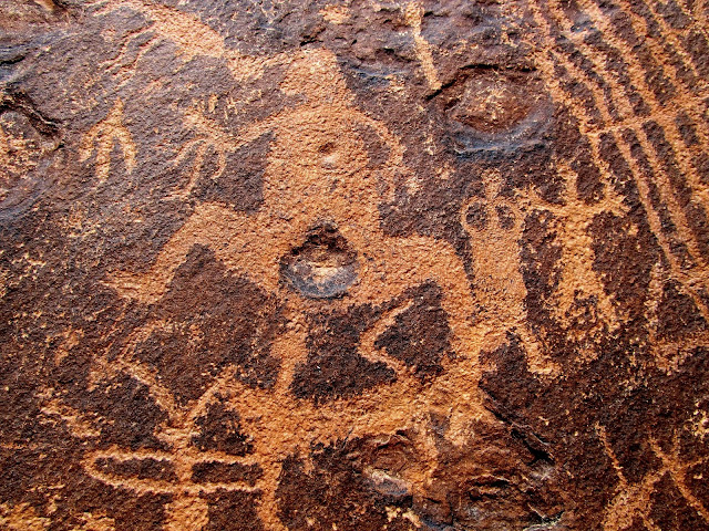
Rochester Panel
Rochester Panel
Rochester Panel
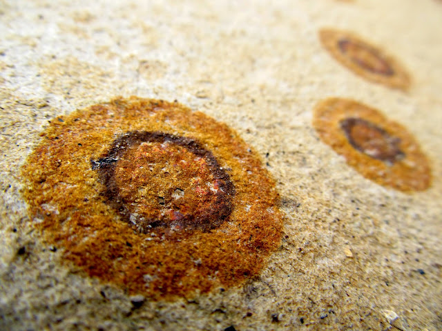
Circular iron stains in the sandstone
Muddy Creek northeast of the Rochester Panel
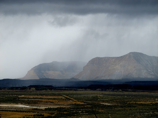
Rain and hail moved in as we were hiking back to the parking lot and everyone in the group split up for the afternoon. I had my family and Chris in the Jeep and we drove to an interesting place south of Emery near the Coal Cliffs, overlooking Quitchupah Creek. There, the sandstone has turned a reddish color due to heat from an active underground coal seam fire. A fault in the ground, likely caused by subsidence from the coal reduction below, was spewing out heat and noxious gases. We returned to camp and found my sister and her family there, and the group was joined later by one other geocacher. It was a small group but we enjoyed a great potluck dinner followed by another late-ish night around the campfire.
Rain over Emery and the Wasatch Plateau
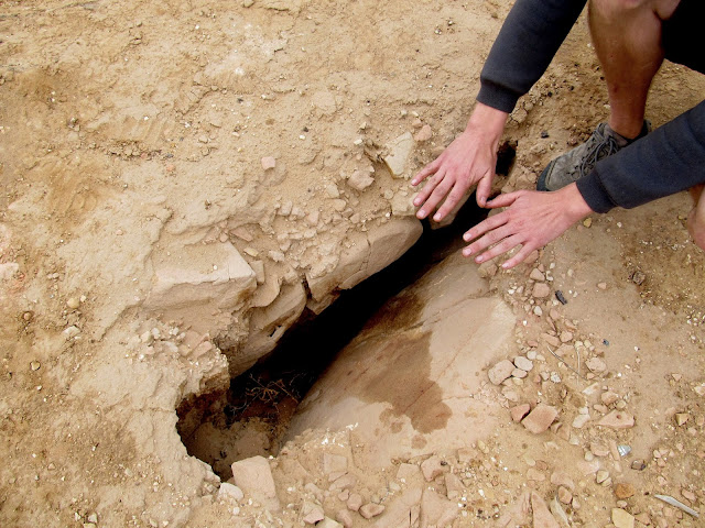
Vent hole for an underground coal fire
Camp on Saturday evening
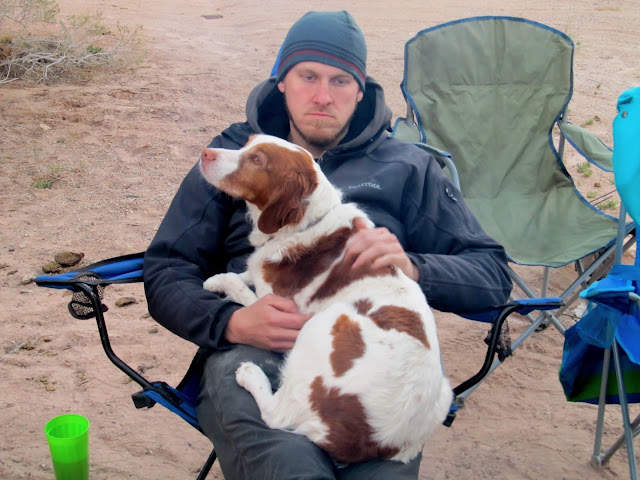
Chris and Torrey
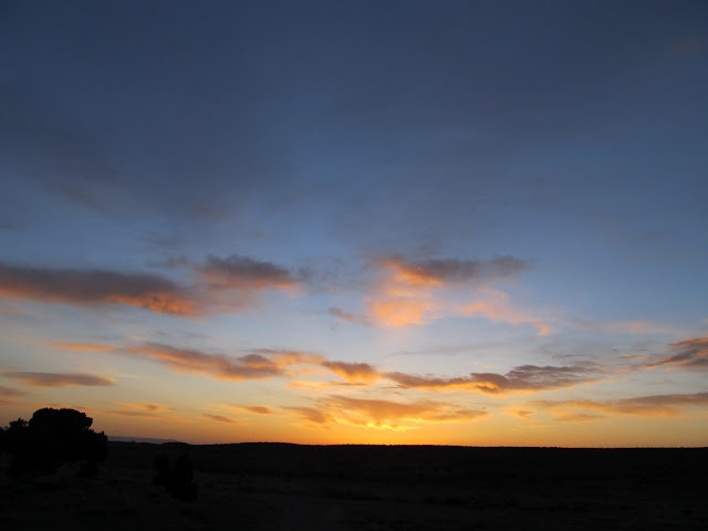
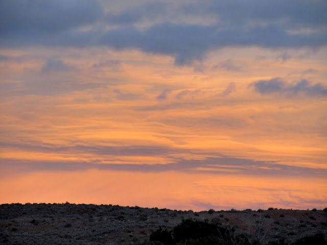
Laminar clouds at sunset
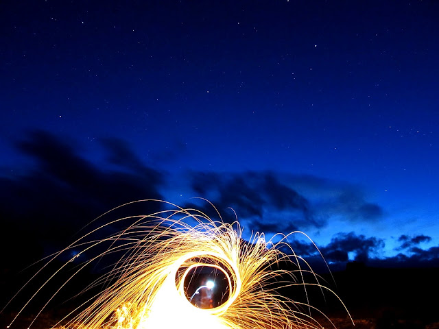
Spinning wool
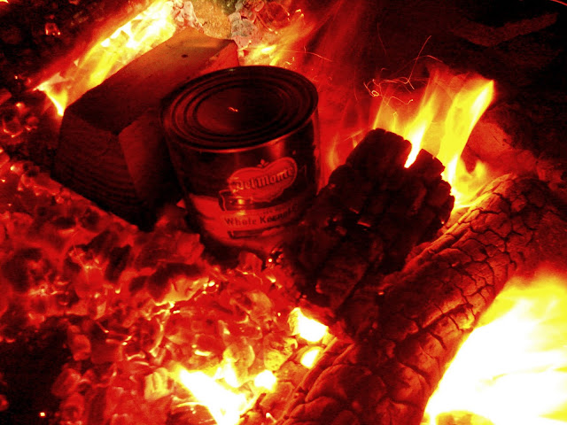
Popcorn
On Sunday morning Chris and I took the kids and dogs for a short hike near camp. Everyone cleared out pretty early, though as usual Traci and I were the last to leave. It was pretty wonderful getting home from a trip early in the day 'cause it left time to unwind after unpacking the truck and trailer.
Camp before leaving on Sunday
Full photo gallery: https://picasaweb.google.com/Dennis.Udink/SanRafaelSpring2014
[parsehtml]<iframe width="640" height="480" frameborder="0" scrolling="no" marginheight="0" marginwidth="0" src="https://maps.google.com/maps?q=http:%2F%2Fudink.org%2Fgeo%2FSanRafaelSpring2014.kmz&hl=en&sspn=0.082137,0.169086&t=h&ie=UTF8&ll=38.907858,-111.150028&spn=0.141105,0.189981&output=embed"></iframe><br /><small><a href="https://maps.google.com/maps?q=http:%2F%2Fudink.org%2Fgeo%2FSanRafaelSpring2014.kmz&hl=en&sspn=0.082137,0.169086&t=h&ie=UTF8&ll=38.907858,-111.150028&spn=0.141105,0.189981&source=embed" style="color:#0000FF;text-align:left">View Larger Map</a></small>[/parsehtml]http://udink.org/geo/SanRafaelSpring2014.kmz
Featured image for home page:

Astragalus mollissimus (Locoweed)
Dark clouds blowing in
Dark clouds over camp
The dogs' restlessness woke me just before sunrise on Wednesday morning, so I let them outside for a bit then went back to sleep for another hour or so. After breakfast I hopped in the truck for a short drive along the eastern edge of Molen Reef and then began hiking to some pictographs that I've known of for years but had never visited. I've become so spoiled with my Jeep that driving the truck felt like driving a tank. Worse, actually. I found an arrowhead and saw a lot of wildflowers while hiking. It was overcast and cool--perfect weather for hiking and rock art hunting. I only knew roughly where the pictograph were, somewhere within a half-mile stretch of a small canyon. I found it easily and took a few photos before heading back toward the truck.
Wednesday's sunrise
Truck parked with Molen Reef stretching across the background
Ooh, a pretty rock!
Outcropping of orange soil
Physaria rectipes (Bladderpod)
Oreocarya flavoculata (?)
The Observer
The Observer
The Observer
The Observer
Allium textile (Onion)
Allium textile (Onion), which I dug up and ate with dinner
Section corner survey marker
In the afternoon I made another short drive to find another pictograph that I learned of just a few months ago. During the drive I had to stop for a nice, bright Claret Cup that was in bloom a couple hundred feet from the road--the first I'd seen blooming this year. The "Fairy" pictograph was easy to find since Alan had been there several weeks earlier and narrowed the location down for me. The quality of the rock art wasn't great but the Fairy figure was unique.
Echinocereus triglochidiatus (Claret Cup Cactus)
Canyon along Molen Reef
Fairy pictograph
Indiscernible pictographs near the Fairy
Pictograph near the Fairy
Thursday was probably my favorite day. I spent several hours exploring Short Canyon. I began hiking after I drove my truck into the canyon about as far as it could go. There's quite a bit of rock art in Short Canyon, and though I didn't know the location of any of it, I think I found it all. It was a clear, sunny day, so the dogs got hot quickly with all the running they do, but I kept a slower pace and was fairly comfortable. I had actually been in Short Canyon twice before, each time to find a geocache, but each time I'd hiked in from the main road because the BLM had posted closure signs at the Short Canyon turnoff--I simply wasn't interested enough in the rock art back then to continue the hike to look for it. This time there were no closure signs and I cheerily drove on the Short Canyon road. The rock art got better and better as I ascended the canyon on foot. The first pictograph panel isn't terribly well made and looks quite bright--I'll hesitate to call it recent, but it doesn't look very ancient, either. There was a smattering of pictographs and petroglyphs before reaching the very cool Wavy Arms Guy. Next was a large pictograph panel that had petroglyphs pecked over the top of it--certainly two different cultures, perhaps the more recent trying to diss the older. Finally, there was a great Barrier Canyon style figure with large eyes, antennae, and an upheld, perfect five-fingered hand.
Thursday's sunrise
Truck parked in Short Canyon
Torrey and Boulder cooling off in the shade of a tree
Phacelia crenulata (Notched-leaved Phacelia)
Short Canyon pictographs
Paint splatter near some pictographs
Short Canyon petroglyphs
Wavy Arms Guy
Spiral pictograph with horns
Short Canyon pictographs with overlaid petroglyphs
Short Canyon pictographs with overlaid petroglyphs
Short Canyon pictographs
Head and antennae detail
Torrey and Boulder drinking from Short Canyon Spring
I got back to camp and found that Terry and Karen had arrived and set up their camp outfit. Traci and the kids showed up late in the evening after Bradley's soccer game, bringing my precious Jeep so I wouldn't have to drive the tank any more. Chris got there late at night and we stayed up until early in the morning around the campfire. No surprise--I spent Friday lying in bed until the afternoon.
Ken and Jan got to camp sometime while I was konked out. Chris, Bradley, and I went for a short drive on Friday evening along the Moore Cutoff Road and hiked around a bit, and a while after returning to camp I noticed a tire on the Jeep going flat. I didn't want to change it right then so I put the jack under the axle to keep the wheel from sitting on the tire and left it that way for the night.Dinosaur footprint near the Moore Cutoff Road
Pediocactus despainii (San Rafael Cactus), an endangered cactus, this being the first I've ever seen
Large snake petroglyph at Dry Wash
Camp on Friday evening
I changed the tire on Saturday morning and forgot to chock the wheels or use the parking brake and the Jeep rolled off the jack. There was still room to get the jack back under the axle and raise it again, but I had to hammer the brake heat shield back into shape. The tire had a damned sidewall puncture (my third this year after already having one on the truck and camp trailer), and later at home I ended up putting two new tires on it and using the other good used tire as my spare. Later in the morning the whole group headed to the Rochester Panel. It had been several years since my first visit, and I still chuckled at some of the pornographic petroglyphs.
Jeep brake rotor on the ground
Our group parked at the Rochester Panel trailhead
Hiking to the Rochester Panel
Rochester Panel
Rochester Panel
Rochester Panel
Rochester Panel
Rochester Panel
Circular iron stains in the sandstone
Muddy Creek northeast of the Rochester Panel
Rain and hail moved in as we were hiking back to the parking lot and everyone in the group split up for the afternoon. I had my family and Chris in the Jeep and we drove to an interesting place south of Emery near the Coal Cliffs, overlooking Quitchupah Creek. There, the sandstone has turned a reddish color due to heat from an active underground coal seam fire. A fault in the ground, likely caused by subsidence from the coal reduction below, was spewing out heat and noxious gases. We returned to camp and found my sister and her family there, and the group was joined later by one other geocacher. It was a small group but we enjoyed a great potluck dinner followed by another late-ish night around the campfire.
Rain over Emery and the Wasatch Plateau
Vent hole for an underground coal fire
Camp on Saturday evening
Chris and Torrey
Laminar clouds at sunset
Spinning wool
Popcorn
On Sunday morning Chris and I took the kids and dogs for a short hike near camp. Everyone cleared out pretty early, though as usual Traci and I were the last to leave. It was pretty wonderful getting home from a trip early in the day 'cause it left time to unwind after unpacking the truck and trailer.
Camp before leaving on Sunday
Full photo gallery: https://picasaweb.google.com/Dennis.Udink/SanRafaelSpring2014
[parsehtml]<iframe width="640" height="480" frameborder="0" scrolling="no" marginheight="0" marginwidth="0" src="https://maps.google.com/maps?q=http:%2F%2Fudink.org%2Fgeo%2FSanRafaelSpring2014.kmz&hl=en&sspn=0.082137,0.169086&t=h&ie=UTF8&ll=38.907858,-111.150028&spn=0.141105,0.189981&output=embed"></iframe><br /><small><a href="https://maps.google.com/maps?q=http:%2F%2Fudink.org%2Fgeo%2FSanRafaelSpring2014.kmz&hl=en&sspn=0.082137,0.169086&t=h&ie=UTF8&ll=38.907858,-111.150028&spn=0.141105,0.189981&source=embed" style="color:#0000FF;text-align:left">View Larger Map</a></small>[/parsehtml]http://udink.org/geo/SanRafaelSpring2014.kmz
Featured image for home page:
