Udink
Still right here.
- Joined
- Jan 17, 2012
- Messages
- 1,734
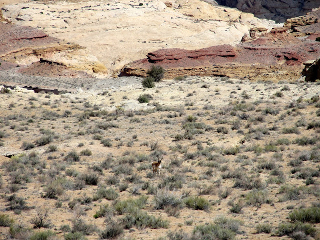
Almost two weeks ago I hiked in the San Rafael Reef between Little Wild Horse Canyon and Chute Canyon. I chose the location largely because the fins/cracks in the Reef east of LWHC intrigued me. I also liked that there was a semi-major drainage between LWH and Chute for which there was no information on the web. It was perfect for my kind of exploration, but any lesser drainage in the Reef would have been fine. I parked the car on the shoulder of the paved Little Wild Horse Road and started hiking by 10:15AM. The weather forecast called for partly cloudy and a 20% chance of rain, though the clouds were light and high and fast-moving, with plenty of blue sky between. I hiked cross-country and encountered a pronghorn who seemed disturbed by my presence. He made a strange noise--sort of a mix between a snort and a raven's caw. He kept getting closer to me until I lost sight of him behind a hill and never saw him again.
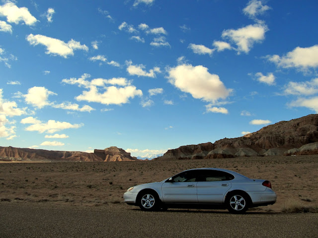
Parked just off the Little Wild Horse road
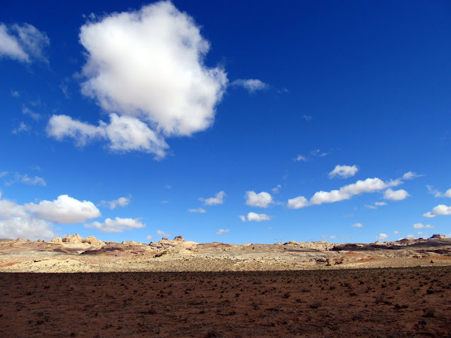
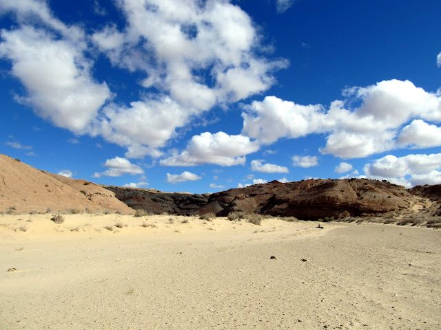
The start of the hike. The first mile was flat and uninteresting.
This pronghorn seemed pissed at me. He was making some strange sound and kept coming closer to me.
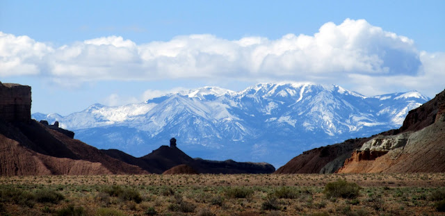
View of the Henry Mountains through Wild Horse Canyon
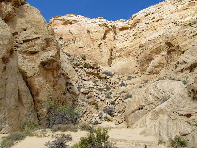
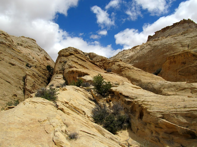
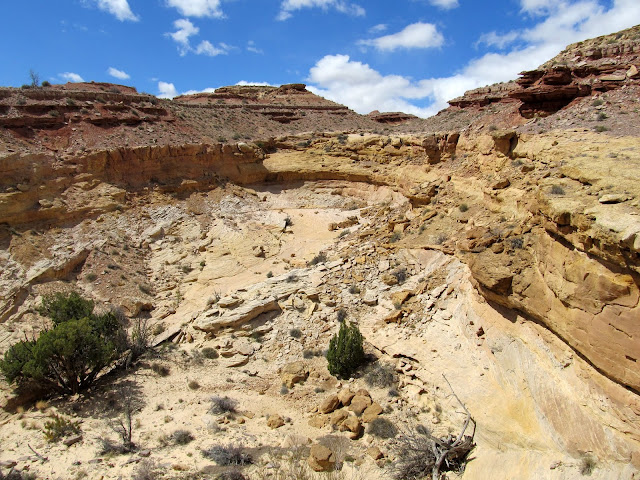
The first mile-ish wasn't very interesting--just a simple walk through a sandy/gravely wash. As the San Rafael Reef rose ahead of me and the canyon narrowed up, the canyon bottom became rough with typical Carmel Formation rocks. That section quickly passed behind me and I encountered the top of the Navajo Sandstone. There, potholes had formed and Torrey was able to get a drink. I came to a fork in the canyon and took the left fork, which I'd already decided upon based on my research in Google Earth. The right fork looked more interesting, but I was saving that for the return hike. The canyon was your standard Reef canyon--sandy bottom mixed with slickrock, with occasional dryfalls and potholes--except that my upstream progress ended in a box canyon with a jumble of rocks instead of a dryfall.
View up the wash I hiked in
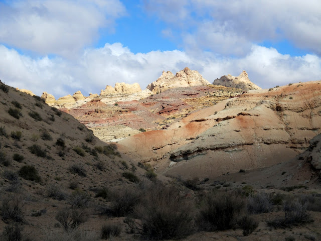
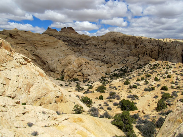
San Rafael Reef
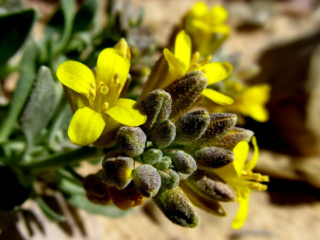
Wildflowers
Here the canyon begins to deepen
Potholes
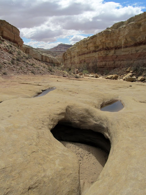
Potholes near a junction in the canyon. I went left here and later returned down the fork visible in this photo.
In the left fork
A view over the canyon toward Wild Horse Butte
In the left fork

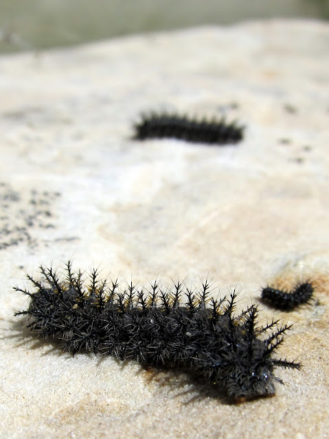
Caterpillars
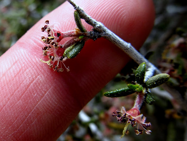
Tiny flowers on a bush
The drainage abruptly ended here
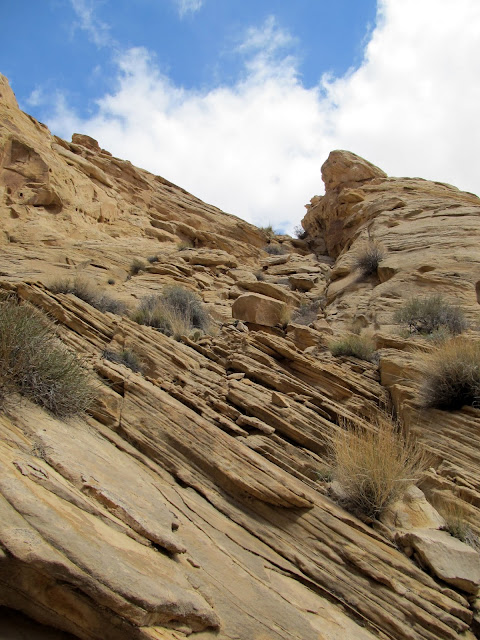
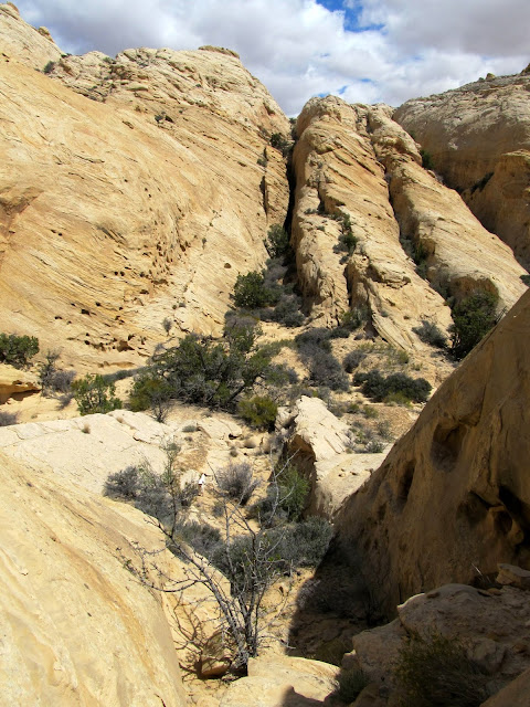
I climbed up a small gap in the canyon wall to my right (northeast) into another small valley. I knew that from there I'd need to navigate some cracks and fins to get farther northeast into the upper right fork that I'd passed up earlier. I immediately saw a fin that looked like it could be ascended to get me into the next valley, but I explored the current valley up- and downstream looking for an easier route. Finding none (but trying a joint between fins that narrowed down to nothing), I returned to the fin and started the climb. A couple of spots that looked sketchy from below turned out to be quite easy. I found out just how easy because, before I could get a close look, Torrey would ascend and disappear over each spot with little effort.
The scramble into the next drainage over
View into the next drainage
A joint between the fins that I'd hoped would lead me into the next drainage, but it got too skinny
View up the fins that I climbed over
View down the fin into the drainage from which I came
The topography on the other side of the fin was crazy. I descended into the next valley easily enough, but once I reached the bottom of the drainage I immediately ran into a pothole that, once I entered it, I probably couldn't climb back out of on the up-canyon side. Since I couldn't see far beyond the pothole I decided not to drop into it. I climbed out of the canyon and did some thinking. I wasn't confident that the terrain would be easy enough to return to the car down this drainage in a reasonable amount of time. I also didn't want to return the way I'd come. I decided to give myself 30 minutes to try descending this part of the canyon and, if it didn't look promising by then, I would turn around and retrace my entry route.
View into the next drainage over
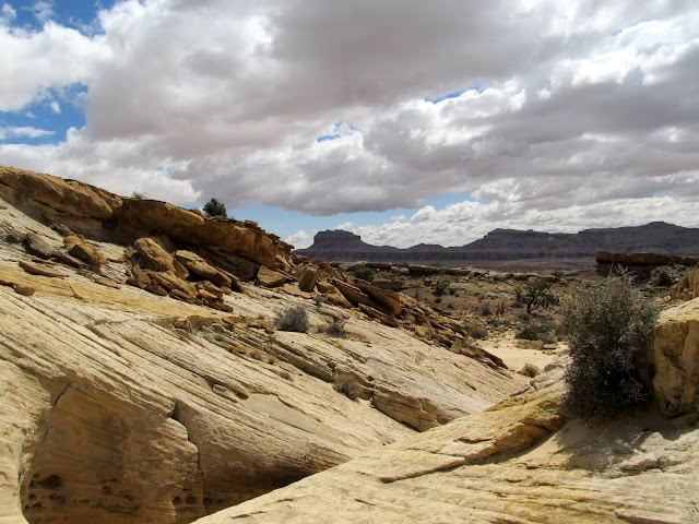
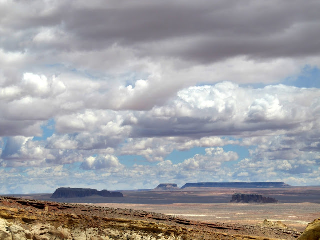
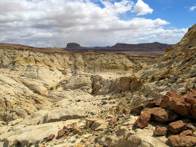
Gilson Butte, Molly's Castle, and the Flat Tops
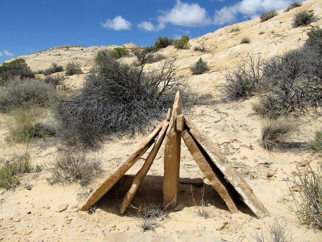
Strange place for a man-made cairn
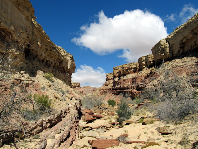
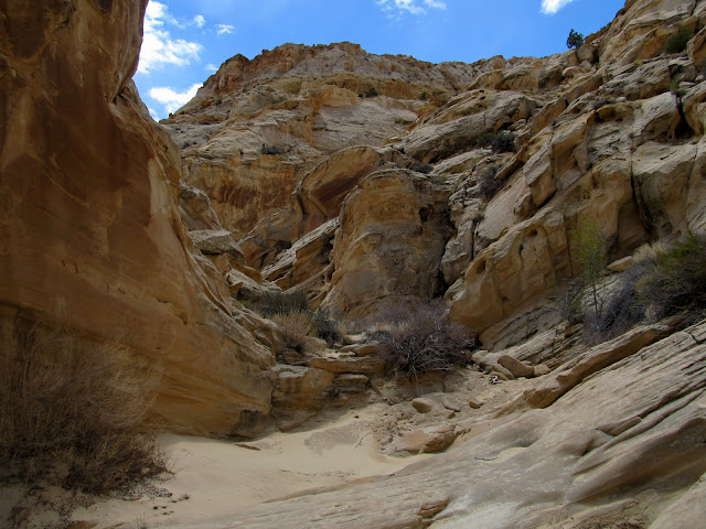
In the canyon
This section stopped me from proceeding down the canyon
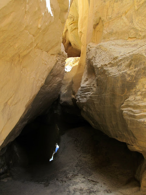
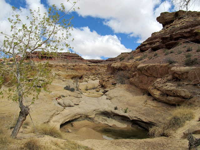
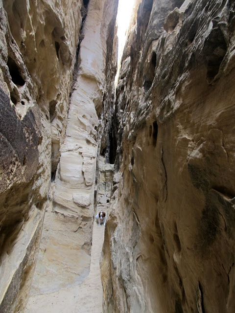
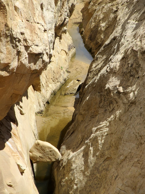
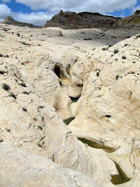
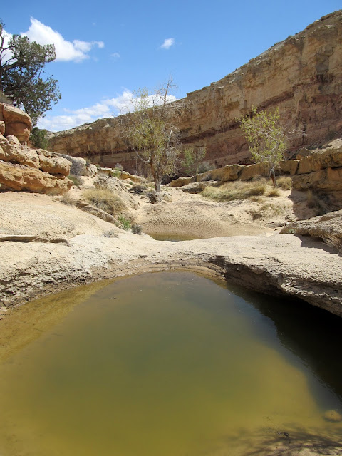
I went high above the canyon rim to where the terrain leveled out a bit and followed the rim downstream. Barely 20 minutes later I was back in the bottom of the canyon, and the going had been easier than it appeared from farther up. There were some deep, water-filled potholes ahead of me but they looked easy to bypass, so I sat down on a ledge and took a rest/snack break. The pothole section was followed by a slot section filled with some water. I dropped back into the canyon just below the slot then hiked up it a short distance to have a look. This canyon would definitely be fun to fully descend with the proper equipment.
Finding my way down-canyon
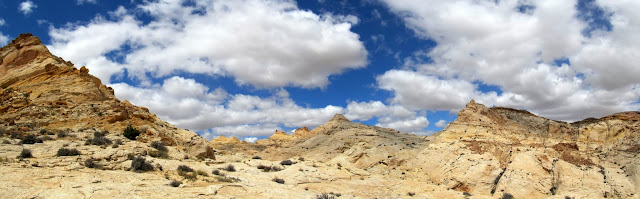
Four-shot pano of the upper drainage
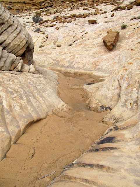
Slot below the potholes
Potholes
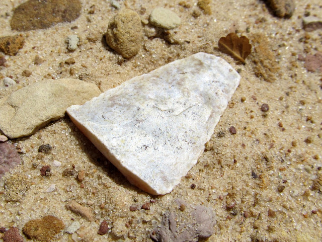
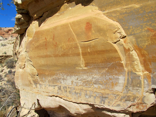
The rest of the canyon back to the fork was easy. It was mostly a flat, sandy bottom with one easily bypassable dryfall. I wasn't at all surprised to find a broken arrowhead before reaching the fork--I'd been keeping my eye out for them the entire hike. I explored a small side canyon before the fork and found a nice pictograph panel near an alcove. Part of the alcove had collapsed and it had a tiny seep of water coming from the back wall. I'm sure it would have made a decent shelter a few hundred years ago. The pictographs were a little unusual, but many of the details were typical of San Rafael Reef rock art (such as designs scratched over the top of the pigment). The main figure was large, perhaps 18" tall, and the other designs were unclear or possibly unfinished. Seeing both an arrowhead and rock art on this trip served to make it nearly perfect. Maybe a bighorn sheep or rattlesnake sighting would have completed it.") I got back to the car about 5.5 hours after starting the hike and I covered 6.6 miles. Yes, you can tell I dawdle quite a bit, but that's precisely why I venture out there.
I got back to the car about 5.5 hours after starting the hike and I covered 6.6 miles. Yes, you can tell I dawdle quite a bit, but that's precisely why I venture out there.
View down the canyon
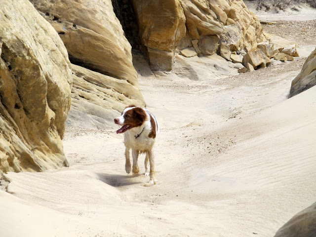
Torrey
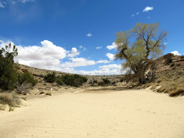
Wide, sandy section of canyon
Arrowhead
I avoided the dryfall by scrambling down the rocky terrain just right of center
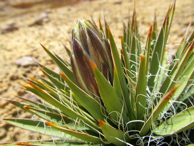
Yucca about to bloom
More pools, almost back to the canyon junction to join my previous route
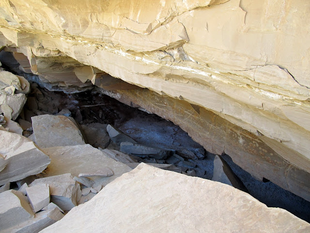
An alcove with some fairly recent rockfall in front of it
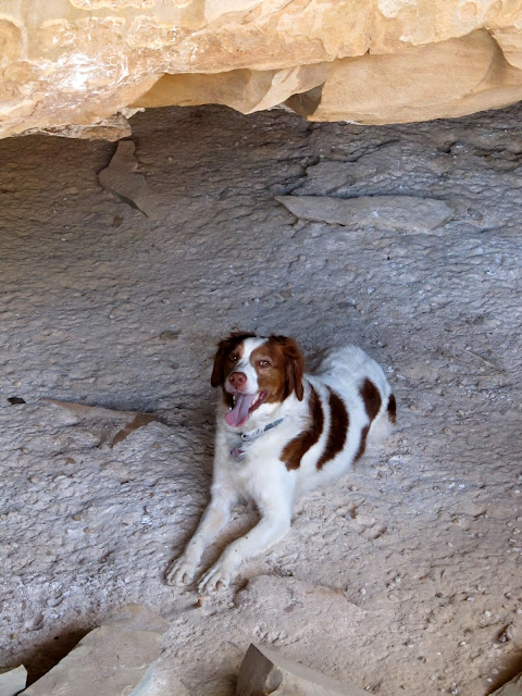
Torrey in the alcove
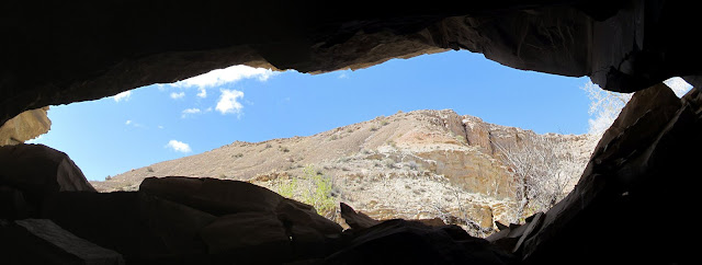
View out of the alcove
Pictographs
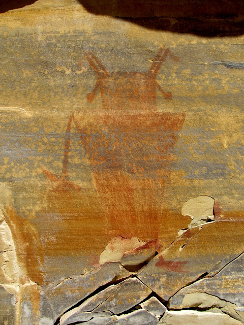
Pictographs
Full photo gallery:
https://picasaweb.google.com/Dennis.Udink/SanRafaelReefBetweenLWHAndChute
GPS tracklog and photo waypoints:
[parsehtml]<iframe width="640" height="480" frameborder="0" scrolling="no" marginheight="0" marginwidth="0" src="https://maps.google.com/maps?q=http:%2F%2Fudink.org%2Fgeo%2FSanRafaelReefBetweenLWHandChute.kmz&hl=en&sll=39.499761,-111.547028&sspn=4.907901,10.821533&t=h&ie=UTF8&ll=38.589772,-110.767422&spn=0.032202,0.054932&z=14&output=embed"></iframe><br /><small><a href="https://maps.google.com/maps?q=http:%2F%2Fudink.org%2Fgeo%2FSanRafaelReefBetweenLWHandChute.kmz&hl=en&sll=39.499761,-111.547028&sspn=4.907901,10.821533&t=h&ie=UTF8&ll=38.589772,-110.767422&spn=0.032202,0.054932&z=14&source=embed" style="color:#0000FF;text-align:left">View Larger Map</a></small>[/parsehtml]http://udink.org/geo/SanRafaelReefBetweenLWHandChute.kmz
Featured image for home page:

Parked just off the Little Wild Horse road
The start of the hike. The first mile was flat and uninteresting.
This pronghorn seemed pissed at me. He was making some strange sound and kept coming closer to me.
View of the Henry Mountains through Wild Horse Canyon
The first mile-ish wasn't very interesting--just a simple walk through a sandy/gravely wash. As the San Rafael Reef rose ahead of me and the canyon narrowed up, the canyon bottom became rough with typical Carmel Formation rocks. That section quickly passed behind me and I encountered the top of the Navajo Sandstone. There, potholes had formed and Torrey was able to get a drink. I came to a fork in the canyon and took the left fork, which I'd already decided upon based on my research in Google Earth. The right fork looked more interesting, but I was saving that for the return hike. The canyon was your standard Reef canyon--sandy bottom mixed with slickrock, with occasional dryfalls and potholes--except that my upstream progress ended in a box canyon with a jumble of rocks instead of a dryfall.
View up the wash I hiked in
San Rafael Reef
Wildflowers
Here the canyon begins to deepen
Potholes
Potholes near a junction in the canyon. I went left here and later returned down the fork visible in this photo.
In the left fork
A view over the canyon toward Wild Horse Butte
In the left fork
Caterpillars
Tiny flowers on a bush
The drainage abruptly ended here
I climbed up a small gap in the canyon wall to my right (northeast) into another small valley. I knew that from there I'd need to navigate some cracks and fins to get farther northeast into the upper right fork that I'd passed up earlier. I immediately saw a fin that looked like it could be ascended to get me into the next valley, but I explored the current valley up- and downstream looking for an easier route. Finding none (but trying a joint between fins that narrowed down to nothing), I returned to the fin and started the climb. A couple of spots that looked sketchy from below turned out to be quite easy. I found out just how easy because, before I could get a close look, Torrey would ascend and disappear over each spot with little effort.
The scramble into the next drainage over
View into the next drainage
A joint between the fins that I'd hoped would lead me into the next drainage, but it got too skinny
View up the fins that I climbed over
View down the fin into the drainage from which I came
The topography on the other side of the fin was crazy. I descended into the next valley easily enough, but once I reached the bottom of the drainage I immediately ran into a pothole that, once I entered it, I probably couldn't climb back out of on the up-canyon side. Since I couldn't see far beyond the pothole I decided not to drop into it. I climbed out of the canyon and did some thinking. I wasn't confident that the terrain would be easy enough to return to the car down this drainage in a reasonable amount of time. I also didn't want to return the way I'd come. I decided to give myself 30 minutes to try descending this part of the canyon and, if it didn't look promising by then, I would turn around and retrace my entry route.
View into the next drainage over
Gilson Butte, Molly's Castle, and the Flat Tops
Strange place for a man-made cairn
In the canyon
This section stopped me from proceeding down the canyon
I went high above the canyon rim to where the terrain leveled out a bit and followed the rim downstream. Barely 20 minutes later I was back in the bottom of the canyon, and the going had been easier than it appeared from farther up. There were some deep, water-filled potholes ahead of me but they looked easy to bypass, so I sat down on a ledge and took a rest/snack break. The pothole section was followed by a slot section filled with some water. I dropped back into the canyon just below the slot then hiked up it a short distance to have a look. This canyon would definitely be fun to fully descend with the proper equipment.
Finding my way down-canyon
Four-shot pano of the upper drainage
Slot below the potholes
Potholes
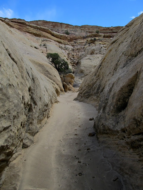
The rest of the canyon back to the fork was easy. It was mostly a flat, sandy bottom with one easily bypassable dryfall. I wasn't at all surprised to find a broken arrowhead before reaching the fork--I'd been keeping my eye out for them the entire hike. I explored a small side canyon before the fork and found a nice pictograph panel near an alcove. Part of the alcove had collapsed and it had a tiny seep of water coming from the back wall. I'm sure it would have made a decent shelter a few hundred years ago. The pictographs were a little unusual, but many of the details were typical of San Rafael Reef rock art (such as designs scratched over the top of the pigment). The main figure was large, perhaps 18" tall, and the other designs were unclear or possibly unfinished. Seeing both an arrowhead and rock art on this trip served to make it nearly perfect. Maybe a bighorn sheep or rattlesnake sighting would have completed it.
I got back to the car about 5.5 hours after starting the hike and I covered 6.6 miles. Yes, you can tell I dawdle quite a bit, but that's precisely why I venture out there.View down the canyon
Torrey
Wide, sandy section of canyon
Arrowhead
I avoided the dryfall by scrambling down the rocky terrain just right of center
Yucca about to bloom
More pools, almost back to the canyon junction to join my previous route
An alcove with some fairly recent rockfall in front of it
Torrey in the alcove
View out of the alcove
Pictographs
Pictographs
Full photo gallery:
https://picasaweb.google.com/Dennis.Udink/SanRafaelReefBetweenLWHAndChute
GPS tracklog and photo waypoints:
[parsehtml]<iframe width="640" height="480" frameborder="0" scrolling="no" marginheight="0" marginwidth="0" src="https://maps.google.com/maps?q=http:%2F%2Fudink.org%2Fgeo%2FSanRafaelReefBetweenLWHandChute.kmz&hl=en&sll=39.499761,-111.547028&sspn=4.907901,10.821533&t=h&ie=UTF8&ll=38.589772,-110.767422&spn=0.032202,0.054932&z=14&output=embed"></iframe><br /><small><a href="https://maps.google.com/maps?q=http:%2F%2Fudink.org%2Fgeo%2FSanRafaelReefBetweenLWHandChute.kmz&hl=en&sll=39.499761,-111.547028&sspn=4.907901,10.821533&t=h&ie=UTF8&ll=38.589772,-110.767422&spn=0.032202,0.054932&z=14&source=embed" style="color:#0000FF;text-align:left">View Larger Map</a></small>[/parsehtml]http://udink.org/geo/SanRafaelReefBetweenLWHandChute.kmz
Featured image for home page: