IntrepidXJ
ADVENTR
- Joined
- Jan 17, 2012
- Messages
- 3,488
The San Juan River | Sand Island to Mexican Hat
Sunday - Wednesday, May 11-14, 2014
We didn't have any luck in the San Juan River lottery again this year, but I managed to grab an open date on the calendar for a time my friends and I would be able to go during the month of May. Like last year, I was only able to secure a permit from Sand Island to Mexican Hat. It was probably a good thing because I really didn't want to take too much more time off from work in May since I had already taken a few days for my backpacking trip in Salt Creek Canyon and I have a few other days scheduled off for later in the month.
On Sunday afternoon I picked up Jackson and we drove down to Montezuma Canyon to do a little hiking and exploring before starting our float down the San Juan River Monday morning. We found a few new rock art panels and visited another site that I've been to a few times before, which I finally got a decent photo of. We camped in the canyon at a nice site I've camped at a few times before. It was pretty windy in the evening and most of the night, but the campsite was in a nice sheltered place which kept most of the wind away from us, though we could hear it pretty loudly throughout the night.
Following a cow trail on the search for rock art.

Cow Trail by IntrepidXJ, on Flickr
A nice large pictograph panel I was looking for.

Pictograph Alcove by IntrepidXJ, on Flickr
We found a few petroglyph panels nearby.

Angled Panel by IntrepidXJ, on Flickr
Glen Canyon Style figures.

Glen Canyon Style by IntrepidXJ, on Flickr

High Panel by IntrepidXJ, on Flickr
Finally, a decent photo of this interesting petroglyph panel. Every time I've been here before, part of the panel has been in the shade and the sun. No shadows this time!

Prayer Stick Panel by IntrepidXJ, on Flickr
We met the rest of our group at the Twin Rocks Cafe in Bluff for breakfast on Monday morning before heading over to Sand Island and unloading our boats and gear. We took my Jeep down to Mexican Hat to use as the shuttle vehicle for when we would get off the river a few days later. The storm front that had moved through overnight had left some cooler temperatures behind it, but it certainly wasn't nearly as bad as the cold and rainy start we had last year. The temperature was still a bit cooler than I would have liked it to be, but at least we weren't paddling through any rain or wind during the rest of our trip. We even had some nice clouds in the sky on the first day. We made an obligatory stop at the Lower Butler Wash petroglyphs after a few hours on the river, but decided to skip the upper Butler Wash Panels and River House since we had all visited those locations numerous times before. We did stop to hike to the Desecration Panel again, which was a good decision since we found some new panels that we had missed on the previous trip. Plus, the reflected light on the sandstone wall was much nicer this time around for better photos.
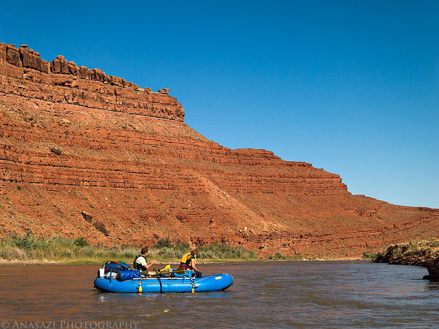
Steve is waiting for the glue to dry on a patch in his raft while the rest of us load our gear into our inflatable kayaks.
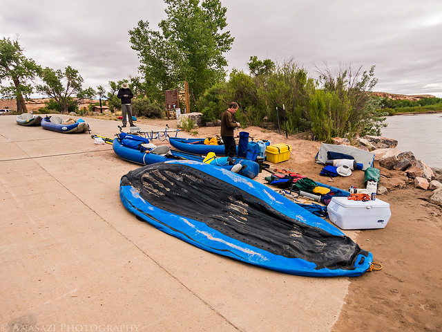
Getting Ready by IntrepidXJ, on Flickr
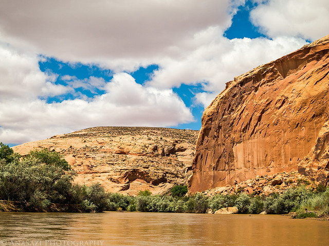
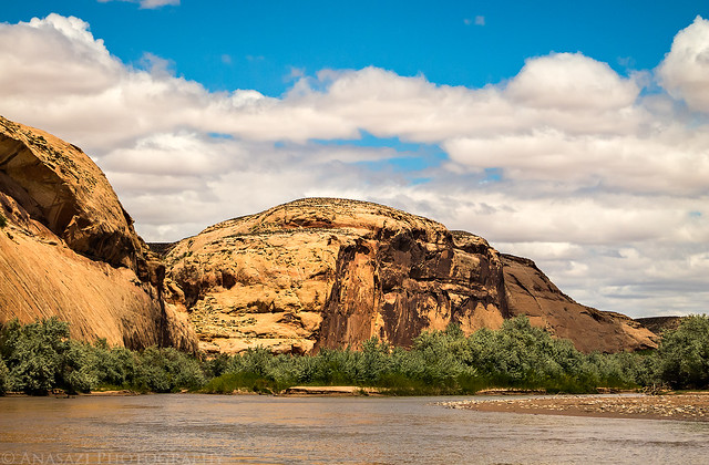
Our group under the Tiger Wall.
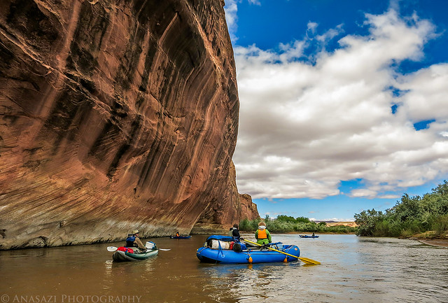
Tiger Wall by IntrepidXJ, on Flickr
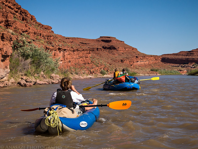
Jackson paddles ahead under cloudy skies.
Jackson Paddling by IntrepidXJ, on Flickr
Soon the sky starts to clear up and leaves some nice clouds behind.
Below Cliffs by IntrepidXJ, on Flickr
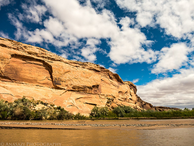
Nice Clouds by IntrepidXJ, on Flickr
Approaching the mouth of Butler Wash.
Mouth of Butler Wash by IntrepidXJ, on Flickr
There were many blooming cactus's near Butler Wash.
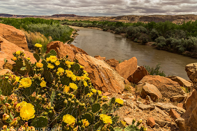
Flowers Over the River by IntrepidXJ, on Flickr
This one was a nice yellow and red color.
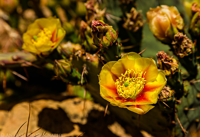
Yellow & Red by IntrepidXJ, on Flickr
Of course, there were plenty of petroglyphs around, too.

Rider by IntrepidXJ, on Flickr

Out of the Shadows by IntrepidXJ, on Flickr
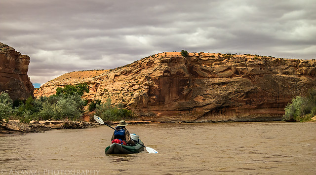
Leaving Butler Wash, we let the river carry us further downstream.
Leaving Butler by IntrepidXJ, on Flickr
Shortly after leaving Butler Wash we stopped again and hiked up to the impressive Desecration Panel. Here's a view back down towards the river from near the panels.
San Juan River by IntrepidXJ, on Flickr
Here's a few of the petroglyphs we missed the last time we were here. I guess it helped that we started hiking from a different spot this time. I love the way the petroglyphs were pecked between the natural diagonal lines of the sandstone. The lichen surrounding them is a nice touch, too.

Lichen & Lines by IntrepidXJ, on Flickr

Striped Panel by IntrepidXJ, on Flickr

Big Headdress by IntrepidXJ, on Flickr

Desecration Abstract by IntrepidXJ, on Flickr

Lines by IntrepidXJ, on Flickr
We hiked all the way over to the main Desecration Panel. There were a lot of other petroglyphs along this sheer sandstone cliff. I could have spent all day exploring just this area.

The Desecration Panel by IntrepidXJ, on Flickr

Ramp Panel by IntrepidXJ, on Flickr

Desecrated by IntrepidXJ, on Flickr
We were hoping to spend the night near Chinle Wash this year (like we had also hoped to do last year), but it was taken by someone who had rushed down the river past us to get it. We took our time and enjoyed the river, so I guess we lost out... We ended up at the Big Stick Campsite again, which is a really nice site, it's just on the wrong side of the river to hike up Chinle Wash from camp.
My boat at the Big Stick camp.
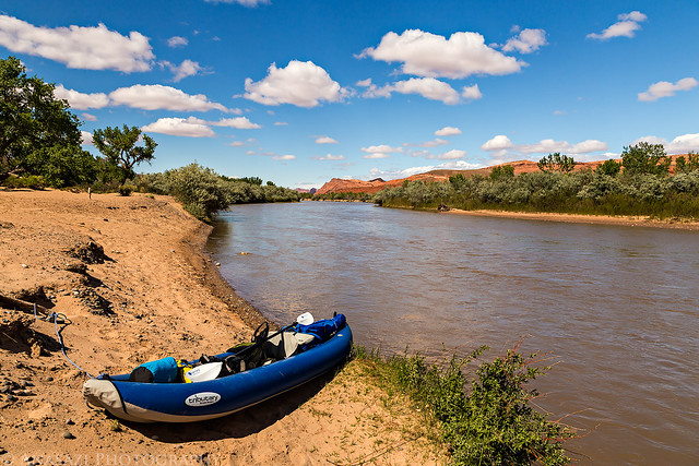
Big Stick by IntrepidXJ, on Flickr
It was a bit cold this evening and there was some blowing sand, so I thought it was best to use the rainfly.
Big Stick Tent by IntrepidXJ, on Flickr
The nice sandy beach of Big Stick under the Mule Ear.
Big Stick Camp by IntrepidXJ, on Flickr
As the sun was setting, I hiked along the river from camp and took a few photos along the way.
Mule Ear Diatreme by IntrepidXJ, on Flickr
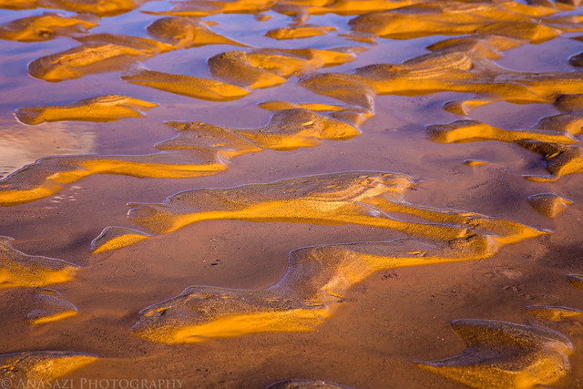
Sand & Water by IntrepidXJ, on Flickr
Blue River by IntrepidXJ, on Flickr
Warming up around the fire before retiring to our tents for some much needed sleep.
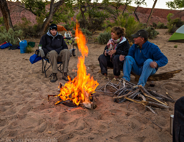
Around the Fire by IntrepidXJ, on Flickr
The following morning we packed up camp and floated a short distance to the other side of the river so we could hike up Chinle Wash. After bushwhacking through the vegetation along the shore we followed a sandy trail to the wash and followed it up the canyon to visit a few ruins and rock art sites. Hopefully one day I can return and spend much more time hiking further up the canyon.

Wood Roof by IntrepidXJ, on Flickr

Ledge Ruins by IntrepidXJ, on Flickr

Duckheads by IntrepidXJ, on Flickr

Sheep by IntrepidXJ, on Flickr

Spiral Detail by IntrepidXJ, on Flickr

The Journey by IntrepidXJ, on Flickr

Baseball Man Panel by IntrepidXJ, on Flickr

Baseball Man by IntrepidXJ, on Flickr

Walking Shield by IntrepidXJ, on Flickr
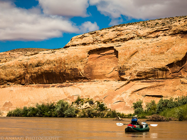
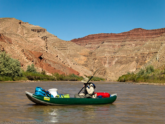
After our hike, we continued downstream into San Juan Canyon and stopped for lunch around the first large bend in the river. We spent the rest of the day enjoying this beautiful stretch of canyon and had a little excitement when we reached the few rapids found here. It was much nicer paddling through through the rapids and The Narrows this year without the strong winds and cold temperatures. A much more pleasurable experience. We were hoping to camp at the Fossil Camp, but as seems to be the case with the sites we want, it was already occupied. I really didn't want to copy the exact same trip from last year, so we ended up camping at the mouth of Lime Creek for our final night. It was actually a very nice site with some great scenery.
In the depths of San Juan Canyon
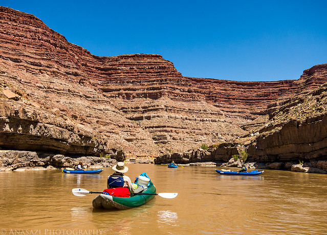
San Juan Canyon by IntrepidXJ, on Flickr
We came across these bighorn sheep who appeared to be so thirsty that they didn't mind as we floated by.
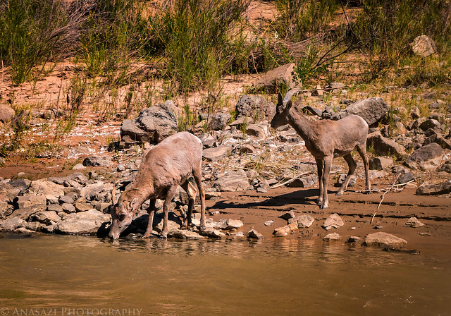
Drinking by IntrepidXJ, on Flickr
Jackson by IntrepidXJ, on Flickr
Stopped at the mouth of Lime Creek.
Mouth of Lime Creek by IntrepidXJ, on Flickr
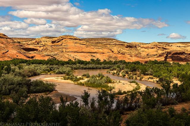
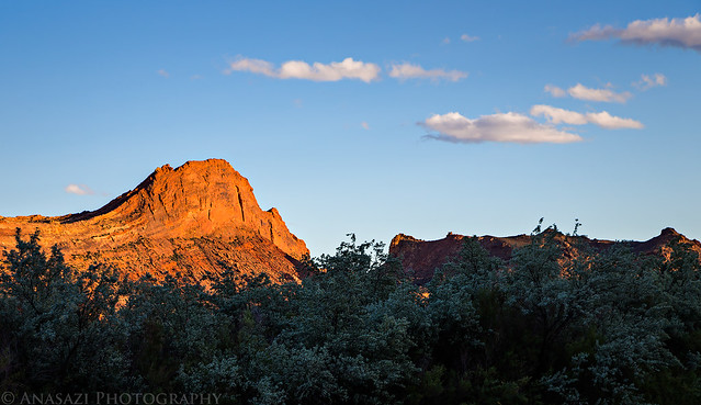
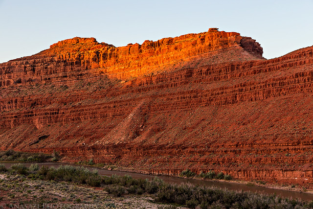
There was a nice view of Raplee Ridge from camp.
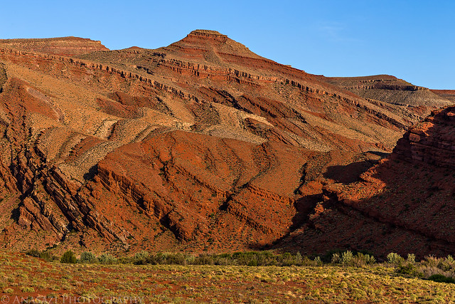
Raplee Ridge by IntrepidXJ, on Flickr
Looking up Lime Creek.
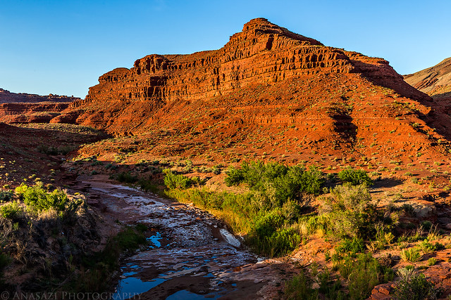
Lime Creek by IntrepidXJ, on Flickr
A pretty nice reflection.
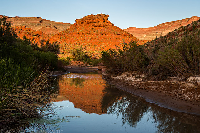
Lime Creek Reflection by IntrepidXJ, on Flickr
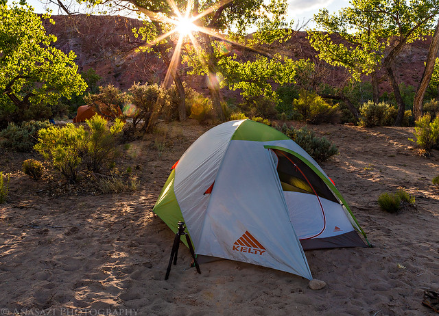
My tent on the second night. There was more blowing sand when I setup camp, so the rainfly went on again...
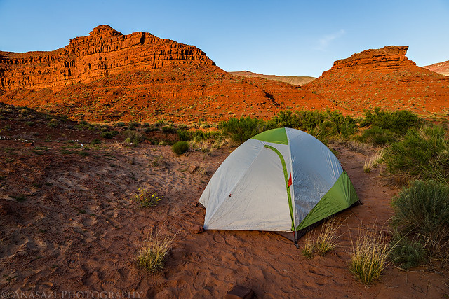
Lime Creek Camp by IntrepidXJ, on Flickr
The final day was a short one since we were not too far from the takeout at Mexican Hat. We spent a few relaxing hours floating down the the river on the warmest day yet. We ended up reaching the boat ramp before lunchtime.
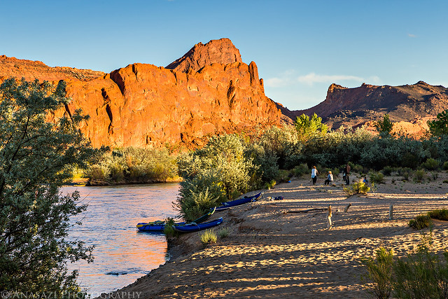
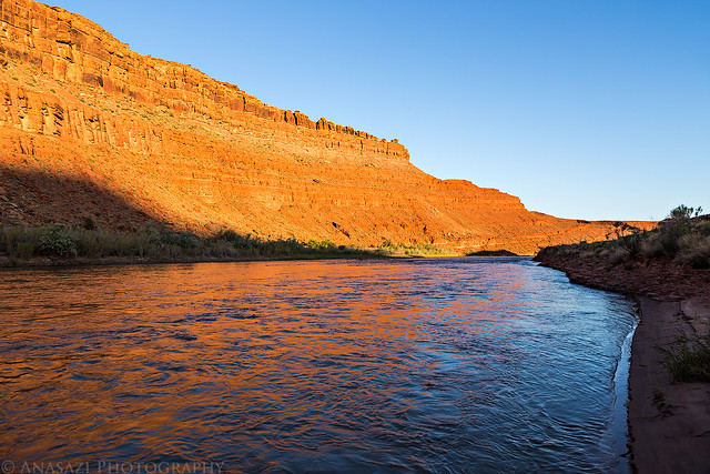
I was up early enough to photograph the sunrise.
Morning Light by IntrepidXJ, on Flickr
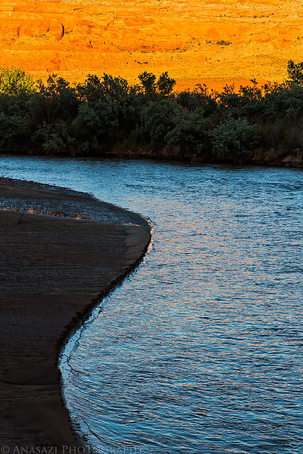
Reflected light on moving water.
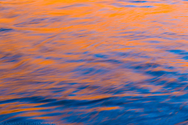
Light on the River by IntrepidXJ, on Flickr
San Juan Morning by IntrepidXJ, on Flickr
On our way towards Mexican Hat...
Last Stretch by IntrepidXJ, on Flickr
Leaving Camp by IntrepidXJ, on Flickr
Passing under Mexican Hat Rock.
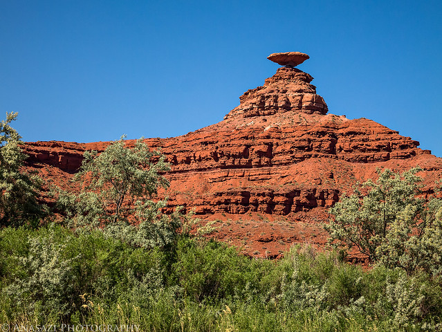
Mexican Hat Rock by IntrepidXJ, on Flickr
It really was a nice trip, but next year I would really like to experience the stretch of the river between Mexican Hat and Clay Hills Crossing. Hopefully we will have better luck in the lottery...
>> San Juan Canyon Photo Gallery
>> The Original Trip Report on ADVENTR.CO
Sunday - Wednesday, May 11-14, 2014
We didn't have any luck in the San Juan River lottery again this year, but I managed to grab an open date on the calendar for a time my friends and I would be able to go during the month of May. Like last year, I was only able to secure a permit from Sand Island to Mexican Hat. It was probably a good thing because I really didn't want to take too much more time off from work in May since I had already taken a few days for my backpacking trip in Salt Creek Canyon and I have a few other days scheduled off for later in the month.
On Sunday afternoon I picked up Jackson and we drove down to Montezuma Canyon to do a little hiking and exploring before starting our float down the San Juan River Monday morning. We found a few new rock art panels and visited another site that I've been to a few times before, which I finally got a decent photo of. We camped in the canyon at a nice site I've camped at a few times before. It was pretty windy in the evening and most of the night, but the campsite was in a nice sheltered place which kept most of the wind away from us, though we could hear it pretty loudly throughout the night.
Following a cow trail on the search for rock art.
Cow Trail by IntrepidXJ, on Flickr
A nice large pictograph panel I was looking for.
Pictograph Alcove by IntrepidXJ, on Flickr
We found a few petroglyph panels nearby.
Angled Panel by IntrepidXJ, on Flickr
Glen Canyon Style figures.
Glen Canyon Style by IntrepidXJ, on Flickr
High Panel by IntrepidXJ, on Flickr
Finally, a decent photo of this interesting petroglyph panel. Every time I've been here before, part of the panel has been in the shade and the sun. No shadows this time!
Prayer Stick Panel by IntrepidXJ, on Flickr
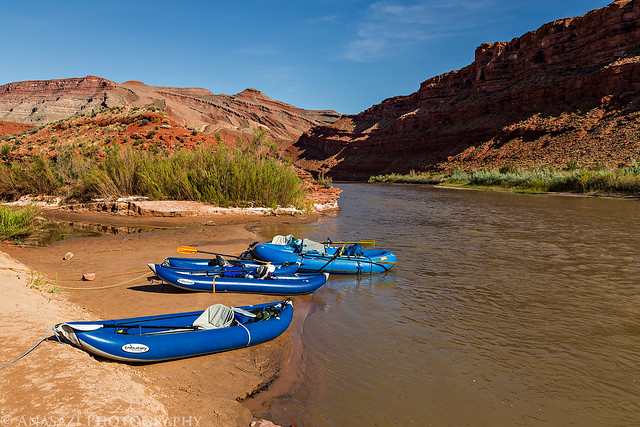
We met the rest of our group at the Twin Rocks Cafe in Bluff for breakfast on Monday morning before heading over to Sand Island and unloading our boats and gear. We took my Jeep down to Mexican Hat to use as the shuttle vehicle for when we would get off the river a few days later. The storm front that had moved through overnight had left some cooler temperatures behind it, but it certainly wasn't nearly as bad as the cold and rainy start we had last year. The temperature was still a bit cooler than I would have liked it to be, but at least we weren't paddling through any rain or wind during the rest of our trip. We even had some nice clouds in the sky on the first day. We made an obligatory stop at the Lower Butler Wash petroglyphs after a few hours on the river, but decided to skip the upper Butler Wash Panels and River House since we had all visited those locations numerous times before. We did stop to hike to the Desecration Panel again, which was a good decision since we found some new panels that we had missed on the previous trip. Plus, the reflected light on the sandstone wall was much nicer this time around for better photos.
Steve is waiting for the glue to dry on a patch in his raft while the rest of us load our gear into our inflatable kayaks.
Getting Ready by IntrepidXJ, on Flickr
Our group under the Tiger Wall.
Tiger Wall by IntrepidXJ, on Flickr
Jackson paddles ahead under cloudy skies.
Jackson Paddling by IntrepidXJ, on Flickr
Soon the sky starts to clear up and leaves some nice clouds behind.
Below Cliffs by IntrepidXJ, on Flickr
Nice Clouds by IntrepidXJ, on Flickr
Approaching the mouth of Butler Wash.
Mouth of Butler Wash by IntrepidXJ, on Flickr
There were many blooming cactus's near Butler Wash.
Flowers Over the River by IntrepidXJ, on Flickr
This one was a nice yellow and red color.
Yellow & Red by IntrepidXJ, on Flickr
Of course, there were plenty of petroglyphs around, too.
Rider by IntrepidXJ, on Flickr
Out of the Shadows by IntrepidXJ, on Flickr
Leaving Butler Wash, we let the river carry us further downstream.
Leaving Butler by IntrepidXJ, on Flickr
Shortly after leaving Butler Wash we stopped again and hiked up to the impressive Desecration Panel. Here's a view back down towards the river from near the panels.
San Juan River by IntrepidXJ, on Flickr
Here's a few of the petroglyphs we missed the last time we were here. I guess it helped that we started hiking from a different spot this time. I love the way the petroglyphs were pecked between the natural diagonal lines of the sandstone. The lichen surrounding them is a nice touch, too.
Lichen & Lines by IntrepidXJ, on Flickr
Striped Panel by IntrepidXJ, on Flickr
Big Headdress by IntrepidXJ, on Flickr
Desecration Abstract by IntrepidXJ, on Flickr
Lines by IntrepidXJ, on Flickr
We hiked all the way over to the main Desecration Panel. There were a lot of other petroglyphs along this sheer sandstone cliff. I could have spent all day exploring just this area.
The Desecration Panel by IntrepidXJ, on Flickr
Ramp Panel by IntrepidXJ, on Flickr
Desecrated by IntrepidXJ, on Flickr
We were hoping to spend the night near Chinle Wash this year (like we had also hoped to do last year), but it was taken by someone who had rushed down the river past us to get it. We took our time and enjoyed the river, so I guess we lost out... We ended up at the Big Stick Campsite again, which is a really nice site, it's just on the wrong side of the river to hike up Chinle Wash from camp.
My boat at the Big Stick camp.
Big Stick by IntrepidXJ, on Flickr
It was a bit cold this evening and there was some blowing sand, so I thought it was best to use the rainfly.
Big Stick Tent by IntrepidXJ, on Flickr
The nice sandy beach of Big Stick under the Mule Ear.
Big Stick Camp by IntrepidXJ, on Flickr
As the sun was setting, I hiked along the river from camp and took a few photos along the way.
Mule Ear Diatreme by IntrepidXJ, on Flickr
Sand & Water by IntrepidXJ, on Flickr
Blue River by IntrepidXJ, on Flickr
Warming up around the fire before retiring to our tents for some much needed sleep.
Around the Fire by IntrepidXJ, on Flickr
The following morning we packed up camp and floated a short distance to the other side of the river so we could hike up Chinle Wash. After bushwhacking through the vegetation along the shore we followed a sandy trail to the wash and followed it up the canyon to visit a few ruins and rock art sites. Hopefully one day I can return and spend much more time hiking further up the canyon.
Wood Roof by IntrepidXJ, on Flickr
Ledge Ruins by IntrepidXJ, on Flickr
Duckheads by IntrepidXJ, on Flickr
Sheep by IntrepidXJ, on Flickr
Spiral Detail by IntrepidXJ, on Flickr
The Journey by IntrepidXJ, on Flickr
Baseball Man Panel by IntrepidXJ, on Flickr
Baseball Man by IntrepidXJ, on Flickr
Walking Shield by IntrepidXJ, on Flickr
After our hike, we continued downstream into San Juan Canyon and stopped for lunch around the first large bend in the river. We spent the rest of the day enjoying this beautiful stretch of canyon and had a little excitement when we reached the few rapids found here. It was much nicer paddling through through the rapids and The Narrows this year without the strong winds and cold temperatures. A much more pleasurable experience. We were hoping to camp at the Fossil Camp, but as seems to be the case with the sites we want, it was already occupied. I really didn't want to copy the exact same trip from last year, so we ended up camping at the mouth of Lime Creek for our final night. It was actually a very nice site with some great scenery.
In the depths of San Juan Canyon
San Juan Canyon by IntrepidXJ, on Flickr
We came across these bighorn sheep who appeared to be so thirsty that they didn't mind as we floated by.
Drinking by IntrepidXJ, on Flickr
Jackson by IntrepidXJ, on Flickr
Stopped at the mouth of Lime Creek.
Mouth of Lime Creek by IntrepidXJ, on Flickr
There was a nice view of Raplee Ridge from camp.
Raplee Ridge by IntrepidXJ, on Flickr
Looking up Lime Creek.
Lime Creek by IntrepidXJ, on Flickr
A pretty nice reflection.
Lime Creek Reflection by IntrepidXJ, on Flickr
My tent on the second night. There was more blowing sand when I setup camp, so the rainfly went on again...
Lime Creek Camp by IntrepidXJ, on Flickr
The final day was a short one since we were not too far from the takeout at Mexican Hat. We spent a few relaxing hours floating down the the river on the warmest day yet. We ended up reaching the boat ramp before lunchtime.
I was up early enough to photograph the sunrise.
Morning Light by IntrepidXJ, on Flickr
Reflected light on moving water.
Light on the River by IntrepidXJ, on Flickr
San Juan Morning by IntrepidXJ, on Flickr
On our way towards Mexican Hat...
Last Stretch by IntrepidXJ, on Flickr
Leaving Camp by IntrepidXJ, on Flickr
Passing under Mexican Hat Rock.
Mexican Hat Rock by IntrepidXJ, on Flickr
It really was a nice trip, but next year I would really like to experience the stretch of the river between Mexican Hat and Clay Hills Crossing. Hopefully we will have better luck in the lottery...
>> San Juan Canyon Photo Gallery
>> The Original Trip Report on ADVENTR.CO