- Joined
- Jan 4, 2015
- Messages
- 2,901
I don't know about you, but I don't normally think of the Wasatch as a backpacking destination. Dayhiking? Peakbagging? Scrambling? Maybe a quick overnighter up to a beautiful lake? That's the Wasatch. But to do any serious backpacking, you need to head elsewhere - say, to the Uintas, the Winds or the Sawtooths.
But the Wasatch, despite its reputation as "Was Angeles", is a beautiful range,. By getting a little creative, I figured I could string together a longer hike. I'm of course following in the footsteps of many, more illustrious people. Liz Thomas and Katie Brown have done complete traverses of the range. BCP member @WasatchWill, put together a Park City to Provo route a few years back.
My idea was to hike from the lowest point in Salt Lake County to the highest. The lowest point, at least, the lowest point I could legally access, was the Jordan River just south of where it flows into the Great Salt Lake. The highest point, of course, is the American Fork Twin Peaks. The difference between the two? 7,200 vertical feet. I admittedly didn't do a ton of prep for this hike. After all, it's the Wasatch; how hard can it be? And as a result, I dealt with private property issues, long water carries, and some truly horrendous bushwhacking above Summit Park. But part of the vague preparation was by design. I wanted to test my ability to adapt to unknown conditions on the fly, in a relatively low-risk environment.
But enough of the waxing of the purple.
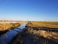
Day 1: I started at a sewage canal in North Salt Lake (really!) and climbed through Woods Cross and a whole bunch of richy-rich neighborhoods to the mouth of North Canyon. I followed the road, which soon turned to dirt and eventually to trail, up into the mountains. I got on the ridgeline that forms the north wall of City Creek Canyon and picked my way along the mostly trail-less ridgeline, bagging Grandview just before sunset. Although it wasn't a long day, a sustained 5,000 foot climb through scrub oak and steep sidehill will wear on a body. i found a tiny campsite and cowboyed for the night.
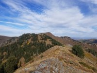
Day 2: Soon after leaving camp, I hit the Great Western Trail, whereupon the trail tread improved significantly. I saw at least a dozen hunters over the next couple hours, at least three of whom had gotten an animal. I was very grateful for my orange regalia as shots periodically rang out through the area. I stopped just beyond Big Mountain Pass, still riding the ridgeline, for lunch. As I approached Parleys Summit, I ran into some private property and had to detour around it, at one point walking the shoulder of the freeway. Scary! UDOT is building a wildlife bridge right at the summit which will be very useful for hikers once completed. I grabbed dinner at the crappy gas station at the summit. Climbing out of the Summit Park neighborhood, I found a backcountry skier smoke shack on the ridge and camped there, out of the wind.

Day 3: This is where the barebones prep really bit me. The USGS maps do not show a very complete/accurate trail network, especially outside of National Forests. As a result, I did a horrible bushwack along the main Wasatch crest between Summit Park Peak and Murdock Peak. My pants definitely have a few more holes than they did prior! I suspect the best way would have been to drop down to Toll Canyon and hope that there's a trail that connects Toll Canyon to Murdock, but such is life. The rest of the day was spent cruising the Wasatch Crest Trail/Great Western Trail to Guardsman Pass. I climbed Peak 10,420 and Clayton, camping on the ridge south of Clayton. As I went to bed, I saw two bull elk going at it, bellowing, chasing each other, and from the sounds of it, fighting. It's that time of year!
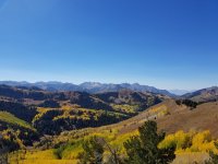
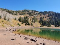

Day 4: I continued the traverse of Brighton. I was surprised at the amount of decent use trail I found; last time I'd been up here, I'd done a lot more bushwhacking. Within a couple hours, I found myself cruising down Catherine Pass into Albion Basin, where I'd pick up the Cecret Lake Tra.... oh, nevermind. Turns out the Cecret Lake Trail was closed for dam repairs, so my plan to climb up to the Baldy/Sugarloaf Saddle was foiled. I considered my only option - to walk all the way down the base of Alta, climb back up the Collins side, adding many miles and thousands of feet to my hike. More importantly, the detour would spoil the aesthetic beauty of the line that I had walked - to stay high, on or near the ridge, all the way from Lowest to Highest. I had no desire to engage in the detour to - what? Prove something to everyone? Not look the fool in front of others? Frankly, it wasn't worth it. My hike was wonderful and enjoyable, even if it ended 4 miles short of where I intended. I've been there before, I'll get there again.

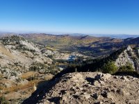
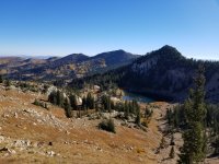
Overall impressions: I loved the SLCL2H (everything needs an acronym, doncha know). I followed a really neat line. I saw new places, revisited old places, and saw many of them in a whole new light. Overall, very few of the miles were dull - in the words of Sum 41, all killer, no filler. Terrific mountain landscapes, changing fall colors, interesting urban areas (everything from industrial to 1%-er), and a surprising amount of solitude, given the urban environment. Oh, and it's accessible via public transit or hitchhiking at both ends.
Sorry, no map: I enjoyed my route but wouldn't recommend my specific route choices to others due to the private property issues. Go map your own. You'll probably do it better than I did.
Time of year: Fall was absolutely magical. Given the extremes of high and low, it's probably the only time of year to do it comfortably. Oh, and the aspens were absolutely top-shelf. Gorgeous.
Water: you're on a ridge the whole time. Tank up. The longest water carry I had was between North Fork Canyon and Parley's Summit, at least 20 miles.
But the Wasatch, despite its reputation as "Was Angeles", is a beautiful range,. By getting a little creative, I figured I could string together a longer hike. I'm of course following in the footsteps of many, more illustrious people. Liz Thomas and Katie Brown have done complete traverses of the range. BCP member @WasatchWill, put together a Park City to Provo route a few years back.
My idea was to hike from the lowest point in Salt Lake County to the highest. The lowest point, at least, the lowest point I could legally access, was the Jordan River just south of where it flows into the Great Salt Lake. The highest point, of course, is the American Fork Twin Peaks. The difference between the two? 7,200 vertical feet. I admittedly didn't do a ton of prep for this hike. After all, it's the Wasatch; how hard can it be? And as a result, I dealt with private property issues, long water carries, and some truly horrendous bushwhacking above Summit Park. But part of the vague preparation was by design. I wanted to test my ability to adapt to unknown conditions on the fly, in a relatively low-risk environment.
But enough of the waxing of the purple.
Day 1: I started at a sewage canal in North Salt Lake (really!) and climbed through Woods Cross and a whole bunch of richy-rich neighborhoods to the mouth of North Canyon. I followed the road, which soon turned to dirt and eventually to trail, up into the mountains. I got on the ridgeline that forms the north wall of City Creek Canyon and picked my way along the mostly trail-less ridgeline, bagging Grandview just before sunset. Although it wasn't a long day, a sustained 5,000 foot climb through scrub oak and steep sidehill will wear on a body. i found a tiny campsite and cowboyed for the night.


Day 2: Soon after leaving camp, I hit the Great Western Trail, whereupon the trail tread improved significantly. I saw at least a dozen hunters over the next couple hours, at least three of whom had gotten an animal. I was very grateful for my orange regalia as shots periodically rang out through the area. I stopped just beyond Big Mountain Pass, still riding the ridgeline, for lunch. As I approached Parleys Summit, I ran into some private property and had to detour around it, at one point walking the shoulder of the freeway. Scary! UDOT is building a wildlife bridge right at the summit which will be very useful for hikers once completed. I grabbed dinner at the crappy gas station at the summit. Climbing out of the Summit Park neighborhood, I found a backcountry skier smoke shack on the ridge and camped there, out of the wind.

Day 3: This is where the barebones prep really bit me. The USGS maps do not show a very complete/accurate trail network, especially outside of National Forests. As a result, I did a horrible bushwack along the main Wasatch crest between Summit Park Peak and Murdock Peak. My pants definitely have a few more holes than they did prior! I suspect the best way would have been to drop down to Toll Canyon and hope that there's a trail that connects Toll Canyon to Murdock, but such is life. The rest of the day was spent cruising the Wasatch Crest Trail/Great Western Trail to Guardsman Pass. I climbed Peak 10,420 and Clayton, camping on the ridge south of Clayton. As I went to bed, I saw two bull elk going at it, bellowing, chasing each other, and from the sounds of it, fighting. It's that time of year!


Day 4: I continued the traverse of Brighton. I was surprised at the amount of decent use trail I found; last time I'd been up here, I'd done a lot more bushwhacking. Within a couple hours, I found myself cruising down Catherine Pass into Albion Basin, where I'd pick up the Cecret Lake Tra.... oh, nevermind. Turns out the Cecret Lake Trail was closed for dam repairs, so my plan to climb up to the Baldy/Sugarloaf Saddle was foiled. I considered my only option - to walk all the way down the base of Alta, climb back up the Collins side, adding many miles and thousands of feet to my hike. More importantly, the detour would spoil the aesthetic beauty of the line that I had walked - to stay high, on or near the ridge, all the way from Lowest to Highest. I had no desire to engage in the detour to - what? Prove something to everyone? Not look the fool in front of others? Frankly, it wasn't worth it. My hike was wonderful and enjoyable, even if it ended 4 miles short of where I intended. I've been there before, I'll get there again.


Overall impressions: I loved the SLCL2H (everything needs an acronym, doncha know). I followed a really neat line. I saw new places, revisited old places, and saw many of them in a whole new light. Overall, very few of the miles were dull - in the words of Sum 41, all killer, no filler. Terrific mountain landscapes, changing fall colors, interesting urban areas (everything from industrial to 1%-er), and a surprising amount of solitude, given the urban environment. Oh, and it's accessible via public transit or hitchhiking at both ends.
Sorry, no map: I enjoyed my route but wouldn't recommend my specific route choices to others due to the private property issues. Go map your own. You'll probably do it better than I did.
Time of year: Fall was absolutely magical. Given the extremes of high and low, it's probably the only time of year to do it comfortably. Oh, and the aspens were absolutely top-shelf. Gorgeous.
Water: you're on a ridge the whole time. Tank up. The longest water carry I had was between North Fork Canyon and Parley's Summit, at least 20 miles.
