Yvonne
I lava it!!!
- Joined
- Jan 19, 2012
- Messages
- 4,177
I hesitated a lot to post a few of my trip reports from last year due to the loss of most of my pictures to Hurricane Sandy. Luckily I had uploaded a few pictures online before it happened so it wasn't at least not a total loss. ")
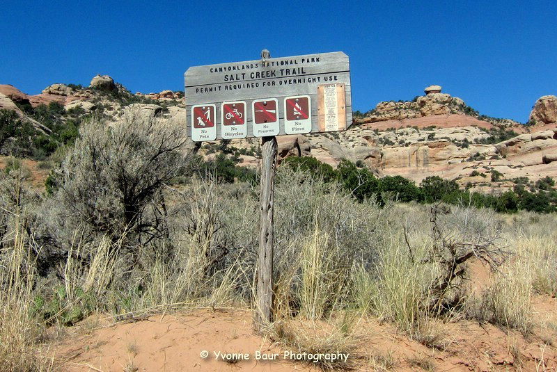
Salt Creek Canyon June 2012
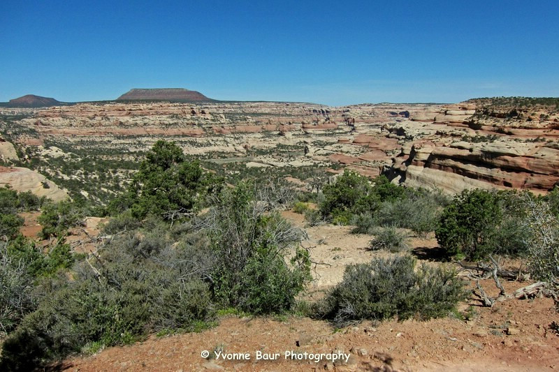
After I have visited Angel Arch during an overnight backpacking trip in 2011, I decided I wanted to see the rest of Salt Creek Canyon this year. Unfortunately no one was able to join me so I had to do it as an out and back solo trip. The afternoon before my trip I picked up my permit at the backcountry office just before closing time. Wow, great timing. I was the only one to camp there for the next few days, no one else had picked up a permit. I drove via Beef Basin Road to the Cathedral Butte Trail Head and set up camp just in time for sunset.
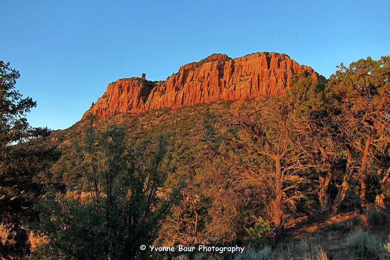
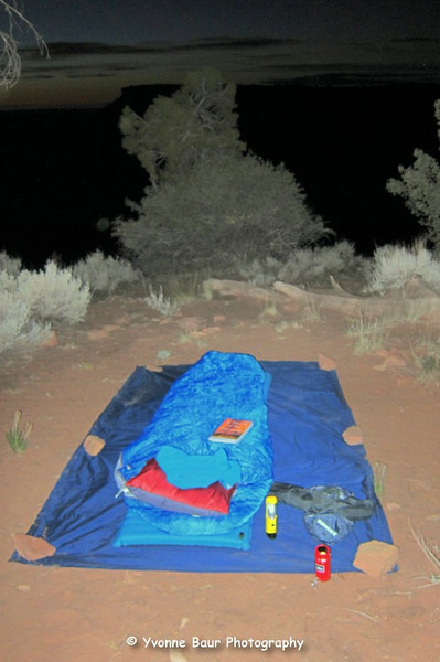
I had a nice view into Big Pocket and Salt Creek Canyon and decided to sleep under the stars just next to the canyon rim.
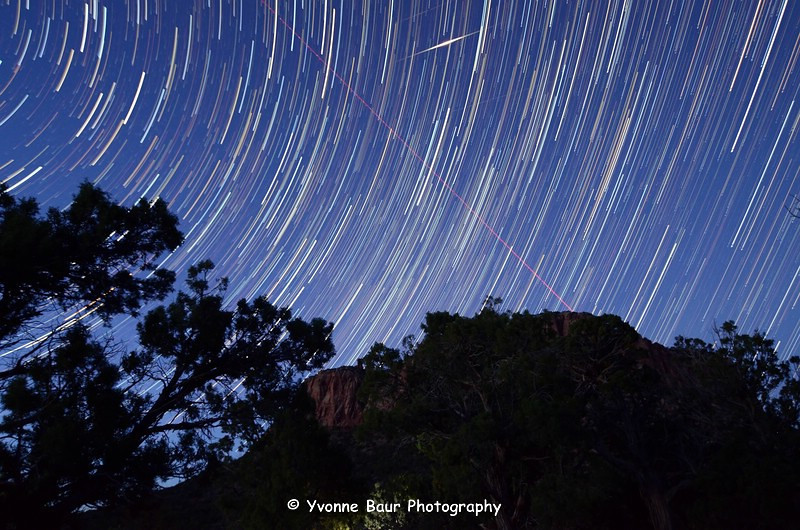
I also did a few star trails from my camp site and captured some Iridium falre of a passing satellite. Nice, I've never seen it before and it was really bright.
Shortly after sunrise I broke up camp and packed the rest of my stuff into my pack. Because of the extremely hot temperatures I decided to start early, so I could do quite a few miles before seeking for some shady spots.
The first part of the trail was a bit steep with lots of loose rocks. It was definitely a part where I needed to be careful, especially after I have hit some rocks that gave way the weeks before on my way out of the Maze.
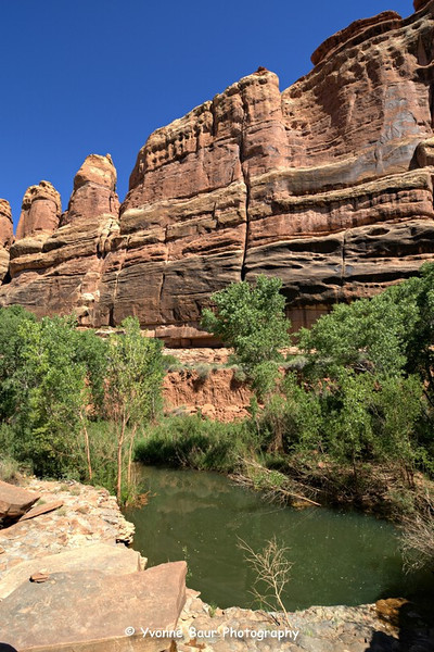
After an elevation loss of approximately 1000 feet I eventually reached East Salt Creek and the Park boundary.
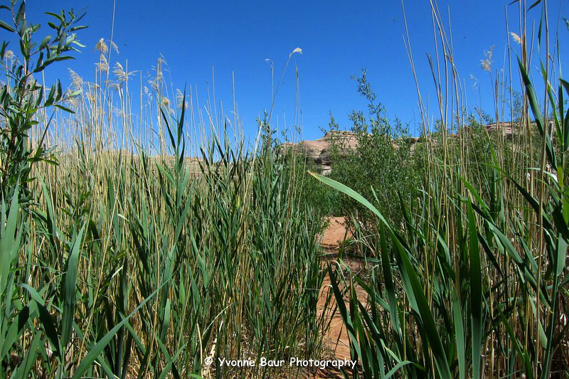
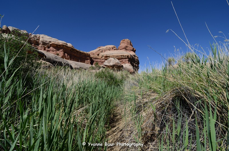
I followed the trail for a while and soon it changed into a dense riparian area with tall grasses, bushes and a usually marshy area. But everything was bone dry, not a single wet spot was visible. Here I found the visible signs of bear activity, a lot of foot prints and poop.
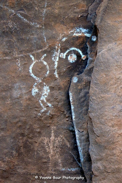
I walked through a tamarisk jungle and soon discovered the first pictograph panel.
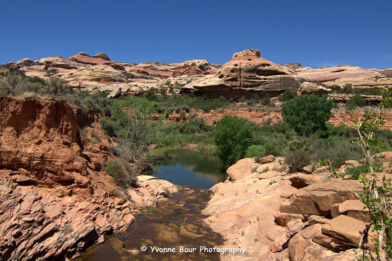
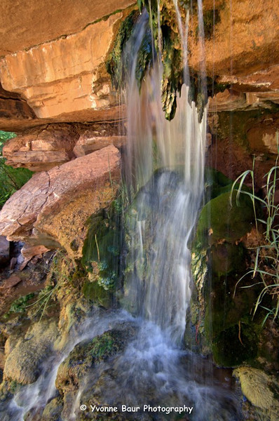
Shortly after the panel I reached the waterslide near Kirk's Cabin and filled my bladders with fresh tasty water. It really was a nice spot for a rest.
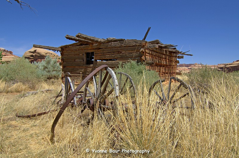
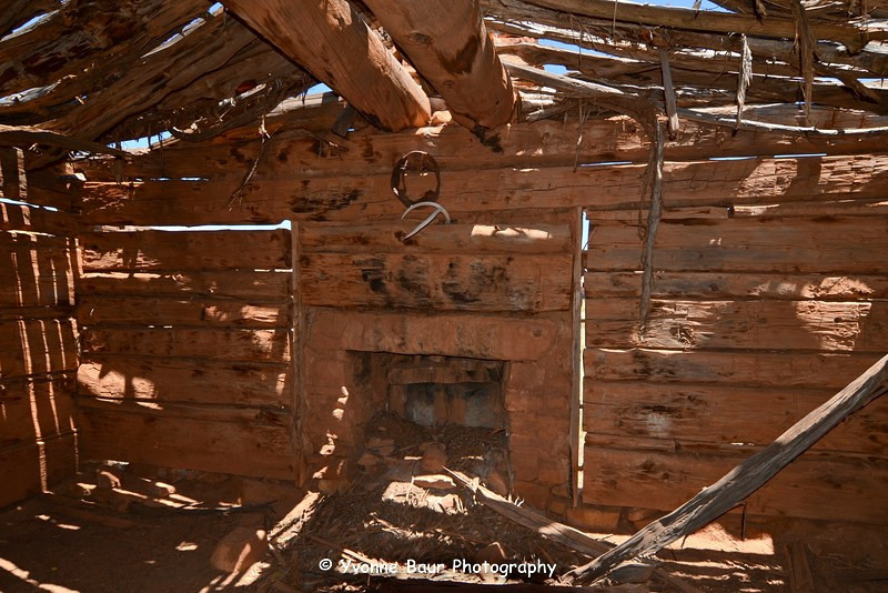
After the waterslide I stopped at Kirk's Cabin.
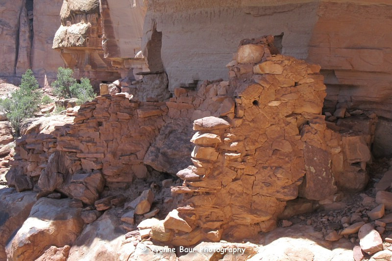
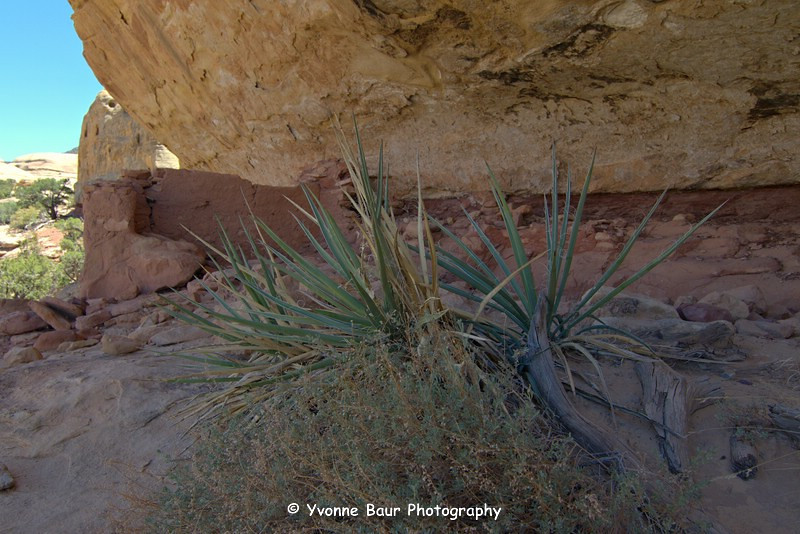
A spur trail lead to campsites SC 1 and SC2 nearby. I hiked past it and passed a fence that seemed to be build by Kirk. I followed a spur trail to an easy accessible ruin under an overhang.
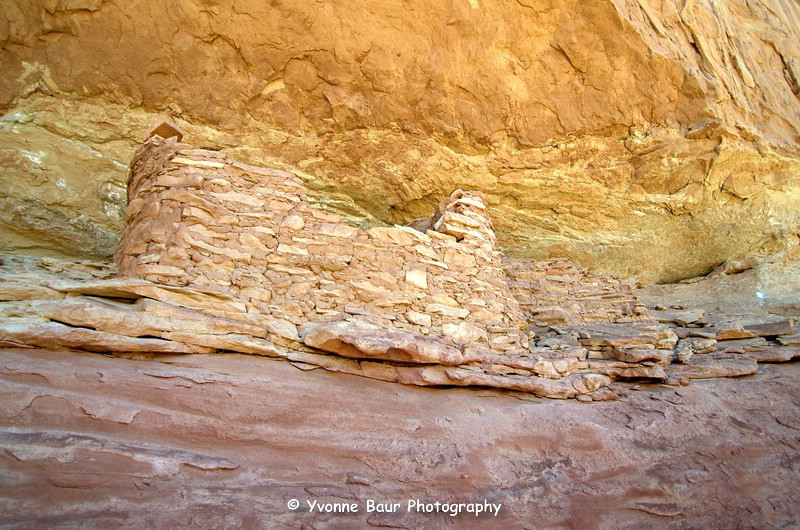
Shortly after that I saw a whole collection of granaries on the left and a spur trail led to the granaries. But I decided to visit them on my way back, so I would have a highlight to visit in my way out. On the right was Big Pocket and I knew that there are some ruins, too. I also saved this side trip for my return trip.
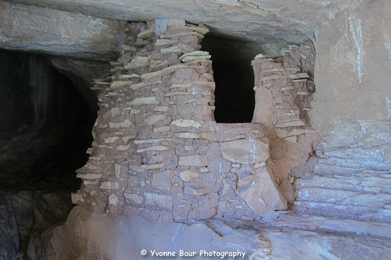
On the right I passed Wedding Ring Arch and shortly after it I followed a foot path to an Alcove with one of the most impressive granaries.
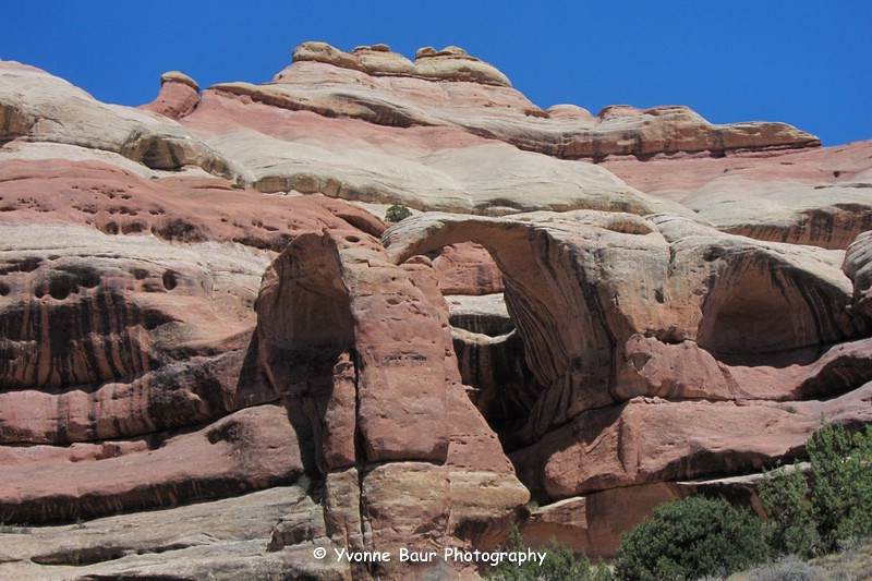
Wedding Ring Arch
It was absolutely amazing to see the squash still growing in front of the granary and the flowers of it had just wilted recently. This must be awesome to see the actual squash grow in front of it, basically ready to harvest.
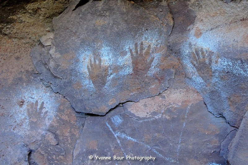
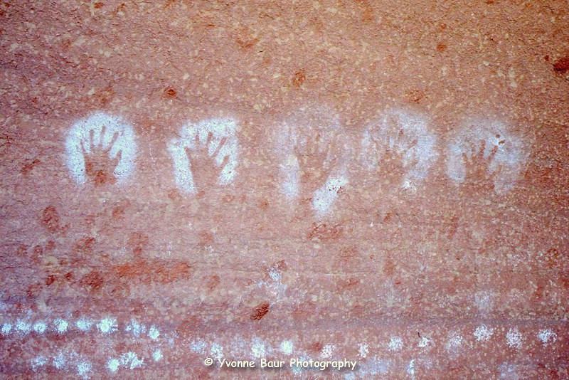
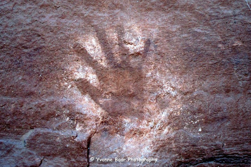
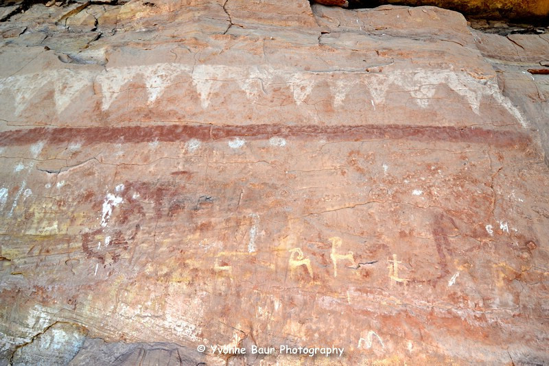
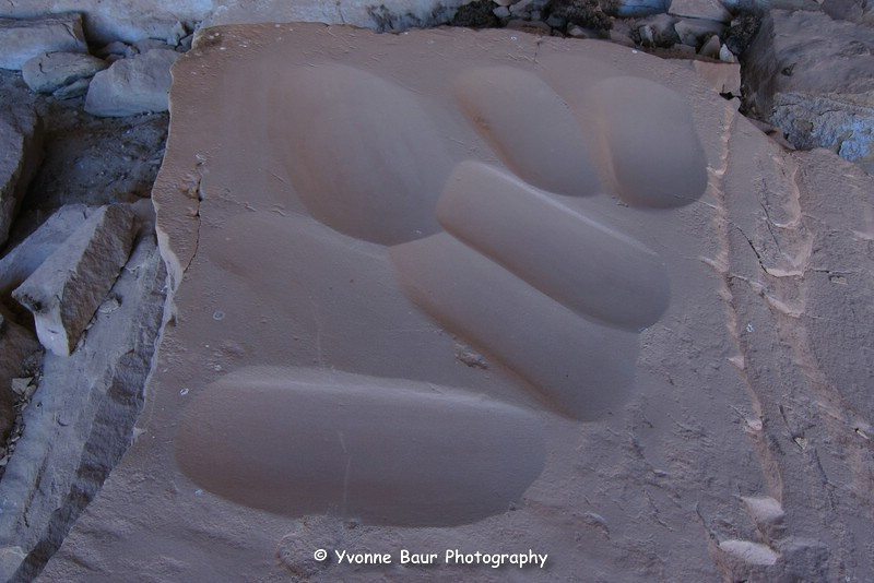
Beside the squash there was a nice panel with hands and dots.
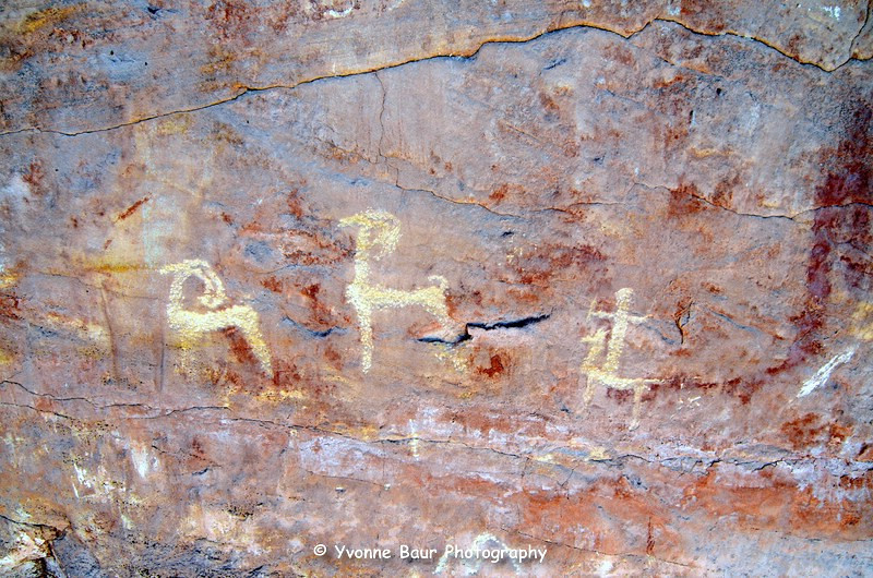
Shortly after the squash I discovered another little alcove with lots of hand panels in it.
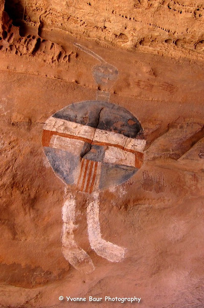
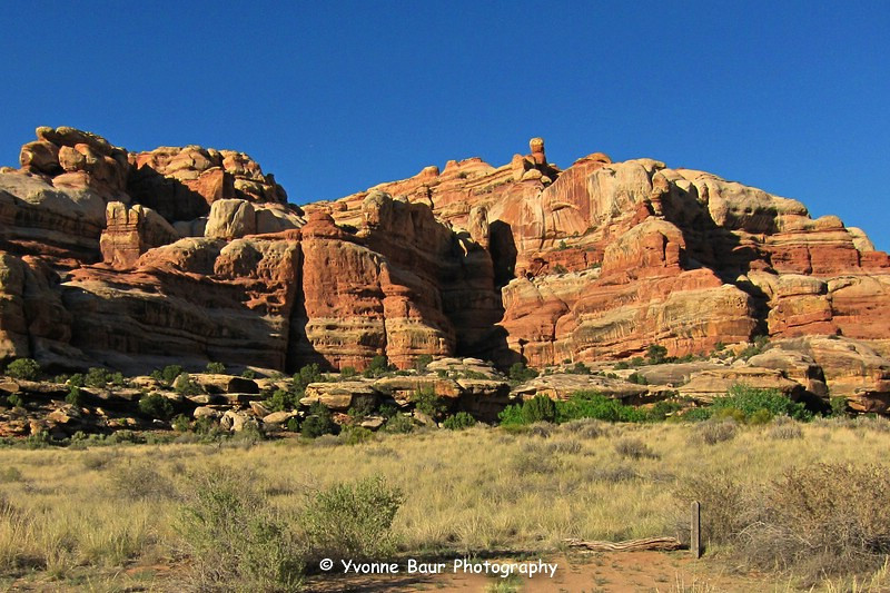
After a while the canyon narrowed and looked more dramatic. The canyon walls got higher and more interesting and I eventually reached the All American Man Pictograph Panel. This particular panel was one of the reasons I did this trip, I desperately wanted to see the All American Man. The panel was located in a small cave and went up to take a few close up shots.
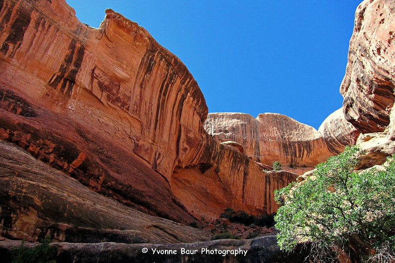
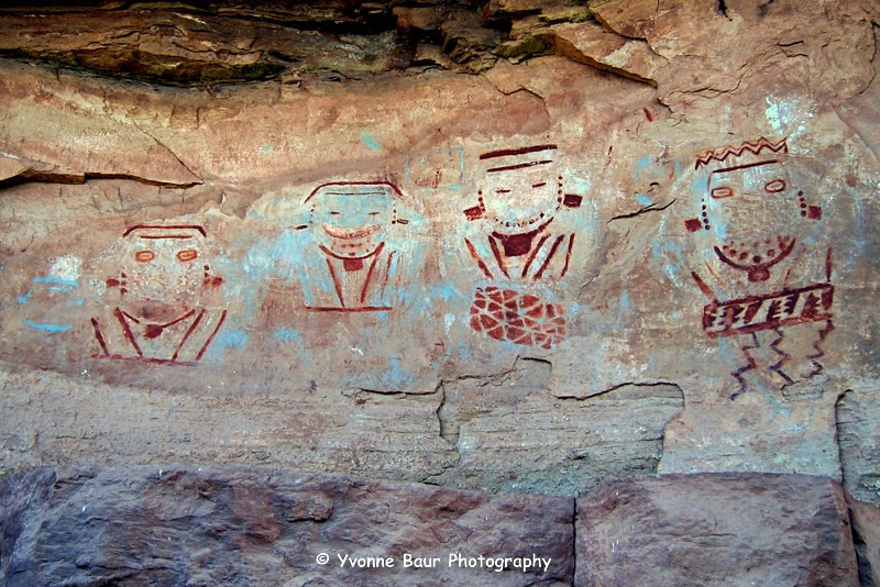
Past the All American Man the trail went through a kind of crack and descended into the canyon again. Shortly after it the landscape changed again and I entered a heavily vegetated area with thickets of willow and riparian undergrowth and after a while I reached a nice spring. This was Four Faces Spring and turned from here to an overhang where I could see the Four Faces Panel. This was definitely one of the most interesting ones I've seen so far today. I explored a bit of the area and had a rest in the shade.

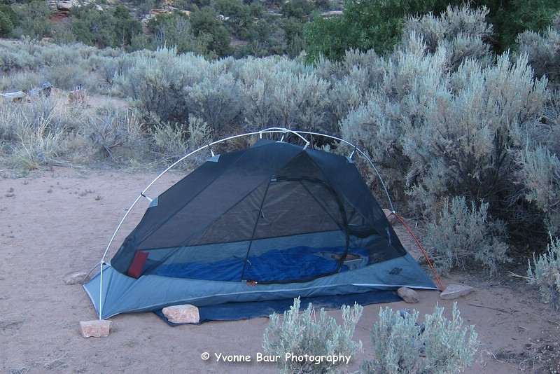
I then filled my water bladders and headed to my campsite for tonight, SC3. The campsite was roughly half a mile away and I set up camp and stored my stuff in the bear containers. I enjoyed a relaxing evening at camp and read a bit before I got too tired.
The next morning I slept in a bit and took my time to break up camp. Today would be one of the shorter legs of my trip, so I wasn't in a hurry. I filled my water bladder at Four Faces Spring and headed toward Upper Jump. It doesn't take long and I reached another granary. Here I found some nice pictographs, but unfortunately the lighting wasn't the best.
After approximately 20 minutes I reached Upper Jump with it's wonderful little cascade and a very inviting desert pool. I refilled my water sources and relaxed a bit next to the waterfall.
The trail continued through a thicket of vegetation and I saw again dozens of signs of fresh bear activity. Eventually I reached ledge with a whole collection of granaries. I never counted them all, but I guess it were at least a dozen. Some were hidden in a cave and I also saw some nice pictographs along with them.
After walking for a while through a riparian undergrowth I reached my next campsite, SC4. Usually there should be some water nearby , but for miles everything was bone dry. The only little reliable water source was a little seep approximately a mile before reaching camp. I hoped to find more water on my way to Angel Arch , so I stored my food in the bear containers, set up camp and went with my pack and and bladders toward Angel Arch camp.
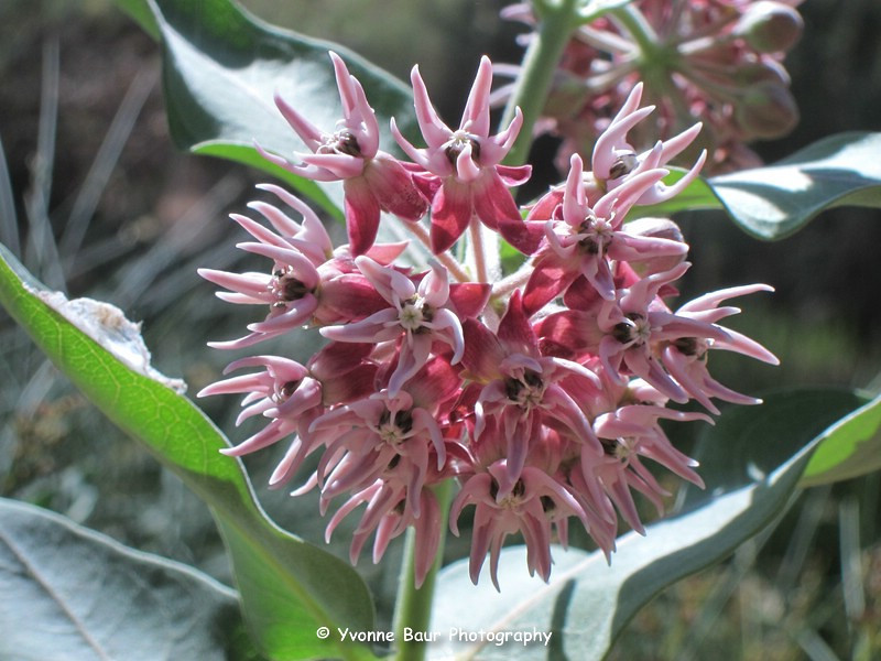
But the further away I went from camp the drier it got. Dried out and cracked dirt, but no water. I saw a few toads and some nice milkweed, but still no sign of water. Last year I saw big pools of water in this area, but now there was nothing.
This wasn't a good sign, originally I wanted to go past Angel Arch tomorrow morning. But with the lack of water this was definitely no good idea. After 2 miles I found a little water hole, but it smelled like death and looked definitely not really inviting. No way!! So I went on and near Angel Arch camp I found another tiny water hole. It wasn't the best water, but better than nothing.
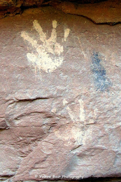
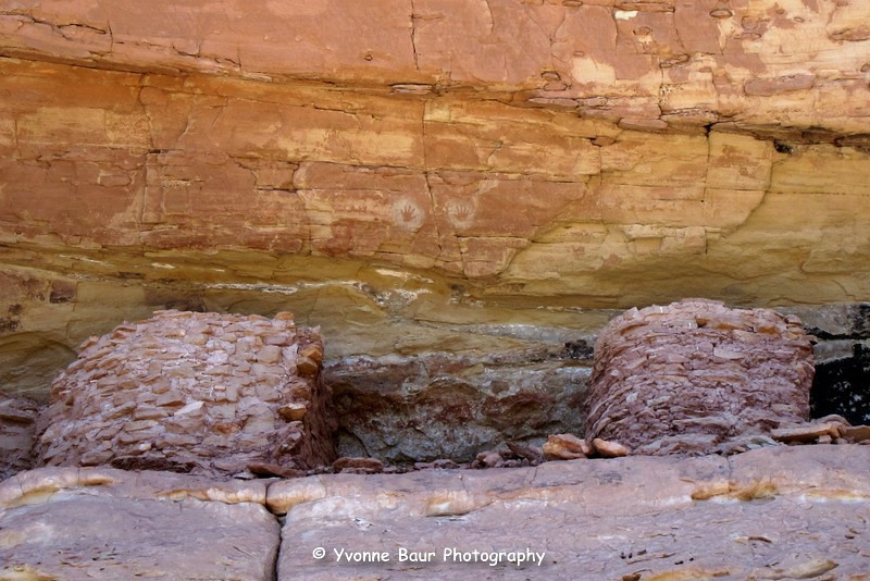
Near Angel Arch camp I also discovered a few hand prints.
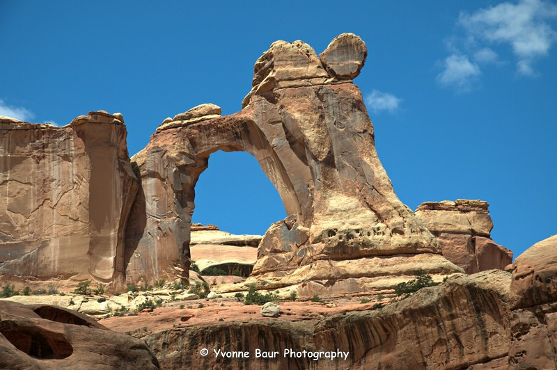
Because I was so close to Angel Arch, I decided to visit it again. last year there was alot of flowing water on my way to the arch, but this time everything was bone dry. After a while I reached the arch, it again was really impressive to see.
I decided against a sunrise trip to the arch tomorrow morning . I took a few shots and went back to camp where I then headed to that little seep. It was extremely shallow, but at least it had flowing water and the best part of it was tasty. Back at camp I had dinner and a nice evening, now and then you could hear the bears nearby. They were really noisy for quite a while.
The next morning I headed back to SC 3, where I would spent a nother night. I had a long picknick near the Upper Jump.
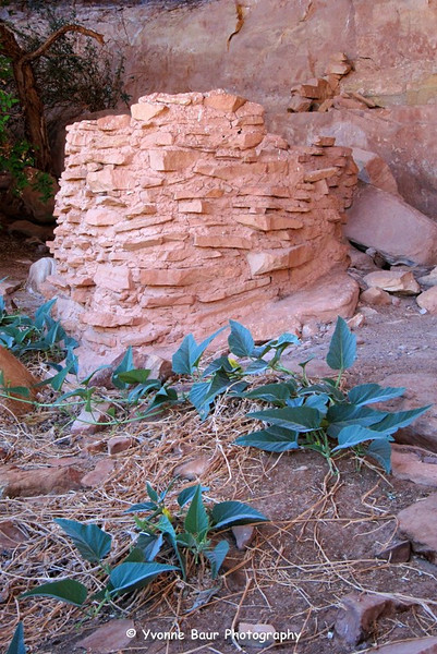
Back at SC3 I explored a bit of the area near camp and found a few granaries and a metate. The mano was missing.
There also was a kind of an old cowboy camp under an overhang . This night I took a few night shots.

The next morning I started relaxed again. I broke up camp late and filled my water bladders at the Four Faces Spring before I started to go back toward Kirk's Cabin.
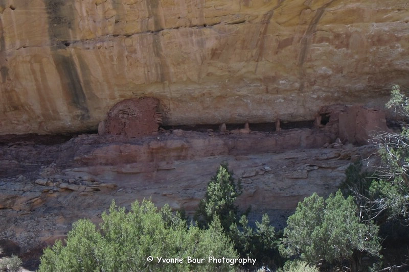
My first big side trip today were Big Ruins and I was really impressed of the collection of granaries high on a cliff under an overhang. Between the granaries were a few hand pictograph panels, really nice.
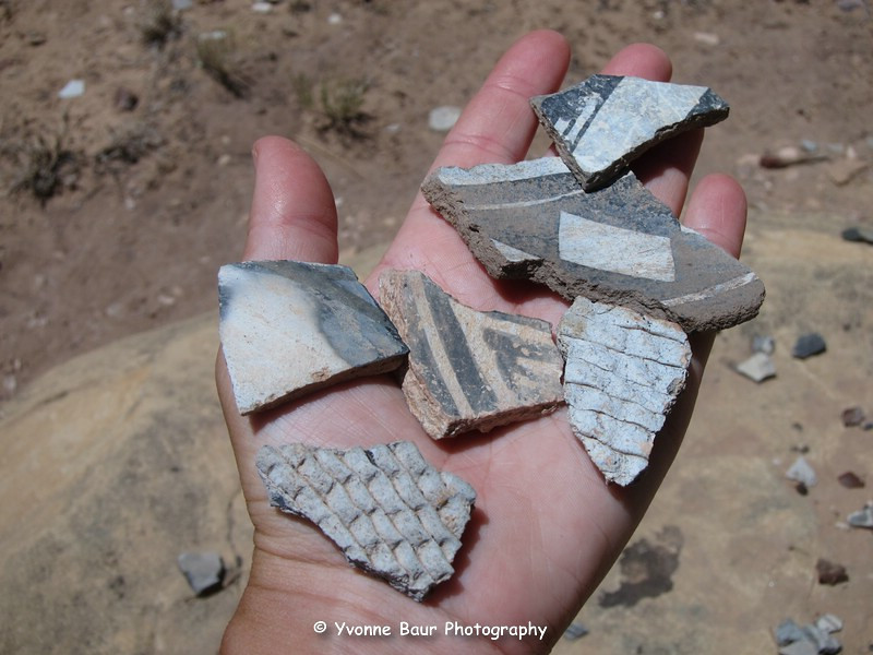
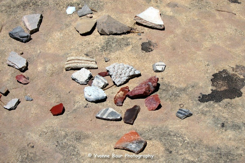
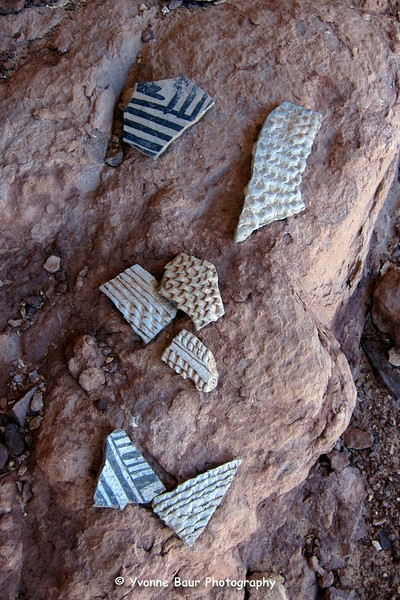
I also found a lot of pot sherds in all colors and shapes, wow.
There also was a metate and mano which was broken in tow parts. A sign that this site was abandoned by the natives. I explored for a while in this area and my next side trip took me into Big Pockets. After a while I discovered a granary on a cliff and walked through it. With a bit of scrambling I could reach it easily and again I found a lot of pot sherds.
From here it wasn't too far to SC 2, where I would spent the last night. But it was still early and I wasn't overly exhausted. So I decided to hike out tonight after it cooled down a bit and enjoyed a few hours near the water slide and finished my book. Around 5:30 pm I left and climbed out to the trail head. It was a bit steep but no problem at all. Shortly before sunset I reached the trail head and set up camp.
It was a wonderful trip and the only downside was the lack of reliable water and the extremely hot temperatures for this time of the year.
I will definitely come back and explore the rest of the granaries that I left out due to the lack of water.
Salt Creek Canyon is definitely an area you can visit a couple of times and never get tired of.
Featured image for home page:

Salt Creek Canyon June 2012
After I have visited Angel Arch during an overnight backpacking trip in 2011, I decided I wanted to see the rest of Salt Creek Canyon this year. Unfortunately no one was able to join me so I had to do it as an out and back solo trip. The afternoon before my trip I picked up my permit at the backcountry office just before closing time. Wow, great timing. I was the only one to camp there for the next few days, no one else had picked up a permit. I drove via Beef Basin Road to the Cathedral Butte Trail Head and set up camp just in time for sunset.
I had a nice view into Big Pocket and Salt Creek Canyon and decided to sleep under the stars just next to the canyon rim.
I also did a few star trails from my camp site and captured some Iridium falre of a passing satellite. Nice, I've never seen it before and it was really bright.
Shortly after sunrise I broke up camp and packed the rest of my stuff into my pack. Because of the extremely hot temperatures I decided to start early, so I could do quite a few miles before seeking for some shady spots.
The first part of the trail was a bit steep with lots of loose rocks. It was definitely a part where I needed to be careful, especially after I have hit some rocks that gave way the weeks before on my way out of the Maze.
After an elevation loss of approximately 1000 feet I eventually reached East Salt Creek and the Park boundary.
I followed the trail for a while and soon it changed into a dense riparian area with tall grasses, bushes and a usually marshy area. But everything was bone dry, not a single wet spot was visible. Here I found the visible signs of bear activity, a lot of foot prints and poop.
I walked through a tamarisk jungle and soon discovered the first pictograph panel.
Shortly after the panel I reached the waterslide near Kirk's Cabin and filled my bladders with fresh tasty water. It really was a nice spot for a rest.
After the waterslide I stopped at Kirk's Cabin.
A spur trail lead to campsites SC 1 and SC2 nearby. I hiked past it and passed a fence that seemed to be build by Kirk. I followed a spur trail to an easy accessible ruin under an overhang.
Shortly after that I saw a whole collection of granaries on the left and a spur trail led to the granaries. But I decided to visit them on my way back, so I would have a highlight to visit in my way out. On the right was Big Pocket and I knew that there are some ruins, too. I also saved this side trip for my return trip.
On the right I passed Wedding Ring Arch and shortly after it I followed a foot path to an Alcove with one of the most impressive granaries.
Wedding Ring Arch
It was absolutely amazing to see the squash still growing in front of the granary and the flowers of it had just wilted recently. This must be awesome to see the actual squash grow in front of it, basically ready to harvest.
Beside the squash there was a nice panel with hands and dots.
Shortly after the squash I discovered another little alcove with lots of hand panels in it.
After a while the canyon narrowed and looked more dramatic. The canyon walls got higher and more interesting and I eventually reached the All American Man Pictograph Panel. This particular panel was one of the reasons I did this trip, I desperately wanted to see the All American Man. The panel was located in a small cave and went up to take a few close up shots.
Past the All American Man the trail went through a kind of crack and descended into the canyon again. Shortly after it the landscape changed again and I entered a heavily vegetated area with thickets of willow and riparian undergrowth and after a while I reached a nice spring. This was Four Faces Spring and turned from here to an overhang where I could see the Four Faces Panel. This was definitely one of the most interesting ones I've seen so far today. I explored a bit of the area and had a rest in the shade.
I then filled my water bladders and headed to my campsite for tonight, SC3. The campsite was roughly half a mile away and I set up camp and stored my stuff in the bear containers. I enjoyed a relaxing evening at camp and read a bit before I got too tired.
The next morning I slept in a bit and took my time to break up camp. Today would be one of the shorter legs of my trip, so I wasn't in a hurry. I filled my water bladder at Four Faces Spring and headed toward Upper Jump. It doesn't take long and I reached another granary. Here I found some nice pictographs, but unfortunately the lighting wasn't the best.
After approximately 20 minutes I reached Upper Jump with it's wonderful little cascade and a very inviting desert pool. I refilled my water sources and relaxed a bit next to the waterfall.
The trail continued through a thicket of vegetation and I saw again dozens of signs of fresh bear activity. Eventually I reached ledge with a whole collection of granaries. I never counted them all, but I guess it were at least a dozen. Some were hidden in a cave and I also saw some nice pictographs along with them.
After walking for a while through a riparian undergrowth I reached my next campsite, SC4. Usually there should be some water nearby , but for miles everything was bone dry. The only little reliable water source was a little seep approximately a mile before reaching camp. I hoped to find more water on my way to Angel Arch , so I stored my food in the bear containers, set up camp and went with my pack and and bladders toward Angel Arch camp.
But the further away I went from camp the drier it got. Dried out and cracked dirt, but no water. I saw a few toads and some nice milkweed, but still no sign of water. Last year I saw big pools of water in this area, but now there was nothing.
This wasn't a good sign, originally I wanted to go past Angel Arch tomorrow morning. But with the lack of water this was definitely no good idea. After 2 miles I found a little water hole, but it smelled like death and looked definitely not really inviting. No way!!
So I went on and near Angel Arch camp I found another tiny water hole. It wasn't the best water, but better than nothing.Near Angel Arch camp I also discovered a few hand prints.
Because I was so close to Angel Arch, I decided to visit it again. last year there was alot of flowing water on my way to the arch, but this time everything was bone dry. After a while I reached the arch, it again was really impressive to see.
I decided against a sunrise trip to the arch tomorrow morning . I took a few shots and went back to camp where I then headed to that little seep. It was extremely shallow, but at least it had flowing water and the best part of it was tasty. Back at camp I had dinner and a nice evening, now and then you could hear the bears nearby. They were really noisy for quite a while.
The next morning I headed back to SC 3, where I would spent a nother night. I had a long picknick near the Upper Jump.
Back at SC3 I explored a bit of the area near camp and found a few granaries and a metate. The mano was missing.
There also was a kind of an old cowboy camp under an overhang . This night I took a few night shots.
The next morning I started relaxed again. I broke up camp late and filled my water bladders at the Four Faces Spring before I started to go back toward Kirk's Cabin.
My first big side trip today were Big Ruins and I was really impressed of the collection of granaries high on a cliff under an overhang. Between the granaries were a few hand pictograph panels, really nice.
I also found a lot of pot sherds in all colors and shapes, wow.
There also was a metate and mano which was broken in tow parts. A sign that this site was abandoned by the natives. I explored for a while in this area and my next side trip took me into Big Pockets. After a while I discovered a granary on a cliff and walked through it. With a bit of scrambling I could reach it easily and again I found a lot of pot sherds.
From here it wasn't too far to SC 2, where I would spent the last night. But it was still early and I wasn't overly exhausted. So I decided to hike out tonight after it cooled down a bit and enjoyed a few hours near the water slide and finished my book. Around 5:30 pm I left and climbed out to the trail head. It was a bit steep but no problem at all. Shortly before sunset I reached the trail head and set up camp.
It was a wonderful trip and the only downside was the lack of reliable water and the extremely hot temperatures for this time of the year.
I will definitely come back and explore the rest of the granaries that I left out due to the lack of water.
Salt Creek Canyon is definitely an area you can visit a couple of times and never get tired of.
Featured image for home page: