Skiwi
Member
- Joined
- Oct 5, 2014
- Messages
- 40
A bit of background to this hike
When I have talked to others about backpacking destinations, the Ruby Mountains has come up enough times that I finally had to go there. For a long time it hadn't been on my radar as Nevada is not a destination that came to my mind for backpacking. For any of you that haven't been there, I hope my trip report will give you an idea of why you should add it to your list of destinations!
The best information I found out there for planning this hike was on the Backpacking in the Ruby Mountains website - Bill also has a page on Facebook where he provides updates on conditions. www.rubymountains.net also has some useful information. If you want to stay in Lamoille Canyon before you start the hike, there is very limited dispersed camping accessible by car and only one (very popular) campground. But it is not far from Elko where there are plenty of accommodation options.
Tuesday 6/28
We started off from the Roads End Trailhead in Lamoille Canyon at 8:30 am and it was already pretty warm.
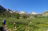
There are two trails to Lamoille Lake from this trailhead, one of these is for stock, the other is the northern most section of the Ruby Crest Trail. We chose the RCT which was a fairly easily climb over two miles to Lamoille Lake with some stream crossings and snow patches to negotiate at this time of summer.
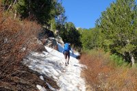
One of the reasons we chose to hike this part of the Ruby Mountains was the number of lakes we could potentially see. It wasn't long before we came to the first of them, Dollar Lakes, which treated us to the first of some beautiful reflections.
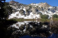
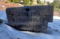
Shortly before Lamoille Lake the stock trail joins back into the Ruby Crest Trail. I missed seeing the sign at first!
Lamoille Lake is at 9,700 feet and had more ice/snow around the edges than any of the other lakes we saw but it won't be long before that is all gone too.
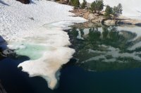
Our aim right from the start was to continue on the RCT over Liberty Pass so we could explore more of the area there but we weren't sure if it would be possible due to the amount of snow still around as we don't have crampons or ice axes. Liberty Pass is at the base of the slope on the left side of the photo below.
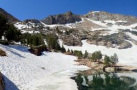
The trail switchbacks up from Lamoille Lake to the pass (740 feet elevation gain over around 1/2 mile distance) and we followed the trail when we could. More was melted out than it looks like in the photo above and we were able to safely make our way up to the pass.
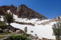
We thought that Dollar and Lamoille Lakes were beautiful, but shortly after the pass Liberty Lake came into view and that surpassed them.
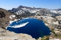
We loved it so much that we decided that it would be a perfect place to camp and we chose a great spot near the outlet (southern end) of the lake.
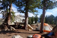
Our campsite elevation was just over 10,000 feet which meant it thankfully wasn't nearly as hot as the 100 degree temps in Elko not far away (but a lot lower in elevation). It was still pretty warm and we were grateful for the breeze that wafted around also pushing the remaining ice around the lake.
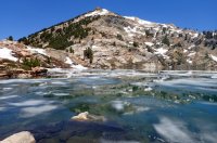
Our campsite was only four miles from the trailhead and we were there before lunch. This meant there was plenty of time for an afternoon walk to explore the area near our camp. We ended up walking another four miles with around half of this off trail. It is the loop near center of the map below from our campsite (yellow dot).
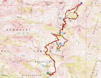
From Liberty Lake we walked off trail to the east up onto a ridge to get views down out of the mountain range to flatter lands that are more typical of Nevada.

We then walked down a slope among lots of alpine type wildflowers to Favre Lake.
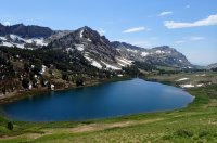
I am not sure whether there is a "trail" up to Castle Lake in a cirque above Favre Lake, but with so much snow on the ground in the trees there, we just made our way up. It was a reasonably steep but short climb.

We dropped back down to Fahve Lake before taking the Ruby Crest Trail back up to Liberty Lake. From this trail we looked west down the Kleckner Creek drainage. Having just looked out the eastern side of the range, this view accentuated how narrow of a range of mountains they are.

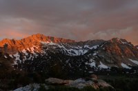
The clouds built up late afternoon but apart from a few micro bursts of wind, no bad weather eventuated. It did make for a nice moody sunset and a touch of alpen glow in the evening.
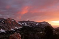
These views are from just below our campsite. In the photo below Castle Lake is in the cirque and Fahve Lake is the bottom in the shadow.
Wednesday June 29
After coming over Liberty Pass the previous day, we had seen NO people. With this solitude we decided not to change campsite and left our camp set up going for a day hike south along the Ruby Crest Trail. We woke to a mostly cloudy sky so concerned about possible thunderstorms later, we left early for our hike.
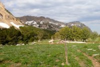
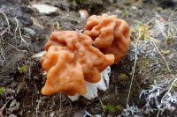
After dropping down into the Kleckner Creek drainage and crossing the creek at about 9,400 feet in elevation, the trail gradually climbed up to a saddle at just over 10,000 feet. Once again we encountered snow patches, rushing streams and some mud, but nothing troublesome. We did see some pretty cool fungi too.
From the saddle we could see down into a different drainage which included North Furlong Lake. We did consider going to it but Wines Peak above it looked more appealing. It is a little hard to see North Furlong Lake in the photo below but it is around the center with Wines Peak at left.
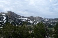
The trail dropped down before climbing again - both a gradual descent and ascent. Before the main part of the climb, the trail crossed the head of North Furlong Creek and for a while after there were the deepest snow patches we encountered which made navigating through more tricky.
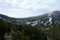
The stream was a great chance to refill our bladder for our water filter before getting up onto the waterless plateau and Wines Peak.

I was happy there was cloud cover as we gradually ascended Wines Peak as once up on the plateau approach and the peak, there were no trees. The RCT actually goes pretty much to the top of the peak so we were able to use that for our climb.
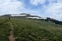
The trail skirted the eastern side of the plateau in a few locations with views into steep chutes. We did see a nanny goat and her kid traversing the rocky slopes but they were too far away to capture in a photo.
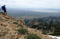
Wines Peak is just under 11,000 feet and has expansive views in all directions but the most appealing to me was looking down to North Furlong Lake below.
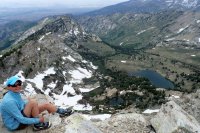
We didn't stay up there too long as we didn't want to get caught out if a thunderstorm did roll in. We had covered five miles since we left camp and decided this was a good turn around point although it was tempting to go further. The photo below shows the view south as the RCT continues on.
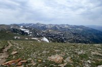
I'll only put in a couple of photos of the way back to camp as we covered the same ground. It is nice to look in the other direction though to get a different perspective. The first photo below shows the view back through wildflowers to the saddle we went over to get back into the Kleckner Creek drainage. The second is the view from near the top of that saddle down into the drainage and the mountains beyond.


After being worried about thunderstorms while up high, it was ironic that the clouds disappeared just before the climb from Favre Lake back up to our campsite. It made for a hot climb but the wash off in the creek after was more welcome even if freezing cold. That evening we were treated to another great sunset.

Thursday June 30
I hope you are not too bored with this TR, not long to go now. We awoke to a sunny morning and I enjoyed sitting down by the lake appreciating it before we packed up. The last of the ice had melted by the previous evening so it was reflections without the ice.
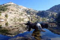
On the way back to the trailhead we did take a couple of diversions to take in different views. This includes me climbing part of the peak to the east of the pass to take in the view down Lamoille Canyon.

And at another viewpoint looking down on Lamoille Lake.

We took the stock trail down for a change. In doing this we missed out on Dollar Lakes but as this trail gets more sun, there was no snow to deal with and lots of wildflowers out.
Looking south back to the pass as we descend the switchbacks on the stock trail.

And north down the canyon.

After lunch in Elko and a four and a bit hour drive, we were home buzzing from this adventure and already planning the next! Maybe we will get a chance to hike the whole RCT in the future.
Thoughts and recommendations
Camping - there were some great campsites at Liberty Lake although I suspect they get quite a bit of use and some were way too close to the lake. Judging by the amount of trash I took out from there, being so close to the TH means these sites also don't always attract people who appreciate the backcountry. Castle Lake had some nice campsites but I wasn't so taken by those near Favre Lake.
People - the snow on the pass would have put some people off from going over but even so, we were surprised that we saw hardly anyone and most of those we saw were in Lamoille Canyon. I suspect this would be different a few days later with the holiday. With Lamoille Lake and Island Lake (which we didn't go to) both only 2 miles from the TH, they must get a lot of use. Over the pass would be preferable to get more of a chance of solitude but if you are up to off trail travel, Bill has some recommendations for other locations. There are other trailheads in the Ruby Mountains that also might attract less people but I am not sure that it ever gets that busy.
When I have talked to others about backpacking destinations, the Ruby Mountains has come up enough times that I finally had to go there. For a long time it hadn't been on my radar as Nevada is not a destination that came to my mind for backpacking. For any of you that haven't been there, I hope my trip report will give you an idea of why you should add it to your list of destinations!
The best information I found out there for planning this hike was on the Backpacking in the Ruby Mountains website - Bill also has a page on Facebook where he provides updates on conditions. www.rubymountains.net also has some useful information. If you want to stay in Lamoille Canyon before you start the hike, there is very limited dispersed camping accessible by car and only one (very popular) campground. But it is not far from Elko where there are plenty of accommodation options.
Tuesday 6/28
We started off from the Roads End Trailhead in Lamoille Canyon at 8:30 am and it was already pretty warm.

There are two trails to Lamoille Lake from this trailhead, one of these is for stock, the other is the northern most section of the Ruby Crest Trail. We chose the RCT which was a fairly easily climb over two miles to Lamoille Lake with some stream crossings and snow patches to negotiate at this time of summer.

One of the reasons we chose to hike this part of the Ruby Mountains was the number of lakes we could potentially see. It wasn't long before we came to the first of them, Dollar Lakes, which treated us to the first of some beautiful reflections.

Shortly before Lamoille Lake the stock trail joins back into the Ruby Crest Trail. I missed seeing the sign at first!

Lamoille Lake is at 9,700 feet and had more ice/snow around the edges than any of the other lakes we saw but it won't be long before that is all gone too.

Our aim right from the start was to continue on the RCT over Liberty Pass so we could explore more of the area there but we weren't sure if it would be possible due to the amount of snow still around as we don't have crampons or ice axes. Liberty Pass is at the base of the slope on the left side of the photo below.

The trail switchbacks up from Lamoille Lake to the pass (740 feet elevation gain over around 1/2 mile distance) and we followed the trail when we could. More was melted out than it looks like in the photo above and we were able to safely make our way up to the pass.

We thought that Dollar and Lamoille Lakes were beautiful, but shortly after the pass Liberty Lake came into view and that surpassed them.

We loved it so much that we decided that it would be a perfect place to camp and we chose a great spot near the outlet (southern end) of the lake.

Our campsite elevation was just over 10,000 feet which meant it thankfully wasn't nearly as hot as the 100 degree temps in Elko not far away (but a lot lower in elevation). It was still pretty warm and we were grateful for the breeze that wafted around also pushing the remaining ice around the lake.

Our campsite was only four miles from the trailhead and we were there before lunch. This meant there was plenty of time for an afternoon walk to explore the area near our camp. We ended up walking another four miles with around half of this off trail. It is the loop near center of the map below from our campsite (yellow dot).

From Liberty Lake we walked off trail to the east up onto a ridge to get views down out of the mountain range to flatter lands that are more typical of Nevada.

We then walked down a slope among lots of alpine type wildflowers to Favre Lake.

I am not sure whether there is a "trail" up to Castle Lake in a cirque above Favre Lake, but with so much snow on the ground in the trees there, we just made our way up. It was a reasonably steep but short climb.

We dropped back down to Fahve Lake before taking the Ruby Crest Trail back up to Liberty Lake. From this trail we looked west down the Kleckner Creek drainage. Having just looked out the eastern side of the range, this view accentuated how narrow of a range of mountains they are.

The clouds built up late afternoon but apart from a few micro bursts of wind, no bad weather eventuated. It did make for a nice moody sunset and a touch of alpen glow in the evening.

These views are from just below our campsite. In the photo below Castle Lake is in the cirque and Fahve Lake is the bottom in the shadow.

Wednesday June 29
After coming over Liberty Pass the previous day, we had seen NO people. With this solitude we decided not to change campsite and left our camp set up going for a day hike south along the Ruby Crest Trail. We woke to a mostly cloudy sky so concerned about possible thunderstorms later, we left early for our hike.

After dropping down into the Kleckner Creek drainage and crossing the creek at about 9,400 feet in elevation, the trail gradually climbed up to a saddle at just over 10,000 feet. Once again we encountered snow patches, rushing streams and some mud, but nothing troublesome. We did see some pretty cool fungi too.

From the saddle we could see down into a different drainage which included North Furlong Lake. We did consider going to it but Wines Peak above it looked more appealing. It is a little hard to see North Furlong Lake in the photo below but it is around the center with Wines Peak at left.

The trail dropped down before climbing again - both a gradual descent and ascent. Before the main part of the climb, the trail crossed the head of North Furlong Creek and for a while after there were the deepest snow patches we encountered which made navigating through more tricky.

The stream was a great chance to refill our bladder for our water filter before getting up onto the waterless plateau and Wines Peak.

I was happy there was cloud cover as we gradually ascended Wines Peak as once up on the plateau approach and the peak, there were no trees. The RCT actually goes pretty much to the top of the peak so we were able to use that for our climb.

The trail skirted the eastern side of the plateau in a few locations with views into steep chutes. We did see a nanny goat and her kid traversing the rocky slopes but they were too far away to capture in a photo.

Wines Peak is just under 11,000 feet and has expansive views in all directions but the most appealing to me was looking down to North Furlong Lake below.

We didn't stay up there too long as we didn't want to get caught out if a thunderstorm did roll in. We had covered five miles since we left camp and decided this was a good turn around point although it was tempting to go further. The photo below shows the view south as the RCT continues on.

I'll only put in a couple of photos of the way back to camp as we covered the same ground. It is nice to look in the other direction though to get a different perspective. The first photo below shows the view back through wildflowers to the saddle we went over to get back into the Kleckner Creek drainage. The second is the view from near the top of that saddle down into the drainage and the mountains beyond.


After being worried about thunderstorms while up high, it was ironic that the clouds disappeared just before the climb from Favre Lake back up to our campsite. It made for a hot climb but the wash off in the creek after was more welcome even if freezing cold. That evening we were treated to another great sunset.

Thursday June 30
I hope you are not too bored with this TR, not long to go now. We awoke to a sunny morning and I enjoyed sitting down by the lake appreciating it before we packed up. The last of the ice had melted by the previous evening so it was reflections without the ice.

On the way back to the trailhead we did take a couple of diversions to take in different views. This includes me climbing part of the peak to the east of the pass to take in the view down Lamoille Canyon.

And at another viewpoint looking down on Lamoille Lake.

We took the stock trail down for a change. In doing this we missed out on Dollar Lakes but as this trail gets more sun, there was no snow to deal with and lots of wildflowers out.
Looking south back to the pass as we descend the switchbacks on the stock trail.

And north down the canyon.

After lunch in Elko and a four and a bit hour drive, we were home buzzing from this adventure and already planning the next! Maybe we will get a chance to hike the whole RCT in the future.
Thoughts and recommendations
Camping - there were some great campsites at Liberty Lake although I suspect they get quite a bit of use and some were way too close to the lake. Judging by the amount of trash I took out from there, being so close to the TH means these sites also don't always attract people who appreciate the backcountry. Castle Lake had some nice campsites but I wasn't so taken by those near Favre Lake.
People - the snow on the pass would have put some people off from going over but even so, we were surprised that we saw hardly anyone and most of those we saw were in Lamoille Canyon. I suspect this would be different a few days later with the holiday. With Lamoille Lake and Island Lake (which we didn't go to) both only 2 miles from the TH, they must get a lot of use. Over the pass would be preferable to get more of a chance of solitude but if you are up to off trail travel, Bill has some recommendations for other locations. There are other trailheads in the Ruby Mountains that also might attract less people but I am not sure that it ever gets that busy.
