Jenessa
Member
- Joined
- Sep 13, 2017
- Messages
- 10
Ruby Dome is the highest point in Elko County, where I live, at 11,392 feet. We had been talking about hiking to the top of it with some friends, and in September we had a free weekend so we decided to turn it into a backpacking trip. I had attempted it in a single day many years ago and decided it was a bit longer and more extreme of a hike than I really wanted to do in one day. Since there is a nice little lake a few miles up the trail we decided to spend two nights camped at Griswold Lake and summit the mountain on day two.
This is us getting off to a late start on our first day. The trail head starts from the Spring Creek campground. You have to get through a locked gate to access the trail head, fortunately one of my coworkers lives in Spring Creek and loaned me a key. You can get one from the Spring Creek homeowners association, but that seemed like a lot more work. My GPS says the trail head is at 6,540 feet. There is a sign at the trail head that says 3 miles to Griswold Lake and 4 miles to the Dome. This is obviously the straight line distance, I no longer remember what my GPS said for the distance, but it was several miles longer overall.
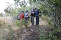
The trail starts out in typical northern Nevada lower elevation sagebrush country. This trail basically heads straight up the canyon and it fairly steep the whole way. After the sagebrush, you head through a pleasant aspen grove along Butterfield Creek. There were a few cows hanging out on this lower part of the trail.
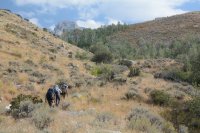
Once through the aspens you break out into the rocky part of Hennen Canyon. In the lower section you get to hike over nice big slabs of rock and it's fairly easy going.
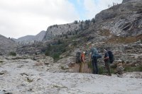
This is looking back down the canyon towards Spring Creek. It was a pretty hazy weekend, so the normal view was obscured.
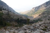
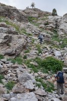
Further up the trail it gets very bouldery. There are cairns all along the canyon to indicate the better routes. Before the lake the cairns are actually pretty helpful. Once you start getting closer to the summit was a different story and there were cairns all over, with many that led us astray. Picking our way through these boulders with a fully loaded pack on was a little rough, especially since it is pretty steep going.
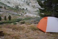
Finally we made it to Griswold Lake and set up camp. We had a pretty subdued evening with only a few beers consumed. It was cold and windy, so we hit the hay pretty early. Night temps that weekend were somewhere below freezing. Both of us women were freezing at night and didn't sleep that well. I have a 15F degree bag, but I get cold easily and just couldn't get warm that first night.
Since we had all day to summit the mountain we had a fairly lazy morning. From our camp we saw two other hikers go by that were doing the hike in one day and obviously got up much earlier than us. We hiked around the lake to the climbers left side of the canyon and then it was back to steep uphill hiking. We all felt lightweight with our little daypacks on.
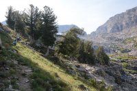
This is looking back down the canyon at Griswold Lake. It's a pretty shallow little lake, but pretty. My husband brought a fishing pole, but didn't end up using it at all.
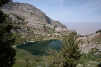
Another view down the canyon towards Griswold Lake and Spring Creek.
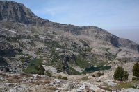
After climbing up around the lake you reach a shelf in the canyon that affords the first good view of Ruby Dome, which is the big rounded peak on the right.
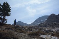
Then you get to pick your way through a huge boulder field. This is about how far I had made it the last time. It was well into the afternoon by the time my group got here so we decided to turn around. That was a good call because it took a surprising amount of time to get through this mess. Some of my friends have said it is easier when there is more snow since it is much faster to walk on top of the snow fields.
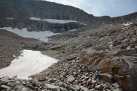
The going got rough at this point and I had to put my camera in my pack until we reached the top. Now, I am not a peak bagger, and definitely not a rock climber. There are two main routes to the top of the mountain, one along a knife ridge and the other up a chute. We opted for the chute which involved more scrambling than I am used to, and it scared the crap out of me. I almost turned around, but that option was also scary so I continued up. I love hiking, scrambling is not my thing. After the chute we had another boulder field to cross to get to the very summit of the mountain. There are a lot of dang boulders on this mountain.
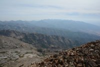
Here is the view looking out towards the southern end of the Ruby Mountains from the top of the dome after I retrieved my camera from my pack.
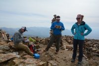
The top! Enjoying some snacks and checking out the log book. We had brought a couple of summit beers with us, but since the hike had been rather intense we decided to carry them back down to a lower point on the trail. Safety first.
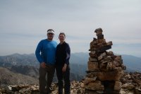
My husband and I at the top of the Dome!
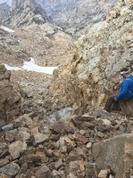
Here is a shot of the chute on our way down. As is usual with pictures, the chute doesn't look nearly as bad as it felt to me. Going down wasn't quite as bad as going up had been though. Unfortunately when we got to the bottom of the chute my husband slipped off a loose rock and banged his knee on another rock. We were at a snow patch so he was able to ice it down right away. I always hike with a first aid kit, but I had forgotten to transfer it from my backpack to my daypack. Stupid mistake on my part. Thus we were unable to bandage his knee until we got back to camp. Fortunately he was able to walk alright.
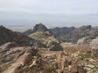
This last picture is on our way back to the lake. We followed some different cairns which ended up taking us on a bad route that included a small cliff. We made it back to the regular trail eventually, but those stupid cairns made our trip quite a bit longer. We knew that we were following a different route, but had hoped it would be a bit easier. That was not the case.
We contemplated breaking camp and heading back into town because of the knee injury. But it was already evening, we were tired, didn't want to hike out by headlamp, and we the bleeding had stopped. So we spent another quiet night at the lake. My husband's leg was pretty stiff on the hike out the next day, but we made it out and headed back to town. The urgent care clinic was just closing when we got into town and wouldn't see any more patients that day. We felt the injury did not require a trip to the emergency room, so we settled for Mexican food, margaritas, and butterfly bandages.
Overall this was a pretty fun trip, but now that I have been to the top of the Dome I have no intentions to go back. I will probably head back up to Griswold Lake some day. That section of the hike isn't too bad and the trail doesn't get a lot of traffic. We had the lake to ourselves both nights and only saw a handfull of day hikers the whole time. For those that really like bagging peaks though, the views are pretty stellar.
This is us getting off to a late start on our first day. The trail head starts from the Spring Creek campground. You have to get through a locked gate to access the trail head, fortunately one of my coworkers lives in Spring Creek and loaned me a key. You can get one from the Spring Creek homeowners association, but that seemed like a lot more work. My GPS says the trail head is at 6,540 feet. There is a sign at the trail head that says 3 miles to Griswold Lake and 4 miles to the Dome. This is obviously the straight line distance, I no longer remember what my GPS said for the distance, but it was several miles longer overall.

The trail starts out in typical northern Nevada lower elevation sagebrush country. This trail basically heads straight up the canyon and it fairly steep the whole way. After the sagebrush, you head through a pleasant aspen grove along Butterfield Creek. There were a few cows hanging out on this lower part of the trail.

Once through the aspens you break out into the rocky part of Hennen Canyon. In the lower section you get to hike over nice big slabs of rock and it's fairly easy going.

This is looking back down the canyon towards Spring Creek. It was a pretty hazy weekend, so the normal view was obscured.

Further up the trail it gets very bouldery. There are cairns all along the canyon to indicate the better routes. Before the lake the cairns are actually pretty helpful. Once you start getting closer to the summit was a different story and there were cairns all over, with many that led us astray. Picking our way through these boulders with a fully loaded pack on was a little rough, especially since it is pretty steep going.

Finally we made it to Griswold Lake and set up camp. We had a pretty subdued evening with only a few beers consumed. It was cold and windy, so we hit the hay pretty early. Night temps that weekend were somewhere below freezing. Both of us women were freezing at night and didn't sleep that well. I have a 15F degree bag, but I get cold easily and just couldn't get warm that first night.

Since we had all day to summit the mountain we had a fairly lazy morning. From our camp we saw two other hikers go by that were doing the hike in one day and obviously got up much earlier than us. We hiked around the lake to the climbers left side of the canyon and then it was back to steep uphill hiking. We all felt lightweight with our little daypacks on.

This is looking back down the canyon at Griswold Lake. It's a pretty shallow little lake, but pretty. My husband brought a fishing pole, but didn't end up using it at all.

Another view down the canyon towards Griswold Lake and Spring Creek.

After climbing up around the lake you reach a shelf in the canyon that affords the first good view of Ruby Dome, which is the big rounded peak on the right.

Then you get to pick your way through a huge boulder field. This is about how far I had made it the last time. It was well into the afternoon by the time my group got here so we decided to turn around. That was a good call because it took a surprising amount of time to get through this mess. Some of my friends have said it is easier when there is more snow since it is much faster to walk on top of the snow fields.

The going got rough at this point and I had to put my camera in my pack until we reached the top. Now, I am not a peak bagger, and definitely not a rock climber. There are two main routes to the top of the mountain, one along a knife ridge and the other up a chute. We opted for the chute which involved more scrambling than I am used to, and it scared the crap out of me. I almost turned around, but that option was also scary so I continued up. I love hiking, scrambling is not my thing. After the chute we had another boulder field to cross to get to the very summit of the mountain. There are a lot of dang boulders on this mountain.
Here is the view looking out towards the southern end of the Ruby Mountains from the top of the dome after I retrieved my camera from my pack.

The top! Enjoying some snacks and checking out the log book. We had brought a couple of summit beers with us, but since the hike had been rather intense we decided to carry them back down to a lower point on the trail. Safety first.

My husband and I at the top of the Dome!

Here is a shot of the chute on our way down. As is usual with pictures, the chute doesn't look nearly as bad as it felt to me. Going down wasn't quite as bad as going up had been though. Unfortunately when we got to the bottom of the chute my husband slipped off a loose rock and banged his knee on another rock. We were at a snow patch so he was able to ice it down right away. I always hike with a first aid kit, but I had forgotten to transfer it from my backpack to my daypack. Stupid mistake on my part. Thus we were unable to bandage his knee until we got back to camp. Fortunately he was able to walk alright.

This last picture is on our way back to the lake. We followed some different cairns which ended up taking us on a bad route that included a small cliff. We made it back to the regular trail eventually, but those stupid cairns made our trip quite a bit longer. We knew that we were following a different route, but had hoped it would be a bit easier. That was not the case.

We contemplated breaking camp and heading back into town because of the knee injury. But it was already evening, we were tired, didn't want to hike out by headlamp, and we the bleeding had stopped. So we spent another quiet night at the lake. My husband's leg was pretty stiff on the hike out the next day, but we made it out and headed back to town. The urgent care clinic was just closing when we got into town and wouldn't see any more patients that day. We felt the injury did not require a trip to the emergency room, so we settled for Mexican food, margaritas, and butterfly bandages.
Overall this was a pretty fun trip, but now that I have been to the top of the Dome I have no intentions to go back. I will probably head back up to Griswold Lake some day. That section of the hike isn't too bad and the trail doesn't get a lot of traffic. We had the lake to ourselves both nights and only saw a handfull of day hikers the whole time. For those that really like bagging peaks though, the views are pretty stellar.
