Robinson's Couloir - July 7, 2018

scatman

Member
.
Joined
Dec 23, 2013
Messages
3,629
I wanted to name this post "Broads Fork Twin Peaks - The Robinson's Variant", but since we didn't make it up to the peaks, I settled for Robinson's Couloir instead. My daughter and I arrived at the Broads Fork Trailhead at 6:10 am to attempt to make it to the top of Broads Fork Twin Peaks. The temperature at the trailhead was a balmy 77 degrees and the parking lot was already full, so we had to park along the S curve.

As we made our way up the trail, I could tell that my daughter was struggling a bit to keep up, so I took her four water bottles and added them to my pack to help her out. I told her we would hike up to where the Broads Fork Valley opens up and we would see how she felt then. Along the trail, the wildflowers were on full display. When we finally reached the big meadow, we stopped for a break and checked out the draw we were going to be heading up to gain the ridge to the north of the eastern Twin Peaks summit. After resting for about 15 minutes I asked my daughter if she thought she could make it to the ridge and she said she thought she could.

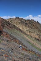
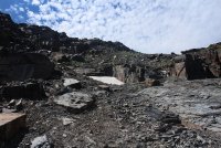
So we began our hike up what I'm calling the Robinson's Couloir. This is a steep ascent to gain the low point along the ridge at the top of the draw. The terrain consists of loose talus and scree, along with slabs of fairly slick rock. I wasn't sure what line we should take, but we started out heading up the middle before eventually peeling off to our right. As we neared the saddle, the going got slower due to the steepness of the terrain, and just the heat of the day.

When we finally reached the saddle, my daughter informed me that she was out of gas. So instead of scrambling along the ridge to the south and up to the eastern peak, we decide to take a long lunch before heading back down.

When we returned home the thermometer at my house read 101 F.

Here are some shots of our hike.
TP_01.jpg
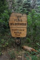
Wilderness boundary

TP_02.jpg
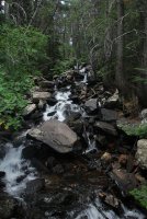
Broads Fork

TP_03.jpg
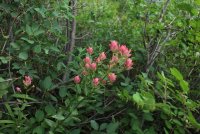
Indian Paintbrush


TP_04.jpg
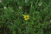
Yellow Salsify

TP_05.jpg
Horsemint along the trail

TP_06.jpg
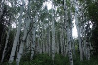
Nice grove of aspen the trail goes through
TP_07.jpg
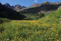
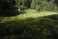
Meadow of Showy Goldeneye

TP_08.jpg
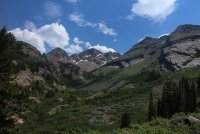
The big meadow of Broads Fork with Dromedary, Sunrise and the easterm Twin Peak Peaks visible. You can also make out the small saddle, along the ridge at the upper right hand side of the image, that we will be shooting for to gain the ridge.
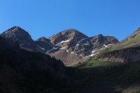
TP_09.jpg
Close up of Dromedary and Sunrise Peaks
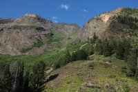
TP_10.jpg
Looking up Robinson's Couloir

TP_11.jpg
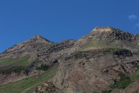
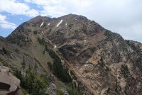
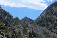
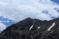
Close up of the eastern peak of Twin Peaks and the ridge we hoped to scramble across.
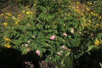
TP_12.jpg
Some wild rose among the Showy Goldeneye
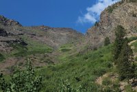
TP_13.jpg
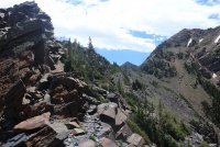
Looking up the draw - our saddle is at the upper left of the image.
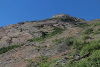
TP_14.jpg
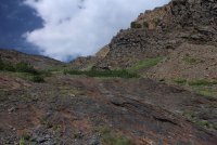
Some of the rock slabs like the ones we would encounter further on up
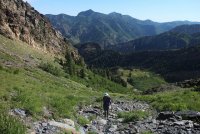
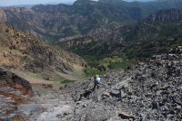
TP_15.jpg
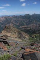
Katie making her way up the talus

TP_16.jpg
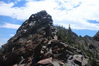
Encountering some rock slabs at this point
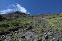
TP_17.jpg
Is that low point getting any closer?
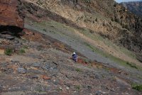
TP_18.jpg
What now?

TP_19.jpg
Getting pretty steep and this point.

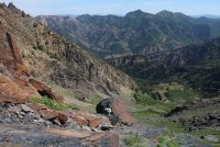
TP_20.jpg
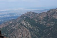
A good look down into the meadow

TP_21.jpg
A quick scat break

TP_22.jpg
Katie, holding on for dear life. :)

TP_23.jpg
Almost to the ridge

TP_24.jpg
Mount Olympus to the north

TP_24b.jpg
The north side of Broads Fork Twin Peaks
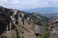
TP_25.jpg
Looking down Deaf Smith Canyon

TP_26.jpg
Almost there! Mount Raymond and Gobblers Knob can be seen along the Millcreek Ridge
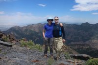
TP_27.jpg
On the low point of the ridge with Wildcat Ridge, from Mount Olympus to Mount Raymond behind us.
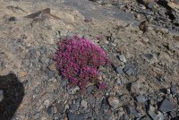
TP_28.jpg
Hey, @xjblue, or anyone else, do you know what flower this is? Just below 10,000 ft on rocky, scree terrain
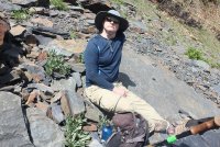
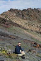
TP_29.jpg
Chillin' on the way down

TP_30.jpg
A look up Broads Fork in the afternoon
TP_31.jpg
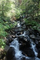
Broads Fork


The end.
 
Last edited:
Love the photos @scatman ! I can't imagine hiking up there with that exposure and heat (?) in pants & long sleeved shirts ... I'm sure there's a reason why you guys dressed that way.
 
Nice, what a beautiful area. Compared to the nearby lake blanche I imagine you had the place to yourself as well.

I always hike in long sleeves and pants. I've already had skin cancer at the age of 35 and it makes one very conscious about sun exposure, especially at high altitudes.
 
Nice!
I almost always hike in long pants, ya never know when it's going to turn into a bushwhack.
 
Broads Fork is a great place to adventure! Looks like you had one for sure! Thanks for sharing! Awesome!
 
I've long wanted to do the twins via Robinson, how long/difficult of a hike/scramble is it to the Twins from your stopping point?
I did the twins when I was in decent shape, not sure I could handle it right now...
 
Yay! Look at you guys go!
Awesome report. Thanks for the share!
 
Beautiful wildflowers!

They were pretty spectacular. Now is the time to be hiking in the Wasatch


Love the photos @scatman ! I can't imagine hiking up there with that exposure and heat (?) in pants & long sleeved shirts ... I'm sure there's a reason why you guys dressed that way.

I debated about wearing the kilt, but ultimately decided against it. This hike pretty much takes me most of the day to complete if I make it to the summit. Since I am very fair skinned (thanks mom), I have to reapply sunscreen every 90 minutes to 2 hours. This can be a pain sometimes when I'm under a time constraint. Plus I do occasionally forget that its been 2 hours because I'm in the middle of a scramble, or just concentrating on something else at the time. Or the hike has just plain worn me out and my tired mind doesn't remember.


Nice, what a beautiful area. Compared to the nearby lake blanche I imagine you had the place to yourself as well.

I always hike in long sleeves and pants. I've already had skin cancer at the age of 35 and it makes one very conscious about sun exposure, especially at high altitudes.

We did have a couple follow us up the couloir, but towards the top when it gets steep, they turned around and headed back down. It was funny, because they passed us while we were taking a break and then we passed them again on our climb to the ridge. As we passed them, the lady said, "You picked the wrong route." I was a bit taken aback and told her that sometimes you have to pick your poison. I'm guessing they were following us believing that we knew the route when in fact we had only been up the normal route before.


Nice!
I almost always hike in long pants, ya never know when it's going to turn into a bushwhack.

Agreed.


What, no kilt?

See above plus I thought there would be some bushwhacking to get to from the meadow to the bottom of the couloir. It turns out that there is a trail, overgrown in a couple spots that leads you onto the talus and from there you are on your own.


I've long wanted to do the twins via Robinson, how long/difficult of a hike/scramble is it to the Twins from your stopping point?
I did the twins when I was in decent shape, not sure I could handle it right now...

The last time I made it to the top was six years ago. I attempted it with my kids two years ago (the normal route up), but we had to cut it short because when we got to the knife's edge ridge, the wind was blowing so hard, I could barely keep my feet so I didn't feel comfortable taking my kids any further.

I'm guessing it would take between an hour to an hour and a half to reach the summit from where we were. It looked pretty straight forward to me with a lot of class 3 scrambling. And the parts that looked a little trickier along the ridge, it looked like you could just come down off the ridge and go around. I don't think you would have any problem with the ridge.

Here are some shots of the ridge. There is a bad sun angle, which is why I didn't include them in my original post.

TP_35.jpg
lookin up and south along the ridge that leads to the eastern summit

TP_36.jpg
More of the ridge

TP_37.jpg
Towards the upper right of the image might be a tad rougher, but it looks like if you drop off the ridge you'd be okay.

TP_38.jpg
Eastern summit

I'm giving some thought to attempting this again in the Fall when it cools off some, maybe late September or early October. Are you interested? You would have to put up with slowpoke though. :)


Yay! Look at you guys go!
Awesome report. Thanks for the share!

Thanks Miya! On our way down, we saw a moose laying down by an unnamed pond. Would I have to arrest it too? :D
 
Up to you. You are the boss, but if he didn't have his tent up, I am thinking you could cut him some slack.

Where is the picture of the moose?! Lol


TP_39.jpg
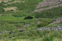
Can you make it out by the pond?
 
I'm giving some thought to attempting this again in the Fall when it cools off some, maybe late September or early October. Are you interested? You would have to put up with slowpoke though. :)
Thanks for the pics! Looks rough but doable. Yes, I'd be up for this in early fall!
 
I can see a large brown mass and will trust you that it is a moose. :)

It is indeed a moose. We watched it come into the clearing by the pond and lay down as we made our way down form the ridge. Just past this vantage point, shrubs and trees obscured our view of the moose and pond, so we could not get a closer shot.
 
View attachment 66227
Hey, @xjblue, or anyone else, do you know what flower this is? Just below 10,000 ft on rocky, scree terrain

Douglasia montana var. ???

An unidentified Rocky Mountain Dwarf Primrose variation would be my best guess.

Though the range for Douglasia montana covers Idaho, Wyo, Mont, and Canada, i believe this plant (pictured) to be a variation that is strictly endemic to the purplish-black Proterozoic Agrillite-slate out crop forming the ridge between Storm Mountain peak and Broads Twin Peaks and occuring above 9900ft+, on and below the ridge. My assumption is founded on my handful of observations of the pictured plant over the years while scrambling around that ridge and personally observing the aforementioned plant up in Montana-alpine.
On your next time up (around peak bloom) make sure to visit the NNW scree slope just below 'Peak 10350' and above the imposing upper Stairs Gulch slabs, there exist a healthy patch that really pops against the black shale. absolute alpine magic.

I searched the databases in the past and also shared my observations with an USFS ecologist contractor, to no avail.

...then again, i could be completely wrong...

Until I hear otherwise, i will refer to it as Douglasia montana var. Scatman:cool:

Thanks for the flower identification @moose droppings, it's very much appreciated. I'll try and hit peak 10350 and see the patch you describe. I noticed the clump that I took a picture of from a distance, and slowly made my way over to it. It was strikingly beautiful set all alone among the slabs. I'm afraid my picture doesn't do it justice.
 
Similar threads
Thread starter Title Forum Replies Date
scatman Broads Fork Twin Peaks, Robinson's Variation - September 29, 2018 Hiking & Camping 14
Dave Eric Robinson found at Allsop Lake General Discussion 52
regehr Deseret Peak West Twin Couloir Hiking & Camping 14
Duke GTNP: Climbers Stranded Overnight in Stettner Couloir Suffer Hypothermia, Prompt Rescue General Discussion 2
Bob Teton Wilderness July 2024 Trip Planning 38
BobFink Mirror Plateau via Pelican Valley and Pelican Creek, July / August 2023 Backpacking 12
TheMountainRabbit Southern Absaroka & Thorofare Mountain (Teton/Washakie Wilderness) - July 2023 Backpacking 23
kwc Album Denali Highway July 2023 Photography 3
scatman Reid's Peak - Uintas - July 22, 2023 Hiking & Camping 6
scatman Mount Superior - July 14, 2023 Hiking & Camping 16
scatman Mount Raymond - July 8, 2023 Hiking & Camping 17
TractorDoc Mohican State Park -- July 4, 2023 Hiking & Camping 11
C Teton Wilderness Early July Trip Planning 16
shredhiker Kings Canyon July 2022 Kearsarge, Rae, & Sixty Lakes Backpacking 8
Parashakti Late July in Yellowstone Trip Planning 9
F 12 days in Wyoming's Teton Wilderness, part 7 of 9, July 26-27, 2022 Backpacking 13
Jackson Mid-July in the Missions Backpacking 8
Georgia Yankee Snake River; Wolverine, Coulter, Pilgrim Creeks, July-Aug. 2022 Backpacking 18
scatman Shoshone Lake Lollipop Loop - Yellowstone National Park - July 24, 2022 Backpacking 63
TheMountainRabbit Younts Peak (Teton/Washakie Wilderness) - July 2022 Backpacking 22
Jackson Fourth of July Fireworks Avoidance Backpacking 5
scatman The Pfeifferhorn - July 14, 2022 Hiking & Camping 35
scatman West Millcreek Ridge - July 10, 2022 Hiking & Camping 22
scatman East Millcreek Ridge - July 2, 2022 Hiking & Camping 21
F Teton Wilderness, late July 2022 Trip Planning 6
TheMountainRabbit Invite Younts Peak, July 2022 Meet Up (Members Only) 11
ram Glacier Peak July 2021 Backpacking 9
Yvonne Climbing Mount Saint Helens via Monitor Ridge Route, July 2021 Hiking & Camping 16
Mikjik86 4 Days Backpacking Grand Teton Wilderness/Teton Crest Trail - Wyoming, July, 2021 Backpacking 0
scatman Beartooth Wilderness - Flat Rock Lake Lollipop Loop - July 26, 2021 Backpacking 56
scatman Lone Peak - July 14, 2021 Hiking & Camping 28
TheMountainRabbit Horse Ridge to Mount Febbas (Fitzpatrick Wilderness) - July 2021 Backpacking 24
Jackson Fourth of July Overnighter Backpacking 10
scatman North Summit, Mount Olympus - July 3, 2021 Hiking & Camping 12
futurafree Yellowstone partners in July Meet Up (Members Only) 0
TheMountainRabbit Invite Southern GYE, July 9th-11th Meet Up (Members Only) 0
dgosche Teton Crest July Trip Planning 2
Born to Hike 85 miles on the Uinta Highline Trail including Crater Lake and a Dinosaur: July 26 - Aug 1, 2020 Backpacking 35
scatman Grandview Peak - July 24, 2020 Hiking & Camping 11
scatman Broads Fork Twin Peaks - July 14, 2020 Hiking & Camping 20
scatman Bourbon Lake, Uintas - July 11, 2020 Hiking & Camping 4
scatman Millvue Peak - July 3, 2020 Hiking & Camping 2
U Favorite sites in Glacier in North Fork, Lake McDonald or Cole/Nyack? Looking at mid july Trip Planning 2
zionsky Zion to Resume Shuttles July 1 General Discussion 2
U Just picked up a permit for Shelf Lake 2 nights in Mid/Late July. Any ideas for a day hike/summit from there? Trip Planning 0
U Any recommendations for 5 days hiking in Wyoming, Idaho or MT? This is around July 15-20. Not counting on Glacier being open Trip Planning 9
U Glacier North Circle Loop Mid July - Looking for an alternative back-up plan for a 3-4 nighter Trip Planning 0
E Glacier National Park in Mid July Trip Planning 0
Yvonne Backpacking the Winds: From Elkhart TH to Titcomb Basin, July 2018 Backpacking 20
Dreamer Wind River Dreaming | Summer 2019 July 17 - July 29 | Green River Lakes - Elkhart Park Backpacking 14

Similar threads

Back
Top