Robbers Roost River Crossing and Roads

Jackson

I ❤️ GYE
.
Joined
May 31, 2015
Messages
3,208
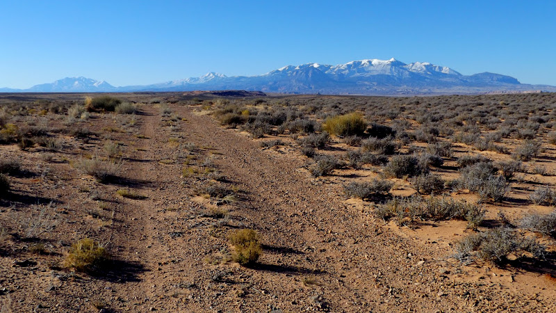
My final spring break is coming up next week, and Jessica and I were planning on getting out and backpacking somewhere from 3/14-3/16. We have an interest in going to Robbers Roost Canyon via Angel Point West and crossing the Dirty Devil. In a drier year, I wouldn't be as unsure about doing this, but given how much rain and snow the entire state has gotten this season, would it (1) be foolhardy to drive those roads in an Outback, and (2) be very likely that we'd encounter impassable quicksand along the DD (or even be able to walk across the river at all)?

I've honestly never really seen the Colorado Plateau after such a wet season, so I'm not sure what to expect as far as overall muddiness and such on roads and trails. I'm thinking it's possible that we'll end up somewhere else down there, but I figured I should check on this area.

Thanks for any insights you can offer.
 
I'm not sure what a safe level is for crossing the Dirty Devil, but it's running at 182 CFS right now which seems pretty high. It may be higher or lower in a couple of weeks. Either warm dry weather, or wet weather, will cause it to rise, so I would expect it to only go up until the snow is all melted.

I think the roads will probably okay unless there is significant rain or snow in the week leading up to your trip. It's been a few years since I was last out that way, but the roads are generally sandy/gravelly and don't receive a lot of traffic. These were taken in November 2015 near the Angel Point West trailhead:

DSCF1275.JPG


DSCF1278.JPG


If the river flow is too high to cross, there's a good route into Robber's Roost Canyon from the Angel Point East trailhead (I can share my GPS track privately if you'd like). However, it's a much longer drive with more possibilities for bad roads. There's a lot more traffic out that way and after rain/snow like we've had lately, the roads are likely torn up pretty badly just getting to the road junction near Little Saucer Basin where you would turn south toward the Roost.
 
Would the folks at Hans Flat be able to offer advice on road conditions??
 
I agree that those roads should be fine. Nice and sandy/gravelly/well-draining soils there. Unless you get a big rain or river levels go up significantly I don't think the crossing should be much of an issue. Trekking poles would probably be nice. I've crossed there a couple times in March along and seems like you usually have a narrow deepish channel on one of the banks (maybe up to thigh deep) but most of it is still only ~calf deep.
 
I'm not sure what a safe level is for crossing the Dirty Devil, but it's running at 182 CFS right now which seems pretty high. It may be higher or lower in a couple of weeks. Either warm dry weather, or wet weather, will cause it to rise, so I would expect it to only go up until the snow is all melted.

I think the roads will probably okay unless there is significant rain or snow in the week leading up to your trip. It's been a few years since I was last out that way, but the roads are generally sandy/gravelly and don't receive a lot of traffic. These were taken in November 2015 near the Angel Point West trailhead:

DSCF1275.JPG


DSCF1278.JPG


If the river flow is too high to cross, there's a good route into Robber's Roost Canyon from the Angel Point East trailhead (I can share my GPS track privately if you'd like). However, it's a much longer drive with more possibilities for bad roads. There's a lot more traffic out that way and after rain/snow like we've had lately, the roads are likely torn up pretty badly just getting to the road junction near Little Saucer Basin where you would turn south toward the Roost.
Thanks for the tips! I appreciate it. I think we may just go for it on the west side, and if we decide it's too sketchy at any point, we'll have a backup plan or just head out early. Would definitely be interested in the eastern approach at some point though.

I agree that those roads should be fine. Nice and sandy/gravelly/well-draining soils there. Unless you get a big rain or river levels go up significantly I don't think the crossing should be much of an issue. Trekking poles would probably be nice. I've crossed there a couple times in March along and seems like you usually have a narrow deepish channel on one of the banks (maybe up to thigh deep) but most of it is still only ~calf deep.
Thanks for the response. Do you know roughly around what flows the crossing becomes treacherous? From what I understand, the riverbed is very wide and shallow, so I'm guessing it would take a whole lot.
 
Sorta related, I talked to the folks at the Hanksville BLM office yesterday about the Poison Springs Road, which I hope to drive down next week. They said it had been fine up until recently, but there had been a lot of moisture and it may have deteriorated. They were going to send someone down there late this week or over the weekend. I plan to call them on Monday or Tuesday to get an update, will report back here if I learn anything.

With some friends, I'm hoping to float from Angel Cove to Poison Springs late next week. May see you down there! We'll do something with less floating if the PS road is bad, if weather looks particularly crappy, or if the DD flow is too high or low (not looking like it'll be too low).
 
I have backpacked in almost all the Dirty Devil west side canyons. The Roost was the least attractive due to the effects of ongoing grazing.
Thanks, that's very good to know. Are there any that you'd recommend for a two-nighter over that way?
 
I have backpacked in almost all the Dirty Devil west side canyons. The Roost was the least attractive due to the effects of ongoing grazing.
This is very true, especially if coming up from the bottom. The upper ends are still good if you come in from White Roost but the lower end from the river has gotten pretty hammered.

For a lot of the good loops (SMB/TCB, Larry/No Mans) I suspect most people would want another night or two. If you are fine just doing an out and back like you would in Robbers Roost and Poison Spring road is ok, the lower ends of Hatch and Fiddler Cove are pretty special.
 
Just talked to guy at the Hanksville BLM office and as of Friday the PS road is in good shape, but with quite a lot of water running.

Would be super happy to hear more info from any of you if you have anything more recent
 
Just talked to guy at the Hanksville BLM office and as of Friday the PS road is in good shape, but with quite a lot of water running.

Would be super happy to hear more info from any of you if you have anything more recent
All I can offer is that I drove all of Poison Spring Canyon on February 2nd and it was in great shape. 2WD all the way except for one ice ledge at a stream crossing that's probably gone now. There wasn't a whole lot of flow then, though.
 
Action Jackson!

I have crossed the devil on foot safely from 45 - 175 CFS. I have not tried it any deeper - not because of any reason not to - I just simply not wanting to and there when it was greater than that.

The best gage is at Poison Springs:
https://waterdata.usgs.gov/ut/nwis/uv?09333500

That is the place where the only real road crossing is too. I have not driven across either but will someday. I have crossed there when it was shin deep but don't know what the flow rate was.

Luck!
 
@Jackson, what did you get done?
Admittedly nothing as far as backpacking goes. After some discussion, we decided to visit the Grand Canyon and save the backpacking for another time. I was a bit reluctant at first but really enjoyed the trip!

We had ended up planning on going backpacking somewhere other than the Roost given how much time we had, so both the Roost and that trip are shelved for the time being. I may go for one of the two as my annual "congratulations on finishing finals" trip, but I'm also very drawn to an area west of Capitol Reef that I've not been able to find any information on. There is too much to see!
 
Similar threads
Thread starter Title Forum Replies Date
D Advice for short backpacking trip in Robbers Roost Trip Planning 2
Dhuff3243 Robbers Roost/White Roost Trip Planning 1
Dhuff3243 North Fork Robbers Roost and Blarney canyon Trip Planning 0
George_Washington_Hayduke White Roost Canyons (east and west forks) & North Fork of Robbers Roost Canyon Canyoneering 3
George_Washington_Hayduke Dirty Devil Bikerafting Canyoneeering Loop: S. Fork Robbers Roost to No Mans Canyon On The Water 0
gnwatts Robbers Roost birthday Hiking & Camping 13
E Help regarding Robbers Roost Camping Trip Planning 16
lostlandscapes Lost Spring Canyon, Robbers Roost Canyoneering 4
Aldaron Buck Canyon, Robbers Roost Trip Planning 8
Deadeye008 Robbers Roost Ranch Carvings Trip Planning 6
regehr cows in the roost? Trip Planning 5
Udink Angel Point to Robber's Roost Canyon Hiking & Camping 0
westy Roost and Swell fun Canyoneering 3
Blake Merrell Canyoneering in the Roost! Canyoneering 25
Nick Relaxing In The Roost Hiking & Camping 8
M Doable, right? What do you think...Canyoneering the Roost Trip Planning 4
Nick Invite Backcountrypost Fest, Nov 2012: The Roost Meet Up (Members Only) 61
Tyler Roost Country: Keg Knoll, Colonnade Arch, Moonshine Wash, Goblin Valley Hiking & Camping 1
M Lost a drone in the San Rafael River area/below the wedge. No time to hike in to retrieve. General Discussion 0
fossana Colorado River talks in Springdale, UT (March 27th, April 5th) General Discussion 4
TractorDoc Yellowstone's Gallatin River -- September 7-9th 2023 Backpacking 12
BJett Rockcastle River No Shuttle Packrafting - Kentucky On The Water 2
Janice Such a GRAND Canyon - Deer Creek / Tapeats / Thunder River Backpacking 21
Kullaberg63 Suggestions for Escalante east of river, south of Choprock Trip Planning 4
scatman The Gallatin River, Bighorn and Fawn Passes, Yellowstone National Park - September 7, 2023 Backpacking 14
shredhiker Thorofare, Heart Lake, Snake River Sept. 2023 Backpacking 16
Ugly Headless Valley- Film about traveling the Nahanni River General Discussion 5
meowtaingal Wind river high route mid september Trip Planning 7
BJett Packrafting the Obed National Wild & Scenic River - Tennessee On The Water 1
kwc Savage River, Denali NP Hiking & Camping 1
D Wind River offtrail route questions Trip Planning 28
Rockskipper You think you found a pithouse, or maybe an Ancestral Puebloan tower near Green River, UT? It's maybe something even more interesting... General Discussion 3
SteveR Sheep River Road Ride on May Day Everything Else 2
F Upper Escalante River Backpack conditions Trip Planning 6
W Greetings from the West Side of the Winds (Wind River range) Noobs: Introduce yourself! 5
marquiri Wind River Range - Angel Pass Trip Planning 24
Writhdar Day hikes in the White Clouds and Lost River Range Hiking & Camping 1
BJett Packrafting the Cumberland River Below the Falls - Kentucky On The Water 6
Mikjik86 Backpacking The Wind River Range - Wyoming, September 2022 Trip Reports 3
kwc Cedar River Flow, Central Adirondacks On The Water 1
kwc Fall paddle on the West Branch of the Sacandaga River 10/23/22 On The Water 0
Jackson Heart Lake and Snake River for Labor Day Backpacking 23
Stephanie B Dirty Devil River Impassible at Poison Springs Canyon Off Road 0
R Wind River Range: Green River Lakes/Clarks Trail/Porcupine Creek Trail Trip Planning 3
BJett Amazing Appalachians - Backpacking/Packrafting the AT and Nantahala River Backpacking 5
Georgia Yankee Snake River; Wolverine, Coulter, Pilgrim Creeks, July-Aug. 2022 Backpacking 18
Mikjik86 Another Wind River Trip Planning! Elkhart/Titcomb/Knapsack/Shannons Pass loop back to Elkhart, or continue to Green River Lakes Trailhead? Trip Planning 10
wsp_scott Wind River Range Sept 2021 (part 2) Backpacking 4
wsp_scott Wind River Range Sept 2021 (part 1) Backpacking 16
WasatchWill WRHR - Day 7: Beaver Park to Green River Lakes Backpacking 15

Similar threads

Back
Top