- Joined
- May 31, 2015
- Messages
- 3,329
February 17-18, 2018
As some may recall, last March, I did an overnighter backpacking in along the San Rafael River. We had hoped to see Virgin Spring Canyon and its pictographs, but a combination of misreading the map and my companion's fatigue kept us from getting there. I also went on a dayhike in the gorge in October. As a result, I didn't think I'd be back any time soon, but I ended up with some time over Presidents Day weekend, and the pictographs were calling my name. My friend Dan was more than willing to join me, and the weather looked pretty good.
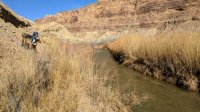
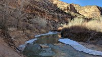
We got to the trailhead around 9 or 9:30. The temperature was in the low 40s, but the sun made it seem much warmer. We set out and the views were nice. It's a pretty straightforward walk most of the way, sometimes taking you through some brush and branches that may scratch you up a bit. There were quite a few cows for the first while as well. The river had ice especially in shady spots, and the surface was slushy in a lot of places, even in the sun for the first bit. Here's Dan looking upriver.
Nice rocks all over.
We were nearing Cane Wash before long. Once we got there, we had a snack and looked at the pictographs. I didn't take any pictures of them this time.
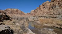
We opted to take the cutoff to save some distance and time. So we headed up that way.
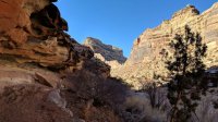
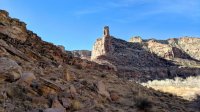
I always like being able to see the giant rock wall from this vantage point.
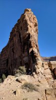
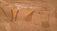
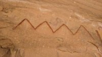
We set out from the top to go find some yellow and red pictographs I had seen photos of before. We got to them in about 10 minutes, and they were great. Not sure what they're supposed to be, but we just stared at them for a while.
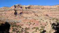
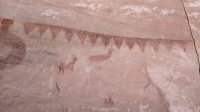
We saw a little petroglyph nearby too, but it barely showed up in the picture I took of it.
We continued up the river.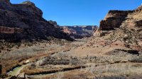
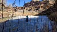
We came to a spot that had very thick ice and walked out on it. This spot probably doesn't get much sun in the winter. I liked the blade of grass covering my eyes in photo.
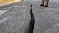
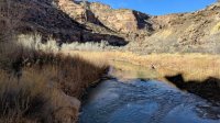
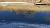
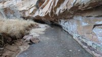
The water was moving very slowly. Nice reflection with some ice chunks floating through.
We got going again. We were getting close to our destination.
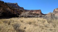
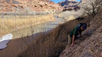
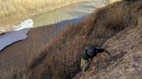
I had read that we would likely have to ford the river before we got there. Given how much ice we had encountered, wading across the river was not sounding pleasant. We had brought wading shoes just in case, but we ended up finding a fairly simple couple of scrambles that kept us on the south side. What a relief.
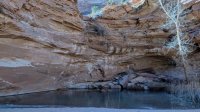
We got to the canyon and headed up. We ended up walking too close to one side and we completely missed the pictographs on our way up. We got to the spring, which was frozen everywhere but the far side, where there was some algae keeping the water from freezing.
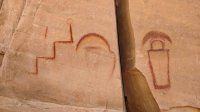
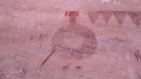
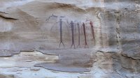
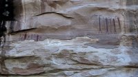
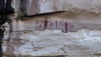
We headed a bit down the canyon, found a good place for camp, and dropped our packs. We went farther down and found the pictographs. What a cool panel. Unfortunate that parts of it have flaked off. It looks like more of it could fall any day, sadly.
We headed back to our packs and set up camp. The sand was slightly wet and partially frozen, so getting stakes into it was not fun.
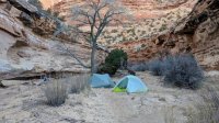
Being such a small canyon in the winter meant that it got dark down there by mid-afternoon. We could still see the sun up high for a few more hours though.
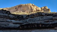
We checked out the frozen stream running from the spring. It was fun to get a running start and slide around.
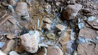
Where the water was really shallow, there were interesting ice formations.
We had dinner and waited until it got dark so we could look at stars. It was pretty cold that night. Maybe high teens or low 20s.
We got going pretty quickly the next day. Taking down the tents was a pain because the sand had frozen even harder overnight. We ended up snapping a few stakes trying to pull them out. I had never seen that happen before. And there I was thinking MSR Groundhogs are indestructible.
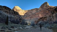
Getting back up onto the ledge we had scrambled onto the day before was a bit tricky, but I ended up just running at it and hoisting myself up. It was nice to be back in the sun.
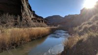
Ice had formed where the water ran over some rocks in the river, and I thought it looked cool.
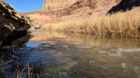
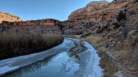
Here's the most frozen section. I was tempted to test out the strength of that ice bridge, but the possibility of falling into frigid water that I didn't know the depth of kept me away.
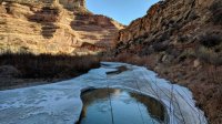
I liked how the ice chunks were floating in a line down this channel through the ice.
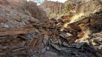
We got back to the ascent to the cutoff. The rocks through there are interesting. This makes it look much more challenging to go up than it really is.
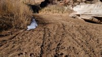
And when we got to Cane Wash, we saw tire tracks in the mud. I had no idea that people were allowed to drive vehicles down Cane Wash, but maybe the cattle ranchers can. Anyway, our theory was that they drove a few people down the day before, and those people ran the cows out of the gorge back to the trailhead that afternoon. We didn't see any cows until we spotted a few at the trailhead.
We got back to the trailhead and headed to Price for lunch.
We ended up seeing everything we set out to, and other than a few cows, we didn't see anyone the entire time. Great trip.
As some may recall, last March, I did an overnighter backpacking in along the San Rafael River. We had hoped to see Virgin Spring Canyon and its pictographs, but a combination of misreading the map and my companion's fatigue kept us from getting there. I also went on a dayhike in the gorge in October. As a result, I didn't think I'd be back any time soon, but I ended up with some time over Presidents Day weekend, and the pictographs were calling my name. My friend Dan was more than willing to join me, and the weather looked pretty good.
We got to the trailhead around 9 or 9:30. The temperature was in the low 40s, but the sun made it seem much warmer. We set out and the views were nice. It's a pretty straightforward walk most of the way, sometimes taking you through some brush and branches that may scratch you up a bit. There were quite a few cows for the first while as well. The river had ice especially in shady spots, and the surface was slushy in a lot of places, even in the sun for the first bit. Here's Dan looking upriver.

Nice rocks all over.


We were nearing Cane Wash before long. Once we got there, we had a snack and looked at the pictographs. I didn't take any pictures of them this time.

We opted to take the cutoff to save some distance and time. So we headed up that way.

I always like being able to see the giant rock wall from this vantage point.

We set out from the top to go find some yellow and red pictographs I had seen photos of before. We got to them in about 10 minutes, and they were great. Not sure what they're supposed to be, but we just stared at them for a while.


We saw a little petroglyph nearby too, but it barely showed up in the picture I took of it.
We continued up the river.

We came to a spot that had very thick ice and walked out on it. This spot probably doesn't get much sun in the winter. I liked the blade of grass covering my eyes in photo.


The water was moving very slowly. Nice reflection with some ice chunks floating through.

We got going again. We were getting close to our destination.

I had read that we would likely have to ford the river before we got there. Given how much ice we had encountered, wading across the river was not sounding pleasant. We had brought wading shoes just in case, but we ended up finding a fairly simple couple of scrambles that kept us on the south side. What a relief.


We got to the canyon and headed up. We ended up walking too close to one side and we completely missed the pictographs on our way up. We got to the spring, which was frozen everywhere but the far side, where there was some algae keeping the water from freezing.

We headed a bit down the canyon, found a good place for camp, and dropped our packs. We went farther down and found the pictographs. What a cool panel. Unfortunate that parts of it have flaked off. It looks like more of it could fall any day, sadly.


We headed back to our packs and set up camp. The sand was slightly wet and partially frozen, so getting stakes into it was not fun.

Being such a small canyon in the winter meant that it got dark down there by mid-afternoon. We could still see the sun up high for a few more hours though.

We checked out the frozen stream running from the spring. It was fun to get a running start and slide around.

Where the water was really shallow, there were interesting ice formations.

We had dinner and waited until it got dark so we could look at stars. It was pretty cold that night. Maybe high teens or low 20s.
We got going pretty quickly the next day. Taking down the tents was a pain because the sand had frozen even harder overnight. We ended up snapping a few stakes trying to pull them out. I had never seen that happen before. And there I was thinking MSR Groundhogs are indestructible.

Getting back up onto the ledge we had scrambled onto the day before was a bit tricky, but I ended up just running at it and hoisting myself up. It was nice to be back in the sun.

Ice had formed where the water ran over some rocks in the river, and I thought it looked cool.

Here's the most frozen section. I was tempted to test out the strength of that ice bridge, but the possibility of falling into frigid water that I didn't know the depth of kept me away.

I liked how the ice chunks were floating in a line down this channel through the ice.

We got back to the ascent to the cutoff. The rocks through there are interesting. This makes it look much more challenging to go up than it really is.

And when we got to Cane Wash, we saw tire tracks in the mud. I had no idea that people were allowed to drive vehicles down Cane Wash, but maybe the cattle ranchers can. Anyway, our theory was that they drove a few people down the day before, and those people ran the cows out of the gorge back to the trailhead that afternoon. We didn't see any cows until we spotted a few at the trailhead.

We got back to the trailhead and headed to Price for lunch.
We ended up seeing everything we set out to, and other than a few cows, we didn't see anyone the entire time. Great trip.
