- Joined
- Feb 23, 2012
- Messages
- 662
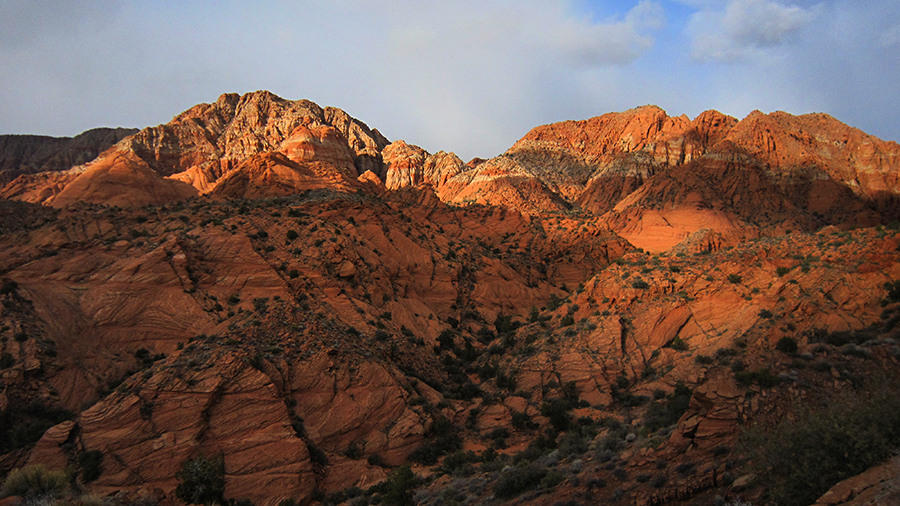
After driving by the Red Cliffs Conservation Area just north of St. George for so many years, I finally decided to stop and explore a little. My ultimate goal was to find a backpacker-friendly route through the heart of the Cottonwood Wash area. Planning for a longer hike someday, I was looking for a cool route that would link St. George to the Pine Valley Mountains en route to the Kolob Canyons. But, now I know this area is cool enough to be a destination in its own right. What I present here is not actually how I did the hike, but instead a suggested route for a 2-3 day backpack trip. I actually stayed out two nights and then did two additional half days hiking in from alternate trailheads just to make sure all the routes would connect.
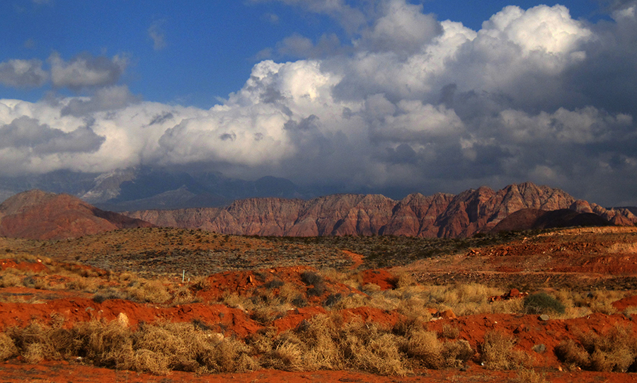
I wanted to set out from the Green Spring or Millcreek areas just north of St. George, but the recent development here has led to a series of road closures and a confusing maze of residential streets. Here's a peek into the conservation area (behind me are rows and rows of new homes!):
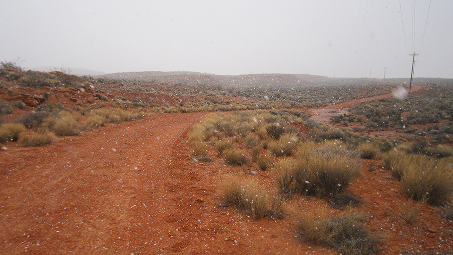
So, instead I headed over to the Grapevine trailhead and went in that way. It was a crazy day of intermixed sunshine and snow:
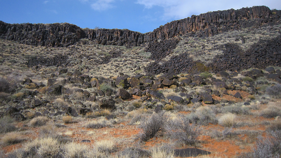
The Grapevine Trail (ie dirt road) ends at an island of slickrock walled in by this cliff of lava:
BTW -- those last two pictures were taken about 40 minutes apart. Crazy weather!
This is the boundary between the Lower and Upper Zones in the Conservation Area. In the Lower Zone you must stay on designated trails and no camping is allowed. In the Upper Zone you can go cross-country and camp. So, with that freedom, I was able to route-find just a bit to get on top of the lava and then head up toward Washington Hollow.
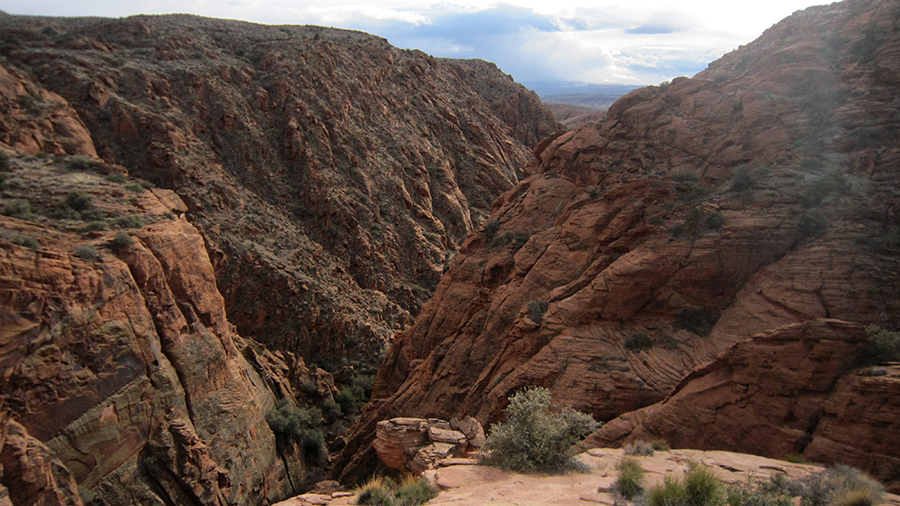
I skirted along the edge of Upper Bone Wash. I was originally going to come up this canyon and climb out at the dryfall. Looking down in I'm glad I didn't as it would have been a lot of work:
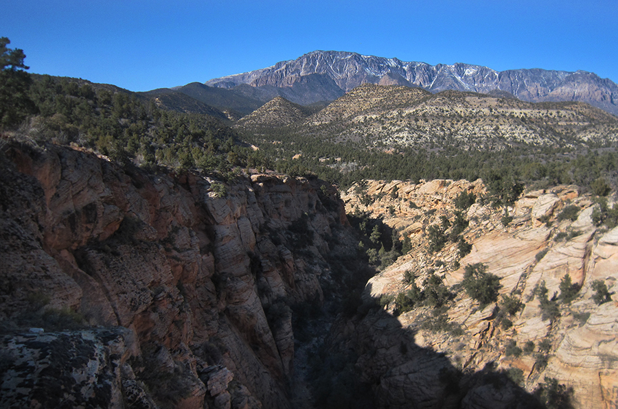
From here I kept heading toward Washington Hollow and a pass that I hoped would connect me with Cottonwood Wash. It was a lot of up and down across the drainages, but when the sun popped out it was worth it with great views:
Sure enough, the route up to and through the pass worked with only minor amounts of scrambling. Here's looking back down the sandstone ramps I went up:
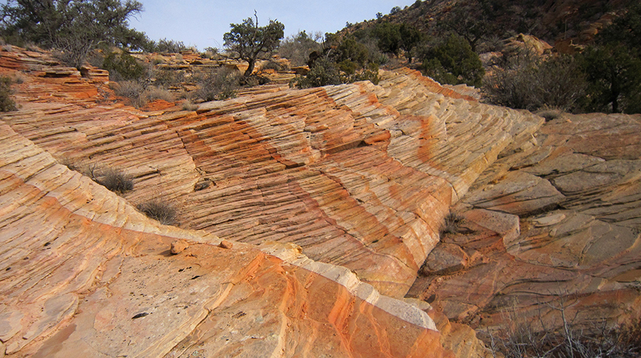
This pass is actually quite colorful with nice swirls of orange, brown and white sandstone:
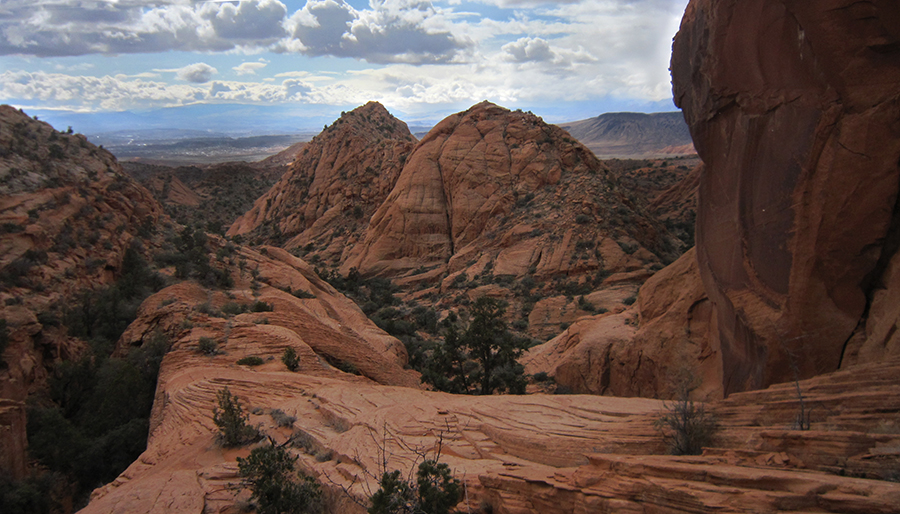
From here it's a fairly easy walk over to the mid-section of Cottonwood Wash. It's in this area that I found a steep route up to Yant Flat which could lead over to Cottonwood Road, but for now I wanted to stay in the canyons so instead I headed down toward Heath Wash and made camp. Here's looking back up Cottonwood Wash from near the jct with Heath Wash:
BTW -- there's decent camping in this area with a LOT of wood if one wanted to make fire. You aren't likely to see any water though until in the upper sections of the canyon and even then still very little.
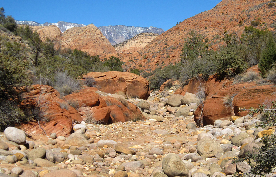
Walking in Cottonwood Wash was nice with fairly firm gray sand and occasional boulders. Heading up Heath Wash wasn't as much fun due to non-stop boulders, thus I ridge walked some of the way. Here's the actual wash:
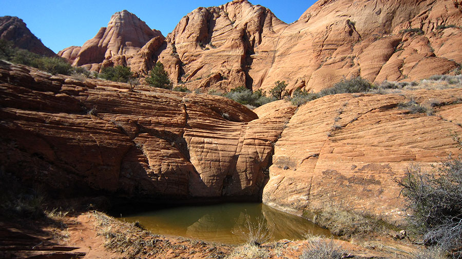
About half way up Heath Wash there are several side canyons that are really cool with some big full potholes of water. I scouted the area, but wasn't able to connect any routes with higher ground above:
I finally found a way out of Heath Wash via the canyon just south of Big Hollow. The route wasn't that bad with just a bit of brush and minor boulder hopping. Here's a shot from the rim:
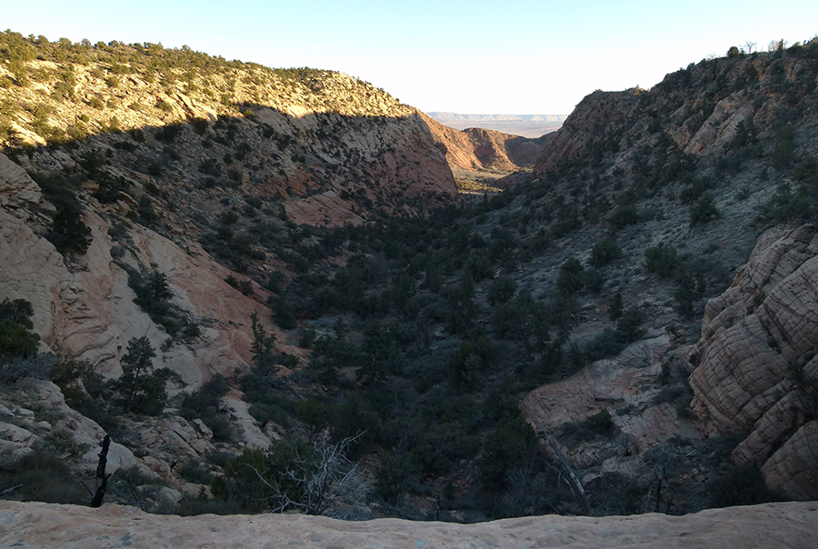
From here it's easy to go cross-country to the road near the top of Yankee Doodle canyoneering route. Walking the road along here affords some great views into Yankee Doodle and Big Hollow canyons:
After fighting through a little brush it's easy to get down into Big Hollow. I was happy to see a dripping wall and what looked like a permanent spring right near the top. Walking down canyon required some boulder-hopping, but nothing bad at all:
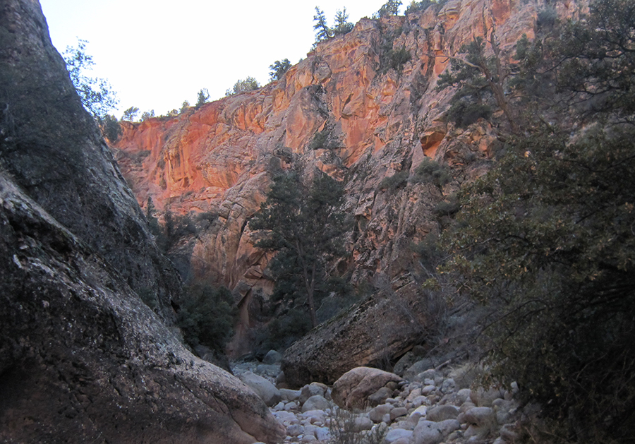
About a mile farther down or so is the junction of Heath Wash and then some fairly shallow narrows:
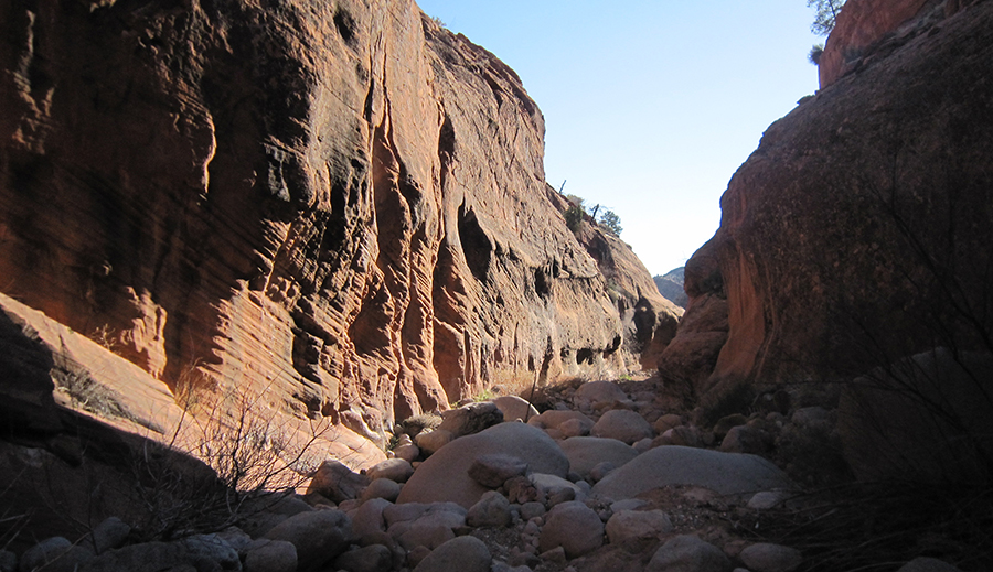
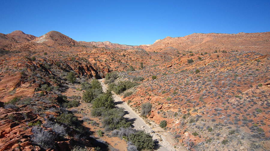
Less than another mile and I was back to where I left the wash up the side canyon. From this point it was just a couple of hours back down Heath Wash/ Cottonwood Wash and down to the Trailhead. Lower Cottonwood Wash is nice, but not as scenic as the upper portion:
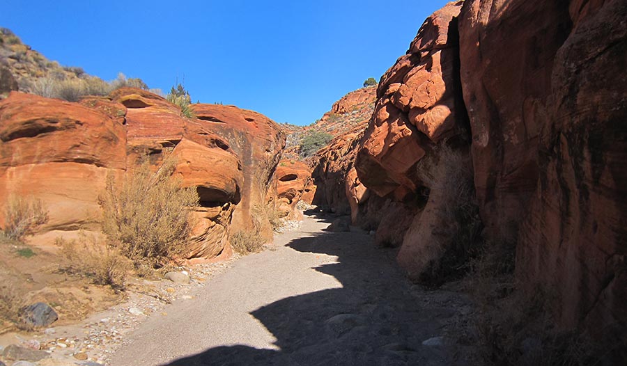
Near the bottom it would be possible to follow the Cottonwood Hills or Prospector trails to close the loop back to the Grapevine TH. I didn't do this section, but it looks fairly straightforward and well traveled.
In summary -- this is a little-visited, nice little area to escape the nearby urbanization (though I could still hear the roar of I-15 from one my camps!) There are plenty of opportunities for exploring and if you get lucky you might even see a Gila Monster or a Chuckwalla.
See the original report on my site for a few extra pictures and a map of the route.
- Jamal
Featured Image for Homepage:

I wanted to set out from the Green Spring or Millcreek areas just north of St. George, but the recent development here has led to a series of road closures and a confusing maze of residential streets. Here's a peek into the conservation area (behind me are rows and rows of new homes!):
So, instead I headed over to the Grapevine trailhead and went in that way. It was a crazy day of intermixed sunshine and snow:
The Grapevine Trail (ie dirt road) ends at an island of slickrock walled in by this cliff of lava:
BTW -- those last two pictures were taken about 40 minutes apart. Crazy weather!
This is the boundary between the Lower and Upper Zones in the Conservation Area. In the Lower Zone you must stay on designated trails and no camping is allowed. In the Upper Zone you can go cross-country and camp. So, with that freedom, I was able to route-find just a bit to get on top of the lava and then head up toward Washington Hollow.
I skirted along the edge of Upper Bone Wash. I was originally going to come up this canyon and climb out at the dryfall. Looking down in I'm glad I didn't as it would have been a lot of work:
From here I kept heading toward Washington Hollow and a pass that I hoped would connect me with Cottonwood Wash. It was a lot of up and down across the drainages, but when the sun popped out it was worth it with great views:
Sure enough, the route up to and through the pass worked with only minor amounts of scrambling. Here's looking back down the sandstone ramps I went up:
This pass is actually quite colorful with nice swirls of orange, brown and white sandstone:
From here it's a fairly easy walk over to the mid-section of Cottonwood Wash. It's in this area that I found a steep route up to Yant Flat which could lead over to Cottonwood Road, but for now I wanted to stay in the canyons so instead I headed down toward Heath Wash and made camp. Here's looking back up Cottonwood Wash from near the jct with Heath Wash:
BTW -- there's decent camping in this area with a LOT of wood if one wanted to make fire. You aren't likely to see any water though until in the upper sections of the canyon and even then still very little.
Walking in Cottonwood Wash was nice with fairly firm gray sand and occasional boulders. Heading up Heath Wash wasn't as much fun due to non-stop boulders, thus I ridge walked some of the way. Here's the actual wash:
About half way up Heath Wash there are several side canyons that are really cool with some big full potholes of water. I scouted the area, but wasn't able to connect any routes with higher ground above:
I finally found a way out of Heath Wash via the canyon just south of Big Hollow. The route wasn't that bad with just a bit of brush and minor boulder hopping. Here's a shot from the rim:
From here it's easy to go cross-country to the road near the top of Yankee Doodle canyoneering route. Walking the road along here affords some great views into Yankee Doodle and Big Hollow canyons:
After fighting through a little brush it's easy to get down into Big Hollow. I was happy to see a dripping wall and what looked like a permanent spring right near the top. Walking down canyon required some boulder-hopping, but nothing bad at all:
About a mile farther down or so is the junction of Heath Wash and then some fairly shallow narrows:
Less than another mile and I was back to where I left the wash up the side canyon. From this point it was just a couple of hours back down Heath Wash/ Cottonwood Wash and down to the Trailhead. Lower Cottonwood Wash is nice, but not as scenic as the upper portion:
Near the bottom it would be possible to follow the Cottonwood Hills or Prospector trails to close the loop back to the Grapevine TH. I didn't do this section, but it looks fairly straightforward and well traveled.
In summary -- this is a little-visited, nice little area to escape the nearby urbanization (though I could still hear the roar of I-15 from one my camps!) There are plenty of opportunities for exploring and if you get lucky you might even see a Gila Monster or a Chuckwalla.
See the original report on my site for a few extra pictures and a map of the route.
- Jamal
Featured Image for Homepage:
")