- Joined
- Oct 30, 2016
- Messages
- 991
A couple of buddies flew out from Illinois for a four day three night trip to the Rawah Wilderness this past week. I'd spent a couple months weighing the merits of various destinations, even solicited some ideas here, and ultimately this seemed like the best balance of adventure vs not killing the flatlanders. Worked out great.
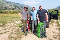
The Rawah is a couple hours west of Fort Collins, and about 30 miles south of Wyoming. I wasn't entirely sure what to expect as it lacks any peaks 13K or higher.
Our trip started on Labor Day. Colorado has been bathed in wildfire smoke from all the action north/northwest of us, and I couldn't even see the foothills behind my house when we headed out that morning. Thankfully things were a bit clearer by the time we got to the West Branch trailhead after a very pretty drive through Poudre Canyon. There was a mass exodus from the wilderness going on as we headed in, and these folks would be the last we'd see for four days with very few exceptions.
Bob had some backpacking experience and really killed it all four days. This was Dustin's first backpacking trip, so it was right in to the deep end of the pool for him. He's also a weight lifting fanatic and a huge guy (we met each other in a gym a few years ago) and had blistered up his feet the week before doing a Tough Mudder, but not a bit of whining the entire trip.
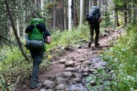
The first day was the worst of it and I warned them accordingly. We'd be hiking from the trailhead at 8500 feet to Twin Crater Lakes at just over 11,000 feet. I figured that even if we moved at a snail's pace, we'd hit 11K with enough daylight left to get back out if someone really had a problem with the elevation.

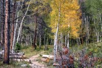
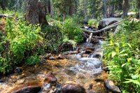
Very pretty hike. Lots of water crossings, none nearly as bad as I had read ahead of time.
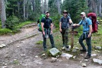
About three miles in we reached the junction with Camp Lake trail. We'd reach this spot again upon completing the loop on the hike out. Dustin's looking a little worse for wear here, but ample breaks for catching breath and lowering heart rates eventually got us to the top without any lasting damage.
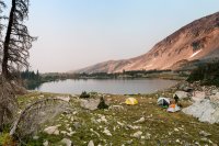
We camped on a stretch of ground separating the Twin Crater Lakes. Views were great even though the wildfire smoke was really limiting visibility. Lots of chirping marmots behind us, and we saw a fox run past along the lake shore later that night.
I lent Dustin my old 2-man North Face tent for the trip in addition to some other gear I've eventually replaced with lighter equivalents. He's in yellow below. Bob brought a BA Rattlesnake 2-man. I'm in my usual Copper Spur 1-man.
About the only good thing about all the smoke is the nice sunrise/sunsets it makes. I got up early the next morning and wandered around the area taking advantage.
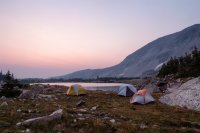
First time in my life I actually watched the sun climb up from behind the horizon (a mountain ridge in this case) and up in to the sky. The smoke dimmed it out that much.
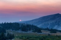
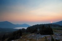
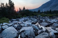
Alpenglow on the peaks behind our camp.
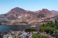
We had breakfast and hiked out around 10:30. Can't really make it out here, but there's a bench lake behind the ridge on the left sending a massive outflow waterfall down the slope. Sounded like a jet engine.
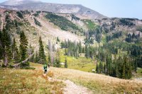
Day two's hike was a short one at just over 5 miles. We'd drop down about 600 feet before ascending back up and over Grassy Pass to the Rawah Lakes area. Again the smoke sort of robbed us of the views, but they were still decent. The pass was cold and windy. Lots of rest breaks on the way and we saw our first fellow traveler here since the hike in - a solo backpacker having lunch just past the top of the pass.

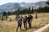
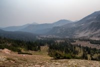
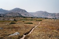
Camp for the night would be at Rawah Lake #2 (there are four), so we headed down to Rawah Lake #3 to make our way north. This was where we saw our first moose of the trip. Two bulls munching vegetation along the shoreline of the lake. Shortly afterwards we rounded a corner and saw a cow, her calf and another bull in the thickets next to us.
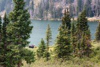
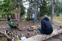
You are allowed to have camp fires below 10800 feet in the Rawah, and we managed to scrounge up enough dry wood to do just that. This probably kept us up and moving for an hour we'd have otherwise spent huddled inside our tents. It was a brutally cold night with temps dipping down in to the 20's and the wind starting to pick up a bit. It was also a full moon, and everyone agreed it was the brightest moon we'd ever experienced.
Another beautiful sunrise the next morning, though I admit I had to force myself out of my bag to go photograph it.
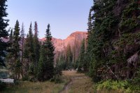
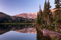
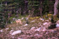
Didn't make it 50 yards from camp before running in to wildlife. Numerous deer were moving around on the hillside behind camp.
Further up trail, I rounded a bend and found myself up close and personal with a moose. If you are loathe to watch yet another YouTube hiking video, you still may want to fast forward your way through the one below for a couple of decent segments of moose being moosey. It was cool for me at any rate, having only ever seen moose from a distance and never so close that I was resigned to the fact that if they decided to charge it would be lights out for me.
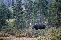
This particular guy quickly lost interest in staring me down and got on with scraping as many trees as he could.
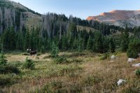
Another 10:00ish start to the day saw us hiking out and past Rawah Lake #1 on our way to Upper Camp Lake. This was our second human sighting, spotting a tent in the woods on the north side of the lake.
Another easy hiking day, even with a couple unexpected additions.

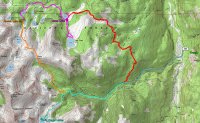
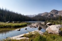
All in we put in just over 6 miles (despite the graph above) from the Rawah Lakes, past Camp Lake, to Upper Camp Lake, and then back and around Camp Lake. Upper Camp Lake is seen below, but there was no good camping spots around the lake itself. I noticed some elk watching me from a ridge above the lake, so I scouted up there and did find a couple existing sites but they were surrounded by beetle kill and very buggy (first and last mosquitos we ran in to on the trip). They'd also mean a 100 foot scramble to and from the lake for water.
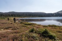
I suggested we take a look for a site on the north side of the lower lake and again there were a few to be found, but they were enclosed in the woods with no views and a boggy marsh to traverse in order to reach the lake for water. So, and oh how I appreciate non-bitching companions, I marched us back to the other side of Camp Lake via the same trail we'd already gone out and back on to hit Upper Camp Lake and we found a really sweet spot to set up - views of both Camp Lake to our north and Sheep Mountain to our west.
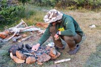
Another bonus - fire ring and ample wood to burn. Dustin the beast even carried over three logs so large I almost got a hernia just watching him lift them in order to make us a nice bench to chill on in front of the fire.
Here's Bob working his magic for a second night in a row.
Dustin called me over at one point while he was collecting wood and we went to check out a sound he'd heard back in the woods behind camp. Turned out to be another bull moose stomping around there. A small stream wound from that area to an open area near our camp before draining in to the lake, and eventually the moose spent a few hours ambling on through the area eating his fill while occasionally looking up to check us out. Very surreal chatting around a campfire while a couple thousand pounds of unpredictable animal hangs out 50 yards away.

So, you know, time to put your back to it and take some pics...
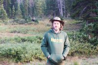
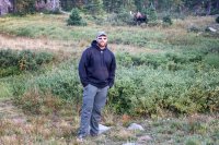
Next morning didn't exactly deliver the great sunrise, but was still pretty enough in its own way.
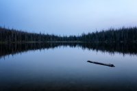

While making my coffee, I watched a few elk come down to the lake to drink. A minute later a pack of coyotes cut loose with the howls and yips. I'd never heard such a racket or apparent number of them, and we hear them a lot near my house. The elk were gone back up the mountain in a blink. Managed to capture the noise on the video.
We got started a bit earlier to head out and back to the trailhead. Another easy, if longer, hike and not the most scenic after the bar having been set pretty high the preceding three days. Camp Lake trail follows a man made ditch for most of its way back to the West Branch trail. The Rawah ditch was dug in the early 1900's until work stopped after Wyoming sued Colorado in the 20's, successfully claiming that Colorado had no right to be diverting water from the Laramie River. The result today is an unsightly scrape full of stagnant water running through the forest, alongside which sits Camp Lake trail on top of a man made berm. After about 4 miles you reach the West Branch trail, and we made our way back over familiar ground to the trailhead.

Alive and well, very stinky, very hungry and thirsty.
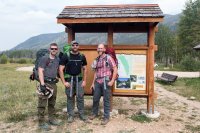
Overall the trip was 26 miles of near perfection. Only negative to speak of was the wildfire smoke mucking up the views. Otherwise the weather was ideal for all four days, everyone had fun, and we saw more wildlife than people.
Drove back out the Poudre and hit up The Still Whiskey Steaks in Fort Collins on the way to dropping the guys off in Denver. Great food and a hell of a fine, friendly lady tending the bar.
Video of the trip here:

The Rawah is a couple hours west of Fort Collins, and about 30 miles south of Wyoming. I wasn't entirely sure what to expect as it lacks any peaks 13K or higher.

Our trip started on Labor Day. Colorado has been bathed in wildfire smoke from all the action north/northwest of us, and I couldn't even see the foothills behind my house when we headed out that morning. Thankfully things were a bit clearer by the time we got to the West Branch trailhead after a very pretty drive through Poudre Canyon. There was a mass exodus from the wilderness going on as we headed in, and these folks would be the last we'd see for four days with very few exceptions.

Bob had some backpacking experience and really killed it all four days. This was Dustin's first backpacking trip, so it was right in to the deep end of the pool for him. He's also a weight lifting fanatic and a huge guy (we met each other in a gym a few years ago) and had blistered up his feet the week before doing a Tough Mudder, but not a bit of whining the entire trip.

The first day was the worst of it and I warned them accordingly. We'd be hiking from the trailhead at 8500 feet to Twin Crater Lakes at just over 11,000 feet. I figured that even if we moved at a snail's pace, we'd hit 11K with enough daylight left to get back out if someone really had a problem with the elevation.
Very pretty hike. Lots of water crossings, none nearly as bad as I had read ahead of time.

About three miles in we reached the junction with Camp Lake trail. We'd reach this spot again upon completing the loop on the hike out. Dustin's looking a little worse for wear here, but ample breaks for catching breath and lowering heart rates eventually got us to the top without any lasting damage.

We camped on a stretch of ground separating the Twin Crater Lakes. Views were great even though the wildfire smoke was really limiting visibility. Lots of chirping marmots behind us, and we saw a fox run past along the lake shore later that night.
I lent Dustin my old 2-man North Face tent for the trip in addition to some other gear I've eventually replaced with lighter equivalents. He's in yellow below. Bob brought a BA Rattlesnake 2-man. I'm in my usual Copper Spur 1-man.

About the only good thing about all the smoke is the nice sunrise/sunsets it makes. I got up early the next morning and wandered around the area taking advantage.

First time in my life I actually watched the sun climb up from behind the horizon (a mountain ridge in this case) and up in to the sky. The smoke dimmed it out that much.


Alpenglow on the peaks behind our camp.

We had breakfast and hiked out around 10:30. Can't really make it out here, but there's a bench lake behind the ridge on the left sending a massive outflow waterfall down the slope. Sounded like a jet engine.

Day two's hike was a short one at just over 5 miles. We'd drop down about 600 feet before ascending back up and over Grassy Pass to the Rawah Lakes area. Again the smoke sort of robbed us of the views, but they were still decent. The pass was cold and windy. Lots of rest breaks on the way and we saw our first fellow traveler here since the hike in - a solo backpacker having lunch just past the top of the pass.


Camp for the night would be at Rawah Lake #2 (there are four), so we headed down to Rawah Lake #3 to make our way north. This was where we saw our first moose of the trip. Two bulls munching vegetation along the shoreline of the lake. Shortly afterwards we rounded a corner and saw a cow, her calf and another bull in the thickets next to us.

You are allowed to have camp fires below 10800 feet in the Rawah, and we managed to scrounge up enough dry wood to do just that. This probably kept us up and moving for an hour we'd have otherwise spent huddled inside our tents. It was a brutally cold night with temps dipping down in to the 20's and the wind starting to pick up a bit. It was also a full moon, and everyone agreed it was the brightest moon we'd ever experienced.

Another beautiful sunrise the next morning, though I admit I had to force myself out of my bag to go photograph it.


Didn't make it 50 yards from camp before running in to wildlife. Numerous deer were moving around on the hillside behind camp.

Further up trail, I rounded a bend and found myself up close and personal with a moose. If you are loathe to watch yet another YouTube hiking video, you still may want to fast forward your way through the one below for a couple of decent segments of moose being moosey. It was cool for me at any rate, having only ever seen moose from a distance and never so close that I was resigned to the fact that if they decided to charge it would be lights out for me.

This particular guy quickly lost interest in staring me down and got on with scraping as many trees as he could.

Another 10:00ish start to the day saw us hiking out and past Rawah Lake #1 on our way to Upper Camp Lake. This was our second human sighting, spotting a tent in the woods on the north side of the lake.

Another easy hiking day, even with a couple unexpected additions.
All in we put in just over 6 miles (despite the graph above) from the Rawah Lakes, past Camp Lake, to Upper Camp Lake, and then back and around Camp Lake. Upper Camp Lake is seen below, but there was no good camping spots around the lake itself. I noticed some elk watching me from a ridge above the lake, so I scouted up there and did find a couple existing sites but they were surrounded by beetle kill and very buggy (first and last mosquitos we ran in to on the trip). They'd also mean a 100 foot scramble to and from the lake for water.

I suggested we take a look for a site on the north side of the lower lake and again there were a few to be found, but they were enclosed in the woods with no views and a boggy marsh to traverse in order to reach the lake for water. So, and oh how I appreciate non-bitching companions, I marched us back to the other side of Camp Lake via the same trail we'd already gone out and back on to hit Upper Camp Lake and we found a really sweet spot to set up - views of both Camp Lake to our north and Sheep Mountain to our west.
Another bonus - fire ring and ample wood to burn. Dustin the beast even carried over three logs so large I almost got a hernia just watching him lift them in order to make us a nice bench to chill on in front of the fire.
Here's Bob working his magic for a second night in a row.

Dustin called me over at one point while he was collecting wood and we went to check out a sound he'd heard back in the woods behind camp. Turned out to be another bull moose stomping around there. A small stream wound from that area to an open area near our camp before draining in to the lake, and eventually the moose spent a few hours ambling on through the area eating his fill while occasionally looking up to check us out. Very surreal chatting around a campfire while a couple thousand pounds of unpredictable animal hangs out 50 yards away.

So, you know, time to put your back to it and take some pics...


Next morning didn't exactly deliver the great sunrise, but was still pretty enough in its own way.


While making my coffee, I watched a few elk come down to the lake to drink. A minute later a pack of coyotes cut loose with the howls and yips. I'd never heard such a racket or apparent number of them, and we hear them a lot near my house. The elk were gone back up the mountain in a blink. Managed to capture the noise on the video.
We got started a bit earlier to head out and back to the trailhead. Another easy, if longer, hike and not the most scenic after the bar having been set pretty high the preceding three days. Camp Lake trail follows a man made ditch for most of its way back to the West Branch trail. The Rawah ditch was dug in the early 1900's until work stopped after Wyoming sued Colorado in the 20's, successfully claiming that Colorado had no right to be diverting water from the Laramie River. The result today is an unsightly scrape full of stagnant water running through the forest, alongside which sits Camp Lake trail on top of a man made berm. After about 4 miles you reach the West Branch trail, and we made our way back over familiar ground to the trailhead.
Alive and well, very stinky, very hungry and thirsty.

Overall the trip was 26 miles of near perfection. Only negative to speak of was the wildfire smoke mucking up the views. Otherwise the weather was ideal for all four days, everyone had fun, and we saw more wildlife than people.
Drove back out the Poudre and hit up The Still Whiskey Steaks in Fort Collins on the way to dropping the guys off in Denver. Great food and a hell of a fine, friendly lady tending the bar.
Video of the trip here:
Last edited:
