- Joined
- Oct 30, 2016
- Messages
- 991
The day after Christmas I decided to hike through Mordor and toss the ring in to Mount Doom, forever ending the threat of Sauron and his minions.
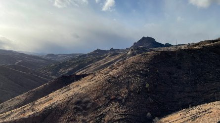
Well not quite, but hiking to Raleigh Peak along the Colorado Trail through the Hayman Fire burn scar makes for some pretty haunting views.
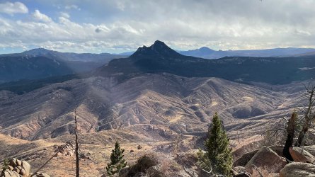
Mount Doom in the above picture is Long Scraggly Peak, and I've posted a number of photos of harassing trout in the S Platte which flows beneath its west face. We've had high winds this weekend as waves of winter storms pass through the nearby mountains, stirring things up but unfortunately dumping all the moisture up at elevation with none making it down to us. Since spending hours fiddling with tangled fly lines didn't sound fun, I decided I'd hike a bit of the Colorado Trail as it crosses the Platte and moves west on its journey down state.
The trail climbs from the parking lot and quickly switchbacks up the side of the hill to put you 500 feet above the road and the river it parallels. Great weather to be back here - 40 degrees and low-angle winter sun which (apart from the hellacious winds) made things pleasant. It gets very hot back here in the summer and due to the burn most of the time the trail is exposed.
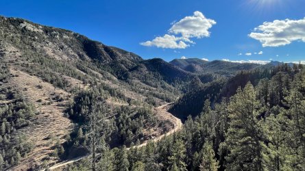
Moving west you walk through an area that hasn't seen much attention in many decades. Yellow metal stamped signs mark long abandoned, barely visible roads warning 'no motor vehicle access'. A number of mines and quarry sites are spread out through these hills. About a mile and a quarter up trail a prominent quarry site and someone's ancient shooting target stands off to the left of the trail.
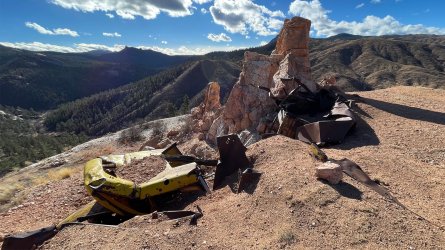
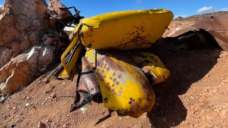
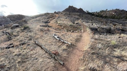
The first couple of miles are an exposed traipse through slowly recovering hellscape before entering a loop that, travelling counterclockwise, continues west to Raleigh Peak before circling back around to its junction with the Colorado Trail.
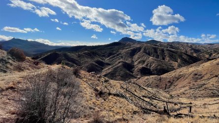
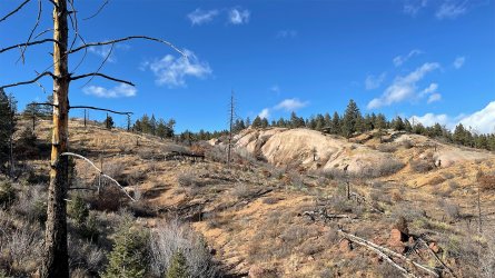
First views of Raleigh Peak a few miles further.
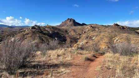
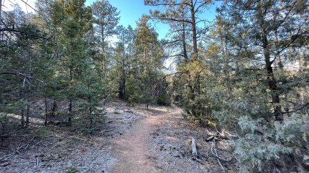
Taking the north leg of the loop the trail moves in to a more forested area along the perimeter of the burn. I kicked up a lot of deer through here and there was a fair amount of cat scat to be seen as well. I've come across large chunks of deer leftovers in the hills just a little back from the river before, and all the caves tucked in the massive piles of boulders everywhere probably make perfect dens. The shady north faces held just a trace of snow above 7000 feet.
Hit the top of the loop at around 4.5 miles and 1600ft of a fairly steady incline and circled around to pass just along the north side of Raleigh Peak. I had read that you could 'leave the trail and summit Raleigh' which made it sound trivial. Standing there I saw no trail and twin summits that loomed at least another 700-800 feet above me.
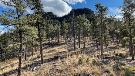
I had kept a pretty good pace so I decided I'd give it an hour with a 2pm turnaround leaving time to hike down and drive back to the house by dinner. I started hiking up, aiming for the saddle. There was no trail but it was minimal bushwhacking and mainly just following the path of least resistance through brush, downed trees and boulder gardens.
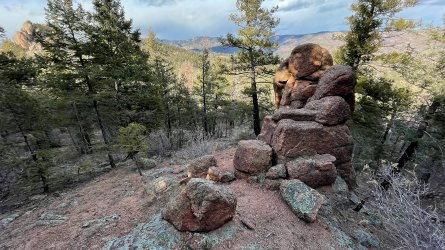
It didn't take long to get up beneath the summits. I'd done no research on either so I thought I'd just see if it looked like there would be a way to scramble up one or the other. Having looked it up since, I wasn't anywhere near the standard routes up but on the spot I thought the west summit looked possible. Workable sized slabs not so steeply inclined that I thought I might be able to crawl my way up.
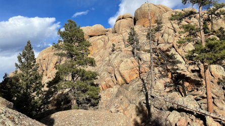
Possible or not, it quickly proved too exposed for a solo hiker who hadn't seen a soul in miles so I climbed down after only 50 feet or so. Good views though. The snow storms were getting closer and I could see it snowing behind Chair Rocks (foreground) and Cathedral Spires. The hike back was very windy and much colder.
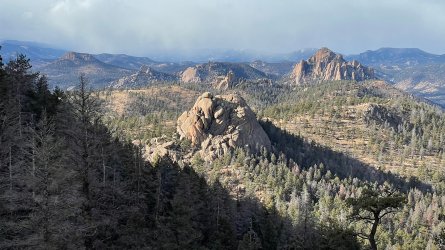
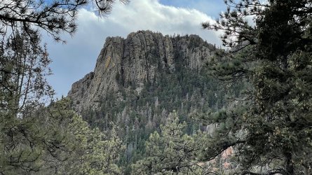
Looking back at the western summit from the trail. Unlike the saddle area, this side is very fluted and less a big pile of boulders.
Didn't take long to close the loop and get back to the Colorado Trail. I'd actually intended to out and back directly to Raleigh but didn't see the trail split on the way up. It was more obvious descending, and it is actually marked. Sort of.
A final glimpse back at Raleigh Peak.
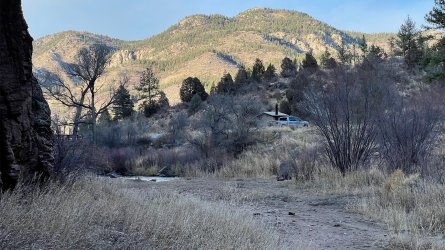
And not very long to get back down to the trailhead to call it a day after a bit over 10 miles/2400ft including the monkeying around on the peak.
Well not quite, but hiking to Raleigh Peak along the Colorado Trail through the Hayman Fire burn scar makes for some pretty haunting views.

In 2002 much of the Front Range of the Rocky Mountains in Colorado was rich in dry vegetation as a result of fire exclusion and the droughty conditions that prevailed in recent years. These dry and heavy fuel loadings were continuous along the South Platte River corridor located between Denver and Colorado Springs on the Front Range. These topographic and fuel conditions combined with a dry and windy weather system centered over eastern Washington to produce ideal burning conditions. The start of the Hayman Fire was timed and located perfectly to take advantage of these conditions resulting in a wildfire run in 1 day of over 60,000 acres and finally impacting over 138,000 acres.
Mount Doom in the above picture is Long Scraggly Peak, and I've posted a number of photos of harassing trout in the S Platte which flows beneath its west face. We've had high winds this weekend as waves of winter storms pass through the nearby mountains, stirring things up but unfortunately dumping all the moisture up at elevation with none making it down to us. Since spending hours fiddling with tangled fly lines didn't sound fun, I decided I'd hike a bit of the Colorado Trail as it crosses the Platte and moves west on its journey down state.
The trail climbs from the parking lot and quickly switchbacks up the side of the hill to put you 500 feet above the road and the river it parallels. Great weather to be back here - 40 degrees and low-angle winter sun which (apart from the hellacious winds) made things pleasant. It gets very hot back here in the summer and due to the burn most of the time the trail is exposed.

Moving west you walk through an area that hasn't seen much attention in many decades. Yellow metal stamped signs mark long abandoned, barely visible roads warning 'no motor vehicle access'. A number of mines and quarry sites are spread out through these hills. About a mile and a quarter up trail a prominent quarry site and someone's ancient shooting target stands off to the left of the trail.


The first couple of miles are an exposed traipse through slowly recovering hellscape before entering a loop that, travelling counterclockwise, continues west to Raleigh Peak before circling back around to its junction with the Colorado Trail.


First views of Raleigh Peak a few miles further.

Taking the north leg of the loop the trail moves in to a more forested area along the perimeter of the burn. I kicked up a lot of deer through here and there was a fair amount of cat scat to be seen as well. I've come across large chunks of deer leftovers in the hills just a little back from the river before, and all the caves tucked in the massive piles of boulders everywhere probably make perfect dens. The shady north faces held just a trace of snow above 7000 feet.

Hit the top of the loop at around 4.5 miles and 1600ft of a fairly steady incline and circled around to pass just along the north side of Raleigh Peak. I had read that you could 'leave the trail and summit Raleigh' which made it sound trivial. Standing there I saw no trail and twin summits that loomed at least another 700-800 feet above me.

I had kept a pretty good pace so I decided I'd give it an hour with a 2pm turnaround leaving time to hike down and drive back to the house by dinner. I started hiking up, aiming for the saddle. There was no trail but it was minimal bushwhacking and mainly just following the path of least resistance through brush, downed trees and boulder gardens.

It didn't take long to get up beneath the summits. I'd done no research on either so I thought I'd just see if it looked like there would be a way to scramble up one or the other. Having looked it up since, I wasn't anywhere near the standard routes up but on the spot I thought the west summit looked possible. Workable sized slabs not so steeply inclined that I thought I might be able to crawl my way up.

Possible or not, it quickly proved too exposed for a solo hiker who hadn't seen a soul in miles so I climbed down after only 50 feet or so. Good views though. The snow storms were getting closer and I could see it snowing behind Chair Rocks (foreground) and Cathedral Spires. The hike back was very windy and much colder.

Looking back at the western summit from the trail. Unlike the saddle area, this side is very fluted and less a big pile of boulders.

Didn't take long to close the loop and get back to the Colorado Trail. I'd actually intended to out and back directly to Raleigh but didn't see the trail split on the way up. It was more obvious descending, and it is actually marked. Sort of.

A final glimpse back at Raleigh Peak.

And not very long to get back down to the trailhead to call it a day after a bit over 10 miles/2400ft including the monkeying around on the peak.

Last edited:
