- Joined
- Feb 23, 2012
- Messages
- 662
It's been nearly 9 months since my initial visit to Rainbow Ridge. Yes... I'm still calling it that even though almost everybody knows the area as something else. I just hate that 'other' name as it's geographically incorrect AND I'd rather not have my pages indexed by Google with the others.
That said -- I'm open to discussion (hence the post.) The general location was never a secret and is less so as each month goes by. Before going in February there were only a few sites online talking about the general location. Now there are dozens, including a few with detailed maps. I thought about not adding to the momentum by holding back on this report. BUT, if I can share the giddiness that I feel when out among the colorful sandstone -- then it's worth it. I just hope I get my fill before this spot becomes really popular. It's interesting, despite the rise in popularity of the general area, Rainbow Ridge remains relatively obscure. I hope it stays this way (but I know I just jinxed it.)
BTW -- see the full gallery and a little more detail in the full report on my site.
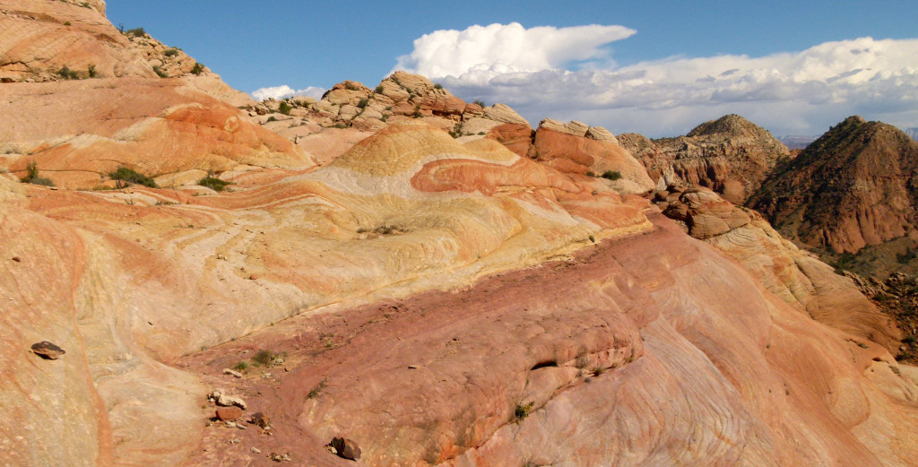
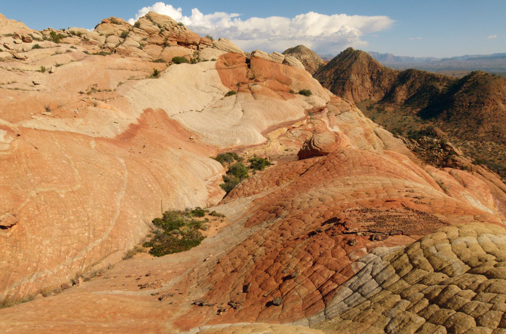
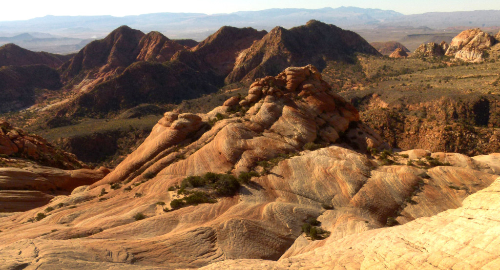
On my last visit I climbed UP the steep cliffs to the slickrock. This time out I took the more-common route in from the dirt road to the north. Arriving at the unofficial TH I was semi shocked to find 4 other cars already there. Ug. That said... I was happy that after I passed two slow groups walking in, from that point on I didn't see them or anybody else the entire time I was wandering around the "goodies". This is probably because I made a beeline to the more obscure areas and waited to visit the popular area late in the day. First on the agenda was... Rainbow Ridge:
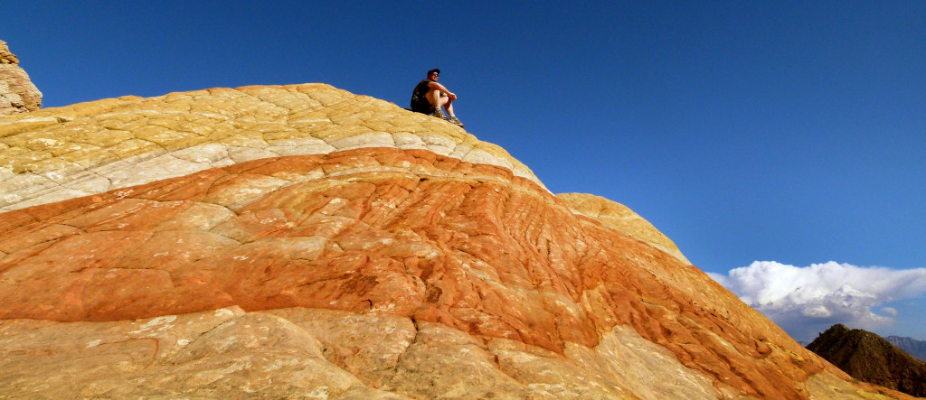
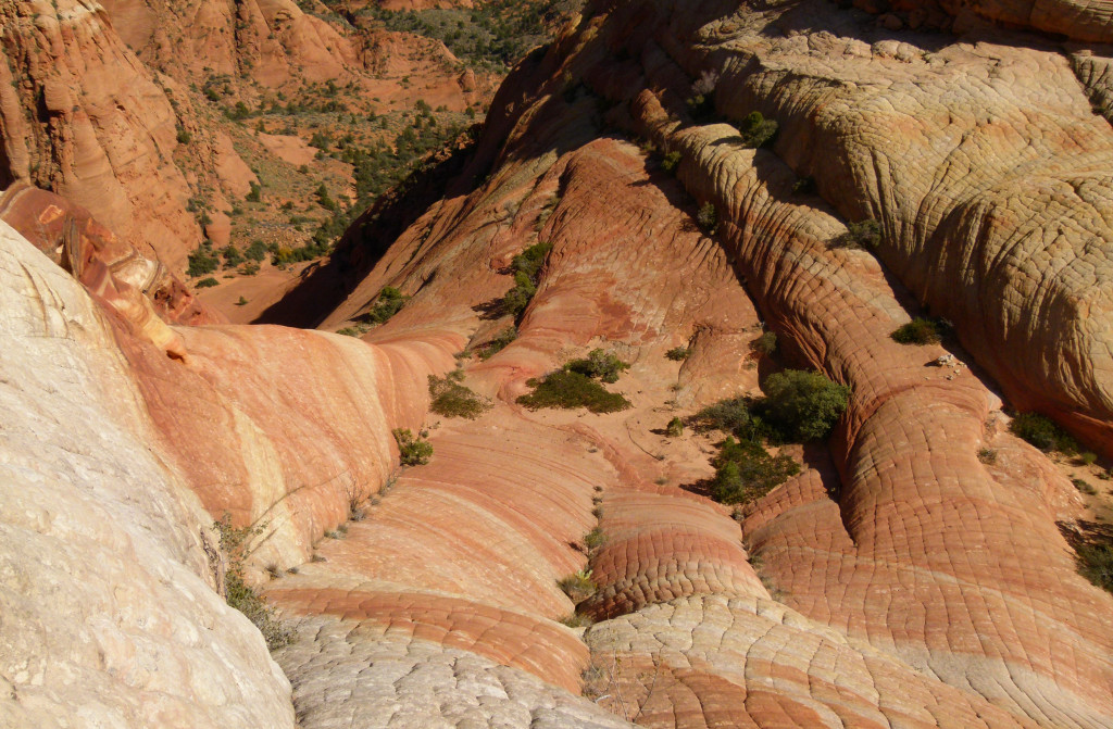
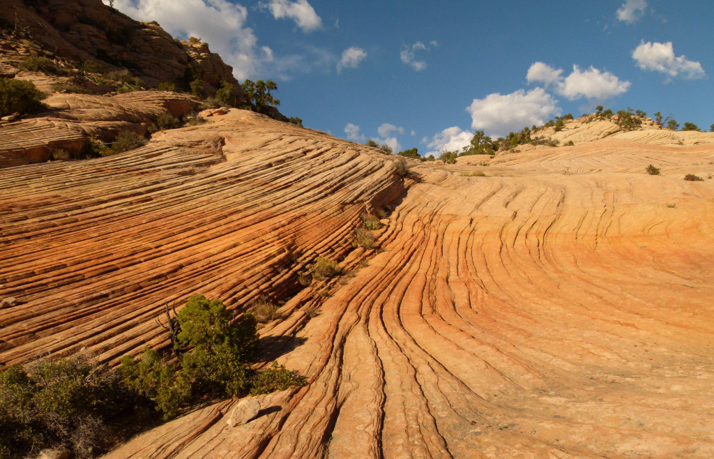
Like my previous visit, the weather was great; sunny with blue skies. Once again I was amazed by the beautiful colors. I sat atop what I call the Turtle Shell and had a snack while soaking it all in.
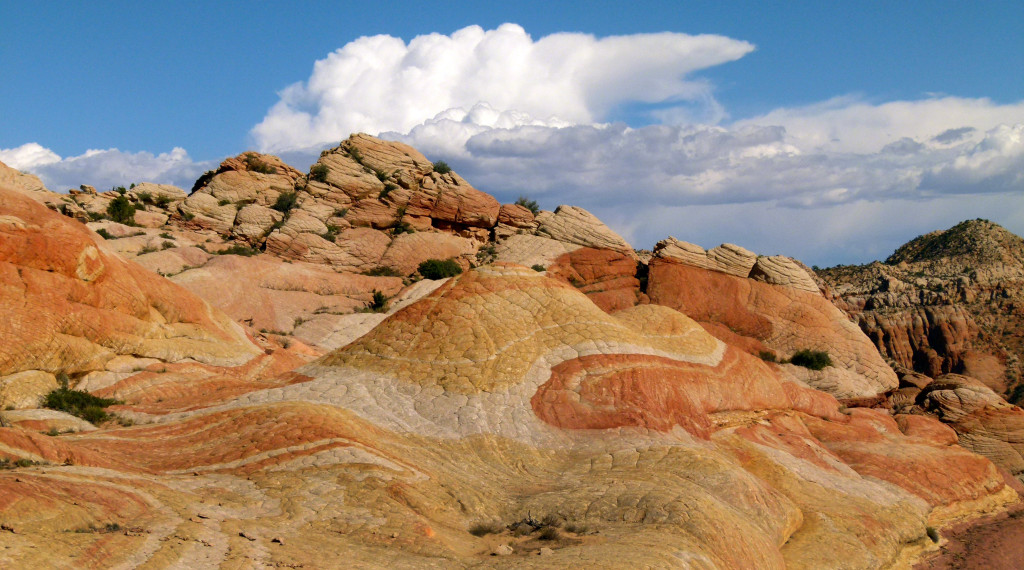
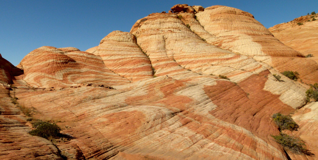
A few more views:
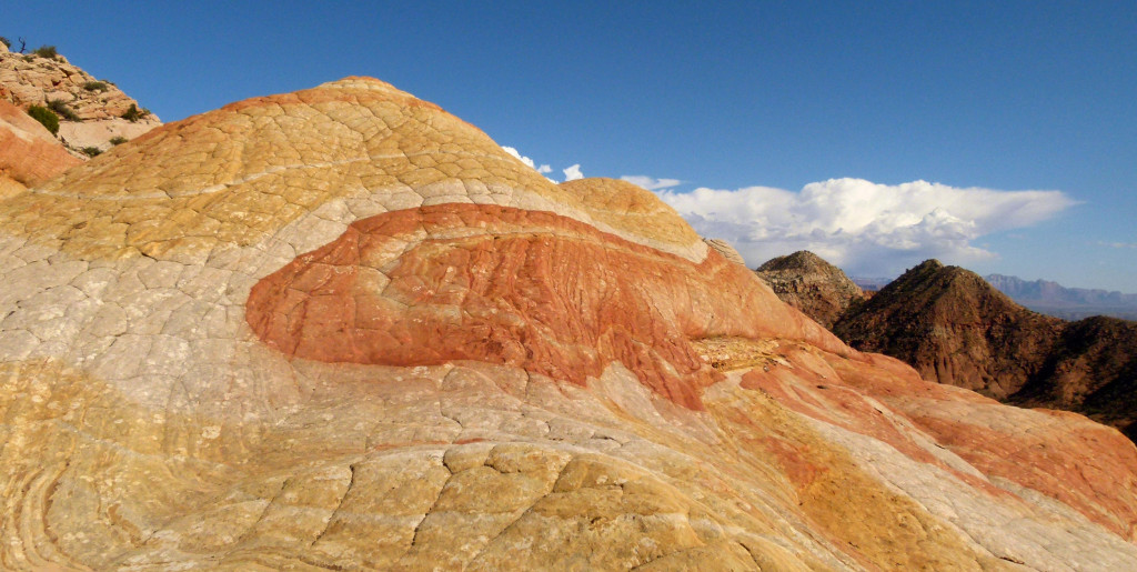
Looking down to what I call the Flag of Japan (yes, I like to name things!):
I've talked to another group who connected this area to the the valley directly below. I was turned away last time by two different sections I found too intimidating. This time I checked a few different routes. Both of the new routes seemed more feasible, but again I backed away as I had on slick shoes and going solo seemed just a bit too risky. Would you solo this:
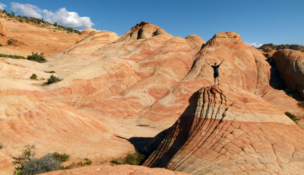
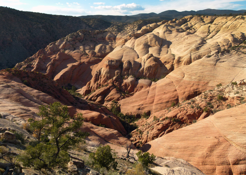
Finally I I headed to the "main" area that I call Valley #1. This is the area that deservedly gets most of the attention:
I spent some time shooting the various knolls in the now late-afternoon sun. I didn't linger too long though as I wanted to explore a few other side valleys on the way back to the road. I skipped Valley #2 as I had walked its entire length last time. It's not quite as impressive as Valley #1, but still a very colorful area with a lot of great photogenic slickrock. Here's just a peek from the top:
Farther north, Valley #3 looked very promising via SAT imagery, but in reality the colors were very pale compared to other areas nearby and in general the area is more overgrown:
There might be some goodies hiding in the undulating hills, but I didn't find them and gave up growing impatient wanting to continue to one more valley.
Working my way along the rim NW I finally arrived at Valley #4. This one is definitely majestic -- but again it seems to pale in comparison to the the first two valleys. As incredible as it is from afar, it didn't seem that friendly for exploration nor to include any great "micro" features. With the sun getting low in the sky, I decided to save deeper exploration for another day:
I headed back into the junipers and found my way back to the trail. It had been a tough 12-mile day up and over a lot of slickrock.
Then, on the final stretch back to the Jeep I passed another group heading in. I asked if they were going in for sundown. "Yeah" was all I got as a hurried answer. As they shuffled past I noticed the leader of the group was focused intently on a print-out from a website. I'm not sure which site it was, but... it wasn't mine.")
Reminder -- full gallery on my site.
- Jamal
Featured image for home page:

That said -- I'm open to discussion (hence the post.) The general location was never a secret and is less so as each month goes by. Before going in February there were only a few sites online talking about the general location. Now there are dozens, including a few with detailed maps. I thought about not adding to the momentum by holding back on this report. BUT, if I can share the giddiness that I feel when out among the colorful sandstone -- then it's worth it. I just hope I get my fill before this spot becomes really popular. It's interesting, despite the rise in popularity of the general area, Rainbow Ridge remains relatively obscure. I hope it stays this way (but I know I just jinxed it.)
BTW -- see the full gallery and a little more detail in the full report on my site.
On my last visit I climbed UP the steep cliffs to the slickrock. This time out I took the more-common route in from the dirt road to the north. Arriving at the unofficial TH I was semi shocked to find 4 other cars already there. Ug. That said... I was happy that after I passed two slow groups walking in, from that point on I didn't see them or anybody else the entire time I was wandering around the "goodies". This is probably because I made a beeline to the more obscure areas and waited to visit the popular area late in the day. First on the agenda was... Rainbow Ridge:
Like my previous visit, the weather was great; sunny with blue skies. Once again I was amazed by the beautiful colors. I sat atop what I call the Turtle Shell and had a snack while soaking it all in.
A few more views:
Looking down to what I call the Flag of Japan (yes, I like to name things!):
I've talked to another group who connected this area to the the valley directly below. I was turned away last time by two different sections I found too intimidating. This time I checked a few different routes. Both of the new routes seemed more feasible, but again I backed away as I had on slick shoes and going solo seemed just a bit too risky. Would you solo this:
Finally I I headed to the "main" area that I call Valley #1. This is the area that deservedly gets most of the attention:
I spent some time shooting the various knolls in the now late-afternoon sun. I didn't linger too long though as I wanted to explore a few other side valleys on the way back to the road. I skipped Valley #2 as I had walked its entire length last time. It's not quite as impressive as Valley #1, but still a very colorful area with a lot of great photogenic slickrock. Here's just a peek from the top:
Farther north, Valley #3 looked very promising via SAT imagery, but in reality the colors were very pale compared to other areas nearby and in general the area is more overgrown:
There might be some goodies hiding in the undulating hills, but I didn't find them and gave up growing impatient wanting to continue to one more valley.
Working my way along the rim NW I finally arrived at Valley #4. This one is definitely majestic -- but again it seems to pale in comparison to the the first two valleys. As incredible as it is from afar, it didn't seem that friendly for exploration nor to include any great "micro" features. With the sun getting low in the sky, I decided to save deeper exploration for another day:
I headed back into the junipers and found my way back to the trail. It had been a tough 12-mile day up and over a lot of slickrock.
Then, on the final stretch back to the Jeep I passed another group heading in. I asked if they were going in for sundown. "Yeah" was all I got as a hurried answer. As they shuffled past I noticed the leader of the group was focused intently on a print-out from a website. I'm not sure which site it was, but... it wasn't mine.
Reminder -- full gallery on my site.
- Jamal
Featured image for home page:
")

