swmalone
Member
- Joined
- Apr 27, 2016
- Messages
- 484
6 March 2019 04:00, so early. We wake up and get ready to head out for our first trip to Escalante. We leave the house a little after 05:00 and are able to make it through Salt Lake City and Utah county before the worst of the morning traffic kicks in. After a little more than 6 hours of driving, mostly through rain and occasional snow, we arrived at the Escalante Interagency Visitor Center.
We went over the repeatedly modified plan with the rangers and came up with a few options. They were really pushing trails off the paved portion of the Burr Trail Road, but said since we had 4 wheel drive and the county had recently graded HITRR that we should be able to make it the 8 miles to the parking area near where Halfway Hollow crosses. We also discussed camping spots and since most that I had identified during my initial planning were farther down HITRR and typically off side roads that were mostly impassible at the moment we decided to camp in the large open area that is about ½ mile down HITRR off Highway 12.
We head out from the visitor center and turn off on to HITRR. The road was pretty wet and muddy but not as bad as we expected after speaking with the rangers. I did use 4 wheel drive to go up the hill after crossing Alvey Wash. We probably didn’t need to use it, but since we had it why not. We arrived at the parking area near Halfway Hollow in the early afternoon, right as the rain and wind picked up.
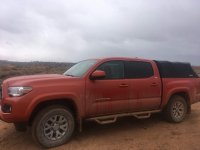
We put on the rain jackets and headed out to connect with Halfway Hollow. The more we hiked the more beautiful the scenery. We explored a couple of little side areas and were just enjoying being out even though it was windy and raining.
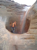
Eventually we reached the much larger Harris Wash and turned up the wash. By now our feet were beginning to pick up a fair bit of weight from the mud sticking to our shoes, but we trudged on. We eventually came to a canyon entering from the East, described as a unique slot canyon in the Bighorn Canyon Hike of Canyoneering 3. It is currently known by a more well known name, but until I am able to see the feature that earned it that name I refuse to use it. There was water immediately upon entering the canyon. We did not come prepared for that amount of water so couldn’t make it very far and with it being overcast the prominent striping eluded us.
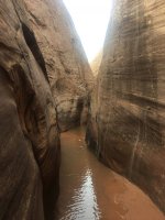
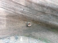
We did look at the walls noticing the evidence of moqui marbles.
We then headed up the slope to get above the unique slot on the left side. This gave us some great views.
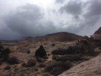
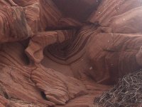
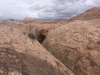
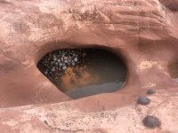
We had headed up here to look for the large expanses of moqui marbles we had heard about. We crawled under the fence that crossed the rock right up to the edge of the slot. Eventually we came across the areas of moqui marbles. This was very cool, but compared to pictures we had seen we wondered if illegal collection had been going on.
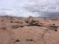
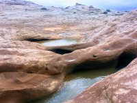
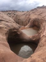
The view of the unique slot from the top is fairly impressive. We looked at the collection of moqui marbles in some of the potholes and then looked at the larger potholes full of water and the drop into the slot. This area is included in some of the Bighorn hike that we had been thinking of doing that connected from Harris Wash to Old Sheffield Road.
After taking advantage of a break in the rain to have some snacks we started heading back towards HITRR. We saw the dark clouds heading in and the rain and wind quickly returned. The temperature was beginning to drop so we tried to get back to the road as quickly as possible. The amount of mud had increased as we were out and was making the hike a bit more difficult than it should have been. We reached the truck and quickly climbed in to begin warming up. We had a great time out even with the weather. We had hiked a bit over 7 miles and been out for a little over 4 hours and hadn’t seen another person, a perfect hike.
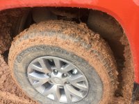
It was starting to get dark and we noticed that HITRR had deteriorated significantly while we had been out. We were happy we had 4 wheel drive, but wished I had better tires. We ended up going down the hill partly sideways.
After making it down HITRR we pulled into the large area to find a semi-sheltered campsite. We begin setting up the tent but the wind kept yanking the stakes right out of the ground, even using MSR groundhog stakes. I cut lengths of paracord to extend the anchor points and Kim was trying to melt the cut ends and I just hear a muttered “windproof my ass” as the zippo she was using continually went out. We eventually got everything put together and we placed rocks on the extended anchors.
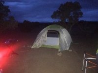
I then started working on dinner while Kim set up the bedding area. The grill had a hard time with the wind, but luckily we both enjoy a medium rare to rare steak.
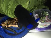
After eating in a new moon, cloudy darkness we retired to the tent and played a card game I had recently acquired. Kim wanted me to make sure that I posted that she destroyed me in the game.
After the game we went off to sleep. I was running cold for some reason, it may have had to do with the use of an air mattress in the tent as opposed to our usual sleeping pads. Before going to sleep we had discussed our plans and had decided that we might only stay one night. I had developed a stress fracture on my foot earlier in the year and thought it was better but my foot was hurting after our hike, and Kim was developing blisters from a pair of shoes that guaranteed no blisters. So with that in mind and the weather forecast showing a high wind advisory we figured one night might be enough.
In the middle of the night we both suddenly wake to what sounded like a freight train, and we both realized that it is wind. It is eerily calm as we lay there waiting for it to arrive. When it does the tent collapsed on me. I was sure I was going to have to go out and add extra guy out points, but luckily once the strong gust was over the tent sprung back up.
7 March 2019
Kim was burrowed down in her sleeping bag so when it lightened up she didn’t even notice so I decided to work on mapping our expected route for the day and playing with the temperature data logger. It said that the coldest it got in the tent was 37 degrees Fahrenheit. This was towards the top of the tent and included heat from our respiration. I really think that trying to gain comfort by using an air mattress led to me being uncomfortable from the cold.
Eventually I decided to wake up Kim. We started tearing down the tent and heating up water for coffee and oatmeal. The day was a lot different with a light breeze and a lot less clouds in the sky. After eating we headed down HITRR about 4 miles and parked to head on our Bighorn Canyon hike.
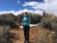
It didn’t take long for us to realized that Alvey Wash had a lot more water than we had planned to deal with. If we had water shoes with us we would have probably crossed and continued on, but we decided we didn’t want to soak ourselves that early in the hike.
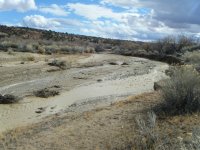
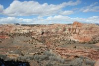
We could have headed down to where we were yesterday and hike down Harris Wash until we reached Bighorn, but decided we didn’t want to repeat that much of the hike with both of us having sore feet. So instead we decided to head towards Lower Calf Creek Falls. That section of Highway 12 between Escalante and Boulder has some beautiful scenery.

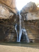
Lower Calf Creek Falls is definitely not where you want to go for solitude. It might have had less people the previous day with the bad weather, but with it being sunny and warmer there were quite a few people on the trail. We were fortunate enough that when we reached the falls we had it to ourselves for several minutes. I was surprised at how high the falls were. It was definitely a bit cooler there in the shade with the mist from the falls all around. We will have to come back later in the year so I can see the hanging gardens during growing season.
We hiked out and had a quick lunch before heading into Boulder. We ended up hiking a bit over 7 miles in a little over 3 hours.
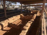
We reached Anasazi State Park a little before 4, which is apparently when they close. They said we had about 15 minutes and told us they wouldn’t charge us. We quickly looked at what had been excavated and walked through the museum. I wish we could have spent a few more minutes taking everything in.
With that we ended our trip to the Escalante Area and started the long drive home, with hopes of returning soon.
We went over the repeatedly modified plan with the rangers and came up with a few options. They were really pushing trails off the paved portion of the Burr Trail Road, but said since we had 4 wheel drive and the county had recently graded HITRR that we should be able to make it the 8 miles to the parking area near where Halfway Hollow crosses. We also discussed camping spots and since most that I had identified during my initial planning were farther down HITRR and typically off side roads that were mostly impassible at the moment we decided to camp in the large open area that is about ½ mile down HITRR off Highway 12.
We head out from the visitor center and turn off on to HITRR. The road was pretty wet and muddy but not as bad as we expected after speaking with the rangers. I did use 4 wheel drive to go up the hill after crossing Alvey Wash. We probably didn’t need to use it, but since we had it why not. We arrived at the parking area near Halfway Hollow in the early afternoon, right as the rain and wind picked up.

We put on the rain jackets and headed out to connect with Halfway Hollow. The more we hiked the more beautiful the scenery. We explored a couple of little side areas and were just enjoying being out even though it was windy and raining.

Eventually we reached the much larger Harris Wash and turned up the wash. By now our feet were beginning to pick up a fair bit of weight from the mud sticking to our shoes, but we trudged on. We eventually came to a canyon entering from the East, described as a unique slot canyon in the Bighorn Canyon Hike of Canyoneering 3. It is currently known by a more well known name, but until I am able to see the feature that earned it that name I refuse to use it. There was water immediately upon entering the canyon. We did not come prepared for that amount of water so couldn’t make it very far and with it being overcast the prominent striping eluded us.

We did look at the walls noticing the evidence of moqui marbles.

We then headed up the slope to get above the unique slot on the left side. This gave us some great views.


We had headed up here to look for the large expanses of moqui marbles we had heard about. We crawled under the fence that crossed the rock right up to the edge of the slot. Eventually we came across the areas of moqui marbles. This was very cool, but compared to pictures we had seen we wondered if illegal collection had been going on.

The view of the unique slot from the top is fairly impressive. We looked at the collection of moqui marbles in some of the potholes and then looked at the larger potholes full of water and the drop into the slot. This area is included in some of the Bighorn hike that we had been thinking of doing that connected from Harris Wash to Old Sheffield Road.


After taking advantage of a break in the rain to have some snacks we started heading back towards HITRR. We saw the dark clouds heading in and the rain and wind quickly returned. The temperature was beginning to drop so we tried to get back to the road as quickly as possible. The amount of mud had increased as we were out and was making the hike a bit more difficult than it should have been. We reached the truck and quickly climbed in to begin warming up. We had a great time out even with the weather. We had hiked a bit over 7 miles and been out for a little over 4 hours and hadn’t seen another person, a perfect hike.
It was starting to get dark and we noticed that HITRR had deteriorated significantly while we had been out. We were happy we had 4 wheel drive, but wished I had better tires. We ended up going down the hill partly sideways.

After making it down HITRR we pulled into the large area to find a semi-sheltered campsite. We begin setting up the tent but the wind kept yanking the stakes right out of the ground, even using MSR groundhog stakes. I cut lengths of paracord to extend the anchor points and Kim was trying to melt the cut ends and I just hear a muttered “windproof my ass” as the zippo she was using continually went out. We eventually got everything put together and we placed rocks on the extended anchors.

I then started working on dinner while Kim set up the bedding area. The grill had a hard time with the wind, but luckily we both enjoy a medium rare to rare steak.

After eating in a new moon, cloudy darkness we retired to the tent and played a card game I had recently acquired. Kim wanted me to make sure that I posted that she destroyed me in the game.
After the game we went off to sleep. I was running cold for some reason, it may have had to do with the use of an air mattress in the tent as opposed to our usual sleeping pads. Before going to sleep we had discussed our plans and had decided that we might only stay one night. I had developed a stress fracture on my foot earlier in the year and thought it was better but my foot was hurting after our hike, and Kim was developing blisters from a pair of shoes that guaranteed no blisters. So with that in mind and the weather forecast showing a high wind advisory we figured one night might be enough.
In the middle of the night we both suddenly wake to what sounded like a freight train, and we both realized that it is wind. It is eerily calm as we lay there waiting for it to arrive. When it does the tent collapsed on me. I was sure I was going to have to go out and add extra guy out points, but luckily once the strong gust was over the tent sprung back up.
7 March 2019
Kim was burrowed down in her sleeping bag so when it lightened up she didn’t even notice so I decided to work on mapping our expected route for the day and playing with the temperature data logger. It said that the coldest it got in the tent was 37 degrees Fahrenheit. This was towards the top of the tent and included heat from our respiration. I really think that trying to gain comfort by using an air mattress led to me being uncomfortable from the cold.
Eventually I decided to wake up Kim. We started tearing down the tent and heating up water for coffee and oatmeal. The day was a lot different with a light breeze and a lot less clouds in the sky. After eating we headed down HITRR about 4 miles and parked to head on our Bighorn Canyon hike.

It didn’t take long for us to realized that Alvey Wash had a lot more water than we had planned to deal with. If we had water shoes with us we would have probably crossed and continued on, but we decided we didn’t want to soak ourselves that early in the hike.

We could have headed down to where we were yesterday and hike down Harris Wash until we reached Bighorn, but decided we didn’t want to repeat that much of the hike with both of us having sore feet. So instead we decided to head towards Lower Calf Creek Falls. That section of Highway 12 between Escalante and Boulder has some beautiful scenery.

Lower Calf Creek Falls is definitely not where you want to go for solitude. It might have had less people the previous day with the bad weather, but with it being sunny and warmer there were quite a few people on the trail. We were fortunate enough that when we reached the falls we had it to ourselves for several minutes. I was surprised at how high the falls were. It was definitely a bit cooler there in the shade with the mist from the falls all around. We will have to come back later in the year so I can see the hanging gardens during growing season.

We hiked out and had a quick lunch before heading into Boulder. We ended up hiking a bit over 7 miles in a little over 3 hours.
We reached Anasazi State Park a little before 4, which is apparently when they close. They said we had about 15 minutes and told us they wouldn’t charge us. We quickly looked at what had been excavated and walked through the museum. I wish we could have spent a few more minutes taking everything in.

With that we ended our trip to the Escalante Area and started the long drive home, with hopes of returning soon.

Last edited:
