- Joined
- Feb 15, 2020
- Messages
- 616
Well, after dragging my brother up Yellowstone Point and beating him up a bit last year, I promised him a more laid back trip this year - but not too laid back, of course. I'd never done an extended trip in the southwest corner of Yellowstone. The Bechler region had always put me off a bit due it's very wet conditions and limited views, but with the extra water comes some pretty stunning waterfalls - and turns out it's right up against the very dry Pitchstone Plateau. I drew up a loop to get what seemed like a good taste of both and I wasn't disappointed.
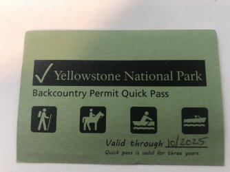
We did however have a pretty interesting start to our trip - the first thing the ranger at the South Entrance told me was, "I don't think I can give you this permit." I've put together some pretty strange itineraries before - much more so than this one - and this was the first time I'd gotten more than a raised eyebrow or two. She sat us down at the TV for yet another viewing of "Beyond Road's End" while she spent the whole time (and at least a half hour more) trying to track down a backcountry ranger. Finally someone told her that "yes" she could give such a permit, but that it was not recommended. So she gave us a big "NOT RECOMMENDED" label in multiple locations on our permit. All respect to her, she clearly didn't know who she was talking to... that made my day. What better endorsement of a route is there? And warning me of marauding grizzlies all over Pitchstone Plateau? Stop selling already, I'm in. (Sadly, this aspect seems to have been much exaggerated.)
Before handing me the permit she said solemnly, "We do not recommend you do this."
So off we went...
Day 1: 8K4 Phantom/Pitchstone TH to 8P2 Phantom
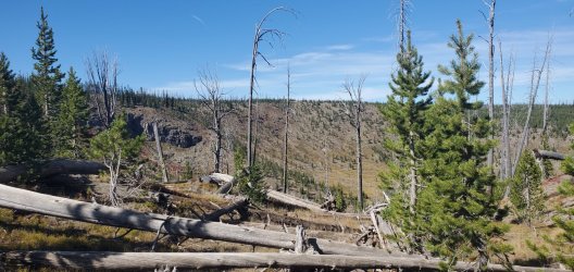
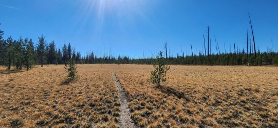
We started our "not recommended" trip at the small pullout where the trail up to Phantom Fumarole gets started - this trailhead might actually qualify as "not recommended", but just because it's a quick, not-too-scenic climb straight up to start your trip. We hiked through a few old burn areas w/ significant deadfall, but the trail was in great shape so the going was pretty easy. I really started to enjoy the views as things opened up higher on the plateau.
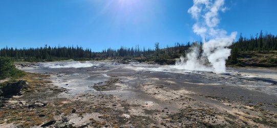
Phantom Fumarole was actually more active and interesting than I'd expected. We enjoyed a small break here before continuing on to our camp for the evening.
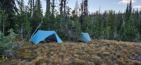
Camp for the evening was nice. The water source was only OK, but it did the trick. Given the lack of water on the plateau overall though, the two springs here are about the only game in town.
Day 2: 8P2 Phantom to 8T1 Basin Beach
Today was the first of the "not recommended" sections of our trip... we would go off-trail from our site, to the high point of the Pitchstone Plateau, and then make our way down to the southern shore of Shoshone Lake. Most of the day was fairly straightforward - route-finding up on the plateau is easy as it is completely open. Very dry though in September, so we carried water from the previous night's camp. Dropping down from the plateau towards Shoshone presents a few options - all of which have some challenges. I had my eyes on a 500' dry waterfall I wanted to downclimb, but bushwhacking through fairly dense forest a little to the west was an option, too.
Much of the route up the plateau was on dry seasonal streambeds - I bet it's quite a sight when these are running during the spring thaw.
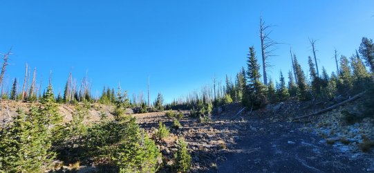
Once up top, there wasn't much to stop us from going whichever direction we so choose. (Except maybe a near total lack of water at this time of year.)
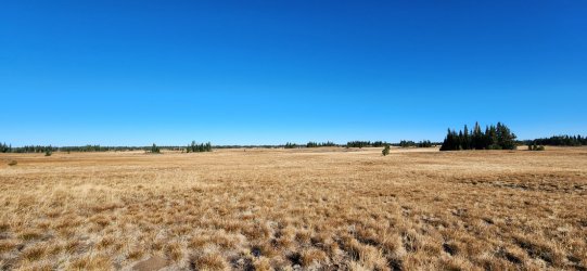
Throughout the day we could see the Tetons standing tall to the south.

The high point of the plateau - not particularly prominent, but a nice spot for lunch nonetheless.

Just below the high point was a small water hole - mostly mud - with the only signs of life on the entire upper plateau.

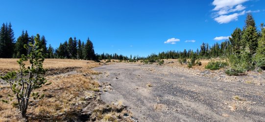
Much like the way up, the way down took us through mostly dry streambeds.
Eventually the stream dropped right off the plateau - a pretty spectacular view. And our first look at Shoshone Lake where we'd be spending the night.

Looking back up our downclimb. A few sections of mild Class 3, but nothing crazy. (Just stay off of the vegetation and on the rocks as much as possible to avoid slipping.) Probably easier to go up than down, but route-finding might be trickier.

The boulder field at the base was not very consolidated - lots of moving rocks. Probably not much faster than the initial downclimb.
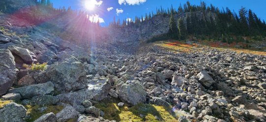
Once beyond the boulder field we had two options: a) deadfall; or
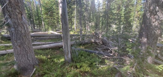
b) marsh. Much slower going than the AM, but it didn't last too long.

Just a few bruises and very wet feet later and we were back on trail to Shoshone Lake.

Shoshone Lake was very still and beautiful upon our arrival. The site itself however was nothing too special - though the water source was fantastic.

Day 3: 8T1 Basin Beach to 9D4 Continental Divide
With only a short day ahead of us, I took the rare occasion to sleep in a bit. Was very pleasant. We took our time through the nearby geyser basin before making our way up to a double crossing of the Continental Divide and our camp site for the evening.
Late morning at the campsite.
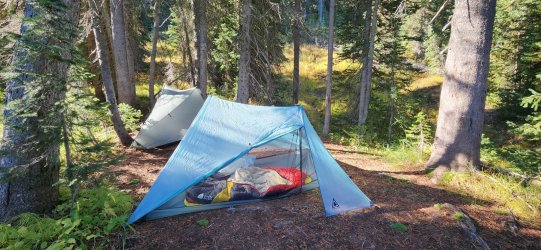
The morning trail was pretty soggy and unimproved until Shoshone Geyser Basin, but was much easier going after that point. I assume most traffic doesn't go beyond the geyser basin.
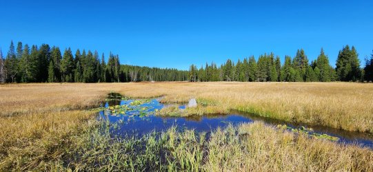
Entering the geyser basin.
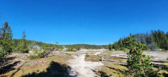
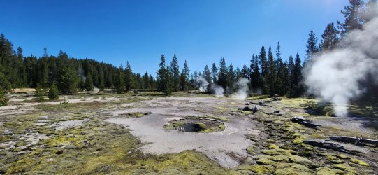
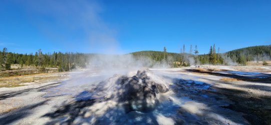
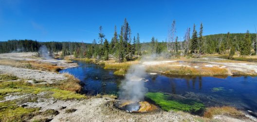

One of the more uninteresting crossings of the Continental Divide you will find in a wilderness area.
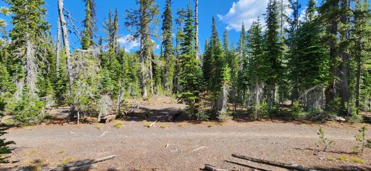
Camp for the night was fairly uninteresting as well, but pleasant weather made for a nice evening w/ my brother.
Day 4: 9D4 Continental Divide to 9B4 Ouzel Falls
This day would take us down Bechler Canyon to Bechler Meadows - a pretty spectacular trip. Lots of waterfalls, a few thermal features, good weather, and a mild downhill on improved trail all day.
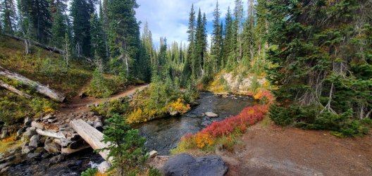
Twister Falls along the Gregg Fork.

Gregg Fork headed towards the main body of the Bechler River.
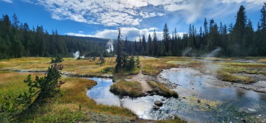
Thermal features along the Ferris Fork.
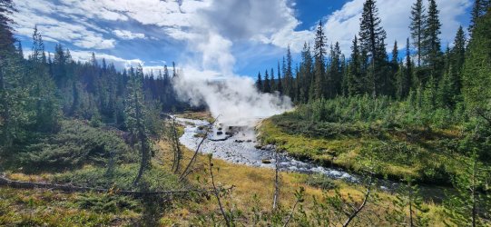
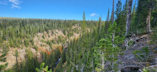
Upper section of Bechler Canyon as the three primary forks combine.

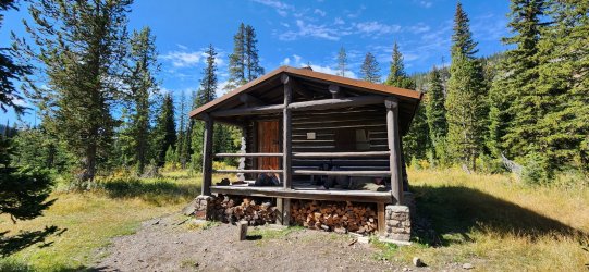
Took a little lunch break at the Three Rivers Patrol Cabin.
The Bechler River starting to open up now.
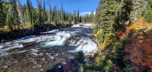
Iris Falls.
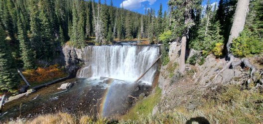
Colonnade Falls.
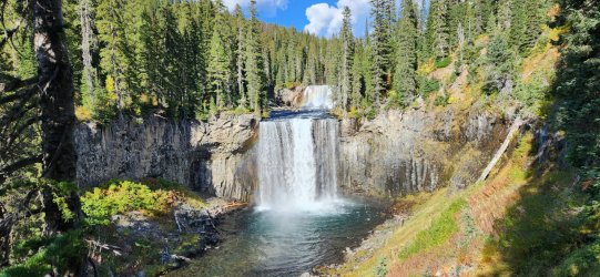
Camp for the evening was a pleasant spot along the Bechler River. Lots of tent spaces and a big fire pit - probably used to accommodating larger groups than ours.
Day 5: 9B4 Ouzel Falls to 9U4 Union Falls
Day 5 would start to see the weather turn on us - as expected. There was still sunshine off-and-on, but punctuated by distant thunder and occasional showers. Just enough to dampen the vegetation and keep us nice and wet most of the day.
Bechler Meadows.
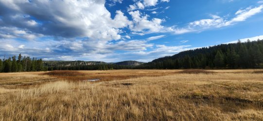
Bechler River much calmer through this section.

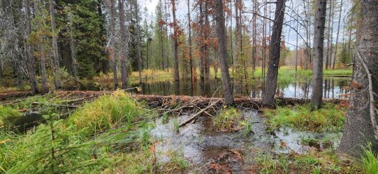
Beavers. We didn't see any, but the word started to become a curse - and I imagine some park rangers share the sentiment. As we cut off from the Bechler River towards Mountain Ash Creek, we stumbled across a newly re-routed trail - presumably intended to circumvent a very large beaver dam complex completely swamping the trail. All seemed well, until a few hundred feet along the newly established route... the beavers found this one, too. Suffice to say: we got very wet.
Can you spot the brand-new trail marker on a tree standing in at least 5' of standing water? I won't be surprised if this cut-off trail ends up closed or no longer maintained in the future. Seems like the beavers have taken complete control. Honestly very impressive.
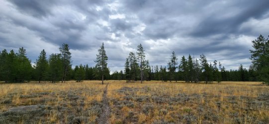
As we made our way up Mountain Ash Creek we got our first (and only ) large mammal sighting of the trip. A moose was grazing peacefully on the far side of a small meadow.
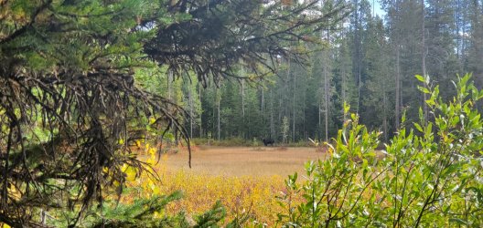
We watched him for a bit, but once he took notice of us he seemed a bit perturbed so we moved on.

We set up camp nice and early, but the day wasn't over yet. Even though we'd be passing by again in the morning, we wanted to go check out Union Falls.
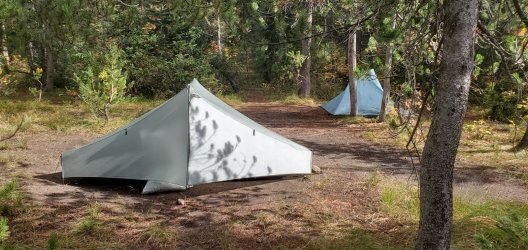
On the way to Union Falls - and very near our campsite - we passed the Union Falls Patrol Cabin. One of the more uniquely constructed in the Yellowstone backcountry.

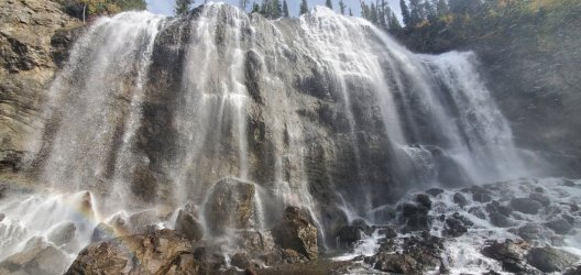
Union Falls! I'd been looking forward to this since initially planning the trip - I'd tried to make it out here a couple times on day hikes, but been held up by conditions/weather. It was great to be here. Absolutely lived up to my hype.

Hiked down to the bottom. Got pretty wet. Spectacular.
Day 6: 9U4 Union Falls to 8K4 Phantom/Pitchstone TH
I anticipated our final day would be the most challenging and I wasn't disappointed. In the morning we hiked back up to Union Falls, but this time we just kept going up. The crux of the trip was the two miles along Mountain Ash Creek above Union Falls - it was certainly rugged, but not exceptionally bad. Instead of following the main body of the creek all the way up to the plateau, I thought turning up a dry inlet stream would be more pleasant (and fun). In retrospect, I think I was right - though it did require a bit steeper climb. Continuing all the way up the creek would likely have worked just fine, too. Once back up on the plateau we were able to find cairns marking the Pitchstone Plateau Trail, though it was clearly very lightly traveled with almost no visible tread. After passing our first campsite the visible tread increased greatly and it was an easy shot back to my truck.
At the top of Union Falls.
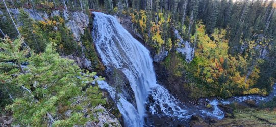
Overnight rain had saturated the foliage - we stayed wet all the way up to the plateau trail.

We eventually crossed the creek and headed up a steep (and mostly dry) inlet stream.

The way up got a little steep, but views started to open up quickly.

Finding the familiar dry stream beds again. We did find a good amount of bear sign through here, but it was mostly limited to a small band between 8,000' and 8,200'.

Our immediate weather was fantastic - but the forecast for the evening was looking pretty rough. Seems we timed things pretty well.

Another great trip in the Yellowstone backcountry. Not much in the way of wildlife - nor much indication that much was around - at least as compared to other areas in the park. I did enjoy the juxtaposition of the dry plateau with the wet meadows and obviously the waterfalls were fantastic. I'm sure I'll be back - there's certainly a lot of side canyons to explore and many more water features to see. Maybe not at the top of the list though. I do think I'd like to stay at the plateau campsite early in the season and day hike up on the plateau when the large seasonal streams are flowing - that could make a fun weekend trip.
I give the trip a solid "NOT RECOMMENDED", but with the caveat that the sections getting off of and onto the plateau require some route-finding and a good tolerance for off-trail travel.
My last big trip for the summer - glad it was a good one!
We did however have a pretty interesting start to our trip - the first thing the ranger at the South Entrance told me was, "I don't think I can give you this permit." I've put together some pretty strange itineraries before - much more so than this one - and this was the first time I'd gotten more than a raised eyebrow or two. She sat us down at the TV for yet another viewing of "Beyond Road's End" while she spent the whole time (and at least a half hour more) trying to track down a backcountry ranger. Finally someone told her that "yes" she could give such a permit, but that it was not recommended. So she gave us a big "NOT RECOMMENDED" label in multiple locations on our permit. All respect to her, she clearly didn't know who she was talking to... that made my day. What better endorsement of a route is there? And warning me of marauding grizzlies all over Pitchstone Plateau? Stop selling already, I'm in. (Sadly, this aspect seems to have been much exaggerated.)
Before handing me the permit she said solemnly, "We do not recommend you do this."
So off we went...
Day 1: 8K4 Phantom/Pitchstone TH to 8P2 Phantom
We started our "not recommended" trip at the small pullout where the trail up to Phantom Fumarole gets started - this trailhead might actually qualify as "not recommended", but just because it's a quick, not-too-scenic climb straight up to start your trip. We hiked through a few old burn areas w/ significant deadfall, but the trail was in great shape so the going was pretty easy. I really started to enjoy the views as things opened up higher on the plateau.


Phantom Fumarole was actually more active and interesting than I'd expected. We enjoyed a small break here before continuing on to our camp for the evening.

Camp for the evening was nice. The water source was only OK, but it did the trick. Given the lack of water on the plateau overall though, the two springs here are about the only game in town.

Day 2: 8P2 Phantom to 8T1 Basin Beach
Today was the first of the "not recommended" sections of our trip... we would go off-trail from our site, to the high point of the Pitchstone Plateau, and then make our way down to the southern shore of Shoshone Lake. Most of the day was fairly straightforward - route-finding up on the plateau is easy as it is completely open. Very dry though in September, so we carried water from the previous night's camp. Dropping down from the plateau towards Shoshone presents a few options - all of which have some challenges. I had my eyes on a 500' dry waterfall I wanted to downclimb, but bushwhacking through fairly dense forest a little to the west was an option, too.
Much of the route up the plateau was on dry seasonal streambeds - I bet it's quite a sight when these are running during the spring thaw.

Once up top, there wasn't much to stop us from going whichever direction we so choose. (Except maybe a near total lack of water at this time of year.)

Throughout the day we could see the Tetons standing tall to the south.

The high point of the plateau - not particularly prominent, but a nice spot for lunch nonetheless.

Just below the high point was a small water hole - mostly mud - with the only signs of life on the entire upper plateau.

Much like the way up, the way down took us through mostly dry streambeds.

Eventually the stream dropped right off the plateau - a pretty spectacular view. And our first look at Shoshone Lake where we'd be spending the night.

Looking back up our downclimb. A few sections of mild Class 3, but nothing crazy. (Just stay off of the vegetation and on the rocks as much as possible to avoid slipping.) Probably easier to go up than down, but route-finding might be trickier.

The boulder field at the base was not very consolidated - lots of moving rocks. Probably not much faster than the initial downclimb.

Once beyond the boulder field we had two options: a) deadfall; or

b) marsh. Much slower going than the AM, but it didn't last too long.

Just a few bruises and very wet feet later and we were back on trail to Shoshone Lake.

Shoshone Lake was very still and beautiful upon our arrival. The site itself however was nothing too special - though the water source was fantastic.

Day 3: 8T1 Basin Beach to 9D4 Continental Divide
With only a short day ahead of us, I took the rare occasion to sleep in a bit. Was very pleasant. We took our time through the nearby geyser basin before making our way up to a double crossing of the Continental Divide and our camp site for the evening.
Late morning at the campsite.

The morning trail was pretty soggy and unimproved until Shoshone Geyser Basin, but was much easier going after that point. I assume most traffic doesn't go beyond the geyser basin.

Entering the geyser basin.


One of the more uninteresting crossings of the Continental Divide you will find in a wilderness area.

Camp for the night was fairly uninteresting as well, but pleasant weather made for a nice evening w/ my brother.
Day 4: 9D4 Continental Divide to 9B4 Ouzel Falls
This day would take us down Bechler Canyon to Bechler Meadows - a pretty spectacular trip. Lots of waterfalls, a few thermal features, good weather, and a mild downhill on improved trail all day.

Twister Falls along the Gregg Fork.

Gregg Fork headed towards the main body of the Bechler River.

Thermal features along the Ferris Fork.


Upper section of Bechler Canyon as the three primary forks combine.

Took a little lunch break at the Three Rivers Patrol Cabin.

The Bechler River starting to open up now.

Iris Falls.

Colonnade Falls.

Camp for the evening was a pleasant spot along the Bechler River. Lots of tent spaces and a big fire pit - probably used to accommodating larger groups than ours.
Day 5: 9B4 Ouzel Falls to 9U4 Union Falls
Day 5 would start to see the weather turn on us - as expected. There was still sunshine off-and-on, but punctuated by distant thunder and occasional showers. Just enough to dampen the vegetation and keep us nice and wet most of the day.
Bechler Meadows.

Bechler River much calmer through this section.

Beavers. We didn't see any, but the word started to become a curse - and I imagine some park rangers share the sentiment. As we cut off from the Bechler River towards Mountain Ash Creek, we stumbled across a newly re-routed trail - presumably intended to circumvent a very large beaver dam complex completely swamping the trail. All seemed well, until a few hundred feet along the newly established route... the beavers found this one, too. Suffice to say: we got very wet.
Can you spot the brand-new trail marker on a tree standing in at least 5' of standing water? I won't be surprised if this cut-off trail ends up closed or no longer maintained in the future. Seems like the beavers have taken complete control.


As we made our way up Mountain Ash Creek we got our first (and only

We watched him for a bit, but once he took notice of us he seemed a bit perturbed so we moved on.

We set up camp nice and early, but the day wasn't over yet. Even though we'd be passing by again in the morning, we wanted to go check out Union Falls.

On the way to Union Falls - and very near our campsite - we passed the Union Falls Patrol Cabin. One of the more uniquely constructed in the Yellowstone backcountry.

Union Falls! I'd been looking forward to this since initially planning the trip - I'd tried to make it out here a couple times on day hikes, but been held up by conditions/weather. It was great to be here. Absolutely lived up to my hype.

Hiked down to the bottom. Got pretty wet. Spectacular.

Day 6: 9U4 Union Falls to 8K4 Phantom/Pitchstone TH
I anticipated our final day would be the most challenging and I wasn't disappointed. In the morning we hiked back up to Union Falls, but this time we just kept going up. The crux of the trip was the two miles along Mountain Ash Creek above Union Falls - it was certainly rugged, but not exceptionally bad. Instead of following the main body of the creek all the way up to the plateau, I thought turning up a dry inlet stream would be more pleasant (and fun). In retrospect, I think I was right - though it did require a bit steeper climb. Continuing all the way up the creek would likely have worked just fine, too. Once back up on the plateau we were able to find cairns marking the Pitchstone Plateau Trail, though it was clearly very lightly traveled with almost no visible tread. After passing our first campsite the visible tread increased greatly and it was an easy shot back to my truck.
At the top of Union Falls.

Overnight rain had saturated the foliage - we stayed wet all the way up to the plateau trail.

We eventually crossed the creek and headed up a steep (and mostly dry) inlet stream.

The way up got a little steep, but views started to open up quickly.

Finding the familiar dry stream beds again. We did find a good amount of bear sign through here, but it was mostly limited to a small band between 8,000' and 8,200'.

Our immediate weather was fantastic - but the forecast for the evening was looking pretty rough. Seems we timed things pretty well.

Another great trip in the Yellowstone backcountry. Not much in the way of wildlife - nor much indication that much was around - at least as compared to other areas in the park. I did enjoy the juxtaposition of the dry plateau with the wet meadows and obviously the waterfalls were fantastic. I'm sure I'll be back - there's certainly a lot of side canyons to explore and many more water features to see. Maybe not at the top of the list though. I do think I'd like to stay at the plateau campsite early in the season and day hike up on the plateau when the large seasonal streams are flowing - that could make a fun weekend trip.
I give the trip a solid "
My last big trip for the summer - glad it was a good one!
Last edited:


