I lived by Pictured Rocks National Lakeshore for 20 years. I hadn't been back for 9 years, and decided I needed to go visit friends, and do a little hike into the backcountry. Spending a night in the backcountry was like spending a night at home. It used to be that I could walk in to the visitor center, look at a little board that listed open campsites, and get a permit. Now you need to go through recreation dot gov. It was kind of awful. About two weeks before I left Wyoming, I managed to get a site at one of the two camp areas that I wanted. From that, I just printed my permit. I didn't even need to go to the ranger station.
I got to the parking lot to see this mess. That was different from the dozen years ago since I moved to Wyoming. It used to be no one went there, especially after Labor Day. Sigh. I did manage to get a parking spot.

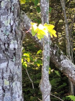
After a short walk down the hill, I came to the little bridge. I smiled at the ferns and the clear water in the creek. All the plants were fighting for some sun, and everybody seemed to get getting enough, or at least some. Smell the woods.

From the bridge, the trail climbs a little. There used to be a little side trail, which led 10 yards to an old cabin. What was left of it was only about 3 feet high, but that, and even the side trail, are gone now.

I moved through the woods happily, but slowly, looking at things. Since I left, I have said that it was ok to leave Pictured Rocks, because my feet knew all the roots and rocks. Well now, my feet weren't always enjoying the roots and rocks, but my eyes were sure enjoying seeing things.

It didn't take too long before I got to the first backcountry campground. I watched a deer nibble at grasses in one of the campsites.

Continuing down the trail, I approached the bridge over the Mosquito River. I would turn away from the bridge, but it was great to see, and pleasant to listen to.

This was one of my favorite camp areas. After I had my camp set up, I would go sit on, or above the rocks, and just watch. I used to sit and read a book, but then I discovered audio books, and I'd sit and listen and watch at the same time. In the summer, there were usually other people camped here. I think there were five sites. By the weekend before Thanksgiving, I was usually alone. I always joked that if the zipper on my sleeping bag got stuck, they'd find my body in the spring, still stuck in the sleeping bag.

The trail remains low, at lake level, for a mile or more. In the cold season, waves will crash into the shore, and spray will hit these trees and freeze. The trees can't handle the weight, and break, so for a distance, the woods looks "icky" like this. I remember hearing a man tell his son (about 8 years old?) that this was the Gnome Forest. I have always thought of that when I pass through this area.

Usually it isn't foggy, and you get really nice, up close view of Lover's Leap. I kind of like this ethereal version.

More gnome forest.

I made progress! This is looking back at Lover's Leap.


After Lover's Leap, the trail goes up to the top of the cliffs. The cliffs are up to 200 feet over the water. I was going to take a co-worker and his 14 year old son backpacking, and asked if they were afraid of heights. The man responded, "No." Then I saw the look on his face change, and he asked how high the heights were. You never have to get too close to the edge, but if you choose to, it can be quite a ways down.
This is, or at least was, called Indian Head. This loop was always a special hike, because as you progressed, there was always something big to see. The lake, the rock formations, heck, even lots of the trees were big. I tried to do this loop once or more every year.

Once I saw a group of four on top of the formation. It was apparent that it was two young couples, and I assumed they were from the nearby university. The guys were going down the formation. I was horrified. They didn't go far before they went back up, but a fall would have been really bad.


The above picture, I think, is Gull Rookery. There is/was a gull nesting area under it. There are lots of shelves the trail takes you by, and you can walk out to the edge. I took groups of students a few times. Once, a young guy got down on his belly to crawl the last few feet to look over the edge. He was wearing a No Fear hat.
Sometimes I did wander over to the edge. The view didn't seem any better, but the consequences seemed higher. In a different area of the Lakeshore, a man had eaten his lunch on one of these shelves, and geology did what geology does, and it dropped about 8 feet. He was stuck there for a day or two, until some other hikers came along. The person caught on the ledge was panicking and grabbing at them, trying to get off the ledge NOW. All ended well, but it was scary to think about. (I might have more than a couple details wrong, it's been a while. I just remember the ranger telling about the guy grabbing at the other hiker(s).)

It was a beautiful day, even with the fog. I think this was near a spot that had a log, and made a great lunch stop. While I looked, I never found the log. In fact, there were many places that had previously held the trail, than had either been abandoned and moved inland, or had collapsed into space.
I encountered many other hikers. This is a nice 10-ish mile day hike, or an overnight. I have done it as a day hike, but I much prefer lingering.


When you round the corner of Indian Head, you get different views. Not better just different.
This is one of the parts of the trail that dribbles off into space.

I walked by what I think is Coral mushroom, or fungus. There were a few clumps of it.

Remember when I said my feet knew all the rocks and roots? My feet were getting a little sore by this point.

I hadn't lost any altitude, and the lake hadn't risen, so this was probably pretty close to 200 feet high.

Look! Somebody found a buffet here!


Fall is the best time to hike.
Unless it's spring or summer, or maybe winter.

The fog came and went.

Confetti!


Starting to lose altitude, slowly.


This is Grand Portal. You can't see if from the other direction, but you get a good look at if from a number of places on this side. I know some rock dropped in 1998, but there had been rock under the bridge for long before that. I do remember looking at pictures on either the Library of Congress site, or the National Archives, that showed it open, so it hasn't been blocked for super long, geologically speaking.

Yay! That's the beach where the backcountry campground is. On the left, you can see a weird rock formation... Chapel Rock.

In the last formations before the beach, there are little coves.

The outer formations (helping to create the coves) are sometimes lined up, and referred to as the Battleships. They do look sort of like battleships all docked one after another. One of the Pictured Rocks cruise boats is approching. They go into one of the coves. People take lots of pictures. They oo and ah.

Why be a boring mushroom when you can show your sense of style?

I had been wondering since I got the permit, what the descent here was now like. In the time I've been hiking here, they've done all kinds of things to make this safer, if not easier. If you're young and nible, it's easy most any way you approach it. I'm not so young and nimble anymore. The current trail heads a little inland, and then you pick your way down some seep-covered sandstone, and then back to this glorious looking staircase, and then climb the trail into the campground area. Sandstone sounds nice and grippy, but I picked my way slowly. Consequences.

The last few feet before the beach overlook.

Ahhh, that's pretty. That's looking back at where I had come from.
There were people down on the beach. Some were swimming, but Lake Superior is cold, so most don't even wade.
I put my tent up at my reserved recreation dot gov site. It was nice enough. Then I went out to explore a little.
You can kind of make out a second "battleship" from the picture below.

It was a glorious and beautiful day, and the Pictured Rocks Cruises boats were out regularly.

I walked to Chapel Creek, or river, I forget which. This is the cascade as it drops the final feet to Lake Superior.

This bridge is part of the Lakeshore Trail. It's not exactly flat and level, but it keeps your feet dry!

This is Chapel Rock. It's at the east end of Chapel Beach, near Chapel Creel. Are you seeing a trend here?
I had heard that Chapel Rock was so named because Father Marquette said mass under the rock, during a rain, for a group of natives. There is now a sign, accompnied by signs saying to stay behind the fence, that someone else had written about the rock, describing it as like a chapel. Whatever the real story, it's an imposing rock. I'll guess it's 25-30 feet high, but it could be more. (or less)

This picture was taken from behind the fence.") Remember earlier, when I spoke about the student with the No Fear hat? On that trip, when we got to Chapel Rock, there was a young man inching his way across that root. One of the people in my group said she had to move ahead. When asked, she was a nurse, and if the guy had fallen and hurt himself, she was mandated to help. She didn't want to be involved in that, so she moved on. We took a few pictures and caught up with her further down the beach.
Remember earlier, when I spoke about the student with the No Fear hat? On that trip, when we got to Chapel Rock, there was a young man inching his way across that root. One of the people in my group said she had to move ahead. When asked, she was a nurse, and if the guy had fallen and hurt himself, she was mandated to help. She didn't want to be involved in that, so she moved on. We took a few pictures and caught up with her further down the beach.

This is the same bridge I had just crossed, only from a different angle. As I said, it keeps your feet dry.


After looking at Chapel Rock, I grabbed my camp chair and food bag, and came and sat on the bench. It takes a little work to find place to put a Helinox chair, that it doesn't sink into the sand, but I found a spot and sat. I looked at the lake, I looked t the plants, I looked t the beach, I watched the little lapping waves, and occasionally, saw others doing the same.
I had my pastie, too. I had picked it up in town. It wasn't hot anymore, but it was warm. Beef, with rutabegas. No catsup. No gravy. Mmmmm.
I moved a couple of times, too.

There were two boats on the evening cruise. Maybe it was a dinner cruise. I dunno. Sometimes the peope would wave. I'd wave back.

It grew more quiet.


This was my campsite. My tent is just behind me, or beside me. There was no real view from inside the tent, but the site was ok.

When I looked straight up, this was what I saw. I know now that the aurora borealis was active that night. If I had known, I might have wandered out to the lakeshore. But, it was down a sort of windy path through the woods, and I might not have chosen to go, anyway.

I forgot to take a picture when the tent was up. As I said, it was a nice spot. Right behind the foot of the tent was a "path" (ok, it was a drop off with a landing pad of soft soil and mud) down to the creek for water.

I packed most of my stuff in my pack, picked up my food from the bear box, and went back out to the ledge overlooking the beach. There was one area that had boardwalk on top of the soft, churned sand, and I put my chair on that. It was early, I figured no one was coming. Five seconds later a couple showed up. I didn't have to move, but so much for my plans. With the chair on the boardwalk, and my feet on the sand, the chair is just about the perfect height!
I sat and drank coffee and ate whatever I had brought for breakfast, and knew I was going to have to say good-bye to the lake and the camp area and the trail again. I love Yellowstone. But I love Pictured Rocks, too. It was hard.

The time had come. I packed everything up and turned inland. There was now a boardwalk for quite a ways. Lots of people come to this area because the hike it nice, and the beach is nice. The park service recognizes all of the use, and has put in some nice, new outhouses. There are only two outhouses--the middle door is storage.

I noticed that a ways off trail, but still very near, was the first outhouse at this site. At least it was the one that was here in 1995, when I first got here. At the time, I thought it was pretty luxurious, but the new ones are nicer.

And while I'm doing an outhouse tour, this is one of the two middle-period outhouses.

The boardwalk led away from the lake for a long ways, It's good that they put in the boardwalk, as otherwise it was just sand. People would stay on the trail, until the sand became soft, and they they would walk to the side of the soft sand. This happened over and over and the trial just got wider and wider, and softer and softer. With the boardwalk, people stayed on the trail.


There's a little side trail that leads to this little lake/pond. As I moved away from Pictured Rocks, they were talking about making a group site here. They apparently didn't.

I ran into two rangers going the other way. I ssume they were working on those steps, but maybe they were doing maintenance or just out checking on people.
I saw these prints in the mud. (Not the people prints, but they are useful for scale.) Anybody know what they are? Dogs shouldn't be here, and there aren't claw marks, but sometimes... . Bobcat?

This trail is not the one that gets used a lot, in hiking into or out of Chapel Beach.
I like it best. You slowly, but surely, climb the hill back toward the parking area. It's about 3 miles, all wooded. But because it's not hiked as much, it's very quiet.

There's an overlook of Chapel Lake.

Not far past the overlook, to the side of the trail, was an old stove. There had been cabins in the area. While it looks like junk now, I can only imagine how happy someone was, long ago, to have a nice stove in their cabin. Maybe it's a relic, rather than junk.

There's joy at finally seeing the parking lot, but sadness, too. I was excited to be moving on, but sad to be leaving this park.
I've decided I need to return more often, not just to see friends, but to see the park, and to see the lake. I'll bring more coffee, next time.

Now I'm home. I've been to Yellowstone a few times, and seen my buddies, the bears. I watched this cinnamon black bear for 20 minutes, until someone else came along. Then I moved on, so they could watch him/her. Sorry it's out of focus, but even out of focus, it shows how delicately the bear was picking rose hips off the roses. I tried one (off a bush far away), and it was a flavorless pulp. I will leave those to the bears.
There are black bears in Pictured Rocks. They avoid humans as best they can. I've only seen a few while hiking. Hunting is allowed, and long ago, I saw one in the back of a pickup, in the parking lot where the hike started. I'm glad they do their best to stay away from humans. Now that I think about it, I think I do, too.

I got to the parking lot to see this mess. That was different from the dozen years ago since I moved to Wyoming. It used to be no one went there, especially after Labor Day. Sigh. I did manage to get a parking spot.
After a short walk down the hill, I came to the little bridge. I smiled at the ferns and the clear water in the creek. All the plants were fighting for some sun, and everybody seemed to get getting enough, or at least some. Smell the woods.
From the bridge, the trail climbs a little. There used to be a little side trail, which led 10 yards to an old cabin. What was left of it was only about 3 feet high, but that, and even the side trail, are gone now.
I moved through the woods happily, but slowly, looking at things. Since I left, I have said that it was ok to leave Pictured Rocks, because my feet knew all the roots and rocks. Well now, my feet weren't always enjoying the roots and rocks, but my eyes were sure enjoying seeing things.
It didn't take too long before I got to the first backcountry campground. I watched a deer nibble at grasses in one of the campsites.
Continuing down the trail, I approached the bridge over the Mosquito River. I would turn away from the bridge, but it was great to see, and pleasant to listen to.
This was one of my favorite camp areas. After I had my camp set up, I would go sit on, or above the rocks, and just watch. I used to sit and read a book, but then I discovered audio books, and I'd sit and listen and watch at the same time. In the summer, there were usually other people camped here. I think there were five sites. By the weekend before Thanksgiving, I was usually alone. I always joked that if the zipper on my sleeping bag got stuck, they'd find my body in the spring, still stuck in the sleeping bag.
The trail remains low, at lake level, for a mile or more. In the cold season, waves will crash into the shore, and spray will hit these trees and freeze. The trees can't handle the weight, and break, so for a distance, the woods looks "icky" like this. I remember hearing a man tell his son (about 8 years old?) that this was the Gnome Forest. I have always thought of that when I pass through this area.
Usually it isn't foggy, and you get really nice, up close view of Lover's Leap. I kind of like this ethereal version.
More gnome forest.
I made progress! This is looking back at Lover's Leap.
After Lover's Leap, the trail goes up to the top of the cliffs. The cliffs are up to 200 feet over the water. I was going to take a co-worker and his 14 year old son backpacking, and asked if they were afraid of heights. The man responded, "No." Then I saw the look on his face change, and he asked how high the heights were. You never have to get too close to the edge, but if you choose to, it can be quite a ways down.
This is, or at least was, called Indian Head. This loop was always a special hike, because as you progressed, there was always something big to see. The lake, the rock formations, heck, even lots of the trees were big. I tried to do this loop once or more every year.
Once I saw a group of four on top of the formation. It was apparent that it was two young couples, and I assumed they were from the nearby university. The guys were going down the formation. I was horrified. They didn't go far before they went back up, but a fall would have been really bad.
The above picture, I think, is Gull Rookery. There is/was a gull nesting area under it. There are lots of shelves the trail takes you by, and you can walk out to the edge. I took groups of students a few times. Once, a young guy got down on his belly to crawl the last few feet to look over the edge. He was wearing a No Fear hat.
Sometimes I did wander over to the edge. The view didn't seem any better, but the consequences seemed higher. In a different area of the Lakeshore, a man had eaten his lunch on one of these shelves, and geology did what geology does, and it dropped about 8 feet. He was stuck there for a day or two, until some other hikers came along. The person caught on the ledge was panicking and grabbing at them, trying to get off the ledge NOW. All ended well, but it was scary to think about. (I might have more than a couple details wrong, it's been a while. I just remember the ranger telling about the guy grabbing at the other hiker(s).)
It was a beautiful day, even with the fog. I think this was near a spot that had a log, and made a great lunch stop. While I looked, I never found the log. In fact, there were many places that had previously held the trail, than had either been abandoned and moved inland, or had collapsed into space.
I encountered many other hikers. This is a nice 10-ish mile day hike, or an overnight. I have done it as a day hike, but I much prefer lingering.
When you round the corner of Indian Head, you get different views. Not better just different.
This is one of the parts of the trail that dribbles off into space.
I walked by what I think is Coral mushroom, or fungus. There were a few clumps of it.
Remember when I said my feet knew all the rocks and roots? My feet were getting a little sore by this point.
I hadn't lost any altitude, and the lake hadn't risen, so this was probably pretty close to 200 feet high.
Look! Somebody found a buffet here!
Fall is the best time to hike.
Unless it's spring or summer, or maybe winter.
The fog came and went.
Confetti!
Starting to lose altitude, slowly.
This is Grand Portal. You can't see if from the other direction, but you get a good look at if from a number of places on this side. I know some rock dropped in 1998, but there had been rock under the bridge for long before that. I do remember looking at pictures on either the Library of Congress site, or the National Archives, that showed it open, so it hasn't been blocked for super long, geologically speaking.
Yay! That's the beach where the backcountry campground is. On the left, you can see a weird rock formation... Chapel Rock.
In the last formations before the beach, there are little coves.
The outer formations (helping to create the coves) are sometimes lined up, and referred to as the Battleships. They do look sort of like battleships all docked one after another. One of the Pictured Rocks cruise boats is approching. They go into one of the coves. People take lots of pictures. They oo and ah.
Why be a boring mushroom when you can show your sense of style?
I had been wondering since I got the permit, what the descent here was now like. In the time I've been hiking here, they've done all kinds of things to make this safer, if not easier. If you're young and nible, it's easy most any way you approach it. I'm not so young and nimble anymore. The current trail heads a little inland, and then you pick your way down some seep-covered sandstone, and then back to this glorious looking staircase, and then climb the trail into the campground area. Sandstone sounds nice and grippy, but I picked my way slowly. Consequences.
The last few feet before the beach overlook.
Ahhh, that's pretty. That's looking back at where I had come from.
There were people down on the beach. Some were swimming, but Lake Superior is cold, so most don't even wade.
I put my tent up at my reserved recreation dot gov site. It was nice enough. Then I went out to explore a little.
You can kind of make out a second "battleship" from the picture below.
It was a glorious and beautiful day, and the Pictured Rocks Cruises boats were out regularly.
I walked to Chapel Creek, or river, I forget which. This is the cascade as it drops the final feet to Lake Superior.
This bridge is part of the Lakeshore Trail. It's not exactly flat and level, but it keeps your feet dry!
This is Chapel Rock. It's at the east end of Chapel Beach, near Chapel Creel. Are you seeing a trend here?
I had heard that Chapel Rock was so named because Father Marquette said mass under the rock, during a rain, for a group of natives. There is now a sign, accompnied by signs saying to stay behind the fence, that someone else had written about the rock, describing it as like a chapel. Whatever the real story, it's an imposing rock. I'll guess it's 25-30 feet high, but it could be more. (or less)
This picture was taken from behind the fence.
Remember earlier, when I spoke about the student with the No Fear hat? On that trip, when we got to Chapel Rock, there was a young man inching his way across that root. One of the people in my group said she had to move ahead. When asked, she was a nurse, and if the guy had fallen and hurt himself, she was mandated to help. She didn't want to be involved in that, so she moved on. We took a few pictures and caught up with her further down the beach.This is the same bridge I had just crossed, only from a different angle. As I said, it keeps your feet dry.
After looking at Chapel Rock, I grabbed my camp chair and food bag, and came and sat on the bench. It takes a little work to find place to put a Helinox chair, that it doesn't sink into the sand, but I found a spot and sat. I looked at the lake, I looked t the plants, I looked t the beach, I watched the little lapping waves, and occasionally, saw others doing the same.
I had my pastie, too. I had picked it up in town. It wasn't hot anymore, but it was warm. Beef, with rutabegas. No catsup. No gravy. Mmmmm.
I moved a couple of times, too.
There were two boats on the evening cruise. Maybe it was a dinner cruise. I dunno. Sometimes the peope would wave. I'd wave back.
It grew more quiet.
This was my campsite. My tent is just behind me, or beside me. There was no real view from inside the tent, but the site was ok.
When I looked straight up, this was what I saw. I know now that the aurora borealis was active that night. If I had known, I might have wandered out to the lakeshore. But, it was down a sort of windy path through the woods, and I might not have chosen to go, anyway.
I forgot to take a picture when the tent was up. As I said, it was a nice spot. Right behind the foot of the tent was a "path" (ok, it was a drop off with a landing pad of soft soil and mud) down to the creek for water.
I packed most of my stuff in my pack, picked up my food from the bear box, and went back out to the ledge overlooking the beach. There was one area that had boardwalk on top of the soft, churned sand, and I put my chair on that. It was early, I figured no one was coming. Five seconds later a couple showed up. I didn't have to move, but so much for my plans. With the chair on the boardwalk, and my feet on the sand, the chair is just about the perfect height!
I sat and drank coffee and ate whatever I had brought for breakfast, and knew I was going to have to say good-bye to the lake and the camp area and the trail again. I love Yellowstone. But I love Pictured Rocks, too. It was hard.
The time had come. I packed everything up and turned inland. There was now a boardwalk for quite a ways. Lots of people come to this area because the hike it nice, and the beach is nice. The park service recognizes all of the use, and has put in some nice, new outhouses. There are only two outhouses--the middle door is storage.
I noticed that a ways off trail, but still very near, was the first outhouse at this site. At least it was the one that was here in 1995, when I first got here. At the time, I thought it was pretty luxurious, but the new ones are nicer.
And while I'm doing an outhouse tour, this is one of the two middle-period outhouses.
The boardwalk led away from the lake for a long ways, It's good that they put in the boardwalk, as otherwise it was just sand. People would stay on the trail, until the sand became soft, and they they would walk to the side of the soft sand. This happened over and over and the trial just got wider and wider, and softer and softer. With the boardwalk, people stayed on the trail.
There's a little side trail that leads to this little lake/pond. As I moved away from Pictured Rocks, they were talking about making a group site here. They apparently didn't.
I ran into two rangers going the other way. I ssume they were working on those steps, but maybe they were doing maintenance or just out checking on people.
I saw these prints in the mud. (Not the people prints, but they are useful for scale.) Anybody know what they are? Dogs shouldn't be here, and there aren't claw marks, but sometimes... . Bobcat?
This trail is not the one that gets used a lot, in hiking into or out of Chapel Beach.
I like it best. You slowly, but surely, climb the hill back toward the parking area. It's about 3 miles, all wooded. But because it's not hiked as much, it's very quiet.
There's an overlook of Chapel Lake.
Not far past the overlook, to the side of the trail, was an old stove. There had been cabins in the area. While it looks like junk now, I can only imagine how happy someone was, long ago, to have a nice stove in their cabin. Maybe it's a relic, rather than junk.
There's joy at finally seeing the parking lot, but sadness, too. I was excited to be moving on, but sad to be leaving this park.
I've decided I need to return more often, not just to see friends, but to see the park, and to see the lake. I'll bring more coffee, next time.
Now I'm home. I've been to Yellowstone a few times, and seen my buddies, the bears.
I watched this cinnamon black bear for 20 minutes, until someone else came along. Then I moved on, so they could watch him/her. Sorry it's out of focus, but even out of focus, it shows how delicately the bear was picking rose hips off the roses. I tried one (off a bush far away), and it was a flavorless pulp. I will leave those to the bears.There are black bears in Pictured Rocks. They avoid humans as best they can. I've only seen a few while hiking. Hunting is allowed, and long ago, I saw one in the back of a pickup, in the parking lot where the hike started. I'm glad they do their best to stay away from humans. Now that I think about it, I think I do, too.
Attachments
Last edited: