After hiking the Inca Trail to Machu Picchu with the family in June my mind quickly turned to another trek I wanted to complete in Peru. Luckily I found a group looking for additional trekkers on the exact trek. Before I knew it the trek and plane tickets were booked and I was headed back to Peru!
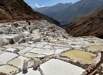 After arriving in Cusco my driver dropped me off at the Maras Salt Mines. Stretched the legs a bit after some long flights and walked the trail along the salt mines down to the Sacred Valley. The salt mines are constituted by a set of approximately 4,500 salt wells placed in the form of stepped terraces in the slope of the hill. The set of wells and canals has been in continuous operation from the pre-Inca period until now.
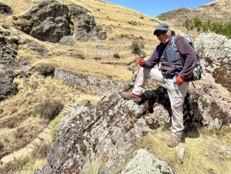
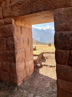
I based myself out of the village of Lamay in the Sacred Valley for a few days to acclimate to the elevation. First hike I did was to the Inca Royal estate of Huchuy Qusqu (Little Cusco) with my awesome 72 year old guide Percy.
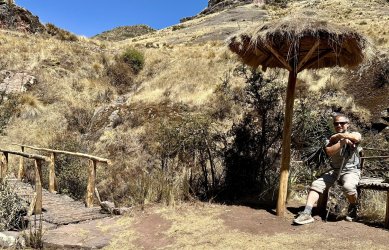
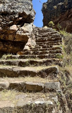
Some nice section of Inca Trail led the way to the site.
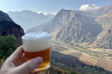
Post hike beer looking out over the Sacred Valley of the Incas.
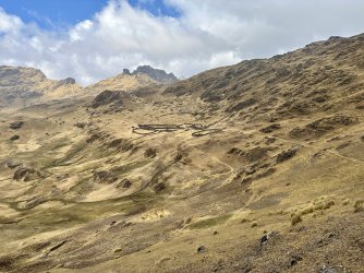
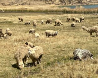
The next day we explored the Andean Puna home to llama, alapaca, and sheep herders.
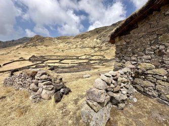
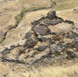
Beautiful rock enclosures used to corral the animals dotted the landscape.
After the hike I moved onto Cusco to meet my group for our trek to Choquequirao and beyond.
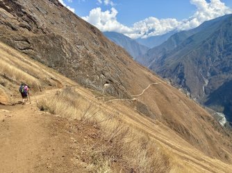
The first day of our trek we dropped 4,624' to the river bottom then back up 2,478' back up to camp. This would be an all too familiar pattern over the upcoming days.
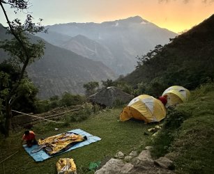
Camp 1 Upper Santa Rosa
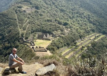
After a couple of days we arrived at Choquequirao. My few pics don't give the ruins or the location high above the river any justice.
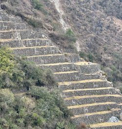
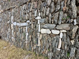
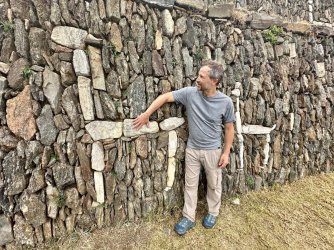
After seeing pictures of these llama figurines years ago I was so happy to see them in person.
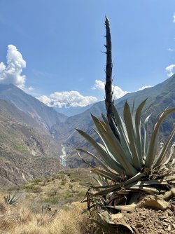
We continued from Choquequirao to the village over Yanama over a few more days.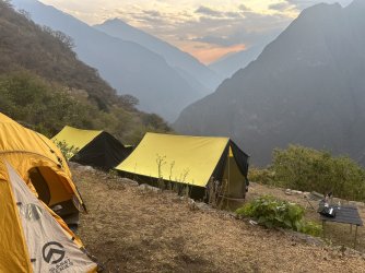
Camp 3 was set on some old Inca Terraces.
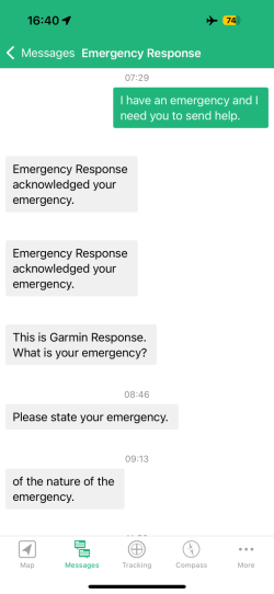
Sometime during the morning of day 5 my Inreach device accidentally sent an SOS. It was in my duffel bag riding on a horse when it sent the SOS. Garmin quickly contacted my parents, wife, and the Peruvian authorities.
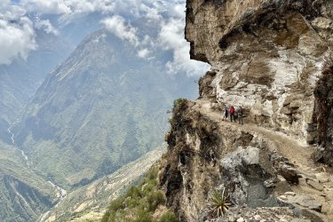
Almost to Yanama, little did I know wait awaited me upon my arrival.
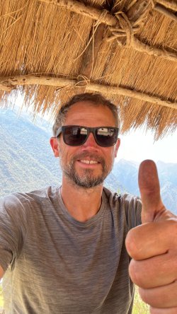
After arriving in Yanama and connecting to the WI-FI I found a flurry of messages asking if I was ok. I spent the next hour assuring everyone (Peruvian police, Garmin, wife) that I was OK and it was an accidental SOS. What a mess, but it's good to know the SOS was taken seriously even though it was a mistake.
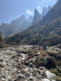
After leaving Yanama we left the beaten path and didn't see any other trekkers for our final three days of the trek.
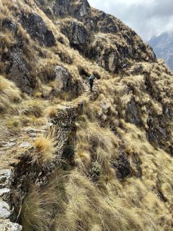
Up this valley are some of the best and most intact sections of Inca Trail remaining in Peru.
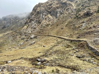
Beautiful sections of trail.
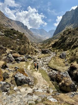
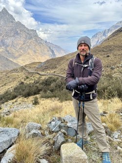
Making our way up to the 15,100' pass along ancient Inca Trails.
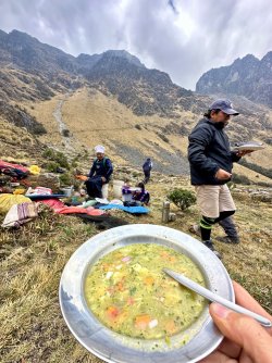
Our camp cook Leo whipped up some soup at 14,000' to help power us up over the pass!
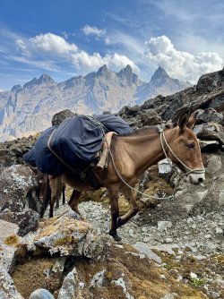
We had six horses supporting our trek.
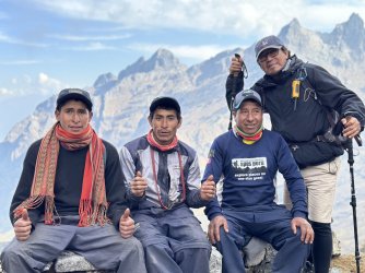
Two horseman, cook, and our guide.
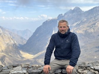
Made it to the top of the pass, 15,100'!
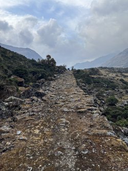
Over 7 days we hiked 55 miles, gained and dropped 21,000' in elevation.
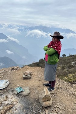
The people of the Andes are remarkable. Strong, hardworking, spiritual, and not far removed from their Inca heritage.
 After arriving in Cusco my driver dropped me off at the Maras Salt Mines. Stretched the legs a bit after some long flights and walked the trail along the salt mines down to the Sacred Valley. The salt mines are constituted by a set of approximately 4,500 salt wells placed in the form of stepped terraces in the slope of the hill. The set of wells and canals has been in continuous operation from the pre-Inca period until now.
I based myself out of the village of Lamay in the Sacred Valley for a few days to acclimate to the elevation. First hike I did was to the Inca Royal estate of Huchuy Qusqu (Little Cusco) with my awesome 72 year old guide Percy.


Some nice section of Inca Trail led the way to the site.


Post hike beer looking out over the Sacred Valley of the Incas.

The next day we explored the Andean Puna home to llama, alapaca, and sheep herders.

Beautiful rock enclosures used to corral the animals dotted the landscape.


After the hike I moved onto Cusco to meet my group for our trek to Choquequirao and beyond.

The first day of our trek we dropped 4,624' to the river bottom then back up 2,478' back up to camp. This would be an all too familiar pattern over the upcoming days.

Camp 1 Upper Santa Rosa

After a couple of days we arrived at Choquequirao. My few pics don't give the ruins or the location high above the river any justice.


After seeing pictures of these llama figurines years ago I was so happy to see them in person.

We continued from Choquequirao to the village over Yanama over a few more days.

Camp 3 was set on some old Inca Terraces.

Sometime during the morning of day 5 my Inreach device accidentally sent an SOS. It was in my duffel bag riding on a horse when it sent the SOS. Garmin quickly contacted my parents, wife, and the Peruvian authorities.

Almost to Yanama, little did I know wait awaited me upon my arrival.

After arriving in Yanama and connecting to the WI-FI I found a flurry of messages asking if I was ok. I spent the next hour assuring everyone (Peruvian police, Garmin, wife) that I was OK and it was an accidental SOS. What a mess, but it's good to know the SOS was taken seriously even though it was a mistake.

After leaving Yanama we left the beaten path and didn't see any other trekkers for our final three days of the trek.

Up this valley are some of the best and most intact sections of Inca Trail remaining in Peru.

Beautiful sections of trail.


Making our way up to the 15,100' pass along ancient Inca Trails.

Our camp cook Leo whipped up some soup at 14,000' to help power us up over the pass!

We had six horses supporting our trek.

Two horseman, cook, and our guide.

Made it to the top of the pass, 15,100'!

Over 7 days we hiked 55 miles, gained and dropped 21,000' in elevation.

The people of the Andes are remarkable. Strong, hardworking, spiritual, and not far removed from their Inca heritage.


