- Joined
- Dec 23, 2013
- Messages
- 4,303
Twenty seven years ago, I hiked across Parley's Ridge. How do I know it was twenty sevens years you might ask? Good question! Well, I know because on my birthday back in 1993 I bought a new Jeep Wrangler, and the Parley's Ridge hike was the first hike I did after the purchase. I drove my new Jeep to the top of Emigration Canyon to begin the trek, and I had my friend pick me up on the west end at the old Cowboy Grub location on Foothill Drive when I was done.
Wind the clocks ahead to this past Saturday, and once I convinced my wife to join me, we set off for a day of adventure and solitude. First, we dropped the Jeep off on the west end at Benchmark Drive, and then we drove our outback to the top of Emigration to start on the east end.
Now the hike is approximately 8.5 miles in length, if you include a ridge walk to the high point of the ridge, which is located on a north-south running sub-ridge that juts out into Emigration Canyon. The hike includes some minor scrambling, some bushwhacking, and a little bit of post-holing at times on the north side of the ridge where there was still snow.
The hike took us eight hours and fifteen minutes to complete, which including two substantial breaks, one on Dale Peak, and the second, on the ridge high point, plus about an hour long lunch on Perkins Peak. Our only wildlife sightings were birds. We observed three vultures, some scrub jays, two Chukars, numerous Spotted Towhees, and while eating lunch, we were fortunate enough to see a Golden Eagle fly past. That was pretty cool! There is supposed to be an elk herd that calls the ridge home, and though we saw plenty of sign, we did not actually see any elk.
On the wildflower side of things, the Glacier Lilies were tremendous. They accompanied us all along the ridge, up until we started dropping off on the west side. Just beautiful. Others that we encountered were: Yellow Bells, Manyflower Stickseeds, Spring Beauties, and a few Arrowleaf Balsamroot at the lower elevations.
Well, lets get this show on the road, and see if the old Scatman can do as well as the strapping young lad of 27 years ago.
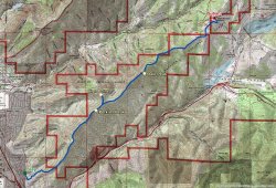
The Scatman approved route.
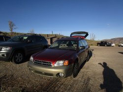
The Subaru at the trailhead parking lot. We arrived around 7:45 am with quite a few vehicles already there. How about that Scat shadow?
I'm guessing most were doing the Little Mountain hike, because we only saw a couple of people on our route.
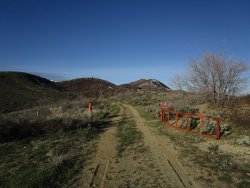
The gateway to adventure! The first part of the hike is a long approach on an old Jeep road that goes to the base of Dale Peak which
can be seen in the distance.
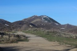
Dale Peak
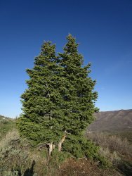
Some mighty firs along the trail
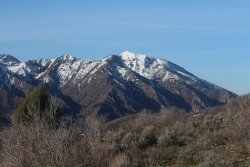
Grandeur Peak to the southwest. Triangle, or Hobbs Peak can be seen on the far left of the image too.
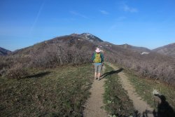
Making our way along the old Jeep road - the Scat shadow is still present.
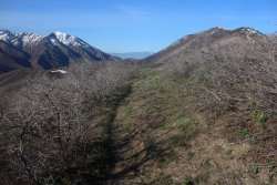
Beginning to encounter some scrub oak. I might mention that this hike is much easier before the oak get their leaves.
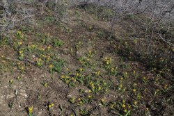
My picture doesn't do them justice, but the Glacier Lilies were magnificent along the entire route.
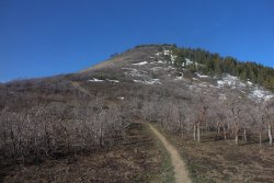
The beginning of the steep ascent to the summit of Dale Peak and the top of the ridge
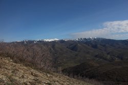
A look to the north towards Grandview and Lookout Peaks, along with housing growth in Emigration Canyon
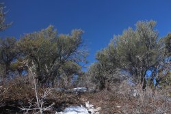
Started running into Mountain Mahogany and patches of snow on the way up to Dale
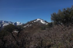
Dale Peak just ahead, with the top of Grandeur beyond.
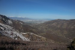
A look down into the western reaches of Emigration Canyon, with the first view of the Salt Lake Valley, also Mount Wire (Beacon
Hill) can be seen along the ridge north of the canyon.
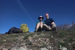
Break time on Dale Peak
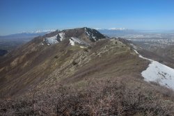
The view west from the summit of Dale Peak
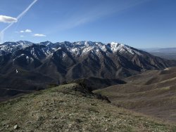
Nice view south into the Wasatch with Parley's Canyon below.
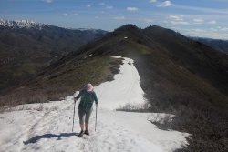
Coming off of Dale Peak along the ridgeline
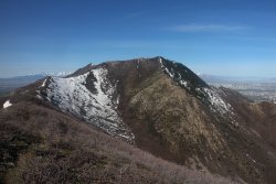
Good view of the north-south running ridge where the high point is located. The little bump to the left of that ridge is Perkins Peak
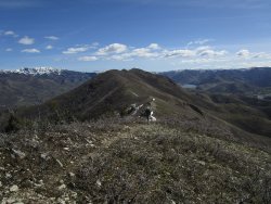
A good look back at Dale Peak, with Lookout Peak and Little Dell Reservoir in the distance
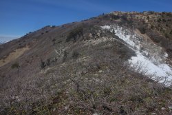
Making our way up the ridge that the high point is located on. Can you make out all the Glacier Lilies in the scrub oak? Wonderful!
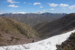
A look down into Perkins Hollow
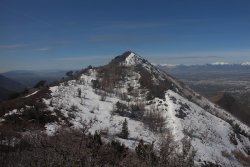
Perkins Peak - as seen from the north south running ridge.
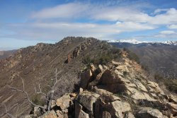
Some ridge walking to get to the high point
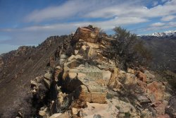
Some minor scrambling along the ridge
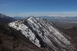
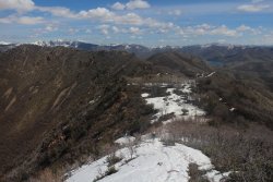
A look at the north side of Parley's Ridge along its westward reaches, still snow covered.
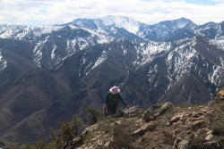
Mount Raymond and Gobblers Knob cheering Sheila on.
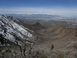
A look down into Spring Canyon and Jacks Mountain along the lower southern ridge
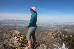
Trail mix on the high point of our route
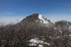
Back on the main ridge looking up at Perkins Peak
Sheila, making her way up Perkins Peak
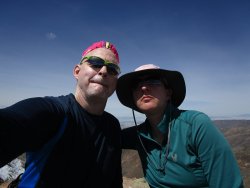
Lunch on Perkins
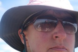
This ones for you @Miya. Look how creative! I call it "The Reflection of Scat". I outdid myself on this one. I only get one, rare,
creative idea a year or so. Yeah, I know what everybody is thinking. More like on the timeline of the seventeen year cicadas!
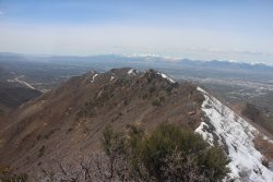
The view to the west (what lies ahead) from Perkins Peak
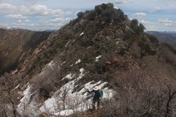
Making our way off Perkins Peak
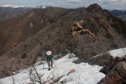
A few steep little humps along the ridgeline after Perkins
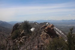
Some scrambling ahead of us
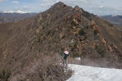
Tired of the snow yet my dear?
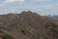
A good look back east of Parley's Ridge, with Dale Peak in the distance and Perkins Peak at the center along the ridge
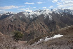
Looking across Parley's Canyon with Gobblers Knob, Mount Raymond, and Grandeur Peak above
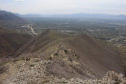
Looking down the western end of Parley's Ridge as it drops to the Salt Lake Valley
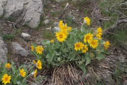
Some Arrowleaf Balsamroot towards the end
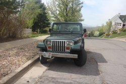
The 94 Jeep Wrangler raring to go, on Benchmark Drive
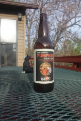
Of course, no hike is complete without the celebratory beer when you get home.
The End.
Wind the clocks ahead to this past Saturday, and once I convinced my wife to join me, we set off for a day of adventure and solitude. First, we dropped the Jeep off on the west end at Benchmark Drive, and then we drove our outback to the top of Emigration to start on the east end.
Now the hike is approximately 8.5 miles in length, if you include a ridge walk to the high point of the ridge, which is located on a north-south running sub-ridge that juts out into Emigration Canyon. The hike includes some minor scrambling, some bushwhacking, and a little bit of post-holing at times on the north side of the ridge where there was still snow.
The hike took us eight hours and fifteen minutes to complete, which including two substantial breaks, one on Dale Peak, and the second, on the ridge high point, plus about an hour long lunch on Perkins Peak. Our only wildlife sightings were birds. We observed three vultures, some scrub jays, two Chukars, numerous Spotted Towhees, and while eating lunch, we were fortunate enough to see a Golden Eagle fly past. That was pretty cool! There is supposed to be an elk herd that calls the ridge home, and though we saw plenty of sign, we did not actually see any elk.
On the wildflower side of things, the Glacier Lilies were tremendous. They accompanied us all along the ridge, up until we started dropping off on the west side. Just beautiful. Others that we encountered were: Yellow Bells, Manyflower Stickseeds, Spring Beauties, and a few Arrowleaf Balsamroot at the lower elevations.
Well, lets get this show on the road, and see if the old Scatman can do as well as the strapping young lad of 27 years ago.

The Scatman approved route.

The Subaru at the trailhead parking lot. We arrived around 7:45 am with quite a few vehicles already there. How about that Scat shadow?
I'm guessing most were doing the Little Mountain hike, because we only saw a couple of people on our route.

The gateway to adventure! The first part of the hike is a long approach on an old Jeep road that goes to the base of Dale Peak which
can be seen in the distance.

Dale Peak

Some mighty firs along the trail

Grandeur Peak to the southwest. Triangle, or Hobbs Peak can be seen on the far left of the image too.

Making our way along the old Jeep road - the Scat shadow is still present.

Beginning to encounter some scrub oak. I might mention that this hike is much easier before the oak get their leaves.

My picture doesn't do them justice, but the Glacier Lilies were magnificent along the entire route.

The beginning of the steep ascent to the summit of Dale Peak and the top of the ridge

A look to the north towards Grandview and Lookout Peaks, along with housing growth in Emigration Canyon

Started running into Mountain Mahogany and patches of snow on the way up to Dale

Dale Peak just ahead, with the top of Grandeur beyond.

A look down into the western reaches of Emigration Canyon, with the first view of the Salt Lake Valley, also Mount Wire (Beacon
Hill) can be seen along the ridge north of the canyon.

Break time on Dale Peak

The view west from the summit of Dale Peak

Nice view south into the Wasatch with Parley's Canyon below.

Coming off of Dale Peak along the ridgeline

Good view of the north-south running ridge where the high point is located. The little bump to the left of that ridge is Perkins Peak

A good look back at Dale Peak, with Lookout Peak and Little Dell Reservoir in the distance

Making our way up the ridge that the high point is located on. Can you make out all the Glacier Lilies in the scrub oak? Wonderful!

A look down into Perkins Hollow

Perkins Peak - as seen from the north south running ridge.

Some ridge walking to get to the high point

Some minor scrambling along the ridge

A look at the north side of Parley's Ridge along its westward reaches, still snow covered.

Mount Raymond and Gobblers Knob cheering Sheila on.

A look down into Spring Canyon and Jacks Mountain along the lower southern ridge

Trail mix on the high point of our route

Back on the main ridge looking up at Perkins Peak

Sheila, making her way up Perkins Peak

Lunch on Perkins

This ones for you @Miya. Look how creative! I call it "The Reflection of Scat". I outdid myself on this one.
creative idea a year or so.

The view to the west (what lies ahead) from Perkins Peak

Making our way off Perkins Peak

A few steep little humps along the ridgeline after Perkins

Some scrambling ahead of us

Tired of the snow yet my dear?

A good look back east of Parley's Ridge, with Dale Peak in the distance and Perkins Peak at the center along the ridge

Looking across Parley's Canyon with Gobblers Knob, Mount Raymond, and Grandeur Peak above

Looking down the western end of Parley's Ridge as it drops to the Salt Lake Valley

Some Arrowleaf Balsamroot towards the end

The 94 Jeep Wrangler raring to go, on Benchmark Drive

Of course, no hike is complete without the celebratory beer when you get home.
The End.
Last edited by a moderator:

