Hi everyone,
I would like to ask for your help to better plan my trip to Paria Canyon.
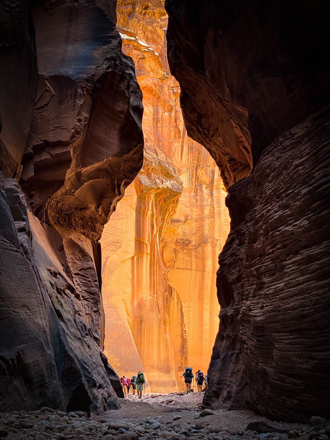
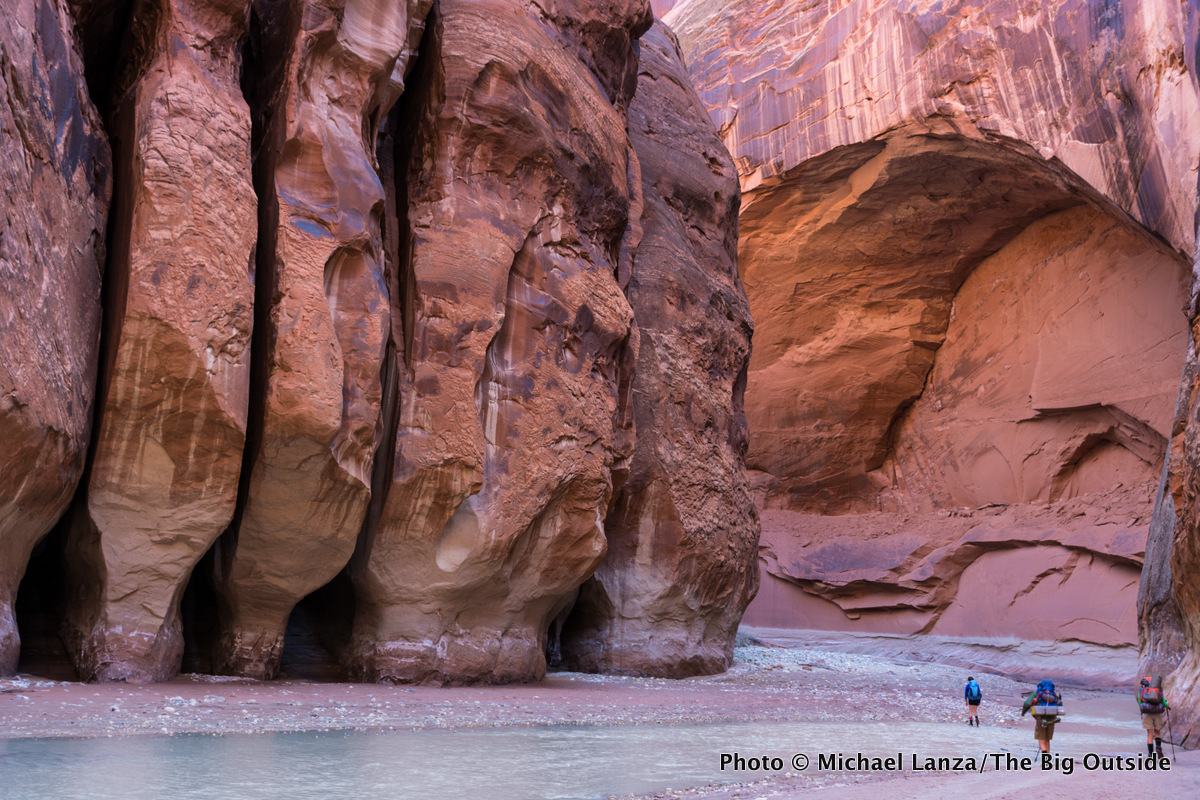
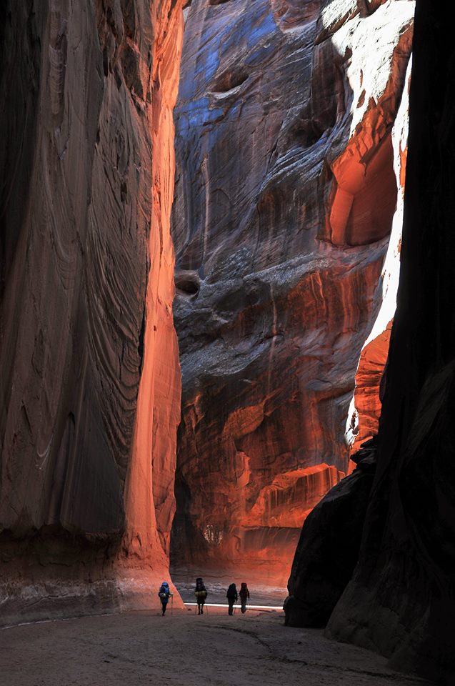
In particular, I can only dedicate one day to the trail, and I am trying to understand which is the best way to approach the trail, considering I'd like to visit the spots you can see in these photos:

(Take into account that I will dedicate another day to visit the Antelope Canyon and Lake Powell)
In which part of the Paria Canyon are these particular spots located?
I am especially referring to the tall and spectacular walls of the canyon you can see in the above pictures.
I have to choose the starting point that allows to reach the places of the photos in the shortest time possible, considering a maximum of about 4 hours to reach the innermost part of the canyon and 4 hours to return at the starting point.
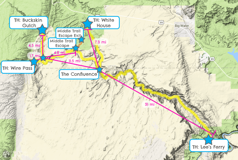
I think the options are:
-Starting from Lee Ferry (and walk for about 10/15 mi)
-Starting from Wire Pass (and walk to the Confluence or a little more)
-Starting from White House (and walk to the Confluence or a little more)
-Starting from Buckskin Gulch (and walk to the Confluence or a little more)
Which path would you suggest?
And which are the differences between these trails in term of landscape?
Any help is highly appreciated.
Many thanks in advance!
Alberto
I would like to ask for your help to better plan my trip to Paria Canyon.
In particular, I can only dedicate one day to the trail, and I am trying to understand which is the best way to approach the trail, considering I'd like to visit the spots you can see in these photos:
(Take into account that I will dedicate another day to visit the Antelope Canyon and Lake Powell)
In which part of the Paria Canyon are these particular spots located?
I am especially referring to the tall and spectacular walls of the canyon you can see in the above pictures.
I have to choose the starting point that allows to reach the places of the photos in the shortest time possible, considering a maximum of about 4 hours to reach the innermost part of the canyon and 4 hours to return at the starting point.
I think the options are:
-Starting from Lee Ferry (and walk for about 10/15 mi)
-Starting from Wire Pass (and walk to the Confluence or a little more)
-Starting from White House (and walk to the Confluence or a little more)
-Starting from Buckskin Gulch (and walk to the Confluence or a little more)
Which path would you suggest?
And which are the differences between these trails in term of landscape?
Any help is highly appreciated.
Many thanks in advance!
Alberto
