piper01
Member
- Joined
- Oct 27, 2013
- Messages
- 182
October 8-10, 2016
After reading the many excellent trip reports posted last year about Glen Canyon and packrafting the canyons of the Escalante, I developed an itch to do the same. Only one way to cure my fixation- I had to buy a packraft and go exploring too!
After a full day of flying then driving, I finally reached Hole in the Rock Road well after dark Saturday night. I had my campsite in mind- I was going to start my trip at the same camp where I had ended my last visit to the area. Driving down the side road, every potential site I passed was already full. I wasn't holding out much hope as I turned the bend to "my" site, but amazingly, it was unoccupied. Success!
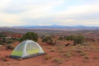
Sunday dawned overcast, but the sky soon cleared as the day progressed. My next order of business was deciding where to leave my vehicle. My plan was to descend Willow, paddle to Davis, paddle back to 50 Mile, whence I would emerge to road-walk back to my car. I parked at the Willow trailhead, dropped my pack, then decided to drive down to 50 Mile to scout the terrain, with the hope that I might catch a ride back with some kindly group on their way home. Alas, no such luck; I didn't see a single other vehicle. With the time already pushing 1 o'clock, I was anxious to get started and ultimately just drove back to Willow.
The descent into Willow Canyon
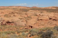
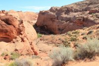

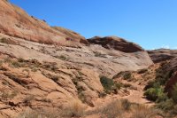

Let's face it, I love rocks.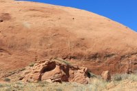
Looking backward towards my starting direction
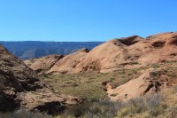
The canyon's character quickly changed with the first appearance of water. I enjoyed the refreshing splash through the shallow water in my sandals.
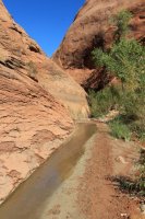
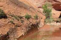
Just before the bend above Broken Bow Arch, I came across a couple and their dog, the only people I would see that day.
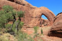
Pinchy-pinchy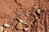
I dropped my pack, climbed up to the arch, and took some time to enjoy the view. Broken Bow Arch, looking upcanyon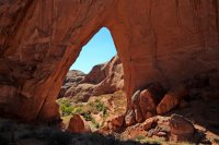
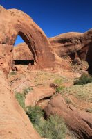
View from under the arch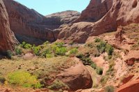
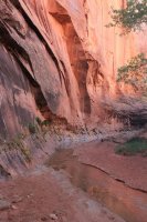
I resumed my walk downcanyon, marveling at the light bouncing off the walls.
Water seeping from the rock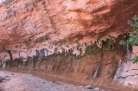
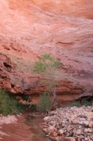

Soon I reached the water-filled narrows section. I dropped my stuff, gingerly waded in up to my stomach, and felt the water suddenly turn much cooler as I stretched my foot out for the next step. That was it; why carry my heavy pack over my head through deep water and risk dropping it if I stumbled? The walls were nice and wide, so I took the easy way through- I inflated my raft and floated across.
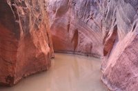
A minute or two later, I reached the confluence with 40 Mile Canyon. I contemplated leaving my pack and exploring a little ways up 40 Mile, but with the sun no longer reaching the canyon floor, I wasn't up for immersing myself in the cool water.
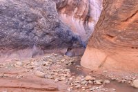
Continuing down Willow

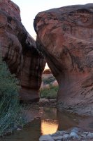

Dryfall where the next side canyon intersected Willow. I would have liked to explore it further, but there's never enough time to see everything in one trip.
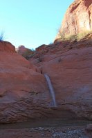
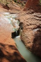
Also where the side canyon connected in, Willow's floor dropped to form these lovely waterfalls.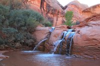
Silt deposits and bathtub rings- must mean I'm getting close to Lake Powell.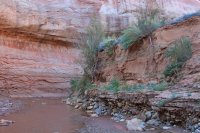
I had been anxiously watching the water level in Lake Powell in the weeks leading up to my trip, hoping for it to drop as low as possible to expose more of the canyons. However, heavy rain in September resulted in water inflow and outflow being nearly equal for two weeks, and the lake elevation staying flat at slightly under 3611'. This turned out to be my benefit. The silt had time to de-water so quickmud wasn't a problem, other than a few isolated ankle-deep patches.
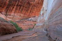
And suddenly, there was the lake. Despite the smell, I opted to set up camp on the "beach" right at the water's edge, mainly due to the lack of significantly better sites upcanyon. Downsides to the site: the smell, have to backtrack for fresh water, gnats, and a mouse chewed a hole in my hot-cocoa bag that I left unattended for several minutes. Upside: I was treated to an awesome show of bats swirling around my head catching the afore-mentioned gnats!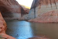
After dinner, I climbed into my bag right around sunset to read for a bit before an early bedtime. I had decided to forgo carrying a tent and sleep on a tarp instead, so I was picturing that mouse scurrying across my face as I slept. No more than a few minutes after I settled in, I heard a boat engine grow increasingly loud and voices as boaters claimed a nearby campsite. Fortunately, they didn't continue any further up the lake and stumble across me, and they were quiet and early to bed too. Thanks, good neighbors! I came across them the next morning. It turned out to be a small group in two fishing boats, just around the next bend in a giant alcove.
The lake was flat as glass in the stillness of the morning.
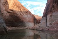
And here's Shippy McShipface, inflated and ready to launch! An Alpacka wasn't in my budget, so I went with the Klymit LWD. For the price point, I was happy with its performance. Buying everything on sale, I was able to get my raft, paddle, and PFD all for under $250.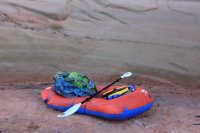
Paddling Willow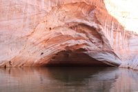
My first order of business was an excursion up Bishop Canyon. The lack of information on the hiking portion was tantalizing. Armed only with Kelsey's description of narrows in it, and one picture I found online of said narrows, I had to see if I could get in. However, all the info I had indicated that the mouth was prone to being blocked with logs and floating debris.

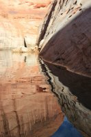
Reflections, disturbed by my presence
Large logs, as promised

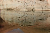
And more logs. On the upside, at this water level there were several nice places to pull ashore for a break.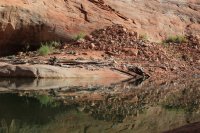
And......drat. A thick layer of mulch coated the water, with a hearty interspersion of large sticks. I gingerly picked my way into the first 15-20' of it, then pulled ashore at a spot where I could beach my boat to scout out ahead.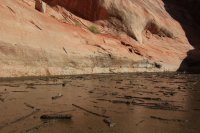
The end of the lake must have been close, but I couldn't see around the bend so I didn't know how long the debris field continued or if it became worse. Solo, in a single-chamber inflatable raft where one puncture could sink me, a mile down a seldom traveled side-canyon of a side-canyon, on a Monday morning in the shoulder-season with little chance of a boat happening my way...I would have been foolhardy to continue. Swallowing my disappointment- I was so close! it was right there!- I made the wise choice and turned around.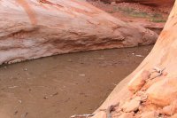
Paddling back out Bishop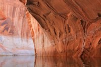
Flooded alcove in Bishop
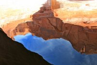
Junction of Willow and the main Escalante arm. Buoy (left of center) marking the entrance
After another hour and a half of paddling (neither my boat nor I was very fast, I averaged roughly 1.5 mph including the breaks I took), I came across this fantastic private beach. Perfect for a swim, lunch, and some poking around the rock above!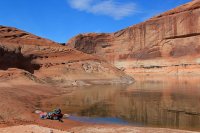
Secret garden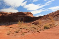
After another hour of paddling, during which I was beginning to question many of my life choices, I finally passed 50 Mile and arrived at these rocks in the center of the channel, marking the entrance to Davis. I had finally begun to see some more boat traffic, though only a jetski and 3 or 4 ski boats.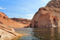
Looking back at the main channel. See that tiny buoy in the distance?
Several speed boats were zipping up and down this channel, many of which didn't bother to slow down when (if?) they saw me in my tiny raft. Added to the chop that had developed with the afternoon breeze, their waves reverberating off the canyon walls were a challenge for my tired shoulders and arms, but their magnitudes really weren't too bad; Shippy McShipface handled them like a champ! One of my test runs had been at the beach along the Gulf of Mexico, so I knew she was capable of handling more.
La Gorce Arch, the destination of many of the boats. The only houseboat I saw on my trip was beached around the next bend, though I know more were out there somewhere.
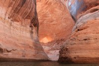
La Gorce from the other side- standing on land again!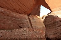
And the lake has ended. I encountered several groups of people walking to or from their boats, on a short canyon excursion.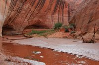
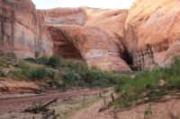
Double waterfall a short walk up from the lake. One man told me there wasn't a way to climb up it, and mused on the benefits of a higher lake level so he could float over it to see what was above.
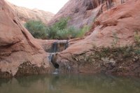
Taking the detour up and around the waterfall. Just look for footprints and a path...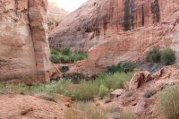
Looking down into the canyon
The giant alcove, beautiful except for the boater graffiti
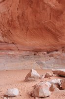
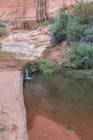
Another waterfall. I ended up setting up camp in a small alcove above the canyon floor just beyond this, where I was able to enjoy the soothing sound of the running water.
Spider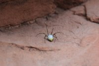
Hoodoos outside my alcove
Early evening view from camp
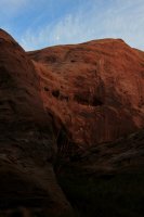
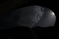
I closed my eyes to this view. It would have been absolutely stunning to see stars filling the horizon, but the nearly full moon and clouds were impressive in their own way.
Part 2 continued here
After reading the many excellent trip reports posted last year about Glen Canyon and packrafting the canyons of the Escalante, I developed an itch to do the same. Only one way to cure my fixation- I had to buy a packraft and go exploring too!
After a full day of flying then driving, I finally reached Hole in the Rock Road well after dark Saturday night. I had my campsite in mind- I was going to start my trip at the same camp where I had ended my last visit to the area. Driving down the side road, every potential site I passed was already full. I wasn't holding out much hope as I turned the bend to "my" site, but amazingly, it was unoccupied. Success!

Sunday dawned overcast, but the sky soon cleared as the day progressed. My next order of business was deciding where to leave my vehicle. My plan was to descend Willow, paddle to Davis, paddle back to 50 Mile, whence I would emerge to road-walk back to my car. I parked at the Willow trailhead, dropped my pack, then decided to drive down to 50 Mile to scout the terrain, with the hope that I might catch a ride back with some kindly group on their way home. Alas, no such luck; I didn't see a single other vehicle. With the time already pushing 1 o'clock, I was anxious to get started and ultimately just drove back to Willow.
The descent into Willow Canyon


Let's face it, I love rocks.

Looking backward towards my starting direction

The canyon's character quickly changed with the first appearance of water. I enjoyed the refreshing splash through the shallow water in my sandals.


Just before the bend above Broken Bow Arch, I came across a couple and their dog, the only people I would see that day.

Pinchy-pinchy

I dropped my pack, climbed up to the arch, and took some time to enjoy the view. Broken Bow Arch, looking upcanyon

View from under the arch


I resumed my walk downcanyon, marveling at the light bouncing off the walls.

Water seeping from the rock


Soon I reached the water-filled narrows section. I dropped my stuff, gingerly waded in up to my stomach, and felt the water suddenly turn much cooler as I stretched my foot out for the next step. That was it; why carry my heavy pack over my head through deep water and risk dropping it if I stumbled? The walls were nice and wide, so I took the easy way through- I inflated my raft and floated across.

A minute or two later, I reached the confluence with 40 Mile Canyon. I contemplated leaving my pack and exploring a little ways up 40 Mile, but with the sun no longer reaching the canyon floor, I wasn't up for immersing myself in the cool water.

Continuing down Willow


Dryfall where the next side canyon intersected Willow. I would have liked to explore it further, but there's never enough time to see everything in one trip.

Also where the side canyon connected in, Willow's floor dropped to form these lovely waterfalls.

Silt deposits and bathtub rings- must mean I'm getting close to Lake Powell.

I had been anxiously watching the water level in Lake Powell in the weeks leading up to my trip, hoping for it to drop as low as possible to expose more of the canyons. However, heavy rain in September resulted in water inflow and outflow being nearly equal for two weeks, and the lake elevation staying flat at slightly under 3611'. This turned out to be my benefit. The silt had time to de-water so quickmud wasn't a problem, other than a few isolated ankle-deep patches.

And suddenly, there was the lake. Despite the smell, I opted to set up camp on the "beach" right at the water's edge, mainly due to the lack of significantly better sites upcanyon. Downsides to the site: the smell, have to backtrack for fresh water, gnats, and a mouse chewed a hole in my hot-cocoa bag that I left unattended for several minutes. Upside: I was treated to an awesome show of bats swirling around my head catching the afore-mentioned gnats!

After dinner, I climbed into my bag right around sunset to read for a bit before an early bedtime. I had decided to forgo carrying a tent and sleep on a tarp instead, so I was picturing that mouse scurrying across my face as I slept. No more than a few minutes after I settled in, I heard a boat engine grow increasingly loud and voices as boaters claimed a nearby campsite. Fortunately, they didn't continue any further up the lake and stumble across me, and they were quiet and early to bed too. Thanks, good neighbors! I came across them the next morning. It turned out to be a small group in two fishing boats, just around the next bend in a giant alcove.
The lake was flat as glass in the stillness of the morning.

And here's Shippy McShipface, inflated and ready to launch! An Alpacka wasn't in my budget, so I went with the Klymit LWD. For the price point, I was happy with its performance. Buying everything on sale, I was able to get my raft, paddle, and PFD all for under $250.

Paddling Willow

My first order of business was an excursion up Bishop Canyon. The lack of information on the hiking portion was tantalizing. Armed only with Kelsey's description of narrows in it, and one picture I found online of said narrows, I had to see if I could get in. However, all the info I had indicated that the mouth was prone to being blocked with logs and floating debris.

Reflections, disturbed by my presence

Large logs, as promised

And more logs. On the upside, at this water level there were several nice places to pull ashore for a break.


And......drat. A thick layer of mulch coated the water, with a hearty interspersion of large sticks. I gingerly picked my way into the first 15-20' of it, then pulled ashore at a spot where I could beach my boat to scout out ahead.

The end of the lake must have been close, but I couldn't see around the bend so I didn't know how long the debris field continued or if it became worse. Solo, in a single-chamber inflatable raft where one puncture could sink me, a mile down a seldom traveled side-canyon of a side-canyon, on a Monday morning in the shoulder-season with little chance of a boat happening my way...I would have been foolhardy to continue. Swallowing my disappointment- I was so close! it was right there!- I made the wise choice and turned around.

Paddling back out Bishop

Flooded alcove in Bishop


Junction of Willow and the main Escalante arm. Buoy (left of center) marking the entrance

After another hour and a half of paddling (neither my boat nor I was very fast, I averaged roughly 1.5 mph including the breaks I took), I came across this fantastic private beach. Perfect for a swim, lunch, and some poking around the rock above!

Secret garden

After another hour of paddling, during which I was beginning to question many of my life choices, I finally passed 50 Mile and arrived at these rocks in the center of the channel, marking the entrance to Davis. I had finally begun to see some more boat traffic, though only a jetski and 3 or 4 ski boats.

Looking back at the main channel. See that tiny buoy in the distance?

Several speed boats were zipping up and down this channel, many of which didn't bother to slow down when (if?) they saw me in my tiny raft. Added to the chop that had developed with the afternoon breeze, their waves reverberating off the canyon walls were a challenge for my tired shoulders and arms, but their magnitudes really weren't too bad; Shippy McShipface handled them like a champ! One of my test runs had been at the beach along the Gulf of Mexico, so I knew she was capable of handling more.
La Gorce Arch, the destination of many of the boats. The only houseboat I saw on my trip was beached around the next bend, though I know more were out there somewhere.

La Gorce from the other side- standing on land again!

And the lake has ended. I encountered several groups of people walking to or from their boats, on a short canyon excursion.


Double waterfall a short walk up from the lake. One man told me there wasn't a way to climb up it, and mused on the benefits of a higher lake level so he could float over it to see what was above.


Taking the detour up and around the waterfall. Just look for footprints and a path...

Looking down into the canyon

The giant alcove, beautiful except for the boater graffiti

Another waterfall. I ended up setting up camp in a small alcove above the canyon floor just beyond this, where I was able to enjoy the soothing sound of the running water.

Spider

Hoodoos outside my alcove

Early evening view from camp

I closed my eyes to this view. It would have been absolutely stunning to see stars filling the horizon, but the nearly full moon and clouds were impressive in their own way.

Part 2 continued here
Last edited:
