IntrepidXJ
ADVENTR
- Joined
- Jan 17, 2012
- Messages
- 3,488
In November I decided that it was time to finally finish hiking all of the 'official trails' in the Island in the Sky like I had done with The Needles last year. While I had hiked almost all of the trails on top of the mesa, I had not hiked any that went from the top down to the White Rim. It was a lot of fun hiking the remaining trails these last few weeks. Here are a couple photos from each visit with links to the full trip reports.
Over the Edge: Island in the Sky
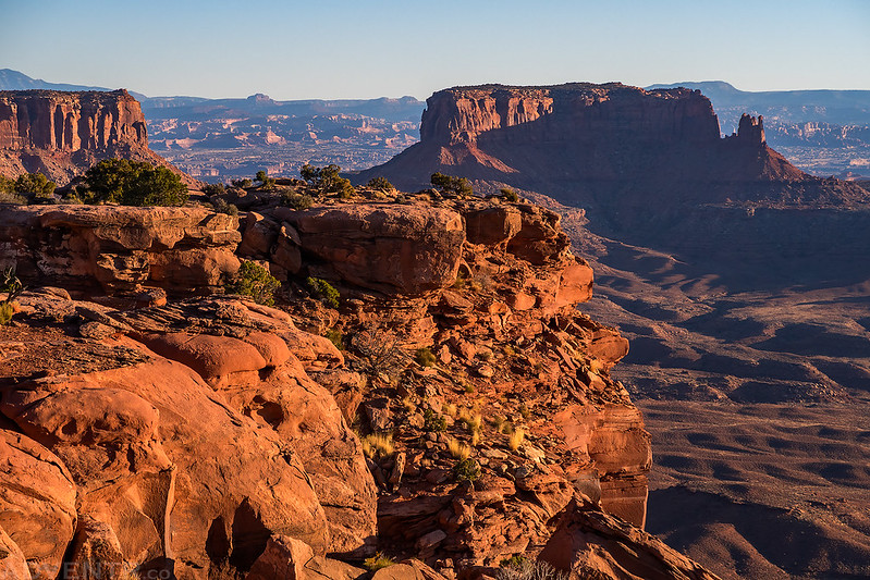
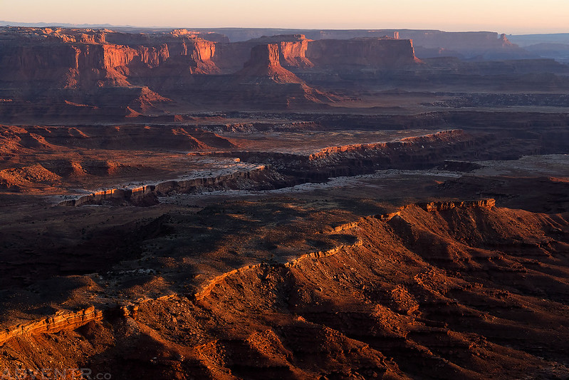
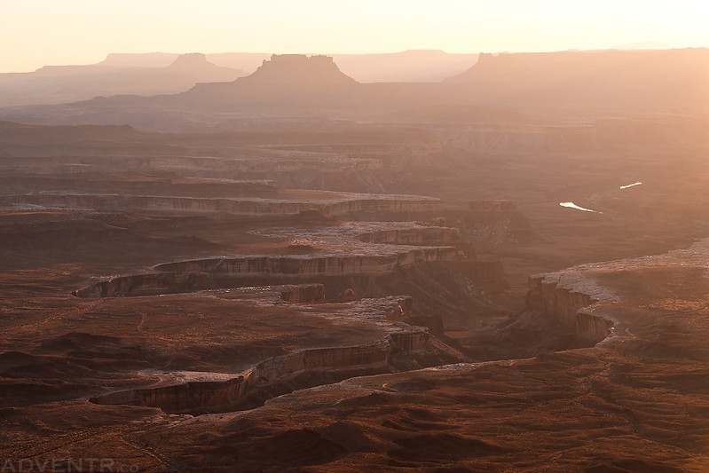
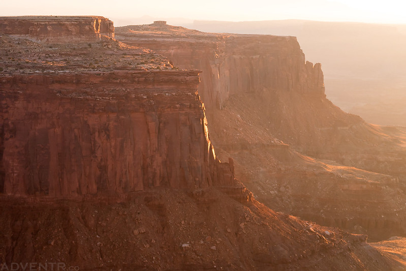
On this first trip I concentrated on the trails that started from Grand View Point including the Murphy Trail Loop, Murphy Point and Gooseberry Trail.
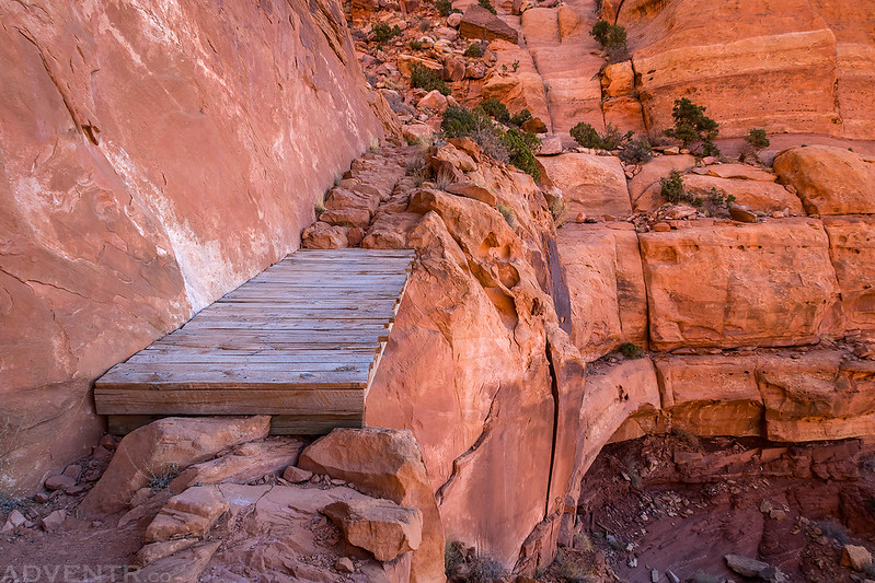
Murphy Trail Bridge by Randy Langstraat, on Flickr
Junction Butte by Randy Langstraat, on Flickr
White Rim Morning by Randy Langstraat, on Flickr
Hazy Morning View by Randy Langstraat, on Flickr
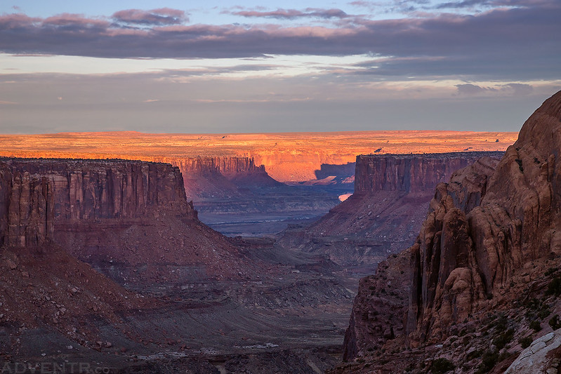
Island in the Sky: From West to East
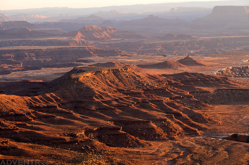
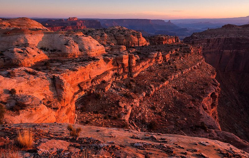
On my second trip I hiked the Wilhite Trail and Lathrop Trail.
Green River Overlook by Randy Langstraat, on Flickr
Lathrop Point Sunrise by Randy Langstraat, on Flickr
Edge of the World by Randy Langstraat, on Flickr
Morning Cliffs by Randy Langstraat, on Flickr
Island in the Sky: Syncline Loop Trail
My third trip was just a day-hike of the Syncline Loop Trail.
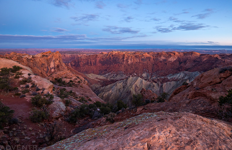
Upheaval Dome Crater by Randy Langstraat, on Flickr
Labyrinth Canyon View by Randy Langstraat, on Flickr
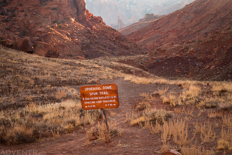
Upheaval Dome Spur Trail Sign by Randy Langstraat, on Flickr
Syncline Valley by Randy Langstraat, on Flickr
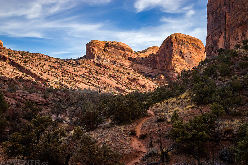
Island in the Sky: Taylor Canyon & Upheaval Canyon
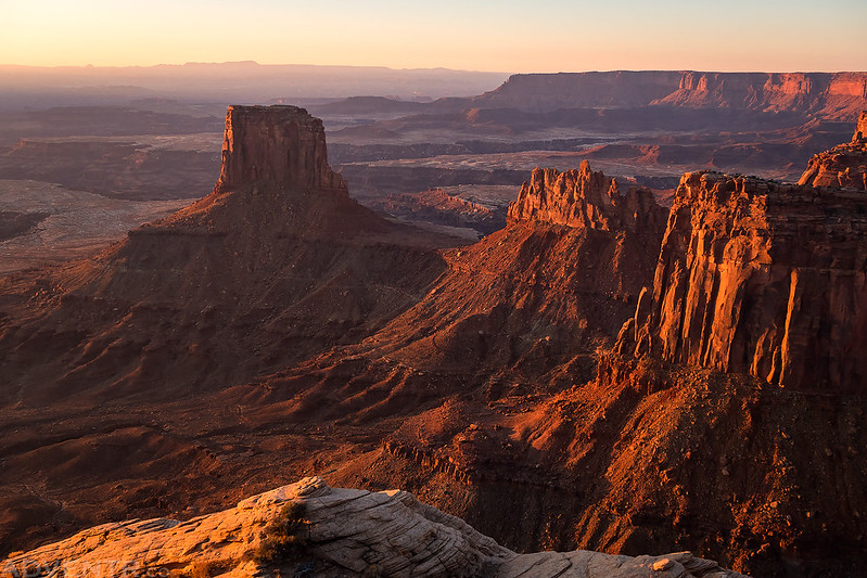
My fourth and final trip this past weekend included the Moses and Zeus Trail, Upheaval Canyon Trail and Alcove Spring Trail. Also, after driving the spur road up Taylor Canyon I have now driven every open road in all of Canyonlands National Park, too!
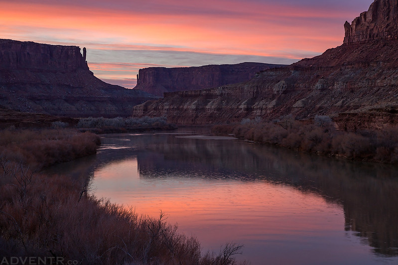
Labyrinth Canyon Dawn by Randy Langstraat, on Flickr
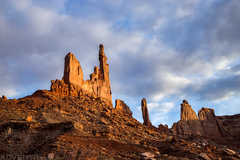
Zeus and Moses by Randy Langstraat, on Flickr
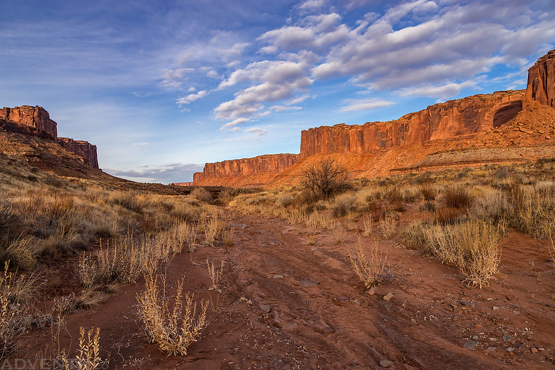
Taylor Canyon Wash by Randy Langstraat, on Flickr
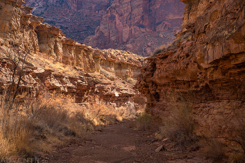
Upheaval Canyon Narrows by Randy Langstraat, on Flickr
Over the Edge: Island in the Sky
On this first trip I concentrated on the trails that started from Grand View Point including the Murphy Trail Loop, Murphy Point and Gooseberry Trail.
Murphy Trail Bridge by Randy Langstraat, on Flickr
Junction Butte by Randy Langstraat, on Flickr
White Rim Morning by Randy Langstraat, on Flickr
Hazy Morning View by Randy Langstraat, on Flickr
Island in the Sky: From West to East
On my second trip I hiked the Wilhite Trail and Lathrop Trail.
Green River Overlook by Randy Langstraat, on Flickr
Lathrop Point Sunrise by Randy Langstraat, on Flickr
Edge of the World by Randy Langstraat, on Flickr
Morning Cliffs by Randy Langstraat, on Flickr
Island in the Sky: Syncline Loop Trail
My third trip was just a day-hike of the Syncline Loop Trail.
Upheaval Dome Crater by Randy Langstraat, on Flickr
Labyrinth Canyon View by Randy Langstraat, on Flickr
Upheaval Dome Spur Trail Sign by Randy Langstraat, on Flickr
Syncline Valley by Randy Langstraat, on Flickr
Island in the Sky: Taylor Canyon & Upheaval Canyon
My fourth and final trip this past weekend included the Moses and Zeus Trail, Upheaval Canyon Trail and Alcove Spring Trail. Also, after driving the spur road up Taylor Canyon I have now driven every open road in all of Canyonlands National Park, too!
Labyrinth Canyon Dawn by Randy Langstraat, on Flickr
Zeus and Moses by Randy Langstraat, on Flickr
Taylor Canyon Wash by Randy Langstraat, on Flickr
Upheaval Canyon Narrows by Randy Langstraat, on Flickr