- Joined
- Feb 15, 2020
- Messages
- 579
It's been a while since I've posted a trip report - and there's a few worthy trips that precede this one I'd still like to write up at some point. (Including a really fun one from June w/ @Nethos in the Pecos Wilderness.) However, this one was spectacular and I have an abundance of pictures, so I'm going to start here.
A couple weekends ago I drove up to Pinedale to begin this loop. It was originally going to be a solo trip, then went up to five(!), before settling at the three of us that departed early on a Monday morning. The original goals of the loop I drew up were: 1) get back to the northern sections of the Winds, where I hadn't been in a few years; and 2) summit Bastion/Rampart Peaks, which were so striking on my last visit. Happy to report that both goals were successful - in fact, the whole route went as planned generally. There is one section I would not recommend - it was just a beating and probably not worth it, but we'll get to that - only place I felt like a real chance of bears though... As usual in the Winds, not much wildlife on this one - but the conditions/scenery were as stunning as ever.
Day 1: Elkhart Park to Indian Basin
I'm not a big fan of starting at Elkhart Park due to the crowds, but in this case it just made the most sense. Starting early on a weekday made it much more tolerable than my last visit, too. This section of the route was by far the most heavily traveled - and thus well documented - but it was a beautiful and tame start to the trip. The goal for the day was just to make it beyond Island Lake and set up for going over Indian Pass the next morning.
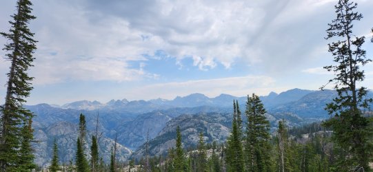
Views improve with every step.
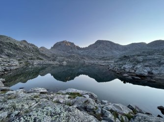
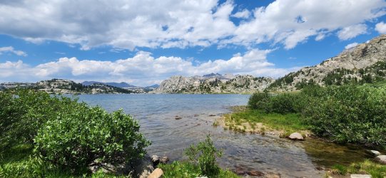
Short break at Island Lake.
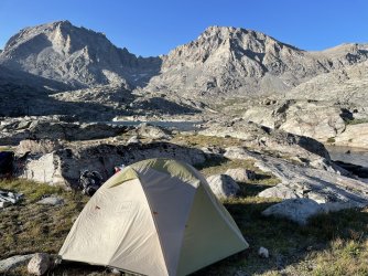
Home for the evening. Talked with a couple folks on their way down from summiting Fremont Peak.
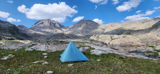
Day 2: Indian Basin to North Fork Bull Lake Creek
Today would be fairly short, but would be the start of our more adventurous days. Indian Pass has a nice trail from the west side, but descending the east can follow a few different variations. We pretty much went straight down while curling slightly to the north as our planned camp for the evening would be the upper sections of North Fork Bull Lake Creek - one of my favorite areas of the Winds.
Very calm morning in Indian Basin. The lack of wind would become a theme for the next few days - it seemed to keep most of the smoke down in the plains where we could see it in the distance, but it didn't affect us much on the route. A couple of evenings when a breeze picked up we did have a bit more smoke - particularly our last night.
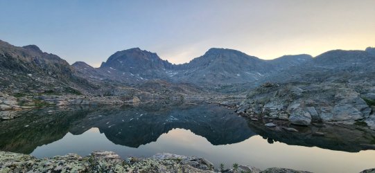
Looking back on Indian Basin.
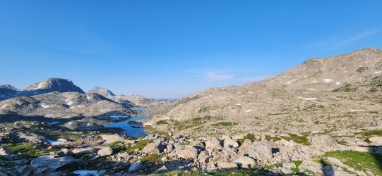
Near the top of Indian Pass.
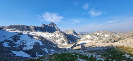
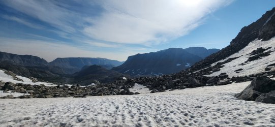
And on to the far side... Knife Point Glacier has receded enough at this point to not be much of an obstacle, but still a fair bit of rock hopping and snow crossing to keep things fun.
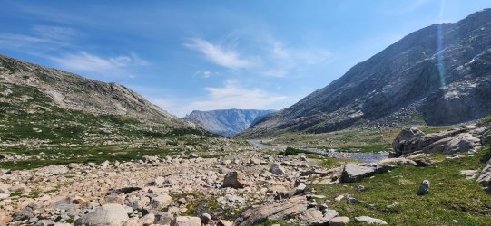
 It greened up nicely once we got off of the big rocks.
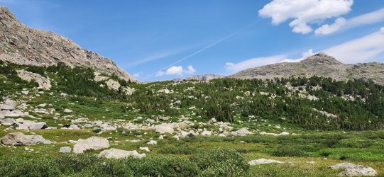
I really enjoyed this little mini-basin at the fork of the creek.
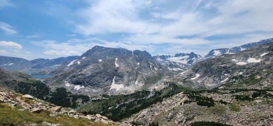
Took a little jaunt to the nearby high point and the views did not disappoint.
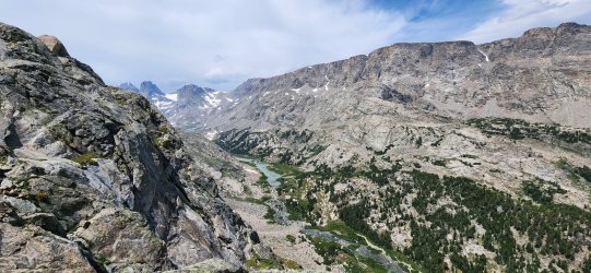
Beautiful camp for the evening - w/ tomorrow's problem (Blaurock Pass) in the background.
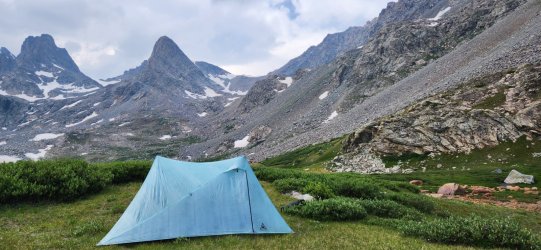
Day 3: North Fork Bull Lake Creek to Gannett Creek
Today would be a fun one - and we'd be re-tracing (in reverse) some of a trip two of us had taken just a few years ago, but we'd bailed on the other side of Blaurock Pass due to conditions. (I'd been "skunked" on this side of the pass a few years before that, too, so Blaurock was becoming a bit of a blemish on my hiking record. ) I was looking forward to getting over Blaurock finally, as well as seeing West Sentinel Pass and Gannett Glacier again.
We tried to get a reasonably early start - hoping to relax a bit down by Dinwoody Creek before starting up West Sentinel.
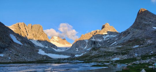
Gannett Peak and West Sentinel Pass from Blaurock Pass.
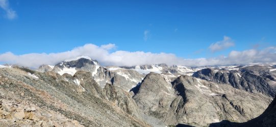
360° from Blaurock Pass.
Heap Steep Glacier and Gannett Peak.
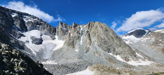
After our break at Dinwoody Creek it was time to head up West Sentinel Pass to Gannett Glacier.
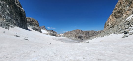
Looking up the glacier.
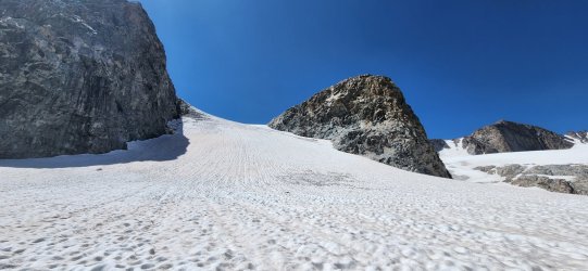
Video of glacial melt.
Rocky camp - but given the options, pretty darn good. This was the first grass we'd seen since Dinwoody Creek.
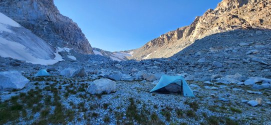
Day 4: Gannett Creek to Wells Creek
This was essentially our "goal" day and the crux (we thought) of the trip overall. I'd really fallen in love w/ Bastion Peak last time I was through and used that as a great excuse to return. I was richly rewarded - both Bastion and Rampart Peaks were fun mountains with spectacular views. The descent was long and rocky, but wild and beautiful as well.
This is actually a sub-peak of Bastion, but arguably the more spectacular for the way it dominates the skyline.
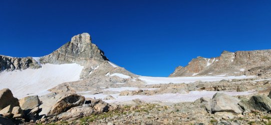
360° from Bastion Peak.
Gannett Peak and the upper glacier. Mount Koven in the middle distance.
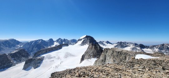
Video of Gannett Glacier from point 13370.
Desolation Lake from near the Rampart Peak summit.
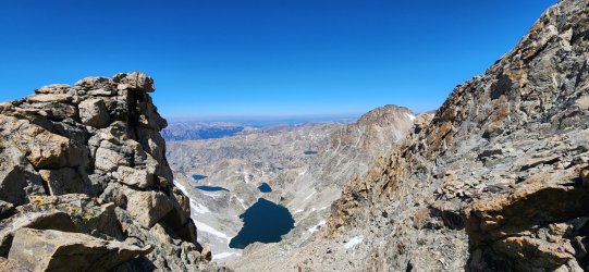
360° from Rampart Peak.
The slushy, but firm enough, snow was a relief after many hours of rock hopping.
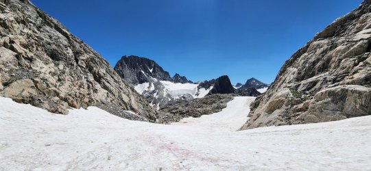
The lake in the distance does not appear on topographic maps and was revealed by recession of Minor Glacier. (So I guess we can call it Minor Lake?)
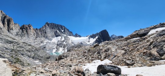
Wonderful valley below Minor Glacier. Fun waterfall downclimb. Or you can take the easy grassy ramps, I guess.
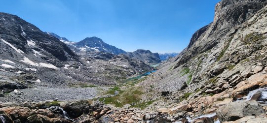
Another beautiful unnamed lake.
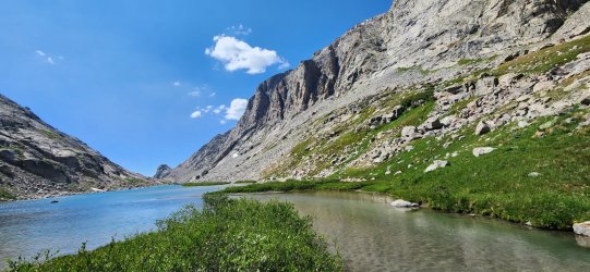
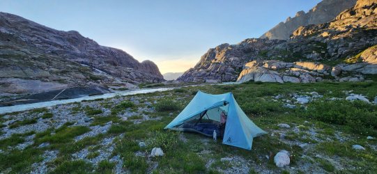
Another great camp. Smoke was a little more visible this evening - especially down the valley.
Day 5: Wells Creek to Sauerkraut Lakes
Today's goal would be go over Stone Pillar Pass, visit Elbow Lakes basin, try an unnamed pass, and camp at Sauerkraut Lakes. Our excellent conditions continued - though the lack of wind would make things feel quite warm. I really enjoyed Stone Pillar Pass and the descent to Stonehammer Lake - I would caution that the descent to the lake is on notably slick/loose rock, so take care if you ever visit.
Never get tired of waking up to these views.
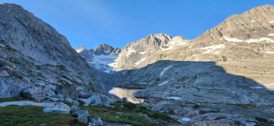
Looking back up Stone Pillar Pass. Fitting enough name.
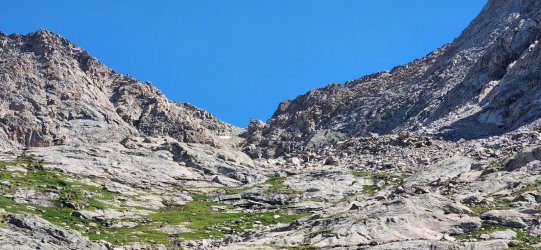
Finally down to Stonehammer Lake - but lots of boulder hopping to get around the lake.
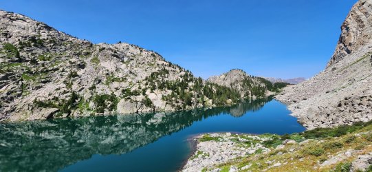
Quick break at Peak Lake. Back on trail - for a few minutes at least.
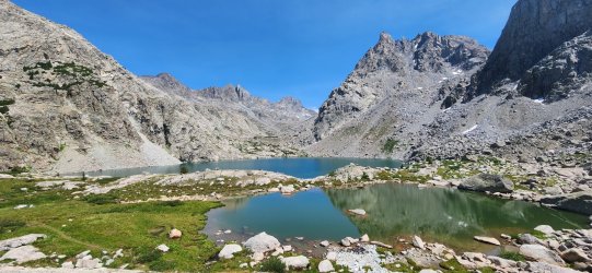
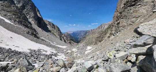
Didn't take many pictures on the next objective - might say something, might not. Rather than the obvious, on-trail route, I had it in my head to try out the nearby unnamed pass. (Though we referred to it as "Oeneis Pass" in reference to the accompanying peak.)
The north side was very slow going over very large boulders all the way up - the south side was a huge contrast, consisting of a long lush ramp all the way down to Elbow Lake.
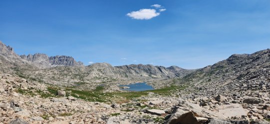
Pass Lake. We met back up w/ the trail and followed to near its terminus along Sauerkraut Lakes. (The official trail goes to Bridger Lakes, but it starts petering out here and does not exist beyond Bridger Lakes.)
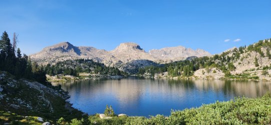
Lowest and most forested site of the trip. Also the smokiest - but the whole trip had better conditions than expected in that regard.
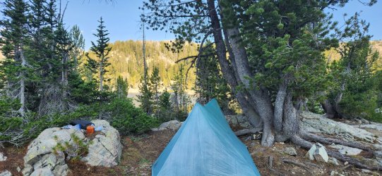
Looking over the lakes.
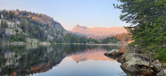
Day 6: Sauerkraut Lakes to Elkhart Park
Today was an absolute beating. Not the best planning on my part to make the final day such a pain in the butt. In my defense, I'd originally planned the trip as a solo affair and sometimes bushwhacking up/down an unknown drainage is my masochistic idea of fun. But... I generally try not to subject anyone else. (No need to chime in @travel2walk. ) About halfway down the drainage I had the realization that I was subjecting two other people to this and thought, "Boy, I bet they hate me right now." (We had agreed to split up and meet, given our relative fatigue and estimated speed.) I wasn't wrong, but all was forgiven after a few burgers.
Not many pictures of this day - it was a beating physically and not really that scenic (in that relative sense) anyway.
The largest of Bridger Lakes. Any semblance of a trail disappeared here - as expected.
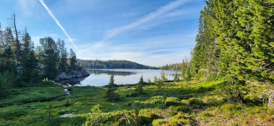
Bridger Canyon - and pain.
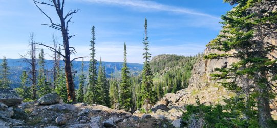
Very comforting in dense brush. Nice to know we had company, I guess - and closest thing to a wildlife encounter.
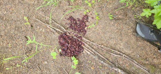
Long Lake. Just a very unfortunately placed 1,500' climb to go.
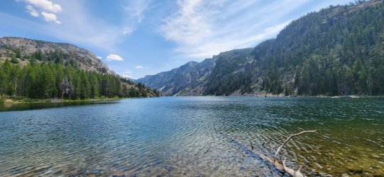
Anyway, it was another great one! Really had a blast and lucked out with weather conditions, too. Came up w/ some new inspiration in the area, too - so hopefully it won't be as long before I return. (So many places to go, so little time!)
Heading north of the Arctic Circle at the end of this week, but I'll try to come back with both that trip report and a few that others I've missed. All the best to all of you!
A couple weekends ago I drove up to Pinedale to begin this loop. It was originally going to be a solo trip, then went up to five(!), before settling at the three of us that departed early on a Monday morning. The original goals of the loop I drew up were: 1) get back to the northern sections of the Winds, where I hadn't been in a few years; and 2) summit Bastion/Rampart Peaks, which were so striking on my last visit. Happy to report that both goals were successful - in fact, the whole route went as planned generally. There is one section I would not recommend - it was just a beating and probably not worth it, but we'll get to that - only place I felt like a real chance of bears though... As usual in the Winds, not much wildlife on this one - but the conditions/scenery were as stunning as ever.
Day 1: Elkhart Park to Indian Basin
I'm not a big fan of starting at Elkhart Park due to the crowds, but in this case it just made the most sense. Starting early on a weekday made it much more tolerable than my last visit, too. This section of the route was by far the most heavily traveled - and thus well documented - but it was a beautiful and tame start to the trip. The goal for the day was just to make it beyond Island Lake and set up for going over Indian Pass the next morning.
Views improve with every step.

Short break at Island Lake.

Home for the evening. Talked with a couple folks on their way down from summiting Fremont Peak.

Day 2: Indian Basin to North Fork Bull Lake Creek
Today would be fairly short, but would be the start of our more adventurous days. Indian Pass has a nice trail from the west side, but descending the east can follow a few different variations. We pretty much went straight down while curling slightly to the north as our planned camp for the evening would be the upper sections of North Fork Bull Lake Creek - one of my favorite areas of the Winds.
Very calm morning in Indian Basin. The lack of wind would become a theme for the next few days - it seemed to keep most of the smoke down in the plains where we could see it in the distance, but it didn't affect us much on the route. A couple of evenings when a breeze picked up we did have a bit more smoke - particularly our last night.

Looking back on Indian Basin.

Near the top of Indian Pass.

And on to the far side... Knife Point Glacier has receded enough at this point to not be much of an obstacle, but still a fair bit of rock hopping and snow crossing to keep things fun.
 It greened up nicely once we got off of the big rocks.
I really enjoyed this little mini-basin at the fork of the creek.

Took a little jaunt to the nearby high point and the views did not disappoint.


Beautiful camp for the evening - w/ tomorrow's problem (Blaurock Pass) in the background.

Day 3: North Fork Bull Lake Creek to Gannett Creek
Today would be a fun one - and we'd be re-tracing (in reverse) some of a trip two of us had taken just a few years ago, but we'd bailed on the other side of Blaurock Pass due to conditions. (I'd been "skunked" on this side of the pass a few years before that, too, so Blaurock was becoming a bit of a blemish on my hiking record.
We tried to get a reasonably early start - hoping to relax a bit down by Dinwoody Creek before starting up West Sentinel.

Gannett Peak and West Sentinel Pass from Blaurock Pass.

360° from Blaurock Pass.

After our break at Dinwoody Creek it was time to head up West Sentinel Pass to Gannett Glacier.

Looking up the glacier.

Video of glacial melt.

Day 4: Gannett Creek to Wells Creek
This was essentially our "goal" day and the crux (we thought) of the trip overall. I'd really fallen in love w/ Bastion Peak last time I was through and used that as a great excuse to return. I was richly rewarded - both Bastion and Rampart Peaks were fun mountains with spectacular views. The descent was long and rocky, but wild and beautiful as well.
This is actually a sub-peak of Bastion, but arguably the more spectacular for the way it dominates the skyline.

360° from Bastion Peak.

Video of Gannett Glacier from point 13370.

360° from Rampart Peak.

The lake in the distance does not appear on topographic maps and was revealed by recession of Minor Glacier. (So I guess we can call it Minor Lake?)

Wonderful valley below Minor Glacier. Fun waterfall downclimb. Or you can take the easy grassy ramps, I guess.

Another beautiful unnamed lake.

Another great camp. Smoke was a little more visible this evening - especially down the valley.

Day 5: Wells Creek to Sauerkraut Lakes
Today's goal would be go over Stone Pillar Pass, visit Elbow Lakes basin, try an unnamed pass, and camp at Sauerkraut Lakes. Our excellent conditions continued - though the lack of wind would make things feel quite warm. I really enjoyed Stone Pillar Pass and the descent to Stonehammer Lake - I would caution that the descent to the lake is on notably slick/loose rock, so take care if you ever visit.
Never get tired of waking up to these views.

Looking back up Stone Pillar Pass. Fitting enough name.

Finally down to Stonehammer Lake - but lots of boulder hopping to get around the lake.

Quick break at Peak Lake. Back on trail - for a few minutes at least.

Didn't take many pictures on the next objective - might say something, might not. Rather than the obvious, on-trail route, I had it in my head to try out the nearby unnamed pass. (Though we referred to it as "Oeneis Pass" in reference to the accompanying peak.)
The north side was very slow going over very large boulders all the way up - the south side was a huge contrast, consisting of a long lush ramp all the way down to Elbow Lake.


Pass Lake. We met back up w/ the trail and followed to near its terminus along Sauerkraut Lakes. (The official trail goes to Bridger Lakes, but it starts petering out here and does not exist beyond Bridger Lakes.)

Lowest and most forested site of the trip. Also the smokiest - but the whole trip had better conditions than expected in that regard.

Looking over the lakes.

Day 6: Sauerkraut Lakes to Elkhart Park
Today was an absolute beating. Not the best planning on my part to make the final day such a pain in the butt. In my defense, I'd originally planned the trip as a solo affair and sometimes bushwhacking up/down an unknown drainage is my masochistic idea of fun. But... I generally try not to subject anyone else. (No need to chime in @travel2walk.
Not many pictures of this day - it was a beating physically and not really that scenic (in that relative sense) anyway.
The largest of Bridger Lakes. Any semblance of a trail disappeared here - as expected.

Bridger Canyon - and pain.

Very comforting in dense brush.

Long Lake. Just a very unfortunately placed 1,500' climb to go.

Anyway, it was another great one! Really had a blast and lucked out with weather conditions, too. Came up w/ some new inspiration in the area, too - so hopefully it won't be as long before I return. (So many places to go, so little time!)
Heading north of the Arctic Circle at the end of this week, but I'll try to come back with both that trip report and a few that others I've missed. All the best to all of you!
Last edited:

