Udink
Still right here.
- Joined
- Jan 17, 2012
- Messages
- 1,748
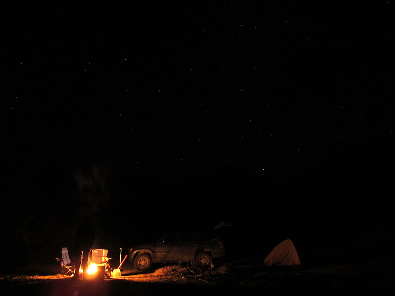
I dodged a bullet this weekend, weather-wise. The forecast called for a 50% chance of rain/snow, a low of 29 degrees, and heavy wind with gusts of 55 MPH. Chris had to work until 3PM, and by the time he got to Price and loaded his gear into my Jeep it was 6PM. I drove south on US-6 and took the Green River Cutoff Road until I reached the Tidwell Draw Road, then headed south on the rougher-than-I-remember dirt road. We reached our planned campsite at Cottonwood Wash around 8:00. Our first order of business was to open a couple of Epic beers, then we set about gathering up some firewood. By 9:00 we were nice and toasty. ") It was 56 degrees according to the thermometer in the Jeep, with just a light breeze, and we only saw a few sprinkles all night. Chris and I turned in to bed around 12:30AM and slept relatively late into the morning.
It was 56 degrees according to the thermometer in the Jeep, with just a light breeze, and we only saw a few sprinkles all night. Chris and I turned in to bed around 12:30AM and slept relatively late into the morning.
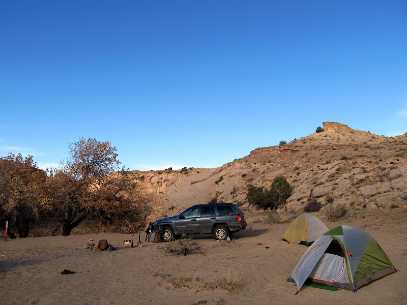
Camping in Cottonwood Wash
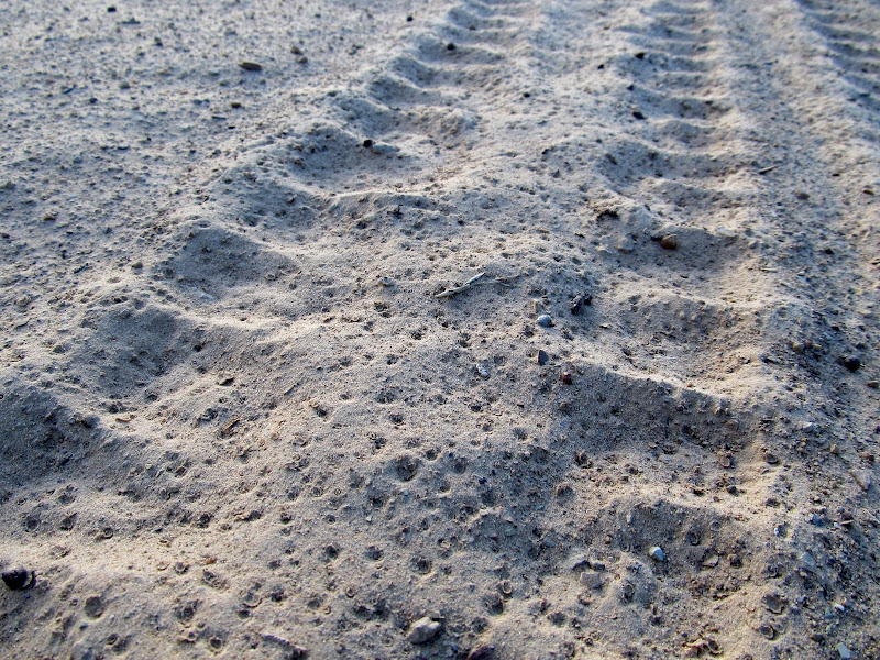
Rain sprinkles in the sand over my tire tracks
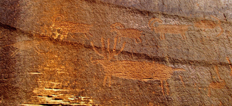
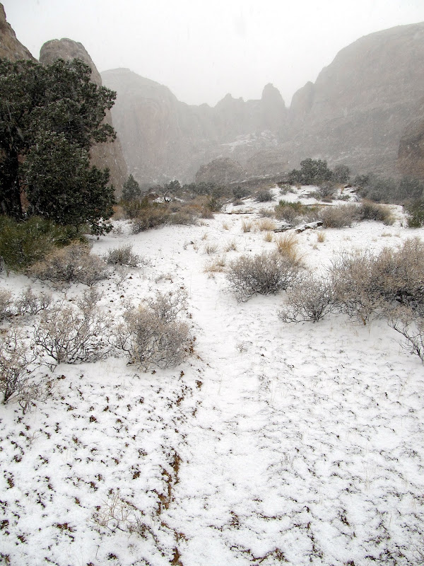
The weather couldn't have been much better for the second week in November. I slept until after 8:00AM, which is the latest I can recall ever getting up when tent camping. I got up and stoked the fire back to life, and when Chris crawled out of his tent we each made a simple breakfast and some coffee. After breakfast we packed up our gear and almost left without finding the rock art I'd missed the last time I was in Cottonwood Wash--good thing Chris reminded me before we drove off. We hiked up the wash and easily found the rock art, but didn't find the geocache that I found there a few years ago. I found out after I got home (just last night, actually) that I missed another rock art panel a little farther up the wash. Not that I needed an excuse to return to Cottonwood, but I'll have to go back to see it another time.
Cottonwood Wash camp
Searching out the petroglyphs in Cottonwood Wash
Petroglyphs
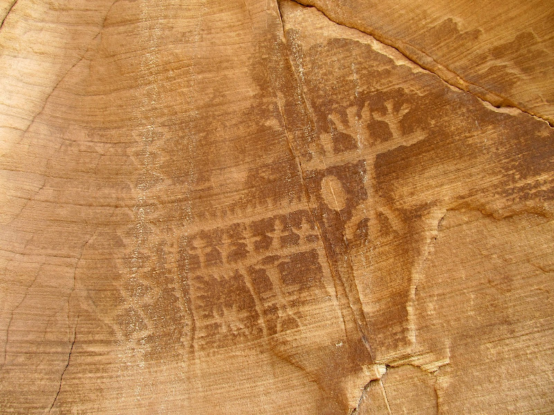
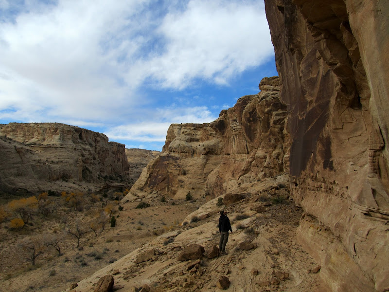
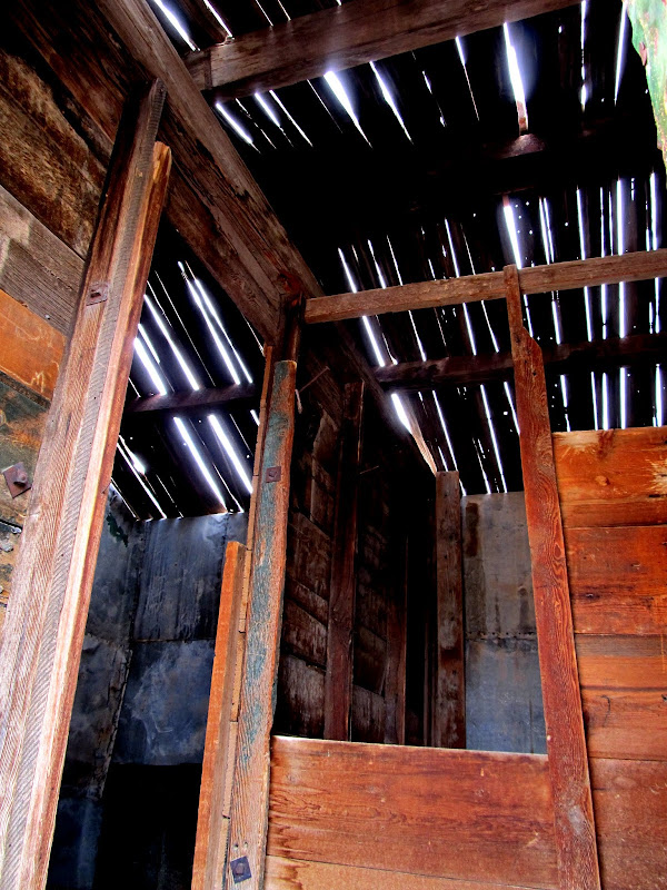
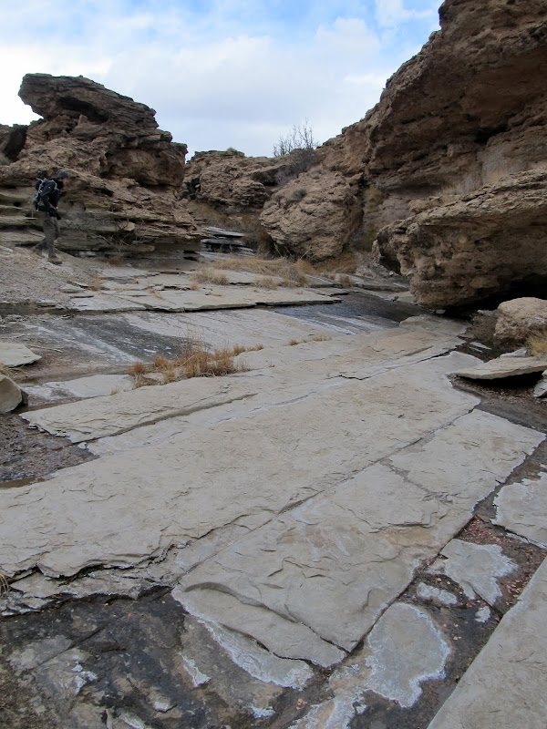
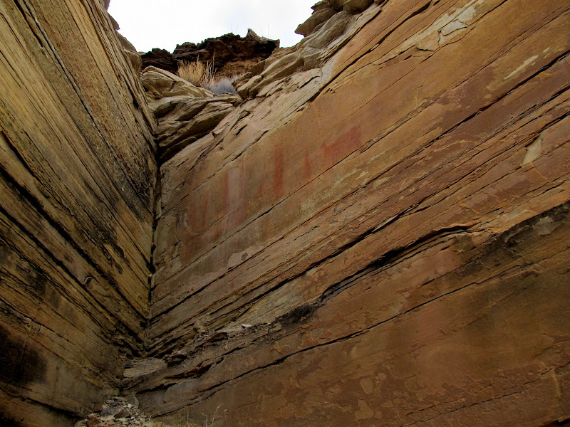
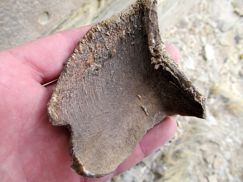
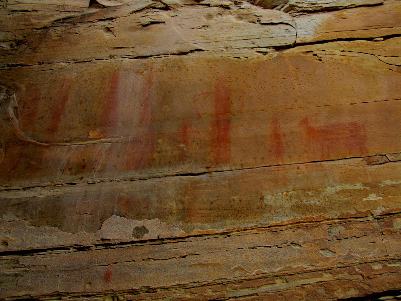
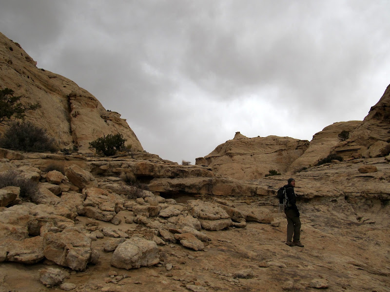
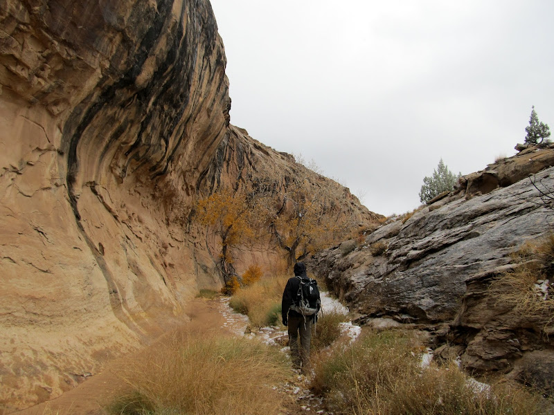
We walked back to the Jeep and drove farther south on the Tidwell Draw Road. We stopped at Smith Cabin to look for a couple of geocaches, then continued south as the road grew even rougher. I'd mapped out several hikes we could have done in the area and uploaded waypoints for each to my GPS, but I decided on hiking an unnamed canyon that holds Ednah Natural Bridge. I'd talked to Bill online earlier in the week and he mentioned possibly hiking in that area, but I'd forgotten all about it until I saw his SUV parked at the mouth of the canyon. I parked the Jeep near his Montero, then Chris and I started our hike. When I created the waypoints for the hike it was apparently clear in Google Earth which drainage we should hike up, but on the ground it wasn't so. We started up one drainage but it didn't look right to me (not a well-defined enough water course), so we crossed over into the next drainage to the north and started hiking up it. There were some interesting sandstone slabs angled up with the uplift of the San Rafael Reef, with spring water seeping out of the cracks in the rock and running down the wash. As we progressed and the canyon deepened, I looked more closely at the topo contours on my GPS map and realized we were in the wrong drainage. Oh well, I thought, we can cross back over to the south higher up the canyon instead of backtracking. It turned out to be a fortuitous wrong turn. After we ascended the canyon for a bit and were looking for a route back into the Ednah drainage, I spotted a nice pictograph panel. We scrambled up to the rock art, and as I was taking photos I noticed something odd wedged in a crack next to the pictographs. It looked like a piece of wood, but after a minute of trying to pry it out of the crack, it came free and I realized it was an animal hoof--probably bighorn or pronghorn. It had to have been placed there by human hands, but how long ago I couldn't say.
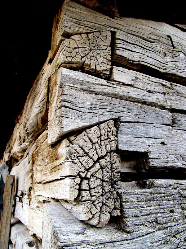
Smith Cabin
Dovetail joints on Smith Cabin
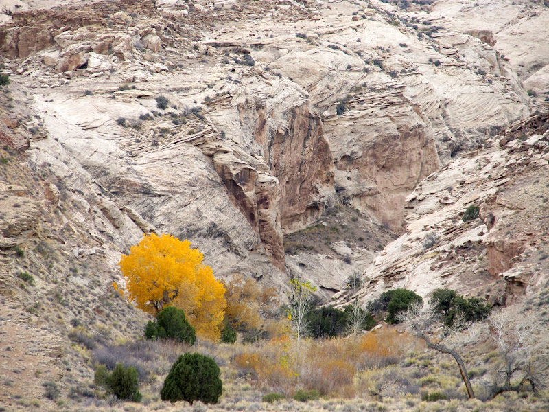
Colorful cottonwood tree at the mouth of a Reef canyon
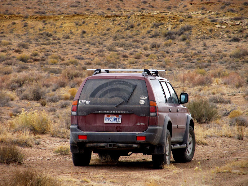
Hey look, someone else is out enjoying the nice weather too
Heading up the wrong canyon, with a long stretch of sandstone slabs with spring water seeping out
On a ridge between the two canyons
Pictographs
Bighorn or pronghorn hoof that was wedged in the cliff near the pictographs
Pictographs
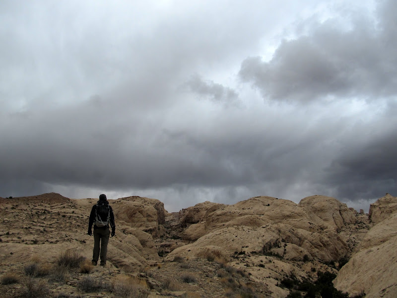
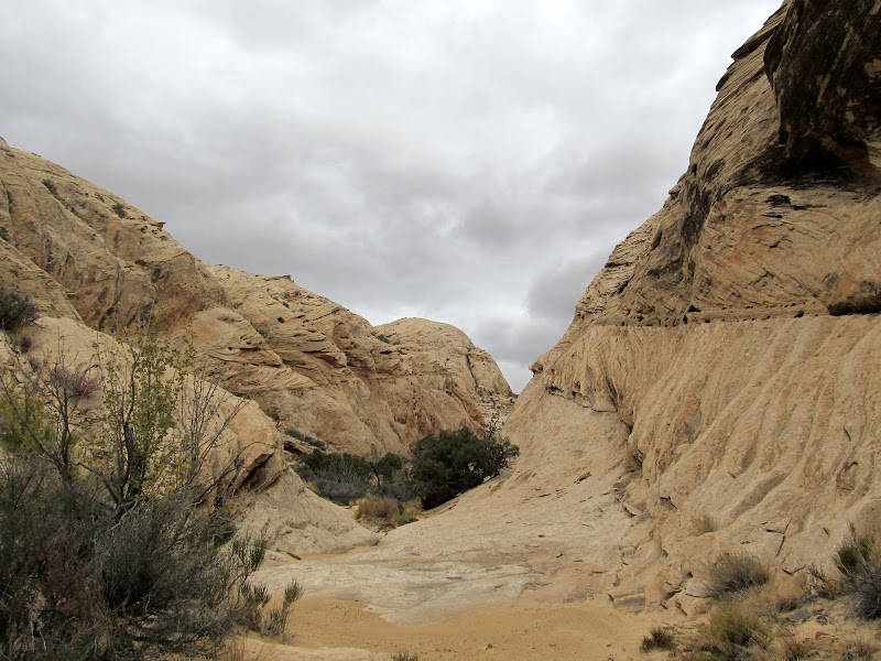
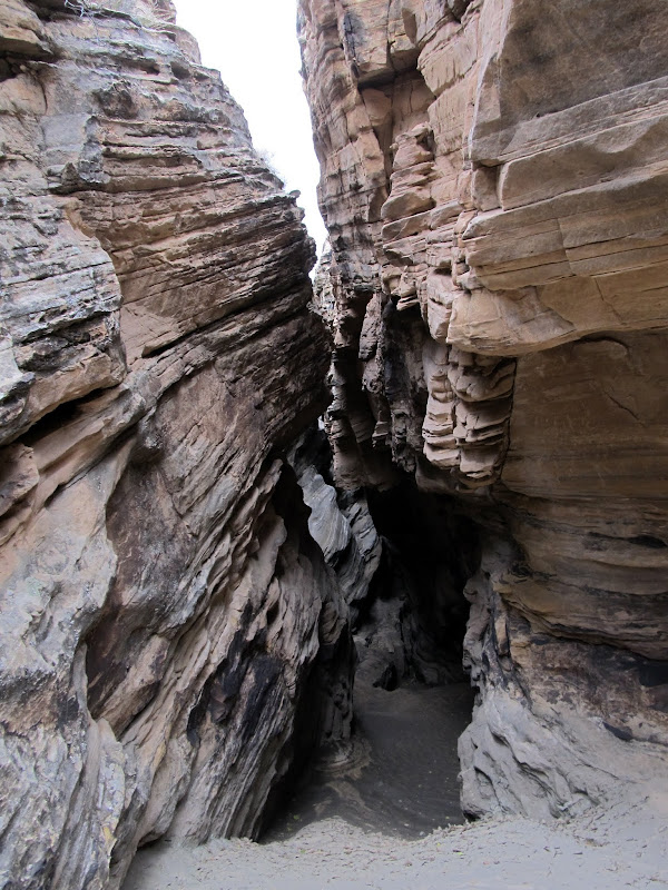
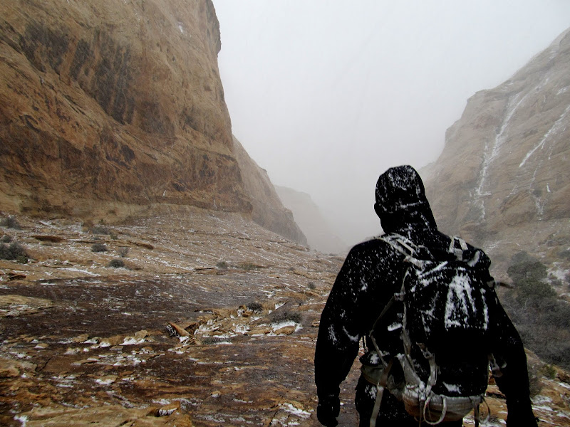
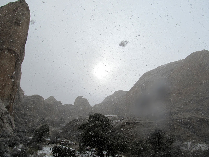
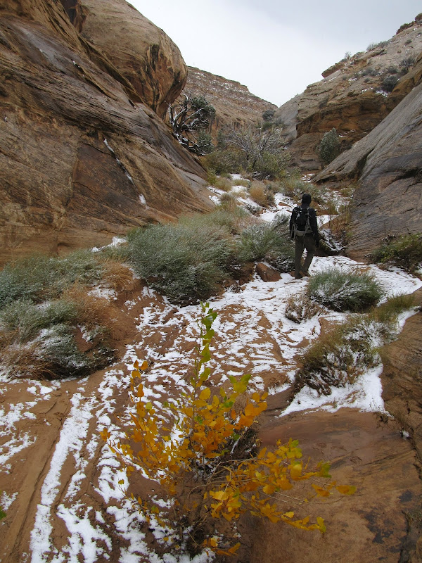
We never did find a way down into the Ednah drainage at that point, so we decided to just keep ascending the canyon we were in. It was interesting enough that I didn't mind exploring it further. We hiked up the canyon for about 45 minutes while I kept an eye out for rock art on the cliffs and arrowheads in the wash (my usual M.O. for hiking just about any canyon). The canyon slotted up for a short distance. Chris managed to upclimb the slot, but I attempted it and found it too difficult, so Torrey and I scrambled around the slot easily on the south side. We could see a storm moving in as we hiked up the canyon. It hit pretty suddenly, with a strong wind and pellet-like snow. We continued hiking for a short while in the snow, but it didn't take long before I was too cold to feel good about continuing--I hadn't dressed for snow and wind, and the cold was cutting easily through my clothing.
Back into the bottom of the canyon
Here, the canyon slotted up
Getting ever higher in the Reef
After the cold wind picked up and it started snowing, we turned around
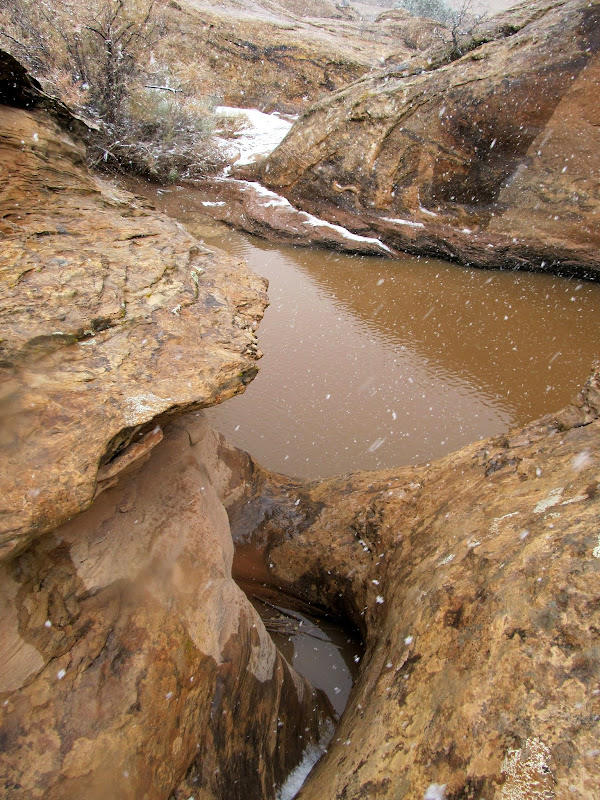
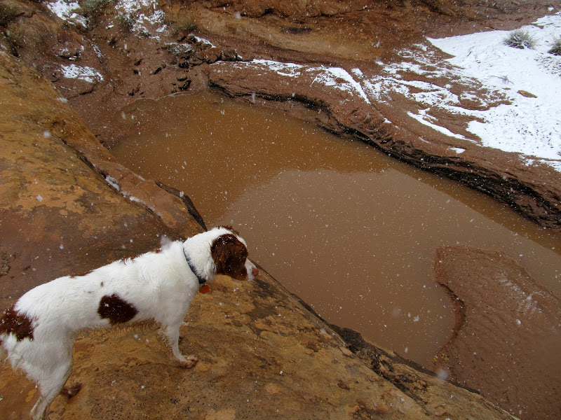
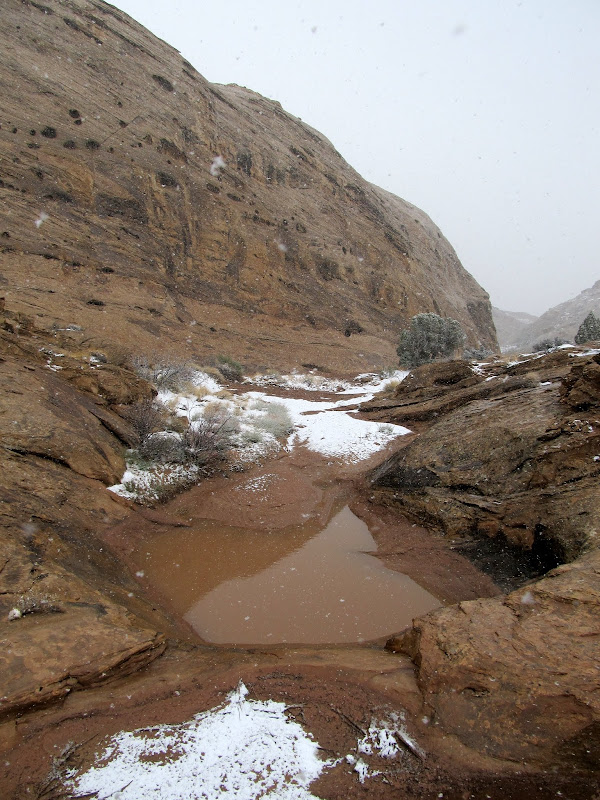
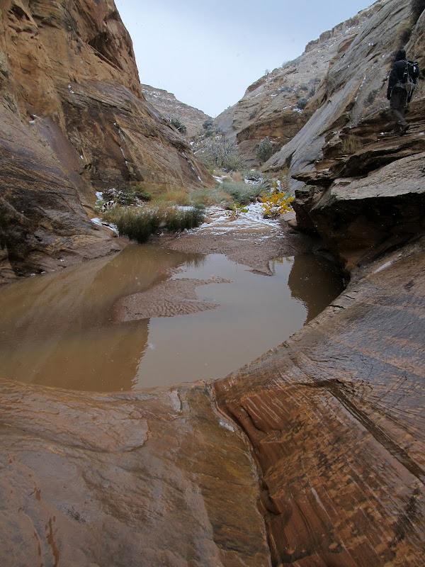
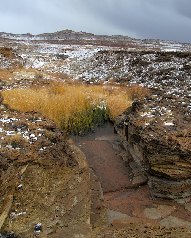
We turned around and descended the canyon, but checked out a likely cut-over point into the Ednah drainage that I'd spotted a little earlier. The wind subsided and the snow turned into regular flakes as we tried the route into Ednah. The route led us easily into the canyon we should have been in in the first place, and we continued our descent back toward the Jeep. Not counting the rock art in the other canyon, this canyon was much more interesting. There were several deep water-filled potholes that made finding a route around them tricky. I didn't have my camera out much because snow kept getting on the lens. Near the bottom of the canyon and almost within sight of the Jeep, there was a large spring-fed pool full of tall grasses and reeds, and the water looked heavily mineralized. Just beyond that we saw Bill down by the vehicles, and as we approached we met him and his wife who had just gotten back from a hike up the Reef overlooking the San Rafael River. We talked for a while, then Bill and his wife split while Chris and I decided what to do next. Neither of us wanted to camp out another night if it was going to be snowy, windy, and much colder than the previous night, so we opted to work our way toward I-70 while finding some geocaches along the way.
We found a route with a fairly well used trail into the Ednah drainage
In the Ednah drainage
A deep pothole
Torrey contemplating a dip in the cold water
Another large pothole--the canyon was full of them
Pothole
Finally, the snow let up
Hiking out of the canyon
Spring-fed pool
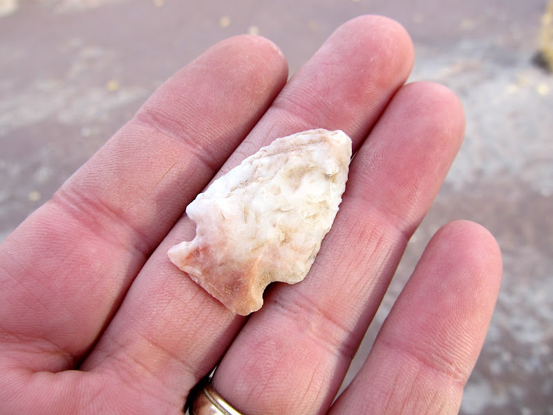
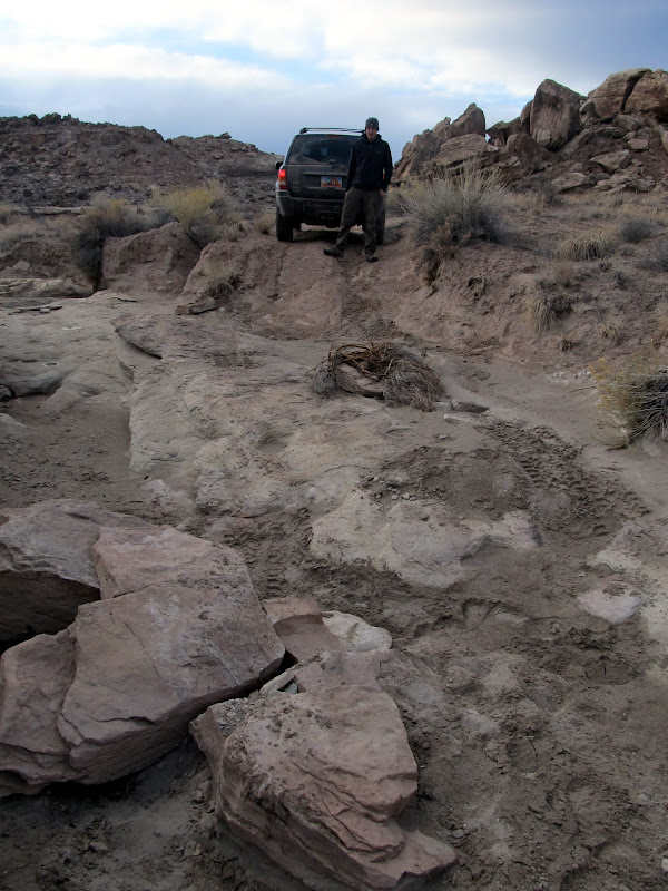
I had to drive back to the north on the Tidwell Draw Road to Smith Cabin in order to connect with another road that leads into the Buckmaster Draw area. That road was the best I'd seen since leaving the pavement the evening before, but soon we'd find ourselves on the worst roads I've driven my Jeep on. We briefly took one side road to find a geocache and stopped to check out an old uranium mine that we saw along the way. I was determined not to use the 4WD, and I managed to do that but once I had to take a second run at a loose, rocky hill. Back at the main road we found two more geocaches, and I found a nice arrowhead only 35 feet from the cache. I drove west from there on an old mining track that soon deteriorated to the point where it was clear no full-sized vehicles had been through in a long time. One part of the road had two small boulders blocking it. There was nowhere to turn around without backing up a few hundred feet, so instead, Chris and I moved the boulders just enough and stacked a few rocks so that I could drive over the top of them. I couldn't get away without using 4-low from then on.
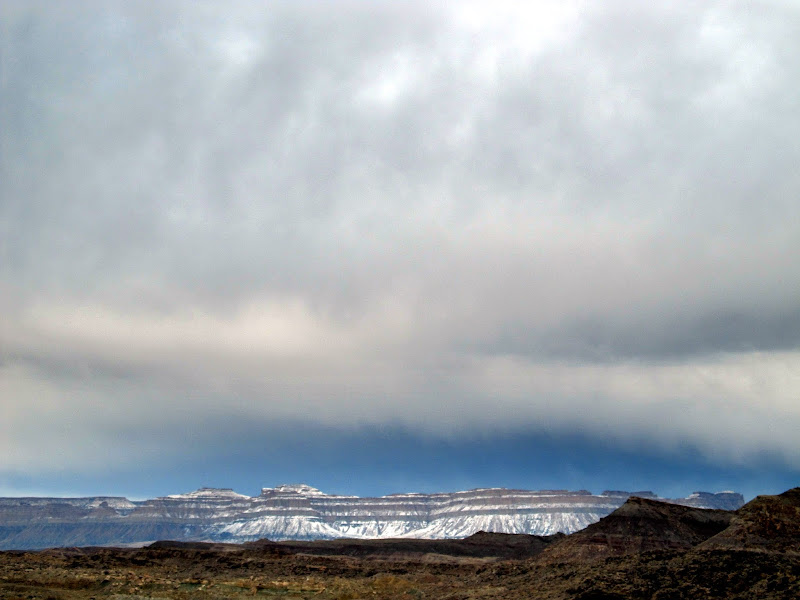
Storm over the snowy Book Cliffs
Abandoned uranium mine
Stopped to find a geocache
Stopped to find a geocache
Ooh, a pretty rock!
We had to move a couple of small boulders to get up this road
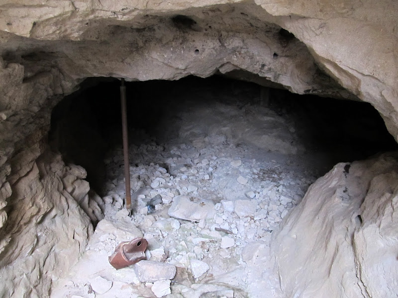
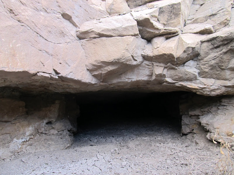
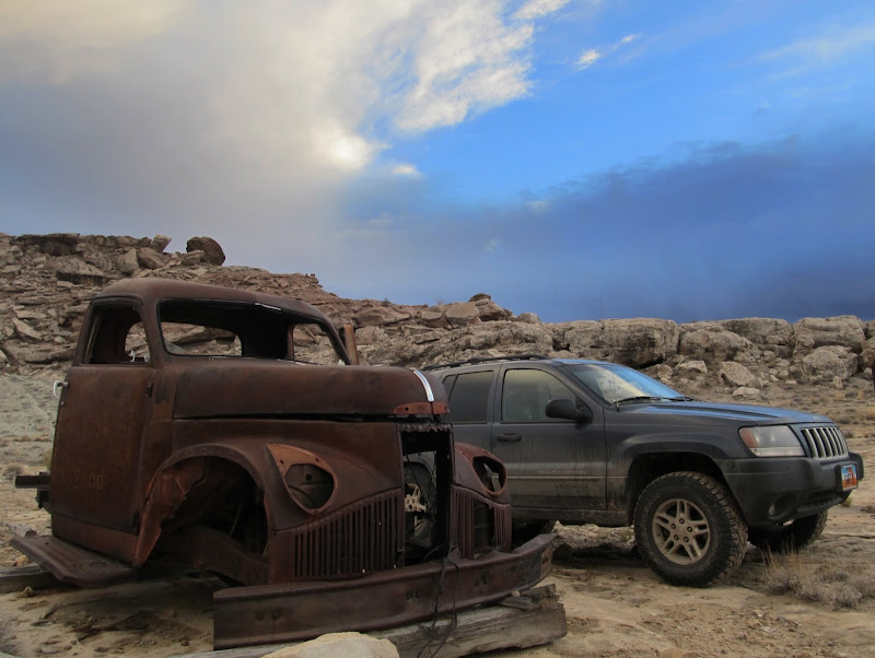
After another third of a mile we stopped to find another geocache. The coordinates put me out in the open where there was nowhere to hide a cache, and it took Chris and I a while to realize that there was a small mine opening 50' away that led underground in the direction of the coordinates. The cache was supposed to be 50' inside the tunnel, but luckily a previous finder had kindly left the container at the opening. Nearby there was the front half of an old truck that must have been used with a cable system to haul ore out of the mine. Our last stop of the day, after the sun had set, was about a mile to the south on top of a bluff overlooking I-70. Another snow storm blew in from the west just as we were finishing up at the geocache, and we were confident that we'd made a good decision in not camping another night.
Uranium mine with a geocache in it
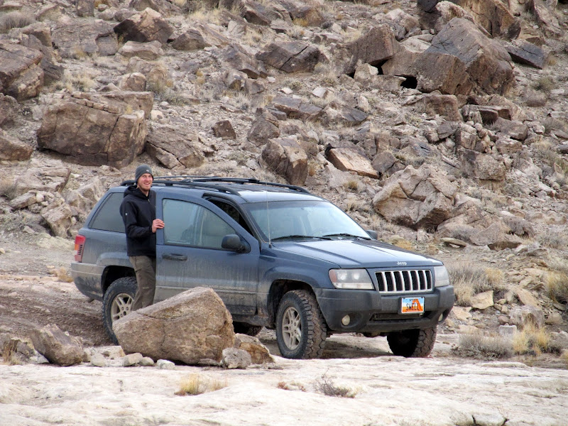
A pair of swell vehicles
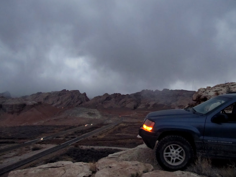
Parked on a cliff above I-70 at the last geocache find of the day
Full photo gallery:
[parsehtml]<embed type="application/x-shockwave-flash" src="https://picasaweb.google.com/s/c/bin/slideshow.swf" width="600" height="400" flashvars="host=picasaweb.google.com&captions=1&noautoplay=1&hl=en_US&feat=flashalbum&RGB=0x000000&feed=https%3A%2F%2Fpicasaweb.google.com%2Fdata%2Ffeed%2Fapi%2Fuser%2F115479031052354900696%2Falbumid%2F5809681325806574177%3Falt%3Drss%26kind%3Dphoto%26hl%3Den_US" pluginspage="http://www.macromedia.com/go/getflashplayer"></embed>[/parsehtml]https://picasaweb.google.com/Dennis.Udink/NorthernReef
GPS tracklog and photo waypoints:
[parsehtml]<iframe width="640" height="480" frameborder="0" scrolling="no" marginheight="0" marginwidth="0" src="https://maps.google.com/maps?q=http:%2F%2Fudink.org%2Fgeo%2FNorthernReef.kmz&hl=en&sll=39.002644,-110.386505&sspn=0.308955,0.676346&t=h&ie=UTF8&ll=39.002644,-110.386505&spn=0.25613,0.439453&z=11&output=embed"></iframe><br /><small><a href="https://maps.google.com/maps?q=http:%2F%2Fudink.org%2Fgeo%2FNorthernReef.kmz&hl=en&sll=39.002644,-110.386505&sspn=0.308955,0.676346&t=h&ie=UTF8&ll=39.002644,-110.386505&spn=0.25613,0.439453&z=11&source=embed" style="color:#0000FF;text-align:left">View Larger Map</a></small>[/parsehtml]http://udink.org/geo/NorthernReef.kmz
Featured image for home page:

It was 56 degrees according to the thermometer in the Jeep, with just a light breeze, and we only saw a few sprinkles all night. Chris and I turned in to bed around 12:30AM and slept relatively late into the morning.Camping in Cottonwood Wash
Rain sprinkles in the sand over my tire tracks
The weather couldn't have been much better for the second week in November. I slept until after 8:00AM, which is the latest I can recall ever getting up when tent camping. I got up and stoked the fire back to life, and when Chris crawled out of his tent we each made a simple breakfast and some coffee. After breakfast we packed up our gear and almost left without finding the rock art I'd missed the last time I was in Cottonwood Wash--good thing Chris reminded me before we drove off. We hiked up the wash and easily found the rock art, but didn't find the geocache that I found there a few years ago. I found out after I got home (just last night, actually) that I missed another rock art panel a little farther up the wash. Not that I needed an excuse to return to Cottonwood, but I'll have to go back to see it another time.
Cottonwood Wash camp
Searching out the petroglyphs in Cottonwood Wash
Petroglyphs
We walked back to the Jeep and drove farther south on the Tidwell Draw Road. We stopped at Smith Cabin to look for a couple of geocaches, then continued south as the road grew even rougher. I'd mapped out several hikes we could have done in the area and uploaded waypoints for each to my GPS, but I decided on hiking an unnamed canyon that holds Ednah Natural Bridge. I'd talked to Bill online earlier in the week and he mentioned possibly hiking in that area, but I'd forgotten all about it until I saw his SUV parked at the mouth of the canyon. I parked the Jeep near his Montero, then Chris and I started our hike. When I created the waypoints for the hike it was apparently clear in Google Earth which drainage we should hike up, but on the ground it wasn't so. We started up one drainage but it didn't look right to me (not a well-defined enough water course), so we crossed over into the next drainage to the north and started hiking up it. There were some interesting sandstone slabs angled up with the uplift of the San Rafael Reef, with spring water seeping out of the cracks in the rock and running down the wash. As we progressed and the canyon deepened, I looked more closely at the topo contours on my GPS map and realized we were in the wrong drainage. Oh well, I thought, we can cross back over to the south higher up the canyon instead of backtracking. It turned out to be a fortuitous wrong turn. After we ascended the canyon for a bit and were looking for a route back into the Ednah drainage, I spotted a nice pictograph panel. We scrambled up to the rock art, and as I was taking photos I noticed something odd wedged in a crack next to the pictographs. It looked like a piece of wood, but after a minute of trying to pry it out of the crack, it came free and I realized it was an animal hoof--probably bighorn or pronghorn. It had to have been placed there by human hands, but how long ago I couldn't say.
Smith Cabin
Dovetail joints on Smith Cabin
Colorful cottonwood tree at the mouth of a Reef canyon
Hey look, someone else is out enjoying the nice weather too
Heading up the wrong canyon, with a long stretch of sandstone slabs with spring water seeping out
On a ridge between the two canyons
Pictographs
Bighorn or pronghorn hoof that was wedged in the cliff near the pictographs
Pictographs
We never did find a way down into the Ednah drainage at that point, so we decided to just keep ascending the canyon we were in. It was interesting enough that I didn't mind exploring it further. We hiked up the canyon for about 45 minutes while I kept an eye out for rock art on the cliffs and arrowheads in the wash (my usual M.O. for hiking just about any canyon). The canyon slotted up for a short distance. Chris managed to upclimb the slot, but I attempted it and found it too difficult, so Torrey and I scrambled around the slot easily on the south side. We could see a storm moving in as we hiked up the canyon. It hit pretty suddenly, with a strong wind and pellet-like snow. We continued hiking for a short while in the snow, but it didn't take long before I was too cold to feel good about continuing--I hadn't dressed for snow and wind, and the cold was cutting easily through my clothing.
Back into the bottom of the canyon
Here, the canyon slotted up
Getting ever higher in the Reef
After the cold wind picked up and it started snowing, we turned around
We turned around and descended the canyon, but checked out a likely cut-over point into the Ednah drainage that I'd spotted a little earlier. The wind subsided and the snow turned into regular flakes as we tried the route into Ednah. The route led us easily into the canyon we should have been in in the first place, and we continued our descent back toward the Jeep. Not counting the rock art in the other canyon, this canyon was much more interesting. There were several deep water-filled potholes that made finding a route around them tricky. I didn't have my camera out much because snow kept getting on the lens. Near the bottom of the canyon and almost within sight of the Jeep, there was a large spring-fed pool full of tall grasses and reeds, and the water looked heavily mineralized. Just beyond that we saw Bill down by the vehicles, and as we approached we met him and his wife who had just gotten back from a hike up the Reef overlooking the San Rafael River. We talked for a while, then Bill and his wife split while Chris and I decided what to do next. Neither of us wanted to camp out another night if it was going to be snowy, windy, and much colder than the previous night, so we opted to work our way toward I-70 while finding some geocaches along the way.
We found a route with a fairly well used trail into the Ednah drainage
In the Ednah drainage
A deep pothole
Torrey contemplating a dip in the cold water
Another large pothole--the canyon was full of them
Pothole
Finally, the snow let up
Hiking out of the canyon
Spring-fed pool
I had to drive back to the north on the Tidwell Draw Road to Smith Cabin in order to connect with another road that leads into the Buckmaster Draw area. That road was the best I'd seen since leaving the pavement the evening before, but soon we'd find ourselves on the worst roads I've driven my Jeep on. We briefly took one side road to find a geocache and stopped to check out an old uranium mine that we saw along the way. I was determined not to use the 4WD, and I managed to do that but once I had to take a second run at a loose, rocky hill. Back at the main road we found two more geocaches, and I found a nice arrowhead only 35 feet from the cache. I drove west from there on an old mining track that soon deteriorated to the point where it was clear no full-sized vehicles had been through in a long time. One part of the road had two small boulders blocking it. There was nowhere to turn around without backing up a few hundred feet, so instead, Chris and I moved the boulders just enough and stacked a few rocks so that I could drive over the top of them. I couldn't get away without using 4-low from then on.
Storm over the snowy Book Cliffs
Abandoned uranium mine
Stopped to find a geocache
Stopped to find a geocache
Ooh, a pretty rock!
We had to move a couple of small boulders to get up this road
After another third of a mile we stopped to find another geocache. The coordinates put me out in the open where there was nowhere to hide a cache, and it took Chris and I a while to realize that there was a small mine opening 50' away that led underground in the direction of the coordinates. The cache was supposed to be 50' inside the tunnel, but luckily a previous finder had kindly left the container at the opening. Nearby there was the front half of an old truck that must have been used with a cable system to haul ore out of the mine. Our last stop of the day, after the sun had set, was about a mile to the south on top of a bluff overlooking I-70. Another snow storm blew in from the west just as we were finishing up at the geocache, and we were confident that we'd made a good decision in not camping another night.
Uranium mine with a geocache in it
A pair of swell vehicles
Parked on a cliff above I-70 at the last geocache find of the day
Full photo gallery:
[parsehtml]<embed type="application/x-shockwave-flash" src="https://picasaweb.google.com/s/c/bin/slideshow.swf" width="600" height="400" flashvars="host=picasaweb.google.com&captions=1&noautoplay=1&hl=en_US&feat=flashalbum&RGB=0x000000&feed=https%3A%2F%2Fpicasaweb.google.com%2Fdata%2Ffeed%2Fapi%2Fuser%2F115479031052354900696%2Falbumid%2F5809681325806574177%3Falt%3Drss%26kind%3Dphoto%26hl%3Den_US" pluginspage="http://www.macromedia.com/go/getflashplayer"></embed>[/parsehtml]https://picasaweb.google.com/Dennis.Udink/NorthernReef
GPS tracklog and photo waypoints:
[parsehtml]<iframe width="640" height="480" frameborder="0" scrolling="no" marginheight="0" marginwidth="0" src="https://maps.google.com/maps?q=http:%2F%2Fudink.org%2Fgeo%2FNorthernReef.kmz&hl=en&sll=39.002644,-110.386505&sspn=0.308955,0.676346&t=h&ie=UTF8&ll=39.002644,-110.386505&spn=0.25613,0.439453&z=11&output=embed"></iframe><br /><small><a href="https://maps.google.com/maps?q=http:%2F%2Fudink.org%2Fgeo%2FNorthernReef.kmz&hl=en&sll=39.002644,-110.386505&sspn=0.308955,0.676346&t=h&ie=UTF8&ll=39.002644,-110.386505&spn=0.25613,0.439453&z=11&source=embed" style="color:#0000FF;text-align:left">View Larger Map</a></small>[/parsehtml]http://udink.org/geo/NorthernReef.kmz
Featured image for home page:
 . Thanks for sharing.